Route 66 in Sierra Madre CA
Index to this page
About Sierra Madre California
Facts, Trivia and useful information
Elevation: 827 ft (252 m). Population 10,969 (2025).
Time zone: Pacific (MST): UTC minus 8 hours. Summer (DST) PDT (UTC-7).
Sierra Madre (See-er'-a Mad-rei) is a city located close to Route 66 in Los Angeles County in southern California on the San Gabriel Mountains' foothills; it is part of the Los Angeles metropolitan area.
Sierra Madre and Route 66
Strictly speaking, Route 66 never went through Sierra Madre: Old 1926-1933 Route 66 alignment ran just south of the city limits of Sierra Madre, 0.8 miles from the center of the city, in an area that was open fields north of Arcadia and east of Pasadena. Sierra Madre was the only town in the area between Arcadia and Pasadena.
Just south of Foothill Blvd. were the tracks of the AT & Santa Fe Railroad and Santa Anita Ranch, the Arboretum and rural countryside. Then, in 1934, US 66 was realigned further south, along a newly built roadbed on Colorado St. this moved it even further from Sierra Madre.
Below, in the historic context section we discuss why we included Sierra Madre on Route 66 even though it was never part of it.
The history of Sierra Madre
The foothills of the San Gabriel Mountains have been inhabited for over 10,000 years. When the Spanish explored the area in the 1600s they encountered a hunter - gatherer Native American society, the "Tongva", which they named after the mountain range where they lived, Gabrieleños or Gabrielinos.
A Mission was established nearby in 1771 (San Gabriel Arcángel) and the original "Mount Wilson Trail" was built by the natives to carry timber down from the mountains to the Mission.
The land owned by the Mission was nationalized by the Mexican government (Mexico had gained its independence from Spain in 1821, and what now is California, Utah, Nevada, Arizona, Colorado and New Mexico was Mexican terriory. The authorities granted this land to Mexican citizens in the 1840s.
Hugo Reid, a Scotsman who had naturalized as a Mexican was one of them, and he receieved a land grant in 1841 which he named "Rancho Santa Anita."
After being defeated in the Mexican American war (1846-48), Mexico ceded California (and what now is CO, NM, AZ, UT) to the U.S.
Rancho Santa Anita was acquired by Elias Jackson Baldwin in 1875 and he sold an 845 acre tract to Nathaniel Carter in 1881. Carter added more land in 1888 and established his "Villa Sierra Madre" on it.
The Los Angeles and San Gabriel Valley Railroad built a line through the region and linked it with the A.T. & Santa Fe Railroad in 1887, the station (Santa Anita Depot) was built on it, here by Baldwini's ranch, just south of Villa Sierra Madre in 1888.
The Name, Sierra Madre
The words are Spanish and mean "Mother Range", it was given to them by the Spanish explorers in 1775: "Sierra Madre de California" becaue it seemed that the other ranges in this area, that spread inland, the Sierra Nevada, Coast Mountains, and San Bernardino Mountains sprung up from it.
When Nathaniel C. Carter subdivided part of Rancho Santa Anita in 1881, he named it Villa Sierra Madre.
By the way, the 1948 film "The Treasure of the Sierra Madre" starring Humphrey Bogart, is about another range, in Mexico, with the same name.
Soon after the Pacific Electric Railway "Red Car" tramway extended a line into Sierra Madre; and it ran until October 6, 1950.
The City was incorporated in 1907.
In the 1910s the use of the automobile had grown so much that the National Old Trails (N.O.T.) Association was created to promote a highway linking Los Angeles with New York. The road, when built, ran along Foothill Boulevard south of the city. Later, in 1926 U.S. Highway 66 was aligned along it. In 1932 it was realigned along Colorado Pl and Colorado St. west of Arcadia into Pasadena, further south.
Sierra Madre and the SF film, "The Invasion of the Body Snatchers"
The 1956 movie "The Invasion of the Body Snatchers" was filmed in Sierra Madre, starring Kevin McCarthy, Dana Wynter and Larry Gates. This movie was selected in 1993 for preservation in the U.S. National Film Registry by the Library of Congress because of its cultural, historical and aesthetical significance". It is a classic 1950s "B Movie".
Sierra Madre Trivia
Sierra Madre was hit by a M 5.8 earthquake on June 28, 1991.

Accommodation in Sierra Madre
You can find your lodging in the neighboring city of Arcadia.
> > Book your Hotel in Arcadia
More Lodging close to Sierra Madre along Route 66
Below you will find a list some of the towns along U.S. Hwy 66 east and west of Sierra Madre; click on any of the links to find your hotel in these towns.
>> Check out the RV campground near Sierra Madre, in Pomona
The Weather in Sierra Madre
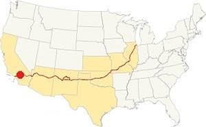
Location of Sierra Madre on Route 66
The climate in Sierra Madre is a "Warm Summer" Mediterranean one. Rather dry and hot in summer but cool and wet during winter (which is the rainy season). The average monthly temperatures does not exceed 71.6 °F (22°C).
Sierra Madre has some 290 sunny days each year and during fall (autumn) strong dry winds blow from the desert (Santa Ana winds) drying out the area and increasing the risk of wildfires in the foothills.
The summer average high is 89.4°F (31.9°C) and the average low is 61.1°F (16.2°C). During winter the average high is (Jan) 67.8°F (19.9°C) and the average low is 44.3°F (6.8°C) in winter, the peaks of the San Gabriel Mountains receive snow, and it may very rarely fall in Sierra Madre. You may experience frost during winter (Dec. to Mar.)
Rainfall averages 22 in. per year (559 mm), with the period April to October being the driest one. There are some 43.5 rainy days per year
Tornado risk
Sierra Madre is very close to the Pacific Ocean is located very far from the Rocky Mountains (western limit for tornadoes), there is no risk of tornadoes in this area.
Tornado Risk: read more about Tornado Risk along Route66.
Map of Route 66 near Sierra Madre
>> Custom map of Route 66 along the southern side of Sierra Madre.
National Old Trails Highway (N.O.T.) in Sierra Madre
The 1910s highway system was aligned along Foothill Blvd from Pasadena to Monrovia on its transcontinental route between Los Angeles and New York.
Route 66 Map
In 1926 Route 66 was aligned along the National Old Trails roadway and the green line in our custom map marks the 1926-34 alignment of Route 66 along Foothill Ave. In 1933 Route 66 was realigned along Huntington Dr., Colorado Pl., and Colorado St., and it is marked with a Until then it ran along the course marked with a red line in our custom map.
The map below published by the USGS in 1928 shows Sierra Madre (left) and Route 66 running across empty contryside from Monrovia to Pasadena, north of Arcadia and south of Sierra Madre.

1956 Shell Roadmap, SW CA
Click on image to enlarge.
Credits
The map above shows the same area in 1956; a freeway now links Victorville with Cajon and San Bernardino with Los Angeles.
In the historic context section below we discuss why we included Sierra Madre on Route 66 even though it was never technically part of it.
Route 66 Alignment near Sierra Madre
With maps and full information on the Mother Road.
- Pasadena to Santa Monica (Next)
- Barstow to Pasadena (Sierra Madre's)
- Topock to Barstow (Previous)

Sights and Attractions in town
Historic context
The 1939 "Guide to the Golden State" written by the WPA (a Federal department that funded public works across the nation during the Great Depression) described the Sierra Madre section of Route 66 as follows:
SIERRA MADRE, 36.9 m. (835 alt., 3,550 pop.), is a foothill town surrounded by the deep green of orange groves. A trellised wistaria on the FENNEL ESTATE (adm. 10$), Carter St. and Hermos Ave., planted in 1894, extends over an acre of ground, and its blooming season March 10 to April 1 is occasion for the Sierra Madre Wistaria Fete, held annually since 1921. WPA (1946)
Just after the end of World War II, Jack DeVere Rittenhouse rode along Route 66 (1946) collecting information for his famous: "A Guide Book to Highway 66". He mentioned that there were many towns in this area, and lists them without adding too much, but specificall mentions Sierra Madre as if the highway went through it! "... Now you pass through SIERRA MADRE at 353 mi. and soon enter PASADENA at 359 mi."
Arcadia, Pasadena and Sierra Madre
On the western tip of Arcadia, at Colorado Blvd. and Michillinda Avenue, Route 66's 1934-74 aligmnemt leaves the city and enters East Pasadena, an unincorporated community in Los Angeles County; it crosses it along a short (0.6 mile-long) stretch and then enters Pasadena the next town along the alignment.
However as we see above, Rittenhouse in his classic 1946 Guidebook to Highway 66 mentions Sierra Madre between Arcadia and Pasadena despite the fact that Sierra Madre city limits are 0.6 miles north of Colorado Blvd. Below is a map from his book showing Sierra Madre; 2 miles west of Arcadia and six east of Pasadena:
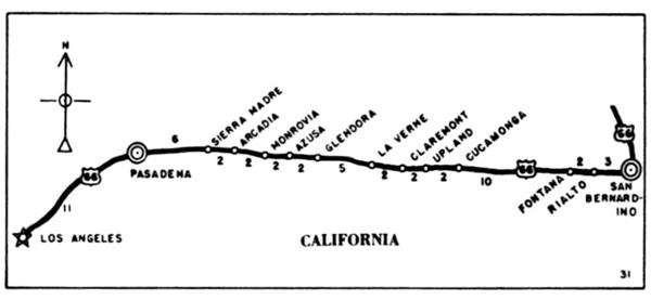
It is natural that Rittenhouse mention Sierra Madre because this area was open country in 1946 west of the fork back by the racetrack all the way to Rosemead Ave in Pasadena, the only town here was Sierra Madre just north of the highway.

1931 ACSC map Duarte to Pasadena Source
Click on image to enlarge.
The 1931 map (click on it to enlarge it) of U.S. Hwy 66 marks it running along Foothill Blvd from Monrovia to Pasadena, clearly shows the US 66 shield and "SIERRA MADRE" at mileage 18.5 and 19.5 east of Los Angeles. So some may have believed it was located on the highway.
Sierra Madre City tour
Driving westwards from Arcadia, you need to head north to visit Sierra Madre. From Colorado St., head north along N. Baldwin Ave. (1.3 mi. - See map with directions) to visit downtown Sierra Madre at the junction of N. Baldwin Ave. and Sierra Madre Blvd. Take a left along Sierra Madre Blvd. and after 2 blocks, on your right is the Sierra Madre Playhouse:
Sierra Madre Playhouse
At 87 W Sierra Madre Blvd, Sierra M
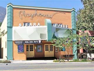
Sierra Madre Playhouse. Source
click image for St. view
The building dates back to 1923, it served as the Wistaria Theater until 1929 when it was renamed "Sierra Madre Theater". Later it was an arcade and now it is the venue of the "Sierra Madre Playhouse", a non-profit organization. The building was renovated in 1998.
Head back to N. Baldwin Ave. and take a left to visit the classic Hotel Shirley.
Hotel Shirley
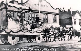
Sierra Madre Hotel Shirley c.1930s. Source
At 30 N Baldwin Ave. This building dates back to 1911, that is, 25 years before Route 66 was created. It was restored in 1998.
The black and white image from the 1920s shows it hasn't changed much.
Current view of Sierra Madre's Hotel Shirley

Sierra Madre's Wisteria: the largest flowering plant in the world
Guinness Record Plant
505 and 535 North Hermosa Ave. See Map with location.
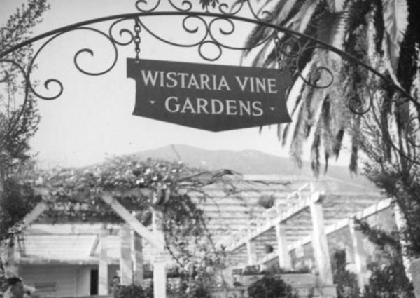
The city is also known as "Wisteria City", and a wisteria (also spelled wistaria) appers on the city's seal because of the enormous wisteria vine growing in town.
The Wisteria or Wistaria plant
Wisteria (also spelled Wistaria or Wysteria) is a genus of flowering plants belonging to the pea faimily. They are climbing vines, with woody trunks, native to Eastern Asia (Japan, China, Korea) and Eastern USA. It was named for Henry Wistar of the University of Pennsylvania in 1818 to honor his contributions to science.
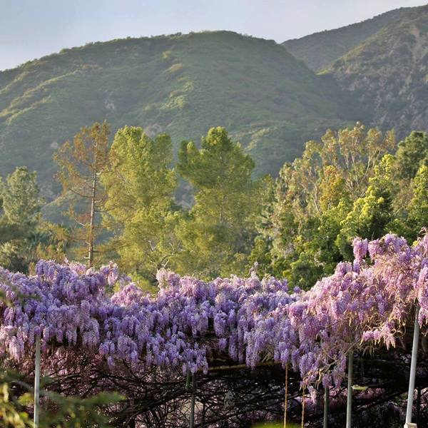
The Chinese wistaria (Wisteria sinensis) growing in Sierra Madre, has been proclaimed by the Guinness Book of World Records as the world's largest flowering plant.
It was planted by Mrs. Brugman and her neighbor, Mrs. W. B. Crisp in 1894. They bought it in the Wilson nursery in Monrovia, it came in a gallon-sized can and cost 75 ¢ Alice chose it because she'd heard that it was a fast growing plant. She planted it on her home's front porch. The vine grew and the enormous weight of its branches collapsed the building in the 1930s.
The wisteria, after 130 years, now weighs over 250 tons and its branches span 500 ft.(150 m) covering about 1 acre in two properties. The sweet smelling pale violet blooms reach their peak in March and an estimated 1.5 million blossoms are produced during the five-week blossoming period.
Annual Sierra Madre Wistaria Festival
The event his held in the downtown at Sierra Madre Blvd. and N. Baldwin Ave. with music, food trucks, handicraft vendors and more. There is an open-house at the two properties where the vine grows at 505 and 535 North Hermosa Avenue.
According to The Guinness Book of Records website it is the largest blossoming plant.
Outdoors and Nature
You can visit more sights in the area, further from Sierra Madre's downtown.
Mount Wilson
The mountain (5,710 feet - 1.740 m) is named after Benjamin "Don Benito" Davis Wilson who owned Rancho San Pascual and a winery. He built a trail in the 1860s to bring wood from the mountains to make casks for his wines. This was known as the "Mount Wilson Trail".
In 1889, Harvard College established the first Mount Wilson Astronomical Observatory so the trail was expanded, to allow the telescope to reach the summit. That same year, a toll road was opened to the public, the "New Mt. Wilson Trail". It became very popular.
In 1908, the first Mount Wilson Trail Race was run, and after a long pause between World War II and 1966 it has been run continuously since then. Visit the official website: www.mountwilsontrailrace.com.
The Mount Wilson Observatory has a 60-inch (1,5m) and 100-inch (2,5 m) telescopes. It was the world's largest telescope until the opening of the 200-inch Palomar Hale Telescope in 1948.
Sierra Madre Historical Wilderness Area
Created in 1967 and dedicated in 1968, Sierra Madre became the first city in Southern California to own a wilderness area. Later (1993), the Sierra Madre City Council added the Mt. Wilson Trail to its Register of Historic Cultural Landmarks.
Continue your Road Trip
This marks the end of your trip across Sierra Madre, head west to continue your Route 66 road trip in neighboring Pasadena.

Sponsored Content
>> Book your Hotel in Santa Monica

Credits
Banner image: Hackberry General Store, Hackberry, Arizona by Perla Eichenblat
A Guide to the Golden State; Federal Writers' Project of the Works Progress Administration, Hastings House, New York, 1939.
Jack DeVere Rittenhouse, (1946). A Guide Book to Highway 66.


