The last (or first) town in Oklahoma
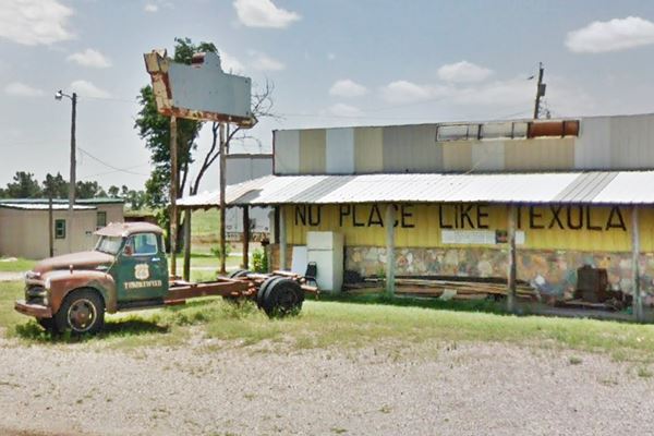
Old bar with the words "There is no place like Texola" painted on its wall
Index to this page
About Texola, Oklahoma
Facts, Trivia and useful information
Elevation: 2,146 ft (654 m). Population: 40 (2024).Time zone: Central (CST): UTC minus 6 hours. Summer (DST) CDT (UTC-5).
Texola is a town in Beckham county barely one mile east of the Texas state line. Its nickname is "Beerola" and its unofficial motto is "There is No Place Like Texola".
Old Bar & Diner in Texola, Oklahoma
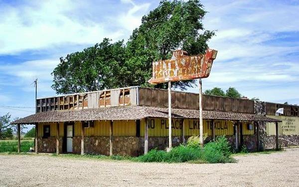
Its location is very close to the 100th meridian, which marks the border between Texas and Oklahoma led to it being surveyed on eight different occasions, as the line moved back and forth. Finally the initial residents found themselves in Oklahoma.
The name: Texola
The townsite had two previous names before deciding on "Texola": Texoma and Texokla, all of them referring to its location barely 1 mile east of the Texas - Oklahoma state line.
As with most towns along Route 66 in this part of Oklahoma, the townsite was the outcome of the railway expansion westwards, into Texas. The Choctaw, Oklahoma and Gulf Railroad (later Chicago, Rock Island and Pacific Railway) planned a new rail line west from Weatherford to Texola. It began construction in 1901 and it also set up a company (The Choctaw Town Site and Improvement Company) to plan and lay out towns along the tracks and sell lots to "Sooners" who were seeking a better life in the West.
A post office was established in 1901 and Its first postmaster was Reuben H. Grimes. At that time Texola was part of a very large Greer County and Sayre was part of Roger Mills Co. After Oklahoma's statehood in 1907, Greer and Roger Mills counties were reorganized and Beckham County was created.
Shortly after (1902), the Choctaw, Oklahoma and Gulf Railroad line laid its tracks through Texola.
The rural area surrounding the station produced cotton which was processed at the local cotton gins. The town had a newspaper between 1902 and 1921. And population grew steadily.
Route 66 was aligned through the town in 1926 (5th Street), in those days it followed Oklahoma State Highway No. 3. The road was later paved and drew a growing flow of travelers.
The Great Depression in the 1930s plus the Dust Bowl led to an exodus of dispossessed farmers from region, and the town is mentioned in John Steinbeck's novel "The Grapes of Wrath" which deals with that subject (Read More about this classic: Grapes of Wrath.)
Joads and Wilsons crawled westward as a unit: El Reno and Bridgeport, Clinton, Elk City, Sayre, and Texola. There's the border, and Oklahoma was behind. John Steinbeck, The Grapes of Wrath
Route 66 was a great help for the local economy until the early 1970s, when Interstate I-40 bypassed the town. Population has dropped from a peak of 581 in 1930 to less than 50 after 1990, and now stands at 36; the place is Almost a Ghost Town.

Hotels close to Texola
You can book your hotel near Texola. There is accommodation in nearby towns along Route 66
> > Book your Hotels in nearby
Lodging Near Texola along Route 66
There are several hotels in the area close to this town. Alternatively you can also find your accommodation along Route 66 in the neighboring towns and cities. We list them below (listed from east to west):
On Route 66's Main alignment
Eastwards
Westwards
>> There is a RV campground in Texola.
Texola’s Weather

Location of Texola on Route 66
This part of Oklahoma is a relatively dry region. The yearly rainfall is around 24 in (618 mm). Summers are hot but with lower temperature during the night which make them bearable.
The average high during summer is above 90°F (30°C) and the average low is around 65°F (19°C). During the winter the average temperature ranges between 50°F (10°C) and 25°F (-4°C).
Snow: Snow falls in this region at any time between September and May (the first snowfall takes place usually, on the first week of December). Its altitude causes greater snowfall than locations further east: averaging 17” per year (with maximum values of about 40”) - 43 to 102 cm.
Tornado risk
Texola is located in Oklahoma's "Tornado Alley and experiences about 11 Tornado watches every year.
Tornado Risk: read more about Tornado Risk along Route66.
Map of Route 66 through Texola
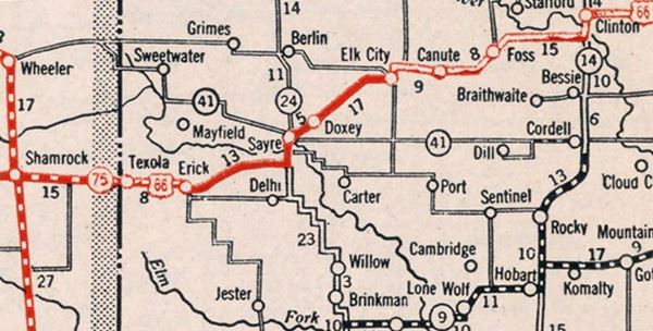
The map below, from 1931, shows Route 66 from Clinton OK, to Shamrock TX, with Texola on the far left. Part of the alignment was paved (solid red line) and the rest was unpaved yet it was an "All-weather road" west of Erick, through Texola and in Texas.
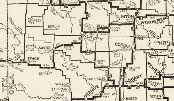
An earlier map, from 1924 -two years before Route 66 was created, shows the alignment of Route 66 in Texola.
Check out Texola on our Map of Route 66 Map in Oklahoma. It has the different US66 alignments and all the towns along it.
This map shows US 66's alignment in Texola
Route 66 Alignment near Texola
- Texola to Amarillo (next)
- Clinton to Texola (Texola's)
- Yukon to Clinton (previous)
Route 66 landmarks & attractions
What to see and do in Texola
We have a great description of Route 66 in Jack DeVere Rittenhouse's iconic travel guide: "A Guide Book to Highway 66" published in 1946. In it he wrote that Texola had "gas; cafes; no courts; limited facilities", its population was 337 and he described it as a "sun-baked small town" with "stores which truly savor of pioneer days".
We will drive through Texola starting at its eastern tip just west of N 1710 Rd. and Route 66. The tour of Texola is short, only 3.7 miles long (City Tour Map).
Original Route 66 alignment
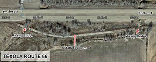
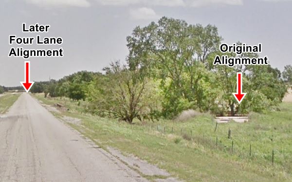
To your left, on the south side of the eastbound lane at Little Turkey Creek, 2.8 miles east of Texola, is a section of the original Route 66 alignment.
The old road runs with a curved alignment between two culverts on the Creek, one at each tip of the segment. The culverts are gone and the road cannot be driven. See this map showing its location.
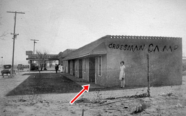
Crossman's Camp
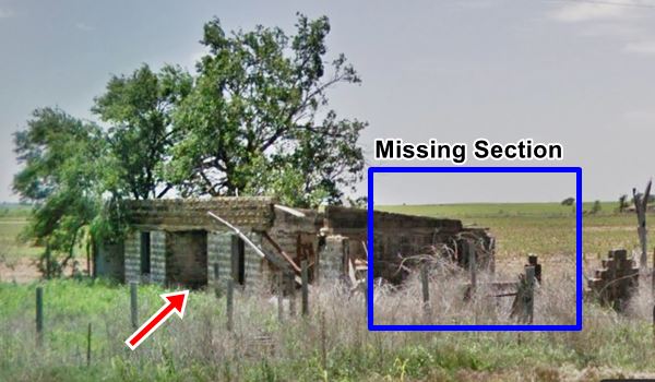
Drive west for 2.2 miles, and on the SW corner of US 66 and N 1680 Rd. you will spot an abandoned building, falling apart. It is what is left of Crossman's Camp.
The building faces the dirt road that runs with a South to North alignment. This was the original 1926 Route 66 alingment, which here turned sharply, 90° to the west, to go through Texola.
A 1937 book (Trailers by Freeman Marsh) mentions two "auto camps" in Texola, Corvallis Auto Camp, and this one, Crossman's Camp, which was on the "E. edge town".
Below is a Then-and-Now sequence, part of the building has collapsed (blue rectangle), and only two of the four garage bays are still visible (red arrow).
Ahead the divided highway's four lanes converge into an urban avenue. On the first corner, Main Ave., head north for one block to visit the old jail.
Texola Jail
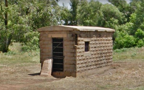
4th St. and Main St. To your right is a single-room or single-cell jail. It is a monolithic stone building that was erected in 1910 with iron bars for door and windows to incarcerate the local ruffians.
There is a stone with an inscription next to the jail's door: "Seniors 39" and a list of names of students of the Class of 1939.
Friendly Cafe
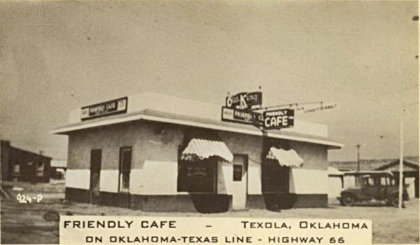
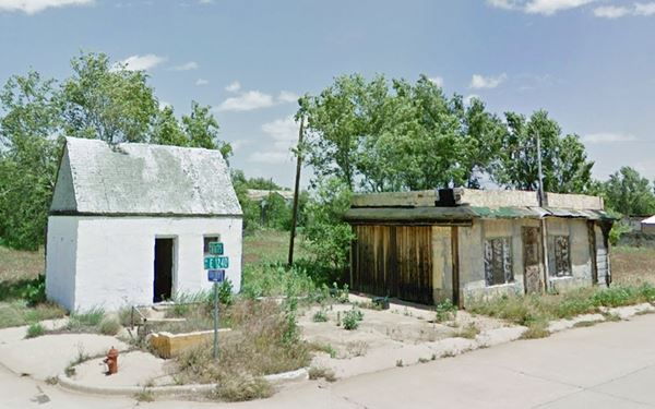
Retrace your steps and head west along Route 66, on the second block, at Grand Ave. and Route 66 (NE corner) is a former café and gas station (?).
The building -like most of the town- is a shambles. It is flanked on its northwestern side by a small building with a steep gabled roof, which may have been a gas station.
Below is a Then-and-Now set of images. The old Cafe is clearly recognizable, in the old postcard it had a neon sign and window awnings.
Magnolia Service Station
Across the street, on the southwestern corner of Grand Ave. and Route 66, Texola, OK.
Listed in the National Register of Historic Places
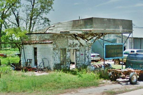
This ruinous building is all that remains of a vintage 1930's Route 66 Magnolia Service Station in Texola.
It was built around 1930 with a very simple design: "box and canopy" in which the office was a cube facing the filling bay which in turn was covered by a streamlined canopy that continued as one unit with the office.
It sold Magnolia brand fuel. It is also a departure from the "cottage" style seen in other gasoline filling stations of that period. It reflects a more austere and modern design with Art Moderne lines in tone with the Great Depression.
Charles Ballew operated it, and it remained operational until the 1960s. Today it is an abandoned building.
Magnolia gas station Texola, Oklahoma
Tumbleweed and Water Hole #2 Cafe
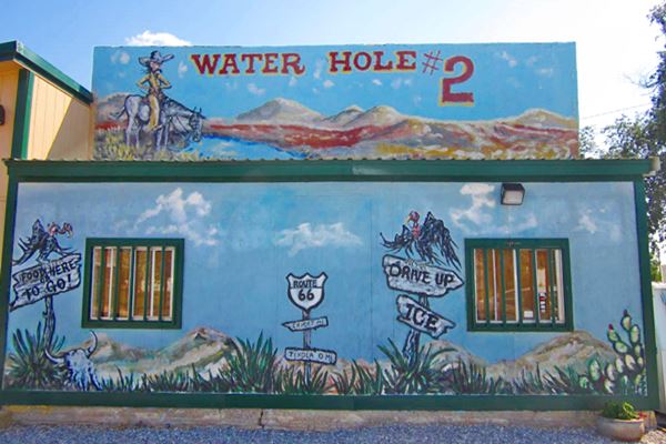
Ahead the road curves to the northwest and has a divider between east and westbound lanes. To your right is a classic cafe.
Cafe and grill, with souvenirs and home cooking. The owners renovated the original ancient structure into the "oldest building on Route 66 operating as a restaurant."
No Place Like Texola Bar
Next to the Cafe, to the west is this old building with a rusting sign. And its two famous signs.
One says "There is no place like Texola". The other has a longer text:
There is no other place
like this place
anywhere near this place
so this must be the place
No longer open, you can see pictures of the old bar at the top of this page.
Texola Route 66 Marker and Shield
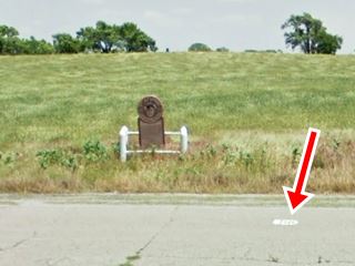
Just 300 yards west of the Old Texola Bar, on the right side of the road is the monument and Marker. Next to it on the road is the painted Route 66 shield (red arrow in the picture).
The marker has the following inscription:
"U.S. 66 Chicago to Los Angeles.
Illinois, Missouri, Kansas, Oklahoma, Texas, New Mexico, Arizona, California.
Will Rogers Highway.
June 26, 1952, on this location, Route 66 was rededicated as the Will Rogers Highway. This was one of the many ceremonies that took place on the state lines
of Illinois, Missouri, Kansas, Texas, New Mexico, Arizona, California as well as Oklahoma, when a booster Caravan traveled from St. Louis, MO. To Santa Monica, CA.
The Caravan was organized by the Natl. U.S. Highway 66 Assoc., Warner Brothers Film Studio, Ford Motor Company, and the Rt. 66 Associations from those eight states.
The original bronze plaque placed here to mark the dedication read:
Will Rogers Highway, Dedicated 1952 to Will Rogers Humorist - World Traveler - Good Neighbor
This Main Street of America Highway 66 Was the first road he traveled in a career that led him straight to the hearts of his countrymen."
State Line
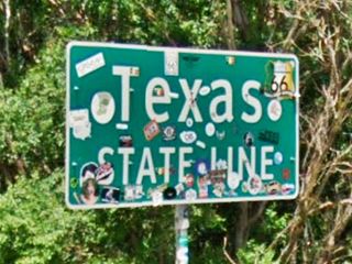
Ahead, 750 feet along the highway is the Texas - Oklahoma state line, marking the end of your journey through Texola.
Some sponsored content
>> Book your Hotel in Tulsa

Credits
Banner image: Hackberry General Store, Hackberry, Arizona by Perla Eichenblat
Texola – Magnolia Service Station National Park Service.
Jack DeVere Rittenhouse, (1946). A Guide Book to Highway 66.


