Index to this page
Historic Route 66 Texola to Amarillo
Texas Route 66 Itinerary and maps
Each leg of Route 66 described below has an interactive map and many image maps so you can follow the alignments of the highway along the way:
New Mexico, next leg
Oklahoma, previous leg
Background on Historic Route 66
The alignments
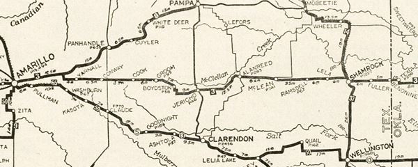
Below is a map published in 1924 (two years before US 66 was created). It shows the different "auto trails" of that time. These were mainly dirt roads that could be driven relatively safely by cars.
You can follow the trail "3" from Texola to Amarillo, this trail was the "Postal Highway". Trail "50" entering Amarillo from the South was the "Ozark Trail" it ran from Oklahoma City westwards to the south of what would later become Route 66.
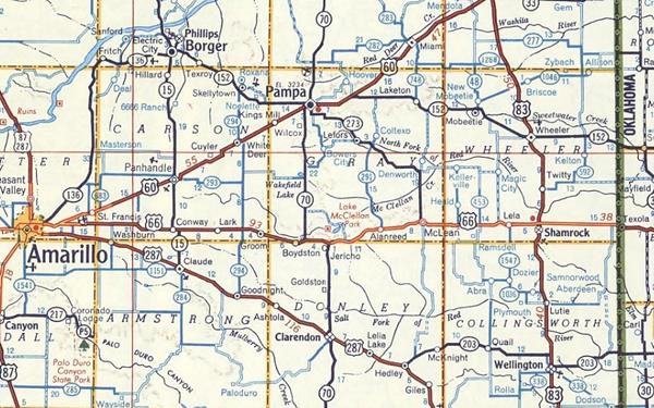
Years later, in 1956, Route 66 was a paved highway, and as you can see below, some parts a were four-lane divided highway all the way to Jericho, and the final part near Amarillo.
Starting point: State line by Texola Oklahoma
Route 66 in Texas begins at state line, less than one mile west of Texola, Oklahoma. The four lane alignment runs with a SE-NW course for half a mile and meets I-40, curving to adopt an east-west course as the South Frontage Road of the freeway and also narrowing down to two single lanes. Here is the fomer railroad depot of Benonine on the north side of I-40 (the tracks of the The Chicago, Rock Island and Gulf Railway, now long gone, ran to the north of the highway).
>> red line in our custom map is the stateline to Shamrock alignment
Route 66 ran along this alignment from 1926 until it was replaced by I-40. Six miles from the start of your journey you will cross the "Historic Bridge" (map showing the spot).
Route 66 Bridge over the Chicago, Rock Island and Gulf Railroad
Listed in the National Register of Historic Places
Located on the Interstate 40 Service Road, about 30 feet (10 m) to the south of I-40. The five-span steel bridge was built to allow the old Route 66 to span the former CRI&G Railroad (Chicago, Rock Island and Gulf Railroad). The railway bed ran 25 feet (7.6 m) below the bridge's deck.
It was designed by M. L. Grady and built by E. T. Prater in 1932. It cost $28,568.74. It is 125 feet (38 m) long and the roadway is 24 feet wide (7.3 m).
Its main span has steel-I-beams encased in concrete, which was quite unique because it made the structure lighter and therefore cheaper. The other spans were built with reinforced concrete as were the retaining walls slabs.
The concrete casing protected the steel structure and also those driving across the bridge from the sparks and smoke of the steam engines running under the bridge. Route 66 traffic crossed this bridge until 1960 when Interstate 40 was completed. Nowadays, the historic U.S. 66 roadbed is part of the I-40 frontage road system.
CRI&G began operating as a chartered company back in 1847. It was the first railroad to bridge the Mississippi and its demise in 1980 was the longest one in the history of U.S. railways. The tracks (rails and ties) that ran below the bridge have been removed.
The bridge stands today as it did back in 1932. It was listed in the National Register of Historic Places in 2007.

1940s four lane highway
In the 1940s the road was upgraded to a four-lane divided highway, the current S. Frontage Rd. carried the eastbound lanes. The westbound ones are now buried under I-40's eastbound lanes.
From the 1970s, to 1985 when Route 66 was deliste, the modern westbound lanes of I-40 were built, and the original Route 66 became its South Frontage Road.
Shamrock
After 14.3 miles, Route 66 reaches Shamrock, (map with directions).
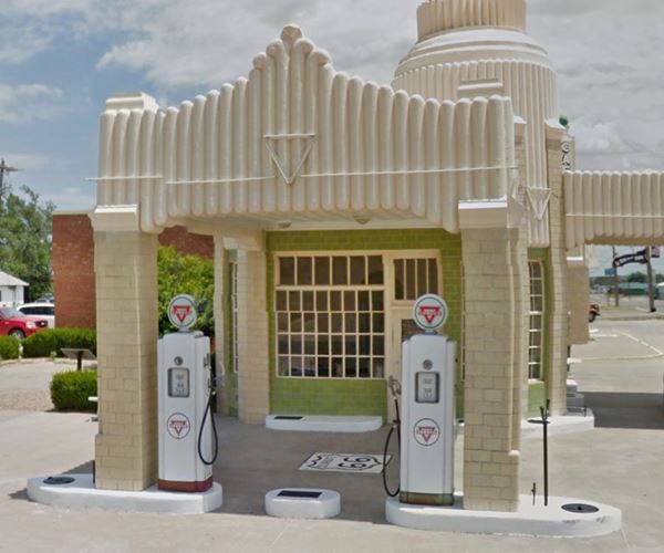
Historic CONOCO Tower Station, Shamrock Texas
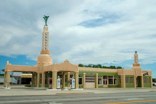
Clinton Steeds
Head west along Route 66 from the Shamrock Conoco Station and head west along Bus I-40 (West 12th Street); it then becomes State Spur 556. One mi west of the Conoco) there is a fork to the right, don't take it, it enters I-40's north Frontage Rd. Stay on the south service Rd. and head west.
Take care with the traffic leaving I-40 just ahead.
Lela
When you reach the crossing of Farm to Market Rd. 1547, you can drive to the other side of I-40 (right turn) to visit the small village of Lela, it now lies to the north of I-40 (Exit 157). In the past it face US 66 but part of the town's block that faced US66 was razed when the freeway was built.
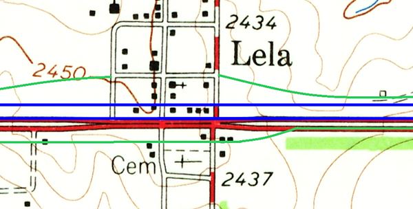
The map above, published by the USGS in 1963 shows how the 4-lane US 66 of those days passed through Lela (red lines). The original westbound lanes are now buried under the eastbound lanes of I-4O (lower blue line). The two city blocks that faced old Route 66 was razed and the westbound lanes of the freeway were built across them (upper blue line). Then the south frontage Rd. (bottom green line) was built and continued the old eastbound Route 66 past the Cemetery. On the north side, a new frontage Rd. was built and it went through what was left of Lela (upper green line).
From: Lela to McLean
>> red line in our custom map is the Lela to McLean 1926-70 US66
Keep westbound along Route 66 and you will reach the next town, McLean.
The original 1926-70s alignment took a SE-NW course into the town but now it is cut off by I-40 (black line in custom map) so you have to enter McLean just ahead at Exit 143, pass under I-40 and drive into the town along its 1st St.
>> black line in our custom map is the gap at I-40 on the eastern side of McLean
The USGS map from 1963 shows that US66 was a divided four-lane highway at that time, and its eastbound lanes ran along Railroad St. while the westbound ones took 1st St.
>> red and blue lines in our custom map are the east and westbound lanes across McLean
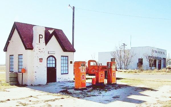
Route 66 west from McLean
The 1926-32 alignment
This was an unpaved road, it ran south along FM Rd 2695 and then west along a course south of the railroad (roughly the one followed by BB Rd. nowadays), and entered Alanreed, the next town in the alignment along its Main St. (map with directions).
>> green line in our custom map is the 1926-32 McLean to Alanreed US66
1932-56 Alignment west of McLean
The first paved alignment in 1932-36 (solid blue line in the 1936 image map below), curved sharply on the western side of McLean and followed the now abandoned Rock Island and Gulf Railway. It took what is now 26 1&frasl2 Rd. and ran on the north side of the tracks, following its winding alignment until a point where it took a straight course into Alanreed leaving the tracks. Part of this alignment can be driven. In other parts you can see the old roadbed, but it can't be driven.
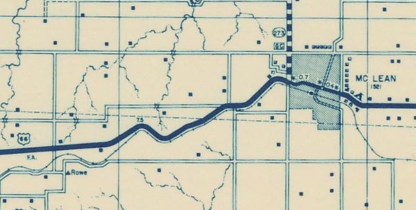
>> 1932-56 alignment in our custom map is color coded as follows:
Pale blue: northern segment, that can be driven. Bordeaux: middle segment, can't be driven. Teal: driveable south leg. Yellow: old roadbed visible by the highway.
The first part of this alignment is this one Map with directions, and can be driven. Then comes a section where the road is no longer in use, abandoned (bordeaux line in our custom map), and finally a section on the western tip that once again can be driven: Map with directions (teal line in our custom map). Please note that these roads may run inside private property!
In this Satellite View you can see the abandoned roadbed, paved and in very bad shape.
Just ahead, to your left, you can see some of the 1930s original paving, now abandoned, to the south of the S. Frontage Rd. (red arrow in image below, and see this satellite image where it describes a curve). Marked with a yellow line in our custom map.
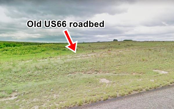
1956-70s US &&
The highway was upgraded to four lanes and followed a straighter course west of McLean:
>> violet line in our custom map is the 1956-70s US 66 West of McLean
Towards Alanreed
West of that point, the 1933 to 1940s two lane highway ran more or less along what is now the S. Frontage Rd. for 5 miles into the next community, Alanreed (map with directions).
>> orange line in our custom map is US66 into Alanreed
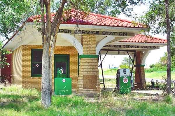
The 1926-32 and the 1932-70s alignment met in the town, by the 66 Super Service Texaco station pictured above on Main (old US66) and the later US 66 alignment.
West of Alanreed
After driving through Alanreed keep west along the south Frontage Road of I-40, this is a new roadway built in the 1960s. The original 1926-60s alignment is mostly buried by the freeway. This segment can be driven but it becomes a dirt road that ends in a dead end further west. So at Exit 132 of I-40 you have to leave the old alignment. The eastern part of this alignment was paved in 1933, the western part was nerver paved.
>> orange and lines in our custom map are the driveable section of US 66 west of Alanreed
The gaps are located in "Rockledge", and marked in black:
>> black lines in our custom map are the gaps where the road has been removed.
Jericho Gap
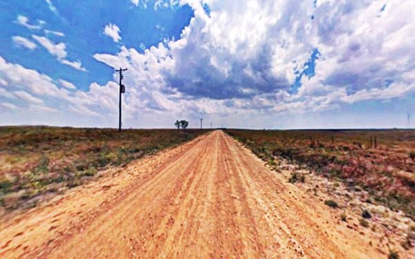
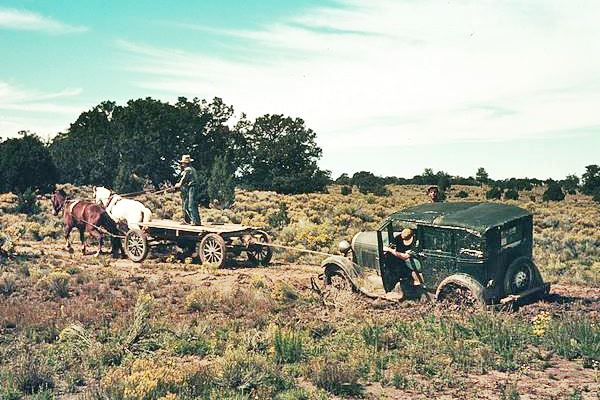
The infamous muddy stretch of the Jericho Gap starts in Rockledge. The less adventurous should stick to I-40 for the next few miles.
In 1933 the highway was moved to the north, realigned, straightened and paved; and is now under the roadbed of I-40, however a segment of the original aligment survives (map showing where) and can be driven.
>> yellow line in our custom map is the paved 1933-60s Route 66 alignment from West Alanreed to Groom
Jericho
>> red line in our custom map is the driveable Jericho Gap segment
Click on the thumbnail map, to see large sized map showing Route 66 alignment through Jericho TX
Follow I-40 west and leave it at Exit 124, get on to TX-70 southbound, cross to the south side of I-40. Here you can visit the old Jericho Cemetery, a few miles southwest of the Exit and drive the western part of the Jericho Gap into "Boydston". The alignment has a gap at each end.
Otherwise keep on the I-40 westbound and take the overpass at Exit 121 and drive along the south service road westwards.
Groom
At Exit 114 (30 miles) the I-40 Frontage Road becomes I-40BUS and goes into the town of Groom (along Front St.), crossing Main St.
>> yellow line in our custom map is US66 entering Groom
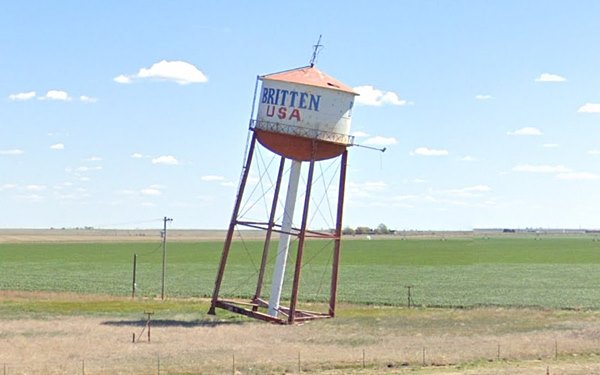
The 1926 to 32 dirt alignment from Jericho reached Groom from the east on the North side of the Freeway (blue line in our custom map). The alignment is now cut by I-40.
Groom to Conway
Leave Groom along Route 66 and head west, the road meets I-40 again at Exit 110. Drive along the south service road (west) and pass Exit 105 which is an I-40 overpass with CR-V on the south and FM-2880 on the north; here was a small but now defunct town: Lark.
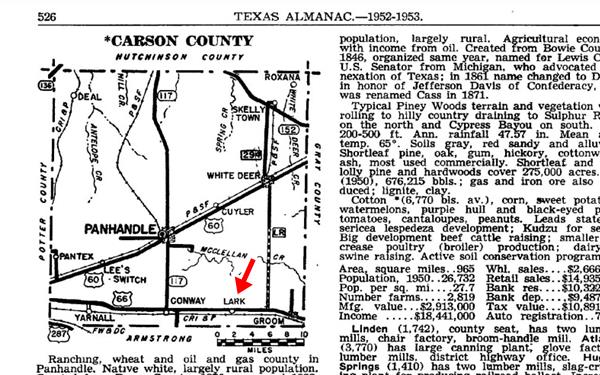
>> pale blue line in our custom map is the Groom to Conway alignment
At the next large intersection you will find County Rd O on the north, leading to I-40's Exit 98 and TX-207 which goes straight ahead, westwards. Take it; this road is the Texas Historic US-66 (TX-207).
Conway
Just ahead there is another crossing: FM 2161 heads west; this road is the old US-66, and it continues west towards Amarillo. At this crossing is the site of the small town of Conway.
Bug Ranch, Graffiti covered Beetles nose down in the ground, Conway Texas
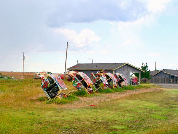
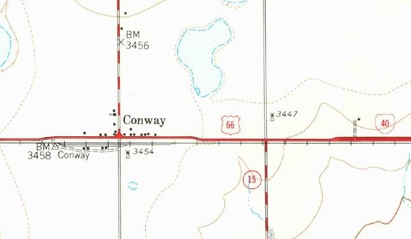
From Conway to Amarillo, TX
This segment of US 66 was listed in the National Register of Historic Places in 2007.
>> red line in our custom map is the Historic Conway segment of Route 66
Ahead the road curves slightly after crossing CR I at the point where FM 2 branches of to the left (this left fork was the 1926 original alignment). Keep right, on U.S. 66 until meeting I-40 by Exit 89. That is where the Historic segment ends. Exit 89 cut the old alignment, that curved here and ran west (now as the N Frontage Rd)
Amarillo
Towards Amarillo Along the 1926-32 alignment
The 1926 to 32 alignment of Route 66 approached Amarillo through the Southeast, from Conway to Washburn, and along US 287 into Amarillo.
>> gren line in our custom map is the 1926-32 US 66 into Amarillo
To Amarillo along the later alignments
The 1932 roadway (comprises the western part of the Historic Alignment west of Conway, and then ran straight west into Amarillo.
Pass the next Exit 87 (FM 2372) and keep west along the north frontage road. There is a rest area just after the exit (see the Peace Farm on the right).
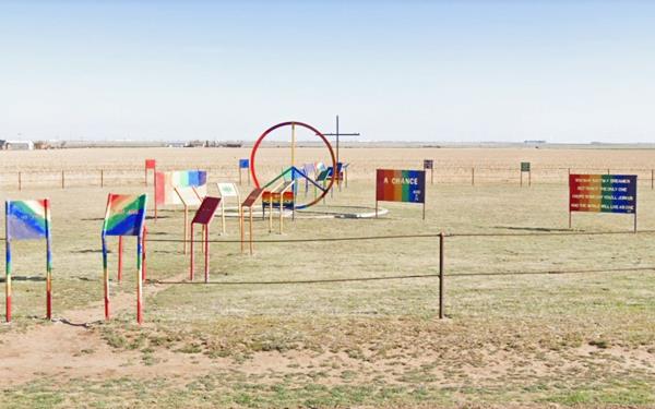
>> navy blue line in our custom map is the 1932-56 US 66 into Amarillo. Notice the gap (black line) at the airport.
Routes into Amarillo
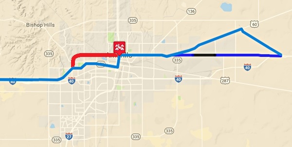
Alignments of Route 66 Through Amarillo.
Click links for large size image maps
Color Key to these maps of Route 66 in Amarillo: Pale Blue: driveable 1956-85 Route 66 alignment into Amarillo; Blue line: 1932-56 Route 66 alignment now cut by the airport. Black line: roadbed now gone or buried under airport.
Our custom maps:
>> black line in our custom map is the gap at the airport
>> blue line in our custom map is the 1932-56 Route 66 West of the Airport
The 1932 and 1956 alignments meet on the western side of the airport at the "Triangle" and head into Downtown Amarillo:
>> red line in our custom map is the 1932-85 US 66 into Amarillo
Keep on straight along Amarillo Blvd till you reach Pierce St. (US 87) in the center of the city of Amarillo.
Route 66 1932-56 alignment and the 1956-85 Alignments Split Here
At Fillmore and East Amarillo Blvd. the original Route 66 alignment turned south along S Fillmore St. and headed into Downtown Amarillo (now it does so along Pierce St.)
>> violet line in our custom map is the 1932-56 US66 into Downtown
Only in 1956 did Route 66 bypass the city center, as a "Beltline", that curved around the city along W Amarillo Blvd. The older alignment became B.R. 66. See Map with directions of Beltline 66.
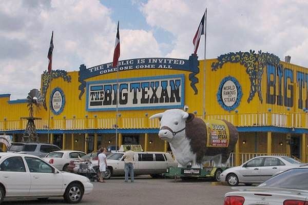
Amarillo, the end of your Journey
This marks the end of this leg of Route 66. In our next section we describe the highway west of Downtown Amarillo all the way to Glenrio on the state line with New Mexico.
Next Section
Route 66's alignments from Amarillo to Glenrio
Previous Section
Route 66's alignments from Clinton to Texola

Some sponsored content
> > Book your Hotel in Amarillo

Credits
Banner image: Hackberry General Store, Hackberry, Arizona by Perla Eichenblat.
Survey of Route 66 through Texas Texas Historical Commission.
Maps Texas Historical Commission.


