Route 66 in Victorville CA
Index to this page
About Victorville California
Facts, Trivia and useful information
Elevation 2,726 ft (831 m). Population 141,689 (2025).
Time zone: Pacific (MST): UTC minus 8 hours. Summer (DST) PDT (UTC-7).
Victorville is a city located on Route 66, in the Mojave River Valley, in south western San Bernardino County, in the south of California.
The History of Victorville, California
This part of California has been inhabited for the last 10,000 years. During the recent historic period, the local natives along the Mojave River and the northern foothills of the San Gabriel and San Bernardino Mountains were named "Vanyume" or "Beñemé" by a Spanish missionary, Father Garces during his 1776 expedition to visit the Hopi in Arizona.
These Native Americans traded with other tribes that lived on the Pacific Ocean coast and on the Colorado River. The Vanyume fed on oak acorns gathered in the mountains and spoke a dialect of the Serrano language. The "Serrano", which in Spanish means "mountain people", lived in the San Bernardino Mountains to the southeast of Victorville.
The Spaniards had explored California in 1602 and founded Los Angeles in 1769. From there they slowly moved west and established the Mission San Gabriel Arcángel (1771) and in 1810 they reached San Bernardino where a mission established in 1819 and a Ranch in 1842.
Mojave Trail or Mojave Road
Father Garcés crossed the Mojave desert along the Mojave Trail, an ancient route used by the natives that runs from Cajon Pass - a gap between the San Bernardino and San Gabriel Mountains in the south- to the Colorado River. It follows the Mojave River.
Mojave River
The Mojave river is an itermitent river that flows in a closed basin with an area of 4,580 sq. mi. (11.862 km2), its source is in the San Bernardino Mountains at an elevation of 3,000 ft (900 m) and it discharges into Soda Lake, in the Mojave Desert.
It is 110 mi long (177 km) and its flow ranges from nil to a maximum of 70,600 cu. ft. (2.0000 m3). Most of its water flow is underground as the river bed is dry most of the year.
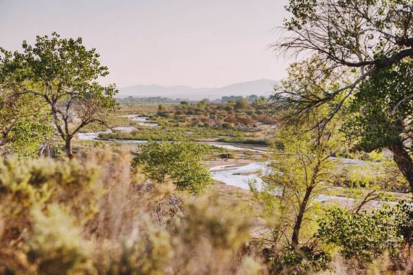
Father Garces named it in 1776 as Arroyo de los Mártires (Martyrs' Creek). It runs on the north side of Victorville, and the underground course of the Mohave River was marked by vegetation growing next to it.
Jedediah Smith became the first American to use the trail when he headed west from Utah in 1826 and he named the water course as the "Inconstant River". By that time, Mexico had become independent from Spain (1821) and what is now the southwestern USA was part of Mexico.
When the US defeated Mexico in the 1846-48 war it annexed these territories to the Union.
Later, the Mormons expanded west and settled along the "Mormon Corridor", buying the San Bernardino ranch in 1851 and founding the town of San Bernardino.
The first settler in Victor Valley was Aaron G. Lane a veteran of the Mexican-American war. In 1858 he set up his homestead on the Mojave River, beside its lower crossing, close to what is now Oro Grande. At his way station Lane offered lodging and groceries to travellers trekking along the Mojave Trail. He catered to Lt. Edward Beale during his expedition that surveyed a wagon trail from Fort Smith in Arkansas to California.
Lane's Crossing was located at what is now Turner Rd., two miles north of where I-15 crosses the river. Lane sold his way station to John F. Miller who renamed the spot Pioneer Station. Population grew to 10 in 1860.
The Highmoor family were Mormon pioneers and they settled at Highmoor's Crossing, near today's Oro Grande bridge. In 1867 Lafayette Meacham, another Mormon made a wagon road from his station in Barstow to what is now Victorville, the "Stoddard Wells Road" it crossed the River at 6th St., at "Mormon Crossing".
A stage coach stop was built there in 1870 and gold was discovered in the area in 1873.
The Railroad
When silver was found in the Calico Mountains near Barstow in 1881, the Southern Pacific Railroad (SP) extended its line from Bakersfield to the mines and tried to block their rival, the Atlantic & Pacific Railroad (A & P) from reaching California. But they were too late. A &P (that later was absorbed by the Atchison Topeka & Santa Fe Railroad), had already crossed the Colorado River at Needles in 1883. Both lines linked there. In 1884 A &P forced its rival to sell them the Mojave line. In 1885 it built its line south towards San Bernardino through Cajon Pass, passing through Mormon Crossing and building a siding there, naming it "Victor".
Victorville, the name
The siding was named Victor after the General Manager of California Southern Railroad, Jacob Victor Nash. But changed to Victorville in 1901 to avoid confusion with the town of Victor in Colorado.
The town was platted in 1886 and farming was the mainstay of the local economy until limestone and granite were mined. Later cement became the most important industry.
The National Old Trails highway built in the early 1900s followed the Mojave and the railroad from Victorville to Barstow, and in 1926 Route 66 was aligned along it.
The Army Airfield was built between 1941 and 43 during World War II and it was deactivated in 1992, now it is the Southern California Logistics Airport, which is an airplane boneyard.
After the war, traffic grew peaking in 1960 at over 1.1 million travellers passing through Victorville that year. A new safer road was needed and it was finally built: I-15. The freeway opened in stages, the section from the foot of Cajon Pass through Victorville to Barstow was completed in 1958, sealing the fate of the towns along the old Route 66 alignment (Helendale, Oro Grande, Lenwood and Hodges). I-15 was completed across the Pass into San Bernardino in 1971-72.
Faster flowing traffic meant that overnight stops in Victorville fell, hurting the Route 66 motels and as it bypassed the commercial district, where many shops closed.

Accommodation in Victorville: Where to Stay
There are many lodging options in town.
> > Book your Hotel in Victorville
More Lodging Near Victorville along Route 66
Below you will find a list with some of the towns along Route 66 east and west of Victorville; click on any of the links to find your hotel in these towns.
>> Check out RV campground nearby in Barstow and also in Victorville
The Weather in Victorville
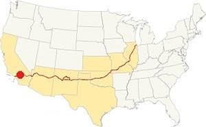
Location of Victorville on Route 66
The weather in Victorville is dry -arid climate- with cool winters and hot summers (hotter than in the Los Angeles area). The average summer (Jul) high is 99°F (37°C) and the average winter high (Jan) is 60°F (16°C). The average low during summer (Jul) is 61°F (16°C), and in winter (Jan) is 31°F (-1°C) - below freezing.
Little rain falls in the area: 6.2 in (158 mm), with most of it falling during the Dec. through Mar. period. June is the driest month (0.06 in - 1.5 mm) of rain. There are 28 days with precipitation per year.
You can expect around 1.4 inches (36 mm) of snow on average yearly. You will see snow in the high mountain area south of Victorville, at Cajon Pass during winter.
Tornado risk
As Victorville is located very far from the Rocky Mountains (western limit for tornadoes), there is no risk of tornadoes in this area.
Tornado Risk: read more about Tornado Risk along Route66.
Map of Route 66 in Victorville
Read about the Barstow to Pasadena alignment in our dedicated webpage. Below is an interactive map of this section:
>> Custom map with the alignments of US66 in Victorville.
From the N.O.T. Highway to U.S. 66

1927 Road map, SW CA
Click on image to enlarge.
Credits

1956 Shell Roadmap, SW CA
Click on image to enlarge.
Credits
National Old Trails Highway (N.O.T.) in Victorville
In the early 1900s, the use of the automobile had grown considerably and better roads were needed, so the National Old Trails (N.O.T.) association planned a road from Los Angeles to New York, and they aligned it next to the AT & Santa Fe railroad tracks from Cajon Pass, through Victorville, and then via Barstow, to Needles.
The Automobile Club of Southern California's map of 1912 showed Victorville as having gasoline; the road south of the town headed towards Hesperia, with a secondary road going along a shorter course towards Cajon Pass.
The map above -click on it to enlarge it- shows the main trail via the Mojave River, and another that crossed the Rainbow Bridge and went via Stoddard Well to Daggett. It was shorter, and I-15 takes a similar course nowadays.
By 1915 the town offered travelers "Meals - Lodgings, Gasoline - Oil, Garage Repairs." That year, the road from San Bernardino to Barstow became California’s highway LRN 31; becoming the first section of the route to be brought under state jurisdiction. During the early 1920s, the N.O.T. guide described the town as having. "Garage and camp grounds, stores and hotels. A new farming community is being developed here". By 1924 the main road had bypassed Hesperia, and Victorville had added a "Hotel - Garage."
In 1926, the N.O.T. highway became part of the US highway network and the section west of New Mexico became US 66. Nevertheless, Route 66 was known as the "National Old Trails Road" for many years in California. In 1926 U.S. Highway 66 was paved from Victorville southwest into Los Angeles, and the road eastward to Daggett was upgraded to a gravel surface roadway.
Route 66 Alignment near Victorville
With maps and full information on the Mother Road.
- Pasadena to Santa Monica (Next)
- Barstow to Pasadena (Victorville's)
- Topock to Barstow (Previous)

Route 66 sights in Victorville
If you visit Las Vegas
Some tours and sightseeing
Sponsored
Historic Context
Jack Rittenhouse mentioned the city in his "Guidebook to U.S. Highway 66" published in 1946, it was a lengthy entry:
Victorville... several tourist courts, small hotels, garages, cafes and all tourist facilities... Rittenhouse (1946)
Rittenhouse mentioned the Mormon pioneers, and that the town was a farming and resort center, that it was a location for western movies.
The 1939 "Guide to the Golden State" written by the WPA described the town as follows:
VICTORVILLE... is a curious blend of the present and the past a past carefully preserved.
[...] Mining here had dwindled to insignificant proportions by 1900, but the characteristic false front frontier buildings remained, attracting, a decade and a half later, the attention of the young motion-picture industry.
From 1914 to 1937 the town and its "wild West" back country were used as the locale for more than 200 films. [...] Victorville admits its attempts to recapture its waning movie trade.
The atmosphere of OLD TOWN across the railroad tracks (L) is zealously preserved. Even when new ranch houses, corrals, and stables are built in the cattle range back country, they are constructed in the old style to meet the demands of location scouts. Meanwhile, Victorville pursues a more prosaic destiny as the trade center for irrigated farming and poultry and cattle ranches, and as headquarters for quarrying and mining interests. In the heart of town is (L) the ARENA OF THE VICTORVILLE NON-PROFESSIONAL RODEO (two days each Oct.; adm. $1), sponsored by 50 Hollywood writers and actors. Only cowboys working on the ranges of the Southwest are permitted to compete.
US 66 crosses rolling desert country again toward immense blue ranges....WPA (1939)
Victorville and its Route 66 attractions
Where the Mojave meets the mountains
The town's motto is "Key City" of the High Desert ("High Desert" is a name used to define the southern California desert region between 2,000 feet (610 m) and below 4,000 feet (1220 m).
We will follow the alignment of Route 66 through Victorville, starting on the western tip of neighboring Oro Grande, at the old 1930s steel truss bridge across the Mojave River 3.2 mi. north of Downtown Victorville. Here, unlike its northern course, the river carries water year-round because of the bedrock under the river bed. To the north, when sand replaces the bedrock, the river flows under the surface and appears dry.
The banks of the river are verdant and forested.
Pueblo Lodge (gone)
One-half mile west of the bridge, to your right, is an empty lot where this motel used to stand. It had 30 apartments and was owned by John F. and Mary Downing. You can see its ad in the 1959 local telephone directory and this is 1952 postcard of it. It was torn down around 1990 as you can see in the aerial photos of it.
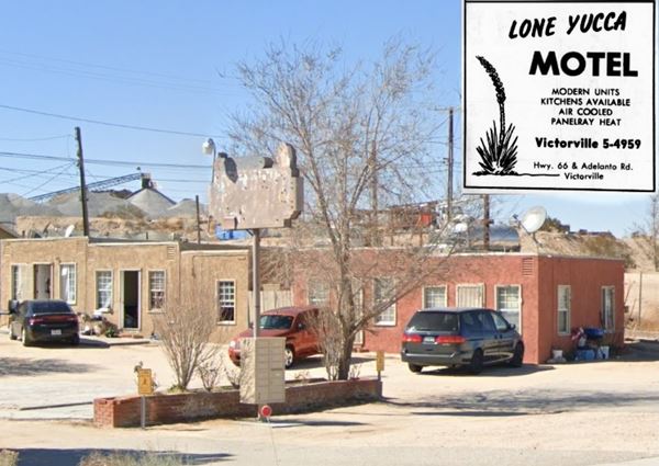
Lone Yucca Motel
Adjacent to the Pueblo Lodge, at 17742 N D Rd. is what used to be the Lone Yucca Motel, now an apartment complex. It appeared in the 1959 phone directory as being located on Hwy 66 and Adelanto Rd. Its old neon sign is still there, fading and rusting atop a slender steel pole, and the original units can still be seen.
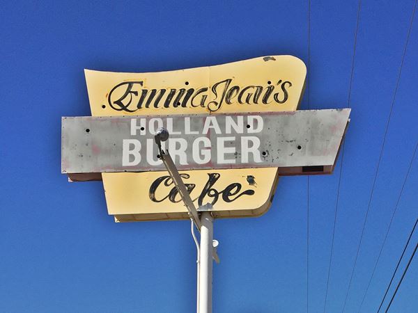
Emma Jean's Café and Truck Stop
Route 66 Marker Plaque on the site
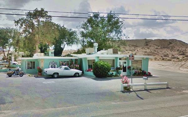
Head southbound towards Victorville, and on your right, after 0.6 miles you will see a classic Route 66 Café at 17143 N D St.
Self-proclaimed as home of the Brian Burger (after Brian, Emma's son, owner of the café); there is a plaque dedicated by the Billy Holcomb Chapter of the Ancient and Honorable Order of E Clampus Vitus (2011), that tells the story of the Café.
Emma's Cafe at Victorville
Click for St. view
It opened in 1947 and was built by Bob and Kate Holland. Emma Jean, wife of Richard Gentry worked as a waitress here for many years and when Richard bought the cafe in 1979, he renamed it after his wife as "Jean's Holland Burger Café".
Emma Jean died in 1996 and Richard in 2008 but his son Brian and his wife Shawna still run the place. Read more at .
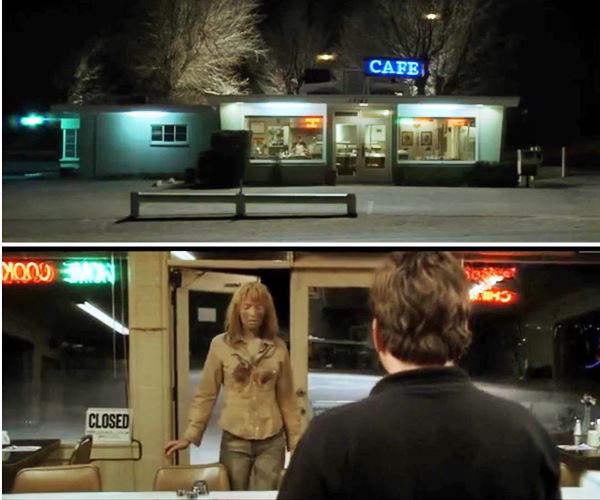
The place was a location site for the famous "May I have a glass of water, please?" scene in Kill Bill: Vol. 2, filmed in 2004.
Into the Old Town in Victorville
Follow Route 66 (North D Street) towards Victorville you will see the cement plant to your left, on the other side of the railroad. Pass under I-15 at Exit 153 and you will reach the city of Victorville, many of the classic old buildings are gone but others have survived.
Old Gas Station
To your left at 16568 D St, on the north side of the road is JJ Tire, a former gas station with two service bays facing the highway, and its empty concrete pumps island under a flat tin canopy with curved tips. This is a classic 1950s service station and it appears in the 1952 aerial photo of the area. Pictured below.
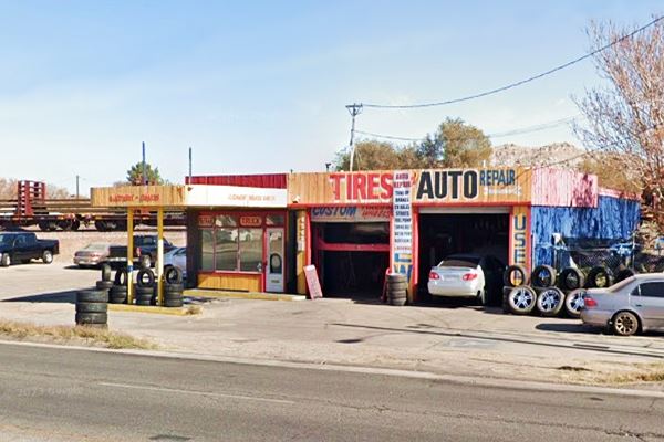
The local 1959-62 telephone directory mentions three gas stations at this location, an ad of "Eddie O'Neal Desa-Mo-Oil Co. Service Is Our Business. Tires, Batteries Accessories, 1st & D, "Clark's Service Mobil Products Hwy 66 & 1st," and "Weber's Shell Service, 1st & D." JJ Tire was one of them, another was the building located opposite, on the NW corner of 1st Street at 16593 D St., an auto repair shop with two service bays that also appears in the aerial photos (St. view), which was the third?.
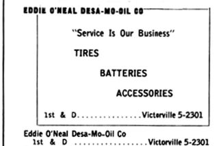
Desa-Mo-Oil phone book ad, 1959
Another Vintage Gas Station
On the SW corner with 4th St., there is another old gas station at 16745 D St., a small building with a single service bay, and a flat canopy over a now vacant gas pumps island.
California Route 66 Museum
Route 66 Roadside Attraction
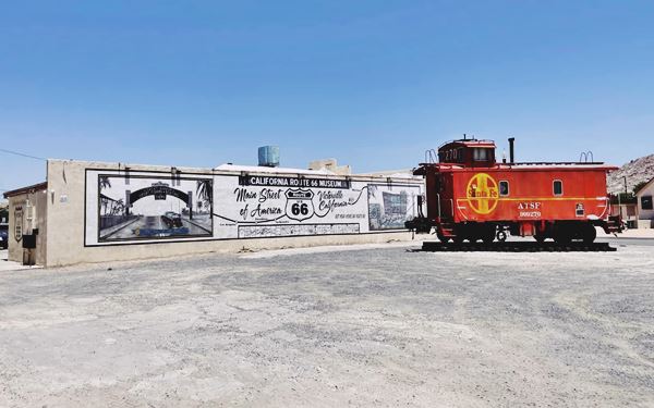
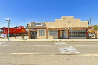
Ahead, at 16825 South D St. Between 5th and 6th streets is the interactive museum.
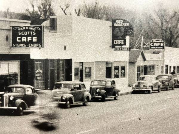
It is located in the building of the old "Red Rooster Cafe, Restaurant and Cocktail Lounge" that opened in the 1930s
It was used as a location for the movie "The Jazz Singer" with a scene shot here as a stand in for Laredo TX, in 1980 and starring Neil Diamond as Jess Robin.
It covers more than 4,500 sq.ft. (418 m2) including a recreated 1950s diner, a Hippy 1960s VW Love Bus and a 1910s Ford T.
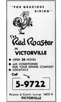
1959 phone directory ad, Red Rooster, Victorville
Visit the "outhouse," enjoy the mural and the caboose, and pick up some Route 66 gifts at the gift shop. More information at the Museum's Facebook page.
The black and white image further up shows how it was in the 1940s with Scott's Cafe, that in the 1960s it became Riley B's Restaurant and Cocktails; and Fred's Cake lounge flanking the Red Rooster. Both buildings have been torn down.
The original Railway Depot stood across the street from the museum. It was torn down long ago. A long, single-story, gable roofed building. Service stopped in 1971. There is a transportation center near the old railway station.
At 7th Street, Route 66 turned sharply to the right, heading south into the town. But before driving along it, take a short side trip to see two landmarks on the north side of town.
North side of Victorville
It is a 3.9 mile round trip (map with directions).
Trigger statue, Roy Rogers steed
At 16020 Apple Valley Rd., Spirit River Center.
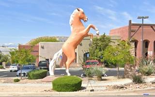
Roy Rogers (1911-1998) was a famous actor, the "King of the Cowboys" in movies and on Rogers' TV show. His loyal steed Trigger, a Golden Palomino, who appeared in dozens of movies, has its 24-foot-tall statue in Victorville. Roy Rogers Ranch is located in neighboring Oro Grande, close to Route 66.
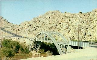
Rainbow Bridge c.1950, Victorville CA. Source. Click image to enlarge
Rainbow Bridge
The old trail from Victorville to Stoddard Well and onwards to Daggett crossed the river here using a bridge built in 1891. It was replaced in 1928 by the "Rainbow" bridge. This bridge is no longer in use, and spans the Mojave River at the Mojave Narrows, and the railroad that runs along the southern bank of the river. In 1963 the old bridge was replaced by the Upper Mojave Narrows Bridge. It can be seen on the western side of the modern bridge on Highway 18.
Head back to 7th Street and turn south into Victorville proper.
Downtown Victorville
Site of the old Hotels, all gone
7th Street was the old town's main street. On its southwest corner, where the service station now stands, the 1959 phone books places the "Hotel Pioneer, 16853 D a good place to stop. Rooms with Bath. Steam Heat. 100% Air Conditioned... Margie Hensley-Prop" followed at 16889 D by the Hotel Stewart that offered weekly rates (pictured below as the two-story corner building in the 1950s). Across the street, on the southeast corner, was the "Mojave Hotel. 16927 D. Modern - Air Conditioned. Panel Ray Heat. Weekly & Monthly Rates," now a car repair shop occupies the premises. These hotels, mentioned by Rittenhouse in 1946, were originally built to cater to railroad passengers. This corner has changed considerably and is unrecognizable compared to its current appearance, as you can see in the "Then and Now" sequence below (click on the images to enlarge them):
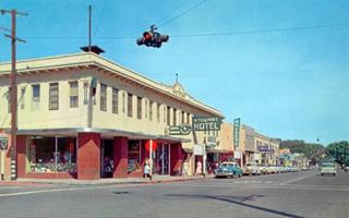
7th & D streets c.1950s, Victorville CA. Source. Click image to enlarge
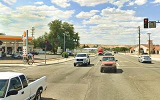
7th & D streets c.1950s, Victorville CA. St. view. Click image to enlarge
Route 66 Old Town gateway
Turning on 7th, you will see the "Route 66 Old Town" gateway across the street. It was erected as part of a City renovation plan of the old Town on Route 66, and in 2021 the archway was refurbished with LED lighting and new signage and arrows decorating the structure (see the original archway before it was upgraded).
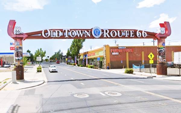
To your right, on the vacant lot beside the gateway's base at 15624 7th, was the now-gone Carl's Texaco service station, next to it was the local Safeways in a building that now houses Alfaro's furniture store.
Across 7th at 15625, was Culbertson's Service Station.
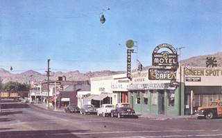
7th & C streets c.1940s, Victorville CA. Source. Click image to enlarge
Where the Mobil Station is now located there was a local bowling alley followed by the Green Sopot Cafe and Cocktails Annex, on the NE corner of C St and 7th, it was also the Greyhound bus stop. Across C, on its SE corner (15595 7th) was a "Bud Hetzler's Shell Service with Goodyear Tires, Batteries and Guaranteed Recapping"., that he relocated to the NE corner after thd Green Spot's Cafe was torn down. In the two photographs from the 1940s and 1950s you can see them.
Looking north along 7th Street in the 1950s.
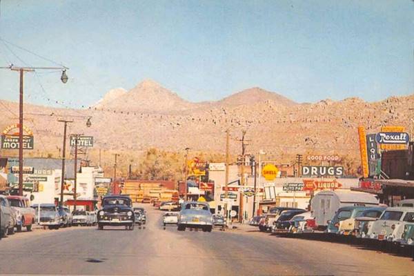
See the current view looking north at that same spot.
Green Spot Motel
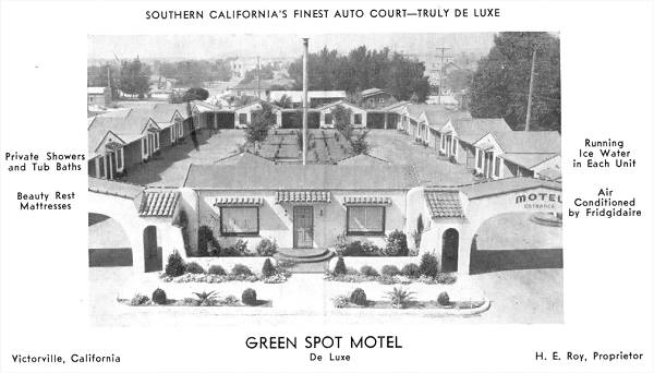
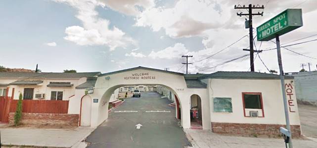
Turn left along C St. and in the middle of that block, to your right, is the classic Route 666 Green Spot Motel, at 16937 C St.
The postcard below states that it is "Southern California's finest auto court - truly de luxe... private showers and tub bath... Beauty rest mattresses... running ice water in each unit... Air conditioned by Frigidaire... H.E. Roy, Proprietor."
It has kept its original appearance, with its cabin-style units around a central courtyard.
The Green Spot Motel in a 1940s postcard
Head back to 7th St., and drive west along it, almost nothing remains of the old cafes, drugstores, diners, garages and service stations. Time has been relentless. They have been torn down: On the corner of 7th and B (15542 7th) was Alfred Broulik's Chevron Service, ahead at A St. there were two gas stations, at 15505 7th was Houghton's Flying A, and on the SW corner (15492) was Love's Signal Service. On the next corner where the Veteran's Memorial is located was Bett's Union Service Station. Ahead where Corona Auto is now located was C.L. Howard's Richfield, across the street, at 15378 was Pebley's Union Service and nest to it is a former motel.
Kleen Spot Auto Court
It was advertised in the 1959 phone directory as follows: "George & Mollie Pace - Owners. Modern Cabins. Reasonable Rates. Steam Heat - Winter. Aire cooled - Summer. 15370-7th St. W Hwy 66." The buildings are still there, the garages that separated the units have been walled in, and the building to the left, now Birrieria Sinaloa) removed the curved pediment, but the main building retained it; see a current view of the place.
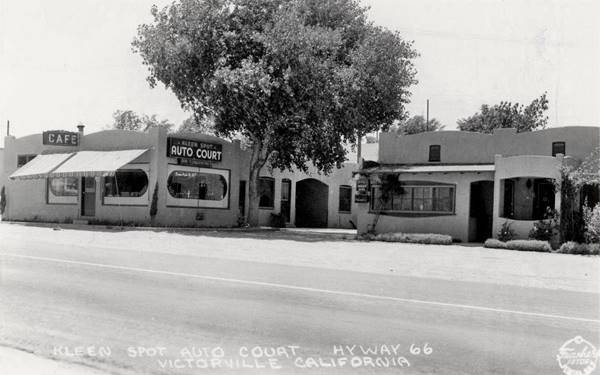
On the corner with Union Street at 15344 7th was Tom & Jerry's Mobile Service (Gral Petroleum Co), now an empty lot. Two blocks west is a small building that housed Rachel & John's Cafe at 15176 7th St. (St. view.)
At 15031 7th is a tire shop that in the 1950s was Fred's Texaco Service its telephone directory advertisement can be seen in the following image. The building has survived, but altered.
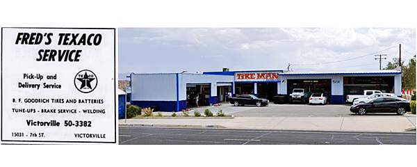
At Merril St (15165 7th) was the now gone Pleasent View Motel.
Victorville Travelodge
To your right at 14998 7th St. was the Travelodge motel that opened in the 1960s and offered travellers "Heated Pool... Free TV... Individual Room Heaters. In Town near Shopping Center & Good Restaurants ." The place survived as a motel until quite recently, though it got ghastly reviews. The images show it "Now and Then".
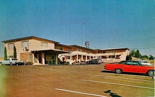
Voyager Motor Lodge
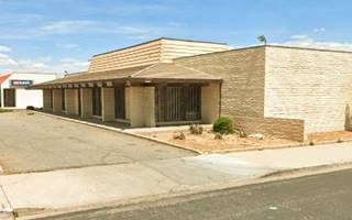
At 14775 7th on the NE corner with Desert Knoll Dr. was the 15-unit Voyager Motor Lodge. It had an unusual block-shaped layout, and the building has survived with many alterations.
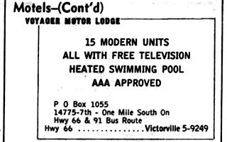
1959 ad, Voyager Motor Lodge
Red Log Cafe
Smith's Red Log Cafe was located across the street, on the SW corner of Desert Knolls Dr. and Route 66 was a popular spot located on "Hwy 66 1⁄4 mi. West, Victorville" it offered dining, nightly dancing, cocktails and Smorgasbord. It belonged to Ward and Marguerite Bible. They also owned Smith's Oasis Cafe in Barstow. Later, Tommy and Edna Hom leased the Red Log Cafe in 1972. It has been torn down.
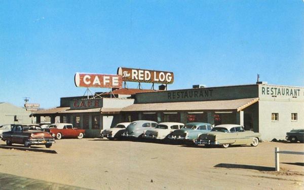
Ahead, at 15090 Hwy 66 the 1959 telephone directory mentions Joshua's Motel it can be seen in the 1952 aerial photograph as having individual cabins around a central courtyard with trees. Now there is a small shopping mall on the site.
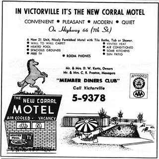
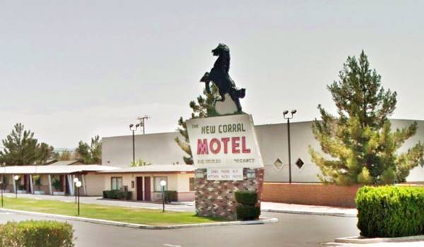
New Corral Motel
Continue westbound, and at 14643 7th St on the left side of Route 66 you will spot the old motel immediately by its rampant colt sign.
It opened in 1953 and has a "L" shaped layout with a central parking area with lawn and pool.
Its 1959 phone directory advertisement shows it was owned by Mr. and Mrs. D.W. Kurtz and managed by another couple, Mr. and Mrs. C. R. Preston., it had 21 units, a heated pool, "Free TV... Sun Patio, Room Phones."
The New Corral reminds us of the days when Old Western movies and Roy Rogers were an important part of Victorville's wild west ambiance.
Green Tree Inn
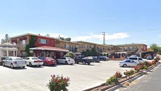
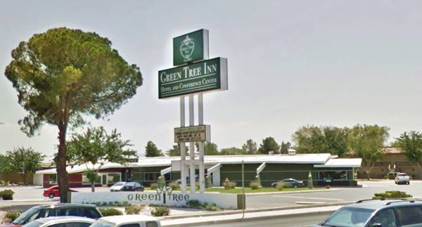
Continue westbound, and at 14173 Green Tree Blvd, you will reach the Green Tree Inn that opened in 1963. It is on your left (reach it via Green Tree Blvd.)
The Inn was built as part of the Golf Country Club in the 1960s, and as I-15 was already there at that time, it was located at a convenient spot, next to the freeway and its exit onto 7th St.
Below are two "Then and Now" views of the Green Tree Inn, which has 200 rooms and suites and a restaurant.
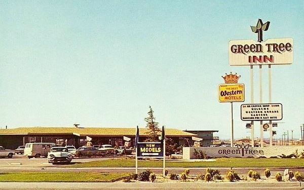
The sign is similar, but lost its 1960s appeal. The pine tree has grown into a healthy tree and the building retains its original looks.
Hesperia
Elevation 3,186 ft (971 m), pop. 100,050 (2024)
Westwards from this point, the original roadway of Route 66 is overlaid by the freeway (I-15), here the highway runs along the western edge of Hesperia, a city located 5 miles east of the alignment. Rittenhouse in 1946 described this segment as follows:
Heading west from Victorville, you enter BALDY MESA, named for the tall peak visible to the southwest... Here are many Joshua trees, twisted shaggy plants. The region is full of cabins built by city folk who find a desert week-end a pleasant diversion...Along the way are several gas stations, one of the best establishments being at 288 mi... at "Millers' Corners." At 290 mi... is a junction with US 395... Rittenhouse (1946)
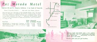
Paz Morada Motel (gone)
Roughly 1 mile west of Bear Valley Rd. on the left side of the highway was a mid 1950s motel (11496 Mariposa Rd) it can be seen in this 1959 aerial picture with the adjacent gas station; it also appeared in the telephone directory of that year.
Paz Morada means "peaceful dwelling" in Spanish. This motel was intended as a destination, not for one night, but to "Rest and play for a few days at Paz Morada Motel - only 1 3⁄4 hours from Los Angeles... enjoy swimming, fishing, hunting, golf, ...hiking or just plain loafing in the sun... Lots of sunshine -no smog or fog... two heated swimming pools, a wading pool, shuffleboard and a playground for the kiddies. Horse corral and miles of good riding". Its daily rates were only $8 on weekdays for bedrooms (2 guests) and $9 on weekends and holidays.
Hulaville
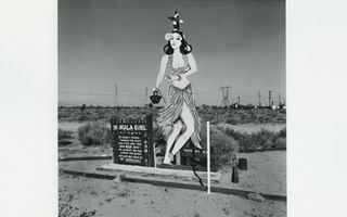
Hula Girl at Hulavillle. Source
If you have stopped by the Elmer's Bottle Tree Ranch in Helendale, you should know that it was inspired by another weird site on Route 66 named "Hulaville" (or "Mahan's Half Acre") which also had wine and beer bottle sculptures, signs, and roadside junk. It was the work of Miles Mahan (1896-1997).
Hulaville was razed long ago but fortunately, some of its works of art (the Hula Girl, pictured above that he scavenged from some tropical restaurant's ruins and the Howdy cowboy are on exhibition at the California Route 66 Museum, here in Victorville; it also has a scale model of Hulaville. See some pictures of the artwork and Mahan.
It was located 2 miles west of the Paz Morada site, at Mesa St. and Amargosa Rd. (Map).
Miller's Corners (gone)
This stop was located at the junction of Main St. with Routes 66 and 91. It was razed to make way for the freeway's Exit 143. You can see it on the western side of the original roadway in this aerial photo taken in 1952. At that time, the area was open countryside.
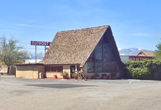
Outpost Cafe
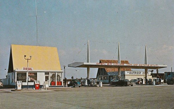
The Outpost Cafe and United Service Station was located 10 miles south of Victorville on the junction of US 66, US 91 and US 395. In the days before the freeway, this was a grade highway intersection and as Rittenhouse mentioned there was a service station there; it can be seen in this 1959 aerial photo. With the freeway, Exit 141 was built and an overpass along Joshua St. was added and the original junction was cut off, and the original service area was razed. Now a cell phone tower stands on the site where you can still see the concrete drive and foundations of the original building (St. view). The Cafe and gas station relocated to their present site in the mid 1960s, and one of the Alpine-style building has survived.
Continue your Road Trip
This leg of your journey ends here; continue your "Route 66 Road Trip" by heading west towards the next stop along the highway: Cajon Pass.

Sponsored Content
>> Book your Hotel in Victorville

Credits
Banner image: Hackberry General Store, Hackberry, Arizona by Perla Eichenblat
A Guide to the Golden State, by the Federal Writers' Project of the Works Progress Administration, Hastings House, New York, 1939.
Jack DeVere Rittenhouse, (1946). A Guide Book to Highway 66.


