Route 66 in Cajon Pass CA
Index to this page
About Cajon Pass California
Facts, Trivia and useful information
Elevation 4,300 ft (1.311 m). Population (2025) n⁄a.
Time zone: Pacific (MST): UTC minus 8 hours. Summer (DST) PDT (UTC-7).
Cajon Pass is a place (not a town or a village) located on Route 66, in south western San Bernardino County in the south of California.
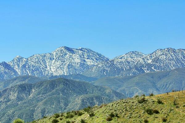
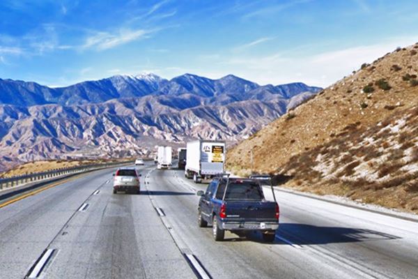
View of the San Gabriel Mountains seen from Cajon Pass
Historic Context of Roads through Cajon Pass
Visit our San Bernardino web page to learn more about the early history of this area.
The name, Cajon Pass
The word Cajon is Spanish for "Box" or "drawer" (cajón), meaning a narrow, boxed-in mountain crossing.
The pass had been used for thousands of years by the Native American people who lived in the area to cross from the Pacific coastal areas and reach the Mojave River and use it to reach the Colorado River and head inland.
In 1772 Pedro Farges (1730-1794), a Spanish officer marched from San Diego California to Monterey and San Francisco along an inland route, and became the first European to cross Cajon Pass.
Father Garces in 1776 used this route on his way to visit the Hopi people in Arizona, but took the old Mojave Indian Trail which runs to the east of the modern highways, from Devore, through Sawpit Canyon to the Mojave River in the north.
The northern approaches to Cajon pass
The Mormons used the pass to reach San Bernardino in the mid 1850s and it was William Sanford who opened the Mormon Trail in 1850. He moved the trail through "Sanford Pass" in 1853 making it easier to use.
North of the pass, the wagon trail, that was adopted by the railroad in 1885), took a wide curve from Victorville, towards the east through Hesperia before tackling the climb along Summit Valley into Cajon Pass.
This route followed the Mojave River, and was the course of the route taken by Father Garces and the one adopted by the "Spanish" and "Santa Fe" trails. It is the one followed by state Hwy. 138 and Summit Valley Rd. nowadays. Later the "Brown turnpike" and the Panamount Stage used this route.
There was a third approach from the north, the "Mormon cut-off" (1852) which ran futher west, from Oro Grande through Baldy Mesa to Summit Valley, it was straigher and shorter.
Toll Way: Brown's Turnpike
When gold was found in the north, an easier route for carts was needed so John Brown, George Tucker, and Henry Willis secured a charter from the California state Legislature in 1861 and built a toll highway across the "Sierra Nevada" it followed the Spanish Trail and was known as "Brown's Turnpike".
The toll for a man with a horse was 25 cents and a wagon payed $1. The 1868 flood razed most of the road but they rebuilt it. It had two toll stations and their concession lasted for 20 years. It then became a free road which was upkept by the county until it was closed in 1938. By then US 66 had replaced it.
Railroads in Cajon Pass
When silver was discovered in 1881 near Barstow, in the Calico Mountains, the Southern Pacific Railroad (SP) extended its line from Bakersfield to move the ore out, and then continued west to block their rival, the Atlantic & Pacific Railroad (A & P) from reaching California.
However, A &P (which later was absorbed by the Atchison Topeka & Santa Fe Railroad), had just crossed the Colorado River at Needles in 1883 so both lines met there.
The following year A &P upped the bet and started building a line westwards towards Barstow, forcing SP to sell them the Mojave line.
In 1885 A&P continued south, from Barstow to San Bernardino going across Cajon Pass. The alignment of the railroad has changed over the years, and in 1972 it was relocated through Summit to reduce the grade in 50 feet. Westwards in Gish and Dell the original 1885 was crossed by Route 66. A new alignment was built trough Alray in 1913 to carry eastbound traffic. And finally in 1967, the Union Pacific built their Palmadale-Colton Cutoff line through Alray.
National Old Trails Highway (N.O.T.) in Cajon Pass
In the early 1900s, the use of the automobile had grown considerably and better roads were needed, so the National Old Trails (N.O.T.) association planned a road from Los Angeles to New York, and they aligned the Californian section close to the AT & Santa Fe railroad tracks from San Bernardino, across Cajon Pass, through Victorville, and then via Barstow, to Needles.
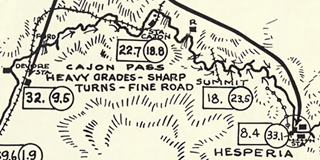
N.O.T map, 1913. Source. Click image to enlarge
At Cajon Pass, the alignment changed over the course of the years. See the red line in our interactive map with the approximate course of the original 1910s-1916 alignment.
The 1912 Automobile Club of Southern California showed the N.O.T. road begin to curve 8 mi. south of Hesperia and 1 mile west it met the SF Railroad, "Summit" was 1 mile ahead and then came an "18% grade" towards "Cajon Station which was 5 miles south, followed, one mile away by "Cozy Dell Store the road crossed the railway tracks several times in this area, and reached Devore 8 miles later.
The 1913 map (click on it to enlarge) shows more or less the same course.
In 1915, the road from San Bernardino to Barstow via Cajon Pass became California’s highway LRN 31; it was the first section of the route to be brought under state jurisdiction.
The 1916 N.O.T. Map shows that the road has been improved as it only crosses the tracks once, north of Cajon Station. "Cosy Dell Store" (now written with an "s") is still there.1
The first part of this route (north side) is a dirt road and requires a high clearance vehicle, the southern part was paved; the N.O.T. paved part of it in the 1910s.
The 1924 map has the main road bypassing Hesperia (which then became the US 66 and I-15 alignment), and has its summit "Cajon Pass EL 4250'" half a mile after the road leaves the desert. Cajon Canyon is shown with the N.O.T. road passing by "Camp Cajon" 6 miles ahead described as "Store-Gas-Oil (Free Auto Camp)", 0.5 mi south was "Cajon" followed 1.5 miles away by "Cosy Dell and as the road enters Blue Cut Canyon,
the "Mountain View Camp" 1 mile ahead. From there it was 6 miles to Devore that had a "Gas Sta.".
See the orange line in our interactive map with this alignment.
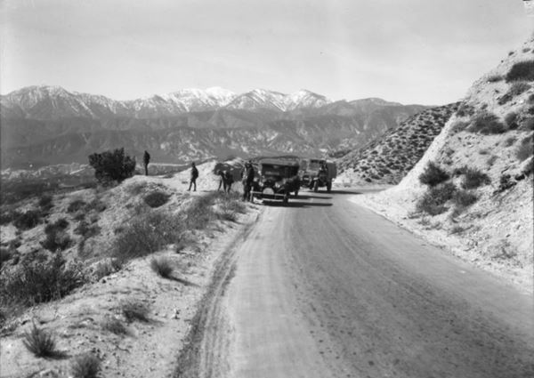
The photo above was taken by A.G. Lucier on Oct. 23, 1920 on the "National Park-to-Park Highway tour" at a lookout on the original roadway of the National Old Trails. It was a narrow meandering highway even though it had been widened to 16 ft. and it had been paved with oiled macadam since 1916.
Route 66 in Cajon Pass
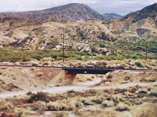
Route 66 was aligned along the N.O.T. roadway in 1926 and used it until it was upgraded to a new alignment in 1930. Below is a picture taken along then new roadway, and the spot is roughly in the spot shown in this map
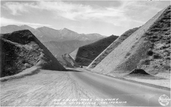
Road Improvements
The new roadway was widened further to 20 ft with 5 foot-wide shoulders, eliminating many of the curves (1930 to 34). Gish and Alray grade crossings were eliminated with underpasses and further west, the Blue Cut area was improved to avoid the landslides caused by the San Andreas fault. Cajon Creek was channelized to prevent flooding. Nevertheless, the great flood of 1938 washed out the road in Blue Cut. So it was relocated further up the hill slope to an area less prone to flooding.
The yellow line in our map shows the two lane U.S. 66 alignment.
Divided Highway in the 1950s
Route 66 was widened to a four lane divided highway across the pass between 1952 and 1955; the second set of lanes is marked with a green line in our custom map, north of Cajon Junction, and with red, blue and yellow lines west of that point.
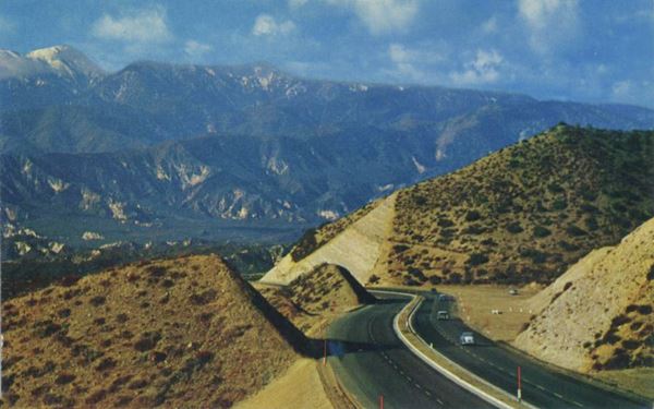
But the highway was not up to the Interstate standard. Traffic grew, peaking in 1960 with over 1.1 million travellers driving through Cajon Pass that year. A new safer road was needed and it was finally built: I-15. With two separate alignments in this part of the pass. It was constructed eastwards from the foot of Cajon Pass through Victorville to Barstow in 1958. Then across the Pass into San Bernardino in 1971-72.
The Pass in a Guidebook from 1939
The WPA "Guide to the Golden State" published in 1939 describes the road from Victorville to San Bernardino in a picturesque prose:
... US 66 crosses rolling desert country again toward immense blue ranges.
MILLERS CORNER, 47.7 m. (3,050 alt.), has a gas station and a few cabins for motorists.
US 66 now sweeps across BALDY MESA (3,000 alt.), a vast, sun-scorched expanse of mesquite and scattered yucca trees. At 49.6 m. is a junction with US 395 (...) , which unites with US 66 for about 30 miles southward.
As the desert surrenders to chaparral-covered foothills, US 66 crosses at 53 m. a boundary of the SAN BERNARDINO NATIONAL FOREST, a preserve of 804,045 acres, containing more than a billion board feet of merchantable timber sugar and Jeffrey pine, big cone spruce, incense cedar and tamarack, among other species. It is maintained principally for watershed protection. A number of streams and lakes in the high country furnish water for hydroelectric power and irrigation, and afford excellent trout fishing.
The mountains draw together to form the mouth of CAJON (Sp., box) PASS, through the Sierra Madre Mountains, for nearly a century the southeastern gateway for overland travel to the coast, since William Wolfskill blazed the Spanish Trail from Santa Fe to Los Angeles through it in 1831. From the summit, 54 m. (4,301 alt.), is an inspiring view over mountains, deserts, orchards, and vineyards. US 66 makes its descent in a series of twisting slopes.
US 66, roughly following (R) alder-grown CAJON CREEK, rolls smoothly downgrade to DEVORE, 67.1 m. (2,025 alt., 153 pop.). MOUNT SAN GORGONIO (11,485 alt.), looms into view. The ARROWHEAD, a natural phenomenon on the face of Arrowhead Peak, is visible at 75.2 m. At 75.3 m. US 66 broad and palm-lined, turns R., dividing the business district (L) of SAN BERNARDINO, 77.1 m. (1,073 alt., 37,486 pop.), seat of San Bernardino County. WPA (1939)
Accommodation in Cajon Pass
You can find a motel at Cajon Junction.
> > Book your Hotel in Cajon Junction
More Lodging Near Cajon Pass along Route 66
Below is a list of some of the towns along Route 66 east and west of Cajon Pass; click on any of the links to find your hotel in these towns.
>> Check out RV campground nearby in San Bernardino
The Weather in Cajon Pass
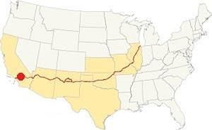
Location of Cajon Pass on Route 66
Cajon Pass experiences extreme weather including snow, wind, and heat. It is at a high altitufde so it gets more rain than the lower areas to the north, this also helps to reduce the temperatures and increase the day - night amplitude.
The average high temperature during summer (July) is 85°F (30°C), and in winter (Jan) it is 51°F (11°C). The average low during summer (Jul) is 64°F (18°C) and in winter (Jan) 37°F (3°C).
Rainfall is lowest from May to September less than 0.1 in (0.3 mm) monthly, January is the wettest month. It can snow in winter. Wildfires and flooding can also cut the traffic.
Tornado risk
Cajon Pass is located well to the west of the Rocky Mountains, so there is no risk of tornados in this part of California.
Tornado Risk: read more about Tornado Risk along Route66.
Map of Route 66 in Cajon Pass
Read about the Barstow to Pasadena alignment in our dedicated webpage. Below is an interactive map of this section:
>> Custom map with the alignments of Route 66 across Cajon Pass.
From the N.O.T. Highway to U.S. 66
The map below from 1927 shows Southwestern California around Los Angeles. You can see the main paved roadway from Victorville to Barstow across Cajon Pass, and Camp Cajon and Cajon are both marked on the map. The old N.O.T. roadway from Hesperia to Camp Cajon also appears in the map.

1927 Road map, SW CA
Click on image to enlarge.
Credits

1956 Shell Roadmap, SW CA
Click on image to enlarge.
Credits
The map above, published in 1956 shows the freeway east of Victorville and west of Verdemont into Los Angeles. The segment between both Verdemont and Victorville is marked as a divided four-lane highway through Cajon and Cajon Pass appearing with an elevation of 4,301 feet.
Route 66 Alignment near Cajon Pass
With maps and full information on the Mother Road.
- Pasadena to Santa Monica (Next)
- Barstow to Pasadena (Cajon Pass')
- Topock to Barstow (Previous)

Cajon Pass attractions and sights
Your Route 66 Road Trip through Cajon Pass
Historic Context
Jack Rittenhouse mentioned the city in his "Guidebook to U.S. Highway 66" published in 1946, it was a lenghty entry:
At 294 mi... you reach CAJON SUMMIT. Gas station here. US 66 then begins to descend through deep cuts in the rock, and winds around to the right in a great descending sweep. This is Cajon Pass... As you descend (sometimes it is necessary to use second gear for safety), your get wonderful, changing vistas of green valleys and mountain ranges in various shades of blue
At 298 mi... is the town of CAJON, providing gas and lunchroom... other gas stations are found frequently along the route of descent. At 299 mi. is a junction with State Road 2, which runs left into Lake Arrowhead, one of the leading mountain resorts of the region. Rittenhouse (1946)
State Road 2 of 1946 is modern CA-138 at Cajon Junction.
The Route Across the Mountains
We will describe this segment heading west from Victorville, the highway climbs from 3,000 feet on the western side of town to 4,000 feet at modern Exit 138 on I-15, the place where the mountains meet the plateau of Baldy Mesa. Here the straight course of Route 66 was altered by the rugged terrain.
Starting at Exit 138, cross to its eastern side and head west along Mariposa Rd., west of the gas station, was the famous Summit Inn. Mariposa Road follows the course of the original Route 66 alignment here; we marked it with a brown line in our custom map. It carried the National Old Trails highway from 1915 to 1926 and Route 66 from then until 1968.
Summit Inn (gone) Three sites
It was located at 5970 Mariposa Rd., past the modern Chevron gas station. This landmark was destroyed by the Blue Cut Fire on Aug. 16, 2016. It is an empty lot and only the sign has survived.
This was the third encarnation and location of this classic landmark; it had stood here since 1955 (or 1952 according to other sources); it was built by Gordon Fields for Mr. Riley in the days when a stop for a coffee or a snack on the "crest" of Route 66 was quite common. Many Las Vegas performers stopped by here en route from Los Angeles to Las Vegas. Below are two views of it while it was still standing.
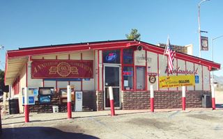
2012 Summit Inn, US66, Hesperia. Source. Click on image to enlarge it
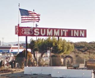
2015 Summit Inn neon sign, US66, Hesperia. St. view. Click on image to enlarge it
It was moved here to remain on the realigned Route 66 when it became a 4-lane highway and bypassed its former location, see the new alignment marked with a pink line in our custom map. See it in this 1959 aerial photo.
1930-1955 (2nd location) Summit Inn
The earlier location was further uphill and it had been there for 25 years, since Route 66 was realigned along that alignment in 1930. It was set along the alignment that carried the highway from 1930 until 1952, marked with a violet line in our custom map. This roadway can still be seen, the asphalt cracking under the desert's sun.
Below is a picture of it in 1947, and you can also see it in this aerial photo; when the freeway was built, the wider roadway and cutting obliterated the site and the building. This map marks the spot of the 2nd site of Summit Inn.
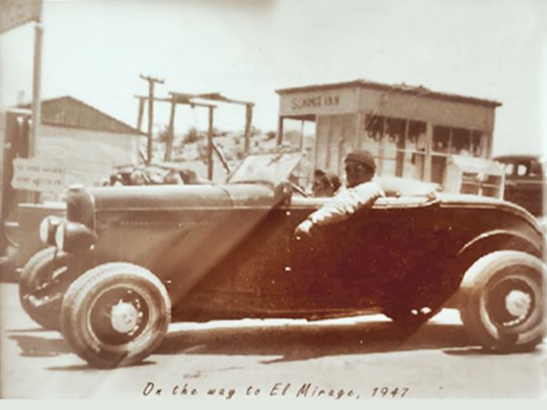
El Mirage, printed on the picture was one of several dry lakebeds in the Mojave Desert where hot rodders raced in the 1940s.
The picture below, taken by Burton Frasher in 1936 was captioned by him as "'The Tops', Summit of Cajon Pass Near San Bernardino, California." The site included a Signal service station, and cabins.
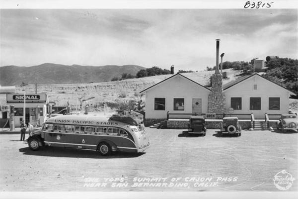
The Summit of the Pass 1930-1955
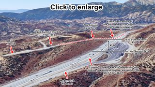
The Summit at Cajon Pass. Satellite view. Click on image to enlarge it
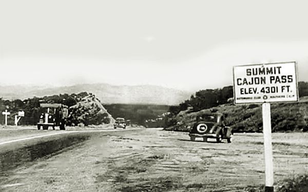
At that time, the summit of Cajon Pass was 4,301 feet above sea leval and was a 150 yards west of the cafe (Map marking the highest spot). The highway ran on higher ground than the current westbound lanes of the freeway. The modern highway was cut deeper into the hillside and the mountain slope where the 1930-55 U.S. 66 ran was removed when the cut was made. I-15's summit has an elevation of 4,260 feet according to the sign on the shoulder. The image shows a view of the summit area and explains the sites along it. Click on the thumbnail image to enlarge it.
The 1st Summit Inn and the original "Summit"
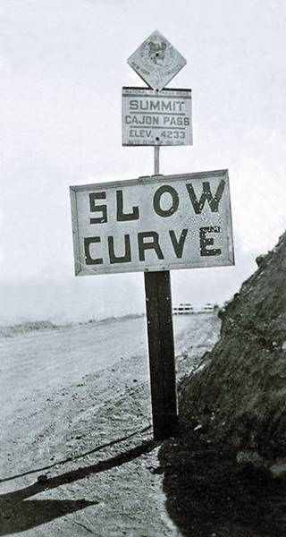
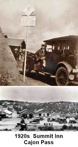
Slow Curve, Summit Cajon Pass, 4,233 ft. c.1920s. Source
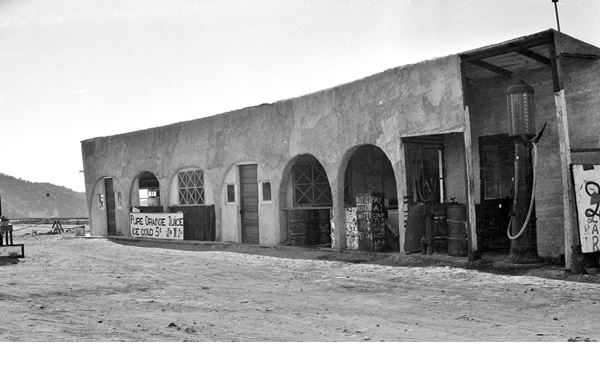
But there was an even earlier site for the Summit Inn, it was located on the first alignment of Route 66 through Cajon Pass, on the National Old Trails alignment (1916-26) and Route 66 used it from 1926 to 1930. This alignment is marked with a red line in our custom map. As you can see, it runs further east, downhill from the later alignments, and at a lower elevation. See this picture of Summit Inn in 1924.1
This map shows where the first Summit Inn stood, 500 feet to the east of the second one.
The highway had a meandering course, it was narrow and hugged the hillside. Its elevation was 4,233 feet, and the summit was 50 yards west of the original Summit Inn. You can see the sign in the images above, and also the gas station by the Summit Inn next to it.
The original alignments of the N.O.T. and Route 66 cannot be driven, they can be walked but since it is part of the San Bernardino National Forest, a pass is required, more information at the SBNF website.
The 1930s alignment is shown with a yellow line westwards from the Summit, and the second set of lanes added in the early 1950s are marked with a green line in our custom map.
The highway curves towards the south and its alignment moved away from the one followed by the freeway. It can be accessed along a dirt road, the Electrical Maintenance Rd. and then Santa Fe Rd. This is where the highway crosses several railroad alignments.
Alray
Here the Nothrup family had built a gas station on the N.O.T. alignment back in 1925. They moved it to the new alignment in the 1930s, and it can be seen in this 1938 aerial photo roughly 300 yards north of the first railroad viaduct (map marking the spot); it was gone by 1952.
Viaduct #1
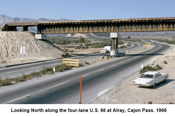
The first railroad is the Union Pacific line, built by Southern Pacific as the Palmdale-Colton Cutoff in 1967. At that time the modern I-15 hadn't yet been built, so the tracks crossed the four-lane US 66 using an overpass, pictured below in 1966 looking northwards towards the Summit. Notice how the four lane highway splits into east and westbound lanes as it climbs towards the Summit.
There was a passing siding here named for railroad supervisor Al Ray. It was removed in 1972.
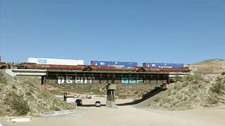
Alray viaduct nowadays. Source
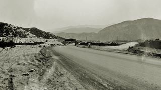
Alray, AT&SF viaduct #2, 1930. Source. Click image to enlarge
Viaduct #2
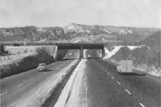
Alray viaduct #2, 1950s & 4-lane US66. Source
The second railroad is 300 feet south of the Alray crossing and is the 1913 low-grade track of the AT&SF railroad for eastbound trains. The N.O.T. had a grade crossing here, but when Route 66 was realigned, an underpass was built here in 1931. The image above looks south at the underpass, the old oiled roadway of the N.O.T. can be seen forking to the grade crossing on the right.
The four-lane US66 squeezed through this narrow underpass in the 1950s (see image).
Gish Viaduct
Heading west, 0.8 miles from Alray is the original railroad built by the AT&SF in 1885. Here, near Gish siding (removed in 1956) is the 3rd viaduct carrying tracks across Route 66. The image looks at it from the NE towards the SW, the dirt road is former Route 66.
Cajon Junction
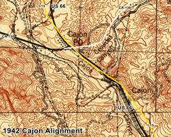
The road continues for 0.8 miles, to the modern junction with CA-138, at I-15's Exit 131. This is Cajon Junction. The original roadway had a completely different course to Santa Fe Rd and Wagon Train Rd. both were distorted and moved when the freeway was built. The 1942 USGS map shows the roadways at that time, we have marked with a yellow line, the current I-15 alignment, and with a white line, modern CA-138.
Cajon Canyon runs with a NW-SE course and Highway 138 runs along it; at the base of Squaw Peak it met the N.O.T. alignment that ran up Crowder Canyon. Here, at Cajon Junction, was the Pine Lodge Service Station that opened in 1924 on the NW side of the crossroads, where the ramp off CA-138 meets the freeway. The 1930s postcard below shows it, looking north along Route 66. You can also see it in this 1938 aerial photo. The same view shown in the postcard, but nowadays, can be seen in this St. view.
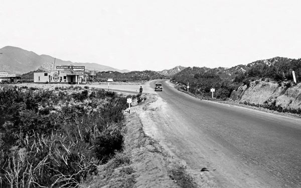
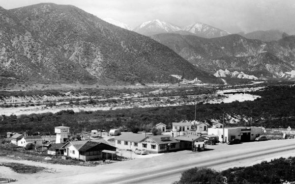
Just north of the gas station was another complex that opened in 1933, known under different names over the years, it had a Shell service station, a garage and the campground with some cabins. It can be seen in the following image. It was called Mountain View Camp, Cajon Mt. Camp and Christianson's Cajon Mt. Camp. It was located where the triangle between the off-ramp of I-15 on the westbound lanes, the freeway, and the incoming ramp from CA-138 (now a barren lot; St. view).
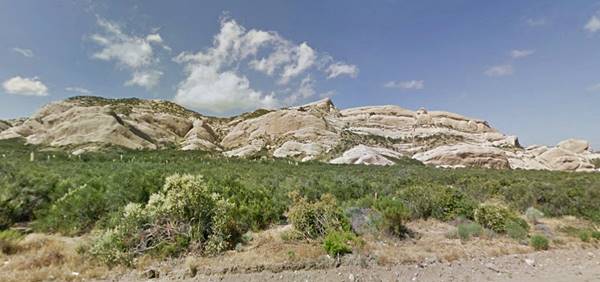
Mormon Rocks
Short side trip (1.5 mi.) at Exit 131, head west along Hwy 138 to see the Mormon Rocks formation.
These rocks, located on the north side of the highway, are sandstone formation that has been exposed by the rifting caused by The San Andreas Fault. They are also known as "Rock Candy Mountains" and their red banded appearance is due to an iron oxide called hematite. These rocks formed some 20 million years ago.
Camp Cajon
Return to Cajon Junction and drive west along Wagon Train Rd. it ends in a dead end by Crowder Canyon. This short segment is only 0.6 miles long, and ecompasses what remains of the long Camp Cajon. Our custom map marks the N.O.T. and 1926-50s Route 66 with a yellow line; the later four-lane alignment is shown with blue and red lines.
Second Meeker's Café - gone
It was located close to the junction of State Hwy 138 and Santa Fe Rd. Later overlaid by the modern Wagon Train Rd. The Marion Meeker moved to Cajon Pass in 1918 and opened a gas station, restaurant, cabins complex (Meeker's Sunrise Cabins) and grocery store on the brand new state highway between San Bernardino and Victorville which later became Route 66. It was located further east, in Camp Cajon. But when Route 66 was widened in 1932, Meeker's site was torn down. He moved north to this location and opened a new Cafe, pictured below.
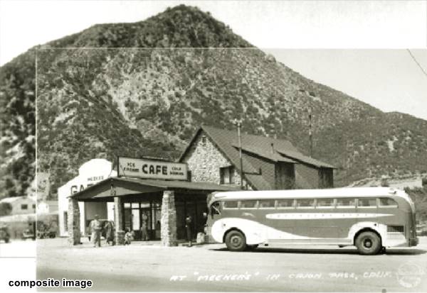
This is the current St. view of this same place.
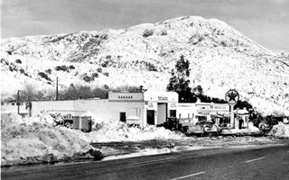
Meeker's after the 1946 rebuilding. Source. Click to enlarge
Ezra Blaine Meeker (1884 - 1966) continued the business after his father's death with his wife Frances. Meeker's garage was next to the stone building which sold cold drinks, ice cream and was a Post Office, Cafe and Grocery.
In 1946 a runaway truck ran into the place and destroyed the café, killing the driver. Ezra rebuilt it with a modern looking cafe and Texaco gas station (pictured).
In 1954 the widening of Route 66 to a four lane highway led to the demolition of Meeker's Café but they moved to a new site Double D Ranch where Meekers built a new place with a gas station and cafe, running it until his death.1
Camp Cajon Site
In the old days, travel in a car was a gruelling experience: dust, heat, poor roads made it necessary to stop frequently and Camp Cajon was a favorite spot, it had all a traveler could possibly need: cool shade, camping facilities, picnic tables, and more.
William M. Bristol a citrus grower, decided that there should be a Welcome Center at the point where the Salt Lake and Santa Fe Trails met in Cajon Pass, a "Gateway to Southern California".
The Santa Fe Railroad donated the land and Bristol designed the layout, built round concrete picnic tables and dedicated the place in 1919. Later stoves were added, barbeque pits, bath and toilet facilities, and several buildings of different organizations.
Nothing remains of it.
It was whittled down in the 1932 Route 66 realignment when Route 66 that ran along the original N.O.T. highway roadbed was widened from 16 to 36 feet, as the buildings along the highway were very close to the right of way, it would have required removing most of them. The California Highway Commission decided not to tear them down, it chose to knock down Meeker's store, gas station and cafe and move most of the structures westwards, that way it would avoid having to dig into the eastern slope of the hill and also, removing the structures that were on that side of the highway, which were more than those on the western side. It was a temporary fix because traffic continued to grow. Nature intervened and the Great Flood of 1938 caused severe damage when Cajon Wash razed the community and the highway. State officials decided not to rebuild the site and instead they opted to improve and widen the highway. WW II delayed the implementation of this project, but in the early 1950s the work began on the four-lane alignment.
The Great Flood of 1938
Starting February 27, 1938 two storms converged on the Los Angeles area and it rained for five days. 32 inches or rain fell in the San Gabriel Mountains and ran downhill flooding the city and its suburbs. When the waters receded, they had destroyed over 5,600 homes, killed 87 people and caused damges exceeding $1.67 billion (in 2024 dollars). Cajon Creek burst out of its channel and eroded bridge supports and embankments. The water washed away tracks, and roads. It cut the flow of traffic along the railways and Route 66. This led to changes in the alignments of both tracks and highways. Route 66 was moved away from Cajon Creek whose waters had eroded the fill used to straighten its course in 1932. After the flood, engineers chose to go further uphill into solid ground and then cut into the hillside removing 30 ft. of it to make space for a new alignment. Current Wagon Train Rd. is the outcome of this uphill move in Cajon Camp
Roughly 200 yards north of the dead end, on the western side of Route 66 was the main building, the post office and campsite administration building built in 1921. It was followed by picnic tables and barbeque pits under the shade of trees. On the hillside (east) were the large tower-like structures housing the Elks Outpost (1921), Santa Fe Sun Outpost (1920), Knights of Pythias Castle (1928) and the Mission Inn Outpost (1924). The latter was next to where the modern Camp Cajon Replica Monument now stands.
Camp Cajon Replica Monument
The original monument was unveiled on July 4, 1919. The new one marks its Centennial and was dedicated in 2019. It is located beside the Salt Lake Monument. It is a replica of the original monument that stood in Camp Cajon opposite the Knights of Pythias Castle roughly where the truck weighing scales parking area is now located, and was removed in 1938.
Beside the monument is a panel with information and replicas of highway shields including US 66, and an original concrete picnic table from the campsite its design was known as the "Camp Cajon-style Table" and reproduced in many parks across the nation.
Santa Fe and Salt Lake Trail Monument
California Historical Marker
The marker is next to the Monument (St. view) and is located where Route 66 meets the Pacific Crest Trail, the white masonry monument has a plaque that says "Erected in 1917 in honor of the brave pioneers of California who traveled the Santa Fe and Salt Lake Trail in 1849 by Sheldon Stoddard, Sydney P. Waite, John Brown, Jr., George Miller, George M. Cooley, Silas C. Cox, Richard Weir, and Jasper N. Corbett". It was at this point that both trails met. It has been moved here after the old Route 66 alignment was cut by the freeway.
Below is a view looking north along U.S. 66 in 1928, with the Knights of Pythias Castle outpost in the middle, opposite the original monument with its flagpole. Left of the Castle is the Elks outpost and right is the Mission Inn Outpost.
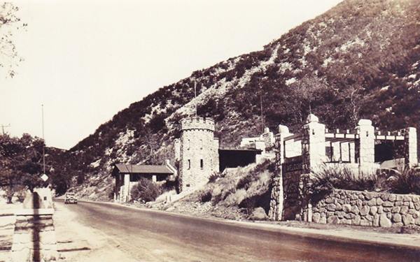
Meeker's Original Store (Gone)
Meeker's original store, gas pump and cafe stood where the western entrance to the weighing scales is now located. The image shows it in 1927, on the original alignment of Route 66 before it was widened in 1932, razing this property. It looks to the SW, from the cliffside.
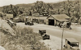
Meeker's original site in 1927. Source. Click to enlarge
It was followed by Palmer's Cafe and Gas station that opened in 1926 and finally the bridge across Crowder Canyon (Coyote Canyon). The Santa Fe and Salt Lake monument stood on the western side of the bridge. Bridge and marker were located in the middle of the modern EB lanes of I-15 at the bridge across Crowder Canyon.
The highway is now cut by the freeway and resurfaces on its southern side. To reach it you must take the Interstate and leave it at Exit 129 along Cleghorn Rd.
Our custom map shows where the bridge was, and where the original alignment ran and where the second set of lanes built in the 1950s was located.
After leaving the freeway, to your right is the original roadway that runs between I-15 and Cajon Creek and ends in a dead end by the site of former Inman Ranch. The early travelers called this spot "Willow Grove and Spring"; here was a Serrano Native American settlement here, Muscupiabit, that in their language meant "place of little pines." There are two additional markers along the Trail that follows the dead end, both similar to the Santa Fe and Salt Lake Monument, obelisks with plaques: the "Stoddard-Waite Monument" erected in 1913 to commemorate the early pioneers who came by horseback and wagon train through the passage, and the Mormon Pioneer Trail Monument, erected in 1851 and records the Mormon pioneers who passed through here in 1851. Here at the crossroads was the Cajon Train station site.
Turn left and head downhill along Route 66 towards San Bernardino. Just ahead the highway crosses a concrete bridge built in 1930 as attested by the date stamped in the concrete; see it in our custom map marked with a red star.
Route 66 1932 upgrade and realignment
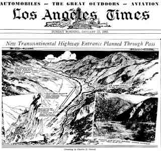
1932 realignment of Route 66 in Cajon Pass. Source.
Click image to enlarge
As mentioned further up, in 1932 the whole highway was widened, and straightened out in 1932. There were 59 curves (another source says 91) from Summit to Blue Cut. Furthermore at Blue Cut, on the San Andreas fault there were continual landslides, that cut the traffic and were dangerous.
In this section, the original highway that carried the N.O.T. and Route 66 ran along the east side of Cajon Wash it was a narrow road that followed the contour of the hillside with a meandering course.
To straighten the highway, engineers filled in the dips and moved the highway away from the hillside, allowing for a straighter course. At Blue cut they dug a channel for Cajon Creek and filled in a platform at the base of the cut moving the new roadway wll away from the steep slope of the cliff. The winding old road was abandoned or buried by the new one.
However, the Great Flood of 1938 burst out of the channel and undercut the fill, washing it away with the roadbed. The rebuilding after the flood moved the highway closer to the hillside, uphill, and removed up to 35 feet of the slopes in the process. Solid hillside was more resistant than fill, and higher ground was safer from floods. You can see an abandoned stretch of the 1932 roadway in our custom map marked with a yellow star.
Cosy Dell (gone)
Cosy Dell, with an "s" in the USGS maps! and with a "z" in the place's picture below, is located on your right, you can spot the ruins and rubble among the shrubs. The palm trees mark the spot (St. view).
Charles Lawrence and Jesse Tay purchased the Bear Flat Ranch in 1875 and a few years later, they acquired the Cajon Pass Toll Road franchise from John Brown. When the franchise expired they reinvented the ranch as Cosy Dell, a cool spot in the mountains, with a resort-lodge. After the toll road franchise ended, the Tay and Lawrence created Cozy Dell, the popular hotel/resort-like rest stop. In 1898 it reverted to the state due to owed back taxes. It was bought by Melissa and Jacob Roesch in 1919. They closed the hotel and became ranchers. With traffic growing on the highway, they opened a gas station and, with Route 66, a restaurant. Jacob Roesch drove the local children to school, an enterprise that grew into the Roesch Transportation Company with over 350 school buses. Jacob and his wife retired in the early 1950s. The family sold the ranch to Bill Hubbard in 1963. Nothing remains of it.
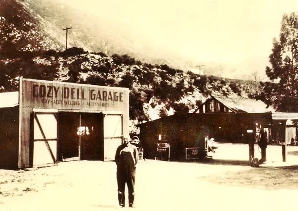
Blue Cut and San Andreas Fault
Ahead is a rest area in the USGS maps, Cajon Campground, roughly where Swarthout Canyon Rd meets Route 66. The road then curves to the west following Cajon Wash, away from I-15, hugging the SF railway tracks, along the canyon and into Blue Cut.
The place is named after the blue-colored rocks on the hills. It is here that the The San Andreas Fault cuts across Route 66's alignment and the Cajon Wash with a SE to NW direction creating a transversal valley that, one mile to the west has a small lake, Lost Lake. See the black line in our custom map marking the fault.
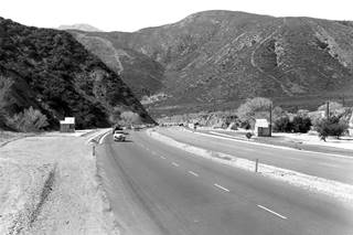
1950s Route 66 in Bluc Cut. Source.
Click image to enlarge
During the Great Depression and the Dust Bowl, there was an inspection point here where the authorities checked on those traveling to California. The booths can be seen on both sides of the highway in the 1950s picture (click on it to enlarge it) that looks west (Blue Cut cliff is the dark steep mountain to the left in the distance); this is the current view at this same spot.
Marker at Blue Cut
Plaque and marker
The plaque (St. view), tells about the different roads through the area and John Brown's toll road; it says: "... The lower end of Cajon Pass consists of a huge alluvial deposit two miles wide. About five miles above Devore is a narrow gorge eroded by Cajon Creek known as Blue Cut, also called Lower Narrows. A toll house for the Brown Road was located nearby. This became the logical path for the railroad, which came in 1885....." The plaque was placed by the Billy Holcomb Chapter of the E. Clampus Vitus order in 1994.
Stone wall guard rail
Don't miss the stone wall which dates from the 1930s and served as a modern guard rail (crash barrier) in those days, keeping cars from falling down the cliffs into the wash.
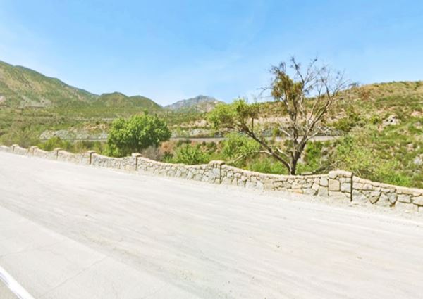
The highway curves around the steep hill at Blue Cut and heads south and then southeast into Keenbrook. Here there were several businesses along the highway. None have survived.
Below is a view looking north with Cajon Wash to the left, stores and two gas stations are visible, a Union 76 and a Texaco. To the right is Blue Cut (same spot nowadays).
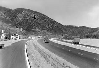
Blue Cut, looking north along Route 66. Source.
Click image to enlarge
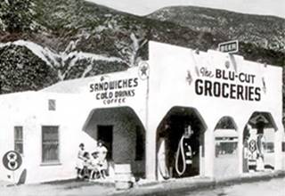
Blu-Cut Groceries Route 66. Source
Above is the Blu-Cut Groceries and gas station, visible in the distance in the upper image. This is the St. view of the spot nowadays.
The Natural setting: Geology of Cajon Pass
Two massive mountain ranges meet at Cajon Pass. The Pass is a natural gap between them. To the east are the San Gabriel Mountains and to the west, the San Bernardino Mountains, and, as an additional element, the famous San Andreas Fault runs across the Pass too.
San Gabriel Mountains
The mountain range is located to the north of Los Angeles and has an east-west orientation. Its highest peak is Mount San Antonio (Mt. Baldy) at 10,064 ft (3.068 m). The Mountains' dimensions are:
- Length: 69 mi (111 km)
- Width: 23 mi (37 km)
- Area: 970 sq mi (2.500 km2)
It is made up of Precambrian to Mesozoic rocks that were uplifted as fault blocks during the Cenozoic (5 - 15 M. years ago).
San Bernardino Mountains
Located to the north and northeast of San Bernardino their highest peak is San Gorgonio Mountain at 11,489 feet (3.502 m).
They were uplifted some 11 M. years ago by the San Andreas Fault and are still rising. Snow accumulates on the peaks during winter, as well as rainfall which feeds rivers that flow into the surrounding desert. The Mountains' dimensions are:
- Length: 60 mi (97 km)
- Width: 41 mi (66 km)
- Area: 2,063 sq mi (5.340 km2)
The San Andreas Fault
The fault formed around 30 M. years ago, and runs for 800 miles (1.300 km) across California with a NW - SE course. It marks the tectonic boundary where the Pacific and North American tectonic plates meet. These plates form the crust of the Earth and the ocean floor, they float on the mantle and move. In the case of the plates that meet at San Andreas, they have a horizontal movement, sliding against each other (right-lateral-strike-slip): the western part of California moves northwards and the eastern part moves with the rest of North America, moves south. The slip is about 0.9 in per year (2.4 cm).
The plates jam in some sections and tension builds up until the rock fails deep in the Earth's crust, causing the plates to jump into position again and releasing all the pent-up energy as an earthquake.
Discovered by Prof. Andrew Lawson in 1895, it was named after the San Andreas Valley. It runs from San Francisco to the Baja California area.
The rocks on each side of the fault nowadays were once hundreds of miles apart, and they have been brought together by this slippage. Over the past 30 M. years the fault has moved some 450 miles.
The final part of Cajon Pass, towards Devore
Double D Ranch Cafe
This is where Meeker moved after this Cafe at Cajon Junction was torn down to make way for the 4-lane Route 66. The only reference we have is that it was 15 miles from San Bernardino, which would place it in this area. The views of the Cafe and the surrounding mountains would place it here. Check out the two views one looking north, the other south. It had a Mobil service station, a cafe and between them he later built a garage.
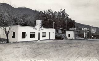
Double "D" Ranch cafe, looking south. Source.
Click image to enlarge
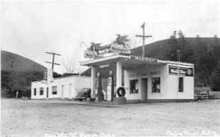
Double "D" Ranch cafe, looking north.
The possible site's St. views are the following: north notice the dip between the mountains, now partly obscured by some trees; and south see the mountain crest protruding above the closer ones. Now the Route 66 Shooting Sports Park is located here.
Westwards the road curves back towards the southeast and approaches I-15, heading towards San Bernardino but its original alignment is cut off at Kenwood Ave. A violet star in our custom map marks this gap. To continue along Route 66 you have to reach Cajon Blvd. south of the I-15 ⁄ I-215 junction that is just ahead. Follow the alignment in this map that shows how to get there.
On the south side of the freeway's junction, in Devore, you can drive along the two alternative Route 66 alignments to continue your road trip.
Continue your Road Trip
This leg of your journey ends here; continue your "Route 66 Road Trip" by heading west towards the next town along the highway: San Bernardino.

Sponsored Content
>> Book your Hotel in San Bernardino

Credits
Banner image: Hackberry General Store, Hackberry, Arizona by Perla Eichenblat
A Guide to the Golden State, by the Federal Writers' Project of the Works Progress Administration, Hastings House, New York, 1939.
Jack DeVere Rittenhouse, (1946). A Guide Book to Highway 66.


