Route 66 in Oro Grande CA
Index to this page
About Oro Grande California
Facts, Trivia and useful information
Elevation 2,589 ft (789 m). Population est. 975 (2025).
Time zone: Pacific (MST): UTC minus 8 hours. Summer (DST) PDT (UTC-7).
Oro Grande is an unincorporated community located on Route 66 on the city boundary of Victorville and Adelanto, in southwestern San Bernardino County, in the south of California.
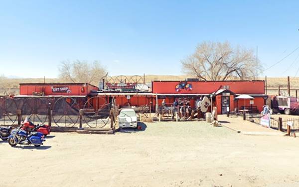
Iron Hog Saloon
The History of Oro Grande, California
Visit our Victorville web page to learn more about the early history of this area.
The Mojave Trail was first used by Father Garces in 1776 en route to the Hopi nation in Arizona. It linked Spanish colonies in New Mexico, Arizona and California, crossing the Mojave desert to the north of the present US 66 and I-40.
Mojave Trail or Mojave Road
The Native Americans in the area used this trail from Cajon Pass (a gap between the San Bernardino and San Gabriel Mountains in the south) to the Colorado River following the Mojave River across the Mojave Desert.
The first American to trek it from east to west, coming from Utah, was Jedediah Smith in 1826. At that time, the territory was Mexican, who had acquired it from Spain after its independence in 1821.
Mexican traders in New Mexico in the late 1820s opened the "Old Spanish Trail" which met the Mojave Trail at Soda Lake in the Mojave.
During the Mexican-American War (1846-48), the Mormon Battalion used the trail into California and, after Mexico was defeated, it ceded the territory to the US.
Settlers used the trail to reach California and many Mormons settled along the " Mormon Corridor" between 1850 adn 1890. In 1851, the Mormons bought the San Bernardino ranch and founded the town of San Bernardino.
The first settler in Victor Valley was Aaron G. Lane, he set up his homestead in 1858 on the Mojave River, beside its lower crossing, close to what is now Oro Grande. He had a way station and offered lodging and groceries to travelers trekking along the Mojave Trail. He catered to Lt. Edward Beale during his expedition (1860), and grew alfalfa as fodder for the horses. The place was known as Lane's Crossing for many years.
Gold was discovered in the area in 1873, and a gold mining camp was established here in 1878 about 2 miles north of Lane's post. The post office that opened in 1881 was named "Halleck" after the mine's stamp mill chemist. The name lasted until 1927 when both town and post office were renamed "Oro Grande".
The Railroad in Helendale
In 1881 the Southern Pacific Railroad (SP) extended its line from Bakersfield east after silver was found near modern Barstow at Calico. SP continued its line to Needles on the Colorado River. They eventually sold out to their competitors (A&P, which later became the AT & Santa Fe railroad) who had built their railroad from Kansas, through New Mexico and Arizona to California. A&P completed their line to Los Angeles in 1885, and it ran along the Mojave River, following the old Trail to San Bernardino.
The railroad built a depot as a watering stop for its steam-powered locomotives and named it "Halleck".
Oro Grande, the name
The town was named after the neighboring mine and it combines two Spanish words "Oro" (gold) and "Grande" (big), hence "Big or large Gold" (mine).
Limestone was quarried here in 1887 and kilns were built to produce lime. Cement was produced after 1907 by the Riverside Cement Co., still operating.
In the early 1900s, the use of the automobile began to grow and better roads became necessary. The National Old Trails (N.O.T.) Association planned a road from Los Angeles to New York, and they built it and aligned it next to the AT & Santa Fe railroad tracks from Cajon Pass to Needles. The road passed through Oro Grande.
Route 66 was aligned along the N.O.T. highway in 1926. After WWII, traffic along Route 66 grew and in 1958 traffic through Oro Grande topped 1.1 million travelers. A safer highway was necessary and the interstate system created in 1956 would replace Route 66 between Barstow and Victorville (I-15), bypassing Oro Grande in 1958. The town lost its service stations and stores that catered to the travelers.

Accommodation in Oro Grande: Where to Stay
There is no lodging in Oro Grande; check out the hotels and motels in neighboring Barstow or Victorville to find your room.
> > Book your Hotel in Barstow or in Victorville
More Lodging Near Oro Grande along Route 66
Below you will find a list of some of the towns along Route 66 east and west of Oro Grande; click on any of the links to find your hotel in these towns.
>> Check out RV campground nearby in Barstow and Victorville
The Weather in Oro Grande
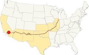
Location of Oro Grande on Route 66
Oro Grande has a semi-arid climate; winters are cool and summers are very hot. Rainfall is scarce and snow is very uncommon.
Average temperatures (high) are: Summer (Jul) 98°F (37°C) and Winter (Jan) 61°F (16°C). And the average Low is, in summer (Jul) 62°F (17°C) and (Jan), winter: 30°F (-1°C).
Rain averages 5.5 in. per year (145 mm) with the driest months being May to Oct (less than 0.2 in monthly - 5 mm).
Tornado risk
Oro Grande is located well to the west of the Rocky Mountains, so there is no risk of tornadoes in this part of California.
Tornado Risk: read more about Tornado Risk along Route66.
Map of Route 66 in Oro Grande
Read about the Barstow to Pasadena alignment in our dedicated webpage. Below is an interactive map of this section:
Map of this segment in Oro Grande.
From the N.O.T. Highway to U.S. 66

1927 Road map, SW CA
Click on image to enlarge.
Credits

1956 Shell Roadmap, SW CA
Click on image to enlarge.
Credits
National Old Trails Highway (N.O.T.)
The 1912 map by the Automobile Club of Southern California (ACSC) showing the road from Barstow to Victorville did include Oro Grande -with no services- followed by Victorville (5 mi.), which had "Gasoline."
Another map (1913?) tells us that Oro Grande offered "Gasoline -Oil", by 1915 Victorville offered "Meals - Lodgings, Gasoline - Oil. Garage Repairs". In 1915 the road linking San Bernardino with Barstow through Cajon Pass became California highway LRN 31, but San Bernardino County maintained it until the mid-1920s.
In 1926, the N.O.T. highway became part of the US highway network and the section west of New Mexico became US 66. Nevertheless Route 66 was known as the "National Old Trails Road" for many years in California, at that time the N.O.T. guidebook tells us that Oro Grande had a "Camp ground and store and garage."
Getting to Oro Grande
You can reach Oro Grande along old Route 66, which here is named "National Old Trails Highway". Also from I-40 in the northeast or from I-15 (north, east and south).
See this Map from Barstow to Oro Grande.
Route 66 Alignment near Oro Grande
With maps and full information on the Mother Road.
- Pasadena to Santa Monica (Next)
- Barstow to Pasadena (Oro Grande's)
- Topock to Barstow (Previous)

Sights and Attractions in Oro Grande
Route 66 Landmarks and things to see
Historic Context
Jack Rittenhouse in his classic Guidebook to U.S. Highway 66 that he self-published in 1946, mentions the town as follows:
ORO GRANDE... whose name means "great gold," had a population seven times its present size when the nearby gold mines were busy, about 70 years ago.Today its only major industry is a large cement plant Rittenhouse (1946)
Oro Grande is mentioned in the 1939 "Guide to the Golden State" published by the WPA:
In the shade of wide-spreading sycamores and spirelike poplars, ORO GRANDE, 31.7 m. (2,648 alt., 600 est. pop.), sprawls along the highway, dreaming of the prosperous gold-boom days of the 1880's. Its population skyrocketed to 2,000 when in 1878 gold was discovered in the OLD SILVER MOUNTAINS and the GRANITE MOUNTAINS (L). After 1885 gold production diminished until in 1928 the last of the mines closed. WPA (1939)
Oro Grande leg of your Route 66 Road Trip
Remains of a Service Station, Cafe and Cabins
Driving west from Helendale. Rittenhouse mentions "a gas station with cafe and a few cabins" he places it 7 miles from Helendale, after checking the maps and aerial photos we place it on the NW corner of N.O.T. and Hibiscus St. Nothing remains of the place, only the foundations of the buildings as you can see in this St. view; it appears in this aerial photo taken in 1959.
Ahead, 0.8 miles along the highway you can take a right on Bryman Rd. and take a short side trip to visit Roy Rogers' Ranch.
Roy Rogers Ranch
Side trip to Roy Rogers Ranch
It is just 2 miles to the ranch (Map), which is located on the western side of the railroad next to the Mojave River.
Roy Rogers
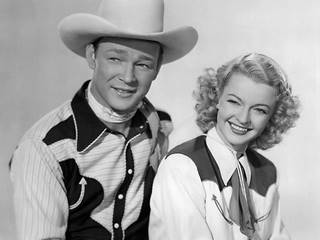
Roy Rogers and Dale Evans. Source. Click to enlarge
Roy Rogers was born in 1911 as Leonard Franklin Slye, and was an American actor and singer. He was known as "The King of Cowboys" starring in many Western movies and in his classic television show. He and Dale Evans worked together in 28 musical movies before getting married in in 1947. Dale Evans (1911-1998) was known as "Queen of the West" and together they hosted their own TV show, The Roy Rogers Show (1950-1957).
They purchased a 67-acre ranch in 1965, the Double R Bar Ranch. It had a 1,700-square-foot home, barns, movie theater, a stable with 15 stalls, a half-mile horse track and the site of Roy Rogers' museum. He bred race horses here. After Roy Rogers' death in 1998, followed by Dale's a vew years later it changed hands many times. The most recent one is a cowboy camp.
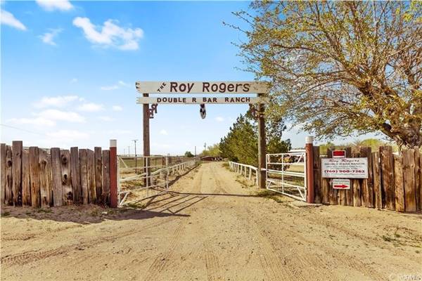
Return to the Mother Road and continue your journey towards Oro Grande
Back to your Road Trip into Oro Grande
End of the Trail Bar
From Bryman Rd., continue west for half a mile. To your left at Desert Flower Rd. (map showing the spot) is a private residence that at one time was the "End of the Trail" Bar, it is a stone building, the work of Guy Wadsworth who had built many of the builidings in neighboring Helendale. It seems likely that this is the place described by Rittenhouse as "a similar establishment one mile west" from the one at Hibiscus St.
Its main feature is the wagon wheel window facing Route 66 (St. view)
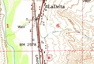
1956 USGS map showing LaDelta and Route 66.
La Delta Service Station and Auto court
Drive 0.4 mi. west, and to your right on the west side of the road is a private residence that at one time was known as "Pinky's Service Station."
It was opened in the 1920s by Theodore Simon (Pinky) Ruiz, the constable of Oro Grande.
Pinky sold out in 1931 (perhaps he couldn't weather the Depression any longer) to Alva Dickens and his wife, who in turn sold the place in 1932. They had named it "La Delta" and the name survived; it also gave its name to the area where the service station was located.
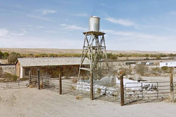
The place had a cactus garden and a store, both of them together with the service station have been razed. The cabins of the auto court have survived, but the water tank pictured below in 2018 has since been removed.
La Delta auto court building and tank in 2018
The Iron Hog Saloon
Head west for another half-mile and to your right, at 20848 National Trails Hwy is this classic "Saloon."
The tavern's website says it dates back to the 1890s as the Butterfield Stage Stop and trading post. It acquired its present form in the 1930s. At one time it was the dealership of Case Farm Equipment in Oro Grande. (1930s-40s), perhaps the Oro Grande Farm Implement Co. The building had been in the family since 1944. Later, it was known as the "Lost Hawg". It is a bar and restaurant offering steaks and more uncommon ostrich steaks (from a nearby ostrich farm).
It has been the location for scenes in the movies Easy Rider, and Erin Brockovitch (1).
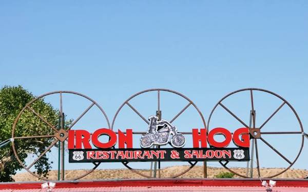
Don't miss the enormous guitar, or Evil Knievel bike and sign by the entrance. The 1959 aerial photo shows that the original buildings were on the north side of the current one.
Danny's Place
To your left 0.4 miles west of the Iron Hog. This was a beer bar and dance hall quite popular in the 1940s and 50s. Sagebrush Annie's boyfriend Johnnie Rogers (she owned the Sage Brush Inn in neighboring Helendale) crashed into a truck head-on here on the curve by Danny's Place. You can see it in this 1952 aerial photo showing Danny's Place.
Ahead is the Oro Grande Underpass built in 1925 to eliminate the blind curve at the railroad grade crossing. It cost $30,000 of those days and it is still in operation.
Paradise Motor Inn ❌

1937 ad of Paradise Motor Inn. Source. Click to enlarge
Here, "6 mi. e. of Victorville, 30 mi. w. of Barstow was the Paradise Motor Inn. The distances from both cities place it here at the underpass. Aerial photographs show the wooded area on the north side of the underpass as the most likely site. The inn had electric connections, toilets, well water, and in 1937 cost "50 cents day with electricity, 25 cents without."
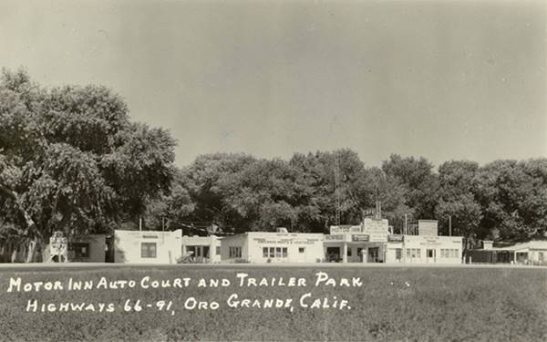
Motor Inn Auto Court
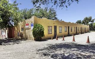
Western wing of units, Motor Inn.
Source. Click to enlarge
After the underpass (location map) at 19684 Nat. Trails Hwy the road curves again towards the left. There, at the curve, nestled among green trees, are the remains of a Route 66 auto court.
The postcard below identifies it as the "Motor Inn auto court and Trailer Park", no address other than Highway 66 - 91, Oro Grande.
When Jack Rittenhouse drove through the town in 1946 he pointed out that the only lodging was "... one trailer camp with a few cabins", very likely this one.
It was built in the 1930s and bought in 1955 by Truman "Warren" Phinney (1919 - 2008), a World War II veteran. His property included a grocery store, a cafe, a Richfield gas station and the Motor Inn with a Restaurant. Later he owned a liquor store in Victorville.
The place is now an apartment complex.
Same buildings nowadays.
Cement Plant on Route 66
Gold mining had begun in 1868 and was milled at Oro Grande. In the 1890s, silver was discovered and smelted in Oro Grande and Victorville when gold mining exhausted the mines in the area. Starting in 1886 marble was quarried for construction in southern California and the inferior grade rock was burned into lime. Kilns were built here, fueled by cottonwood. The modern Golden State Portland Cement built their site here in 1910, that was upgraded by Riverside Cement Co. in 1923. It is still operating as the Calportland Co. (2). The plant is on the north side of the railroad to your right.
Just ahead is the urban area of Oro Grande, and some interesting US 66 sights.
"Downtown" Oro Grande
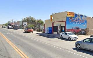
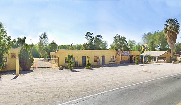
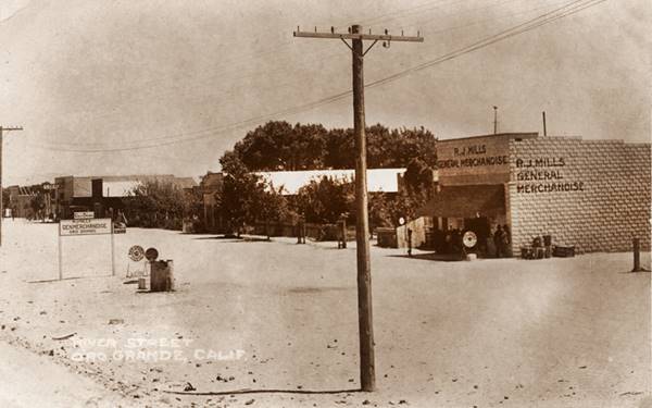
Here were the stores and homes by the Lime and Cement plants at the railroad depot. Below is a 1920s photo looking towards the west, from the National Trails it is captioned "River Street, Oro Grande, Calif." The thumbnail image shows that same view nowadays, a nice mural, the same store in the 1920s it was R.J. Mills General Merchandise store, now it is a Liquor Store, the Oro Grande Market with a Route 66 mural showing a red and white 1950s car, a map of US66 with a highway shield and also text promoting check cashing and booze!
Mohawk Service Station
The first commercial building is located to your right, on the Northwest corner of Mills St. and Route 66 just 0.6 miles south of the underpass.
Mohawk was a California-based refiner and distributor of gasoline. Their refinery, built in 1932, was located in Bakersfield and their corporate offices were in San Francisco. They later became a second brand of Tidewater Associated. Getty acquired Tidewater in 1956, and it was bought by Texaco in 1984. In the middle of these changes, the service station closed and now stands vacant and abandoned.
Judging from the 1970 style pumps and the prices displayed on them, the Mohawk gas station has been closed for a long time.
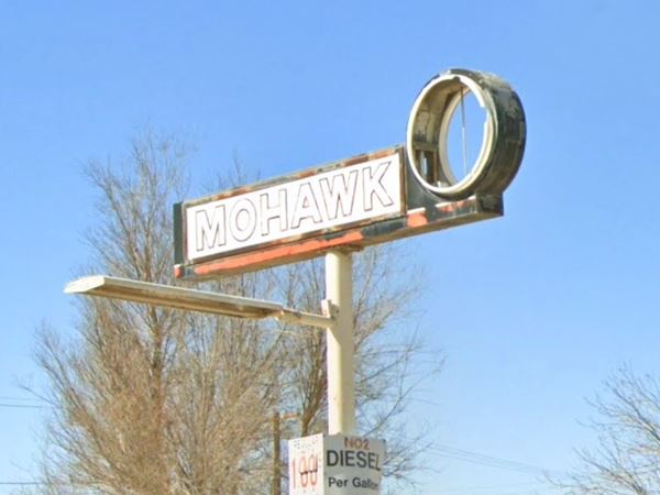
In May 2023 the mini-canopy over the front pump island had gone, the corner had been fenced in, and there was a large heap of gravel on the parking area. The image below is slightly older, from 2021 when the place was in better shape:
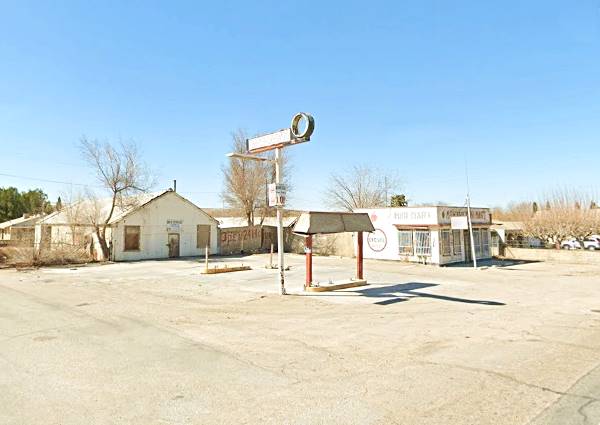
The missing circular acrylic panel would have depicted the face of a Mohawk Indian with his upright feather, similar to the one painted on the parapet of the mini Mart on the north side of the property.
Then come a series of old stores with brick facades dating back to the early 1900s, long before Route 66 was created. There are several antique shops in town.
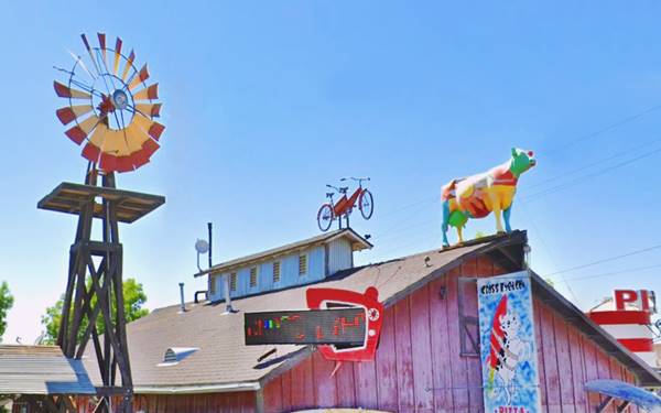
The one on the corner of Circle Rd. has a Route 66 map painted on its southern wall. Across the street is the Cross Eyed Cow Pizza (19242 National Trails Highway), renovated from a 1920s Studebaker repair shop, see it pictured below, with its colorful cow and windmill.
Oro Grande Bridge
2.5 mi. south of Oro Grande, the road curves into the Mohave River, which here does actually carry water year-round because of the bedrock under the river bed that doesn't let it seep away. To the north, when sand replaces the bedrock, the river flows under the surface.
The banks of the river are verdant and forested. Here is the Mojave River truss bridge. Below is a "Then and Now" sequence of this bridge that is now approaching its one-hundredth anniversary (in 2030).
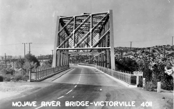
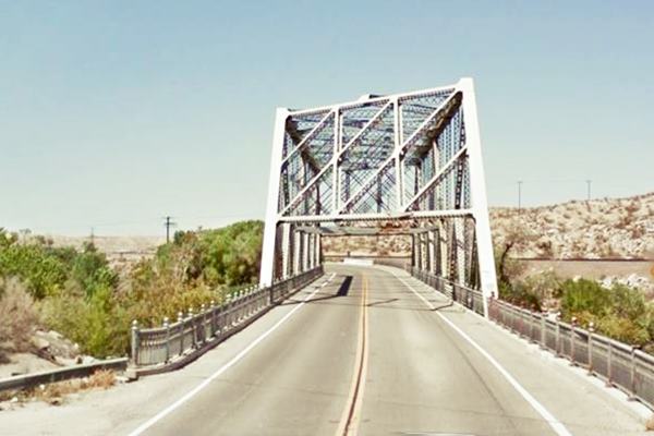
This Baltimore truss bridge is 575 ft. long with a deck 34 ft. wide. Its longest span measures 270 ft. It has a total of 5 spans.
It was built in 1930 to replace an older Parker Through Truss bridge, and to carry the paved U.S. highway 66 across the Mojave River. It is known as the "Victorville Route 66 Bridge" and the "Oro Grande Bridge".
Continue your Road Trip
Your journey through Oro Grande ends here at the Mojave River Bridge.
Continue your "Route 66 Road Trip" by heading west towards the next stop along the highway: Victorville.

Sponsored Content
>> Book your Hotel in Victorville

Credits
Banner image: Hackberry General Store, Hackberry, Arizona by Perla Eichenblat
A Guide to the Golden State, by the Federal Writers' Project of the Works Progress Administration, Hastings House, New York, 1939.
Jack DeVere Rittenhouse, (1946). A Guide Book to Highway 66.


