Route 66 in Rialto CA
Index to this page
About Rialto California
Facts, Trivia and useful information
Elevation: 1,257 ft (383 m). Population 105,878 (2025).
Time zone: Pacific (MST): UTC minus 8 hours. Summer (DST) PDT (UTC-7).
Rialto is a city located on Route 66, in southwestern San Bernardino County in the south of California.
The History of the city of Rialto, California
Check our San Bernardino webpage for the early history of this region.
The San Bernardino & Los Angeles Railway incorporated in 1886 and built a railroad between San Bernardino and Duarte the following year. At Duarte it linked with the Los Angeles and San Gabriel Valley Railroad that via Pasadena and Arroyo Seco reached downtown Los Angeles. The stops along the line became the seeds of future townsites like Rialto and North Cucamonga. A total of 25 stops were built spaced every 2,600 yards, and one of them was Rialto. These companies soon became part of the Atchison Topeka and Santa Fe railroad network.
The "Rialto" colony was founded in 1887 by the Semi-Tropic Land and Water company; they had also founded other townsites in the area: Bloomington, Sansevaine and Fontana. Semi-Tropic brought water from Lytle Creek near San Bernardino to these towns using a six mile canal lined in concrete but to do so it had to mortgage its properties. It was later foreclosed and the land was sold to the "Kansas Colony" which also went broke. Fortunately many of the first settlers who were mostly Methodists that had come to California from Halstead Kansas, retained their lands.
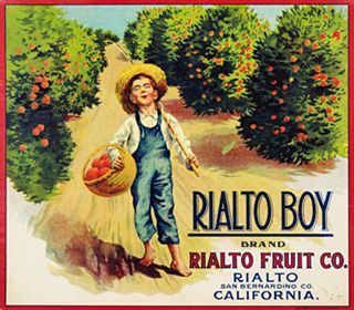
Rialto Boy Brand, 1920. Source
The Methodists planned to build a college, but it was never built. In 1887 the Rialto Hotel built; it burned down in 1907.
Initially it was an agricultural settlement, a "fruit colony" with lemon and orange groves. Several packing plants were built in the area like the Rialto Fruit Co. with its Rialto Boy brand (pictured).
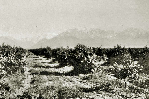
There were vast orange groves along the foothills of the mountains, now replaced by suburban sprawl.
Rialto, the name
Rialto is the contraction of the Italian words "Rivo Alto" or "high" and "river" an elevated mudflat where the first inhabitants settled to found Venice ca. 800 AD. It gave its name to the island and to the canal next to it. It was the old mercantile quarter of medieval Venice. A bridge of the same name spans the Grand Canal, and was built in 1588. The name Rialto became a synonym for "business district" and many towns around the world adopted it.
National Old Trails Highway (N.O.T.) in Rialto
By the early 1900s, the use of the automobile had grown considerably and there was a need for improved roads. The National Old Trails (N.O.T.) Association went ahead with its plan for a highway linking Los Angeles and New York. They aligned it next to the AT & Santa Fe railroad tracks across California and Arizona.
The town incorporated in 1911 and Foothill Boulevard was improved in 1913. The Automobile Club of Southern California's map of 1912 shows the N.O.T. highway running on the north side of the Santa Fe Railroad, passing through Rialto 58 miles from Los Angeles, and straight, west until reaching Cucamonga in those days it did not have the "Rancho" part appended to its name (46 mi. from LA). A local highway can bee seen in the picture below that is captioned "Rialto Cal. 9/28/28."
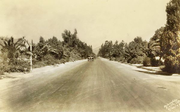
A fire razed the downtown in 1920, and in 1926, the N.O.T. alignment became part of the newly created U.S. Highway 66. And it was gradually improved and widened after that date.
p>Faster flowing traffic led to the replacement of Route 66 in 1964, when it was replaced by the growing Interstate and freeway network east of Los Angeles. This drew business away from the Route 66 motels and the bypassed commercial districts in towns, like Rialto.

Accommodation in Rialto
You can find your room in neighboring Fontana o San Bernardino.
> > Book your Hotel in Fontana
More Lodging near Rialto along Route 66
Have you slept in a wigwam lately? Book a Room in the Wigwam Motel
Below you will find a list some of the towns along Route 66 east and west of Rialto; click on any of the links to find your hotel in these towns.
- San Bernardino
- Fontana
- Rancho Cucamonga
- Pomona
- Claremont
- Monrovia
- Arcadia
- Pasadena
- Los Angeles
- Hollywood
- Beverly Hills
- {
▸End of Route 66
>> Check out RV campground nearby in San Bernardino
The Weather in Rialto
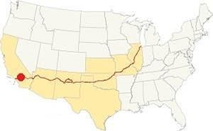
Location of Rialto on Route 66
The weather in Rialto is known as Continental Mediterranean climate, which has hot and dry summers with cool - chilly winters.
During winter, the average high is (Jan) 68.4°F (20.2°C) and the average low is 42.1°F (5.6°C). In sumer the average high is (Jul) 96.2°F (35.7°C) and the average low is 58.5°F (14.7°C).
About 16 inches (406 mm) of rain fall yearly. Snow falls to the north in the San Gabriel Mountains. Rainfall is least during May to September, with less than 0.25 in. falling monthly (6.4 mm). The town has 38 days with precipitation yearly.
The warm dry air blown in by the seasonal Santa Ana winds through Cajon Pass can be felt during autumn (fall) and this dries the area increasing the risk of wildfires the foothill and canyon communities.
Tornado risk
Rialto is located well to the west of the Rocky Mountains, so there is no risk of tornadoes in this part of California.
Tornado Risk: read more about Tornado Risk along Route66.
Map of Route 66 in Rialto
>> Custom map with Route 66's alignment in Rialto.
From the N.O.T. Highway to U.S. 66
The following map was published in 1927, one year after the U.S. Highway system was created. It shows the area of Southwestern California close Los Angeles. You can see Route 66 running from Victorville through Cajon and into San Bernardino and then westwards towards Los Angeles; Rialto is not on this map, but neighboring Fontana does.

1927 Road map, SW CA
Click on image to enlarge.
Credits

1956 Shell Roadmap, SW CA
Click on image to enlarge.
Credits
The map above shows the same area in 1956; a freeway now links Victorville with Cajon and San Bernardino with Los Angeles. Rialto can be seen west of San Bernardino

Detail 1930 roadmap
Click on image to enlarge.
Full map
The thumbnail map shows the alignment of Route 66 from Victorville to Los Angeles, once again you can see neighboring Fontana but not Rialto.
Route 66 Alignment near Rialto
With maps and full information on the Mother Road.
- Pasadena to Santa Monica (Next)
- Barstow to Pasadena (Rialto's)
- Topock to Barstow (Previous)

Route 66 Sights and Attractions in Rialto, California
Historic Context of Route 66
The "Guide to the Golden State" written in 1939 by WPA, said the following about this section of Route 66 during the pre-World War II days:
West of San Bernardino US 66 runs along the base of the Sierra Madre Mountains [actually, the San Gabriel Mountains] through the heart of a picture post card landscape orange groves overlooked by snowcapped peaks. The tile-roofed stucco towns among the orchards along the way are starting points for roads and trails into the forested mountains.
West of SAN BERNARDINO, is RIALTO, 3 m. (1,203 alt., 1,642 pop.), with several orange-packing plants. From here US 66 runs through billowing foothills past miles of citrus groves and vineyards. WPA (1939)
The 1940s Caltrans road map shows Route 66 running straight west along Foothill Blvd., through Rialto and Fontana, then south of Etiwanda and Alta Loma and into Rancho Cucamonga. It was here, after covering vast distances without towns, that the Route 66 traveler encountered the eastern part of the Los Angeles suburbs. Though in the 1940s they were small towns, that were not yet linked into one gigantic urban sprawl.
Jack DeVere Rittenhouse drove along Route 66 in 1946, collecting information for his book "A Guide Book to Highway 66" and when describing this segment west of San Bernardino to Pasadena had little to say about Rialto; he mentioned that there were several towns: "Many of them are so close together as to be practically indistinguishable from each other... At 318 mi. you reach RIALTO, a town of about 2000."
The eastern part of Rialto is still pretty open, with fields and empty lots, but nearer Los Angeles the old classic fruit stands, Route 66 mom and pop stores, motels and service stations have been torn down and replaced by new buildings, malls and shopping centers.
Nevertheless, despite the growth of Los Angeles, the second largest city in the U.S., many icons have survived on Route 66 in this area.
Route 66 Road Trip Leg through Rialto
We will drive westwards from neighboring San Bernardino along Foothill Blvd., that carried Route 66 since it was created in 1926 until 1964 when the highway's western terminus was formally moved to Needles CA (more on where does Route 66 start and end?)
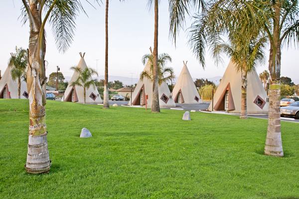
The famous Wigwam Motel is located in San Bernardino, on the western edge of that town. You can learn all about it in our Wigwam Motel entry in our San Bernardino page.
The Wigwam Motel in San Bernardino
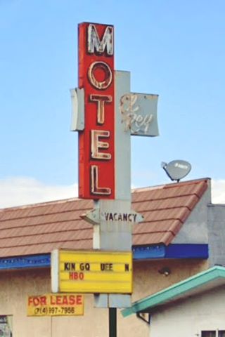
Drive west, after 0.7 miles you will reach the corner with Acacia Avenue. There were lseveral spots and sights here, but only the classic motel has managed to make it into the 21st Century, the El Rey Motel.
The Foothill Drive-In was located at 571 E. Foothill Boulevard,on the southeastern corner. It opened in 1948 and could fit 675 cars. It closed in 1988, it had an eyecatching marquee with a vertical pylon with the name "Foothill" and a low paraped beneath it with "Drive Inn Theater" written on it; a curlicue-waved shape figure completed the facade (pictured in the advertisement below). John's Mobil service station was also located at the crossroads.
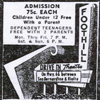
Foothill Drive-In ad, 1957. Source
El Rey Motel
Ahead, to your right at 454 E Foothill Blvd. is the "El Rey Motel", Spanish for "The King" is still open; it appears in the 1959 aerial photograph of the area.
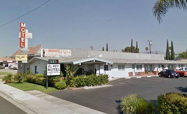
Ned's Hardware (Nervous Ned's Gas Station)
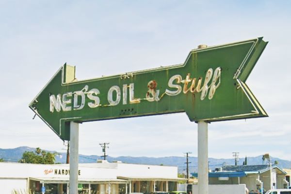
To your right, at 312 E Foothill Blvd. this store has been here for a long time. You can spot its neon sign, the green arrow pictured, but the original one was even more magnificent, a gigantic oil derrick spewing oil with the words "Jet Flame Gasoline" topping it.
It appeared with other gas stations in the advertisement published in the San Bernardino Sun, Volume 66, on 9 October 1959.
The local urban myth has it that he was known as "Nervous" because he got robbed quite a lot. The pump islands were located perpendicular to the highway in front of the store. The building is still there and sells hardware.
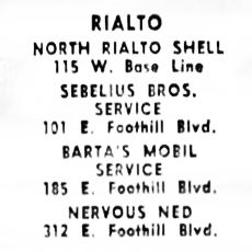
Rialto Gas stations ad, 10-9-1959. Source
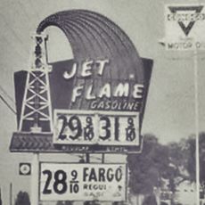
Nervous Ned's original neon. Source
On the next block, between Sycamore and Riverside Ave there were more service stations: Barta's Mobil at 185 E Foothill, torn down, now America Tire Depot stands on the lot. It can be seen on the right side of the picture below (in the distance), after Rialto's Ford dealership that was Don Muth Ford in the 1960s and Bill Ellis Ford in the 1970s (155 E Foothill); now Rialto Car Care Center.
Original image caption: "The 'Home Town' city. Foothill Blvd. looking east toward the San Bernardino Mountains."
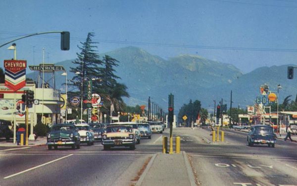
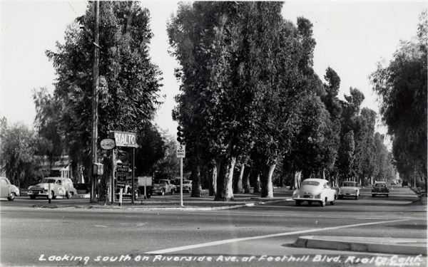
On the SW corner of Olive St. was a Shell Station and at 101 E Foothill, on the SE corner with Riverside Ave. was the Sebelius Bros. Service that can't be seen in the 1950s color picture above, but you can spot it in the early 1960s one below. On the SW corner with Riverside Ave. was a Union 76 station. The tree-lined median along Riverside had a sign on the crossroads reading "Rivalto" and an arrow pointing south to its downtown district. (pictured further down).
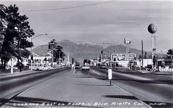
On the north side of the highway you can make out a Chevron station on the NE corner with Riverside, followed by Friendly Chevrolet dealership at 110 E Foothill, and a Texaco gas station. All have been torn down.
Below is the same view looking east along Foothill Blvd at its intersection with Riverside:
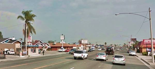
Adobe building from 1853
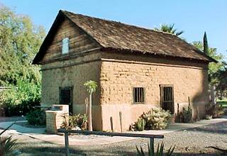
Just ahead, at Lilac Ave., take a left and drive three blocks south, park at Bud Bender Park amd visit an adobe structure built in 1853 by Michael White. The historic building is 150 yards west of the parking lot, where N Millard Ave. meets the park. It is the oldest building in Rialto and it was moved to its present location in 1961, and restored. It was originally located on the north side of Walnut Ave, between Riverside and Sycamore. The city leases it to the Rialto Historical Society for a symbolic $1 per year.
Fiesta Lodge
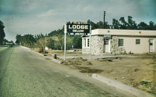
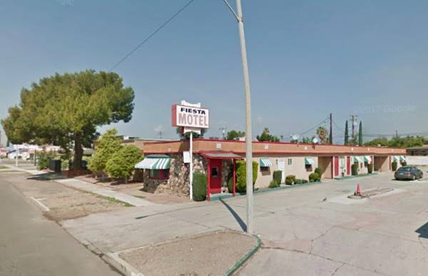
Return to Route 66 and head west, and at 410 W Foothill Blvd. is a motel that is still operating under the same name, whose 1950s matchcovers announced "The best costs no more" at that time the numbering was different, and this property was 344 W Foothill. It appeared in the 1952 AAA Hotel directory with eleven rooms. The stones on the facade came from Lytle Creek in San Bernardino. It had a classic neon sign reading "Fiesta Lodge De Luxe" now gone.
Mac's Garage and Auto Court
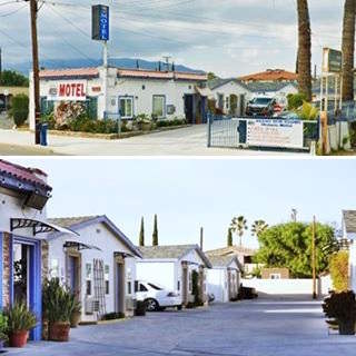
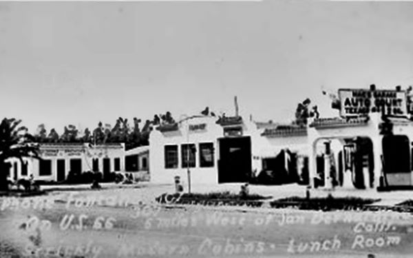
On the NW corner with Linden Ave. and Foothill A. E. McNutt opened his garage back in 1926. He had previously lived in Los Angeles, coming to California in 1923 from New York City, where he opened his first garage back in 1906; a real pioneer. 2 He grew his garageinto a tourist complex, that included a gas station on the corner -you can see it solid pillars and canopy on the right side of the image below, followed by the garage with a curved parapet with a pent roof with red terra cotta tiles on each side. This building is still standing and operating as a garage! On the western side of the property he built an auto court that was advertised in the postcard below c.1930s as having "Strictly Modern Cabins - Lunch Room... 6 miles West of San Bernardino." The cabins are also there at 1526 W Foothill; they evolved into the Route 66 Motel. They also have red tiles along the top of the parapet.
Mac's Garage, Service Station and Auto Court c.1930
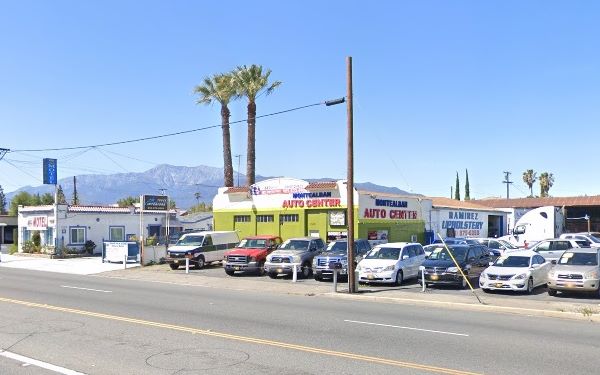
Route 66 Motel
It has survived from the days of Mac's Auto Court; the old motel is narrow and long, with a central drive way lined with separate cabins, each with two units, separated by the open garage areas, typical of a 1930s auto court. Only the office has a box-shaped appearance.
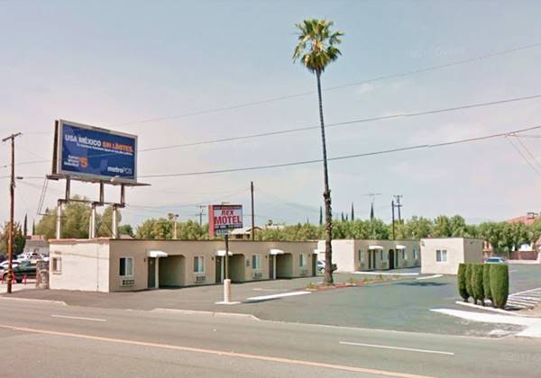
Rex Motel
Next door and adjacent to the Route 66 motel, at 1536 W. Foothill Blvd. It appears in the 1948 aerial picture of the area, so it was built after Mac's complex. It has an L-shaped layout and the roofed garages between the units seem to have been walled in not too long ago.
Continue your Road Trip
This leg of your journey ends here; continue your "Route 66 Road Trip" by heading west towards the next town along the highway: Fontana.

Sponsored Content
>> Book your Hotel in San Bernardino

Credits
Banner image: Hackberry General Store, Hackberry, Arizona by Perla Eichenblat
A Guide to the Golden State, by the Federal Writers' Project of the Works Progress Administration, Hastings House, New York, 1939.
Jack DeVere Rittenhouse, (1946). A Guide Book to Highway 66.


