Route 66 in Claremont CA
Index to this page
About Claremont California
Facts, Trivia and useful information
Elevation: 1,168 ft (356 m). Population 35,124 (2025).
Time zone: Pacific (MST): UTC minus 8 hours. Summer (DST) PDT (UTC-7).
Claremont is a small city located on old Route 66 in Los Angeles County in southern California and is part of the Los Angeles metropolitan area.
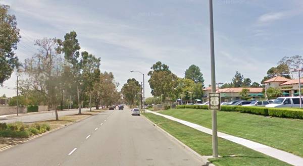
Entering Claremont along Route 66 in Claremont; Foothill Blvd.
The History of the city of Claremont, California
Southern California was peopled at least 13,000 years ago. In recent prehistoric times, the Tongva people,a Native American group lived in the area. The Spaniards called them Gabrielino or Gabrieleño Indians.
The Spanish reached California around 1602, setting out from their colony in Mexico. They founded Los Angeles in 1769, and eight miles west of it, established the Mission San Gabriel Arcángel in 1771. Mexico became independent from Spain in 1821 and retained the former viceroyalty's territories, including California. At that time, what is now Claremont, was open ranchland and would remain as such until the mid 1880s. It was part of the vast 15,000 acre "Rancho San José" which was granted to Ygnacio Palomares by the Mexican Governor Juan Bautista Alvarado in 1837; this land spanned what is nowadays Glendora, La Verne, Pomona and Claremont.
The Railroad in Claremont
In 1883, the Atlantic & Pacific Railroad (later acquired by the Atchison Topeka & Santa Fe Railroad) coming from the east (St. Louis, Topeka, and Albuquerque) had reached San Bernardino. Its owners acquired the right of way across San Gabriel Valley, building their tracks to Pasadena, passing through what would become Claremont in 1887.
That same year a subsidiary of the Santa Fe Railroad named The Pacific Land and Improvement Company platted a town: Claremont.
The name: Claremont
The original idea was to name it after the land's owner, Mr. H. A. Palmer, who declined, suggesting instead various Spanish names which refered to the great view of the San Gabriel Mountains.
The company officials decided to follow suit but using English language words, and one of these directors, who lived in Claremont, New Hampshiere suggested the name "Claremont", which stuck.
The name is French, and comes from "clair" (bright or clear) and "mont" (mill, mount) a prominent hill standing out from a plain.
A College Town
Just as it was founded, in 1887, the Pomona College was established along the lines of a "New England" University, it was coeducational and was the seed from which the town grew up from.
The college was established in Pomona but it moved to Claremont in 1890, and used the town's unfinished hotel as its first building, renaming it "Sumner Hall". despite relocating to Claremont, the college retained its name (Pomona).
The campus covers 140 acres (57 ha.) and has 63 buildings. The town's Claremont Colleges Consortium now has five undergraduate colleges and two graduate institutions.
The town incorporated in 1907, and the USGS survey along the Santa Fe railroad of 1915 says the following about it: "...West of Claremont a spur of the San Gabriel Mountains on the north extends nearer to the railway, and the San Jose Hills, a northern extension of the Santa Ana Mountains, approach from the south. Owing to these conditions the valley narrows to about 3 miles at Lordsburg. In order to pass the San Jose Hills the railway has been deflected to the northwest, a course that soon takes itnear the foot of the San Gabriel Mountains, which are closely skirted from San Dimas to Pasadena."
Foothill Boulevard
Foothill Blvd. is the work of Frank Wheeler, an Englishman who reached Claremont in 1893 and campaigned to improve the dirt highway that would become present Foothill Blvd.
He was the vice president of the Foothill Boulevard Association and worked hard to have the road become a state highway. He worked with Ralph Cornell and designed the layout of the eucaliptus trees that lined the highway through Claremont. It became the roadbed of the National Old Trails Highway, that linked Los Angeles with New York, and in 1926 Route 66 was aligned along it. By then funds had been assigned and the road had been paved and widened.
The Claremont portion of the new highway was completed in 1931 and the whole highway up to San Bernardino became in 1938 the first four-lane divided highway in California.
Citrus groves and orchards grew up around the town until they began to be replaced by urban development after World War II.
During the 1950s, the LA freeway system grew and diverted traffic away from Route 66 which was replaced here in 1964 by I-10 as a major highway; traffic along Foothill Blvd. dwindled. In 1964 the western terminus of Route 66 was formally moved from Santa Monica to Needles CA; however, only the highways up to Pasadena were decertified, the remaining ones remained signed as Route 66 until I-40 was completed between Barstow and Needles in the early 1970s, bypassing Claremont for good.

Accommodation in Claremont
You can find your room in Claremont.
> > Book your Hotel in Claremont
More Lodging near Claremont along Route 66
Below you will find a list some of the towns along Route 66 east and west of Claremont; click on any of the links to find your hotel in these towns.
>> Check out the RV campground near Claremont, in Pomona
The Weather in Claremont
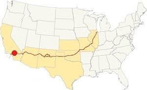
Location of Claremont on Route 66
Claremont has a warm Mediterranean (Continental Mediterranean climate); it is semi-arid, with hot (triple digit temperatures), and dry summers and with cool - chilly winters.
The town has on average, 287 sunny days per year and the strong dry - hot Santa Ana wind blows through Cajon Pass during autumn (fall) drying out the area and increasing the risk of wildfires the foothill communities.
Early summer is usually overcast ("Mat Gray" and "June Gloom") due to the damp oceanic air flowing in.
The average high in winter (Jan) is 68°F (20°C) and the average low is 39°F (4°C). During summer the average high is 88°F (31°C) and the average low is 61°F (16°C).
Rainfall averages 18.4 in. per year (468 mm), with the period May to September being the driest one with less than 0.2 in. monthly (5 mm).
During winter the peaks of the San Gabriel Mountains receive plent of snow, but only very rarely does it snow in Claremont.
Tornado risk
As Claremont is located very far from the Rocky Mountains (western limit for tornadoes), there is no risk of tornadoes in this area.
Tornado Risk: read more about Tornado Risk along Route66.
Map of Route 66 in Claremont
>> Custom map of Route 66 through Claremont.
National Old Trails Highway (N.O.T.) in Claremont
The use of the automobile had grown considerably in the early 1900s, and the National Old Trails (N.O.T.) Association promoted the construction of a highway linking Los Angeles with New York. It was built as a dirt trail, and ran next to the Santa Fe railroad tracks from California, to Arizona and New Mexico, heading norteast from there across the Continent. In Claremont it was aligned along what would later become Foothill Blvd.
The 1912 map by the Automobile Club of Southern California's map shows the N.O.T. highway running on the north side of the Santa Fe Railroad and after crossing the county line (San Bernardino - Los Angeles) it reached Claremont (38 mi. from LA). Here the road had some curves westwards as it headed towards Glendora.
Route 66
The N.O.T. road was incorporated into the brand new U.S. Highway 66 in 1926; this road was slowly widened and improved. The map below was published one year later (1927) and you can follow Route 66 from Victorville through Cajon, San Bernardino and west into Los Angeles; Claremont appears in the map.

1927 Road map, SW CA
Click on image to enlarge.
Credits

1956 Shell Roadmap, SW CA
Click on image to enlarge.
Credits

Detail 1930 roadmap
Click on image to enlarge.
Full map
The thumbnail map shows the alignment of Route 66 from Victorville to Los Angeles, you can see Claremont on it.
The map further up shows the same area in 1956; a freeway now links Victorville with Cajon and San Bernardino with Los Angeles. Notice Claremont on it.
In the 1950s, the freeway system in LA would start to divert traffic away from Route 66. In 1964, Route 66 was replaced by the freeway and traffic along Foothill Blvd. dwindled.
In 1974 Route 66's western terminus was moved to Needles CA and Claremont was bypassed for good.
Route 66 Alignment near Claremont
With maps and full information on the Mother Road.
- Pasadena to Santa Monica (Next)
- Barstow to Pasadena (Claremont's)
- Topock to Barstow (Previous)

Sights in Claremont, California
Historic Context for Route 66 in Upland
The "Guide to the Golden State" written by the WPA and published in 1939, described the town as follows:
...CLAREMONT, 19.4 m. (1,155 alt., 2,719 pop.), in the midst of citrus groves and vineyards, is a city of tree-lined streets and attractive residences. It has a citrus-packing plant and a number of small factories, but is essentially a college town. [...]
POMONA COLLEGE was founded in Pomona in 1887 by the Reverend Charles B. Sumner, a New England Congregational minister. The following January the Santa Fe Railway gave 500 acres of land for a campus here; an unfinished hotel, now Sumner Hall, was the first college building. In 1894 the enrollment was 47; in 1937 it was 900. The buildings, of various architectural styles, are scattered over 24 tree-shaded city blocks. In 1927 Pomona became the sponsor of a plan for a group of affiliated colleges, Claremont Colleges, Inc., of which Pomona (co-educational) was the first unit and Scripps College, the second.
The 50-acre campus of SCRIPPS COLLEGE FOR WOMEN is cut by city streets. Scripps became a unit of Claremont Colleges, Inc., through a gift of Miss Ellen Scripps. The enrollment (200) is limited by rigid scholastic requirements. The buildings are of modified Spanish design. WPA (1939)
The 1940s Caltrans road map shows Foothill Blvd. (US 66) running through unincorporated land west of Upland and, after crossing into Los Angeles County it goes through the north tip of Claremont. At that time Pomona was further south, centered on US 60, 70 and 99, and did not reach US 66 in the north, an area that was then open countryside. Only after passing CA-71 did Route 66 enter another town: La Verne.
Jack DeVere Rittenhouse rode the whole of Route 66 in 1946 and wrote his book: "A Guide Book to Highway 66". He describes this area saying that the towns only the name and mileage for Claremont: "... and CLAREMONT at 334 mi. ...", merely one among many.
Local Celebrities
Some well known celebrities from Claremont: Jessica Alba, Peter F. Drucker and Frank Zappa.
Road Trip Leg: Route 66 in Claremont
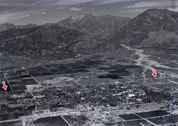
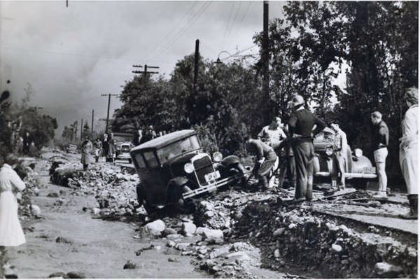
We will begin our Claremont leg of our road trip driving west from Upland along Foothill Blvd. the highway crossed the eastern branches San Antonio Wash, leaving San Bernardino County and Entering Los Angeles County. This is a flat region, the alluvial fan of the Wash, with sand, gravel and boulders eroded from the San Gabriel Mountains to the north. Now a dam has been built upstream at the mouth of San Antonio Canyon, and the runnof is contained by the San Antonio Creek Channel. But in the past, the water overran the floodplain like it did during the Great Flood of 1938 when two storms converged over the Los Angeles aea on February 27, 1938 and it rained for five days. 32 inches or rain fell in the San Gabriel Mountains and ran downhill flooding the city and its suburbs. When the waters receded, they had destroyed over 5,600 homes, killed 87 people and caused damges exceeding $1.67 billion (in 2024 dollars).
Millard Sheets Studio
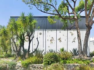
655 East Foothill Blvd. to your right, facing Route 66. This building was built in 1958 to house the art studio of Millard Sheets (1907-1989), an artist who taught at Scripps College. His murals are found across Southern California.
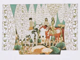
You can see one of them, on the facade of the US Bank, at 393 W Foothill Blvd. one mile west; it is "Indians and Yuccas" (1968) and it depicts mounted Native Americans (pictured further down).
Notice the mosaics on his studio's wall which now is a private office space (pictured below).
Rancho Santa Ana Botanic Garden
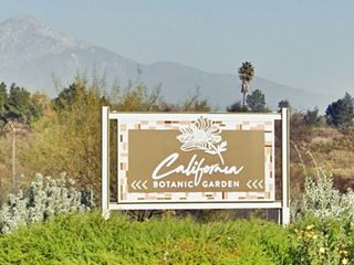
Botanic Garden, Route 66, Claremont CA.
Head west for 0.5 miles and take a right on N. College Ave. just ahead you will reach the Botanic Garden at 1500 North College Avenue
Trees have been a part of Clareomont since it began. It has won the National Arbor Day Association's Tree City USA award for 22 consecutive years. The town is also one of the few places in North Ameria where its Elm trees have not yet been infected by the Dutch elm disease.
It is fitting for it to have the largest collection of native Californian plants with around 2,000 taxas of local plants from Baja California to Oregon. The garden moved to Claremont from Santa Ana in 1952 and covers 86 acres.
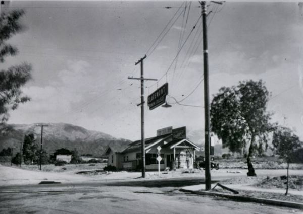
Retrace your steps back to Route 66, turn right and head west, on the first corner (NE corner) at Harvard Avenue and Foothill there was a gas station in the 1920s, pictured below in an image taken on 09-17-1939. There is a sign at the crossroads hanging from two power poles that says "Claremont Pomona College." Now it the property is part of the Library of the Claremont School of Theology.
Wolfe's Marketplace
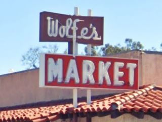
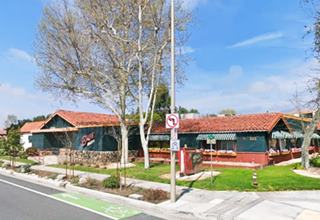
Across the street, to your left, on the SE corner of Harvard and Route 66 is Wolfe's Marketplace (160 West Foothill Blvd). John and Mary Wolfe started the business back in 1917 a few blocsk west of here, on Indian Hill and Foothill. Below are some pictures of that original store that also included gas pumps.
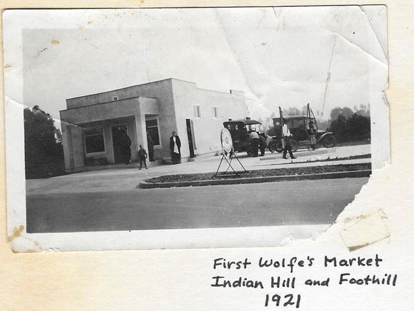
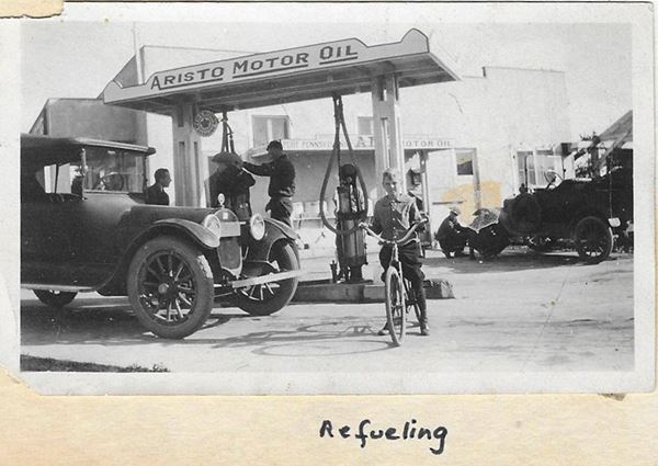
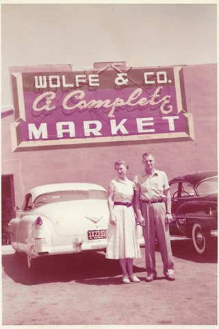
1950s Wolfe and Co. Source
They moved to this site in the early 1930s and it has been a family-run business since then: Claude & Lola Wolfe; 2nd generation, Ed & Elaine Wolfe; 3rd generation, and Tom & Shauna Wolfe; 4th generation.
Wolfe's has been through some rough times over the past century, the Great Depression, WWII, and more recently they refocused the business eliminating groceries and concentrating on specialty deli, gourmet kitchen, bakery and catering.
The color image was taken in 1954 and shows Claude and Lola Wolfe by the store. Below is a view of it in 1965, and its sign nowadays.
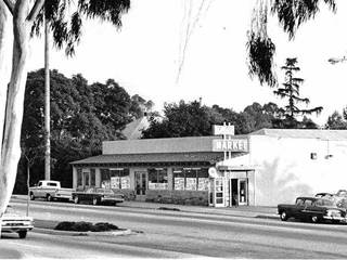
Wolfe's Market in 1965. Source. Click image to enlarge
The 1959-60 telephone directory tells us that across Harvard, opposite Wolfe's was Bob's Texaco service station and one block west, on the SE corner of Foothill and Yale was Joe Ellis Chevron Service; both long gone. On the next corner at Indian Hill Blvd., there is a former gas station.
Sherwood Florist - Garage
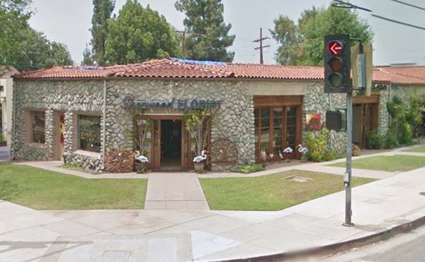
On the SW corner at 404 W Foothill Blvd. This stone building with a red Spanish tiled roofs dates back to 1923 (3 years before Route 66 was created). Now it is a florist shop, but it originally housed the Sterling Oil Spray Co., a business that supplied the citrus ranchers with oil to treat their fruits against insects. The place became a garage, and you can still see the three former service bays. It is made from local boulders picked from the alluvial flood plain here in Claremont.
Sherwood Florist on Route 66:
Old School House
On the opposite side of Foothill, on its NW corner is the site of the old schoolhouse (415 West Foothill Blvd). The original Claremont High School was built here in 1911; it was reformed in 1930s when the third floor was removed after the 1933 Long Beach Earthquake that had a 6.4 magnitued. Finally it was closed and sold in 1971 as it was unfit as it did not meet earthquake safety requirements. It was bought by Griswold's who turned it into shops, and the Candleight Pavilion Diner Theater.
Griswold's Complex
It all began back in 1909 when George Carter Griswold, a retired professor at one of the local colleges, started making candied fruits and orange marmalade at home and selling it by mail. In 1915 he expanded to a small shop where he prepared his products and sold them to tourists in 1915.
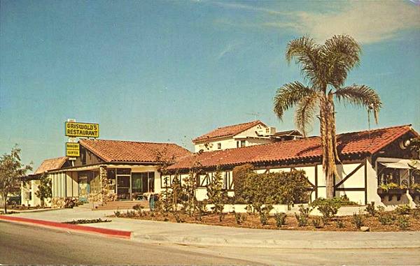
In 1950 he sold the business to Alton (Sandy) and Betty Stanford who described it as a "Jam and jelly kitchen." They continued the mail order business. Their store appeared in the local 1959-60 telephone directory. They added a bakery and a restaurant but needed more space, so they moved to a larger property just west of Indian Hill Blvd. Here they built their smorgasbord restaurant complex (smorgasbord is a Scandinavian meal which is a buffet with many hot and cold dishes set on a table, originally from Sweden), and in 1968, a hotel. In 1970 they purchased the old Claremont High School and repurposed it as a mall. In partnership with Ben Bollinger they opened the Candlelight Pavilion dinner theater in 1985. They opened a second restaurant in Redlands. But recession and the First Gulf War led to them to file for bankruptcy under Chapter 11 in 1992.
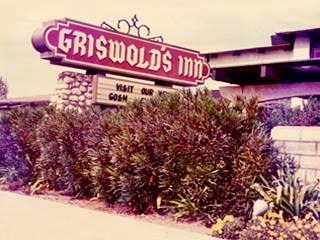
1960s, Griswold's Inn sign. Source
The restaurant now serves Italian food as Buca di Beppo (pictured above; very similar to the original layout). The Candlelight Pavilion became a market (Trader Joe's).
Griswold's Inn at 555 Foothill had 106 rooms "Color TV - Two Pools ... Cocktail Lounge." It was sold, upgraded and now is the DoubleTree by Hilton Hotel Claremont. There is a project to build condominiums on the site.
The postcard below states "Swedish Restaurant featuring SMORGASBORD. We make our own fine preserves and dried fruits. Continental Bakery and gift Shop."
Tugboat Annie's
Americana - Quirky roadside attraction on Route 66
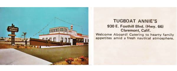
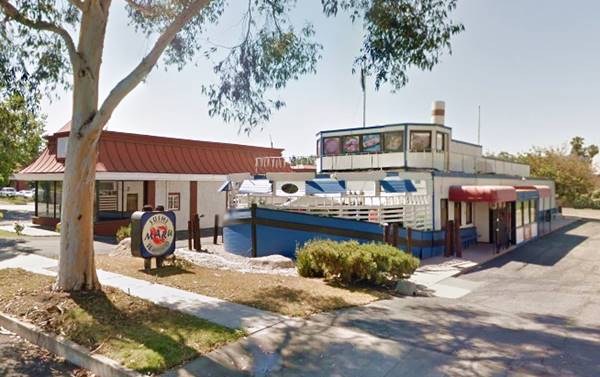
Driuve west along Route 66 for 0.6mi. on the south side of the road (take a "U" turn at N. Regis Ave. to reach it) is an unusual building, the boat shaped former Tugboat Annie's restaurant at 962 W. Foothill Blvd.
Shaped like an real tugboat, this building is unique. It dates back to the late 1960s and was designed as an eye-catcher to entice travelers to eat seafood in a boat on Route 66.
It later became the "Original Shrimp House" and more recently a sushi restaurant (Sushi Maru). Below is a "Then and Now" set of images.
Tugboat Annie
Tugboat Annie is a 1933 film starring Academy Award winer for Best Actress, Marie Dressler, and Wallace Beery. The movie was based on a serial published in the Saturday Evening Post, based on Thea Foss of Tacoma Washington. The film was a hit and was followed by two sequels "Tugboat Annie Sails Again" (1940) and "Captain Tugboat Annie" (1945) and a TV series in Canada (1957).
Continue your Road Trip
This marks the end of this leg of your journey. Continue your Route 66 Road Trip by heading west towards the next town along the highway: Pomona.

Sponsored Content
>> Book your Hotel in San Bernardino

Credits
Banner image: Hackberry General Store, Hackberry, Arizona by Perla Eichenblat
A Guide to the Golden State, by the Federal Writers' Project of the Works Progress Administration, Hastings House, New York, 1939.
Jack DeVere Rittenhouse, (1946). A Guide Book to Highway 66.


