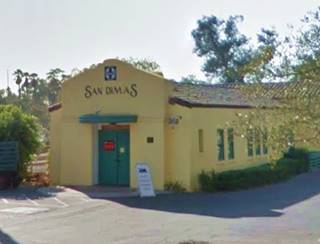
Route 66 in San Dimas CA
Index to this page
About San Dimas California
Facts, Trivia and useful information
Elevation: 955 ft (291 m). Population 33,675 (2025).
Time zone: Pacific (MST): UTC minus 8 hours. Summer (DST) PDT (UTC-7).
San Dimas is a small town set on Route 66 in Los Angeles County in southern California; it is part of the Los Angeles metropolitan area.
The History of the city of San Dimas, California
This region of Southern California has been inhabited for the past ten thousand years. The natives encountered by the Spaniards when they explored California in the 1600s were known as "Tongva". The Spanish called them Gabrielino or Gabrieleño Indians (after the San Gabriel Arcángel Mission established nearby in 1771 ).
The Mission owned a vast tract of land which it retained after Mexico became independent from Spain in 1821, but later had to give up during the "secularization" enforced by the Mexican government in 1837 when way Mexican Governor Juan Bautista Alvarado granted the land in 1837 in what is now San Dimas, Azusa, Covina, Walnut, Glendora, La Verne, Claremont and Pomona, to Ygnacio Palomares and to Ricardo Vejar.
Palomares and Vejar formed a 15,000 acre ranch naming it "Rancho San José." Mexico lost California (and the other Southwestern states) to the US after the 1846-48 war, and in 1850 California became a state of the Union.
After Palomares died in 1864 his widow sold the land and Vejar lost his part due to forclosure. The place at that time was known as "La Ciénaga" (Mud Springs) the local natives had a campsite here, and there was a stop, or station on the Banning Stage Coach Line there. It was ran by Dennis Clancy. There was a marker (now gone) at 503 East Arrow Highway commemorating the spot (now moved to the park by Old San Dimas depot).
In 1878 the Teague family settled here as farmers and grew grain crops. The Atlantic & Pacific Railroad, that ran from Saint Louis MO to Barstow CA was a subsidiary of the Santa Fe Railroad reached San Bernardino in 1885 and immediately set out to reach Los Angeles. It acquired the San Bernardino & Los Angeles Railway and extended its line west from passing through "Mud Springs" (now San Dimas) in 1887; here it linked with the Los Angeles and San Gabriel Valley Railroad (also purchased by them) and proceeded via Pasadena into Los Angles through Arroyo Seco canyon.
The area was developed by the San Jose Ranch Company in 1887 who changed the depot's name to San Dimas after the local Canyon, north of the tracks at the foot of San Gabriel Mountains.
The name: San Dimas
The town was named after San Dimas Canyon in the San Gabriel Mountains. The Canyon was named after Saint Dismas (in Spanish "San Dimas"), who was one of the two thieves crucified with Jesus and canonized by Christ himself. The name originated in Greece -Dimas King of Thrace was grandfather of Troyan heroes Hector and Paris. Palomares called it so because he considered it a lair of cattle rustlers, thieves like Dimas, but unrepentant.
The townsite was platted just south of the Way Hill (1,090 ft.) and it became the hub of a farming community that grew citrus.
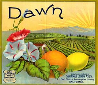
San Dimas, Dawn Lemon brand, 1910s. Source
The land bubble burst in 1889 and the hotel built near the railway depot to house the settlers never lodged anyone. It was later purchased by the Walker family and is now the Historic San Dimas Hotel (also known as the Carruthers Home, Walker House and the San Dimas Mansion).
A marmalade factory and four citrus packing houses were located in the town.
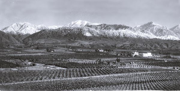
The USGS survey along the Santa Fe railroad of 1915 says the following about the town and its surroundings: "...West of Claremont a spur of the San Gabriel Mountains on the north extends nearer to the railway, and the San Jose Hills, a northern extension of the Santa Ana Mountains, approach from the south. Owing to these conditions the valley narrows to about 3 miles at Lordsburg [now La Verne]. In order to pass the San Jose Hills the railway has been deflected to the northwest, a course that soon takes it near the foot of the San Gabriel Mountains, which are closely skirted from San Dimas to Pasadena... North of San Dimas (dee'mas) a mass of sandstones and shales with interbedded volcanic rocks is exposed at the foot the mountains... halfway between San Dimas and Glendora, the train crosses the dry wash of San Dimas Creek, which heads in a large canyon a few miles to the northeast. It is a good example of a wash formed by a powerful intermittent stream."
At that time, the growing use of cars led to the formation of the National Old Trails (N.O.T.) Association that promoted a highway linking Los Angeles and New York. It crossed northern San Dimas. Route 66 was aligned along it in 1926.
Citrus farming led San Dimas to become the "Queen of the citrus belt" in Southern California. By the 1950s, the citrus groves were affected by disease and many were uprooted, this made space for the growing Los Angeles suburbia. The freeway system
was also expanding rapidly and by 1964, four years after San Dimas incorporated, I-10 replaced Route 66 as the main highway in the area.

Accommodation in San Dimas
You can find your room in San Dimas.
> > Book your Hotel nearby in Monrovia
More Lodging near San Dimas along Route 66
Below you will find a list some of the towns along Route 66 east and west of San Dimas; click on any of the links to find your hotel in these towns.
>> Check out the RV campground near San Dimas, in Pomona
The Weather in San Dimas
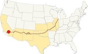
Location of San Dimas on Route 66
The weather in San Dimas is warm Mediterranean one, semi-arid, with hot and dry summers and cool - chilly winters.
The town has on average, 287 sunny days per year and the strong dry - hot Santa Ana wind blows through Cajon Pass during fall drying out the area and increasing the risk of wildfires the foothill communities.
During winter, the average high (Jan) is around 68°F (20°C) and the average low is 43°F (6°C). During summer the average high is 90°F (32°C) and the average low is 62°F (17°C).
Rainfall averages 17.3 in. per year (440 mm), with the period May to September being the driest one with less than 0.2 in. monthly (5 mm).
During winter the peaks of the San Gabriel Mountains receive plent of snow, but none falls on Route 66 in San Dimas.
Tornado risk
As San Dimas is located west of the Rocky Mountains that mark the western limit for tornadoes so the risk of tornadoes striking this region is almost nil.
Tornado Risk: read more about Tornado Risk along Route66.
Map of Route 66 in San Dimas
>> Custom map of Route 66 through San Dimas.
National Old Trails Highway (N.O.T.) in San Dimas
As mentioned further up, in the 1910s the use of the automobile had increased and was becoming popular. However, there were no decent highways to drive on. So different groups were formed to lobby and promote the construction of good roads. One of them, the National Old Trails (N.O.T.) Association aimed at linking New York with Los Angeles. They built and placed signs along the dirt trail that ran along Foothill Blvd. It was improved over the years, widened and paved. The alignment in this area ran close to the Santa Fe railroad tracks. It was aligned along the north side of San Dimas on Foothill Blvd and E Baseline Rd.
Route 66
The N.O.T. highway became the first alignment of U.S. Highway 66 when it was created in 1926. The map below was published one year later (1927) and you can follow Route 66 from Victorville through Cajon, San Bernardino and then into Los Angeles; San Dimas does not appear in this map, it lies between Glendora and Claremont.

1927 Road map, SW CA
Click on image to enlarge.
Credits

1956 Shell Roadmap, SW CA
Click on image to enlarge.
Credits
1930s Realignment
>> orange line is the 1926-30s alignment in West La Verne and San Dimas.

Detail 1930 roadmap
Click on image to enlarge.
Full map
The USGS map from 1928 (click on it to enlarge it) shows that Route 66 had a different course west of the intersection of Baseline Rd. and Footill Blvd. on the western edge of La Verne. Route 66 curved at this point leaving its SE-NW course and headed with a straight west direction along E Baseline Rd. up to N San Dimas Rd. where it turned sharply north, crossed San Dimas Wash, and then followed the SE-NW course of Foothill Blvd.
But the highway was realigned to avoid all these sharp turns when a new alignment was built to span the gap and extend Foothill Blvd. across San Dimas Wash here in the early 1930s.
The black and white 1930 thumbnail map shows the alignment of Route 66 from Victorville to Los Angeles, San Dimas does not figure in this map (west of Claremont).
The final map further up, shows the same area in 1956; a freeway now links Victorville with Cajon and San Bernardino with Los Angeles.
In the 1950s, the freeway system in LA would start to divert traffic away from Route 66. By 1964, Route 66 was replaced by here as a major highway by the freeways and traffic along Foothill Blvd. decreased.
Route 66 Alignment near San Dimas
With maps and full information on the Mother Road.
- Pasadena to Santa Monica (Next)
- Barstow to Pasadena (San Dimas')
- Topock to Barstow (Previous)

Sights and Attractions in San Dimas, California
What to Do, Places to See
Historic Context
The 1939 the "Guide to the Golden State" written by the WPA described the town of San Dimas as follows:
... At 23.3 m. is a junction with San Dimas Canyon Rd. Right on this road to SAN DIMAS CANYON PARK [...] naturally wooded land (picknicking facilities) at the foot of the San Gabriel Mountains. Hiking trails lead into the mountains. The motor road winds up the canyon to WOLFSKILL FALLS, 11 m. WPA (1939)
Jack DeVere Rittenhouse rode the whole of Route 66 and, in 1946 wrote his "A Guide Book to Highway 66" in which he says that the towns in this area "... are so close together as to be practically indistinguishable from each other..." adding "More towns you pass through include LA VERNE at 336 mi., GLENDORA, 241 mi." not mentioning San Dimas, that hadn't incorporated as a town at that time (it did so in 1960).
San Dimas and its Route 66 attractions
Driving west from La Verne Route 66 enters San Dimas at the intersection of Foothill Blvd. with Baseline Rd. The original alignment followed E Baseline Rd (now cutoff, to your left) all the way to St Dimas Ave. and then north along it, continuing with a NW course along Foothill. In the 1920s, the current alignment along Foothill Blvd. didn't exist because the wide San Dimas Wash was an obstacle; it flooded and couldn't be bridged (orange line in our custom map).
San Dimas Canyon Dam
Projected in 1917 the dam in San Dimas Canyon would contain the floods caused by heavy rains that frequently damaged thousands of acres of farmland downstream. The dam would avoid this damage and also help store water. It was built in 1922 and complemented in 1928 with the Puddingstone Reservoir south of it, in La Verne, this second reservoir received the water that was diverted away, from San Dimas Wash, using a two-mile long channel. Water could now be stored in Puddingstone and the San Dimas dam woul only hold water during years with heavy rains.
This effectively "dried-up" San Dimas Wash and allowed Foothill Blvd to be built across it in the early 1930s, when Route 66 was realigned along it as shown with a red line in our custom map.
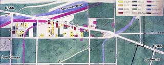
Detail 1947 Land Use Map in San Dimas. Source
Click on image to enlarge.
The 1947 land use map of San Dimas (click on it to enlarge it) shows us what buildings were located along Route 66 at that time. As you can see, most of the area was farmland (green), the dry wash runs across the top (light blue), some homes in yellow and orange, water pumping plants and utilities (violet), and a few commercial buildings (red); we marked these as follows: Those with a (*) were the four auto courts (motels) in town; along Foothill there was an "apple Stand" (1), followed by a "Cafe" (2), a "Florist" (3), and a "General Store" (4). There was a "Drink Stand" on the NE side of San Dimas Wash (5). None have survived.
The 1959-60 telephone directory doesn't list any motels along Route 66, but it mentions a Gas Station at 700 E Foothill, on the SE corner with San Dimas Ave. now a Domino's Pizza.
Pinnacle Peak Steakhouse
Drive west for one mile, to your right, at 269 W. Foothill Boulevard is a classic steak house.
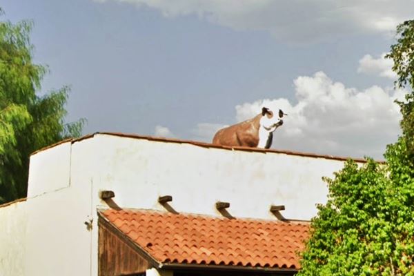
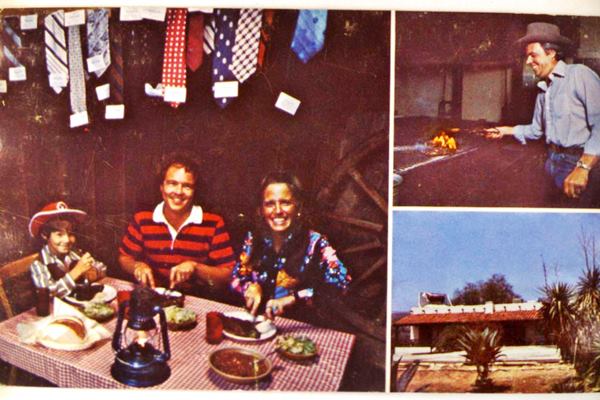
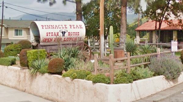
There is a "Covered Wagon" as an eye-catcher in the parking lot and a steer perched atop the roof of a building with the look of an adobe ranch with vigas and Spanish tiles. This is a homage to quirky Route 66 landmarks. The place is which opened in 1967, it is a steak house (a simple place to eat ribs and steaks with no-frills). Its postcard claimed it to be the home of the "Internationally famous mesquite-broiled steak."
It has an interesting rule: "NO TIES ALLOWED", which if not removed promptly, are cut off and hung from the rafters. So don't wear a tie!.
The rooftop steer at Pinnacle Peak steak house
The covered wagon at Pinnacle Peak
Foothill Blvd. has no other landmarks from the golden days of Route 66. West of Pinnacle Peak, the north side of the avenue becomes Glendora, while the south side is San Dimas all the way to Amelia Ave. This marks the end of this leg of your Route 66 Road Trip.
Take a side trip into San Dimas' commercial district 1.3 miles south of Historic Route 66.
Side Trip into San Dimas downtown district
The itinerary is shown in this map with directions, a 3.4 mile-long round trip.
The first stop is on San Dimas Avenue, the Historic Walker House (1887).
San Dimas Hotel or Walker House
Listed on the National Register of Historic Places
To your right at 121 San Dimas Ave., San Dimas. It is also known as: The San Dimas Hotel, Walker House, the Carruthers Home, and the San Dimas Mansion.
Built in 1887 to serve as a railroad hotel, it was designed by Joseph Newsom in Queen Anne style which was favored during the Victorian period.
Historic Walker House in San Dimas:
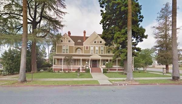
It covers 15,000 sq. ft. (1.400 m2) and had 18 bedrooms, 33 rooms in total, 14 fireplaces, a veranda, porch, cupola, and balconies.
It was finished just as the mid 1880s land bubble burst so it never had a single paying guest. The San Jose Ranch Co., who built it, sold it in 1889 to James W. Walker, a wealthy merchant from Kentucky.
It remained in the family until the last occupant, Mrs. Raymond I. Carruthers (J. Walker's granddaughter), and her family leased it in 1979 and a restaurant (San Dimas Mansion) opened there, serving guests like Richard Nixon and John Wayne, but it closed in the 1980s.
The building was acquired by the City in 2000 and renovated; it now houses the San Dimas Historical Society and Museum, and a community art gallery.
Downtown San Dimas: "Western Village"
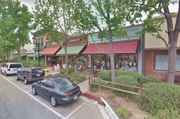
Go south from the Mansion and take a right along Bonita Avenue. You will soon notice that the place has an interesting architecture; the stores are styled with a Western look.
This Old West appearance dates back to the 1970s it was called the "Frontier Village" concept that has guidelines regarding on building code in this area. There are many 1900s brick buildings along Bonita Ave. In tune with this "estern ambiance, there was a Rodeo held in town every year!
San Dimas Western Days Rodeo
Held in October for over 25 years the rodeo takes place at Horsethief Canyon Park. However, in 2023 the Los Angeles County authorities banned rodeo events that routinely harm and kill animals, such as bull riding and calf roping.
Downtown San Dimas along Bonita Ave.
San Dimas Depot
Head west along Bonita Avenue and visit the old Railway depot, to your left by Rhoads Park at Bonita and N. Monte Vista Ave.
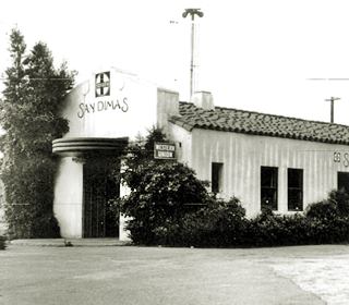
San Dimas Railroad depot, c.1935. Source
The old railway depot is now the home of the Pacific Railroad Society (see their website), and has been restored to its former glory; it houses a museum.
The original depot was built in 1889 and burned in 1933. A new one replaced it the following year and was used until 1961.
This spot marks the end of your tour of San Dimas.
Continue your Road Trip
Return to Foothill Blvd to continue your Route 66 Road Trip and visit the next town along the highway: Glendora.

Sponsored Content
>> Book your Hotel in Santa Monica

Credits
Banner image: Hackberry General Store, Hackberry, Arizona by Perla Eichenblat
A Guide to the Golden State; Federal Writers' Project of the Works Progress Administration, Hastings House, New York, 1939.
Jack DeVere Rittenhouse, (1946). A Guide Book to Highway 66.


