Route 66 in Dwight IL
Index to this page
Dwight IL
Facts, Information and trivia
Elevation: Elevation 631 ft (192 m). Population 3,977 (2024).
Time zone: Central (CST): UTC minus 6 hours. Summer (DST) CDT (UTC-5).
Dwight is a village that is mainly in Livingston County and that also has a small portion in Grundy County, Illinois.
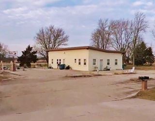
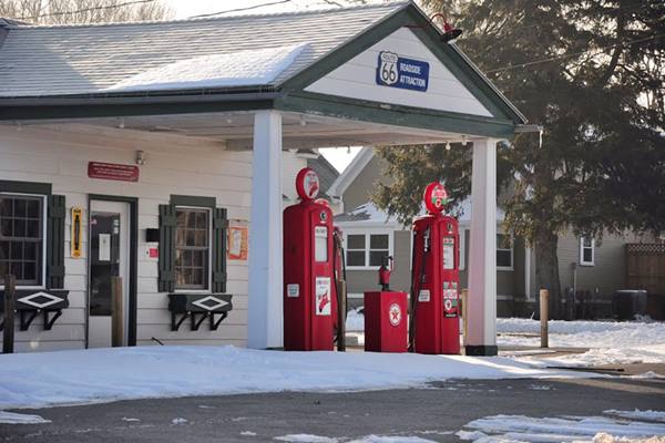
Marathon Oil, a historic gas station from the 1920s
History of Dwight
See the History of Pontiac for a description of the early history of Livingston county, and Gardner's History for that of Grundy County.
Although some settlers arrived at the time that Livingston county was created in the 1830s, definite settlement would have to wait for the railroad in the 1850s.
The Alton & Sangamon Railroad that later became the Chicago & Alton Railroad passed through this area in 1854 and the station named "West New York" was built, but shortly after it was renamed Dwight by Richard P. Morgan Ir., then an engineer and later general superintendent of the Chicago & Mississippi Railroad.
A community sprang up beside the railroad depot. In 1879 Dr. Leslie Keeley opened his institution to treat alcoholism in Dwight. After his death his partner John Oughton continued with the operation, and his house is still standing in Dwight as a Historic site.
The name: Dwight
It was named for Henry A. Dwight Jr. who was the main financier of the railroads (C&M and the Alton and Sangamon) chartered in 1847 and 1852 respectively but stunted due to lack of funds.
Dwight floated bonds, raised the money and built the tracks from Springfield to Joliet. He ended up going bankrupt and left the company.
Dwight, as a name for girls probably comes from the medieval English female name Diot (pet form of Dionysia), a surname derived from the Latin name Dionysius, meaning 'follower of Dionysus' (the Greek god of wine). For boys it apparently comes from Germanic and means "white or blond".

Hotels and Motels in Dwight
There are several hotels in Dwight and in the neighboring towns along Route66.
>> Book your Hotel Dwight
Find More Accommodation near Dwight along Route 66
Below you will find a list of some of the towns along Route 66 east and west of this town; click on any of the links to find your accommodation in these towns (shown from east to west):
Along Route 66 in IL
- Hotels in Illinois
- Route 66 Starting point ▸ Chicago
- Lockport
- Willowbrook
- Bolingbrook
- Plainfield
- Romeoville
- Joliet
- Wilmington
- Dwight
- Pontiac
- Chenoa
- Normal
- Bloomington
- Atlanta
- Lincoln
- Springfield
- Raymond
- Litchfield
- Staunton
- Williamson
- Hamel
- Edwardsville
- Collinsville
- Troy
- Glen Carbon
- Pontoon Beach
- Granite City
- East St. Louis
West in Missouri
- Hotels in Missouri
- Florissant MO
- Bridgeton MO
- St. Louis MO
- Kirkwood MO
>> See the RV campground nearby in Pontiac
The Weather in Dwight
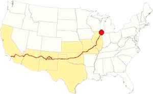
Map showing the location of Dwight, Illinois on U.S. 66
The climate of Dwight is classified as humid continental and has clearly marked seasons with hot and often humid summers, cool and wet springs, mild autumns and cold winters.
Temperatures: Average high in Jan (winter) 31°F (-0.3°C) and the average low is 17°F (-8.6°C). Average high in Jul (summer) 84°F (29°C), with an average low of 64°F (17.7°C).
Precipitation: Rainfall is between 3 and 4.3 (78 and 110 mm) inch per month between April and November, falling to around 1.7 in. monthly (28 mm) during winter. Average rainfall is 36.82 inch (936 mm).
Snow: The city gets 28 inches of snow per year (71 cm), with the first snowfall usually taking place in November and the last one happening in April (with less than a quarter inch -8 mm). You shouldn't see snow from May to September.
Tornado risk
The region where Dwight is located gets hit by 6 tornados per year.
Tornado Risk: read more about Tornado Risk on US 66.
Map of Route 66 in Dwight, IL
>> Our Custom map shows the alignments of US66 in Dwight.
The map below was published in 1924, two years before Route 66 was created. It displays the "Auto Trails" or roads that were suitable for cars. The ones in Dwight are marked with numbers: as "13" and "26" with white numbers inside black squares, these are the "trails", standing for "Mississippi Valley Highway" and "Blue Grass Road" respectively.
The number "4" inside a white circle is what originally was the Pontiac Trail created in 1915 between Chicago and St. Louis. In 1918 the state issued a bond to improve the roads, and the Pontiac Trail became SBI 4 (State Bond Issue) highway number 4, as shown in the map.
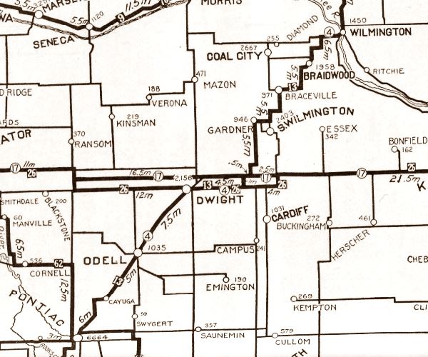
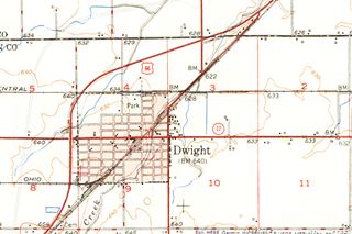
The thumbnail map (click it to enlarge) was published in 1950, at that time I-55 hadn't yet been built (or even planned). You can follow Route 66 as it curves around the town.
Maps with the alignment of Route 66 through Dwight
- Map with US66 1926-43 alignment (red line in our custom map)
- Map of the US66 1943-77 bypass alignment around Dwight (orange line in our custom map)
Route 66 across Illinois
Route 66 is a Historic highway and has also been designated as a National Scenic Byway and an All-American Road in the state of Illinois.
Read this detailed description of Route 66 in Illinois.
The Route 66 alignments near Dwight
Description and interactive maps of US 66.
- Pontiac to Springfield (next)
- Chicago to Pontiac (Dwight's)

Dwight's Route 66 Landmarks and Attractions
What to see in Dwight
US 66 in Dwight: historic context
After his drive from Chicago to Los Angeles, Jack DeVere Rittenhouse published his memorable "A Guide Book to Highway 66" in 1946. It has the following entry for Dwight:
... few tourist cabins; small hotels; Boyer Bros. Garage; stores... the town of Dwight is quiet and pleasant. Rittenhouse (1946)
He also mentioned the famous Keeley Institute and the large veterans' hospital both of which are still standing. We describe them below.
Drive US 66 through Dwight
We will begin our City Tour of Dwight on its northeastern tip, on Route 66, coming from Gardner at the point wherte both 1926-43 and 1944-77 US 66 alignments meet. Here the "Bypass 66" continues straight, and the older "City 66" forks to the left as South Brewster Rd. This 1926-43 alignment runs beside the railroad tracks towards downtown Dwight. Stay on the four lane alignment (1944-77 Bypass 66) to visit a classic spot.
"The First Traffic Light South of Chicago"
The crossroads of U.S. 66 and State Highway 47 was a dangerous one, and ordinary STOP signs didn't work well. Below is an excerpt from an article published in 1968 about this deadly crossroads:
Livingston [ranked] third with 20 [fatalities]. The worst trouble spot in Livingston County is the intersection of U.S. 66 and Illinois 47 at Dwight. Troopers ptrolling this area are convinced that motorists southbound from Chicago become "hypnotized" in the long uninterrupted drive to Dwight where they encounter the first stop light or stop sign. Even though the intersection is well protected with warning signs and flashing lights, motorists apparently just don't "see" the traffic lights until it is too late. The Pantagraph, Bloomington, Illinois, Sun. 21 Jan 1968
The picture below looks east along IL-47 at the crossroads with Route 66 running across the image (left to right), you can see the Standard station and the Crown Restaurant.
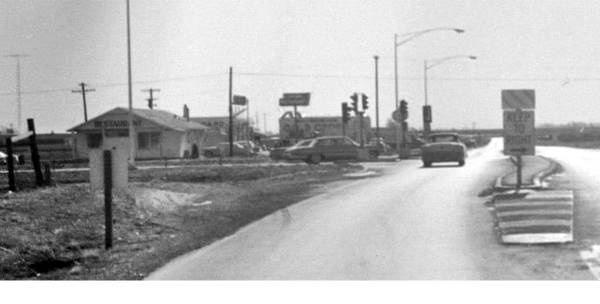
At the crossroads there were two spots on each side of Route 66.
Crown Restaurant and Standard Station (gone)
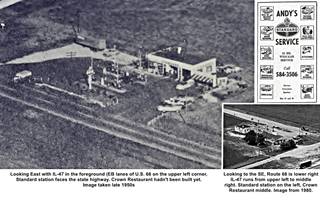
Standard station and Crown Restaurant, Dwight IL. A. Whittall; 1, 2 and 3.
Click image to enlarge it
To your left, on the NE corner. The Standard Station had several owners over the years: McElroy, and Andy Battrell with Mike Chinakis ran it from the mid-1950s. The place has gone and only the concrete foundations of the old gas station, and parking area has survived (street view). The thumbnail image (click on it to enlarge it) has an ad from 1962 when Battrell ran it, an aerial view from 1980 and an earlier aerial prior to the opening of Crown Restaurant operated by Bill Stark, in the late 1950s. It was open 24⁄7.
Former Coffeehouse, now Pete's and Texaco
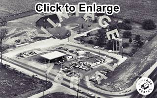
1968 aerial view Texaco & Coffeehouse. Source. Click image to enlarge
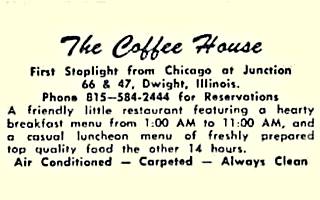
The Coffee house postcard text
Opposite the Standard Station, to your right, on the NE corner of the crossroads there were a diner, the "Coffeehouse" and Texaco gas station. The image (click on it to enlarge) shows a view of the site in 1968, Route 66 is on the lower right side of the image, that looks towards the NE.
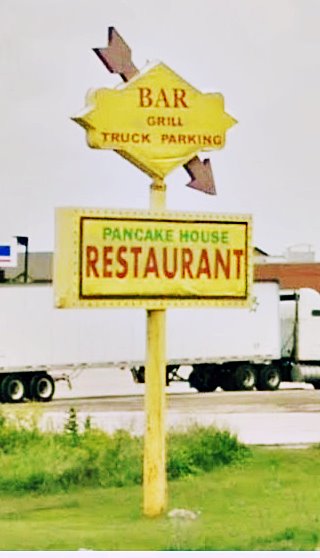
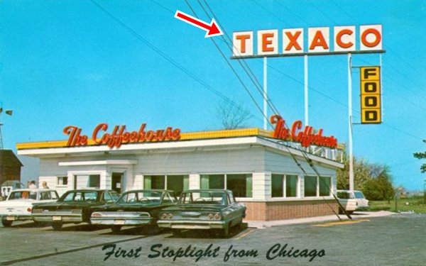
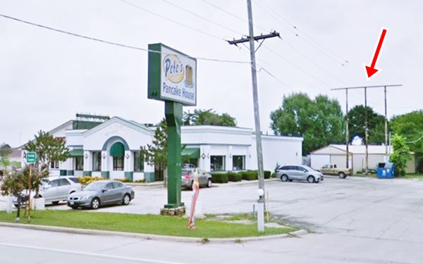
The postcard (pictured) mentions it as being on the "First Stoplight From Chicago". This Coffeehouse was one of several in Illinois, some years ago it became a restaurant (Pete's). At the northern side of the property is the yellow sign shown further up, which is a repurposed Sunoco sign (yellow diamond with the bulges where the S and the O of Suonoco went, and the red arrow), now it is advertising the Pancake House.
Below is a "Then and Now" sequence showing the three steel poles that held up the Texaco sign (red arrow). The gas station stood on the north side of the premises. The place is closed.
Into Dwight
Turn south (right) and drive along IL-47 until it meets the original 1926-44 Route 66 that runs parallel to the railroad tracks, turn right along it continue straight, now the road name changes to McNamara Ave. Just ahead the highway curves to the right, shifting away from the railroad and become W Waupansie St. Here, to your right is a US66 sight.
Big Al’s Hot Dogs (A and W)
302 E Waupansie St. Dwight. Right on north side of the curve was the A and W stand. Later it became Big Al’s Hot Dogs & Beef was located where McNamara Ave and N Chicago St. met, at the entrance into Dwight's urban area on Route 66.
This restaurant is slowly vanishing, first its red and white decor, with the man-sized hot dog went. Whitewashed and sober it sported its flat canopy -without its roof- for some time. Now that has gone too. You can see it in this 1972 aerial photo and in the following pictures with its decay and slowly vanishing canopy (red arrow).

Big Al’s Hot Dogs in 2006, Dwight, Il. Source

Big Al’s Hot Dogs in 2012, Dwight, Il. Source
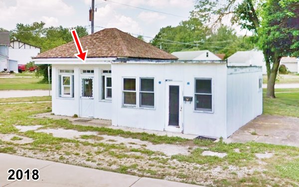
The place has finally closed as you can see in the images above.
Ray Goley's Filling Station (gone)
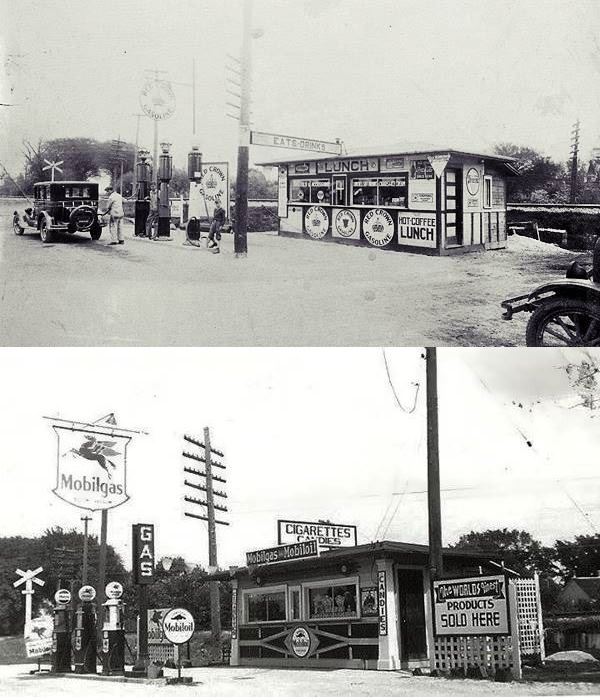
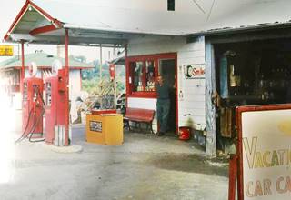
To your left, opposite the old A and W, facing N Chicago St. was the Red Crown ran by Groll in 1927 with his sons Bob and Howard, and later a Mobil station operated by Raymond "Ray" Goley (1907-1986). The station is pictured below. Notice that in those days E Waupansie St. crossed the railroad here with a grade crossing, it was closed many years later.
Groll's Station c.1950s, Dwight, Il. Source
Click image to enlarge
Groll's Gas Station (gone)
Goley later moved to S. Washington and Odell Rd. on the south side of town. Ralph Groll built a second building on the western side of the original one (pictured) but later, in the 1960s moved to Highway 47 at 308 N Union St., where his gas station building has survived until now.
The image shows the old Goley station (the yellow sign on the roof reads "Goley" on it.
Continue your tour. Route 66 bypassed the downtown area by heading west along E Waupansie St and then curving sharply to the south on Dwight's western edge.
But first take a short detour on the next street at N. Franklin St., turn left and drive south for 2 blocks to visit a historic church.

Pioneer Gothic Church, Dwight, Il. Source
Historic Pioneer Gothic Church
Listed in the National Register of Historic Places
201 N Franklin St, Dwight
This is a wood framed Carpenter Gothic Church. It was built in 1857 by the local Presbyterian congregation.
It has the unusual honor of having been visited by the Prince of Wales, Edward, son of Queen Victoria in 1860. He became King of England, as Edward VII in 1901.
It also survived several blazes that razed the town during that period.
Former Hotel Site (gone)
Opposite the church, at 200 N Franklin, on its corner with E Seminole St. was one of the hotels mentioned by Rittenhouse in 1946. It was a boarding house, later the Globe Hotel in the 1920s and finally the Wheel Inn in the 1970s. It burned down.
Retrace your steps and return to Old Route 66 and continue west. Follow it as it curves south and stop at the spot where US 66 meets W. Mazon St, the main East-West throughfare in town, that also carries State Hwy 17. There were many gas stations here, it was a bustling crossroads during Route 66's heyday.
Dwight's Crossroads Mazon and U.S. 66
There was a Texaco, a Sinclair and a Standard Station, a Phillips 66 stood one block south, most of them have gone.
Ambler’s Texaco Gas Station
Northeast corner of Old Route 66 and IL-17 (W Mazon).
Listed in the National Register of Historic Places
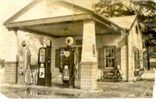
1930s, Ambler's Texaco Dwight, Il. Credits
This service station operated longer than any other one on Route 66. From 1933 to 1999.
This gas station is also known as Vernon's Texaco Station and Becker's Marathon Gas Station. It was built by Jack Shore in 1933 but it was ran by Basil "Tubby" Ambler for almost 30 years, hence its name Ambler’s Texaco Gas Station.
Ambler’s Texaco Gas Station in Dwight, Illinois
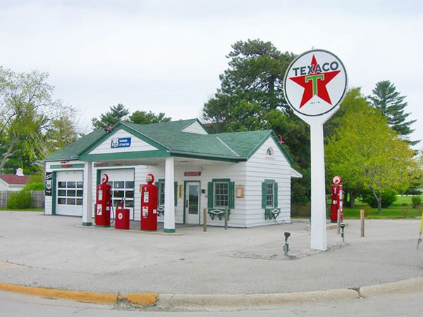
The building was a "Domestic style" gas station adopted by Texaco to blend into the urban neighborhoods. In the 1940s with a gabled canopy and a wood clapboard house-like office.
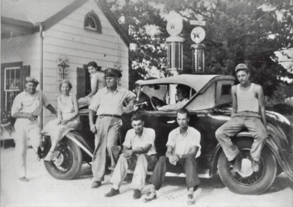
The image shows Mrs. Lorraine Ambler (1913-1972) sitting on the wheel well, who worked as a teacher in Dwight. Her husband Basil H. "Tubby" Ambler (1906-1986) is the tall man standing to her right with a dark hat.
The garge bay on the west side of the building was added in the 1940s. The station later sold Marathon Oil brand. It closed as a service station in 1999 and continued as a repair shop until 2002. Now it is Dwight's Visitor Center.
Welcome Billboard, Selfie Stop & Wayside Exhibits
Just a few feet north of the building, on the north side of the property is a very photogenic billboard that says: "My family's destination is Dwight Illinois" with a 1950s look to it on one side (picture) and "Historic Ambler ⁄ Becker Station" on the other.
You will also find a Route 66 "Eperience Hub" with two display panels; it has a map with Route 66 across Illinois, with trivia and interesting information about the Mother Road. As well as a "Wayside Exhibit" that includes a Passport Station, a stamp on the bottom panel, so you can collect a passport stamp by placing a piece of paper over the rubbing stamp and rubbing it with a pencil.

Welcome to Dwight Billboard, Dwight, Il. Credits. Click image for St. view
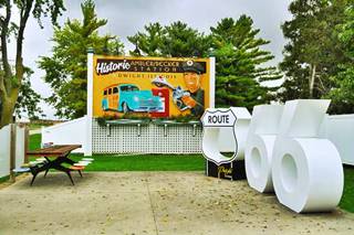
Selfie Stop in Dwight, Il. Credits. Click image for St. view
Route 66 Shield and Centennial Selfie Stop
There is a Selfie Station with a hollow Route 66 shield and a large "66" next to it, ideal for a great photo opportunity! It is part of the 2026 celebration of the Route 66 Centennial (1926-2026) (pictured above).
Shearer Sinclair Station
Kitty-corner from Ambler's, on the SW corner of the crossroads, where the NAPA shop is located, was Shearer's Sinclair Station (1945), later it was acquired by Jack Anderson before the Korean War. By 1962 it was "Mac's Service Station" ran by "Chuck and Kent".
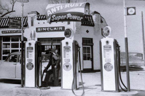
The image below shows it in the early 1950s, notice it had a Spanish Mission style used by Sinclair in the 1930s-40s: Flat roof with pent roof parapets covered in green tile and a stucco exterior finish. It says "Jack Anderson" over the door. Also notice the now gone Route 66 overpass in the background to the right. This is the street view at that same spot nowadays.
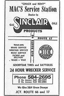
1962 Phone Directory ad of Mac's Sinclair. Source
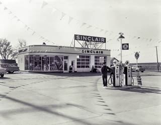
1950s view Sinclair Station, Dwight, Il. Source. Click image to enlarge
By the mid 1950s it had been modernized with enamel tiles and large plate glass windows a shown in the image above. Notice the Route 66 viaduct in the background. By 1972 it was an Arco.
Route 66 overpass
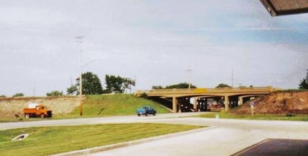
The four lane 1944-1977 Route 66 went over Illinois Highway 17 using an overpass, it was built in the 1950s and removed when I-55 was built through this area in the 1970s. Now nothing remains of it. This viaduct made the junction safer than the deadly "first stoplight" at IL-47 on the north side of town. This is the same view nowadays.
The final gas station at the crossroads was Thomas McNamara's Standard Station where the Sennott Brothers garage now stands, on the NW corner of the crossroads. The original building has been adapted to the current one. It was an icebox station with two service bays and a chamfered corner office both of which survive. See current view. Later it became a Union 76.
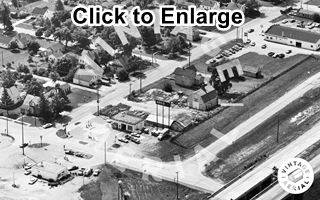
1972 aerial view former Sinclair and Standard stations, looking SE. Source. Click image to enlarge
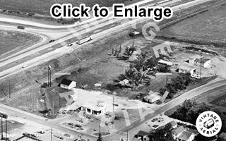
1972 aerial view Standard and Ambler stations, looking NW. Source. Click image to enlarge
The two aerial views above look at the crossroads, the first looks towards the SE, showing U.S. 66's original alignment heading west towards Odell, the former Sinclair (now an Arco) and on the bottom, the Standard Station, a Phillips 66 is on the upper right side, and the viaduct on the lower right side.
The other image looks to the NW, Ambler's Texaco is on the right side of Old 66, McNamara's Standard on the left, the viaduct's embankment is on the top left and the Arco is lower left.
At this point you can take a short detour by heading left along IL-17 - W Mazon Ave. to visit downtown Dwight and its landmarks or continue along Route 66. We describe Downtown Dwight's attractions further down and will continue our tour along U.S. 66.
Along Route 66
Old Route 66 Family Restaurant Mural
As you continue westbound along Route 66, next to the former Sinclair station, to your right is a restaurant with some murals. Besides the murals, you can enjoy classic home cooked food (old style milk shakes, wraps, burgers, melts, and salads).

Mural at restaurant, Dwight, Il. Source. Click for St. view
1972 aerial view Standard and Ambler stations, looking NW. Source. Click image to enlarge
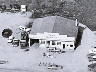
Adams & Marx Garage and Phillips 66
To your right, what is now Route 66 Tire & Auto at 209 S Old Rte 66, was during the 1960s, Virgil Adams' and Don Marx's garage and Phillips 66 gas station. You can see it in the 1972 aerial photograph further up. It also advertised in the 1962 phone book. They lived across the street from the garage. It is pictured above in 1968. The concrete block building with a stepped parapet is still standing, the pumps are gone (current street view).
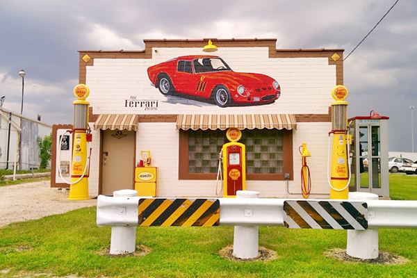
Faux Gas Station
Next to it, to your right, just past W. Chippewa St. is a former garage that at one time was decorated to look like a gas station. Now the pumps shown in the image below have been removed as you can see in this St. view.
Arrow Motel
On the next block as you approach W South St., to your left, at 320 S Old Rte 66 is a former Motel. The building and the old gas station that was beside it, have survived though now they serve as apartments and a home respectively.
Swedish born Martin Paulsen and Metha Eskildsen married in 1924 and moved to Dwight where they opened a cottage-style Phillips 66 gas station on Route 66 in 1935. They added half a dozen cabins to it, with garages separating each unit. It was known as "Paulsen Court". In 1952 it was bought by John and Dorothy Strufe, they refurbished it, and called it "Strufe Motel" at that time they were selling Cities Service gas. In 1959 they renamed it "Arrow Motel," and converted the gas station into the motel's office. The rooms had names (Robin, Cardinal, Dojo, etc.). Later the four carports were enclosed and turned into rooms. Paul Moyemont owned it and it was renamed the Carefree Motel in the 1980s, and 90s, after Route 66 was delisted. Below are some postcards of the motel over the years, and its current appearance.
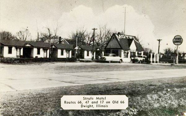
The postcard above shows the gas station as a Cities Service, and it says on its back that it had "...restful surroundings and ... homeñike atmosphere, even hot water heat, and cross ventilation..."
Metha Paulsen was inducted into the Illinois Route 66 Hall of Fame in 1991.
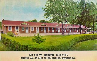
1960s postcard Arrow (Strufe) motel. Dwight, Il. Source
By the motel, on the NE corner of US 66 and W South St. you will find another wayside marker (Mom and Pop Motels Marker) with a plaque, pictures and text about the motel.
L and M Shell
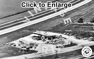
1965 aerial view Shell station, looking West. Source. Click image to enlarge
Drive 0.6 miles south along the Old Route 66, and at the fork where it meets the later 4-lane alignment (map with directions) is a former Shell gas station.
Ths place later became a restaurant and eventually closed. See its 1965 aerial view (click to enlarge). Below is a 1960s advertisement in which we can see it also offered Food. Notice the gas station's upward slanting roof.
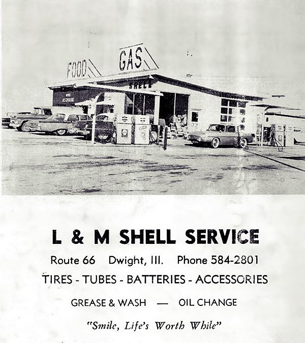
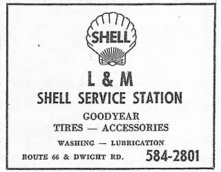
1962 Phone directory ad, L&M Shell. Source
Above is an advertisement published in the 1962 Dwight telephone directory. The place was built in the early 1960s and closed during the 1970s when I-55 bypassed it. At one time it was Butch0s Shell, ran by Butch Eihman who rened it from Vince Cleary and P.L. Murphy. Some time after it closed it became a restaurant owned by Marge Beyer who moved here when the Sip N Bite she ran in downtown Dwight closed. It was known as "Beyer's Restaurant" "Route 66 South Edge of Dwight, ILL - Home Made Pies Our Specialty" also closed and the empty building is still there on Route 66 with its slightly angled flat roof.
Lions Lake and Wayside Exhibit
The road curves here and meets the later four-lane Route 66 that opened in 1944 and remained in use until 1977. Here, at the junction, on the west side of the highway you will see "Lions Lake" with a steel archway over its entrance. There is another "Wayside Exhibit" here next to the parking area. It is the "Shifting Roadways Marker", which tells all about the different alignments of US 66 in Dwight.
The lake was the borrow pit, that was excavated to provide road fill when the Bypass 66 was built around the town in the early 1940s. It later filled with water and became a community park in the 1990s.
Site of the N.J. Truck Stop
South of this point the four lane alignment runs with a NE-SW course, with its former westbound lanes abandoned to your right. Then the freeway approaches the highway and the original WB set of lanes is buried under its EB ones. Afte half a mile, at the point where E 3000 N Rd crosses both U.S. 66 and I-55 there was an N.J. Truck stop until 1975-76, when it was razed to make way for the freeway. You can see it in this 1968 aerial photograph, it sold Pure Oil and had a Café you can also see it in this 1950s aerial view; this is the spot where it stood.
Continue your Journey
Your drive along Route 66 across Dwight ends here. You can head west towards Odell to continue your Route 66 road trip, or you can take a short detour and visit Downtown Dwight's attractions.
Downtown Dwight Attractions
Starting at the historic Ambler's Texaco you can visit downtown Dwight and its attractions, many of them linked to the "Keeley Institute" (see this map with directions).
Keeley Institute, the days before Alcoholics Anonymous (AA)
Dr. Leslie Keeley, in the 1880s came to the conclusion that alcoholism was a disease, and as such, could be treated. He opened an institution in Dwight, Illinois to treat alcoholic patients in a humane manner.
By the early 1900s his "Keeley Institute" (he was associated in it with John Oughton and Curtis Judd) had become world famous.
The "Keeley Cure" (or Gold Cure) though controversial, attracted thousands of patients to Dwight. It was costly and many wealthy people stayed in town. Keeley built many landmarks to impress his customers: the Oughton Estate with its Windmill, the railway Depot, the Livingston Hotel, parks, and even cemteries.
After Keeley's death Oughton, and later his son kept the business running. The Gold Cure had a secret formulation and those who tried to analyze it reported that it contained a weird mix of chemicals such as alcohol, ammonia, strychnine, atropine, and apomorphine.
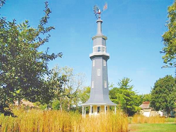
The Windmill (Keeley Institute)
Listed in the National Register of Historic Places

The windmill in a 1907 postcard. Source
The windmill and mansion is at 101 W South St. It is part of Oughton's estate, it was built in 1896.
It was originally known as "the pumping tower", it is the work of the US Wind, Engine & Pump Co., Batavia, Illinois.
It pumps up water from a depth of 840 feet and stores it in an 88-barrel cypres tank. The windmill is part of the Historic John R. Oughton House.
The property covers 7.2 acres (2.9 ha.) and the Victorian stle house (known as The Lodge or Keeley Estate) was built between 1891 and 1895.
It was designed by Julian Barnes.
John R. Oughton, associate of Dr. Leslie Keeley lived here until his death 1925. Five years later it became part of the Keeley Institute an institution for the rehabilitation and treatment of alcoholism. It became a restaurant, but closed in 2017 (Country Mansion).
The historic Windmill in Dwight.
Drive northwards into downtown Dwight, park and stroll along both East and West Main Streets, on both sides of the railroad tracks (map with directions). These are the downtown sights:
Keeley Institute & Livingston Hotel - Veteran's Hospital
On the corner of W Main Ave. and E Mazon St. The hotel, which is still standing, was built to lodge patients who came for treatment at the adjacent Keeley Institute treatmet center.
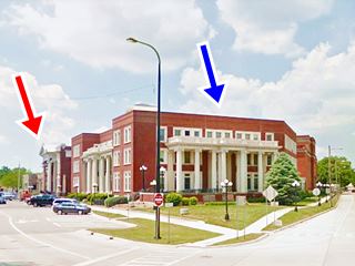
Prohibition (from 1920 to 1933) reduced the flow of alcoholics, so the building next to the hotel, at 134 W Main became the "Veterans' Administration Hospital" (mentioned by Rittenhouse in 1946) from 1926-1966.
The former Institure and Veteran's hospital is currently the "William W. Fox Development Center" which operates as a specialized medical institution.
Below is a then and now sequence. In the current view, the blue arrow marks the former hotel and the red one, the Veterans' hospital. West Main is on the left, and Mazon on the right.

Dwight's Livingston Hotel ca. 1910. Source
Classic Hotels
Rittenhouse mentioned back in 1946 that the town had "Small Hotels", in fact it did, besides the Globe Hotel near the Old Route 66 mentioned further up, it also had the Dwight Cottage Hotel, ran by Mrs Mary Cronin at 118 E Mazon and next to it, the Grand Central Hotel owned by Mrs Cora Mae Conant at 130-34 W Mazon, that was torn down in the 1940s. Both of them stood where the park is now located on the north side of Mazon Ave. The other hotel was the Hotel Frances, now renamed Hotel Francis at 114 E Main, and still operating as a lodging place.
Walk south, half a block along Main and stop at a Historic Bank building designed by a great architect, Frank Lloyd Wright.
Historic Frank L. Smith Bank
Listed in the National Register of Historic Places
122 W Main St, Dwight. The original bank opened in 1906, but it doesn't have the classic Bank facade of the early 1900s, the solid and simple cut limestone blocks give it a contemporary look (but it was built in 1906!).
Frank L. Smith Bank in Dwight, by Frank Lloyd Wright
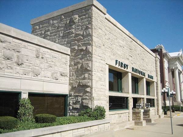
Frank Lloyd Wright designed the building in 1904. It was built the following year. The structure housed not only Frank L. Smith's bank but also his realtor office. It was renovated in the 1950s.
In the 1960s its present owners, the First National Bank of Dwight removed the partition unifying bank and real estate sections. In the 1990s it was expanded to the left with a new structure that blended in with the original one.
Frank Lloyd Wright (1867 – 1959): an American architect, interior designer, educator and writer. He promoted "organic architecture" which harmonized design with the environment and the people who would use it and see it. More than 500 of his 10,000 designs were built.
Across the street, to your left is the historic railroad depot.
Historic Railway Depot
Listed in the National Register of Historic Places
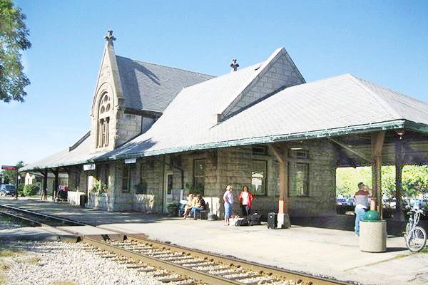
111 W Main St, Dwight. Dwight railway station was built by the Chicago & Alton Railroad in 1891. It was designed in the Richardson Romanesque style by Henry I. Cobb.
Don't miss the fossil shells in the blue stone walls, they were brought from Indiana. It houses the Dwight Historical Society's museum and the local Chamber of Commerce.
Further west, at 401 S. Columbia St. is the brand new Amtrak passenger station finished in 2016.
Historic Railway Depot in Dwight, Illinois
Cross the tracks and walk along E Main Street, here is another bank and the Francis Hotel. On the corner with S. Franklin, look south to see the former Boyer Bros. Garage.
Boyer Bros. Garage
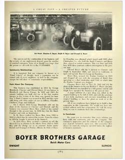
Boyer Bros. ad, 1954 Dwight Centennial book
Mentioned by Rittenhouse in 1946, the business was established in 1911 by George Brumbach and Clarence and Elwood Boyer. Brumbach sold his share in 1914. They were a dealership that over the years sold Buick, Studebaker, Dodge, Chrysler cars. It was located on the SE corner of S Franklin and Delaware Streets, and the building is still standing, now as Cherry Red's Garage at 200 S. Franklin.
Continue your Road Trip
Your City Tour ends here. Head back to Route 66 to continue your journey and visit the next town in your road trip: Odell.

Sponsored Content
>> Book your Hotel in Chicago

Credits
Banner image: Hackberry General Store, Hackberry, Arizona by Perla Eichenblat
Jack DeVere Rittenhouse, (1946). A Guide Book to Highway 66.


