Route 66 in Pontiac IL
Index to this page
Pontiac IL
Facts, Information and trivia
Elevation: 664 ft (202 m). Population 11,013 (2024).
Time zone: Central (CST): UTC minus 6 hours. Summer (DST) CDT (UTC-5).
Pontiac is a city that is the county seat of Livingston County, Illinois.
History of Pontiac
Illinois was initially peopled when the Paleoindians reached the area after the end of the last Ice Age some 11,000 years ago.
The French from Canada and Louisiana explored the Great Lakes and the Mississippi River, reaching Illinois in the 1600s. They encountered Illini (Illinois) natives and Kickapoo people.
After wars between France and Britain, the land passed to the British and after 1776, to the U.S.A., it was organized into a Territory and in 1818 admitted into the union as the state of Illinois.
Settlement in the prairies was slow and only after the 1820s did the first Europeans and American pioneers reach the area where Pontiac is located.
Livingston County was created in 1837, named for Edward Livingston (1874-1836), lawyer and politician who had been mayor of New York City and helped write the Louisiana Civil Code. He was also congressman for Louisiana and New York and US Secretary of State (1831-33).
Henry Weed, Lucius and Seth Young with the backing of Jesse Fell, laid out the town in 1837, with the idea that it would become the seat of the newly created county of Livingston. It was pre-railroad days, so it was laid out around a central square and not a railway depot as was the case of towns platted in the 1850s.
Fell chose the name and the town became the county seat. During the 1840s an economic depression set in, but with the arrival of the railroad in 1854, economy began to boom.
The Name: Pontiac
Pontiac (c.1720-1769), was the name of a chief of the Ottawa Indian people. Its original form in Algonquian language is "bwandiag." There is no proof that he ever lived in what is now Livingston county. He was born ca. 1720 on the Detroit River, an ally of the French he fought against the British in the 1760s in a great uprising that failed. He died in 1769, killed by another Indian in Illinois.
The township was created in 1858 and soon, mainly due to Scott's efforts, became a flourishing farming community.
In the 1920s, Illinois State Higway 4 was paved along its predecessor, the Pontiac Trail built in the 1910s as a hard surfaced, decent road that linked Chicago with St. Louis. When Route 66 was created in 1926 its first alignment followed State Hwy. 4.
In 1943-44 a bypass alignment of U.S. 66 with 4-lanes was planned and built west of the business district to make the highway safer and faster, it was finished in 1954, but shortly after, in 1958, the new I-55 bypassed it too. Route 66 was delisted for good in 1977.

Pontiac: Hotels and Motels
Find your accommodation in Pontiac
> > Book your hotel in Pontiac
Find More Accommodation near Pontiac along Route 66
Below you will find a list of some of the towns along Route 66 east and west of this town; click on any of the links to find your accommodation in these towns (shown from east to west):
Along Route 66 in IL
- Hotels in Illinois
- Route 66 Starting point ▸ Chicago
- Lockport
- Willowbrook
- Bolingbrook
- Plainfield
- Romeoville
- Joliet
- Wilmington
- Dwight
- Pontiac
- Chenoa
- Normal
- Bloomington
- Atlanta
- Lincoln
- Springfield
- Raymond
- Litchfield
- Staunton
- Williamson
- Hamel
- Edwardsville
- Collinsville
- Troy
- Glen Carbon
- Pontoon Beach
- Granite City
- East St. Louis
West in Missouri
- Hotels in Missouri
- Florissant MO
- Bridgeton MO
- St. Louis MO
- Kirkwood MO
>> See the RV campground in Pontiac
The Weather in Pontiac
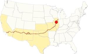
Location of Pontiac on U.S. Hwy. 66
Pontiac has a continental - humid climate with hot summers with little rainfall but high humidity. Its winters are cold.
The average temperatures in Pontiac are: winter (Jan), high of 30°F (-1 °C) and low a cold 17°F (-8.3 deg;C). Summer's high (Jul) is 85°F (29.7°C) and the low is 63°F (17.2°C).
Yearly rainfall is 38 inch (965 mm), falling 70 days, on average, every year. The town has 194 sunny days per year.
Expect snow between November and early April, it averages 26 inches (66 cm) yearly.
Tornado risk
The 2016 Tornado
On June 23, 2016 an EF2 tornado hit Pontiac injuring 7 people.
Livingston county, where Pontiac is located is hit by some 6 tornados every year.
Tornado Risk: read more about Tornado Risk on US 66.
Map of Route 66 through Pontiac, Illinois
Route Alignment
>> Custom map with the alignments of US66 in Pontiac.
 >
>
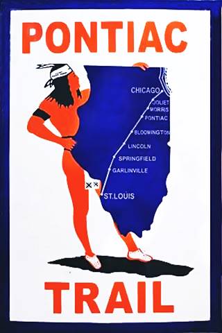
The Pontiac Trail symbol shield
Pontiac Illinois' Route 66
Route 66 reaches the town coming from Cayuga. There have been several alignments of the highway across the town, the first was the Pontiac Trail that predated U.S. 66 by eleven years.
History: State Highway 4 and the Pontiac Trail
In 1915 the Pontiac Trail became the main road linking Chicago and St. Louis. It had been named after the famous Ottawa Indians chief and B.F. Goodrich marked the milage posts, it even had its own shield sign (see image).
But there was lobbying for the state had to take care of its highways. A bond was issued in 1918 to build decent surfaced roads in the state of Illinois, and the Pontiac Trail was to become the SBI 4 (State Bond Issue) highway number 4.
Federal funds were also provided and the road was paved along its whole length by 1923. It had a winding course, following the railroad and county lanes but it provided a good road between both cities. It passed through Pontiac and the state capital in Springfield.
Route 66 was created in 1926 and it used pre-existing highways as its first alignment; in this area it used State Hwy. 4.
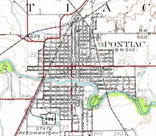
1935 USGS map (See the winding path of Route 66 in red diagonally across the map), Pontiac, Il.
Click thumbnail map to enlarge
1926-45 two-lane Route 66
The original 1920s road had two lanes 9 feet wide and was 6-inches thick. During WWII it was improved to carry heavy trucks; the two lanes were widened to a width of 24 feet and the concrete was increased to a depth of 10 inches.
We begin our journey on the north side of town, just before the crossroads of N 1600 E Rd. there is a gap in the alignment. This was the original 1920s State Hwy 4. When US66 was rerouted around Pontiac in 1945 (current Old Route 66) this segment was eliminated (yellow line in custom map).
It had a winding course with three right angle curves (red line in the 1935 map - click on it to enlarge) and ran on the west side of town; it is marked with a pale blue line in our interactive map.
The highway curves as it reaches Vermillion river and heads towards the SW. Nowadays its southern tip is cut off from the original alignment. This gap dates back to the building of the 1945 four-lane bypass highway. The gap is shown with a Pink line in our custom map.
Historic Route 66, Cayuga to Chenoa, through Pontiac (1943-44 ⁄ 1954-55)
Listed in the National Register of Historic Places
The original road was severely deteriorated by the trucks during WWII so it had to be urgently improved. The highway was rerouted around Pontiac adopting a curved bypass alignment (see the pale blue line to the left). A second set of lanes was added to the original alignment north and south of Pontiac that became the northbound lanes of the 4-lane divided highway. These were completed in 1954-55.
Route 66 had become a four-lane divided freeway. You can still see the now abandoned southbound lanes both north and south of Pontiac, to the west of the current highway; they are pictured below. Further north and south, these lanes are buried beneath the northbound lanes of I-55.
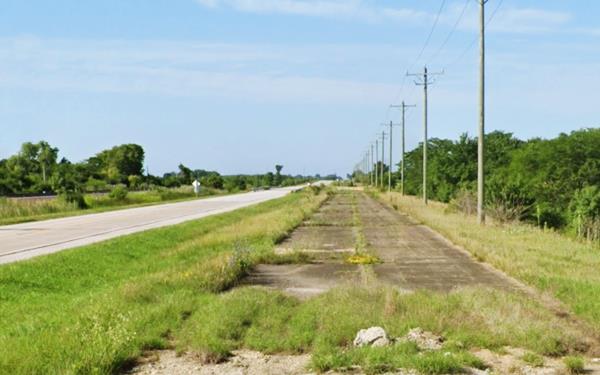
The highway continues southwards from Pontiac, it goes past Ocoya flanked by the abandoned set of lanes.
Route 66 is a Historic highway and has also been designated as a National Scenic Byway and an All-American Road in the state of Illinois.
Visit our pages with old maps and plenty of information about US 66's alignments in this area:
The Route 66 alignments near Pontiac
- Pontiac to Springfield (next)
- Chicago to Pontiac (previous)

Pontiac's Sights and Route 66 Attractions
What to see and do in Pontiac
US 66 in Pontiac: historic context
In 1946, Jack DeVere Rittenhouse drove the whole of Route 66 from Chicago to Los Angeles publishing his memorable "A Guide Book to Highway 66" which gives us a description of Route 66 during its heyday. He wrote the following about Pontiac:
Pontiac is a half-mile east of US 66... gas; stores; no cabins; hotels: Phoenix, Maple Rest, Imperial, Illinois; Jones Co garage Rittenhouse (1946)
Rittenhouse added that it was an agricultural community with some industry. He mentioned the State Penitentiary south of town, for younger male criminals.
Drive US 66 through Pontiac
From East to West, this leg of your road trip begins on the northeastern side of the city, coming from Cayuga the tour at the point where the Bypass 66 alignment that was built in 1943 splits from the original 1926 Route 66 alignment at N 1600 E Rd.
Old Log Cabin Restaurant
Turn left southwards at the crossroads. Here, to your left, at 18700 Historic US 66 is a classic Route 66 attraction.
The Log Cabin restaurant was built in 1926 by Joe and Victor Seloti as an eating spot and a gas station on the original US 66 alignment. That ran along the southern side of the property, beside the railroad. When the bypass was built in the mid 1940s, the highway was realigned on the north side of the restaurant. The story goes that the owners moved the building 180° to face the new four-lane freeway.
It got its name from the cedar telephone poles with which it was built, and which are still there in the walls.
As you can see in the "Then and Now" series of images below, the premises have been expanded. It is still operating as a restaurant.
Vintage view of the Log Cabin Inn, Pontiac, Illinois
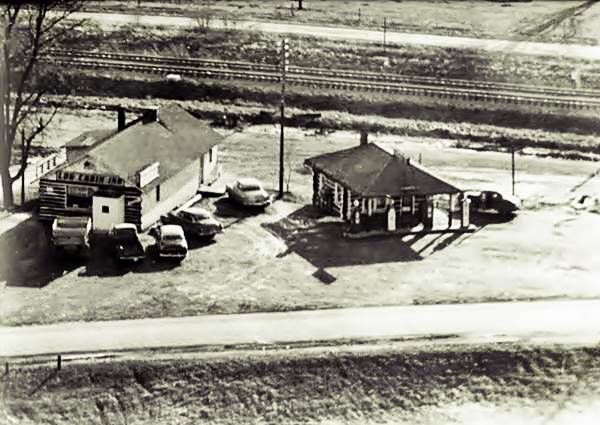
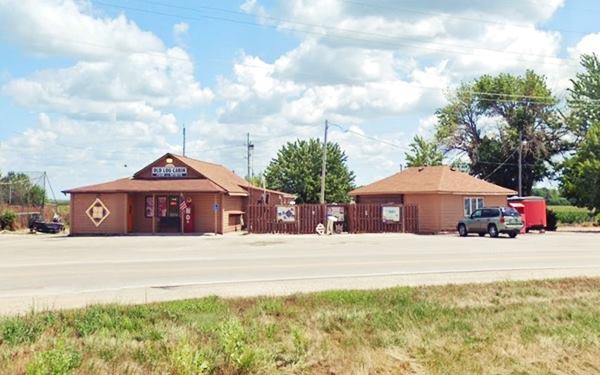
Cross the railroad and drive the 1926-43 Route 66 alignment along Pontiac Rd. which runs close to the railroad tracks and then shifts away to curve into N Division St. head south along it, and at 1120 N Division St. is a Route 66 tavern.
Green Parrot Bar
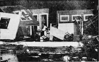
Green Parot after tornado strike in 1940, Pontiac. Source
The bar was originally located further west along U.S. 66, at 900 N. Ladd. It was hit by a twister on April 29, 1940 and "Mrs. Bowman, 52, was injured and taken to St. James Hospital when the tornado twisted the two-story wooden structure from its foundation and threw it over on its side." The bar relocated here and was owned by Dusty Sewell from the 1950's until the 1970'. It had Dinners on Friday evenings. This building is still standing and below is a "Then and Now" view of it.
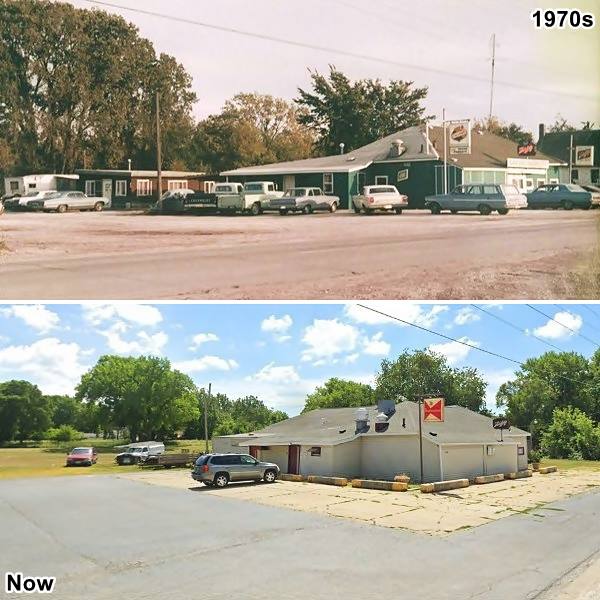
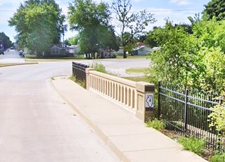
Passing the bar is the State Hwy 4 Division St Bridge.
Division Street Bridge
66 Roadside Attraction
The bridge was built in 1926 and spans North Creek. This is a Location map.
The bridge spans North Creek along the 1926 Alignment of Route 66 (previously it was the State Route 4), it was built in 1926 shortly before the state highway became Route 66. The original bridge was rebuilt in 2005 and is only 33 feet long. The bridge end had the original State Highway 4 marking stencilled on it as was the practice in those days to mark highways. And the original image survived; it was restored in 1927 and you can see it on the bridge end, an outline of the state of Illinois with a number 4 inside of it. The original bridge ends were kept and attached to the new bridge which was built with a railing that is identical to that of the original bridge.
On the NW side of the bridge, on the shoulder by Water St. you will find a Route 66 shield, and two interpretative signs, explaining the bridge's history.
Ideal Lunch, Station and Cabin Court (gone)
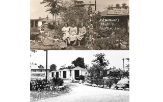
After crossing the creek the road curves west onto W. Lincoln Ave. here was the Ideal Service Station, Ideal Lunch and Ideal Cabin Court to your right along the curve and westwards. It was owned by Gordon Wetherholt and had ten tourist cabins with an odd octagonal shape, and offered "hot & cold showers, garage, lunch, open all night" pictured below.
Old State Police HQ
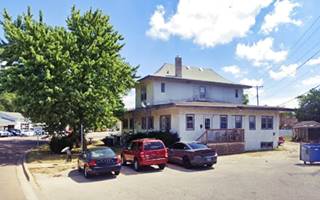
Right on the curve, to your left, at 720 W Lincoln Ave is a two story building with a hip roof. It was rented by the Illinois State Police and was their original headquarters and barracs in this area. Now it is a private home. Later a modern Headquarters was built on the south side of town, on U.S. 66.
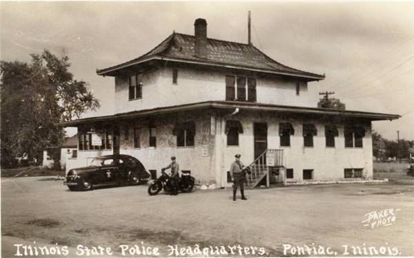
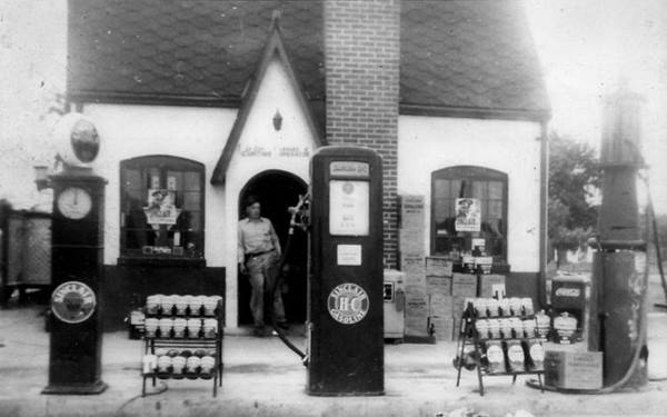
Curtiss Sinclair (gone)
Leroy Curtis ran a cottage-shaped Sinclair gas station across the street from the Police HQ. In 1949 with his wife Pauline he opened the Curtiss Drive-In, one block away on Ladd at IL-23
In 1958 they acquired Fred's Drive In on , which became Leroy's. They sold it in the mid-1960s. In 1969 they opened Pauline's Chicken Villa on the SW corner of Ladd and Madison (804 W Madison) The couple retired in 1974.
Leroy Curtiss at his Sinclair
Adjacent to Curtiss' on its northwestern side was the Pontiac Drive-In theater that opened in July 1949. In 1955 its capacity had grown from 100 to 275 cars, and was ran by Ken Phillips. In 1958 it was acquired by Kerasotes Theatres and renamed Star-Chief Drive-In. The place closed in 1981 (see this 1977 aerial view of the property).
The highway curves here and heads south along N. Ladd St. entering the town and running along its western edge. Ahead to your right there was a "subway" underpass.
Ladd School Subway (gone)
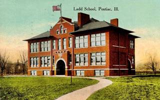
Old Ladd School on US 66, Pontiac. Source
Located at N Ladd St. and W. Praire St.
The old Ladd School that was razed in 1960, was originally located where the current First Baptist Church now stands. The school faced some difficulties with its pupils as the traffic along the highway made it unsafe to cross the street by the school. So they signed a petition requesting that a "subway" or pedestrian underpass be built under Route 66 allowing the students to cross it safely.
The underpass was built around 1934 (when another one in Odell was built)and used until Route 66 bypassed Pontiac in 1945. In the 1970s it was filled to prevent crime, and it has vanished. There is an exhibit with this story on the SW corner of Route 66 and W Prairie St.
It was one of many of these pedestrian underpasses along Route 66; others were the Subway in neighboring Odell, the Chelsea OK underpass, the Sayre OK underpass, the El Reno OK underpass and the Madison IL underpass.
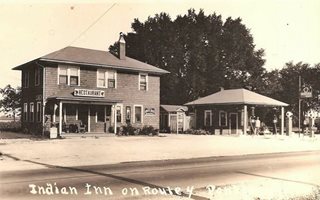
Indian Inn and Gas (gone)
The Indian Inn was located on the SW corner of Ladd and Livingston and had its Indian Gas filling station next door that belonged to Sidney Wilson, who in 1937 leased it to John Corrigan.
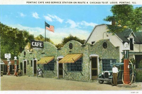
Pontiac Cafe (gone)
The Café was built with Route 66, in 1926-27 on the NE corner with W Madison (749 W Madison) It sold Deep Rock gas and had a stone facade. When the highway moved to the bypass alignment, the site became a grocery and was eventually torn down in the late 1970s, now an insurance office stands on the corner.
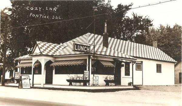
Cozy Inn Restaurant
Illinois Route 66 Hall of Fame Inductee
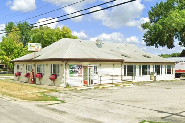
Across the street, on the SE corner, at 748 W Madison St. is an Italian Cuisine Restaurant, Mario's Pizza. It opned on State Highway 4 in the 1920s and was owned by W. I. Lovenstein and later by Clarence E. Holderidge (1903-1993) who also owned the Mile station and Cafe in neighboring Odell.
Mario and Linda Todino purchased Vince's Pizza from Vincenzo "Vince" Evola in 1975. Mario passed away in 1982 and the current owners are Julie and Jerry Causer.
Vintage view of Cozy Inn in Pontiac, Illinois
Now Mario’s Pizza in Pontiac, Illinois
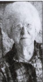
Augusta "Gussie" Keller. Source
Augusta "Gussie" Kelly
Illinois Route 66 Hall of Fame Inductee
Augusta "Gussie" (Griffith) Kelly began working in the kitchen at Odell's Mile Station in 1949, in 1951 she was working in downtown Odell and the following year at the Pine Lounge in Braceville.
In 1953 she was cooking at El Rancho on Route 66 and IL-23, the biggest truck stop along the highway between Chicago and Springfield. After a stint in Downtown Pontiac (1955-59) she returned to Route 66's Harold Shutherland's Drive Inn and remained there until the mid-1970s. She retired in 1985.
A promotional keychain shaped like a hog read "Gussie's Cafe - Pontiac - Come In Like a Pig, Eat Like a Hog."
Gussie was inducted into the Illinois Route 66 Hall of Fame in 2000. She passed away at the age of 93, on Oct. 7, 2003, in Pontiac.
Pontiac Route 66 Murals
From this point you can take a slight detour and leave the path of Route 66 to visit the murals that the town is known for. This side trip will return to Route 66 one block south of this point. We describe it in our dedicated webpage about Pontiac Murals. In the page we also describe some interesting landmarks along the way.
Continue your Road Trip along the 1926-43 U.S. 66
South of the Vermillion River
Ahead the highway curves as it crosses Vermillion river; to your right after the bridge is a Route 66 Motel.
Palamar Motel
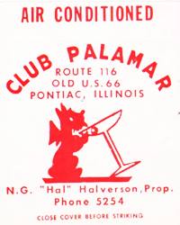
Club Palamar matchcover
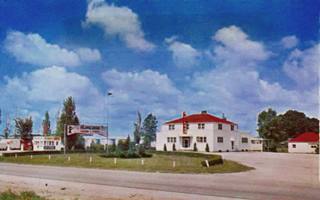
Palamar Motel c.1950s, Pontiac. Source
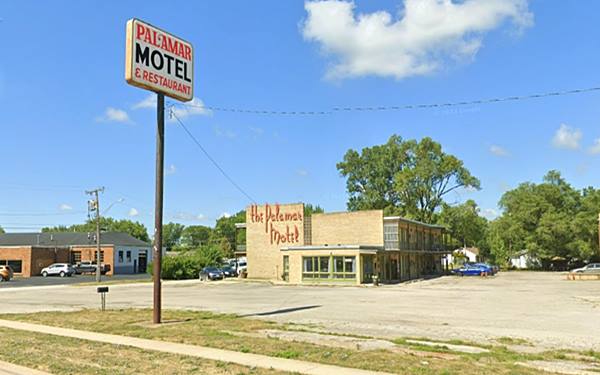
To your right, at 213 S Ladd St, Pontiac. Built in the early 1940s on the "old" alignment. N. G. "Hal" Halverson owned it and the Club Palmar next to it that "Specialize[d] in Chicken and Steak Dinners Home Cooking Mixed Drinks of All Kinds" .
It was damaged by a fire in 1967 and rebuilt with a late 60's "Modern" look and 62 rooms. It was popular as a dance hall in the 1960s too. Its postcard from those days read: "T.V. - Carpeting - Telephones - Tub & Shower - Air-conditioned. Also Banquet & Party Facilities and 'The Polynesian room'."
By the mid 1970s, Gerald Hillyer who also owned the New Log Cabin Restaurant was running the place.
Vintage Postcard Palamar Motel in Pontiac, Illinois
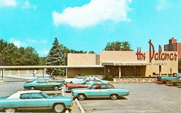
This is a view of the same spot nowadays, an abandoned wing of the Palamar Motel and the site of the now closed pool. Below is a view of the wing that remains operational:
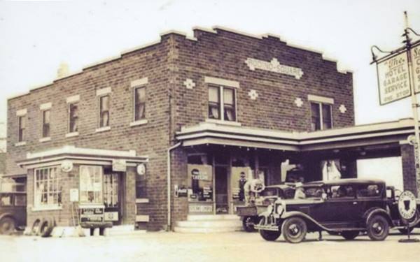
Rodino Square (gone)
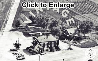
1965 aerial view of Rodino Square and old US 66. Source. Click image to enlarge
Ahead is the crossroads with IL-116 that runs east to west along W Reynolds St. here stood Rodino Square, on the SW corner of the intersection. It was a two story red-brick building. Carmen Carmelo Rodino (1888-1968) ran it with his wife and kids. He migrated to Dwight Illinois from Italy when he was 18. He worked on the railroad and tended his vegetable garden for ten years and managed to buy this property on Route 66 where he operated a grocery store where he sold his homegrown veggies, a hotel, garage and gas station. The place was torn down, there is a gas station on the site (Thornton's).
South of this point the old alignment continues straight, running beside the railroad for 0.3 miles where it ends. The original concrete roadway continues for another 450 ft. but can't be driven, it converges with the later alignment but is cut off from it (see image below). The road south of this point is overlaid by the eastbound lanes of the 1940s-77 four-lane alignment.
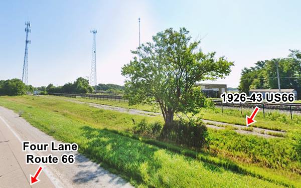
The 1943-77 Four Lane Bypass Alignment of Route 66
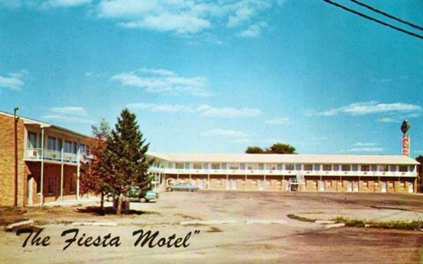
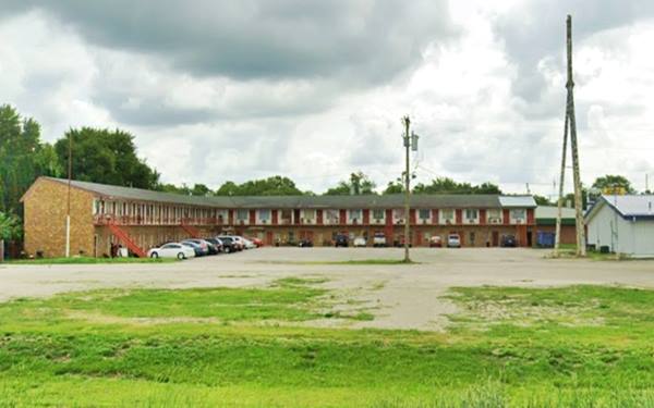
Fiesta Motel
To continue your itinerary, turn along IL-116 (W Reynolds St.) westwards towards the intersection of the four-lane Route 66 and IL-116. On the way, to your right, on the north side of Reynolds is a Motel at 951 W Reynolds St.
Listed by the National Park Service as one of the 1938-58 "Motel Buildings Remaining on Route 66 in Illinois" stating that it has a "Brick, L-shaped, 2 story building with end gable roofs. 60 units. ca. 1950s." Vintage Postcard Fiesta Motel in Pontiac, Illinois Fiesta Motel, same view nowadays:
The motel's postcard stated "Motel-Restaurant, Lounge and Bowling. Air-conditioned - Room Phones - free TV."
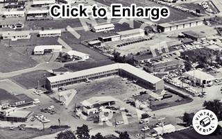
1968 aerial view of the Fiesta Motel, Pontiac. Source. Click image to enlarge
The aerial view taken in 1968 shows the D-X gas station to the right (now a Dollar General) on the NW corner of Old US 66 and W Reynolds St., the motel with its Freedom Oil gas station (icebox-shaped), and on the left side, the Fiesta Motel Cafe where the Subway now stands. The Bowling alley is on the upper right side; it was torn down in 2020.
On the south side of Reyonlds, opposite the motel thre was a Shell service station (at 953 West Reynolds St.) on the SE corner of U.S. 66 and Reynolds. The building was torn down and now JB Hawks Discount Tobacco and Vape stands on the property (1965 aerial photo of the Shell).

Archie’s Standard Service, Pontiac, Il.
Source
Archie’s Standard Service
On the SW corner, to your left, across the four-lane Route 66, the first building was a Standard Service Station located where the S&R Auto Center now stands at 1026 W Reynolds.
This building was originally Archie and Joy Henderson's Standard Service at the "second stoplight south of Chicago," the building has changed but it kept its two service bays.
Below is a "Then and Now" view of the old gas station. Later in the 1970s it became an Amoco.
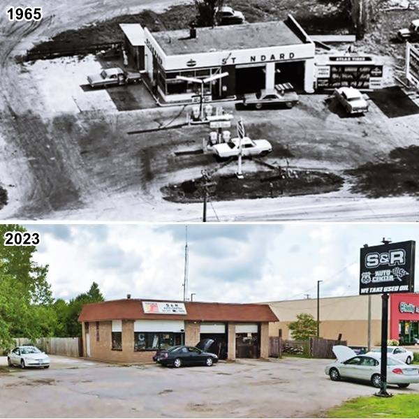
Adjacent to the station was a Skelly gas station (later a Conoco) with a Firestone tire dealership (both gone).
Mobil and Gray's Garage (gone)
On the NW corner of the crossroads at 1023 W Reynolds St., where the First Financial Bank-R.P. is now loacted there was a Mobil gas station (the lot where Walgreen's stands was an empty property). The Mobil stood in front, facing IL-116. The garage was located behind it, facing Route 66.
Roger and Betty Gray opened their garage here on March 23, 1963. They ran a towing business and sold spare parts for Volkswagens and trucks. The Garage is still open, but in a new location on I-55 and Illinois Highway 23. Gray was inducted into the Illinois Route 66 Hall of Fame (1965 aerial view).
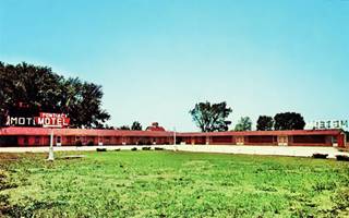
Pontiac Motel (gone)
Pontiac Motel c.1960s. Source
On the western side of the garage, along W Reynolds was the now gone Pontiac Motel, it had an L-shaped layout and was owned by Mr. and Mrs. A. M. Ketchmark. With 16 units it was, according to its postcard -pictured, click to enlarge, "Strictly Modern. It can be seen in this 1968 Aerial photo.
Eastbound along the 4-lane U.S. 66
There were three more sites along the four lane alignment of Route 66 north of this point, a former motel and two gas stations.
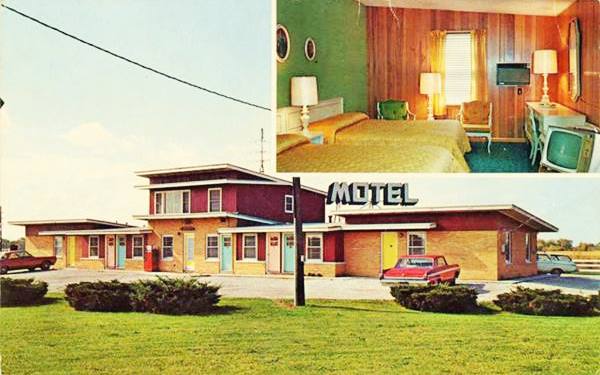
Da-Jo Motel
Turn towards the north, eastbound (towards Chicago) and drive up to the four-lane divided U.S. 66 highway built between 1943 and 1954. Head 1 mile north to see an old motel, the Da-Jo; this is the Map with directions. Located on Interlake Dr south of W Custer Ave.
The vintage postcard below tells us on its back about the "DA-JO MOTEL U. S. Routes 66 & 23 Pontiac, Illinois Air conditioned - TV - Wall to wall carpeting - Tub and showers. Excellent restaurants close by. Quiet, modern motel. Family units. Charles & Celia Gleason, Owners...".
The building is still standing but no longer a motel, perhaps it is an apartment complex.
Da-Jo Motel postcard 1960s in Pontiac, Illinois
Old Phillips 66
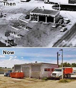
Further north at the intersection with East 1830 North Road, on the left (western) side of the highway there were two service stations. One was a Cities Service and stood where the recycling plant is now located on the north side of the road (1965 aerial view), the other, still standing was located on the south side of the road and was a Phillips 66 station, pictured in a "Then and Now" sequence (1965 aerial view)
Westbound along the 4-lane U.S. 66
Turn around and head south (westbound) along the four-lane alignment to visit the final sight in Pontiac along the Mother Road alignments.
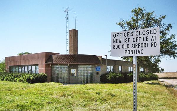
Illinois State Police District 6 Headquarters
Listed in the National Register of Historic Places - Route 66 Hall of Fame
Located on Route 66 south of Pontiac, just 1.7 miles from W Reynolds St., see this Map with directions.
The now empty "Old" State Police District 6 HQ was built in 1941 and were in use until 2003.
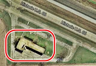
The building was built in the Shape of a pistol (see image with a satellite view) in Art Moderne style, with rounded streamlined corners, glass bricks, and geometric lines that were very popular in those days. The building is not open to the public. Pictured below.
Old State Police HQ in Pontiac, Illinois
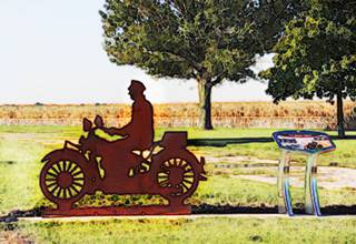
Steel silhouette of a state trooper on his motorcycle, Pontiac, Il. source
The State Police were created in 1922. And the patrol made sure that trucks weren't overloaded and therefore damaging the paving (speed limits were imposed much later, during the 1950s).
Don't miss the steel silhouette or "Shadow Statue" of a highway patrol police on his motorcycle and a Route 66 Wayside Exhibit, an interpretive display.
Now drive another 1.6 miles (Map with directions) to visit the Historic Round Barn:
Historic Raymond Schulz Round Barn

Historic Raymond Schulz Round Barn, Pontiac, Il. Source
Listed in the National Register of Historic Places
Located one mile east of Route 66 at 15221 N 1500 E Rd.
The Raymond Schultz (or Schulz) Round Barn was built in 1918 and is still standing. It is a "round" or cylindrical shaped barn.
It is similar to the more famous Round Barn in Arcadia, Oklahoma, also on Route 66.
Continue your Route 66 Road Trip
This ends your drive through Pontiac. We dedicated a special webpage on the famous Pontiac Murals with a tour of downtown Pontiac.
Drive westwards to continue your road trip and visit the "ghost town" of Ocoya, the next stop on your itinerary.

Sponsored Content
>> Book your Hotel in Chicago

Credits
Banner image: Hackberry General Store, Hackberry, Arizona by Perla Eichenblat
Jack DeVere Rittenhouse, (1946). A Guide Book to Highway 66.


