Route 66 in Braceville IL
Index to this page
Braceville IL
Facts, Information and trivia
Elevation: Elevation 574 ft (175 m). Population 720 (2024).
Time zone: Central (CST): UTC minus 6 hours. Summer (DST) CDT (UTC-5).
Braceville is a village in norteastern Grundy County in NE Illinois less than 100 miles SE of Chicago.
History of Braceville
For an early history of the area, see our Gardner page with the History of Grundy County.
The first settler in future Braceville was Rev. L.S. Robbins; he was a pioneer in what was known then as "Sulphur Springs" in 1834. He was followed by J. Cragg in 1834, who opened a tavern. B. R. Dowd arrived in 1848, and became the township's first supervisor. He named it after the town he had lived in back in Ohio: Braceville.
N. Cotton platted the village of Braceville in 1861. It had been several years since the Chicago & Alton Railroad passed through the town. But it got its economic boom-bust period after coal was discovered by chance just north of Braceville in the early 1870s.
Coal brought work and prosperity as well as a large influx of miners, the population grew and so did the town peaking at 3,500 in the late 1870s. The 1910 strike of the Braceville Coal Co. miners brought an end to this boom; the company shut down operations and moved elsewhere. The unemployed miners moved to new mines and the town was virtually abandoned.
The name: Braceville
Braceville is a township in Trumbull County, Ohio, named for Jonathan Brace. Brace is a surname that may derive from an occupation: the maker and seller of armour designed to protect the arms (from Middle English "brace" which comes from Old French "brace": from the Latin "bracchia": arms). It also could have been the nickname of a person with deformed or large, strong arms (ie. Armstrong).
Route 66 was created in 1926 and it passed through Braceville since then. US ALT 66 was created in 1940, also passing through the village. With both running parallel to the railroad, one on each side of the tracks.

Hotels and Motels in Braceville
There are several hotels close to Braceville and in the neighboring towns along Route66.
>> Book your Hotel in neighboring Wilmington or Dwight
Find More Accommodation near Braceville along Route 66
Below you will find a list of some of the towns along Route 66 east and west of this town; click on any of the links to find your accommodation in these towns (shown from east to west):
Along Route 66 in IL
- Hotels in Illinois
- Route 66 Starting point ▸ Chicago
- Lockport
- Willowbrook
- Bolingbrook
- Plainfield
- Romeoville
- Joliet
- Wilmington
- Dwight
- Pontiac
- Chenoa
- Normal
- Bloomington
- Atlanta
- Lincoln
- Springfield
- Raymond
- Litchfield
- Staunton
- Williamson
- Hamel
- Edwardsville
- Collinsville
- Troy
- Glen Carbon
- Pontoon Beach
- Granite City
- East St. Louis
West in Missouri
- Hotels in Missouri
- Florissant MO
- Bridgeton MO
- St. Louis MO
- Kirkwood MO
>> See the RV campground nearby in Braidwood and also in Joliet
The Weather in Braceville
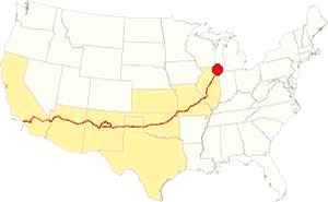
Map showing the location of Braceville, Illinois on U.S. 66
Braceville's climate is humid and continental; with very well defined seasons: Spring is cool and wet; summer is hot and frequently humid. Winter is cold and has on average 28 inches (71 cm) of snow, while autumn is very mild.
Temperatures: Average high in Jan (winter) 31°F (-0.3°C) and the average low is 17°F (-8.6°C). Average high in Jul (summer) 84°F (29°C), with an average low of 64°F (17.7°C).
Rain averages 36.82 inch (936 mm) per year and it is heighest - 3 to 4.3 inch monthly (78 and 110 mm) from Apr. The rest of the year has an average of 1.7 in. (28 mm) per month.
Snow: In Braceville you can expect snow from October to April, however usually the first snow falls in Nov. and the last happens in April (usually one quarter inch -8 mm).
Tornado risk
Grundy county, where Braceville is located gets around 6 tornado strikes per year.
Tornado Risk: read more about Tornado Risk on US 66.
Map of Route 66 in Braceville, IL
>> Our Custom map shows the alignments of U.S. 66 in Braceville.

1945 USGS map of Braceville, Il
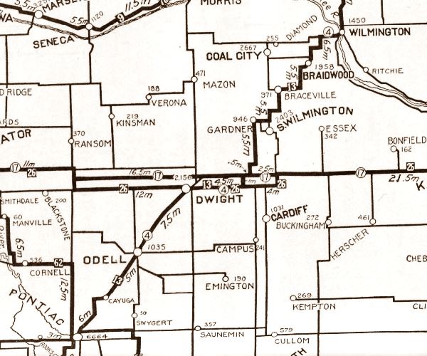
Illinois funded its state highway system by issuing a bond in 1918, this resulted in SBI 4 (State Bond Issue) highway number 4 being built along the former "Pontiac Trail" from Chicago to St. Louis. By 1923 it had been totally paved and in 1926 Route 66 was created and aligned along it. In the area near Braceville the first IL-4 had a zig-zagging course that was straightened out when it was paved.
The map below was published in 1924, two years before Route 66 was created. It displays the "Auto Trails" or roads that were suitable for cars. The ones near Braceville are marked with numbers: as "13" and "26" with white numbers inside black squares, these are the "trails", standing for "Mississippi Valley Highway" and "Blue Grass Road" respectively.
The number "4" inside a white circle is what originally was State Highway 4.
The Route 66 alignments in Braceville
US 66 from 1926 to 1939
The original Route 66 is present IL-53, running along the eastern (or southern) side of the railroad from Braidwood through Braceville into Gardner. It is marked with a green line in our Custom map
US 66 from 1940 to 1956
In 1939 the highway was realigned north of Braidwood, creating a faster and far straighter road that ran through Plainfield and bypassed Joliet and Wilmington. This new highway is marked with a yellow line in our Custom map
It continued west, with a completely new aligngment built along the north side of the railroad, parallel to the original roadway but with the tracks separating both alignments. It is marked with a blue line in our Custom map.
The "new" highway from Plainsfield to Gardner became Route 66 and the "old" one was renamed Alt US 66.
ALT US 66 1940 to 1967
The 1926 alignment from Gardner to Romeoville through Joliet became ALT US 66 and remained so until it was eliminated in February 1967 and replaced by Illinois State Highway 53 from Welco Corners to Gardner.1
Both alignments met on the southern side of Gardner.
The USGS Map of 1945 shows how both roads US 66 and US ALT 66 run past Braceville.
US 66 from 1956 to 1977
In 1956 US 66 was moved further west to a new alignment bypassing the towns from Braidwood to Gardner. Route 66 shared the road with the new freeway (I-55). This roadway is now overlaid by the freeway. See the violet line in our Custom map.
Alternate US 66
In 1959 the American Association of State Highway and Transportation Officials (AASHTO) came up with the "Alternate" designation.
It was to be used to designate a highway that branches off from the main one, passing through certain cities and then links up with the main route again.
If the Main and alternative routes followed a similar course, the better built or shorter highway would be the one marked as "Main", while the other would become the "Alternate" one.
There are only six places along Route 66 where an Alternate 66 alignment existed: From East to West they were this one close on Route 66 into Chicago, Carthage MO, the one in Joplin MO, Oklahoma City, Alt 66 in San Bernardino, California, and the one leading into Los Angeles CA.
Route 66 is a Historic highway and has also been designated as a National Scenic Byway and an All-American Road in the state of Illinois.
The Route 66 alignments near Braceville
Description and interactive maps of US 66.
- Pontiac to Springfield (next)
- Chicago to Pontiac (Braceville's)

Braceville's Route 66 Landmarks and Attractions
What to see in Braceville
US 66 in Braceville: historic context
Jack DeVere Rittenhouse published his classic "A Guide Book to Highway 66" in 1946 and it describes US66 during its post-WWII heyday. He mentiones Braceville as follows:
few gas stations; cafes; small garage.... like Godley, this town is but a remnant of a once-thriving coal town. As you leave town, the typical slag-heaps still blot the countryside Rittenhouse (1946)
Drive US 66 through Braceville
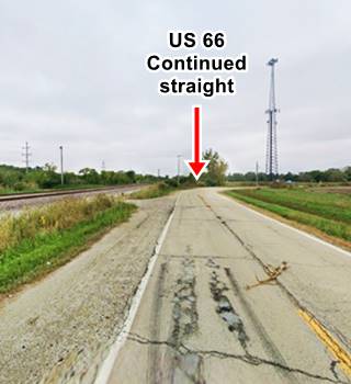
There are no remnants of the gas stations, cafes or garage mentioned by Rittenhouse. Braceville is a small community on the western side of the highway. You can drive north along the original US 66 (1926-39, later US ALT 66 from 1940 to 1967) that runs along the south side of the railroad.
The later US 66 (1940-1977) which runs along the north side of the tracks can only be accessed at County Rd. 8000E, at Braceville; you can turn south and drive along it, but it ends south of Braceville, cut off from the alignment which runs north from Gardner because the bridge there has been removed and not replaced.
Slag Piles
Drive westwards from neighboring Godley, this was a coal mining area with several active mines in the late 1800s and early 1900s. The Braceville Coal Co. had four mines: No. 3 mine spanned 200 acres and produced 0.79 M tons of coal from 1881 to 1891. No. 4 mine with 310 acres produced 1.8 M tons from 1892 to 1900. No. 5 mine extracted 1 M tons and closed in 1907; it covered 222 acres. No. 6 mine spanned 180 acres producing 0.96 M tons from 1903 to 1910. The Chicago, Milwaukee & St. Paul Railroad Co. Braceville No. 2 Mine spanned 400 acres and extracted 2.3 M tons from 1877 to 1894. This meant that a lot of topsoil was removed in the strip mining process as well as in the underground tunnels. These resulted in an irregular countryside with deep ditches and the "the typical slag-heaps" mentioned by Rittenhouse. Erosion and remediation processes (removing slag, filling in mine shafts, levelling the land and seeding the graded slopes with grass to stabilize the heaps) has eliminated many of these slag heaps. A graded slag pile can be seen south of Godley by the highway in this street view. But many slag piles can still be seen. The one below is quite large (the red arrow shows a person standing by it and gives an idea of its size).
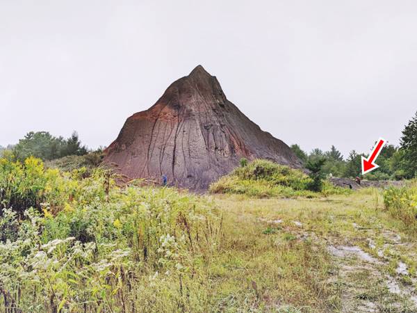
Braceville
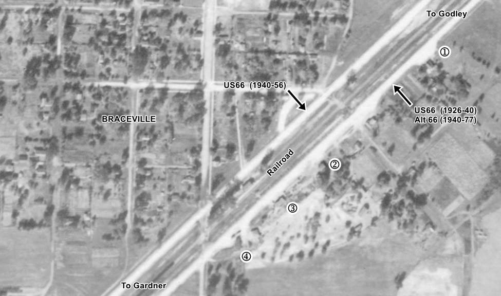
Braceville 1940 aerial view. Source. Click to enlarge
As the highway approaches Braceville, there is the site of a former gas station to your left (map marking the spot); nothing remains of it, except part of the paved apron that led to it. It can be seen in the 1940 aerial picture of Braceville (click on it to enlarge it) marked with a ➀.
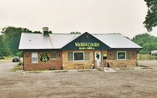
Wicked Cricket Bar and Grill
Ahead, after the fire station is a roadhouse that appears in the 1940 aerial view of the area and is still standing. Under its current owners it has been operating since 2017. Marked with a ➁ in the map.
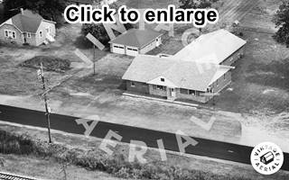
Braceville tavern, 1980 aerial view. Source. Click to enlarge
There was another garage or gas station west of the tavern ➂ in our map, but by the early 1960s it had vanished. Nothing remains of it.
Gray's Standard Service (gone)
Ahead, to your left at the crossroads with County Rd 8000 E, (➃ in our map), was the gas station ran by Forrest Gray (1896-1974) and his wife Berenice (1900-1983). They also had a restaurant. After coming back from the First World War, where he was a Seargent, Forrest worked as a coal miner, then with his wife he ran an ice cream parlor in town. But in 1923 three years before Route 66 was created, they opened the gas station on what then was IL Hwy 4. They ran it until 1966 when they retired. The site was inducted into the Illinois Route 66 Hall of Fame. The place was razed in 1993.
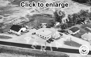
Gray's Standard Station, 1980 aerial view. Source. Click to enlarge
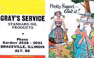
Gray's Standard Station 1960s matchcover
Their son David Russell was killed in 1931 at the age of six by a car on Route 66 in front of the station. They eventually built a four-room house and added some tourist cabins.
Forrest later patrolled the highway as the first Illinois State Trooper from Grundy County.
Below is a view of the old station, with a typical 1920s design with a flat canopy with thick brick columns that overlap above the roof, a pent roof around office and canopy and the Red Crown crown-shaped globes at the top of each pillar. Red Crown was a gasoline brand of Standard Oil.
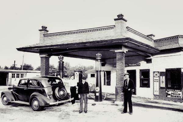
Compared to the 1980s view further up, it appears that the building was modified and the canopy removed.
Bridges that have gone
The former US 66 (1939-57) ends before you reach Mazon River, it has been cut off because its bridge has been removed. We describe the lost bridges in our Gardner page.
The bridge with a viaduct was built as a steel arch bridge over the railroad in 1939. Here, the railroad branched off from the main Garner-Joliet line and headed north towards Coal City. Further west, it crossed the river. This bridge was removed in 2001 and has been lost. The old highway (current IL-129) is now cut before the railroad tracks at E. Huston Rd. The black and white photo shows the bridge crossing the tracks, the color view looks west along old US66, the road now curves west along E Huston, formerly it kept on straight towards the bridge. Alt 66 is on the left, beyond the railroad out of view.
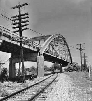
Steel arch bridge carrying US66 over railroad, Braceville. Source
Head back to the Alt 66 alignment and drive west, just 0.9 mi. north of the Mazon River bridge, to your left is a Natural Wildlife Area.
Mazonia-Braidwood State Fish and Wildlife Area
IL Route 53 & E Huston Rd. Braceville. Across the tracks from the cutoff on the main alignment.
Strip mining for coal and shaft mining altered the region's topography. Pits and shafts cover the area and the large sections of land dug up for coal later filled with water. Slag heaps remain like small hummocks. After being abandoned after 1910, the land reverted to a natural state. Unfit for farming, trees covered the area, now it is a hunting and fishing wildlife area.
It covers 1,017 acres. It has over 200 ponds of different sizes (from 30 to 3⁄5 of an acre), stocked with bass, catfish and crappie.
Learn more at the Mazonia-Braidwood website.
Fossil Hunting

The Tully Monster reconstruction. Source
You can hunt for fossils (permit required): collectors come from all across the country. The Tully Monster fossil was discovered here by Francis Tully in 1957.
Jellyfish imprints and shrimp fossils are abundant: strip mining upturned the strata from ancient seabeds, bringing these layers to the surface, now piled up as slag piles.
The Tully Monster (Tullimonstrum gregarium) lived in shallow coastal waters 300 million years ago and was a type of jawless fish similar to a lamprey. It is the state fossil of Illinois. Read more Scientific American article.
Continue your Road Trip
Your Ruote 66 Road Trip in Braceville ends here, head west to visit the next town, neighboring Gardner and continue your adventure!

Sponsored Content
>> Book your Hotel in Chicago

Credits
Banner image: Hackberry General Store, Hackberry, Arizona by Perla Eichenblat
Jack DeVere Rittenhouse, (1946). A Guide Book to Highway 66.


