
"Crossroads of America"
Ranger Motel Neon Sign, El Reno, Oklahoma

Index to this page
About El Reno, Oklahoma
Facts, Trivia and useful information
Elevation: 1,358 ft (414 m). Population: 17,510 (2010).
Time zone: Central (CST): UTC minus 6 hours. Summer (DST) CDT (UTC-5).
El Reno is the county seat of Canadian County and is part of the Oklahoma City Metropolitan Area. Many residents work in Oklahoma City.
Downtown, El Reno.

Oklahoma has been inhabited for at least 11,000 years. Not far from El Reno there is a Paleo-Indian camp site 7,000 to 11,000 years old.
Historic Trivia
The last great battle between the Cheyenne, Arapaho and the United States Army took place in Canadian County.
The Native Americans that lived in the region at the time of settling by European - Amercians were the outcome of a U.S. government's policy that began in around 1820 with the intention of reloctating Indians to "uninhabited" land west of the Mississippi River in the Indian Territory (which would later become Oklahoma).
Starting in 1859, The Cheyenne, Arapaho, Caddo and Wichita tribes were assigned land where El Reno is now located.
However, the government later changed its policy and decided to assimilate the natives as regular U.S. citizens. So it assigned each individual tribe member a plot of land of 160 acres and purchased the surplus land of each Indian Reservation. This land was then reserved for settlement by white Europeans & Americans.
As a consequence, the federal government created County Four in the new Oklahoma Territory, which was renamed after the 1889 "land run" as "Canadian County", after Canadian River which runs through it.
Land Run
A "Land Rush" or "Land Run" was the system used for the initial settlement of this "open" land. Those interested in staking a claim for a plot of land set off from a starting point and rode to the land that was being "opended" to settlement. Once they reached it, they the homesteaders claimed their land. There were several "runs" in the early 1890s in Oklahoma.
A second land run took pace in 1892, in the former Cheyenne and Arapaho Reservation.
The border between both runs was located on the 98th meridian, and it runs right through the town of El Reno. Later settlement was done in a more orderly manner by lotter drawings (1901).
The name: El Reno
The town took its name from the nearby Fort Reno, and added the particle "El" (a Spanish article equivalent to "the") to indicate that it was a different community to the fort and Reno City (which had been established further north).
The Fort was named by its first commander, General Philip Sheridan, after his friend Gen. Jesse Lee Reno (1823 - 1862), who had been killed at South Mountain, Maryland, during the American Civil War.
"El Reno" actually makes sense in Spanish; it means: "The deer". The word derives from old Norse "hreinn" which originated French "renne" and Spanish "reno" among others.
The first outpost in the region was Fort Reno, set up to pacify the natives (1874).
Shortly after the land run, in June 1889, a post office opened and the town was platted on the homestead of John Foreman, the following year it included additional land from Thomas Jensen's plot, after some legal issues, the town was formalized in 1893.
In the meantime the railway reached El Reno in 1890 (The Chicago, Kansas and Nebraska Railroad, later part of the Chicago, Rock Island and Pacific Railway). A second line (Choctaw Coal and Railway Company) linked it to Oklahoma City in 1892. The railroad built a yard and repair shops in the town and was a large employer until it went bankrupt in the 1980s.
The town of Reno City, north of El Reno which had been bypassed by the tracks lost all of its residents, who moved to El Reno.
Reno City : Ghost Town
The town of Reno City was founded on April 22, 1889 on a plot previously platted for the townsite. It grew quickly and soon had almost 1,500 residents and several stores, churches and a school. The post office opened in June 1889.
But the but the Rock Island Railway bypassed it as the city refused to pay the bonus for the tracks to go through the town. A second line, the Choctaw, Oklahoma and Gulf Railway built its tracks on the southern side of Canadian River. This left the town isolated. The residents moved to the town that was on the tracks: El Reno. Soon Reno City became a ghost town. The post office closed in 1902 and only the school remained (and still stands there, as a home).
When Route 66 was aligned through town in 1926 it was a boost to the local business district, which shifted south in the early 1960s when I-40 was built south of the town.
In 1934, the fifth-largest prison in the US was built 2 miles west of the town and to this day is a large local employer (with 430 workers).
A 5.5 magnitued earthquake hit El Reno in 1952 damaging many buildings; it was the strongest earthquake in Oklahoma until 2011, when another hit Sparks.

Events and Fun in El Reno
Fried Onion Burger Day Festival
On the 1st Saturday in May. The world's largest fried onion hamburger is cooked (weighing over 850 lb. - 400 kg). See it being cooked and help eat it!.
Reno has been known for its "Fried Onion Hamburger" since the early 1900s. And has celebrated the Burger day for decades.
Hotels in El Reno
>> Book your Motel or Hotel in El Reno
More Lodging close to Reno on US 66
There are several hotels in the area close to this town. Alternatively you can also find your accommodation along Route 66 in the neighboring towns and cities. We list them below (listed from east to west):
On Route 66's Main alignment
Eastwards
Westwards
>> There are RV campgrounds in El Reno
El Reno’s Weather

Location of El Reno on Route 66
Summers in the central area of Oklahoma are hot and humid. The average summer (Jul) temperatures high is 94.4° (34.7°C) and the low is 70.1°F (21.2°C).
In winter (Jan) the average high is 47.4°F (8.6°C) and the low is 23.9°F (-4.5°C).
Rainfall averages 31.5 inches (800 mm) per year, and May, June and Sept. are the rainiest months with 5.4, 4.4 and 4.1 in. (137, 112 and 104 mm).
About 8 inches of snow falls every year (20.3 cm) between December and March.
There are 85 rainy days per year with most rain falling during summer.
Thunderstorms are quite common during late spring and summer, and come with hail and strong winds. Some spawn tornadoes. Tornadoes can hit at any time during any season.

Multiple vortex tornado of May 31, 2013, El Reno, OK. Credits
Tornado risk
El Reno is next to Oklahoma City, whose metro area is one of the most tornado-prone ones in the whole world: about 150 tornados have struk this area since 1890. Some of them were very strong (F5 on the Fujita scale, which is the maximum value).
El Reno is located in the Oklahoma "Tornado Alley and experiences approximately 11 Tornado watches every year.
Tornado Risk: read more about Tornado Risk along Route66.
Wild Weather
In January 2005 an ice storm hit El Reno and left up to 2 inches of ice in certain areas. In May 2007 tropical storm Erin deposited 10 inches (25 cm) of rain on the town, causing flooding.
Tornados have hit El Reno in recent years: May 8, 2007 and May 24, 2011, the latter killed 9 people and had an EF5 force rating. Then on May 31, 2013 a 2.6 mile wide (4.2 km) tornado struck the city's outskirts killing 8 people (including three storm chasers), it is pictured above.
Map of Route 66 in El Reno, Oklahoma

Historic Route 66 in El Reno
The road was paved in asphalt from the junction with OK-4 in Yukon to the Jct. with U.S. 81 in El Reno, in 1928.
map Yukon to El Reno.
From 1926 to 1932, Route 66 took a 90° turn northwards along Shepard and another 90° turn west along Elm St. Both were paved in asphalt in 1929. Then it went north along Hoff and turned west on Wade, map into El Reno (1926-32).
From 1932 to 1946. It moved from Hoff to Rock Island avoiding two sharp 90° turns: map into El Reno (1932-46).
In 1946 a safer and wider four-lane bypass of Shepard and Elm was completed (Now Bus. 40), map into El Reno (after 1947). It followed the 1932 alignment into downtown El Reno.
The highway crossed the central part of the city with two more sharp tunrs, and left it along Sunset Rd. From there westwards Route 66 was paved in Portland concrete in 1928, for 1.3 miles. Map downtown and west of El Reno.
Heading west the highway ran along the eastbound lanes of modern Bus. 40. At the modern Ft. Reno turnoff it followed modern E1020 Rd. (Route 66).
Route 66 Alignment near El Reno
With maps old maps and all the details along the way.
- Clinton to Texola (next)
- Yukon to Clinton (El Reno's)
- Chandler to Yukon (previous)
Route 66 landmarks & attractions
- El Reno City Tour Route 66 sights - read on below
- Tours close to town
Sponsored content
Jack Devere Rittenhouse drove the whole of Route 66 and then wrothe a Guidebook to US highway 66 in 1946. He described El Reno, and mentioned its history too.
EL RENO... hotels Kerfoot, Southern; courts: Eagle, Colonial Court, Phillips; garages: El Reno and Rother; stores; all facilities... US 66 traverses brick streets through the town at present Rittenhouse (1946)
Sights in El Reno
We will begin our City Tour on the eastern side of town on Route 66. The first surviving landmark of the golden days of US 66 is the former "Chisholm Trail", a gas station and cafe.
Chisholm Trail Cafe & gas station
At 2205 Route 66, to your right. The buildings have survived, and the gas station sells used cars, and the restaurant and cafe is a business.
The "Then and Now" images below show the similarities: the same stone facing and chimney on the building to the right, the slanting roof station in the background (left), and the cafe on the right, notice the glass and aluminum entrance to the cafe is still standing (both marked with red arrows).


The back of the postcard reads "CHISHOLM TRAIL CAFE AND SERVICE STATION Located on U. S. Highways 66 and 270, East edge of El Reno, Oklahoma Open 24 hours - Specializing in Steaks. Phone AM 2-1920."
Barton and Beacon Motels
Former Barton Motel nowadays. Click for St. view
Head west and just as you reach the junction with US 81, to your right, at 1705 E Hwy 66 is the former two story "Barton Motel", still standing, without its neon sign. Next to it (right side) stood the now razed "Beacon Motel".
Location of the movie "Rain Man"
The Beacon motel was a location of the film "Rain Man" (1988) starring Tom Cruise and Dustin Hoffman. In the movie it was renamed "Big 8 Motel" and depicted as being located in Amarillo, Texas. It is part of the scene where Charlie (Cruise) realises that Raymond (Hoffman) was actually his imaginary friend (Rain Man).
The postcard below (The Beacon is on the right side) with a combined advertising suggesting perhaps a joint ownership, says "MOTEL BARTON AND BEACON MOTEL T.V. - Tile Baths Swimming Pool - Air Conditioned - Panel Ray Heat Radio - Cafe in Connection U. S. Highways 66 - 270 - 81 and Interstate 40 El Reno, Oklahoma."
Ranger Motel (great neon sign)

Ranger Motel, 1950s postcard. Click for St. view
Continue west. At S. Shepard Ave. the 1926-46 alignment of Route 66 turned north. There are no remants from that period along the southern part of that alignment so head west along the 1946 Route 66, a safer and wider four-lane highway. Ahead, to your left is the "Ranger Motel.
At 1201 SE 27th St., the Ranger is a classic motel with an amazing 1950s neon sign (pictured at the top of this page). It has a U-shaped layout with gable roof units. The postcard suggests that there was another less provocative sign in the pre-freeway days.
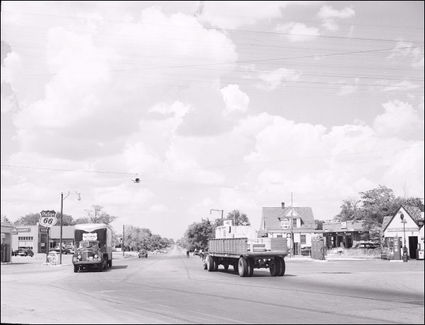
Route 66 into El Reno
Take the curve and follow US66 northwards. This four lane bypass was built in the early 1940s and the railroad viaduct was finished in 1946. At E Elm, you meet the 1932-46 alignment coming from the east. Below is a "Then and Now" sequence at the crossroads. The Phillips 66 to the left has gone, and so has the cottage gas station on the NE corner with E Elm St., but the oblong box station behind, on the right has survived and we describe it further down (marked with red arrow).
Looking north along the 1946-62 Route 66 alignment at Elm St. El Reno.

Farmers Conoco, Tressle and 1928 Culvert
If you turn eastwards (right) along E Elm St. ahead, to your right is a home, former art studio (street view) is the former Farmers Conoco service station, it has an area that appears to be a pump island (see the 1968 advertisement below; the other station at 1300 Sunset Dr. is still standing). It is followed by a railroad tressle built in 1930 and a concrete culvert with a date stamp marked "1928", see image below, red arrow in the back is the tressle.

Farmers Conoco 1968 advert, credits. Click for St. view

Culvert and Tressle on Route 66, click for street view
Ledbetter Mobil Gas Station
Return to Route 66 (Rock Island) and drive north. Just past the corner with Elm St. is the service station we mentioned above, it was Ledbetter's Mobil in 1966. A 1940s oblong box style, with three service bays with multi-windows on their doors and a corner office with large plate glass windows and a detached canopy.

Ledbetter Mobil station. Click for St. view

1936 WPA pedestrian underpass. Click for St. view
Pedestrian underpass
Built in 1936 by the WPA for a safe crossing for pedestrians and specially the children that went to an elementary school elementary school that at that time stood on the west side of the highway. Imagine Route 66 with thousands of trucks and cars driving along Rock Island Ave. every day!. On its side it reads "19 WPA 36".
Head north and at Wade St., the highway turns left. We encourage you to park your car and take a stroll north along this downtown area of El Reno, there are many red-brick buildings from the late 1800s and early 1900s.
Just two blocks ahead where Route 66 turns again, sharply to the right along S. Choctaw Ave. At this important crossing, two service stations vied for customers for over 30 years.
Jackson Conoco Service Sation
At 121 W. Wade, El Reno, OK. On the SE corner.
Listed in the National Register of Historic Places

Vintage Conoco with a home-cottage sty built in 1934, it replaced a Marland Oil service station that was of the "gas pumps only" style.
Set on the southeastern corner of the intersection, it ad a style favored by Conoco at that time, the "house-with-bays style".
It has a steep pitched cross-gabled roof, brick walls with narrow vents in the gable ends.
The detached canopy was probably a 1950s addition.
Jackson Conoco Service Station, El Reno

Avant Service Station
Diagonally across the road from Jacksons, NW at 220 N. Choctaw, El Reno, OK. (NW corner of W Wade and Choctaw Ave.)
Listed in the National Register of Historic Places
A classic Art Moderne - Art Deco service station uilt by Tom Avant in 1933. Its style has modernistic mixed design.

It was built on the site of the former Campbell Hotel (which did not attract Route 66 motorists and went bankrupt). It was a Cities Service Oil Co. station and it had a streamlined appearance with a flat roof with Art Moderne
features combined with geometric zigzag parapet and stepped out pilasters (typical of Art Deco). Its original color was white with green trim, that of Cities Service's brand.
At one time -see black and white picture from 2003- it had a detached canopy, removed during its restoration (below is a "Then and Now" sequence).

Avant station in 2003 Credits

Avant station in 2013, click for street view
Facing both gas stations, on the NE corner is a "New Route 66 Landmark".
Route 66 Monument
The 10-foot tall black and white U.S. 66 shield was erected in 2018 on the NE corner of W Wade and S. Choctaw Ave.
It was specially designed to make it a favorite for tourists, you can sit in the sixes and get great shots. The local Mayor, Matt White was inspired by the queue at the famous Standing on a Corner in Winslow Arizona, also on US 66. He made a new attraction for his town.

Love Locks

Love padlocks on Oklahoma Route 66 sculpture, click for street view
Behind it is the Rock Island Railroad wagon, and next to it, the Love Padlock display.
Visitors attach their locks to a metal sculpture with the shape of a map of Oklahoma with a Route 66 shield in its center.
On the next corner, where Route 66 turns left to head west out of El Reno, to your left (SE corner at 200 Choctaw Ave and Sunset Dr.) you will see a great example of Route 66 weird sights and Americana.
Squawk N Skoot
Now closed for good, it sold fried chicken. It has a great eyecatcher: A chicken sticking out of a brick wall with the place's name and "Chicken N More" written under it.
Before it had been Dwight Kennedy Grocery, commonly known as "Toot N Takem" and in 1966, Jiffy Ice & Grocery owned by Jack and Betty Smith.

1950s gas station
Facing it, on the north side of Sunset Dr. is a Service Station from the 1950s, it has three service bays, a flat roof with a "stepped" design where the service wing is higher than office. A long flat canopy, slightly angled held up by steel poles over the single pump island, and the office has a window wall with stacked windows & horizontal muntins.

1950s gas station. Click for street view

Crossroads or America mural. Click for street view
Crossroads of America mural
On the right side of the building, the mural refers to the crossing of US66 and US 81 in El Reno.
Before you head west along Route 66 (Sunset Drive) and leave the downtown district, consider visiting its historic landmarks, below we give a short summary.
Historic Sites and Landmarks in El Reno
Canadian County Museum
Just five blocks to the SE from the "Crossroads mural" (map), at 300 South Grand Avenue, El Reno OK.
The museum is housed in the restored railroad depot sitting on the historic 98th Meridian. The museum grounds have historic exhibits and several historic buildings on its premises. Local streetcar terminal is here too.
Two sites listed in the National Register of Historic Places, at the museum and the streetcar.

El Reno streetcar, credits
.jpg)
- Mennoville Mennonite Church
It is the oldest building of the Mennonite Faith in Oklahoma, built in 1893, originally located US 81 (north of town - Street View), and moved here (Street view) in 1997. - Red Cross Canteen
Built in 1917 by volunteers to be used by the American Red Cross to provide comfort, food, and drink to the U.S. soldiers who were heading to World War I in Europe. restored in 1975, see street view. - Heritage Streetcar
It is the only city in Oklahoma to have a streetcar in its downtown area. From 1903 to 1947 the electric powered trams linked it with Yukon and Oklahoma City. Other lines reached Guthrie, Edmond and Norman. Nowadays a diesel powered 1924 Brill Motor Car with heated and air-conditioned comfort run from the museum through the downtown district. Wed to Sun. Call (405)-262-5121 for more details.
Hotel "El Reno"

Historic Hotel El Reno. Click for St. view
On the south side of the museum, at 300 S Grand Ave., El Reno, OK.
Listed in the National Register of Historic Places
An Old West hotel built by John Kossuth in 1892, just three years after El Reno was founded. It is a typical two-story frame structure of its time with a "gingerbread porch" and all.
It installed indoor plumbing in 1905, eliminating the chamber-pot. Electricity was installed shortly after and a dining room was added in 1910. It closed in 1974 and the restored building has ten rooms with exhibits on El Reno's history.
Westwards on Route 66
Rock Island Tressle and murals
Just ahead, on Sunset Drive.

The original US 66 alignment in 1926 was a dirt surfaced road that was full of deep ruts (see photo), but in 1927 under SA FA 164 (State Aid and Federal Aid projects) it was greatly improved. Russel St. (now called Sunset Dr.) was graded, drains were built and a grade crossing at the Rock Island RR was built. The railroad tressle was built in 1933 (see same place nowadays).
There are two murals, one on each side of the railroad tressle.

Phillips Courts Motel

Phillips courts nowadays. Click for St. view
Ahead, to your right, at 1221 Sunset Drive is the "Phillips courts" mentioned by Rittenhouse in 1946.
It had a U-shaped layout with the office in the middle.
Now it is the Budget Inn, below is a "Then and Now" sequence.
The bay window on the tip of each end of the property are still there, though windowless (red arrow). In the postcard we see gas pumps in front of the office, they too have gone, and the motel has added another eastern wing.

Jobe's Drive-In
Across from the old motel, on the north side of the road was Jobe's Drive-In. It was according to its advertising, the place "Where Friends Meet", across the street from the old motel, it is still standing and also its classic neon sign. It opened in 1958 and was famous for its homemade char-burgers made with the original hickory sauce recipe.
In the 1960s it was owned by Harold Carl Koebrick and then, after 1969 by Robert Sanders until it closed for good in 2015.


Dons' Conoco (Farmer's Conoco #2)

Don's Conoco station nowadays. Click for St. view
Next to Jobe's, across Boynton Ave. To your right. is a 1950s Conoco station (1300 Sunset Dr).
It has a flat roof canopy over the single pump island, a small office wih a single window. The only service bay has been blocked with brickwork.
This was the second Farmers Conoco in El Reno, the other was on E Elm St., on the south side of the city.
It was also known in the mid 1960s as Don's Conoco. Below is a photo of Don's from 1966.

Bill's Phillips 66

Bill's Phillips 66 in 2014 and 2021.
To your left at 1301 Sunset Dr and facing Don's was Bill's "66" Sunset Service, it offered "Wash, Lube, Tune Up, Free Pick Up & Delivery."
Although it has been altered (the image shows it in 2014 and now), it has kept some features that tell us it was a Phillips 66 station from the 1950s.
It has upward sloping windows, a modern space age look (like an airport's control tower), a flat roof over office and service area, with a "stepped" design (lower over office). A parapet around the building with a deep central groove.
Mr. Swiss

Mr. Swiss, El Reno, click for St. view
Head west. Ahead, to your right, at 1518 Sunset Dr. is a former Mr. Swiss drive-in.
It has an A-frame design, typical of the "Mr. Swiss" hamburger drive-in chain that L. Doefler started in 1964 in Oklahoma City, OK.
It sold hamburgers, ice cream, and sandwiches. It grew to have over 200 stores across the country but folded in the 1970s.
On Route 66 you will fin dthem in Lebanon and Joplin MO, and also in Claremore OK and in Oklahoma City.
Route 66 curves to the NW and again to the west, crossing Adams Park. At the end of the long "S" once stood Hensley's Cafe, see this street view showing it before it was torn down.
Across Route 66 is a long building with three rooms in a row, perhaps the remains of a motel, this is its street view.
Ponderosa Motel
After the curve is the former Ponderosa Motel, to your right. The two story complex is still standing, with minor modifications. The postcard tells us about it: "PONDEROSA MOTEL & RESTAURANT Swimming pool, color TV, push-button phones West edge of El Reno, Oklahoma on U. S. 66, I-40 and U. S. 270... Owners & Managers: Mr. & Mrs. Harley Barnes."

Squaw Drive In Art

Guardian of the Mother Road mural, click for St. view
Pass the "El Reno Bowl", and an old unidentified gas station; its pump islands are there (street view) and turn right along Sabra Pass. Just 400 feet north is the old Sqaw Drive-In theater.
drive-inPainted by Rick Sinnet the work is called "Guardian of the Mother Road a 50-foot tall artwork on the back of the drive in wall. It depitcts some Oklahoma symbols like wheat and a flycatcher.
Your City Tour of El Reno ends here. Head west to drive the "El Reno Loop" into Calumet, Geary and Bridgeport.
Tours & Itineraries
Head out of town westwards along Historic Route 66 to visit Fort Reno.
Fort Reno
It is 6.3 miles NW of El Reno (See Map with directions).
Listed in the National Register of Historic Places
The fort was established as a military outpost in 1875, and continued as such until 1907. From 1908 to 1947 it was an Army remount station, raising horses and mules for the army. Becoming in 1948 a research station of the U.S. Department of Agriculture, the Grazinglands Research Laboratory.
The fort spans 6,700 acres of land and includes historic buildings surrounding the Parade Grounds as well as a cemetery with burials that date from 1874 to 1947 and includes the World War II German and Italian Prisoner of War cemetery.
Fort Reno, near El Reno.

The fort was commissioned in July 1874 to protect the Cheyenne-Arapaho Agency at Darlington after the Red River War of that year. It was officially created on July 15, 1875 and named after Gen. Jesse L. Reno a Civil War Hero.
As from 1876 it was the base from which U.S. troops subdued the Cheyenne and Lakota Indians forcing them to resettle near the Fort. The army also supervised the orderly settlement of the Oklahoam Territory arresting he illegal settlers during the 1880s "boomer invasion" and policing the land runs of 1889, 1892 and 1894.
A pacified Oklahoma in the early 1900s led to a reconversion of the fort in 1908 to a remount station.
P.O.W. Camp
Its location on Route 66 led to its designation as a military prisoner-of-war camp during World War II.
Almost 100 acres of the eastern part of the Fort became a concentration camp for German Prisoners of War (P.O.Ws), and it eventually held 1,300 German and Italian soldiers captured in North Africa. They built the chapel north of the parade ground, and the cemetery holds the remains of 70 POWs from the Texas and Oklahoma prison camps.
Some sponsored content
>> Book your Hotel in Tulsa
Credits
Banner image: Hackberry General Store, Hackberry, Arizona by Perla Eichenblat
Jack DeVere Rittenhouse, (1946). A Guide Book to Highway 66.
City Website www.cityofelreno.com
Cynthia Savage, El Reno. Encyclopedia of Oklahoma History and Culture, www.okhistory.org