Route 66 in Winslow AZ
Index to this page
About Winslow, Arizona
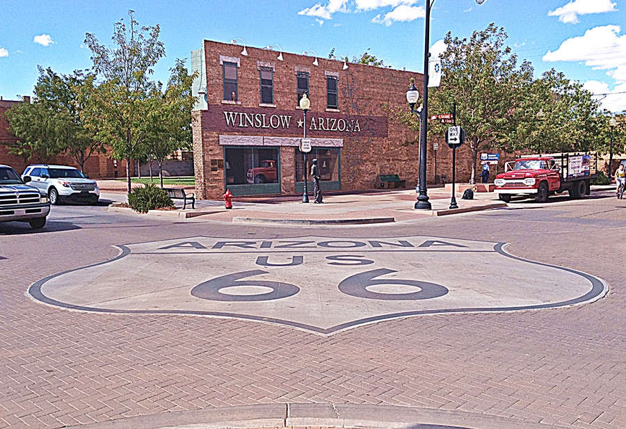
The "Standin' on a corner" shield in Winslow Arizona
Austin Whittall
Facts, Trivia and useful information
Elevation 4,850 ft (1.478 m). Population 8,194 (2025).
Time zone: Mountain (MST): UTC minus 7 hours. Summer (DST) no DST⁄ PDT (UTC-7).
Winslow is a relatively large town in Navajo county in central-eastern Arizona: It is located on the alignment of Route 66.
For over ten thousand years, human beings have hunted and lived in the central part of Arizona. Later, during historic times, the Anasazi or Ancestral Puebloans lived in the higher region north of the Little Colorado River. They were an agricultural society that peaked betwen 700 and 1150 AD. Most of them moved towards New Mexico around 1300 AD as a dry spell and invading groups displaced them from their homeland. Those who would become the Hopi remained behind.
The hunter gatherer Navajo (Diné) people occupied the vacant territory and later adopted farming which they learned from the Pueblo Indians.
A Spanish expedition led by Francisco Vazques de Coronado reached western New Mexico en 1539 and from there, sent a group of men led by García López de Cárdenas to reconnoiter Arizona.
They visited the Hopi pueblos of the province of "Tusayan" and their Hopi guides took them to the river they were seeking: the "Tisado" or "Brand Iron" River.
This is how these Spaniards discovered the Colorado River and became the first Europeans to see the Grand Canyon. Their path to the Hopi land took them by Winslow.
The Hopi
Famous for their August "Snake dance" (the snake in the mouth). The name Hopi derives from Hopituh Shi-nu-mu and means "The Peaceful ones". The Navajo, who were their enemies called them "Moki" or "dead ones".
The Spaniards classed them as Pueblo people due to their towns: Pueblo in Spanish means "Village".
The village of "Old Oraibi" is one of the oldest continuously inhabited villages in the U.S.
Their reservation spans 1.5 million acres and consists of 12 villages. It is surrounded by the Navajo Nation Reservation. In the 1980s there were some land disputes between both tribes. Homolovi Pueblo was the home of the ancestral Hopi before they had to flee to the mesas further north to be safe from their enemies.
The Spanish never occupied central Arizona after they conquered Nueva Mejico in 1597. Mexico, who succeeded Spain in 1821 did not settle it either. It was only after the U.S. annexed the territory after winning the 1846-48 War against Mexico that settlement began.
The Navajo who also occupied the land north of the Little Colorado River were a bellicose tribe and the U.S. Army established Fort Defiance in 1851 to subdue them. The Navajo were finally pacified in 1868 and a treaty assigned them a large reservation in New Mexico and Arizona.
The US government had already explored the region: Lt. Edward Fitzgerald "Ned" Beale (1822 - 1893) surveyed a wagon road from Ft. Smith Arkansas to California in 1857 and followed a trail that roughly lined up with what is now Route 66.
His expedition followed the Little Colorado River and crossed it at Sunset Crossing next to where Winslow is now located. Beale employed camels, imported from Africa as pack animals. Although they were hardier than mules the Army declined to use them in the future because the camels scared the horses and mules.
During the American Civil War, the Unionist government created the Territory of Arizona (1863) separating it from New Mexico and in 1870 a fort was built nearby at Holbrook. In 1876 the Mormons from Utah moved south to settle in Arizona and used a trail which was later known as the "Honeymoon trail".
Honeymoon Trail
The Mormon settlers had to go back to Utah to marry because there were no temples in Arizona. They reached Utah using the "Mormon Wagon Road", which linked Lee's Ferry on the Colorado River with Sunset Crossing right beside Winslow.
In an article written in 1934, Arizona Historian Will Barnes christened this route as the "Honeymoon Trail".
The Mormons established the village of Brigham (after Brigham Young, President of Mormon church from 1847 until his death in 1877 and founder of Salt Lake City) roughly 1.5 miles north of modern Winslow, on the western bank of the Little Colorado River. The Sunset settlement was located on the eastern bank 1 mile from it. Both towns and a third, Obedm, were later abandoned and only Joseph City survived to this day.
The Atlantic and Pacific Railroad (later Atchison Topeka and Santa Fe Railroad - AT&SF) laid their tracks through Winslow in 1882. They crossed the Little Colorado River at Sunset. The first settler was F.C. Demerst who opened a tent in 1880 and tended to the railway workers and local Indians. The first stone building was erected by J. H. Breed ca. 1881. The post office opened in 1882. It grew as a trading center with the Hopi and Navajo, and for the cattle ranches that surrounded it. It was a railway division point too.
The Name: Winslow
The Navajo name for the town is Béésh Sinil, but the station and town were named after General Edward F. Winslow, who was the President of the AT&SF. However some versions have it that it was named after a prospector who lived in the area, Tom Winslow.
The surname Winslow was first written as Wineshlauu (849) and Weneslai (1086). It derives from a personal name "Wine", which meant "friend" and the Old English word "hlaw" or "burial mound". Therefore its means "Wine's burial mound".
Downtown Winslow in the 1960s the changing scenery of Main Street - Route 66

Same spot nowadays:
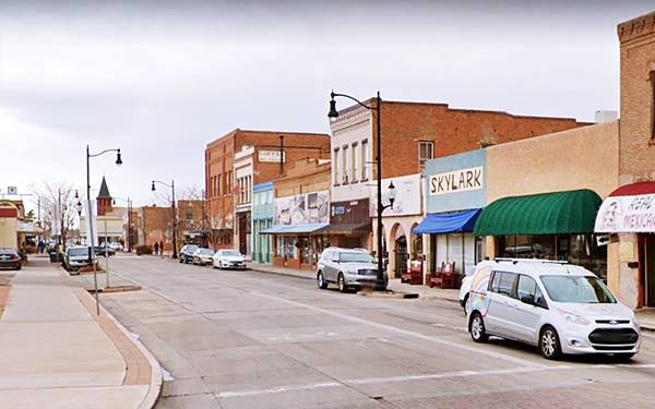
When Route 66 was created in 1926 it was aligned through the city, along its Main Street and remained the main highway until I-40 bypassed the town after 1977.
The town achieved recognition again with the Eagles' 1972 hit "Take it Easy" and the "standin' on a corner" statue attracts many visitors each year.
Hotels in Winslow
Find your hotel on Route 66 in Winslow
>> Book your Hotel in Winslow
More Lodging Near Winslow along Route 66
There are plenty of lodging options in the cities and towns along Route 66 east and west of Winslow; click on the links below to find your accommodation in these towns, listed from east to west:
Eastwards
In Arizona Along Route 66
Westwards
You are so close to Las Vegas and the Grand Canyon!
>> There is a RV campground in Winslow, and nearby in Holbrook and Barringer Crater
Weather in Winslow

Location of Winslow on Route 66
The climate of Winslow is dry, temperate and arid. Relative air humidity is low and this leads to wide variations beween night and day temperatures all through the year, causing hot dry summer days but cool summer nights and cold winter ones.
During summer (Jul), the average high temperature is around 94.5°F (34.7°C) and the average low is 61.9 °F (16.6°C). In winter the average high (Jan) is 49.5°F (9.7°C) and the average low is about 20.8°F (-6.2°C), well below freezing pont.
As expected for an arid area, rainfall is scarce: 6.99 inches (178 mm) yearly and about half of it falls during the summer monsoon period from July to September (3.1 in. - 79 mm). Snowfall is also light, with only 6.4 inches (16.3 cm) per year, between Oct. and April.
It is sunny in Winslow with only 53 days with rain or snow each year.
Tornado risk
There is almost zero tornado risk in Winslow: Navajo County has no Tornado watches. The area west of the Rocky Mountains has virtually no tornado events at all.
Tornado Risk: read more about Tornado Risk along Route66.
Map of Route 66 in Winslow
Read the Detailed Description of this segment: Lupton to Winslow east of town, and Winslow to Winona west of it. Below is the interactive map showing both sections:
>> Custom map of Route 66 in Winslow
Route 66 followed the alignment of the 1910s. National Old Trails (N.O.T.) highway across Winslow. Over the years it changed its course slightly across the town:
The N.O.T. and original Route 66 from 1926 to 1951
This map shows the N.O.T. and Route 66 1926 to 1951 alignment across Winslow. East and westbound traffic ran along 2nd Street. The alignment is cut at both its eastern and western tips by the freeway, you can see the two missing segments there, marked with a yellow line in our custom map with the eliminated segments of Route 66.
From 1951 to 1979
In 1951 the traffic was split along two streets: the eastbound traffic ran along 2nd St. and the westbound traffic along 3rd St. (map with WB lanes).
After W. Fleming St., both east and westbound lanes ran along a divided boulevard as shown in this map and after what is now Arcadia Trailer Park, it ran where the freeway's Eastbound lanes are now located, see purple line in our custom map.
Route 66 Alignment near Winslow
With maps and full information of the old roadway.
- Winona to Williams (next)
- Winslow to Winona (Winslow's)
- Lupton to Winslow (previous)
Winslow, Arizona, its Sights and Attractions
Things to Do and Places to See
- In Winslow, read on below
- Tours & Itineraries
- Parks and outdoors
Route 66's "Standin' on a Corner" Town
Historic context
In 1946, Jack DeVere Rittenhouse drove the whole of Route 66 and published his "A Guide Book to Highway 66". In it, he mentioned the main hotels in town at that time: "La Posada, Chief, Winslow, Palace, Elk" and its courts (Motels): "Bazell, Drumm's, West End, El Hopi, Union, Camp Keyton, Beacon, Sears Auto Camp", some of these classic hotels and motels are still standing.
Winslow is quite a center for tourists, vacationists and health-seeker... It is one of the largest towns in Northern Arizona Rittenhouse (1946)
Trivia: World's Largest Navajo Rug
Rittenhouse also mentioned that the Hubbell Motor Co.'s showroom had the "world's largest Navajo Rug: 21 feet by 37 feet" (6.4 x 11.2 m). It took 3 years and 3 months to weave and weighs 240 lbs. (109 kg).
It was acquired in 2012 by the Winslow Arts Trust at La Posada Hotel. The rug had been commissioned by Lorenzo Hubbell Jr. in 1932 to draw business to his trading post (more on the post below).
The seamless rug, woven on the largest Navajo loom, is valued at $1 million. Its patterns were copied from ancient pottery.
The Arts Trust plans to open the Route 66 Art Museum in summer 2016 to exhibit the rug.
Sponsored Content
Tour Winslow from East to West
Route 66 along 3rd St
Minnetonka Trading Post
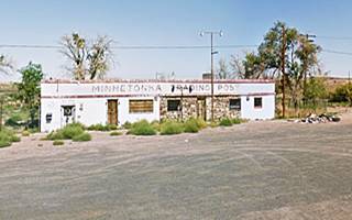
Drive into Winslow from the east, coming from Holbrook and Joseph City, leave the freeway at Exit 257, head left, south across I-40 and as it reaches the intersection with E 3rd St. (the original 1926-79 Route 66, turn left. Just one-quarter mile east, to your left is an old vacant trading post it opened in 1939. The first shop in town! Rittenhouse mentioned it in 1946, one mile east of the Little Colorado River, but called it the "Painted Desert Hideaway". It was the only store on the alignment according to the 1953 aerial photograph of the area. Just ahead the old road is now cut by the Freeway. Turn around and head westwards into town.
9-11 Remembrance Gardens
Drive 2.5 miles, passing by the "Welcome to Winslow" Route 66 shield to visit the 9-11 Remembrance Gardens, a memorial to remember those who lost their lives on September 11, 2001. It preserves two beams that were part of the structure of the Twin Towers in New York.
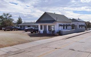
Ahead, where the sonic now stands was the Knotty Pines Motel. And facing it, on the north side of the highway at 1508 W 3rd, is the Arizona 66 Trading Company housed in a former gas station built in 1955, the flat canopy survives (St. view)
Next door, where Tom's Tavern is located, was the PT's Motel.
Whiting Bros Service Station #1 in Winslow
Ahead, to your left (1402 E 2nd St.) facing both westbound and eastbound traffic along East 2nd and 3rd Streets. Below are the views along both streets, the red arrows show the station behind the one viewed. The eastbound traffic gas station still has the "Whiting Bros. - Gas For Less" yellow sign with red letters.
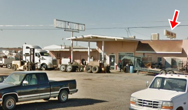
Red arrow shows the westbound station behind it. Click image for Street View
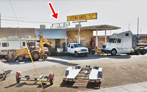
Red arrow shows the eastbound station behind it. Click image for Street View
See this 1990s photograph of the station with all its WB colors.
Read more about all the motels and gas stations of Whiting Bros. on Route 66
Ahead is the back part of the Imperial 400 Motel (1300 block - left)
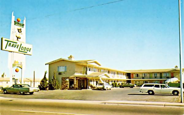
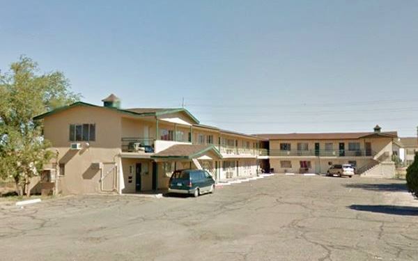
Former Travel Lodge
To your right, at 1216 E 3rd St. now an apartment complex. Its 1960s postcard says: "Winslow newest TRAVEL LODGE... Heated swimming pool. Telephones, Television, Air conditioned. 30 Beautiful Units - Restaurant across street. AAA Approved."
The Travel Lodge as it was in the 1960s in Winslow, AZ. Route 66
Falcon Family Restaurant
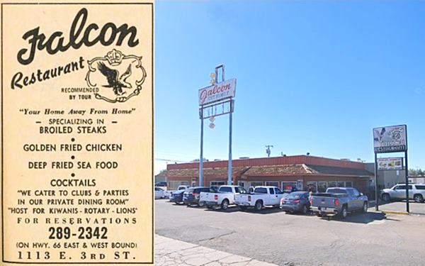
To your left, 1113 E 3rd St. Still serving meals and "Your Home away from Home" as their 1962 Yellow pages advertisement said. It opened in the mid 1950s.
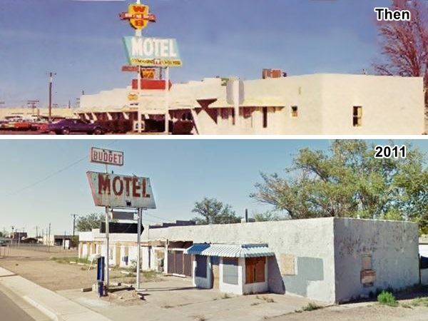
Budget Motel - LZ Motel and Whiting Bros Motel (Gone)
Next door at 1121 E 3rd was the "Budget Motel" from the 1940s.
It was owned and ran by Lee Elzey (hence its name "LZ"). It originally faced Route 66 on E 2nd St. where he owned a tire shop. He gradually expanded it when westbound traffic was moved to 3rd St. and appears in the local 1960 phone directory on the motel premises.
Click on the thumbnail image above to see a large size picture showing its now gone signs facing 2nd and 3rd Streets.
The motel's neon sign over the years

L-Z Motel neon sign 1960s. Source
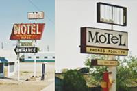
The property was purchased by Whiting Bros and became their eastern motel in Winslow (there was another one on the western side of town). They used the neon sign facing 2nd St. (image shows the L-Z neon sign looking east along E 2nd. in the 1960s) and converted it into a WB sign.
After Whiting Bros. folded, the motel changed hands and finally ended up as the Budget motel that also used the same original 1960s steel sign. Budget motel and signage were all torn down in 2016.
Below is a view of the motel when it was a Whiting Bros motel in the 1970s, and later in 2011 as the Budget Motel. The sign was the same one!
Same neon sign repurposed over the years!
Desert Sun Motel
Opposite the Budget site, to your right at 1000 E 3rd St. is the Desert Sun Motel from 1953. The photos below reveal that the swimming pool has gone but the tree next to it has grown, and the neon sign has changed too, but it still is a "kitschy" Route 66-style sign and not a bland modern one.

1960s postcard of the Desert Sun Motel. Source
Bill's West End Frontier Service station
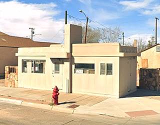
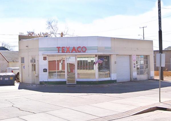
At 1014 Old Hwy 66, to your right is Bill's West End Frontier Service station from 1954. The flat roofed box-shaped building with a flat canopy and a two-door-garage was probably a Texaco filling station. Now it is shuttered.
At the next corner to your right there used to be a billboard pointing left to the Hale Motel "one block" away on E 2nd St., it was torn down, but you can see it in this Street view. Head west, by the bridge, to your left is Harold's Shell Service (1962 phone directory), offering "Lubrication Oil Change Car Washing."
Navajo Lodge, now private property
After the bridge, to your left, at 719 E 3rd St. is a classic US 66 motel: The Navajo Lodge. Its 1960s postcard shown below has printed on its back: "NAVAJO LODGE MOTEL On u.s.Hwy. 66 West 719 E. 3rd St. Winslow, Arizona Phone 289-3331 or 3889. One of Winslow's Newest and Finest Motel accommodations - Singles - Doubles - Twin Units - Combination Bath - TV and Telephones in rooms. Good Restaurant close by - Near Business Center of Town - Refrigerated in Summer - Warm Airconditioned in Winter.
Then: The Navajo Lodge as it was in the 1960s, Winslow AZ
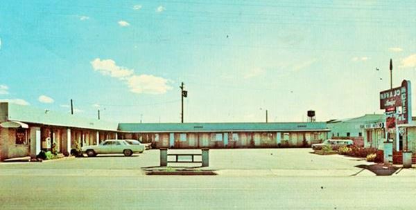
No longer a motel, now it's a private property
Oasis Liquor and Phill's Texaco
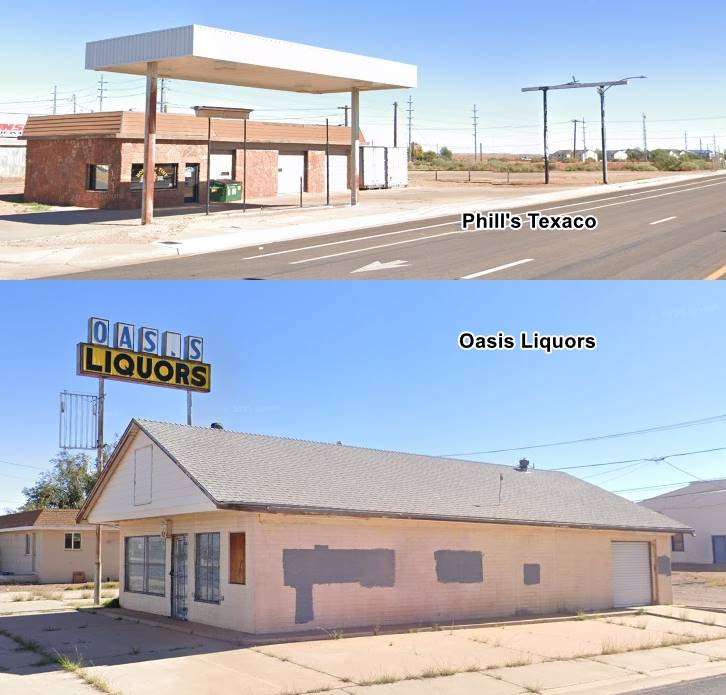
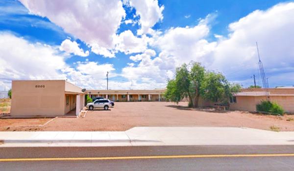
On the corner to your left is the Oasis Liquor Store dating back to 1958 (703 E 3rd) and opposite, at 700 E 3rd. A mansard roof style Texaco station originally built in 1953, Phil's Texaco Service, it sold B.F. Goodrich tires. Click on the thumbnail image for full size pictures.
Marble Motel, now Earl's Motor Court
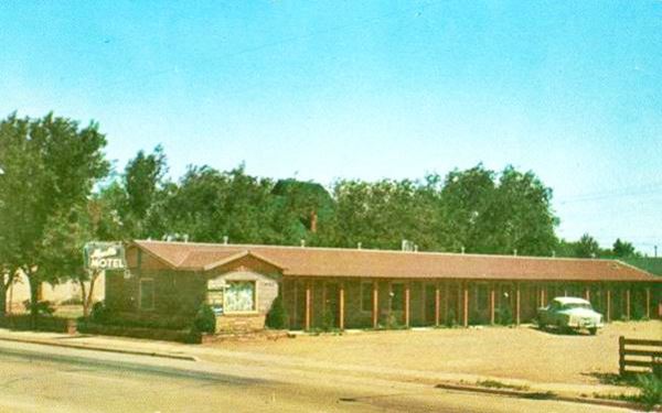
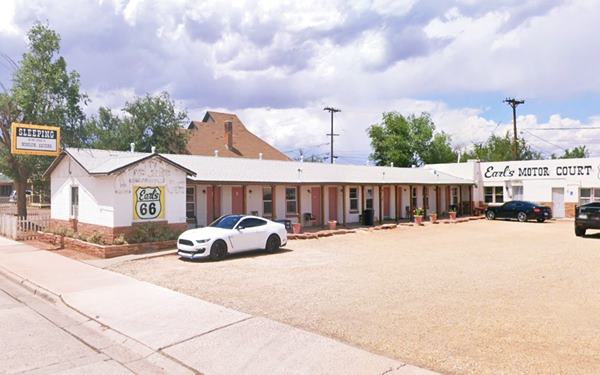
On the next corner, to your right, at 512 East 3rd St. is Earl's Motor Court, formerly "Marble Motel". See its postcard below from 1958. Built in the 1940s and remodeled in 1952. Nowadays it is the Earl's Motor Court, and advertises itself as "Sleeping on the Corner in Winslow". It is the oldest classic Route 66 motel still in operation in Winslow.
The postcard says on its back:"MARBLE MOTEL On Westbound U.S. 66 512 East Third St. Winslow Arizona. Recommended by Duncan Hines "Lodging for a Night". Mr. and Mrs. Rex Marble Owner Operated.", it was named after its owners. Below is a "Then and Now" sequence.
Westerner Motel
Ahead, on the same block (504 E 3rd St.) , across the road, to your left, is the Westerner Motel from 1940. The motel had access on both 2nd and 3rd Street, it is now being reformed. The old postcard below says: "Western Motel ... 31 units, 19 refrigerated, tiled combination baths, 12 air conditioned with tile showers". The swimming pool has been filled in, but you can still make out its ouline in the parking lot.

1960s Oldie postcard of the Westerner Motel. Source
Del's Mobil
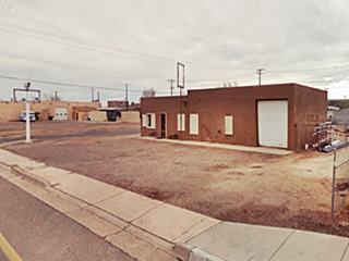
The box-shaped gas station that opened in 1954 is on the next corner to your right (420 E 3rd) and known as "Del's Westbound Service" it offered lubrication, washing & polishing, pick up & delivery service. Now it is a shabby-looking garage. It advertised in the 1962 local phone directory.

Weaver's Snow-Cap in the 1962 phone directory
Weaver's Snow-Cap
Drive past the downtown area (you will return when you drive along the eastbound Route 66 on 2nd St.) At 118 W 3rd, to your right is a home that in 1960 was "Motor Hotel" ran by L.H. Hopper. Ahead, to your left on the SW corner of 3rd and N. Warren Ave is a drive-thru restaurant from the mid 1950s, now part of local congregation. The image above shows its 1962 phone directory advertisement. St. view.
Ahead, on the 700 block is the "Motel 10" that opened in 1977, now the Winslow Inn (701 W 3rd). Next to it is a former restaurant, with a low stone wall and large windows facing the street that opened in 1969 (723 W 3rd).
Former Astro Motel
Go west for 0.7 mi. and visit the former Astro Motel (725 W 3rd St). It has access to 2nd and 3rd streets. Now it is the 10 Motel. Originally part of the Astro chain that spanned Arizona, California, Utah and also reached Kansas. It opened in 1964 with space-age-style (see its serrated roof). It had a standard Googie Architecture design with bold geometric shapes that proclaimed the coming of both Space and Atomic Ages. Boomerang shaped roofs, glass structures and angled buildings were very popular during the 1960s. Later it became a "Motel 6" as you can see in the postcard below. It is still open as a motel and you can spend the night here.
> > You can Book a Room in this Motel: now 10 Motel

1960s Postcard of the Astro Motel. Source
Astro Motels and Route 66
Learn all about these Space Age motels along U.S. 66.
> > Read more: Visit our Astro Motels on Route 66 webpage.
Route 66 Neon Sign
Ahead, on the at 1040 W 3rd (right) is a pawn shop neon sign with a Route 66 appeal (pictured) the 1962 Winslow phone directory tells us it was the "Club Drive In" restaurant. Later it was Bill's Cafe, a store and finally a pawn shop.

El Acapulco restaurant, Winslow (Source). Click image for St. view
El Acapulco
Drive west and at 1216 W 3rd, to your right is a brick building with arches and a Spanish tiled roof. A vacant signpost once topped by words "Restaurant" stands beside it. It was the "El Acapulco" Spanish restaurant in the 1960s. Above is a detail from a postcard. Click on it for the current street view.
Drive west, on the 1600 block by the Gate Store (it appears in the 1962 directory) 2nd and 3rd streets meet and take a SE - NW course as a four lane divided avenue. Two blocks ahead, to your right is another motel:
Starlite Motel
At 1800 W 3rd St. it dates back to 1952. It has an L-shaped layout and is located on a corner. Below is a "Then and Now" set of pictures:

Starlite motel postcard c.1960s. Source
Star Court

Star Court and Texaco Winslow US66. A. Whittall Source
Click on image to enlarge
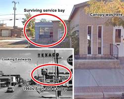
On the small triangular square between 4th and 3rd streets, next to the Starlite was a Texaco (1900 W 3rd). The 1960 phone directory of Winslow says it was owned by Elmer and Bruce De Marse who later moved the Texaco across the street to 1800 W 2nd St. The picture (click on it to enlarge) below looks east, behind the Texaco sign is the Spanish tiled parapet of the Starlite Motel (the color inset shows the current appearance, red arrows mark the spot). To your right is 4th st, to your left is 3rd St. It was torn down. Current street view
On the next block, the original Route 66 forks to the left, along 2nd Street. We will drive this segment when we complete the 3rd St. alignment. From this point westwards it is the 1951 to 1979 alignment that carried both east and westbound traffic out of Winslow. Ahead to your right is a classic motel.
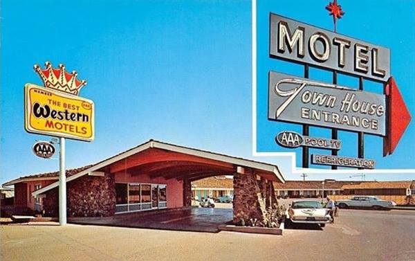
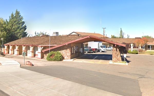
Town House Lodge
Built in 1957; at 1914 W 3rd. Its vintage postcard described it as follows: "U.S. 66 West edge of Winslow... 55 Beautiful Units Refrigerated air conditioning... U.S. Koylon Luxury beds." it was a Best Western Hotels Member and it is still operating as a motel: "The Lodge".
> > You can Book a Room in this Motel: now Lodge Motel
Drive west until you pass the interchange at Exit 252. The 1951-79 roadway continues west for a short stretch and where the divided avenue ends, it went on, and is now overlaid by the freeway's eastbound lanes.
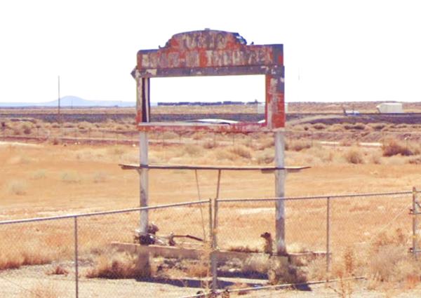
Tonto Drive In Theater
Drive west for half a mile (map with directions) to visit the site of a now defunct "drive in theater" which was located on the western side of town facing Route 66, on the south side of the road. Now it is an area with warehouses. Only the rusting marquee has survived, as you can see below:
This ends the westbound lanes tour of Route 66 through Winslow. Time to drive the eastbound ones.
Eastwards into Winslow
The 1951-79 Alignment
On the first block after the exit's access, take a U-turn and head back along the highway. To your right are two classic sights:
Delta Motel
To your left, at 2141 W 3rd. Its postcard said it was "One of Winslow's newest" Emma and John Gremmel were the owner-managers. It dates back to the early 1950s and is still open.

Delta motel 1950s postcard. Source
Joe's Cafe
At 2125 W 3rd is this classic but now vacant cafe with a neon sign slowly falling apart. It opened around 1950.

Drive east for 0.2 mi and at 2015 W 3rd, is a 1970s Shell station built in ranch-style with wide sloping gable roofs (street view). Ahead after 0.1 miles are two classic gas stations:
Two Gas Stations
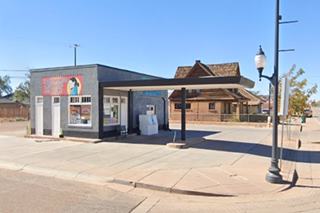
The one on the west at 1961 W 3rd was built in 1958 and is an ice-box style building with two service bays, and a flat canopy extending from the office over the pumps island. The second station at 1925 W rd was built in 1959 and has the style of a Shell station with the stone veneer and the low, double gabled roof facing the front.

Mayfair Motel
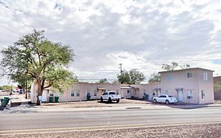
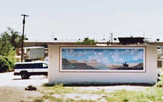
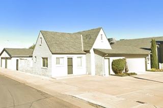
Next to the former Shell are the Winslow Ranch Apartments at 1925 W 3rd. This was the motel that dates back to 1962 and has a layout with two parallel lines of units. It has a cool mural on one of its facades.
Entré Restaurant and Motel
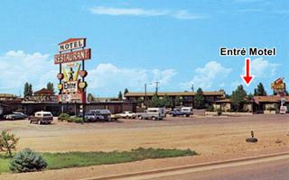
Adjacent to the Mayflower is an apartment complex, the "Winslow Ponderosa Apartments" that encircle a famous restaurant. This is the Entre Motel, built in the late 1960s as an addition to the famour restaurant. It had 40 units including "Family Units... Direct Dial Phones, HBO Color TV, AM - FM Radio.
Ahead, at 1919 W. 2nd St. to your right is the former "Entré Restaurant", shown in the 1970s postcard below. It had opened in 1958 and was run by Steve and Helen Sponduris. It had the town's first Beer Hall (1962), surprisingly, is still open.
The text on the back of the card reads: "ENTRE RESTAURANT AND COCKTAIL LOUNGE, west Winslow on Interstate 40 (US 66). Featuring the finest char-broiled steaks and gourmet sandwiches in our spacious dining room and coffee shop. Authentic locally made Indian Jewelry from the southwests finest silversmiths. Close to better motels with ample off-highway parking."
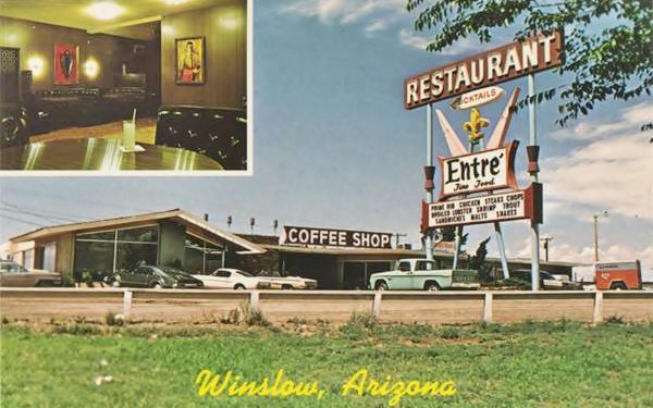
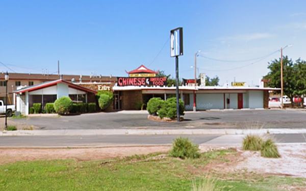
The 1926 to 1951 Route 66
Westwards towards a dead end
On the corner, turn right, fifty yards ahead is Route 66's alignment from 1926 until 1951 that ran west along W 2nd St.
At the intersection with the original US66 is an apartment complex, the Cottonwood Courts apartments we are not sure if they ever were a motel despite their layout around a central courtyard. They appear in the 1967 aerial photograph. Before then the phone directory gives a "West End Garage" at 1915 W 2nd, but no motel. At 1910 were the "Flamingo Apartments."
You can drive west along the original Route 66 for 1.5 miles to its dead end. Turn around and head east.
Tonto Rim Motel
To the left of the Cottonwood Courts at 1901 W 2nd St., is another motel from the 1940s. Its postcard advertised "Kitchinettes, T.V., Air-conditioned." Owned (in 1960) by Pate J.S. It is still there, below is a "Then and Now" sequence:
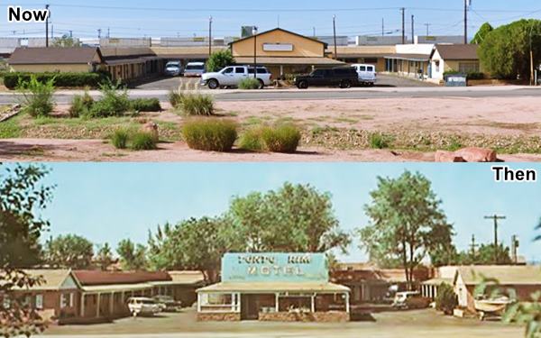
It later operated as the "Rest Inn" motel.
De Marse Texaco (gone)
To the left of the Rest Inn motel, at the fork (1800 W 2nd) was the De Marse Texaco, torn down in 2009, you can see it in this 2008 st. view
Eastwards through Winslow on the 1926-79 US 66
Driving Route 66 in Winslow
East of De Marse's Texaco Route 66 ran along Second Street from 1926 to 1979 eastwards and from 1926 to 1951 westwards. We will drive across Winslow from west to east.
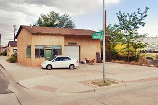
To your left, on the corner at 1420 W 2nd, is a small box-shaped building the 1960 phone book tells us it was "Hillside Dr In" owned by Mr. D. R. Florez; street view.
At 1320 W 2nd St. to your left was the El Rancho motel with 24 modern units in a U-shaped layout and an adjoining restaurant. Nothing remains of it.
El Hopi - Whiting Bros Motel & station
Continue west. On the SW corner with N. Arthur Ave. was Perry's Cafe, torn down in 2015. As you cross N. Arthur, to your right is an old motel and gas station from the 1940s, "El Hopi". Located at 815 "W 2nd., the old building with a U-shaped layout on the SE corner. The gas station is on the left side of the property. It became a Whiting Bros. motel in the 1960s. Both buildings are in need of repair. The gas station has a low sloped gable canopy. Signs have gone (notice the two poles cut off at the level of the sidewalk by the corner). Below is a "Then and Now" set of images:
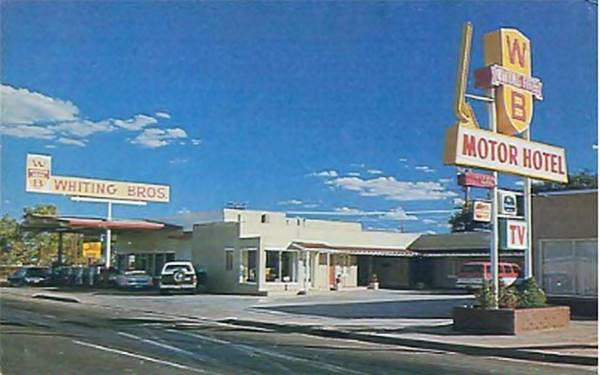
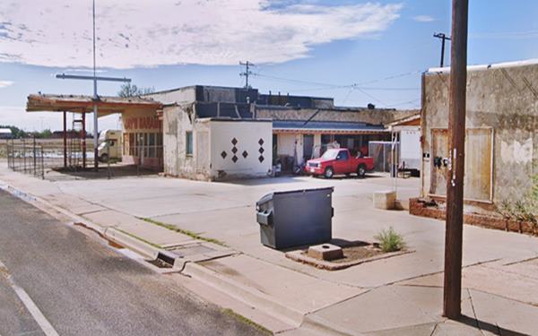

Union Auto Court 1940s postcard. Source
Union Auto Court, later Sand & Sage
Opposite, on the north side of 2nd St. is a classic motel. at 818 W 2nd. The Sand & Sage Motel was originally the Union Auto Court facing 2nd St. and operated by Mr. and Mrs. R. A. Barnes in the 1940s. Rittenhouse mentioned it. It had a Spanish Mission style building. Later it became the Sand & Sage, a long and narrow motel running from 2nd to 3rd streets with units on both sides of a narrow driveway. It opened in dates back to the 1940s but was revamped in 1954 with flat roofs that projected over the driveway.

1950s postcard Sand & Sage motel. Source
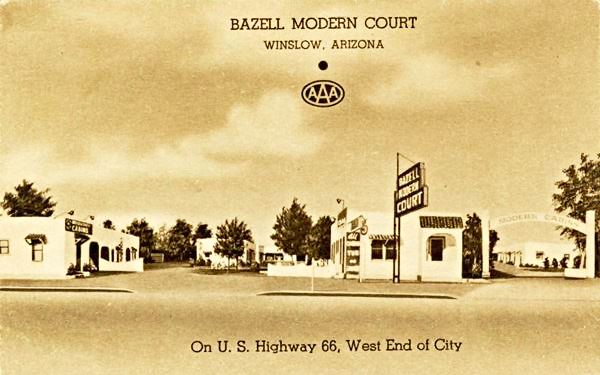
Bazell Modern Court (Razed)
It was located next to the Sand and Sage, at 800 W 2nd St. to your left. It was torn down quite recently (2020)-
Grover Cleveland Bazell, a lawyer, started his business in Winslow in 1921, when he opened a garage and a Buick dealership. He then built the Bazell Moden Camp, with cabins, which they called cottages.
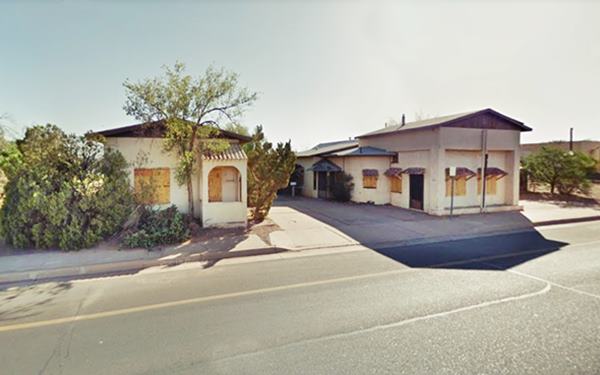
Later the cottages were connected forming a "Court", a primitive form of motel, and the place was renamed Bazell Modern Court and was ran by the Powells. You can still see some of the original buildings on the north side of the road, now converted to homes.
The 1940s? postcard shown below says on the back: "BAZELL MODERN COURT, Winslow, Arizona. Located on the West side of the city, on U. S. 66 at 800 West Second Street. All cottages have either tub or shower, some with kitchenettes. All are equipped with inner-spring mattresses. Comfortably heated in winter and air conditioned in summer. Mr. and Mrs. Robert Powell, operating owners."
The image below shows the same building that is behind the signpost in the postcard above. Its porch with Spanish roof tiles and an arched opening is the same but the house now has a gabled roof instead of a flat one.
West End Motel
Ahead are the Astro and Motel 10 already seen along W 3rd.
At N. Prairie Ave. to your left is a former Motel, located at 624 W 2nd. In the 1960 phone directory it appears as the West End Auto Court ran by Hubert Tatum. No longer operating.
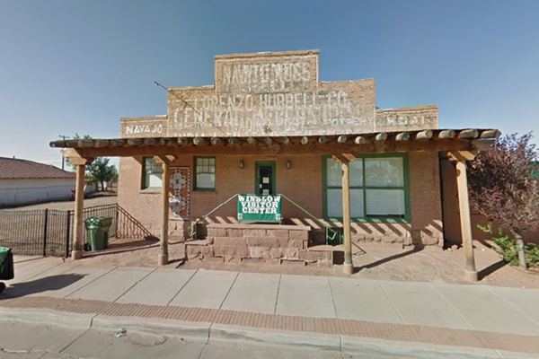
Hubbell Trading Post
523 W. 2nd Street, Winslow, AZ
Listed in the National Register of Historic Places
0.2 mi. ahead, to your right is the Historic "Hubbell Trading Post". The postcard below is from the mid 1940s; it was a warehouse and wholesale store in Winslow. Lorenzo Hubbell began trading with the Navajo from Pueblo Colorado AZ in 1878; he renamed the place Ganado. He ended up owning 24 trading posts, and freight lines. In the early 1920s he opened a warehouse and store in Winslow; his empire collapsed and went bankrupt in 1954. The brick building with a wide porch is still standing and is now home to Winslow's Chamber of Commerce. The sign above the store reads "Navajo Rugs, Lorenzo Hubbell Co. Trading Post".
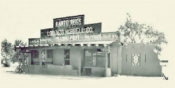
Davis Richfield Station
Head east, at 401 W 2nd, on the SW corner of W 2nd and N Berry, to your right is a 1950s gas station, it has been neatly restored. Notice the brackets within service bay openings (in the corners). It was Davis Richfield Service.
Former Conoco Cottage station
Catty corner from the Richfield is a greatly modified Conoco Cottage-style service station from the 1930s and 40s. It has all the features of these stations: steep pitched cross-gable roof the front facing one (right) is off center with narrow vents in the gable ends. Notice the brick step out at the point where the front facing gable meets the wall, this was typical of Conoco stations.
Across Route 66, facing the Conoco, at 317 W 2nd was the long gone "Drumm's Motel" mentioned by Rittenhouse, that later became the "Travelers Motel."
Ed Ruscha's El Paso station (gone)

1962 El Paso Dixie in Winona by Ed RuschaClick image to enlarge
On the next corner, to your right (SW corner diagonally opposite the church) was an El Paso gas station that was photographed in 1962 by Edward Joseph Ruscha, an American artist who travelled along Route 66 many times from California to visit his family in Oklahoma. His first photobook titled "Twentysix Gasoline Stations" published in 1963 is the result of one of those trips. Below is his take of Bert Hawkins & Sons El Paso Dixie Service at 301 W 2nd. Long gone, the thumbnail image combines current and passt views showing the buildings that are still standing next to the filling station. Click on it to enlarge; this is the current St. view. Later it became an Amoco (see the image below).
Arnold's Shell
On the nex block at 217 W 2nd, to your right was Arnold's Shell, whose building is partially visible behind a more recent structure (Street view.)
Smith's Teague Texaco
The 1960 phone directory tells us that at 201 W 2nd was Smith's Texaco station, a typical 1930s-40s Teague design. This is a Type B. Similar to the Ash Fork AZ "De Soto" station. This design included an oblong box station with an angled office on the corner and a single canopy. It was used on corner sites. This station has been neatly restored and is recovering its former grandeur. The two tall poles with the Texaco sign can be seen in the Arnold's Shell inset, and they are still standing.
>> Learn all about the Teague-style Texaco service stations along Route 66
Winslow's Historic Commercial District
Passing the Texaco, as you cross N Warren Ave, you enter "Winslow's Historic Commercial District". it runs
Between 1st and 3rd Streets and Warren and Williamson Avenues.
Listed in the National Register of Historic Places
This is the historic district, and it has many brick buildings built between 1883 and 1935. And, 0.2 miles east, stop and park your car to visit the main attraction in Winslow:Standin' on a Corner.
Standin' on a Corner in Winslow Arizona
NW corner at N. Kinsley Ave. and W 2nd St., Winslow's Standin' on the Corner Park.
Winslow's famous "Corner"
The statue at the famous "Corner" in Winslow Arizona. Route 66
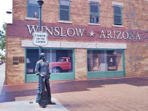
The city of Winslow chose the corner of W 2nd St. and N. Kinsley Ave. to erect a life-size bronze statue of a man carrying an acoustic guitar.
It is placed next to a street lamp with a sign shaped like the Route 66 shield saying "Standin' on the corner".
The mural behind the statue is painted on a red-brick wall, and depicts the reflection of a flat bed Ford pickup driven by a blonde woman. There is an eagle perched
on the first window's sill of the second floor and a couple is embracing in the third window (are they the woman from the pickup and the man from the corner?).
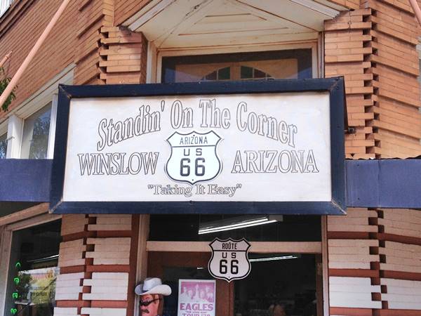
On the street you will see a painted Route 66 shield ("Arizona US 66"). Ideal for a great photograph. The "On The Corner street festival" is held the last week of September.
Elks Building
The red brick building across the street was built in 1912 to house the Elks lodge, at 100 E 2nd.
The Lyrics of "Take it Easy"
Well, I'm running down the road
tryin' to loosen my load
I've got seven women on my mind,
Four that wanna own me,
Two that wanna stone me,
One says she's a friend of mine
Take It easy, take it easy
Don't let the sound of your own wheels drive you crazy
Lighten up while you still can
don't even try to understand
Just find a place to make your stand
and take it easy
Well, I'm a standing on a corner
in Winslow, Arizona
and such a fine sight to see
It's a girl, my Lord, in a flatbed Ford
slowin' down to take a look at me
Come on, baby, don't say maybe
I gotta know if your sweet love is gonna save me
We may lose and we may win
though we will never be here again
so open up, I'm climbin' in,
so take it easy
"Take it Easy" was written by Jackson Browne, Delbert Mcclinton, and Glenn Lewis Frey. It is a catchy song with a great melody and an interesting story in the lyrics. Frey's excellent vocals, both warm and soft, blends nicely with the guitar. It is a great song, moving and charming. It brings back many memories of my youth in the 1970s, listening to it on the radio or at clubs and wondering where Winslow was; a mysterious town in Arizona's desert... with lovely girls driving pickup trucks!
See The Eagles performing "Take it Easy" on Youtube.
The band: The Eagles
The Eagles are an American rock band that was formed by Glenn Frey, Bernie Leadon, Don Henley and Randy Meisner in 1971. They had six number-one albums and five number-one singles. They received six Grammies and five American Music Awards.
They disbanded in 1980, were inducted into the Rock and Roll Hall of Fame in 1998 and have got together to play every now and then.
The song: "Take it Easy"

Flatbed Ford at Standin' on a Corner. Winslow. A. Whittall
Written by Jackson Browne, Delbert Mcclinton and Glenn Lewis Frey, it is copyright of Music Corp. Of America Inc., Swallow Turn Music. Sung by Frey, it became the band's first hit single shortly after it was released on May 1, 1972. It reached position #12 on the Billboard Hot 100 Chart and remained 11 weeks on the chart.
It was the first track on their debut album "Eagles". It is one of the top 500 songs that "Shaped Rock and Roll" of the The Rock and Roll Hall of Fame. Jackson Brown began writing the song in 1971 for his own debut album, but decided to give it to his neighbor and friend Glenn Frey for his new band. Frey finished the song (the line "... such a fine sight to see..." is his).
According to Browne, the corner was not in Winslow but in Flagstaff on East Rte. 66 and Switzer Canyon. The "girl in a flatbed pickup" incident actually took place, she stared at him with lust but, she was not driving a Ford, she was driving a Toyota. He opted for Winslow in the lyricis because his van broke down there.
Eastwards along Second Street
Hotels Palace and Winslow
There are two hotels mentioned by Rittenhouse on the 100 E block: the first one, "Palace Hotel" was adjacent to the Elk Building, at "106 1⁄2 E 2nd" (St. view), on the corner of the same block at "122 1⁄2 E 2nd" was the Winslow Hotel (St. view).
Cottage Style Service Station
Across the street, on the NE corner with N Williamson Ave. at 200 E 2nd is the second "Cottage Style" Conoco in town. The Tudor cottages were adopted in the mid 1920s by Conoco and Phillips so that their gas stations blended in with their residential surroundings. Their friendly home-like appearance attracted customers. This one is a Conoco. But later, in after early 1950s -see the image further down, it was the "Mobil Underpass" station (1962 phone book); notice the sign in the photo with the Pegasus and Mobilgas written on it.
Hotel Chief
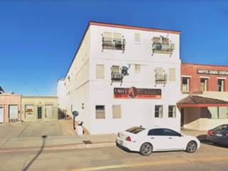
To your right, is the AZ-87 underpass built in 1936 to cross the tracks of the AT&SF railway. Just ahead, to your left at 210 E 2nd is the hotel mentioned by Rittenhouse. It was built when Route 66 was created, in 1936. Now it is an apartment complex. Notice its blue and white neon sign in the vintage photo below. The Arizona Route 66 survey lists its name as Harvell Hotel.

Chief Hotel c.1950. Source
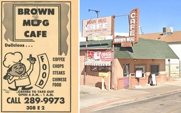
Brown Mug Cafe
To your left, after the hotel, at 308 E 2nd is a classic Café that opened in 1946. Below is its current appearance with a classic neon sign, and an advertisement they published in the 1962 local phone directory. It offered chops, steaks, Chinese food, and coffee. Open 6 AM to 1 AM!
La Posada Hotel and Historic Underpass
Both are Listed in the National Register of Historic Places
Opposite the cafe, at 303 E. 2nd Street. Winslow, AZ
The building and its landscaping was designed by architect Mary Elizabeth Jane Colter well known for her Grand Canyon buildings.
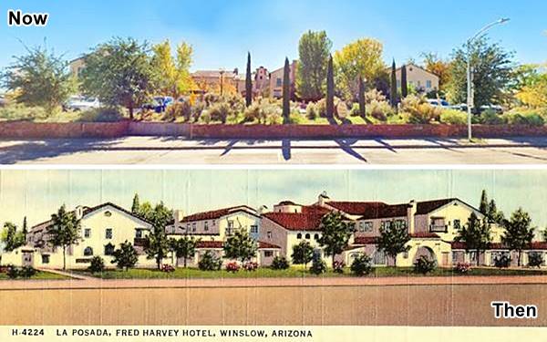
The hotel was built at a cost of over $1 million by the Fred Harvey Company (about $42 million nowadays). As Winslow was the Santa Fe railway's headquarters in Arizona, they chose it to build it.
It opened in 1930, weathered the Great Depression and closed in 1957. It remained in the hands of the railway until 1994 when Allan Affeldt and partners purchased it and restored it.
It was the last Harvey House to open, and its name "Posada" is Spanish, and means "The Inn". It is still operating (www.laposada.org). The Hotel, the railway depot and the 11 acres they comprise, are listed as a Historic Place
Valentine Diner
NW corner of N. Colorado Ave. and 2nd St. The 1960 telephone directory lists it as "Highway Diner."
To your left, across form the La Posada is this classic 1950s diner. The diner was one of at least 2,000 built by the Valentine Manufacturing Company of Wichita, Kansas.
Arthur Valentine (1891 - 1954) invented them and began producing them in 1947. They were movable diners that came in different sizes and models. The Aristocrat had eight seats.
The company gradually lost business in the 1960s and folded in 1975, the fast food chains and suburbia had displaced the small diners. There are several of them along Route 66.

Winslow Valentine Diner. Before restoration
Allen's Texaco
Across the street, on the NE corner (400 E 2nd) is the former Allen's Texaco Station. Corner office has been altered, and only one of the two service bays is there; a gable roof has been placed over the 1950s box-shaped building.
Santa Fe garage

Indian Detour Harveycar brochure, 1927. Source
On the same block, NE corner at 422 E 2nd. This building is listed as "El Gran Motors Buick Studebaker Sales" in the 1962 phone book. It opened in 1927 as the Harvey car storage and passenger building. Fred Harvey Co. took train travelers on bus tours known as "Indian Detours" in their "Harveycars" promising Off the Beaten Path" trips in Arizona; in Winslow they visited the Painted desert. The building has solid steel roof trusses to support its curved roof. Notice its large canopy. It is owned by Paul Ruscha, brother of artist Ed Ruscha.
Westerner Motel
To your left, across the N Snider, on the NE corner at 500 E 2nd, is the southern entrance to the Westerner Motel that faced both east and westbound traffic on Route 66.
Two blocks east, at 600 E 2nd, was the Beacon motel, long gone. Now it is a storage business, but you can still make out the U-shaped layout of the old motel in the new building (st. view).
There is another garage at 722 E 2nd, left (st. view) that in the 1962 phone directory figures as Southwest Motors Inc Sales & Service, offering parts and service for GMC trucks, the Arizona Survey dates it to around 1930.
As you cross the bridge, there are an old garage and another cottage style gas station:
Winslow Tire
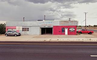
To your left, on the NW corner at 812 E 2nd, "Winslow Tire" that in the 1962 phone book sold Uniroyal tires. Now it is a tatoo shop.
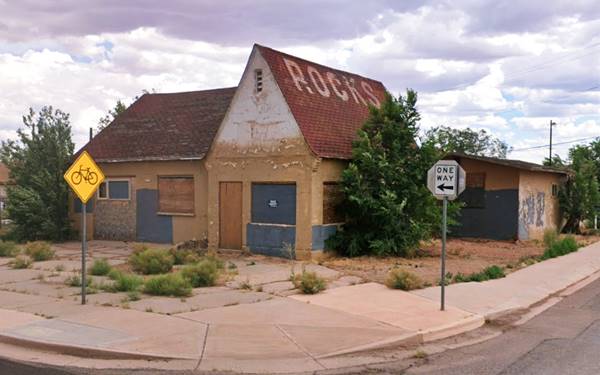
Malco Glen's East End Service
At 901 2nd, SE corner, this was Malco Glen's East End gas station in the 1962 phone book; it also advertised as "Welding 24 hour service... no job too large or too small... we go anywhere anytime"
It was a Conoco gas station from the 1930s, and is very similar to the other two in town. Later it was a Shamrock station and then a rock shop, as you can see by the word "ROCKS" painted on the gabled roof.
La Siesta Motel
Adjacent to the old Conoco, at 913 E Route 66 is the former "La Siesta Motel" which is currently the "Winslow Garden Apartments" and has retained its original appearance. Their postcard proclaimed "30 New, Modern Units. All Private Baths. Forced Air Furnace Heat, Air Conditioned... Mr. & Mrs. John Poeth."

1960s Postcard of the La Siesta motel. Source
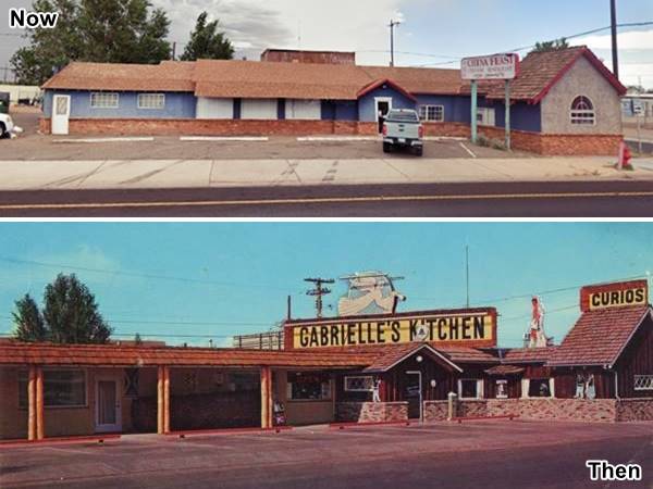
Gabrielle's Kitchen
Facing the "La Siesta", to your right, at 918 E 2nd, was this restaurant owned by Mr. and Mrs. W. H. Hunt. It opened in 1964 and was the "House of Good Food and Coffee... Coffee shop, Dining Room and Curios". Below is a "Then and Now" set of pictures:
Hale Motel later Bel Air
On the next block, to your left, at 1003 E 2nd (SE corner) are the Belaire Apartments. In the 1960s they were the Hale Motel. The U-shaped layout is still clear. Later it became the Bel Air motel at least until the mid 2010s.

El Capitan Motel (Gone)
Adjacent to the Bel Air - Hale was the long gone motel, at 1015 E 2nd El Capitan Motel. In the 1960s it was owned and managed by Mrs. T. C. Travis it offered "a pleasant, nicely furnished motel" with AC and TV in the rooms. It was razed around 2000. Opposite was the also razed Budget Motel mentioned when we drove E 3rd St.
Casa Blanca Cafe and Motel

Casa Blanca Cafe now, in the 1940s and the motel. A. Whittall, St. view & 1940 picture
Click on image to enlarge
Head east, on the second block, to your left at 1201 E 2nd is the Casa Blanca Cafe whose 1962 phone book entry says "Try our delicious Spanish Food."
The Casa Blanca Motel was adjacent and it opened in 1951 (1205 E 2nd). Casa Blanca is Spanish for "White House". The motel has survived, as apartments and so has the cafe, as you can see in the image -click on it to enlarge .
Imperial 400 Motel
Across the street on the next corner, at 1224 2nd Street and spanning the block between 2nd and 3rd streets is this former "Imperial 400 Motel". It was part of a motel chain founded in 1959.
Its buildings had a characteristic "butterfly wing" roof (like this motel has). Their slogan was "Aye, royal Accommodations at Thr-rifty Rates."
The business went broke in the mid 1960s and sold out to new owners. The motel is now the College View Apartments, and the pool has gone. There are several Imperial Motels along western Route 66.

1960s Postcard of the Imperial 400 Motel. Source
Imperial '400' Motels and Route 66
Learn all about these Space Age motels along U.S. 66.
> > Read more: Visit our Imperial "400" Motels on Route 66 webpage.
Holly's Mobil, Little Sue's Cafe and Dairy Queen
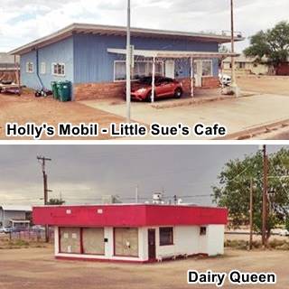
On the next block, to your right is a solitary blue building to the right, at 1313 E 2nd, it was Holly's Mobil Service station and Little Sues Cafe. Both listed in the local phone directory. The gas pumps island is still visible.
To your left, opposite Holly's and in the process of being reformed that was the town's Dairy Queen, at 1314 E 2nd. Both are pictured.
Ahead on the next block, to your left is the Whiting Bros. station that we described along the westbound 66 on E 3rd. St. This is the station facing E 2nd.
The box-shaped building opposite, at 1401 E 2nd, to your right, is described as a "Trading Post" from 1941 in the Arizona Route 66 Survey, but the 1960 phone directory lists it as "Eddy's Body Shop", an auto repair shop. Next to the Whiting Bros. is another old gas station, with its concrete pumps island (1452 E 2nd St.) phone listed in 1960 to Eug. Gutierrez.

Big Indian Trading post's sign over the years. A. Whittall
Joseph Joe's Big Indian Trading Post
To your right (1502 E 2nd St.) is the Sweetland Furniture Mfg. Co., formerly Joseph Joe's Big Indian Trading Post. It appears as being owned by Ernest Voelkel in the 1960 phone book. The place had a sign with an Indian Chief that has fallen apart. See the image below showing its appearance in 2022, 2011 and in the mid 1990s (Source).
Continue your Road Trip
This marks the end of your Route 66 tour across Winslow, you can head west into Leupp Corner to continue your Route 66 Road Trip. Don't miss the awesome natural beauties near Winslow, read on below.
Tours & Itineraries plus outdoor Fun
The area around Winslow
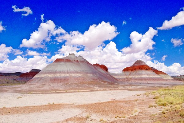
At Winslow, Route 66 crosses the southern part of the "Little Painted Desert", with bright red colored cliffs and grayish - red sands. It extends north into Utah and lies between the eastern plateau and the Little Colorado and Colorado Rivers.
Heading west from Winslow the road gradually climbs into the Arizona Plateau, a table-land which will rise all the way to Flagstaff.
To the west lie the snow capped summits of volcanic San Francisco Peaks around Flagstaff. They are young volcanoes (6-million-years-old) and the highest one is Humphreys Peak which is the highest point in Arizona (12,633 ft - 3.853 m).
US 66 at Winslow leaves the Little Colorado River behind which takes a turn to the nortwest and runs towards the Colorado River and the Grand Canyon. Its original name was Rio Lino (Flax River). The countryside has red sandstones and shales both red and light colored. There are some lava buttes.
National and State Parks, Outdoors
Little Painted Desert

Little Painted Desert. Credits
18 miles north of Winlsow along NM.87. There is a road that leads to the rim, and from an overlook you have great vistas of the coloured hills that are amazing. This is a Map with Directions from Winslow to the Little Painted Desert.
Homolovi State Park
7 miles north of Winslow (Map and Directions) on the Little Colorado River.
Its 4,500 acres protect an Anasazi settlements (ancestral Hopi villages) from the 14th century. It also has ruins of the 1870s Mormon settlement of Sunset. There is a visitor's center and museum plus trails and a campground to enjoy nature.
Barringer Meteor Crater
26 miles west along Route 66. See our page on Barringer Crater. This is the Map with Directions.
Petrified Forest National Park
Tip: consider visiting the Petrified Forest National Park (near Holbrook) on your Road Trip.
The Only National Park on Route 66
Sponsored Content
Lake Havasu City

Lake Havasu City, the lake and London Bridge. Source
The resort town of Lake Havasu City on Lake Havasu has beaches along the lake's scenic shoreline, an active nightlife and the original London bridge (you can take a Tour to visit it)
The adjacent state park is open 24 hs, and there is an entrance fee. It is located on a reservoir on the Colorado River. You can hike and enjoy the riverside.
Visit the scenic shoreline with beautiful beaches, nature trails, boat ramps, and many convenient campsites.
>> Book your Hotel in Lake Havasu City
Learn more about the outdoor sites in the Havasu State Park official website.
>> Book your Hotel in Holbrook AZ

Credits
Banner image: Hackberry General Store, Hackberry, Arizona by Perla Eichenblat
Jack DeVere Rittenhouse, (1946). A Guide Book to Highway 66.
Lyrics of "Take it Easy" by Jackson Browne, Delbert Mcclinton, Glenn Lewis Frey used under Fair use.


