Geary is on the Original Route 66
Route 66 Mural, Geary
Index to this page
About Geary, Oklahoma
Facts, Trivia and useful information
Elevation:1,549 ft (472 m). Population: 1,280 (2010).
Time zone: Central (CST): UTC minus 6 hours. Summer (DST) CDT (UTC-5).
Geary is a town set upon the county line and spans both Blaine and Canadian counties in Central Oklahoma.
The site where Gleary was built, has been inhabited for more than 10,000 years. The Native American population that peopled the area in the mid 1800s however, was settled there by the U.S. government:
Cheyennes & Arapahos
The Cheyenne lived near the Great Lakes in Minnesota and moved towards the Great Plains in the 1700s. The Arapaho lived in Montana, Wyoming, South Dakota and Canada. Both nations met in the plains and formed an alliance whose territory ranged from Texas to Montana. Despite signing a treaty with the U.S. government (1868) which guaranteed the integrity of their traditional lands, European settlers intruded on their territory. This caused conflict and war; a second treaty (1867) promised the Arapaho a Reservation in Kansas, but they opted to move with the Cheyenne to a reservation next to Fort Reno.
But then the US Congress organized the Oklahoma Territory from land formerly ceded to Indian Nations. One of its counties, was County "C", which later became Blaine Co. It was "reserved" from 1890 until 1892, when it was opened to settlement during the "Cheyenne-Arapaho Opening" in April 1892.
Geary is located on land that was the homestead of Shubell and William Huff, father and son, who sold part of it to a Townsite company. Its original location was half a mile northwest of its current site but it was moved to be close to the tracks of the Choctaw, Oklahoma and Gulf Railroad that was advancing west from El Reno.
The name Geary is derived from Le Guerrier
The French surname "Le Guerrier" means "The Warrior". And the town's name is that of a scout and guide of the Old West, Edmund Gasseau Choteau Le Guerrier (1840 - 1921). (pronounced "Lay Gay-rear") He survived the Sand Creek Massacre of 1864.
He was a mixed-blood French and Cheyenne and acted as an interpreter for the U.S. government during the wars between the Cheyenne and the US. He later owned a ranch 3 miles northeast of what is now Geary, which adopted his name but with an easier pronounciation.
The post office opened in October 1892 and adopted the name of Geary.

1865 Portrait of Edmond Guerrier by Charles M. Bell.
Cheyenne Arapaho Opening
3.5 million acres of land were opened for settlement by the U.S. government on April 19, 1892. The settlers flocked to the Oklahoma Territory to claim their 160-acre homestead plot. This land had belonged to the Arapaho-Cheyenne Reservation which had been reposessed by the US Government after distributing 160-acre plots among the tribe members and buying back the rest.
By the end of the "opening", almost 80% of the land remained unclaimed, and by 1892 only 7,600 people had settled there. The area at that time was going through a terrible drought (1885-1896) and crops failed giving the farmers a very bad time. Furthermore there were no railways to get the produce to the markets.
The town was formally established on May 3, 1898, when the Choctaw Railroad (later the Chicago, Rock Island, and Pacific Railroad) built a line from Oklahoma City.
It was, and still is, a rural community based on farming. The original alignment of Route 66 only passed through it between 1926 and 1932, when it was shortened and aligned further south, bypassing both Calumet and Bridgeport.

Getting to Geary
Heading east from Geary down Route 66 are the towns of: Calumet (11 mi), El Reno (23 mi.), Yukon (37 mi.), Oklahoma City (52 mi.), and Edmond (63 miles).
To the west, are Bridgeport (10 mi.), Hydro (21 mi.) and Weatherford, 28 miles.
Where to Stay: Hotels in Geary
Book your hotel in nearby El Reno, 23 miles to the east.
>> Book your Hotel in El Reno
Lodging Near Geary along Route 66
There are several hotels in the area close to this town. Alternatively you can also find your accommodation along Route 66 in the neighboring towns and cities. We list them below (listed from east to west):
On Route 66's Main alignment
Eastwards
Westwards
>> There is a RV campgrounds close to Geary.
Weather in Geary
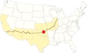
Location of Geary on Route 66
The average high in July (summer) is 93°F (34°C) and the average low is 69°F (21°C). In winter (Jan) the average high is 46°F (8°C), while the average low is 26°F (-3°C).
The yearly precipitation is 28.7 inches (729 mm), and the rainiest months are May and June with over 4 in each (100 mm). Snowfall averages 9.5 inches (24 cm) mostly between Nov. and March.
There are about 88 wet days every year. Thunderstorms take place during spring and summer, and provoke hail and tornadoes.
Tornado risk
Geary is located in Oklahoma's "Tornado Alley and experiences some 11 Tornado watches annually
Tornado Risk: read more about Tornado Risk along Route66.
Map of Route 66 through Geary Oklahoma
Below is a map published in 1924, two years before Route 66 was commissioned. It marks the "auto trails" which were dirt surfaced roads that were suitable for cars. When Route 66 was created it followed the pre-existing "#3" highway alignment from Yukon to Weatherford. This was the "Postal Route".
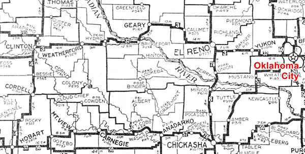
This 1926 alignment was bypassed when the Pony Bridge was built south of Geary in 1934. The new alignment linked Hydro with El Reno via Bridgeport Hill cutting off the town of Geary (and Bridgestone and Calumet) from Route 66.
Look for Geary on our Oklahoma Route 66 Map, with the complete alignment and all the towns along it.
The Old 1926 alignment of Route 66 near Geary
See this Route 66 1926-34 alignment map through Geary.
The later intact 1931-34 alignment of Route 66 that runs from Bridgeport Hill, past Hinton and Bridgeport to Hydro completely bypassed Geary. It was paved in Portland Concrete in 1931, 33 and 34. It is the current alignment of OK-66. It remained operational as US-66 until 1962 when I-40 replaced it and became the new roadbed for US-66 till its decertification.
Route 66 Alignment near Geary
With maps old maps and all the details:
- Clinton to Texola (next)
- Yukon to Clinton (Geary's)
- Chandler to Yukon (previous)
Route 66 landmarks & attractions
Sights in Geary
- Geary "city tour", read below
- Parks
Geary was not mentioned by Rittenhouse in his 1946 Guidebook to US Highway 66, because it had been bypassed 12 years before he drove past it.
Head into town from the Route 66 alignment coming from Calumet, at the junction of US 270 and US 281.
None of the original Route 66 gas stations have survived but the town has several interesting landmarks.
Old Neon Sign
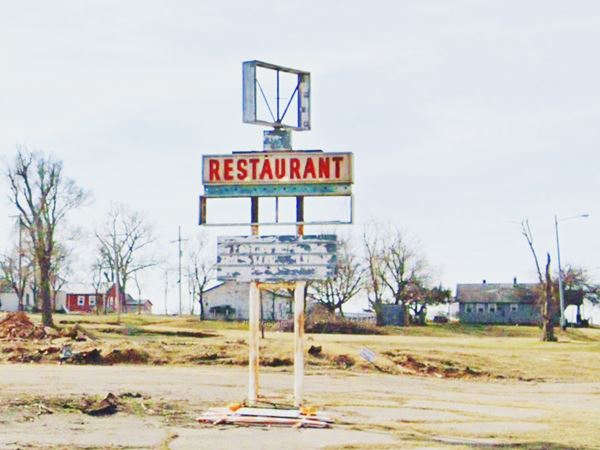
At the crossroads to your left is a neon sign of a now vanished restaurant. To your right a garage that may have been a service station in the past. Turn right and head into town.
As you cross the railroad tracks, to your left in a small field, you will spot a steel sculpture of a buffalo (street view), it is the work of the local FFA.
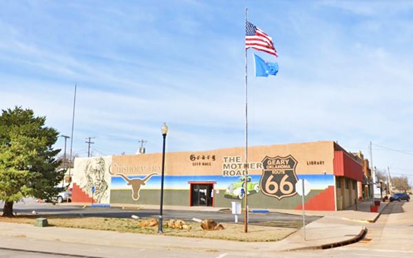
On the SW corner of S Broadway and W Main St. you will see a mural. On the City Hall's eastern wall. It says Chisholm Trail - The Mother Road, and has a Route 66 Shield.
Brake and Sons building
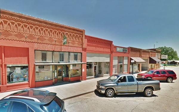
Turn left along West Main St. it has many red-brick buildings from the early 1900s. To your right, at 112 W Main is a former Furniture store owned by Brake & Sons. It was built in 1910.
Historic Route 66 sign
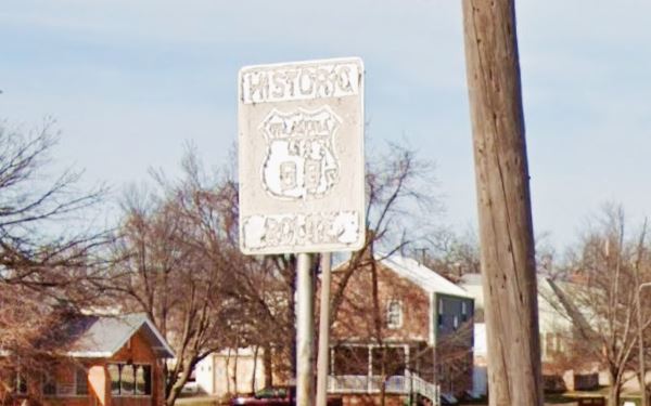
On the next corner (NW on W Main and S Blaine Ave.) you will see a faded and peeling "Historic Route 66" sign. This is quite unexpexted because Route 66 did not enter the town, it ran south from the southern tip of Geary at US 281 and US 270, the Oklahoma DOT's Route 66 Map in Geary suggests that "there may have been an unofficial marked city route through Geary, however no records have been found to substantiate an official routing into the business district."
There is another similar sign on the junction of SW Boulevard and SW South St. (street view), this was the "Postal Route".
Retrace your steps and cross Broadway. Here to your right is the historic Gillespie Building.
Historic Gillespie Building
Across the street, on the SE corner, at 100 E Main St., Geary, OK.
Listed in the National Register of Historic Places
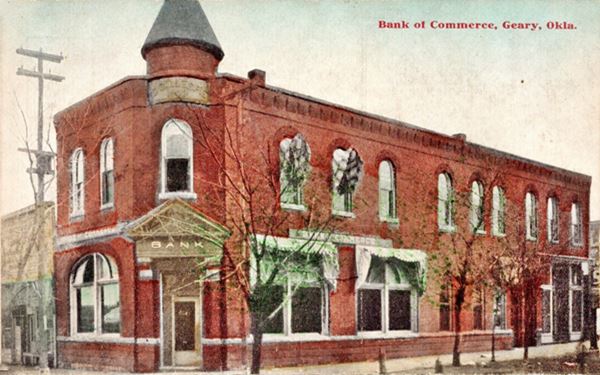
The two-story red-brick building was built in 1903 by G. F. Gillespie as the Citizens Bank which later was renamed Bank of Commerce.
It later became the American State Bank that failed during the Great Depression in the 1930s. Finally in 1984 it was repurposed by the Canadian River Historical Society as a museum (more on this below).
The building is relatively unchanged as you can see in the "Then and Now" sequence below, it has lost the conical roof that capped the corner tower.
Vintage postcard Gillespie Building, titled "Bank of Commerce Geary"
Ed Gillespie building as it looks today
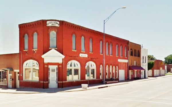
Across the street facing the old Bank of Commerce building is the "jail" and the outdoor section of the "museum".
Canadian River Historical Museum
100 E Main, Geary OK.
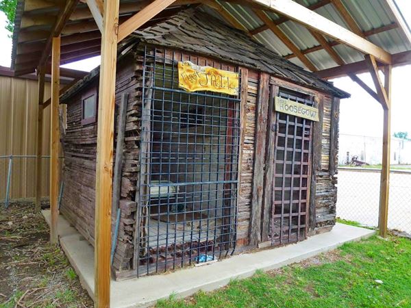
See the Rock Island caboose (caboose street view), the area's first log jail built in 1893 and used until 1909, pictured below, and themed rooms with historic artifacts, flags, tools, Native American objects and more!
The main exhibitions are housed in the historic Gillsepie Building and admission is free of charge.
Hoosegow jail
The word "hoosegow" comes from the Spanish word "Juzgado" that means a court and is pronounced "hoosegau", as the jail and courtroom were usually located in the same building, it also applied to the jail.
On the north side of the museum grounds, you can spot a 1950s gas station (street view), it has a flat roof with a "stepped" design with the garage area higher than the office. The office has an angled corner, a design used by Sinclair, Gulf and Texaco in the 1930-60 period.
Now drive east and on the next corner (NE) is another historic landmark.
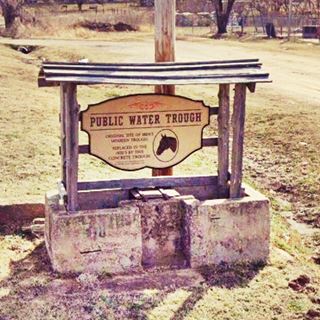
Historic Public Water Trough
On Jct. of Main, Canadian and Northeast Blvd., Geary, OK.
Listed in the National Register of Historic Places
A trough (pronounced trof) is a long shallow container from which animals eat or drink. Geary has a historic public trough.
This historic trough and well served the horses of visitors and locals between 1901 and 1939, after which horse-drawn vehicles declined. A team of two horses could be watered without having to be unharnessed from the wagon.
The concrete trough measured 40 by 89 inches. The first trough was a wooden one, fed by a windmill and pump (replaced in 1903).
Jesse Chisholm Burial site
Listed in the National Register of Historic Places
This landmark is located 8 miles northeast of Geary (See map with directions).

Historic public water trough. Geary. Credits
Jesse Chisholm (c.1805-1868) was a trader, guide, interpreter and explorer who lived the last 40 years of his life in Indian Territory. He died and was buried next to Left Hand Spring on March 4, 1868.
He built many trading posts and a trail from Kansas City to Red River, Texas used to drive cattle overland in the days after the American Civil War.
Apart from the grave (red arrow in the image), there is a "dual" granite marker at the site, on one side it has Chisholm's bio, and on the other side is the "Chief Left Hand" memorial. Left Hand or Niwath (1840-1911) was the main chief of the southern Arapaho people, he signed the Treaty of Medicine that relocated his nation in Oklahoma.
This marks the end of your Geary city tour.
Head south to drive along the original alignment of route 66 and cross the Historic Canadian River Bridge
Natural Attractions
American Horse Lake
13 miles west of Geary (map with directions). The lake has a surface of 100 acres and almost 7 miles of shoreline, it is a "no wake lake". It is a place chosen by fishermen and hunters, there are picnic tables and water.
Some sponsored content
>> Book your Hotel in Tulsa

Credits
Banner image: Hackberry General Store, Hackberry, Arizona by Perla Eichenblat
City of Geary www.cityofgeary.com official website.
The Public Water Trough, the
Bridgeport Hill - Hydro Route 66 Segment, and the
Gillespie Building, NPS historic site registration forms.


