U.S. 66 in Oklahoma City
Index to this page
About Oklahoma City, Oklahoma
Facts, Trivia and useful information
Elevation: 1,201 ft (366 m). Population: 709,330 (2024).
Time zone: Central (CST): UTC minus 6 hours. Summer (DST) CDT (UTC-5).
Oklahoma City is the Capital of Oklahoma State. It is known as "OKC", "The City". Its metro area has 1,474,000 residents.
The area around Oklahoma City has been inhabited for over ten thousand years, as proven by the nearby site at Luther, which dates back to 9,000 BP. The current Native Americans in Oklahoma were relocated there from their original territories in the eastern USA by the American government. The policy at the time was to resettle the natives west of the Mississippi River in the "Indian Territory". Later, in the late 1880s, pressure to settle the area with European settlers led to a change in policy: the Oklahoma Territory was carved out of the Indian Territory (1890), and surplus land was acquired from the tribes to "open" it for settlement.
The land was settled by means of "Land Runs", where the future homesteaders rushed in to stake out and occupy their lot on a given day and time. It was a race to grab the land and it worked admiraly well.
Farming was the original economic base of the community and when Route 66 was aligned through the town in 1926 it brought a growing flow of travelers and prosperity until realigned in 1954 after the completion of two modern expressways on the northeastern part of Oklahoma City.
Where to Stay
Book your hotel in Oklahoma City
> > Book your Hotel in Oklahoma City
Lodging Near Oklahoma City along Route 66
There are several hotels in the area close to this town. Alternatively you can also find your accommodation along Route 66 in the neighboring towns and cities. We list them below (listed from east to west):
On Route 66's Main alignment
Eastwards
Westwards
>> There are many RV campgrounds in Oklahoma City.
Oklahoma City’s Weather
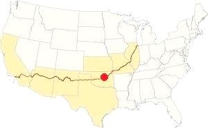
Location of Oklahoma City on Route 66
Summers in the central part of Oklahoma are hot and humid. Winters are relatively mild (but snowstorms can happen) and the other seasons are subject to frequent variations. North winds prevail in winter and during summer those from the south and southeast.
The average yearly temperature is about 61.5°F (16.4°C). During winter the mean temperature is 39.2 °F (4 °C), with highs and lows between 48.5°F (9.2°C) and 25.6°F (-3.5°C).
Snow: around 7.9 inches fall every year (20.1 cm), mostly between December and March.
During summer the average temperature is 83.0 °F (28.3 °C) with average highs and lows of 94°F (34.5°C) and 71°F (21.5°C).
The average yearly rainfall is around 36.5 in. (928 mm). And Oklahoma City has some 84 rainy days per year. Most rain falls during summer.
Storms (thunderstorms) are common in spring and also summer; some may come with hail and strong winds, and also tornadoes. Tornadoes can hit at any time.
Tornado risk
Oklahoma City's metro area is one of the most tornado-prone ones in the whole world: about 150 tornados have struk this area since 1890. Some of them were very strong (F5 on the Fujita scale, which is the maximum value).
Oklahoma City is located in the "Tornado Alley" and experiences approximately 10 Tornado watches every year.
The 1999 F5 Tornado
It struck on 05.03.1999, with a path 38 miles long and 1,760 yards wide, killing 36 and injuring 583 people. It caused $1 billion in damages. It was part of an outbreak of nearly 60 tornados.
An F4 tornado hit neighboring Bethany on 11.19.1930, killing 23 people. It is one of the worst three tornados in Oklahoma since 1900.
Tornado Risk: read more about Tornado Risk along Route66.
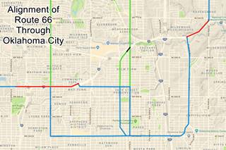
Map of Route 66 through Oklahoma City
The color key to our Map showing Route 66's alignment through the city is the following:
Pale Blue: Historic Route 66 alignments
Green: Beltline alignments.
Black: segment cut by the freeway.
Red: buried under the freeway.
You can also check out our Route 66 Map of Oklahoma, with the complete array of alignments across the state, and all the towns on US66.
Route 66 Alignment near OKC
With plenty of old maps and all the information of the old roadway.
- Yukon to Clinton (next)
- Chandler to Yukon (OKC's)
- Tulsa to Chandler (previous)
Route 66 landmarks & attractions
Sponsored content
Sights in Oklahoma City
The Historic Context Route 66 in 1946
Jack DeVere Rittenhouse in his "Guide Book to Highway 66", which he published in 1946 after driving Route 66 from Chicago to Los Angeles, tells us what the road was like during its heyday.
Rittenhouse mentions the "Belt Line 66" for those who do not wish to stop in the city, drivers could "cut across the northern suburbs of the city and save considerable time". He follows that route turning along Britton Road (there were two gas stations there) and going through Britton. The town had "Ford garage; Owl Court; stores and cafes", then, 3 blocks west of the town the road turned sharply south and passed through Nichol's Hills. to turn again sharply west 3 miles south and met the "City 66" 2 miles west, following this intersection were "many fine tourist courts" such as: "Boyer, Deluxe, Rush, Carlyle, Major, Oklahoma and Hutchinson".
For those entering the city he gave the names of several -now demolished- hotels: the Black, Kingkade, Park-O-Tell, Oklahoma Biltmore and Skirvin. He mentioned the Dolores Restaurant as a "Good Cafe". Leaving town, to the west, he mentioned that Bethany was founded in 1906 by members of the Nazarene Church, which -even in 1946- did not allow cigarettes, tobacco or liquor to be sold in town, no movie theaters either. Just west, after the bridge across the North Canadian River was Lakeview Court overlooking Lake Overholser.
Drive Across Oklahoma City along "City 66"
Leave the freeway at Exit 128A and head south along Lincoln Avenue. In the distance, in the distance you can see the State Capitol. The motels and diners or restaurants that dotted the highway into the city are now gone. It is a wide boulevard with plenty of greenery and grass.
Finally, you reach the Capitol. In the past, as recently as 1956, Route 66 (in those days Business 66 and U.S. 77) met US 62, US 270 and State Hwy. 1 here in a "T" intersection on 23rd Street. Route 66 turned right (westwards). But nowadays the "Oklahoma State Capitol Complex" (Capitol Campus) surrounds it, so former US 66 curves gracefully around it.
Oklahoma State Capitol
Listed in the National Register of Historic Places
2300 N. Lincoln Blvd. Oklahoma City was designated as the territorial capital in 1890 and it became state capital in 1910. Work began on the building Renaissance Revival, Neoclassicalin 1914 and although the original Renaissance Revival - Neoclassical design included a dome, it was not built due to cost overruns (see the vintage postcard). It was completed in 1917.
An earthquake of 5.5 magnitude in El Reno hit the building causing several cracks in the Capitol. In 1998 the Oklahoma Centennial Act funded the dome which was completed in 2002.
Capitol Trivia
The complex that surrounds the building includes oil wells. It is the only state capitol grounds in the US with active oil rigs.
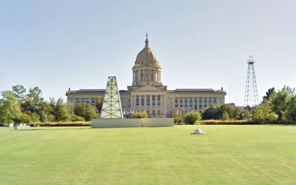
Drive around the Capitol Campus and take a right westwards along 23rd Street. One block past the overpass of I-235 ⁄ US 77,
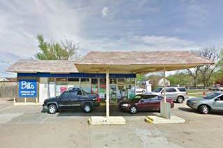
on its western tip is a rather old Tire repair shop (23rd St. and 2400 N Robinson Ave), maybe in the distant past it was a gas station.
Two blocks ahead to your right is what once was a Café.
O’Mealey’s Cafeteria
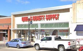
At 319-21 NW 23rd St. Oklahoma City had at one time, more cafeterias per capita than any city in the US, it was known as the "Cafeteria Capital of the World", now most have gone out of business, like O'Mealey's.
Naomi O'Mealey and her partner Ralph Geist opened their first cafeteria at NW 23 and Classen as "the Classen Cafeteria" then O'Mealey's, they eventualy had four of them, they all shut down by 1982. Comparing the "Then and Now" photo sequence below, we can see that there have been changes, but the "feather style" frieze on the building to the left is unchanged. Now it sells cosmetics as a Queen's Beauty Supply store:

O’Mealey’s Cafeteria vintage postcard
66postcards.com
Next to it are vintage-styled Neon Signs: street view), Just ahead, at the corner of 23rd and Hudson Ave. is a Cottage Style Gas Station.
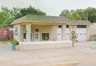
Phillips 66 station
401 NW 23rd St, Oklahoma City. This station built in 1935 on Route 66 was a Phillips 66 built in the domestic - cottage style typical of that time which was used to blend into the surrounding urban setting.
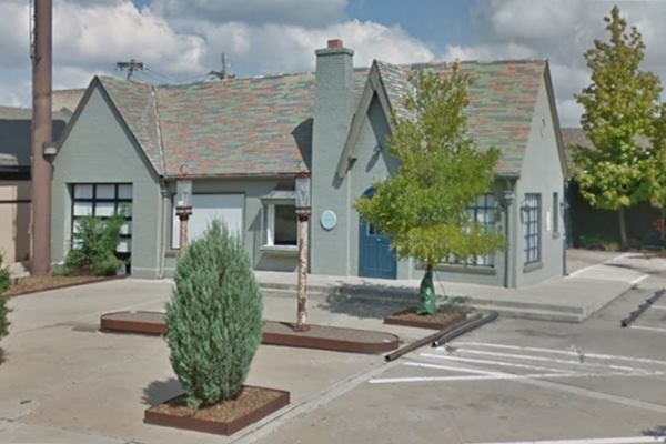
Cheever’s Cafe
2409 N. Hudson, Cheever's is adjacent (north side) to the gas statin.
The first baby born in Oklahoma City in 1889 was named "Oklahoma Belle Cunningham". She married Lawrence Cheever in 1912. When Lawrence lost his job during the Great Depression she kept the family going by selling rosers from her garden.
In 1938 they moved into her grandmother's Victorian style home on Hudson Ave, bought it from her and decorated it in Art Deco style: it became their flower shop and remained in the family for three generations until 1998 when they sold it. Cheever's building is now a cafe.
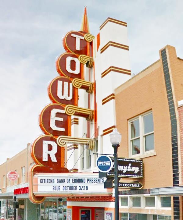
The block along 23rd Street has a Classic Movie Theater with an amazing neon light marquee.
Tower Theater
425 NW 23rd St. The theater opened in 1937 it declined during the 1970s and closed in 1985. It was restored between 2014 and 2016 and is now open, it has the historic theatre space and five bars and restaurants. More at their website: https://towertheatreokc.com.
At the western tip of the block turn right and go north for one block. To your left is a Former Texaco filling station.
Former Texaco Station
2425 N Walker Ave. This is a former Texaco station built in 1929. It has an early 1960s design that replaced the Former Teague set by the company in the 1937. Thinner canopy, no crests on top of it, sleek look. It was Elmer's Texaco from 1953 to the 1970s. It has been restored and now is "The Pump" Bar.
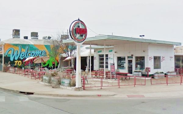
Head west for six blocks. To your right is N Western Avenue, where the 1930-33 Route 66 City alignment and the 1933-54 Alt 66 alignment met.
We describe it below. You can skip it and continue west on 23rd street along the 1933-54 alignment.
N Western Ave. Alignment (1930-33 City 66 & 1933-53 Alt 66)
There are only six places along Route 66 where an Alternate 66 alignment existed: From East to West they were the one into Chicago, Carthage MO, the one in Joplin MO, Oklahoma City, Alt 66 in San Bernardino, California, and the one leading into Los Angeles CA.
Turn right and head north along the avenue, you will pass by the imposing First Presbyterian Church and Fairlawn Cemetery, it is a residential district. After one mile, to your right at NW Eubanks St. is a Vintage gas station.
Former Canopy style gas station
3620 N Western Ave. This is a "Canopy" style gas station, a design favored by all gasoline companies from Texaco to Conoco to Sinclair in the 1920s and 30s, its main feature was an imposing canopy over the pumps, with thick columns supporting it. This one has retained its original shape and the two door garage is also visible. The pump island is now a wide and low wall. Crown Heights Florists has preserved the building as you can see in the image below (Click images for street views).
Across the street is a former ice-box style gas station with two garage bays and the office on the north side, it is on a corner lot. Now it is Weldon Jack Barbershop & Provisions (3621 N Western Ave, Oklahoma City) and this is its Street View.
Keep northbound and two blocks ahead, to your left is an Old Texaco (pictured above).
Former Texaco station
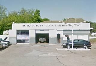
3721 N Western Ave. The place is now a repair shop (Autobahn Foreign Car Repair Inc), but it was a Texaco station based on its design (office and 2 bay garage) plus the old signpost still standing (without the texaco circle in it) at the corner. It is pictured above.
Across the street by the church, is a marker at the corner with a brass plaque on it which reads "Crown Heights", the name of the residential neighborhood created between 1930 and 1941 (street view). Ahead, at N Western and 39th Street 1930-33 Route 66 coming from the city met the 1931-36 Beltline coming from the North and both merged into US 66 heading west along 39th.
From 1933 to 1953 the southern road became ALT 66 and in 1936 the northern road moved two blocks west to Classen. There are no other attractions along 39th here near N Western; but there are some to the north along N Western which we describe in Beltline along N Western.
Turn around and return to your starting point on 23rd and North Western and turn right, westbound.
West along 23rd Street: City 66
Leaving the N Western Ave alignment behind, just one block west is the very first alignment out of the city, the 1926-30 US 66 alignment along Classen to 39th St.
There are two landmarks right here and no need to drive Classen northwards beyond the first block. On the south side (left) of 23rd is the "Gold Dome".
Gold Dome
Listed in the National Register of Historic Places
1112 NW 23rd St, Oklahoma City, SE corner of Classen
This dome is a historical landmark built in 1958 (not that old, in fact, younger than Route 66 here in the city, which no longer went along 23rd St. when it was built).
Commissioned by the now defunct Citizens State Bank it was the fifth geodesic dome constructed in the world, and also the first to be used as a bank. Modern and futuristic back in 1958 it was designed by Bailey, Bozalis, Dickinson, and Roloff.
The "Geodesic dome" is the creation of architect Buckminster Fuller and is a hemispherical shell built with a lattice structure composed of small triangular elements that give it strength and distribute the load throughout the structure. This particular dome has 625 elements from 7.5 to 11.5 ft (2.3 - 3.5 m) and its diameter is 145 feet (44 m).
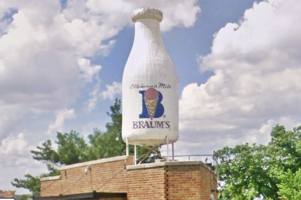
Turn right along Classen and just ahead (you won't be able to miss it with its Milk Bottle on the top of the roof), is another historic landmark.
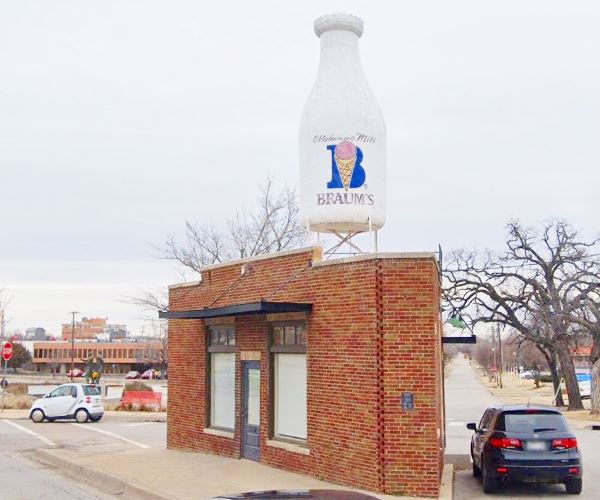
The Milk Bottle Grocery
Listed in the National Register of Historic Places - Americana
2426 North Classen Blvd. It stands out and you just can't miss it, it is a typical example of Route 66 kitsch. Built in 1930 on the original alignment of US 66 it was on prime property: all the traffic through OKC passed in front of it.
It is located on a tiny trianguar block between Classen and N 25th St. a small 350 sq.ft. red brick building with a towering milk bottle atop its flat roof.
The bottle was built in 1948 and was leased to promote dairy related advertisings, repainted according to the milk brand being promoted.
It was originally a grocery but later housed many types of business, from cleaners, to a real estate office or a sandwich shop. Below is its current appearance:
Continue west along 23rd following the 1933-54 US 66 alignment which further ahead followed May Ave and 39th St. On the next block, to your left, a former restaurant from the 1960s.
Former Heap Big Beef
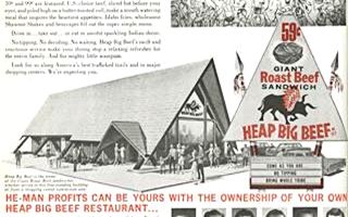
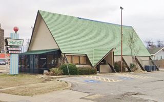
1400 NW 23rd St. Heap Big Beef Roast Beef Restaurant was a late 1960s franchise now defunct. This building is currently "Mutt's Hot Dogs (by the way, check out its neat sign). The outer building is almost unchanged as you can see below with a "Then and Now" comparison of Mutt's with the original franchise print ad from 1967 (click images to enlarge).
Two blocks west to the right, on the corner, is a former Teague Texaco Gas Station.
Old "Teague" styled Texaco Gas Station
1601 NW 23rd St, Oklahoma City
The old and now empty sign on the corner is shaped like a Phillips 66 logo, but the building is Texaco with the classic design created in 1937 by Walter Teague.
The design is simple, clean, and streamlined: a minimalist box-shaped station with a flat canopy. The canopy has rounded corners and two ridge-like crests running across its top. Now it is "Magic Auto Repair".
>> Learn all about the Teague-style Texaco service stations along Route 66
Two blocks west to your left is what looks like an old motel, but no, it never was a motel, the "Flamingo Apartments".
The Flamingo Apartments
1844 NW 23rd St, Oklahoma City. Built in 1961 (several years after US 66 was moved further north, off 23rd Street), in bleak brown bricks it was known as "University Manor Apartments".
Now it has been renovated with pink walls, cacti, and a Southwestern US style, so it does look like a motel, even the name "Flamingo" is reminiscent of Road trip motels. This is its street view. Did you know that there was at one time a "Flamingo Motel" on Lincoln Avenue, just north of the State Capitol? It closed in the 70s with all the other ones that were located there, and was torn down.
Drive west until reaching North May, where Route 66 takes a right and goes north, here to your left is an old Filling station
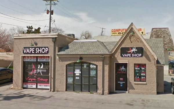
Former Cottage style filling station
2900 NW 23rd St. Located on the SW corner of N May and 23rd, this is a strategic location and here is a former 1930s cottage "domestic" style filling station. The place is currently A&M Vape Shop.
Five blocks to the south, although it is not on Route 66, is a Gull Wing Phillips Gas Station which is worth the visit.
Phillips Gull Wing Station
1900 N May Ave. This gas station pictured below is a former Phillips 66 gas station from the 1960s. At that time, Phillips Petroleum Co. standardized their filling stations across the US, adopting a modern design.
It had a large triangular "gull-wing" canopy which was supported at its narrow tip by a pole designed to look like an oil derrick. The pole was capped with a Phillips 66 revolving sign.
There are two "Gull Wings" in this area (the other is now Pinos Tire Shop on 4843 NW 23rd St, OKC - Street View).
> > Learn more about Phillips 66 Gull Wing stations on Route 66
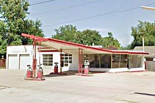
Head north then along N. May and three blocks past 23rd, at 2700 N May to your right is a Gas station, pictured above. Now a convenience store.
Keep northbound and 7 blocks ahead, to your left is a Classic 1950s building.
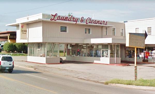
Metro Cleaners building
3131 N May Ave. Built in 1953 on what then was the 1933-54 US 66 and which later became Bus. 66 until 1979, this building is the work of Thompson & Ball.
It has a revolutionary "drive-thru" laundry, a laundromat, now a vacant flower store (Granada Floral) and apartments on the second floor. Notice the slanted glass windows and the neon sign at the corner with an arrow included in its shape, now in disrepair.
Below is its current appearance and this is its 1950s look from its brochure.
Northwest Shopping built across the street is also the work of Thompson & Ball (1953).
Route 66 along N. May turned left at 39th St. and met the Beltline alignment there. The 1955-76 Beltline
came from the north along N. May read our description in Oklahoma City Page #2.
Also, in Oklahoma City Page #2 we detail the attractions west of this point. See Route 66 west towards Yukon.
But, there are more landmarks to the east, between N May and Classen. Drive along NW 39th Street to see them.
Vintage Gas station
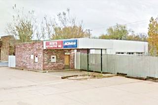
2256 NW 39th St. To your right, on the SE corner. A former gas station (pictured below), the two garage doors are visible on N Young Blvd. It has a red brick and a flat roof canopy. The concrete pump island is still there. Currently Bob's Automotive, an auto repair shop.
On the next block, to your left is a 1920s gas station.
1920s Gas Station
2139 NW 39th St
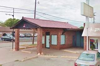
This 2,200 sq ft brick building dates back to 1920 has a gabled canopy over the former gas pump island. Is is located on the NE corner (at N. Barnes Ave.) which has always been part of Route 66 since 1926. Now a coffee shop.
It is pictured below (Gabled canopy). Click on both images for street view.
Along NW 39th, east of this point which was part of Route 66 from 1926 to 1954, there are no other landmarks or attractions. So turn north along N. Barnes Ave. towards the post 1954 alingment. At the frontage road next to the freeway is a 1950s motel:
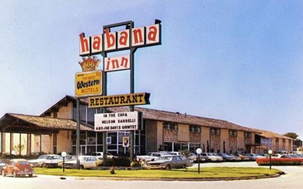
Habana Inn
2200 NW 40th St. This is now the Southwest's Largest Gay Resort, and dates back to the 1960s. The "Then and Now" sequence below shows us that the trees have grown, the sign has changed, but the building's exterior is unchanged.

This is the End of the City Route 66 alignments in Oklahoma. On our Oklahoma City Page #2 we detail the sights west, from North May Ave. towards Yukon and the Beltline Alignments from Edmond that bypass OKC.
More OKC attractions on the Next Page
We describe the rest of Oklahoma City's attractions on Oklahoma City Page 2
Some sponsored content
>> Book your Hotel in Tulsa

Credits
Banner image: Hackberry General Store, Hackberry, Arizona by Perla Eichenblat


