The first alignment of Route 66
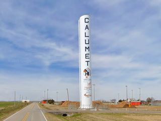
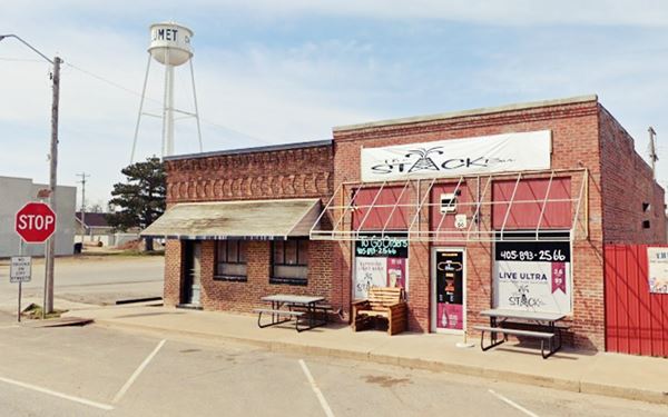
Main Street and water tank, Calumet
Index to this page
About Calumet, Oklahoma
Facts, Trivia and useful information
Elevation:1,381 ft (421 m). Population: 507 (2010).
Time zone: Central (CST): UTC minus 6 hours. Summer (DST) CDT (UTC-5).
Calumet is a town in northwestern Canadian County, Central Oklahoma. It is a part of the Oklahoma City Metro Area.
This part of Oklahoma has been inhabited for more than 10,000 years. The Native American population that peopled the area in the mid 1800s however, was settled there after several migrations:
Cheyennes and Arapahos
The Cheyenne were an agricultural people that lived near the Great Lakes in Minnesota who moved towards the Great Plains in the 1700s. The Arapaho lived in Montana, Wyoming, South Dakota and Canada. Both groups formed an alliance and their territory ranged from Montana to Texas. Though treaties between both nations and the U.S. government (1868) guaranteed the integrity of their traditional lands, the European settlers invaded these native territories and this led to conflict and war. A second treaty (1867) promised the Arapaho a Reservation in Kansas however they agreed to move with the Cheyenne to territory near Fort Reno.
But this would be short lived because the land was too valuable: the US Congress organized Oklahoma Territory from land formerly ceded to Indian Nations. The land of the Reservation was assigned to individual tribe members at 160 acres each and the surplus was puchased by the government. This surplus land was then opened to settlement during the "Cheyenne-Arapaho Opening" in April 1892. Which allowed settlers into "County C", modern Canadian County's western area.
Tribal govenment was dissolved in 1898 in an attempt assimilate the Native Americans.
Calumet: the Name
Calumet is the famous "Peace Pipe" of the American Indians. The word is not a Native American word, it is French, "chalumeau" (pronounced "shall-oo-maw") which means "reeds" (also "straw"). Because reeds were used to make the stem of pipes. The original word is Norman, and was brought to the New World by Norman French settlers in Canada.
The local post office opened in 1893 and Anna Cowdrey was the first postmistress. It was located about 1 mile southwest of the town's current location. The local farmers who homesteaded in the area used El Reno as the nearest railway depot, (15 miles away) but in 1898 the Choctaw, Oklahoma and Gulf Railroad decided to build a depot on William Tyler's homestead. The post office moved to the new site and Reuben G. Shirk laid out the town.
The farming community was included in the first original alignment of Route 66 in 1926 which looped north from El Reno, through Calumet and Geary before heading south again through Bridgeport. But in 1933 a new upgraded highway bypassed this loop, five miles south of the town (El Reno Cutoff) thus Calumet remaind isolated from the prosperity that Route 66 brought other communities along its alignment.
It incorporated in 1942 in order to build a city water system, and has remained an agricultural economy and a typical American small-town.

Getting to Calumet
Heading east from Calumet down Route 66 are the towns of: El Reno (13 mi.), Yukon (27 mi.), Oklahoma City (42 mi.), and Edmond (53 mi.)
To the west, are Geary (11 mi.), Bridgeport (20 mi.), Hydro (31 mi.) and Weatherford, 38 miles.
Hotels in Calumet
You can find a hotel in neighboring El Reno which is only 13 miles to the east.
>> Book your Hotel in El Reno
Lodging close to Calumet along Route 66
There are several hotels in the area close to this town. Alternatively you can also find your accommodation along Route 66 in the neighboring towns and cities. We list them below (listed from east to west):
On Route 66's Main alignment
Eastwards
Westwards
>> There are RV campgrounds in Calumet.
Weather in Calumet
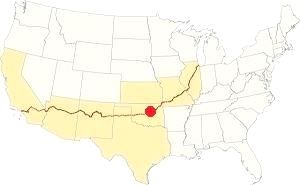
Location of Calumet on Route 66
The average high in January 46.9°F (8.3°C) is and the average low is 24.2°F -below freezing (-4.3°C). The average summer high (July) is 94.4°F (34.7°C) and the average low is 69.9°F (21.1°C).
Rainfall averages 28.1 inches (714 mm) annually, with May, June and September being the rainiest months 4.5, 4.3 and 3.8 inches (114, 109 and 97 mm) respectively.
There are approximately 88 wet days every year with thunderstorms more frequent during summer; these storms may provoke hail and spawn tornadoes.
Snow may fall between November to March: 9.5 inches of snow (24 cm) per year.
Tornado risk
Calumet is located in the "Tornado Alley and experiences approximately 11 Tornado watches annually
Tornado Risk: read more about Tornado Risk along Route66.
Map of Route 66 through Calumet Oklahoma
After leaving El Reno, the 1926-1962 Route 66 followed E1020 Rd. all the way to US 270, map west of El Reno. Its orignal alignment turned right (north) as shown in this map with the missing segments of Route 66 along the Calumet-Geary-Bridgeport alignment.
From 1926 to 1931 Route 66 did not follow the course of current US 270, instead, it ran to the west of it, along what is now N. Calumet Rd. (see this map, and the first orange line in the map with missing segments).
In 1931-32 it was realigned and paved in Portland Concrete along current US 270 - created in 1929, which overlapped US 66 in this area (map). From Six-mile Creek, the paved alignment curved NW and merged with the old unpaved alignment northwards into Calumet along Calumet Rd. The original curve was eliminated in 1986 (second orange line in map).
From Calumet to Geary
US 66 left town between 1926 and 1922 along Todd St (map and the third orange line in missing segments map), and then went north along S. Red Rock until it met the railroad and turned left (west) along current US 270 until reaching Memoral Rd. NW, which it followed west until the junction with N. Karns Rd. where it turned right, northwards all the way to US 270. Then west into Geary. See this map with the alignment.
After 1929 and until 1933 it went from Calumet to Geary straight along the modern alignment of US 270 (map).
In 1934 it was bypassed with the El Reno Cutoff, together with Geary as shown in this map.
The following map was published in 1931; part of the alignment was paved (solid red line), the rest was an "All-weather road" unpaved. Calumet is in the middle of the map.
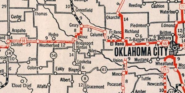
Route 66 Alignment near Calumet
With maps old maps and all the details:
- Clinton to Texola (next)
- Yukon to Clinton (Calumet's)
- Chandler to Yukon (previous)
Route 66 landmarks & attractions
Sights and Attractions in Calumet
We will tour the town along the original alignment first, and for those who opt to drive along the 1934 El Reno cutoff instead, we will describe the must-see landmarks on it.
Original 1926-33 alignment into Calumet
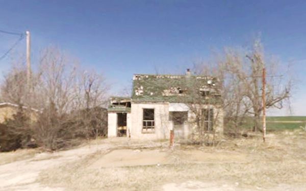
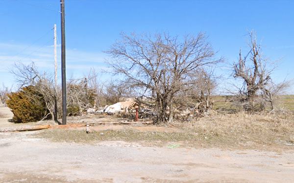
Site of Gas Station
On the crossroads where the original 1926 alignment turned 90° to the right towards Calumet once stood a cottage style gas station. It had a gable roof, and was probably a Conoco or a Phillips 66. It was razed, and rubble marks the spot. Below is a "Then and Now" set of images of the now gone filling station. Route 66 is slowly fading away under our eyes.
Turn right and drive 4.4 miles north to the town of Calumet.
Chieftains water tower
As you approach the town, to your left is a tall and slim water tower with the local "Chieftains" basketball titles painted on it. Calumet High School is the home of the Chieftains.
Filling Station
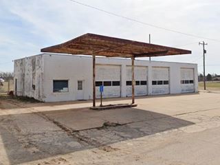
To your right, ahead is a vacant oblong-box style gas station, with four service bays and a detached butterfly canopy over the single pump island. Maybe 1950s.
The small town stretches along five blocks on former Route 66, now US 270. At the curve just ahead, where it heads towards Geary, is another gas station (left).
Stone faced gas station
This complex includes a gable roof gas station to the west, built in stone, with a narrow angled canopy across the front facade, over the pump island. To the left (east), the building extends with an area that was probably a home or a cafe (?) ending with a garage.
It extends south along N Fynnn St. with dorways there.

This is the end of the "City Tour" in Calumet. You can head west along US 270 into Geary from here, or head back to the US 66 crossroads and visit more sights along the 1934-62 alignment (you can also get to Geary using that alignment).
1934-62 Route 66 alignment
Head west from the ruins of the cottage gas station, and drive 7 miles (map) visit two iconic Trading posts.
Cherokee Trading Post
To your right, at US66 and Bus 281, this is I-40's exit 108, north side of the freeway.
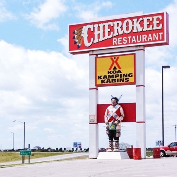
The trading post opened back in 1958 and has been a family-run operation since then. The freeway was aligned next to it in 1962. The restaurant opened in 1965, burned down in 1977 and was rebuilt in 1978. It has several Native American themed structures, a giant teepee, buffalo statues, a larger-than-life Cherokee native statue by the KOA sign, and an equestrian statue.
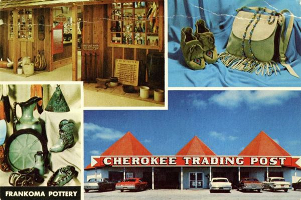
The postcard from the 1960s reads "CHEROKEE TRADING POST 15 Miles West of El Reno, Oklahoma On U. S. Highways 66 and Interstate 40 The Trading Post symbolizes Western Tradition and Indian Culture. A fine selection of Indian crafts and souvenirs. WE FEATURE INDIAN MOCCASINS AND FRANKOMA POTTERY Open the year around. Refrigerated air conditioning. Restaurant and service station open 24 hours a day. Phone Geary TU4-2502."
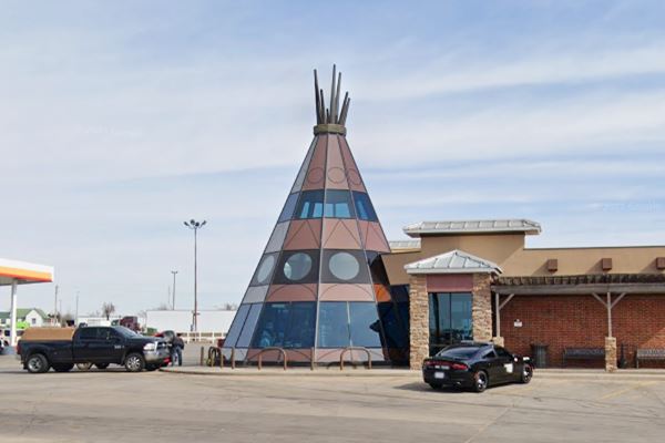
Buffalo and Cherokee bronze statue
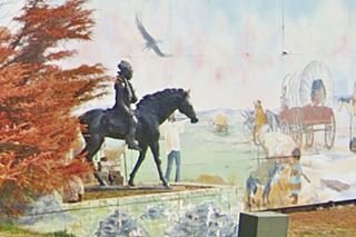
By the mural on the eastern side of the post, you will see the Cherokee rider statue, a bronze sculpture.
There are also two buffalo statues, nicely decorated with paint (street view).
Cherokee Indian statue
On the south side of the property by the "Restaurant" and "KOA" sign is the large "Cherokee Indian" statue.
It wears leggings, and two sashes aross the chest and tied at the hip. These were almost always beaded. Follow this external link to read more about traditional Cherokee attire.
Indian Trading Post Muffler Man

Howe Motors Muffler Man Indian, in Clinton. Source. Click for St. view (2008)
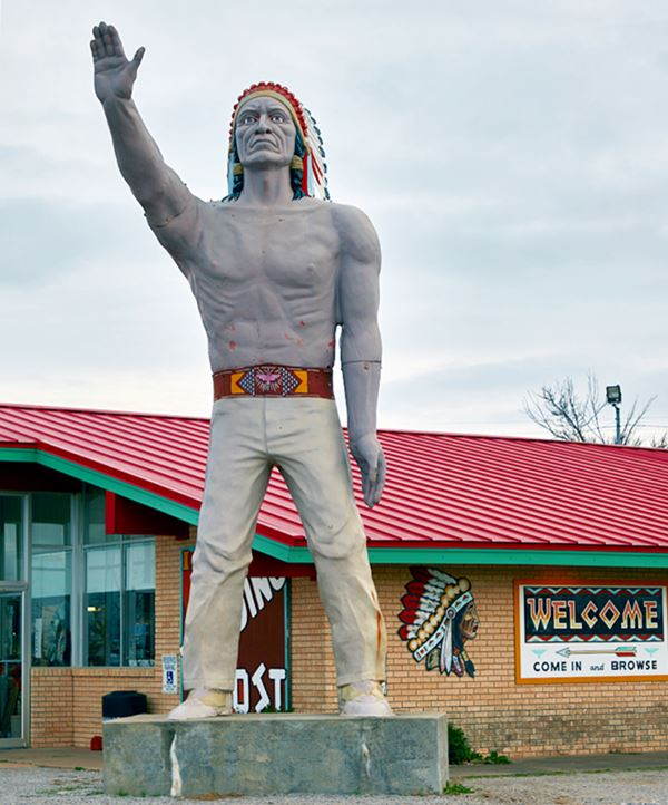
Now go south, cross the freeway along S. Walbaum Rd. and next to I-40s S. Frontage Rd. in the SE corner you will see a "Muffler Man" Indian.
At 825 S Walbaum Rd Calumet, OK
This statue used to be located at Howe Motors in Clinton, fifty miles to the west.
The photo shows it at its former location, at the Howe Nissan dealership in Clinton. It had the word "Howe" on its belt buckle.
Now it stands in front of the "Indian Trading Post". The buckle now sports a Native American design.
At the store you can see genuine Native American handcrafts: moccasins, dreamcatchers, pottery, blankets, jewelry and souvenirs.
Muffler Men on Route 66
Learn more about the other Muffler Men on Route 66
This marks the end of your Route 66 tour in Calumet. Take US Bus 281 to Geary.
Some sponsored content
>> Book your Hotel in Tulsa

Credits
Banner image: Hackberry General Store, Hackberry, Arizona by Perla Eichenblat
Cynthia Savage, Calumet, Encyclopedia of Oklahoma History and Culture, www.okhistory.org


