Ghost Town on Route 66, Oklahoma
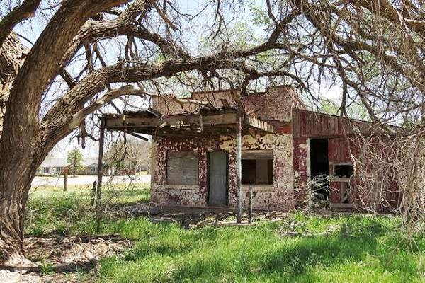
Old Kobels Place Service Station in Foss, slowly falling apart.
Index to this page
About Foss, Oklahoma
Facts, Trivia and useful information
Elevation: 1,640 ft (500 m). Population: 151 (2010).
Time zone: Central (CST): UTC minus 6 hours. Summer (DST) CDT (UTC-5).
Foss is a small town in Washita county which has gradually lost population and today is almost a ghost town.
The area was settled during the 1892 Cheyenne and Arapaho Opening. In the late 1890s, some settlers who lived near the Wilson post office moved 4 miles north to the valley of Turkey Creek. They requested a post office by the name of Graham, but the Post Office Department retorted that Graham had been taken so it named it Maharg, an anagram of Graham; it opened in 1900 and William Radford was the first postmaster.
The Choctaw, Oklahoma and Gulf Railway, (later the Chicago, Rock Island and Pacific Railway), built tracks through the area in 1902, and that same year a flash flood destroyed the village, prompting residents to move closer to the tracks on higher ground. A post office named Foss was established at the new site.
The name: Foss
The town was named after J. M. Foss a postmaster at the town of Cordell 15 miles to the southwest of Foss.
The town grew quickly serving the local rural community. Cotton gins processed the local produce which was shipped out by train.
Population peaked at 525 in 1910 stood steady for some years but by the early 1920s Elk City to the west and Clinton to the east drew investment and trade. Foss began to decline. Even though Route 66 passed through the town in 1926 the Dust Bowl and the Great Depression in the 1930s hit the local economy.
Route 66 was finally moved south of town in 1931, bypassing it.
An Air Force base was set up in Burns Flat in the 1950s, but it closed later. In 1961, six miles north of Foss in Custer County, the U.S. Bureau of Reclamation finished the Foss Dam, which created a lake for water supply, flood control and recreation.
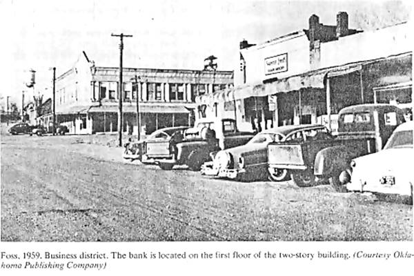
Below is a 1959 photograph looking south along Adam Street in Foss, the bank can be made out to the right. Compare it to the same view nowadays, red arrow marks site of now razed bank.
Main Street (Adam St.) in Foss, a 1959 photograph.
Getting to Foss
Heading east from Foss down Route 66 are the towns of: Clinton and Weatherford. To the west, is Canute and Elk City and Sayre.
Route 66 Alignment near Foss
- Texola to Amarillo (next)
- Clinton to Texola (Foss')
- Yukon to Clinton (previous)
Where to Stay
Book your hotel near Foss
> > Book your Hotel nearby in Clinton
There are several hotels in the area close to this town. Alternatively you can also find your accommodation along Route 66 in the neighboring towns and cities. We list them below (listed from east to west):
On Route 66's Main alignment
Eastwards
Westwards
>> There are RV campgrounds close to Foss
Weather in Foss

Location of Foss on Route 66
Temperature in Foss: Winter average low is (Jan) 25°F (-4°C) and the average high is 50°F (10°C). The summer (Jul) average low is 69°F (21°C) and the average high is 95°F (35°C).
Rainfall is about 26.5 in. (673 mm) per year and the rainiest months are May (5.1 inches - 130 mm) and June (3.5 mm - 89 mm).
There are about 52 Rainy days per year and the relative humidity is approximately 60%.
About 10 inches (25.4 cm) of snow fall every year between October and March, most of it during Jan. and Feb. (more than 2 in. - 5 cm each month).
Risk of Tornados
Foss is located in "Tornado Alley" and has about 11 Tornado watches every year. Tornado Risk: read more about Tornado Risk along Route66.
Map of Route 66 in Foss Oklahoma
Don't forget to visit our Route 66 Map of Oklahoma webpage. It has the alignment of US66 across Oklahoma, and all the towns along it.
See this Map with the alignment of Route 66 in Foss.
An earlier map, from 1924 -two years before Route 66 was created, shows the roads taht would later become US66. You can see Foss upper right, between Clinton and Elk City, with the road running through it with a north to south course (along Adam or Broadway).
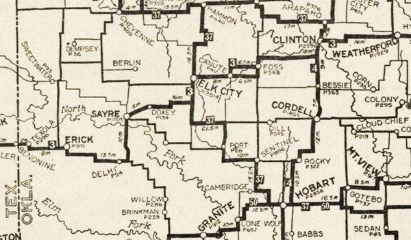
In 1931 it was straightened out and paved, with the historic alignment that runs along the south side of the town.
Foss' Route 66 landmarks & attractions
Sights in Foss... almost a ghost town

Foss in a 1950s USGS map.
Kobel's Place - Gas Station
In his "A Guide Book to Highway 66", published in 1946, Jack DeVere Rittenhouse tells us about Foss, he wrote:
FOSS. (Pop. 306; ALT. 1,622'; garage.) Gas station and cafe at junction. During World War II, there was a Naval Base south of here Rittenhouse (1946)
Begin your tour of Foss at the junction mentioned by Rittenhouse, on Oklahoma State Hwy. 44 and Route 66. If you are driving down I-40, take Exit 53. Just south of this crossroads is the Foss Cemetery.
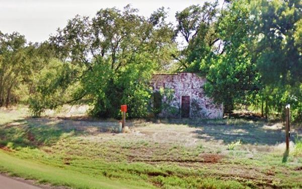
On the SW corner, hidden among the trees is a classic Route 66 gas station in ruins. Blue arrow in map.
A Landmark on Route 66: Kolbers Place
Today you can still see the ruins of the building which at one time was the proud Kobel's Place Gas Station. It sits on the intersection of former Route 66 and Broadway, roughly half a mile south of Foss.
Although it is close to the Interstate I-40 (Exit 53) is just down the road, it never recovered from the loss of traffic that in the early 1970s opted for the faster and safer I-40.
Despite the cracking walls, peeling paint and overgrown trees you can still read "Kobel's Place" on the wall that faces Route 66.
Kobel's Place, Foss, Oklahoma

Drive north along OK-44 into the town. After crossing the railroad, to your right is the old jail.
Foss Jail
Foss has a jail of the single-cell which is quite rare, a surviving "Cage Cell" made of steel bars which was quite common in the old west. In those bygone days there were many outlaws and it took time and money to build a decent jailhouse so the solution was to buy these ready made cages and set them up where they were needed.
Foss' cell is a box shaped cage with steel bars, made by a company that still exists, Pauly Jail Building Company, from St. Louis Missouri. It started out in 1856 building these mobile detention facilities. P. J. Pauly was a steamboat blacksmith on the Mississippi River and they had the know-how to design and build portable steel cages. Today they make equiipment for the detention facilities across the U.S.A.
The cage is mobile indeed, it has been located next to the railway tracks, by the sign that welcomes you to as you enter town from the south on Adams St. and Broadway, and then at Foss Park, next to the post office on 2nd St. and Broadway.
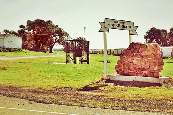
Keep north along the highway, Broadway St. and at the third block (1st St.) turn right, up the hill next to the water tank is Foss Park.
City Monument
There is a monument at the park, with three pink granite plaques. They tell the history of Foss over the years (the central one covers the period 1902-1957).
It tells us that "... lack of students closed the school in 1957 and with the closing of the air force base and decommissioning of sixty six came the closure of the last bank in 1977. In 1982 the Temple Building, one of the only remaining buildings from the town’s glory days and home of the first bank and post office, burned down. Today, little remains of Foss beyond the old church (now a residence), a cemetery, a jail, an abandoned gas station, and a handful of residents." Which helps us understand how Foss became a ghost town.
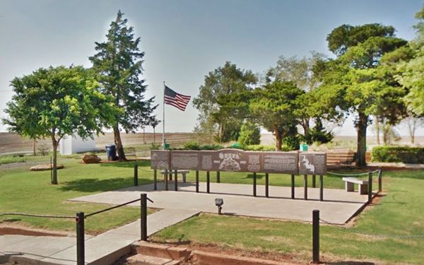
Retrace your steps and head west along the original Route 66 towards Clinton.
Parks and Outdoors
Foss State Park
10252 Hwy 44, Foss. From I-40 take Exit 53, head north along OK-44 for 7 miles and then head west for 0.25 mi. along OK-73. See Map with directions.
The Park is located on Foss lake and is the spot for hiking, riding, fishing, swimming and boating. There are RV campsites some of them full-hookups.
It includes picnic areas, grills and restrooms.
Washita National Wildlife Refuge
The Refuge HQ is located just north of the other one, close to OK-33 -20 miles north of Foss, (see the Map, location and directions).
No fee charged. Hike the trails and watch the wildlife in the rolling hills and creeks.
Visit the Refuge's website
Other Parks
To the northwest of Foss is the Black Kettle National Grassland.
Some sponsored content
>> Book your Hotel in Tulsa

Credits
Banner image: Hackberry General Store, Hackberry, Arizona by Perla Eichenblat
Jack DeVere Rittenhouse, (1946). A Guide Book to Highway 66.
Wayne Boothe, Foss. Encyclopedia of Oklahoma History and Culture, www.okhistory.org


