The town named after a bus line
Index to this page
About Albatross Missouri
Facts, Trivia and useful information
Elevation: 1,211 ft (369 m). Population n⁄a (2010).
Time zone: Central (CST): UTC minus 6 hours. Summer (DST) CDT (UTC-5).
Albatross is a small village on Old Route 66 in Lawrence County, in southwestern Missouri.
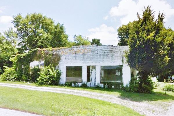
Jim Moot's Auto Body in Albatross Missouri, Route 66
History of Albatross
Learn more about the history of this area in our Carthage Missouri page.
The county created in 1845 was named after James Lawrence a seaman from the English-American War of 1812. After the Civil War, the town of Miller was platted nexts to the station of the St. Louis & San Francisco Railroad which crossed the county from from Mt. Vernon and Aurora in the South to Greenfield in Dade Co. in the north.
County trails linked Miller with Rescue, Phelps and Spencer. The post office at Miller opened in 1891.

1927 Albatross townsite auction
When Route 66 was created in 1926 it ran along the highway that had been built in 1913, two miles south of Miller.
Albatross Bus Line
The bus service of the Albatross Bus Line Co. established a stop at the crossroads of State Highway 39 and U.S. 66. The town of Albatross would soon be born.
The Albatross Bus Line was owned by R. A. McCartney and Coin Combs. It had been in operation for several years before Route 66 was created. An advertisement in the Joplin Globe in 1924 announced "Albatross Line Springfield - Joplin Deluxe Service Bonded". The bulk of those travelling by the Albatross bus were business people and they used the line's sleeper coaches.
The town itself was auctioned in 1927 as you can see in the image. The advert indicated that the bus line offered a special fare: "Albatross Coach Line makes a rate of round trip for one fare for this sale" and that it was a "... principal stop of all coaches of the Albatross Coach Line" between Carthage and Springfield. This implies some involvement in the towniste project.
The name: Albatross
The Ramsay Place Names File confirms that The village was named after the transcontinental Albatross bus line. However, Willie Washam reports that Marjorie Webb, daughter of Warren Webb, who platted the townsite with Charles Lathrum recolected that the name was suggested by her mother, Fay Webb, who was an English teacher. Fay "came up with the name 'Albatross' from Coleridge's poem." Marjorie is referring to the "Rime of the Ancient Mariner" by Samuel Taylor Coleridge. It tells the story of a mariner punished by fate for killing a harmless albatross (The bird is considered lucky, so the heinous act brings misfortune on the mariner).
The name: Albatross
The word albatross comes from Spanish "alcatraz" (pelican) and this in turn from the Arabic "al-ghattas" (sea eagle). Somehow the Latin word for white (albus) influenced the spelling, and then English sailors applied the name to another sea bird, becoming "albatross".
Those travelling along Route 66 promoted the local economy and some grocery stores and service stations opened in Albatross. But after 1958 the town and Route 66 were bypassed by I-44, which ran from Joplin, eastwards along what used to be US-166, south of Albatross into Springfield.

Where to Lodge in Albatross, Missouri
There is no motel in Albatross, but you can find your room nearby in neighboring Carthage or in Springfield.
> > Book your Hotel in Carthage
Find your room
There are several hotels in the area close to this town. Alternatively you can also find your accommodation along Route 66 in the neighboring towns and cities in Missouri. We list them below (from east to west):
On Route 66's Main alignment in MO
Eastwards
Westwards
- Hotels in Kansas
- Baxter Springs KS
- Galena KS
- Riverton KS
- Hotels in Oklahoma
- Miami OK
>> Check out the RV campgrounds in nearby Carthage
Weather in Albatross
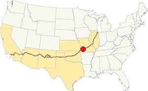
Location of Albatross on Route 66
Albatross has wet and rainy summers, and cold and dry winters. The aveage highs during summer (Jul) are around 90.7°F (32.5°C) and the average lows are 69.1° (21.1°).
For winter the average highs are around 44.8°F (7.2°C) and the average lows are 25.1°F (-3.9deg;C) - below freezing point!
Average yearly rainfall is 46.4 in (1.180 mm), mostly falling during summer. Around 12 in. of snow (30 cm) fall each winter.
Tornado risk
Albatross is located in Missouri' "Tornado Alley"; Lawrence County has an average of 8 tornado strikes per year.
Tornado Risk: read more about Tornado Risk along Route 66.
Map of Route 66 in Albatross
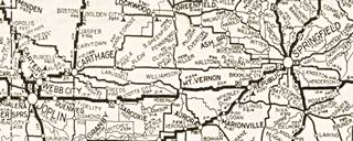
1924 Auto Trails roadmap SW MO
Click on map to enlarge
See large sized map
The thumbnail map (click on it to enlarge) is an "Auto Trail" map printed in 1924, two years before Route 66 was created. Springfield is on the right side, and Joplin on the left side of the map.
These "auto trails" were unpaved dirt-surfaced roads, the one marked #50 was the Ozark Trail and it went through Mt. Vernon and Sarcoxie, roughly where I-44 is now aligned, south of Route 66. Trail #2 from Carthage to Joplin was the "Jefferson Highway".
Route 66 would be aligned along a secondary highway, the stage coach route. Notice that Albatross does not appear in this map (it was founded in 1927), but Miller, Phelps and the now vanished Williamson do figure.
As you head west from Paris Springs and Spencer, Route 66 has an east-west course that runs in a straight line all the way to Carthage. It is a 30 mile-long segment that crosses small hamlets and communities; Albatross is one of them.
See this map of Route 66 in the area.
Route 66 Alignment near Albatross
Visit our pages, with old maps and plenty of information about US 66's alignments.
- Route 66 in Kansas (next)
- Springfield to Joplin (Albatross')
- Rolla to Springfield (previous)
Route 66 Sights in Albatross
Landmarks and Places to See
Historic context, the classic Route 66 in Albatross
"A Guide Book to Highway 66" written and published by Jack DeVere Rittenhouse in 1946 provides us with an insight into U.S. 66 during its golden days. Rittenhouse mentions the village as follows.
Albatross... Garage, several gas stations, cafes and Carver's cabins. Rittenhouse (1946)
The 1993 Route 66 survey in Missouri tells us more about this tiny hamlet.
This small crossroads community began in 1927 as a cluster of three buildings - a bus depot, filling station and lunchroom - and grew into a thriving town as a result of the traffic generated by the highway. Well into the 50's, in fact, the traffic was steady enough to support six gas stations in the one-mile stretch of road west of Albatross. Maura Johnson (1993)
Tour the route 66 landmarks in Albatross
We will tour the village from east to west, coming from Heatonville and heading towards Phelps.
Adamson Oil Co.
Roughly 1 mile east of Albatross, at 13119 Missouri 96 Map showing the spot.
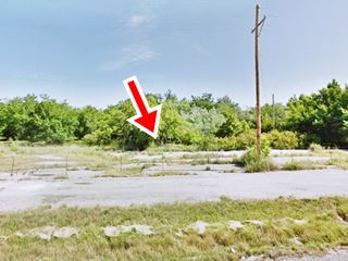
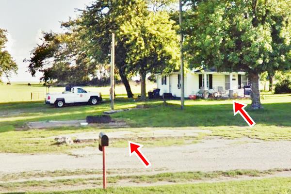
To your left, on the south side of the road. It has been torn down, but you can still see the driveway and the concrete base of the 4-pump island, and the foundation of the office and building.
It was a simple filling station built around 1926 by Billy Adamson. In the mid 1930s, his brother-in-law, Earl Kelly ran the station. Later his brother Andy Adamson operated it. He and his wife Wilma lived in the house behind the station (you can see the house it in two of the following images).
The first gas station c.1930
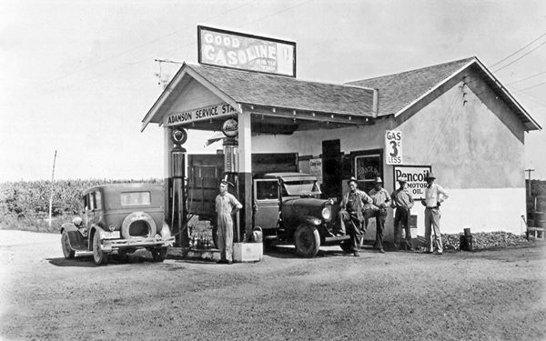
Notice the Adamson home on the right side of the image
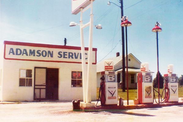
Same spot, red arrows mark pump island and Adamson's home
Hollis Hillhouse Station (gone)
Continue west, and after 0.6 miles, to your right is the site of the former Hollis Hillhouse Station (gone). Only the foundations and driveway remain.

Hollis Hillhouse station in 1993. Credits
Ahead, to your left, on the top of a small bluff is the old "Orchard Service Station and Tourist Camp".
Orchard Service Station and Tourist Camp
The Orchard gas station was built by Lane Shaffer, who was one of the original settlers in the new town of Albatross. The station was a rough stone building with a gable roof that extended over the pump islands as a gabled canopy. See image below.
Looking west from Route 66
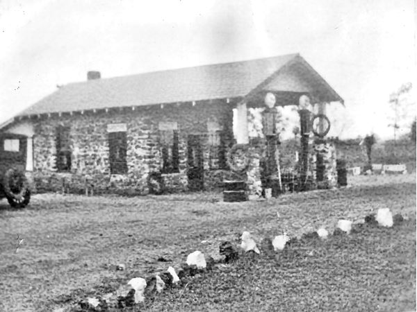
Shaffer built four cabins behind the gas station, the "Tourist Camp".
The building is still standing, though the canopy and pumps island have gone. See below.
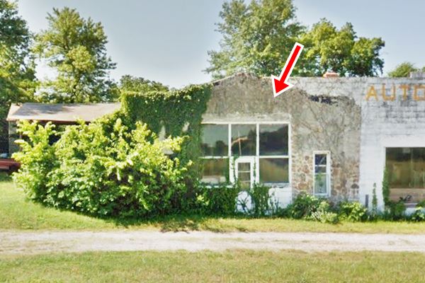
The white building adjacent to Orchard is "Moots Auto Repair".
Jim Moot's Auto Body
This building is listed in the Missouri Route 66 Survey of 1993 as "Jim Moot's Auto Body"; oiginally it had been an Allis Chalmers dealership owned by Wuelliner according to You will see two buildings. The eastern side is the original 1930 building with a triangular parapet and glass panels flanked to the west (right) by a 1949 addition which increased the storage space. Built in concrete blocks with a round roof.
The place is also known as "Albatross Store", owned by Mr. Wilson. There is a parking area in front of the store and a gravel drive. See its photo at the top of the page.
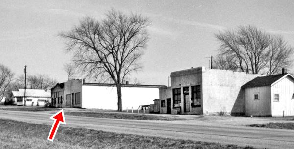
Below is a view looking east along Route 66 in 1970, the red arrow marks Moot's and to the left of it, Orchard Station. Notice all the buildings that have been torn down since then.
Miller's Station
Just west of Moot's, to your left, on the south side of the road.
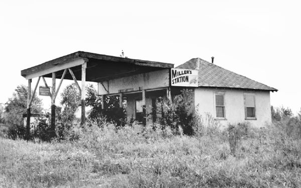
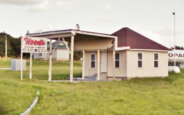
Also known as Morgan's DX it is a wood frame building with stucco walls and a hipped roof. It was built ca. 1945 and the flat roofed canopy added in the 1970s.
It was always a service station. You can see its unpaved and overgrown circular drive. The small building has a hipped roof. Below is a "Then and Now" sequence.
Your Albatross city tour ends here. Continue west towards Phelps to carry on with your Route 66 road trip.

Some sponsored content
> > Book your Hotel in Lebanon

Credits
Banner image: Hackberry General Store, Hackberry, Arizona by Perla Eichenblat
Jack DeVere Rittenhouse, (1946). A Guide Book to Highway 66
Architectural - Historic Survey of Route 66 in Missouri and Detailed Survey, Maura Johnson. 1993
Ozarks History, Families, and Photographs, Willie Washam, 2021


