Tiny Village on Missouri's Route 66
Index to this page
All you need to know about Rescue
Facts, info and Trivia
Elevation: 1,214 (370 m). Population n⁄a (2024).
Time zone: Central (CST): UTC minus 6 hours. Summer (DST) CDT (UTC-5).
Rescue is a small village on Old Route 66 in Lawrence County, in southwestern Missouri.
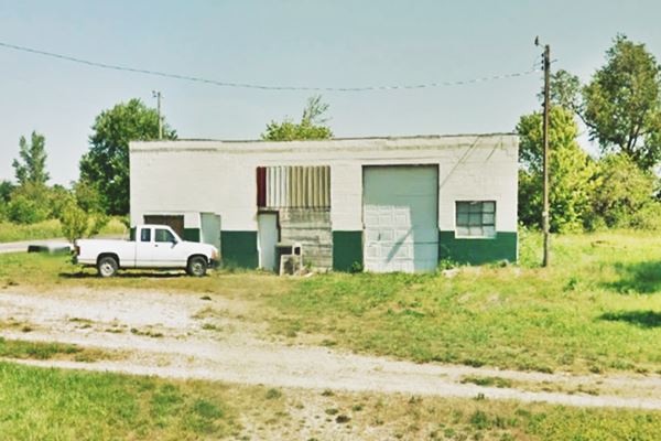
Route 66 "Brown's garage", Rescue
History of Rescue
Learn more about the history of this area in our Carthage Missouri page.
The name: Rescue
There is no record about the origin of this particular name, which according to some sources comes from the rescue of a pioneer family, who was in dire straits in the area (maybe beseiged by the natives).
The county created in 1845 was named after James Lawrence a seaman from the English-American War of 1812.
The post office took the name of "Rescue" when it opened in 1897. It closed in 1904. In the 1920s there was a gas station and a lodge run by the Rogers. It was located on the Ozark Trail which in 1926 became Route 66.
Shortly after, Shadyside Camp (also written Shadyside) opened to the west of town. Travellers along Route 66 kept business alive during the hard days of the Great Depression in the 1930s and thrived on Post World War II travel. But in the late 1950s, I-44 bypassed the area siphoning traffic away from U.S. 66.

Where to Lodge in Rescue, Missouri
There are no hotels or motels in the town, find youor room close to Rescue in neighboring Carthage.
> > Book your hotel in neighboring Carthage
More Lodging near Rescue along Route 66
There are several hotels in the area close to this town. Alternatively you can also find your accommodation along Route 66 in the neighboring towns and cities in Missouri. We list them below (from east to west):
On Route 66's Main alignment in MO
Eastwards
Westwards
- Hotels in Kansas
- Baxter Springs KS
- Galena KS
- Riverton KS
- Hotels in Oklahoma
- Miami OK
>> Check out the RV campgrounds nearby in Carthage
Weather in Rescue
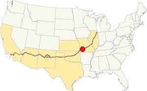
Location of Rescue. on Route 66
Rescue has a wet subtropical climate. Its winters are cold and dry, summers are wet and rainy (the rainy season lasts from April to July, with thunderstorms and tornado risk).
Average rainfall is 46.5 in (1.180 mm) per year. Around 12 in. of snow (30 cm) fall each winter.
The winter (Jan) average high is around 44.9°F (7.2°C), and the average low is below freezing, with 25.0°F (-3.9deg;C). Summer (Jul) average high is 90.6°F (32.6°C); the average low is 69.° (21.1°).
Tornado risk
Rescue is located in the infamous "Tornado Alley", and Lawrence County has around 8 tornado strikes per year.
Tornado Risk: read more about Tornado Risk along Route66.
Route 66 map in Rescue

1956 Roadmap western Missouri. Source
Click for large size map
The thumbnail shows a Shell Highway map (click it to enlarge) was published in 1956, just before the interstate system was built.
You can follow Route 66 from Springfield on the right, all the way to Joplin on the left. Rescue is in the middle.
Running parallel to it, on the bottom, beneath US66, is its spur: U.S. 166 that continued into Kansas beyond Baxter Springs. The freeway (I-44) would in part be aligned along U.S. 166 when it was built a few years later.
Driving westwards from Paris Springs and Spencer, Route 66 has a straight east-to-west alignment for more than 30 miles. It goes through a series of small villages and hamlets, including Rescue.
This is the map of Route 66 in the area.
Route 66 Alignment near Rescue
Visit our pages, with old maps and plenty of information about US 66's alignments.
- Route 66 in Kansas (next)
- Springfield to Joplin (Rescue's)
- Rolla to Springfield (previous)
Route 66 Sights in Rescue
Landmarks and Places to See
Historic context, the classic Route 66 in Rescue
Jack DeVere Rittenhouse mentions Rescue in his 1946 book "A Guide Book to Highway 66" giving us an idea of what Route 66 was like in those days.
Rescue. (Brown's garage, Reed’s Cabins) A small village with a few homes and a couple of groceries. Rittenhouse (1946)
He added that one mile west was a gas station and Shadyside Camp, followed two miles west (in what is now Plew) by more gas stations.
Tour the route 66 landmarks in Rescue
We will tour the village from east to west, driving from Phelps and heading towards Plew. As you reach Rescue, just before Lawrence County Rd. 1040, to your right on the north side of the highway, is the site of an old cabin complex.
Reed’s Cabins
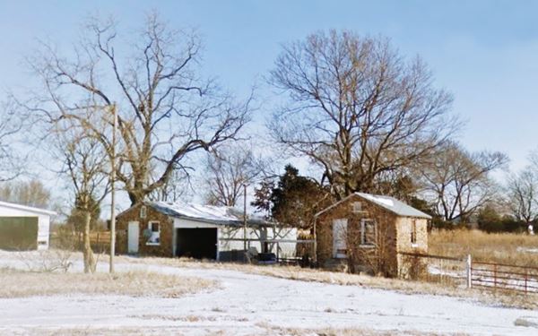
These cabins mentioned by Rittenhouse have managed to survive. Also known as "Reed Cabin Court". There are two stone-wall, wood frame gable roof cabins (a third was razed in the '80s) and are now private propery. On the left side of the property (west) is the former cafe, now a stone-faced residence. The cabins were built ca.1926 and owned together with the cafe by Roy Rogers and his wife. Below is a "Then and Now" view of the cabins.
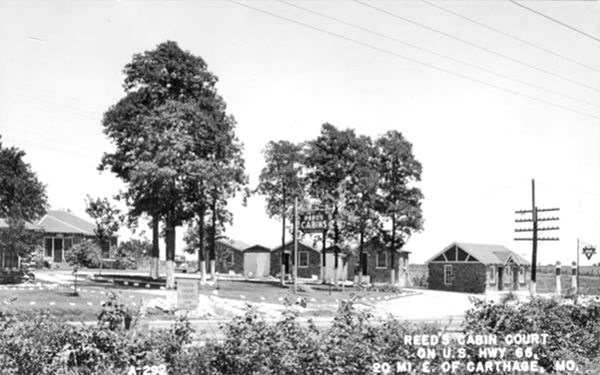
The cabins nowadays.
Brown's Garage
At Route 66 and Co. Rd. 1214, adjacent to Reed's cabins, also mentioned by Rittenhouse. The garage is a white building on the north side of Route 66, to your right.
See the image at the top of this page; it is a flat roofed oblong box building build with concrete blocks. It has two bays in the repair shop area. Perhaps it was the service station ran by the Rogers.
Downtown Rescue
This is the downtown district. Not much to see, only a few scattered buildings. No stores or gas stations.
Head west towards Plew, Avilla and Carthage to see the other remaining sights in Rescue.
Shadyside Camp

Shady Side service station. Source
Just 1.1 mile west of Rescue, to your right (north) is the Shady Side Camp cabins and former service station, at 3268 Missouri 96.
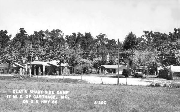
The postcard below names it "Clay’s Shady Side Camp" but Rittenhouse in his 1946 book calls it "Gas station; also Shadyside Camp" (in one word).
L. F. Arthur buitl Shadyside Camp in 1927, he used local rocks and erected four cabins, which survive until this day.
The gas station with a café which faced the road is still standing, but as you can see by comparing the black and white image with its present appearance, the gabled canopy that stood over the gas pumps, has now gone.
The old gas station nowadays.
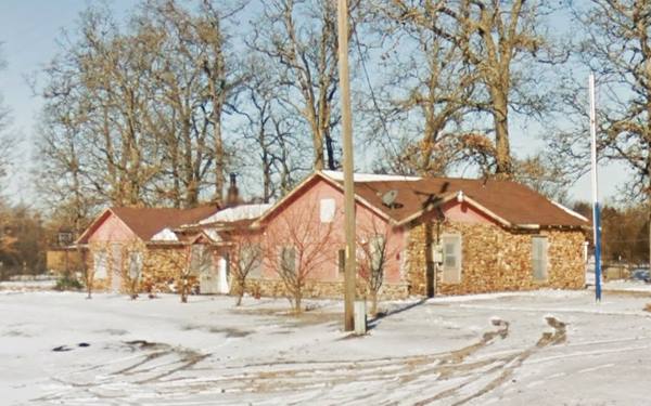
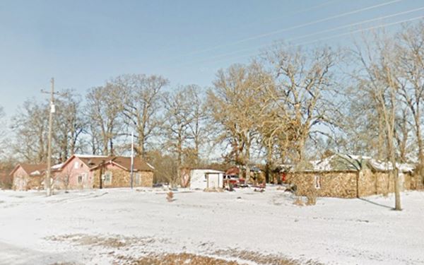
The buildings were arranged around a central court area. Below is a "Then and Now" sequence of the property, cabins on the right side.
A vintage (1940s?) postcard showing ShadySide Camp and Service Station
A view today of what used to be Shady Side Camp in Rescue
Biblical billboards
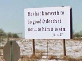
As you drive west towards Plew, you will see some billboards quoting scripture. This is the Bible Belt. The picture shows an example, citing James 4:17.
This marks the end of your tour through Rescue. Head west into Plew to continue your road trip.

Some sponsored content
> > Book your Hotel in Carthage

Credits
Banner image: Hackberry General Store, Hackberry, Arizona by Perla Eichenblat
Jack DeVere Rittenhouse, (1946). A Guide Book to Highway 66
Architectural - Historic Survey of Route 66 in Missouri, Maura Johnson. 1993.
Route 66 in Missouri, NPS. 2008


