Small Hamlet on Route 66
Index to this page
About Phelps Missouri
Facts, Trivia and useful information
Elevation: 1,202 ft (367 m). Population n⁄ (2024).
Time zone: Central (CST): UTC minus 6 hours. Summer (DST) CDT (UTC-5).
Phelps is a very tiny township on Old Route 66 in Lawrence County, in southwestern Missouri.
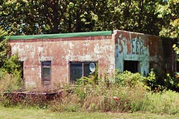
Old building ("Beer" written on wall) on Route 66 in Phelps
History of Phelps

Col William Harlow Phelps, Source
Learn more about the history of this region in our Carthage Missouri page.
The county created in 1845 was named after James Lawrence a seaman from the English-American War of 1812.
The first post office opened in 1854 and was called "Stalls Creek", maybe after the stream that runs close to Phelps (Stahl Creek). This post office closed in 1857. That same year the Phelps post office opened, replacing it. It closed for good in 1922.
The Ozark Trail was aligned through the town in the 1910s, linking it with Carthage and Sprigfield and in 1926 U.S higway 66 was created and routed along the Ozark Trail. Travel along the U.S. 66 gave helped the locals during the Depression in the 1930s. After 1958, traffic dropped off as it took to I-44, which had opened in 1958 between Joplin and Oklahoma City and to the east followed former US-166, south of Phelps into Springfield.
The name: Phelps
Col William "Bill" Harlow Phelps (1845 - 1916). Lawyer, lived in Carthage MO. for many years, after 1872, he served as representative in the Missouri House of Representatives and in the State Senate.
Phelps is a surname in Western England, derived from Phillip, and means Phillip's son:"Phel(i)p's"

Where to Lodge in Phelps, Missouri
Lodging close to Phelps. There is no motel in town, but you can find a room in neighboring Carthage.
> > Book your hotel in neighboring Carthage
More Lodging near Phelps along Route 66
There are several hotels in the area close to this town. Alternatively you can also find your accommodation along Route 66 in the neighboring towns and cities in Missouri. We list them below (from east to west):
On Route 66's Main alignment in MO
Eastwards
Westwards
- Hotels in Kansas
- Baxter Springs KS
- Galena KS
- Riverton KS
- Hotels in Oklahoma
- Miami OK
>> Check out the RV campgrounds in nearby Carthage
Weather in Phelps
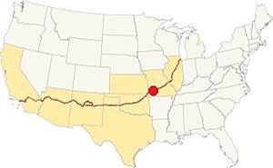
Location of Phelps. on Route 66
The climate in Phelps is subtropical and humid. It has cold and dry winters while its summers are rainy and wet. The rainy season covers April through July. Expect summer thunderstorms.
Summer (Jul) average highs are 90.7°F (32.6°C) with an average low of 69.1° (21.1°). In winter (Jan) the average highs are around 44.8°F (7.2°C), and the average lows are below freezing: 25.1°F (-3.9deg;C).
Average yearly rainfall is 46.4 in (1.180 mm). Around 12 in. of snow (30 cm) fall each winter.
Tornado risk
Phelps inside the "Tornado Alley" and Lawrence County has is hit by some 8 tornados every year.
Tornado Risk: read more about Tornado Risk along Route66.
Map of Route 66 in Phelps
Route 66 runs with a straight east-west course from Paris Springs and Spencer towards Carthage. This is a 30 mile-long segment. The alignment goes through a series of small villages and hamlets, including Phelps.
This is the map of Route 66 in the area.
Route 66 Alignment near Phelps
Visit our pages, with old maps and plenty of information about US 66's alignments.
- Route 66 in Kansas (next)
- Springfield to Joplin (Phelp's)
- Rolla to Springfield (previous)
Below is the platt map from 1879, showing the "Springfield & Carthage Road" that later became Route 66. The other map published in 1921, five years before route 66 was created shows the main highway running across Phelps.

1879 map of Phelps, Source

1921 map of Phelps, USGS
Route 66 Sights in Phelps
Landmarks and Places to See
Historic context, the classic Route 66 in Phelps
In his 1946 book "A Guide Book to Highway 66" Jack DeVere Rittenhouse describes the Mother Road during its golden days, and mentions the small town as follows.
Phelps. Gas stations, cafe, a few homes, and two very old store buildings Rittenhouse (1946)
He also added that there was was no lodging there, and that there was a gas station 3 miles west, that is, roughly one mile east of neighboring Rescue.
Tour the route 66 landmarks in Phelps
We will drive from East to West along present MO-96, which is the post-1955 alignment of US 66 and visit the town's main sights. The Concrete Slab bridge across the Dry Fork river is "recent", and was built in 1955 to replace the older one on the 1926 alignment that was removed at that time when Route 66 was realigned through the village.
The 1955 Realignment of Route 66
You will notice that the town's buildings are on the north side of MO-96, next to a frontage road and that there are no buildings on the south side of the higway. This is so because the frontage road was the original alignment of U.S. 66 through Phelps. It was "straightened out" in 1955.
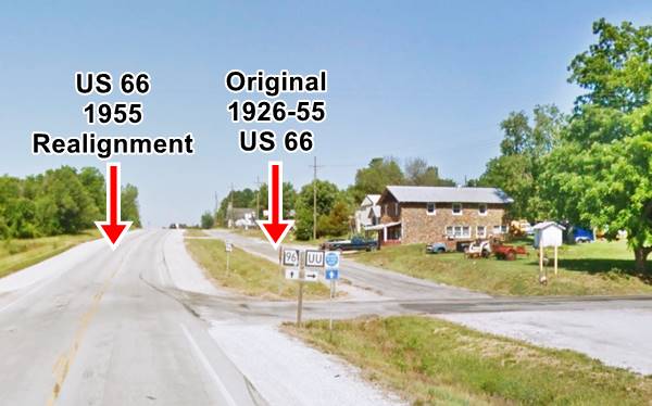
By Austin Whittall
Click image for Street View
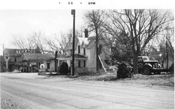
This realignment meant that all the buildings lying in the way of the newer (present) alignment were demolished. These included the Texaco service station and café owned by Harry Parkhurst and his wife, as well as their house (which they upped and moved to neighboring Albatross).
The image below looks east along the original Route 66 and shows the south side of Route 66 in Pehlps before it was razed in 1955.
At the eastern end of town, to your right, on the northeastern corner of UU Rd. and Route 66 was the now gone "Bill's Station".
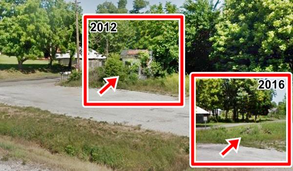
Site of Bill's Station (Gone)
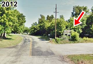
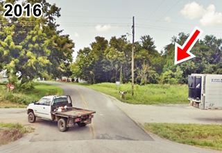
The service station was a very small building belonging to Bill Tiller, it was built in the 1920s. It gradually fell into decay and s you can see in the image below, taken in 1979, it was still in fairly good shape.
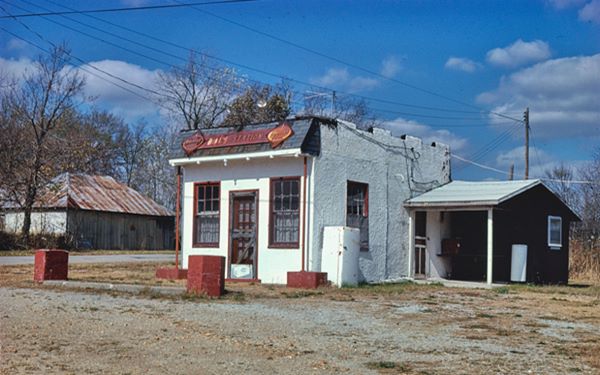
Below it was still standing in 2012, but gone and fallen into a pile of rubble in 2016. Another Route 66 icon gone forever.
Site of former Bill's Station on Route 66 in Phelps
Henson Building (Hotel)
Just ahead, on the old alignment, to your right.
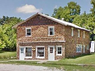
Henson's is a two story building which used to be a hotel. It has 14 rooms (6 on the second floor). Built ca. 1924 in local cobblestone with a broad pitched roof.
It was specially built to accommodate Route 66 travellers. It was owned by John and Belva Henson and also had a restaurant, barber shop, and store. A local urban myth says that 1930s gangsters used to spend the night here.
Head west and, to your right, is the "Old school".
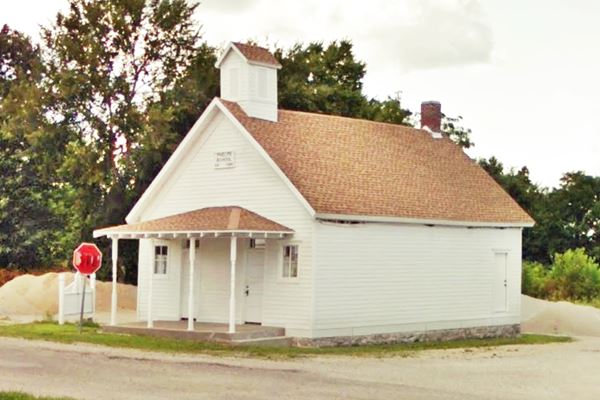
Phelps School
It was a one-room school built in 1889. It was located on the old 1926 alignment of Route 66 and during the 1980s was abandoned. It fell into disrepair but was restored recently to its former appearance.
Head west from the urban area of Phelps, and one mile ahead is an Old building.
Old Store - Service Station?
One mile west of Phelps to your right. North side of US 66, Map with location.
The building dates back to 1942 and may be the service station mentioned by Rittenhouse in 1946 which was one mile west of Phelps. The word "Beer" is clearly visible on its eastern facade. See photo of the store at the top of the page.
Later it was a restaurant and after 1968, a private residence.
This is where your tour through Phelps ends, head west into Rescue to continue your road trip.

Some sponsored content
> > Book your Hotel in Lebanon

Credits
Banner image: Hackberry General Store, Hackberry, Arizona by Perla Eichenblat
Jack DeVere Rittenhouse, (1946). A Guide Book to Highway 66
Architectural - Historic Survey of Route 66 in Missouri, Maura Johnson. 1993


