Route 66 Lupton to Winslow
Sponsored content

TheRoute-66.com is reader-supported. When you buy through links on our site, we may earn an affiliate commission at no additional cost to you.
Index to this page

Welcome Arch at NM AZ state line. US 66 Lupton, 1938. Source
Click on image to enlarge
- Lupton
- Allentown
- Houck
- Sanders
- Navapache
- Chambers
- Navajo
- Holbrook
- Joseph City
- Winslow
- Nature and outdoors
- Hotels
The Alignment of Old Route 66 from Lupton to Winslow
This segment starts in Lupton.
You can see all of the missing segments in our custom map with the eliminated segments of Route 66.

Lupton

Map of US 66 and Lupton AZ, 1937. Source
The Arizona segment of Route 66 starts in Lupton. To the east is New Mexico.
The original alignment ran to the north of the freeway west of Manuelito on the northern bank of the rio Puerco River. As it approached the state line, it continued straight, but is now cut by I-40 as marked with a yellow line in our custom map.
The eastbound lanes of the freeway cover the original road from state line to the access to I-40 on the south side, at Exit 359. Here the old roadway follows the access ramp, and continues west along the South Frontage Rd. You can only drive this segment if you enter the freeway heading east as shown in this map of Lupton ramp.
West along the South Frontage Road

Lupton to Houck, detail of 1937 map. Source
Click on image to enlarge
But from the underpass' on the south side of I-40 you can turn right and head west along the original 1926 to 1965 US 66 (in 1965 the highway was realigned as a four-lane superhighway where I-40 now runs). This segment is shown in this map from Exit 359 to 354.
Just over 1 mile west of Lupton, the highway crosses the steep and narrow gully of Lupton Wash (Original Bridge) built in 1927 and rehabilitated in 1939 this section was known as the "Adamana to Lupton Highway" (map showing where it is.)
On this alignment there was a Trading Post (?) (map), and just west was Stafford's Cafe mentioned by Rittenhouse in 1946 just before Exit 354; this map marks the spot. It was torn down in the late 1990s, but you can clearly see it in this 1970 aerial photo. Below is a view of the highway in this section.
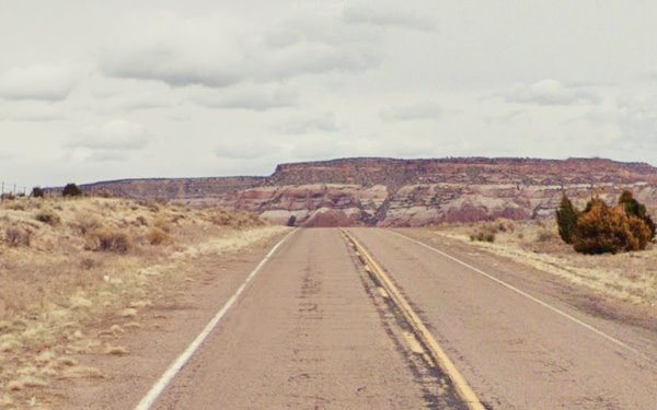
At Exit 354 the original highway is now cut by the freeway, and it headed north, running under I-40 as shown with the green line in our custom map. The curved segment see map north of the freeway was part of the N.O.T. but never carried US 66.
Then it reappears and for the next 2.5 miles the old 1920s-1965 US 66 runs along the north side of the freeway (map) as the N Frontage Rd., it curves around a rest area and reaches Allentown at Exit 351. Here there is a fork in the alignments.
Allentown
Where there is a fork in the alignments
The "town" of Allentown
Elevation 6,065 ft. (1.850 m).
Allentown was named after Allan Johnson, who was part of the Atlantic and Pacific Railroad staff in the construction Department. In the 1880s, the Johnson brothers settled there and raised cattle.
The Apache County map further up, the USGS map of 1923 and the AT& SF Railway map of 1915 both show it as "Allantown" not "Allentown", so the "A" must have become an "E" after the early 1920s.
The railway depot was roughly half way between Lupton and Houck it was the center of the community until Route 66 was realigned further north and the few houses of Allentown are located by I-40's Exit 351.
Below we describe the two alignments west of Allentown:
- N.O.T. and 1926 to 1930 Route 66
- 1930 to 1947 Route 66
1. The N.O.T. 1926-30 Route 66 alignment
The highway crossed the Rio Puerco at Allentown, ran along its south side all the way to Sanders, where it crossed the river again. This is the map of 1926-30 Route 66 from Allentown to Sanders. Drive it with care it is a rough dirt surfaced road.
Old Bridge (1923) at Allentown
Listed in the National Register of Historic Places
Built in 1923 as part of the National Old Trails Road. Three years later it was included in the first alignment of Route 66 through this area. See this vintage photo of the "Allentown" bridge on the "Adamana to Lupton Highway" taken in 1924, two years before US 66 was created.
Map showing where it is. This original alignment ran south what is now I-40, and also, south of the Rio Puerco River, so it crossed it twice, one here, next to Allentown, and again further west, at Sanders. Built in 1923 on the Old Trails across the often flooding Puerco of the West River. It had a wood deck supplied locally to reduce the construction costs.
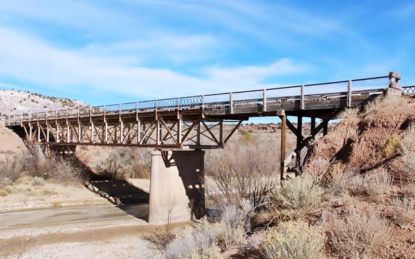
The Allentown Bridge was a Pratt deck truss bridge. Truss is the steel structure formed of triangular units that give the bridge its strength. A "Deck" truss is one where the deck (roadbed) is placed on top of the truss. And a Pratt truss is shaped so that the diagonal beams face towards the center of the bridge. The deck was built in wood, this was supplied locally and lowered the bridge's construction costs
It is closed to traffic, but you can see it to your left, on the eastern side of the modern bridge that replaced it.
This alignment did not go through Houck, it passed well to the south of the village.
You can drive this segment along the original roadbed along Co. Rd. 7240, covering 15.5 miles along a rough back-country road with no services along it.
Sanders
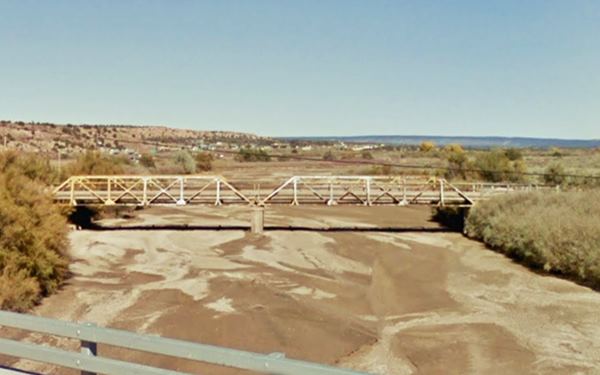
As you reach Sanders you will have to backtrack a very short distance, and then drive through Sanders to continue your journey because the old bridge at the end of the 1920s alignment is closed to traffic.
Historic 1923 Bridge in Sanders
Listed in the National Register of Historic Places
Built in 1923 on the Old Trails it also crossed the often flooding Puerco of the West River. It was a Pratt pony truss bridge. A "pony" is a bridge where the sides of the truss extend above the deck, but are not connected.
2. The 1930 - 1947 Alignment from Allentown to Sanders
This alignment ran along the north side of the Rio Puerco River, and in doing so, went through the small community of Houck.
The two 1923 bridges and the Old Trails alignment required improvement (the wooden deck wore out quickly), and a straighter and shorter route was desireable. So the Arizona Highway Department chose a route along the north side of the railroad, west from Allentown. It was built in 1929 and in 1930 it replaced the old segment, which is a now county road used by the Navajo reservation residents.
The segment from Allentown to Houck is probably overlapped by the lanes of I-40 built in the mid 1960s. However, some maps state that it runs along what is now the North Frontage Rd. into Houck we will follow this alignment; see the Map (1930-65) Allenton-Houck.

Ortega's dome-shaped store on US66, Houck AZ in 1979. Credits
There was a domed Trading Posts built in the late 1960 in Allentown; it was already standing in 1969 (See aerial photo). The dome was replaced by the current building between 1981 and 1997. It is still operating as "Ortega Indian City Arts". John Margoulis pictured it in 1979 while it was a dome.
Houck
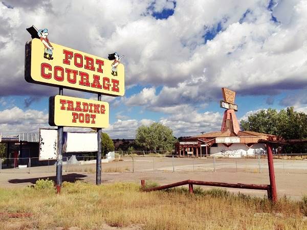
At Houck there wasn't much, a tourist attraction was built here in the mid 1960s (Fort Courage) pictured below.
After Houck Route 66 alignment continued as the north frontage Road and then departs from current I-40, running further north to cross Querino Canyon.
You can drive along it westwards as shown in this 1930 - 47 Houck - Querino Canyon - Cedar Point map.
Box Canyon and Big Arrows Trading Post
About 3 miles west of Houck, there is a bridge across Box Canyon and after passing by the "new" Querino Trading Post at the junction with Hwy 9407, the old highway passes by the ruins of Claude and Clara Lee's Old Querino Trading Post and reaches the deep Querino Canyon and the historic bridge that spans it. It is 4 mi. west of Houck
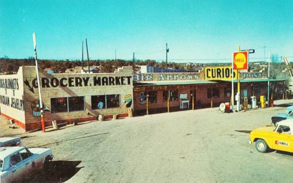
This was the Big Arrows Trading Post that was once owned by Claude and Clara Lee. Nowadays an old chimney and a column stand among the rubble. Rittenhouse described it in 1946 as "another one-structure "town," consisting of the Querino Trading Post. Curios and gas." They moved to a new location when the highway was realigned in 1949, building a second Big Arrows west of Houck that their daughter Arlene managed well into the 1960s. Below are two pictures in a "Then and Now" sequence of the post at Querino Canyon:

Querino Trading post in ruins. Credits

Remains of the Querino Trading Post. Credits
Historic Querino Canyon Bridge

Querino Canyon bridge seen from I-40. A. Whittall. St. View
Click on image to enlarge
Located on Old Route 66, 4 miles west ofHouck, AZ.
Listed in the National Register of Historic Places
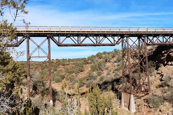
Historic bridge built in 1929 across the deep Querino Canyon on U.S. Highway 66. The Arizona Highway Department decided to shorten the 1926 US66 alignment and avoid crossing the Puerco River twice To do so it laid down a this new roadbed westwards from Houck to Sanders, it only required a big bridge at this canyon. The bridge is 77 ft. long and 20 ft. wide with a steel tressle supported by very tall steel piers rising from the canyon's bed.
It has 307 cubic yards of concrete 288,000 pounds of structural steel and 34,000 pounds of reinforced steel. It was built by F.D. Shufflebcager of Phoenix. Route 66 ran along this alignment an across this bridge until a newer alignment was build in 1947 where I-40 is now located. The bridge is still in use and is part of the local highway network.

Houck to Chambers, detail of 1937 map. Source
Click on image to enlarge
One mile west, Rittenhouse mentions a Trading Post that didn't sell gas. This aerial photo from 1969 shows the building, that is still standing.
The 1937 map from Houck to Chambers (click on it to enlarge) shows the buildings along Route 66.
Highway continues towards the SW and meets the freeway, where it turns west as the North Frontage Rd. The original 66 here runs beneath the freeway towards Cedar Point, just ahead at Exit 341.
1947 Realignment bypassing Querino
The Querino Canyon and the Box Canyon bridges were bypassed with the 2-lane upgrade of the highway that runs where the eastbound lanes of I-40 run. The original bridges on this alignment were also replaced in the late 1970s.
The Second Big Arrows
The Lee's moved to the new alignment and built their second Big Arrows on the north side of the highway (right), with a Shell station. It was located just 0.5 mi west of Houck's Exit 346 as shown in this Satellite view the drives and parking area can still be seen from space, the building has gone. You can see the complex in this 1970 aerial photo. Below is a postcard of the Big Arrows, which had big arrows next to the building (you can see them in the postcard).
Back to Querino Road
Cedar Point
West of the junction where Querino Rd. becomes the N. Frontage Rd., the original US 66 1930-47 roadbed is buried by the freeway (west of Sanders it also comprises the N.O.T. and 1926-65 US66). We marked this alignment with a purple line in our map.
Cedar Point and Indian Ruins
Indian Ruins
Rittenhouse mentions, 3 miles west of the Querino bridge another establishment: "A building here houses some excavations of Indian ruins. Private enterprise." This is where Exit 341 is now located at Cedar Point. The building of I-40 here disturbed the buildings.
This 1970 aerial photo shows, from left to right, the foundations of the Log Cabin and zoo (left) , Ortega's Trading Post (Indian Ruins) and the Cedar Point trading Post (right).
Rittenhouse mentions the "Log Cabin Trading Post" and gas station was ran by Allen "Al" J. Berry who built it with logs in 1927 on the north side of Route 66. He was next to some Indian ruins and after excavating them, he put a fence around the site and charged visitors an admission fee to visit them. His matchcovers promoted "Wild Birds & animals... Beer Liquor." It had burned down in 1945, but Berry rebuilt it.

Log Cabin Trading Post, 1930s. Source
The remains of the foundations are on the north side of the freeway where the frontage road straightens to run beside I-40 (See satellite view above).
Indian Ruins
There is a newer trading post and Navajo handicrafts store to the east of the old Log Cabin site, it was part of the Ortega family's string of trading posts along Route 66 it dates back to the mid 1960s. This one was operated by Armand Ortega. The Indian Ruins store is on the north side of the overpass.

Indian Ruins, Sanders Source
Cedar Point Trading Post
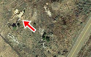
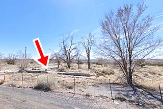
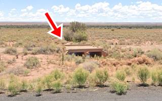
On the south side of the freeway was G. C. Wallace's "Cedar Point Trading Post", offering "General Merchandise, Tourist's Supplies, Navajo Rugs" and a Conoco Gas station. Below is a photograph taken in 1962, looking south from where I-40s eastbound lanes now run (at that time the 2 lanes of US66). The image above shows the same spot now, with the red arrow marking the foundations and part of the wall of the building.
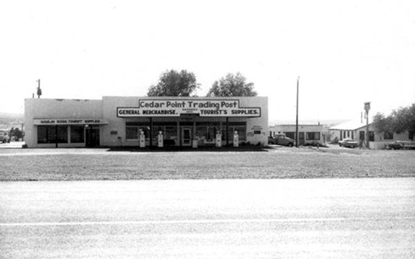
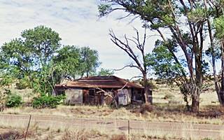
Heading one mile west, Rittenhouse mentions a "Gas station and garage" and at that spot are the remains of a building, east-sanders-gas to your right, on the north side of the frontage Rd. it is pictured below.

Map of US 66 at Sanders AZ, 1937. Source
Sanders
Just ahead, US 66 reaches Sanders. Described by Rittenhouse in 1946 as having 88 residents, "Tipton Bors. Store and two gas stations." The 1962 phone book mentions a Whiting Bros. station in town.
US 66 alignments meet in Sanders
The original 1926 and all the later alignments meet where Exit 339 is now located. The buildings at the junction of Route 66 with what is now US 191,were razed when the freeway was built, with the overpass and ramps at Exit 339. The map above shows Sanders in 1937 (at that time US 191 was Arizona Hwy 81). All of these, and the depot named Cheto have gone.
Route 66 West of Sanders
West of Sanders
The former roadway of Route 66 is overlaid by the freeway through Sanders and westwards (purple line in our custom map.)
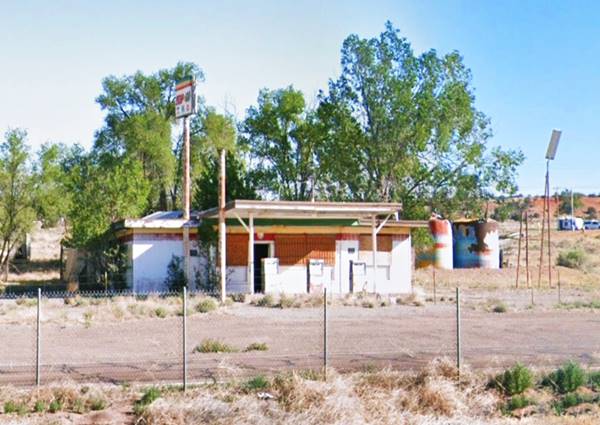
At the junction in Sanders, the Sanders Trading Post and Conoco gasoline service were located on the north side of the highway more or less where the school is now located. All that remains is a vacant former gas station and cafe on the N Frontage Rd. northwest side of the Exit, pictured below. The Arizona Route 66 Survey says it was built in 1965.
White Elephant

Berry's White Elephant, Sanders AZ, 1940s. Source
The White Elephant was a lodge, bar and curio shop had been built by Mitchell Dickens and R.W. "Bob" Cassady Jr. They had run it as the Chamese Lodge. In 1948, Cassady was tried in 1948 for the bribes he paid to avoid prosecution "in the operation of a certain gaming device by the use of slot-machines at Chamese Lodge, adjacent to U.S. Highway 66, Apache County, Arizona" (Source).
After they went broke, it was acquired by Al Berry, of the Log Cabin Trading Post further east; his name appears painted on the building -see image.

Site of White Elephant Lodge. St. view
Click to enlarge
He sold it to Skeet and Maude Eddens; their postcard below says:"Skeet and Maude's White Elephant Lodge (Hi-way 66). 83 miles E. of Winslow, Arizona - 44 miles W. of Gallup, N. Mexico... Open 24 hrs. One stop. Cafe-Bar-Curios-Motel-Gas-Oil-Garage." The 1953 telephone directory mentions Skeet and Maude's White Elephant Lodge as being located in Chambers. These distances, considering the 1950s highway alignment would have placed it in the spot marked by this map and you can see the building (L-shape, upper right) in this aerial photo taken in 1969. The image below show the same bluff whose western and eastern tips can be seen in the two postcards, and nowadays.
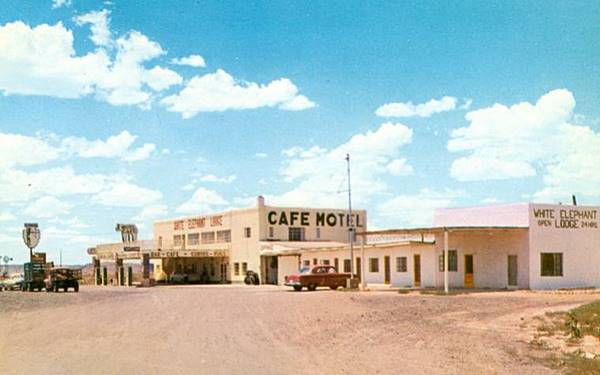
Next to it are the ruins of a bar, cafe (?) that can be seen in the 1969 aerial photo mentioned further up.
Just one and a half miles west, the alignments part again.
Navapache

Aerial photo of Navapache in 1964. Source
Click image to enlarge
The original Route 66 alignment follows Highway 7060. Here the north Frontage Rd. of I-40 forks to the right away from the freeway. At the fork was the "town" of Navapache described by Rittenhouse in 1946 as "another small "town" consisting of one tourist court, a gas station, garage and store."
The image, looks west, and was taken during the freeway construction in 1964. Click on it to enlarge it. You can see the original Route 66 heading off to the right towards Chambers. Navapache trading post and complex was located at the fork and can be seen in the image.
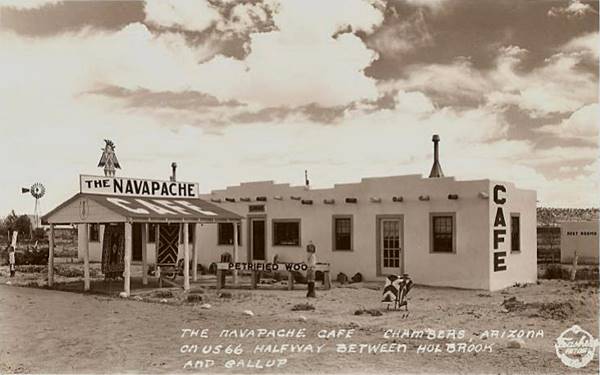
Chambers
The highway continues straight west for another 2 miles and reaches Chambers. Rittenhouse gives it a population of 59 and mentions two gas stations, Riggs Cafe and a small tourist court (motel) plus a few buildings. Little remains of them.

Map of US 66 in Chambers AZ, 1937. Source
Click to enlarge

Eaves trading post, Chambers c.1940. Source
The Wide Ruins Trading post is often mentioned as being located on Route 66, however it isn't. Wide Ruins is about 17 miles north of Chambers along US 191. It is the site of a former pueblo ruin known as Kin-Tiel with formidable stone walls, lost when they were pillaged to build the trading post in the 1890s.
Chambers had several stores and trading posts over the course of the years, but we don't know where they stood: Richard Eaves owned a grocery and station with a post office (see picture), Norris Douglas a service station, and there was the Cassady & Dickens cafe in 1948. Young Frank added his general Store in 1949.
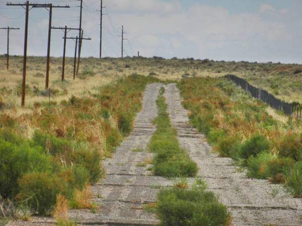
At the junction of the 1926 - 1940s US 66 with US 191 in Chambers, there was a gas station on the NW corner. Later it became a restaurant. Still standing, now as the local Baptist Church. The image below shows the former 1930-1940s alignment west of Chambers (dashed red lines) overgrown with shrubs. The power poles mark the road's course. Perhaps it was Eaves?
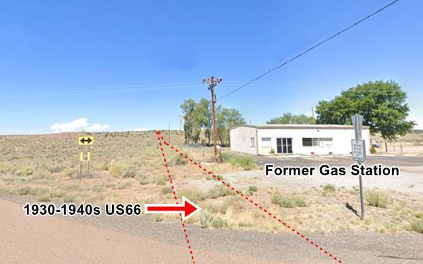
Chambers depot was located further south, and a dirt trail linked it with the buildings along Route 66, this road can be seen in the 1937 map on the left side with an upper right-to-lower left course.
Route 66 West of Chambers
The 1926-40s US66
From the old gas station Route 66 in its N.O.T. to 1940s alignment ran westwards. Our missing segments map marks the gap in the N.O.T to 1926 alignment with a pale blue line, and the gap in the 1930-40s US66 with a blue line.
The road reappears beyond this gap and has some attractions along it (the Indian Village and the Rio Puerco gas station). You have to take the later alignments to visit them. Below we describe this itinerary.
1926-60s alignment
Perhaps due to WW II and the heavy traffic it caused, the highway was improved across Arizona around 1947. So Route 66 in Chambers turned sharply south along a new road, what is now US 191 Frontage Rd., as shown in this 1940s-60s alignment map (or maybe 50s?). It turned sharply west where the westbound lanes of I-40 are now located, and run west as shown in orange in our custom map.
1950s? Alignment
It is possible, but the evidence in the maps does not show this, that in the 1950s, a straighter course was built through Chambers as marked with a red line in our custom map. These lanes were overlaid by I-40s eastbound lanes. The USGS maps don't provide evidence of this but the aerial photographs taken during the construction of I-40 ⁄ US66 in 1964 do show that the highway no longer ran through Indian Village. And that modern US-191 was built with the overpass.
The May 1955 Arizona Highways magazine describes the highway at that time as having been upgraded -though still a two-lane highway, to where Exit 330 is now located:
Up sto four miles west of Chambers, "66" has been modernized all the way from the state line, with wide asphaltic paving, easy curvature ad grades. From there westward the highway is being modernized as fast as possible because the daily traffic count indicatwes a total of almost 3,000 cars per day... Arizona Highway Magazine 05/1955

1964 aerial picture of Chambers. Source
Click to enlarge
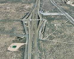
The two images above (click on them to see large size views of them) show the current Exit 333 when it was being built in 1964 and nowadays. You will see that what is now US 191 that uses the overpass, did not exist at that time. Instead what is now the Frontage Rd. of US 191 was the only link at that time (just west of the bridge), and part of the post-1940s US66. The main landmarks are identified in the picture. It seems possible that the EB lanes of I-40 upto the exchange, and then, the WB lanes beyond it, carried US 66 in the 1950s and early 1960s, as marked with the dashed line.
The Motel in Chambers
The motel predates the 1964 freeway construction as you can see in the image above. The pool is still there, but enclosed in a pavillion. The slanting roof on the main building (right) is now interrupted by a second floor with a gabled roof matching the rest of the rooms. The sign has moved further west, in front of the main building.
A 1980s postcard of the Chieftain Motel, Best Western, in Chambers, AZ. Route 66
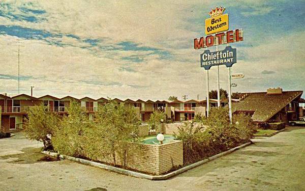
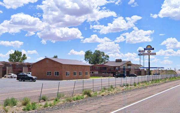
Drive west, you can take the N Frontage Road to visit the garage and gas station from the 1950s.
Red Mesa Garage
On the north frontage road, to your ritght. This building dates back to the 1950s. according to the Arizona Route 66 Survey, and is pictured below.
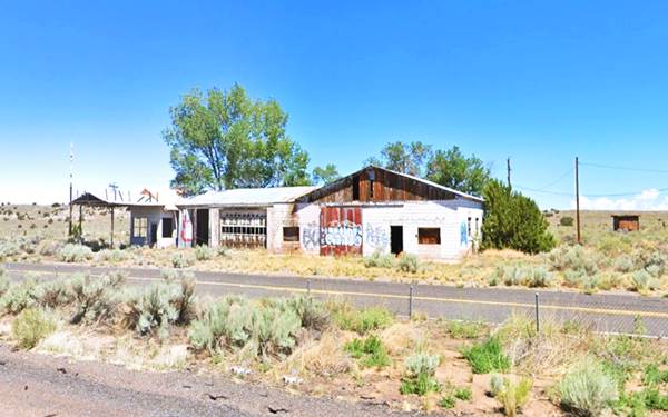
Now head west along the freeway, it overlays the 1940s-1979 US 66 alignment. Below is a view, west of Chambers, in 1964 and nowadays.

1964 aerial picture west of Chambers. Source
Click to enlarge
The red box in the 1964 image marks the same spot that can be seen in the "Then and Now" sequence below that shows a 1950s alignment west of Chambers, with only 2 lanes, long before the freeway construction began.

Same ridge now and in the 1950s. Click for St. view. 1950s view, Street view.
Click image to enlarge
The image above shows the ridge west of Chambers in the 1950s and now. The cliffs to the left, and the ridge are the same. The billboard in the 1950s picture is one mentioning the "Big Arrows" trading post in Houck.
Rio Puerco Gas Station
At Exit 330, the highway took a NE to SW direction, and here was the "Rio Puerco Service station; gas only" mentioned by Rittenhouse
We believe that the gas station was located on the north side of Exit 330 (1969 aerial photo) though it could have been on the south side too. Both spots are shown in the images below.

Looking east from Rio Puerco gas station. St. view
Click on image to enlarge

Looking west from Rio Puerco gas station. St. view
Click on image to enlarge
Indian Village
Ahead, at Exit 330, take a right and drive east along old Route 66 (map), this is private property, and the site of a Trading Post. Beyond it is aa small creek, whose concrete Route 66 bridge is still standing, Rittenhouse mentions " Indian Village Trading Post. No gas", you can see where it is, in this map showing the spot, the aerial photograph shows that the Post has several hogans still standing; they also appear in this 1969 aerial photo. It was owned in the 1950s by Charley Jacobs. Below is a vintage picture from the 1930s:
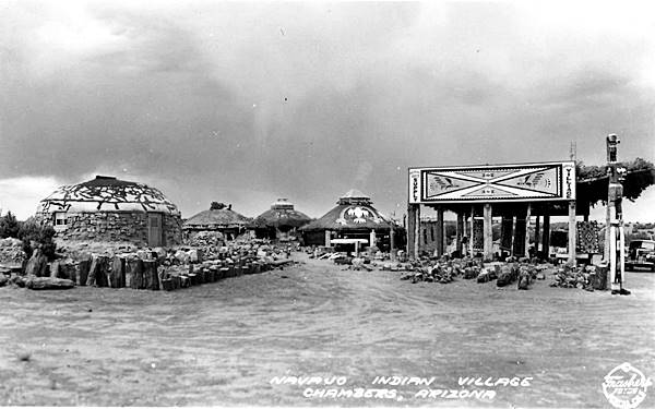
West of this point, the alignment towards the town of Navajo is cut by the freeway at Exit 330, here, the original roadway that ran parallel to a long cliff, moves to the south side of I-40, the brown line in our custom map shows the gap in the road.
Head to the south side of I-40 and drive west along Hwy 7386, it is paved for about one mile to the McCarrell Memorial Cemetery, after there it becomes a rough, dirt-surfaced, back country trail So think twice before trying to drive along it. This segment is almost 4 miles long and is shown in this map (Exit 330 to Navajo).
Navajo

Map of US 66 in Navajo AZ, 1937. Source
Navajo is a small community located half a mile south of I-40s Exit 335 next to the railroad tracks and Rio Puerco. Rittenhouse reported Marty's Trading Post with gas, cafe, five tourist cabins and groceries. Long gone, there are no pictures of the place. The map from 1937 above, shows several stores along the highway, on the SE side of the village. Nothing remains of them.
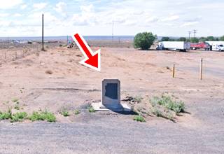
There is a Historic Marker at Exit 325; Park at the gas station and Navajo Center and walk to it, it is to your right on the eastbound lanes of I-40 access ramp (map).
The highway continues west of Navajo as shown in this Map followed by a gap caused by I-40's alignment and marked with a brown line in our custom map.
The dirt surfaced, back country road -rough and poorly maintained, continues west on the north side of the freeway as marked in this map all the way to Painted Desert Trading Post. Check with owners before driving private roads or at the National Park if the road has restricted access.
Painted Desert Trading Post
This is the first landmark west of Navajo mentioned by Rittenhouse in his 1946 guidebook; he describes it as "... bus stop... gas, cafe and curios." However he gives its distance from Navajo as 15 miles, and this is further than the former inn actually is. Maybe he made a mistake in his records or, he gave the distance to the Painted Desert Inn or the Painted Desert Park - Zoo that were further west and about 15 miles from Navajo.
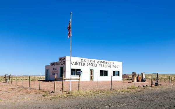
The Painted Desert Trading post offered rugs, curios, jewelry, and also sandwiches and cold beverages. It had two gas pumps in the front (no canopy), and a simple white building with a flat top and the three windows that faced forward with a single entry door.
It was built by Dotch Windsor in 1942, who ran it with his first wife Joy Nevin until they divorced in 1956. It was the dawn of the Interstate period and Dotch closed the post.
Painted Desert Trading Post in the 1930s. Petrified Forest National Park near Holbrook, AZ. Route 66
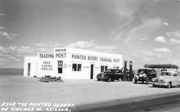
Holbrook, AZ. Source
Over the course of eighty years the passing of time has caused, ruin and decay. As you can see below it was in ruins. The dorway was empty and the windows gone. The words Desert Trading Post were faded but could still be made out on the front of the former store:
Painted Desert Trading Post until recently. Petrified Forest National Park near Holbrook, AZ. Route 66
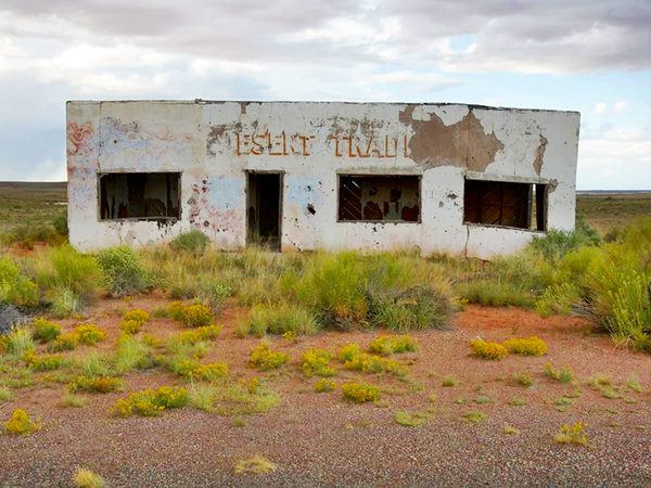
Holbrook, AZ. Source
Fortunately it was recently restored and has recovered its former grandeur. Learn more about the rescue project:

Dead Wash bridge. Source
Head westwards. 800 ft from the old trading post is the bridge over Dead Wash (named so because a prospector named Lewis was found dead there by his neighbor, Jackson, in 1897).
The highway continues west from the Inn for 5.3 miles and meets the current access road into the National Park (map). Just half a mile east of the crossroads is the site of the "Lion Farm."
Painted Desert Park - The Lion Farm (Gone)
Set on the north side (to your right) of the highway, see the map showing where it was, it was the brainchild of Harry E. "Indian" Miller, who also owned the Zoo and Trading Post & gas station further west along US 66 in Two Guns AZ. Miller had partnered with his nephews Paul and William Jacobs in 1927 to build a farm by the Painted Desert. He owned the land, and it was not located within the original boundaries of the Petrified Forest National Monument. At that time the railroad marked its northern boundary. In 1932 it was extended north to include the addition of Painted Desert and that brought the "Lion Farm" into the park. By that time Miller had moved to the Cave of the Seven Devils in Manuelito NM close to the NM-AZ state line and left his sister Julia Miller, mother of Paul and William, in charge.
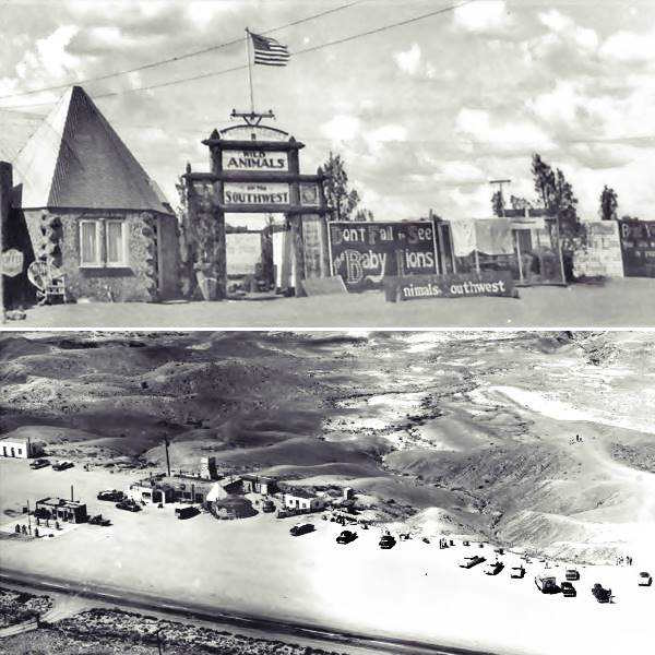
It had a tower overlooking the Painted Desert, cabins, souvenir shop, gas station. Its signs read "Mountain Lion Farm" and "Painted Desert Park Zoo." The zoo had eagles, fox, mountain lions, coyote, bobcat, and later pigs, gila monsters and badgers. The National Monument authorities wanted to buy them out, the zoo was an "eyesore" that had to go. By 1950 Charley Jacobs -Julia's other son- delegated management of the park to Albert Tietjen and refused to sell it. The National Monument put pressure on the Arizona Highway Dept. to realign Route 66 bypassing the Lion Farm in the around 1954 and isolating it from potential visitors. Finally Jacobs sold out his bypassed and vacant Park in April 1962 and the monument was designated as a national park in December 1962. (1)
Route 66 and Petrified Forest Rd.
Ahead, after passing the now vacant "Lion Farm" site, Route 66 ends at its junction with Petrified Forest Rd. Below is a view looking east from the junction.
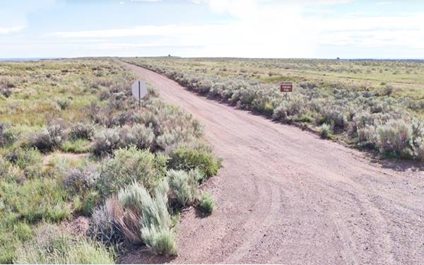
Reaching Dotch's Trading Post from the west
Most of you can't or won't drive along a dirt road, but you can reach it from the west as shown in this map with directions. To do so take I-40 westwards and head north from Exit 311. Enter Petrified Forest National Park, pay the park fee and check at the Visitor Center for additional information, road conditions and permission to drive along it. Below is a photo of the junction of Route 66 with Petrified Forest Rd.
Just ahead (see picture above), take a left along the dirt road eastwards, drive east for 5.3 miles along Pinta Rd.
Petrified Forest National Park
Only National Park on Route 66
Now or later (stop in Holbrook and dedicate a day to visit the park) we strongly recommend visiting it.
>> Visit the Petrified Forest National Park
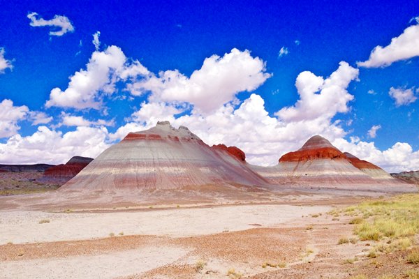
Back to our itinerary. The original Route 66 continued straight on, with a NE to SW course, this original alignment was later erased. but you can see it in our custom map (blue line)
Just west of this junction was another tourist trap, the "Tower":
Painted Desert Tower (razed)
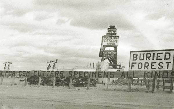
Located west of the Park's visitor center (location map). Julia Miller owned a 160 acre homestead in the middle of the park and she ceded it to her son, Charley Jacobs (who also owned the Indian Village in Chambers.) He was concerned about the realignment in Chambers bypassing his store, so in 1953 he built the Painted Desert Tower on this property as he believed that the new alignment of Route 66 would pass close by his new establishment. However, the National Park Service bought him out in 1958 and razed the spot. Below is a photograph of this tower. I took this picture in 2016 at the Route 66 marker further east.
There is one final Route 66 spot in Petrified Forest National Park and it is worth visiting (Map with directions.) Turn right along Petrified Forest Rd. ahead is another (there were many!) Painted Desert establishment, the Painted Desert Inn.
Painted Desert Inn
National Historic Landmark
The first inn, Stone Tree House, was made of petrified wood and built in the 1920s by Herbert D. Lore. It was renovated in the 1930s by the Civilian Conservation Corps as part of the Painted Desert Addition, in an adobe - pueblo style. After WW II it was reopened under the Fred Harvey Company's management and renewed by Mary Elizabeth Jane Colter in 1947. The museum and inn moved to a new complex in 1963 due to structural issues with the original building, and it was slated for demolition in 1975. A public campaign saved it, it was named a National Historic Landmark in 1987 and is open for all visitors.

Stone Tree House, 1930s postcard. Source

Painted Desert Inn nowadays. A. Whittall
Drive along Petrified Forest Road, stop at the viewing spots, the sights are amazing. Route 66 reappears ahead where it crossed the Petrified Forest Road again. There is a small marker and a must-see monument commemorating Route 66 within the park.
Route 66 Marker
Commemorating Route 66 and Petrified Forest National Park
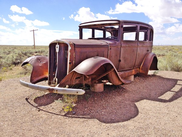
See where it is, in this map, the point marks where Route 66, coming from the trading post in the east, crosses Petrified Forest Rd. and heads west into the desert. The roadbed is not visible at ground level, but can be seen in satellite images. A line of telephone poles marks the alignment of the original Route 66 (you can see them in the photograph).
The marker has a concrete bench with a Route 66 shield, and a chrome vintage car bumper set in it. It belonged to a 1957 Cadillac Fleetwood. It is a front Dagmar Bumper (the word Dagmar came from the splendid figure -and bosom- of Virginia Ruth Egnor's 1950s TV character "Dagmar") pictured below.
Next to it are the remains of a rusty 1932 Studebaker and a sign with information titled "Highway of Dreams", pictured further up.

Here you can retrace your steps back to I-40 to continue your itinerary along Route 66 or continue straight and visit the National Park. You can return to this point later or head west to Holbrook from the South side of the park (South side Petrified Forest to Holbrook along US 180.)
>> Book your Hotel in Holbrook
West of the Petrified Forest National Park
Beyond the National Park
The old alignment coming from the "Lion Farm", "Tower" and "66 Marker" is cut by the Freeway 1.4 mi. further west, and resurfaces on the south side of I-40 Where it can be driven (access it from Exit 303 further west); the 1923 to 1961 alignment follows a wide arch along Adamana Rd. (see this map). Below is a view of its eastern tip, next to an old car dump, formerly Rocky's Old Stage Station:
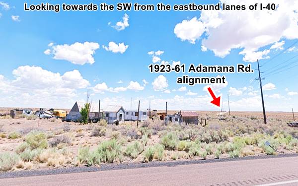
Driving down the Adamana Rd. segment is the site of an old, long gone trading post:
Painted Desert Point Trading Post

1940s postcard of the
Painted Desert Point Trading Post
nps.gov
Yet another Painted Desert Trading Post! It was located 21 miles east of Holbrook. You can reach it (map with directions) from Exit 303 and drive east for 3.8 mi. It is on the north side of the Old Route 66.
Built in 1946, it sold Shell gasoline. Only the foundations of the rectangular building and the concrete base of the gas pumps remain. At one time it was rumored that it had illegal slot machines. It was run by Harry Charles Osborne (1885-1962), who in 1952, aged 78 was forced to kill his deranged son Lee C. (1923-1952) at the trading post who had attacked him with a bar stool.
The arch in its western tip approaches I-40 again, where it runs westwards overlaid by the freeway as shown with the red line in our custom map.
It reappears close to Exit 303, by the "Painted Desert Indian Center" for a short stretch of just over 1 mile (map). Don't miss the tepees and dinosaurs!
It is here just west of the trading post, at Big Lithodendron Wash that it crosses the historic bridge built in 1932. Now closed to traffic
Big Lithodendron Wash Bridge
Route 66Holbrook, AZ.
Listed in the National Register of Historic Places
A wooden truss bridge built in the 1932 on US Highway 66
This wooden bridge is 243 ft. long and 23 ft. wide, its longest span is 18.7 ft. long. It crosses the Little Lithodendron Wash, also known as Carrizo or Little Carrizo Wash -Carrizo is Spanish for "rush".
The word Lithodendron combines the Greek words "Lithos" (stone) and "Dendros" (tree), "stone tree" after the neighboring Petrified Forest National Park.
The wash has several branches that Route 66 had to cross. Two bridges were erected in this spot, and only one survives. It is a timber tressle bridge built 1932 and rehabilitated in 1986 but since then, it fell into disrepair. It has 22 spans, all built in timber, with timber piers.
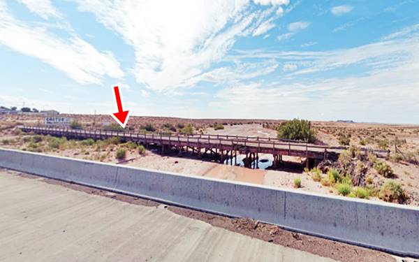
It is a "tressle" bridge because the short timber spans are supported by a rigid frame or "tressle".
Beyond the bridge it once again vanishes under the freeway (yellow line in our custom map).
Goodwater Rd. Little Lithodendron Wash Bridge
Historic Bridge
Just 2.3 miles away, at Goodwater Road, the N.O.T. to 1961 alignment resurfaces on the south side of the interstate, it has an eastern dirt surfaced section, and a paved roadway close to Exit 300. Westwards is the second historic bridge built in 1932; it is an 18 span timber bridge.
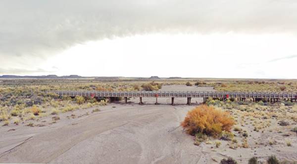
Just ahead, where the freeway underpass is located, the original roadway heads straight and is once again buried by the Interstate and resurfaces on the north side (green line in our custom map. The road can be walked along for the next 3⁄4 mile. Private property though. We mark this segment with a pink line in our custom map. There is a concrete culvert along it too (pictured- red arrows mark dirt surfaced roadway). At Twin wash the road vanishes again, overlaid by the westbound lanes of I-40 for 0.9 mi. (map) and then heads away along Pima St. marked with a
wine colored line in our custom map.
The segment along Pima St. can be driven and is shown in this Pima St. map; it is just over 4 miles long, and ends after heading west along Horse Head Crossing on the NE side of Exit 292
Here it merges into the modern westbound lanes of I-40, our custom map marks the missing alignment.
Exit 294 - Sun Valley
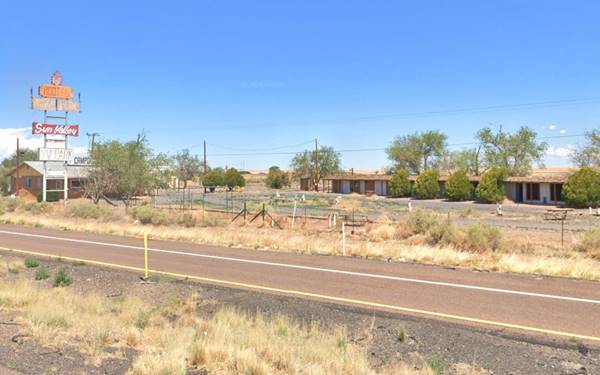
For those driving along the Freeway from Exit 300 to Exit 202, when you reach Exit 294 don't miss the old Sun Valley Motel (now vacant, and until recently the Root 66 Sun Valley RV Park). On the south side of the freeway is a former 1960s Stuckey's and Texaco repurposed as a knife store. All of them are pictured below:
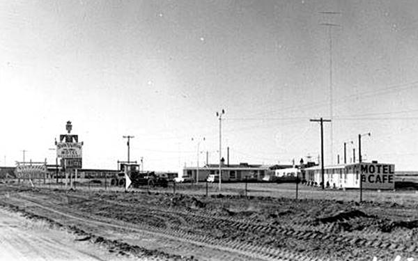

Vintage photo of Stuckey's
Source

Nowadays. Source, Knife City Outlet.

Holbrook
It runs with I-40 for the next 3 miles (map) and then disrupted at Exit 289 as marked with a blue line in our custom map, heads into Holbrook along Navajo Rd.
Across Holbrook
The original Route 66 crossed Holbrook along Navajo Blvd. and W Hopi Dr. map it is cut at its western tip by the freeway, where there were different alignments over the years. It passes in front of the famous Wigwam Village motel.
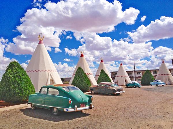
Wigwam Village Motel #6
At 811 West Hopi Dr. this is a classic icon from the 1950s.
Listed in the National Register of Historic Places
Western Holbrook
The 1926 to 1960s alignment of Route 66 headed west along W Hopi Dr. to 12th Ave. and here headed towards the SW, and then west along N.W. Central Ave (this map shows the part that can still be driven). We marked this route with a red line in our custom map.
In the early 1950s, the higway was upgraded to a 4 lane status in this area and two lanes were built on the north side of the original alignment (now under the EB lanes of the freeway). These merged into W. Hopi Dr. This alignment is marked with a blue line in our custom map.
At modern Exit 283 the four lane highway ended, and US 66 continued west along Boyse Rd. See this 1953 aerial photo with these alignments
Towards Joseph City
The Boyse Rd. segment is only 1 mile long (Boyse alignment map, with a bridge along it. Then the highway curves south and is cut by the freeway as marked with a yellow line in our custom map. It curves again, reappearing by the famous Geronimo Trading post located beside a low red sandstone hill. There has been a trading post here for over eighty years. The place is an example of Americana with wigwams painted with Navajo designs and petrified trunks. The shop sells souvenirs and Native American handicrafts.
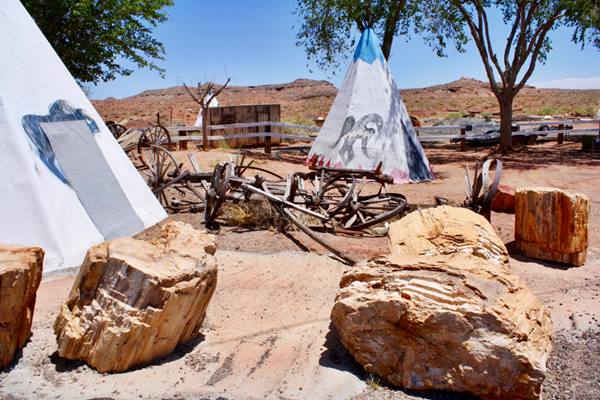
The alignment here (Map) is less than half a mile long, then the road is lost (Green line in our custom map.) The highway curved and ended up on the south side of what is now I-40 where as the Frontage Rd. it can be driven for 1.3 mi. towards Joseph City (map.) At Exit 277 it is cut again by the freeway, the gap is shown with a pale yellow line in our custom map.
Joseph City
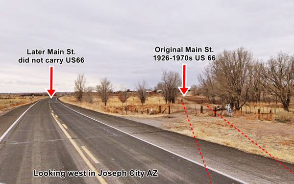
The 1926 to mid 1950s US 66 enters Joseph City along Main St. and crosses it from east to west (map). Until the late 1960s, Main Street took a different course than it has now as you can see in this 1953 aerial photo: the original Main took a SE - NW course at just after N. Porter, and met 3rd North about half a mile east of the current intersection with Main. Main St. was realigned when Exit 274 was built, to provide a better access to the town from the west.
West of Joseph City
Route 66 continued straight west and then as it approached the railroad took a course parallel to it. The freeway cut it (yellow line in our custom map).
Manila
Very likely named during the Spanish American War of 1898, when the American Navy defeated Spanis forces in Manila Bay (May 1, 1898), and later took the city (August 13, 1898).
The highway runs for over 3 miles on the south side of I-40 and passes by Manila. Rittenhouse in 1946 pointed out that it was not located on the highway and "[doesn't] even offer a gas station for the motorist."
Visit the Jack Rabbit Trading Post
On Route 66, on the south side of I-40 at Exit 269, 6 miles west of Joseph City.
A Must-see Stop on Route 66
This is the map of this 1926-70s alignment that at its western tip passes by the Jack Rabbit Trading Post that opened in 1949.

A smiling cute hare in the 2000s. Austin Whittall

1962 photo; Texaco at Jack Rabbit Trading Post. Ed Ruscha
Just west of the old trading post, the alignment ends, and is cut by the freeway as it curves north and then back to the south side as shown in our custom map: pale blue line, you can see culverts along it, like the one pictured below.
On the south side it becomes a dirt trail that can hardly be driven, Hibbard Rd. It also has culverts (see image above). The road heads west, on the south side of the freeway, its old paving can be seen between the shrubs. This is the map of the south section. Be cautious if you intend to drive along it.
At the western tip of this roadway is Havre, mentioned by Rittenhouse as having nothing but a railroad siding.
Hardy: later Havre
The stop was named after a Mr. Hardy, the first superintendent of telegraphs of the Atlantic and Pacific Railroad (which later became the Atchison Topeka and Santa Fe Railroad). It later changed its name to Havre because there already was a "Hardy" on the Santa Fe. Havre may have been chosen after the French port "Le Havre".
Fork in the alignments into Winslow
At Havre the highway splits. The original 1923 to 1930s alignment heads straight and then takes a SE-NW course, crossing I-40 and then heading west towards Cottonwood Wash and meeting with the later alignment beyond the wash (1923-30s map.) You can see the gap in this alignment in our custom map, marked with a pink line.
The later 1930s to 1958 US 66 forks to the northwest along Hibbard Road -see picture above (Green Line in our map), crosses the freeway more or less where Exit 264 is located, and heads west to the north of the earlier alingment. This is the map of this alignment towards Winslow.
Winslow
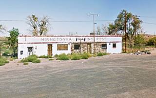
At the freeway the old alignment is cut as shown with a yellow line in our custom map. The road continues on the south side of I-40. It is here that Rittenhouse pointed out in 1946 that the first stop with gas and a cafe west of Joseph City was the "Painted Desert Hideaway", 17 miles west of Joseph City and 4 miles east of Winslow and 1 mile east of the Little Colorado River. There was only one spot here, known later as the Minnetonka Trading Post.
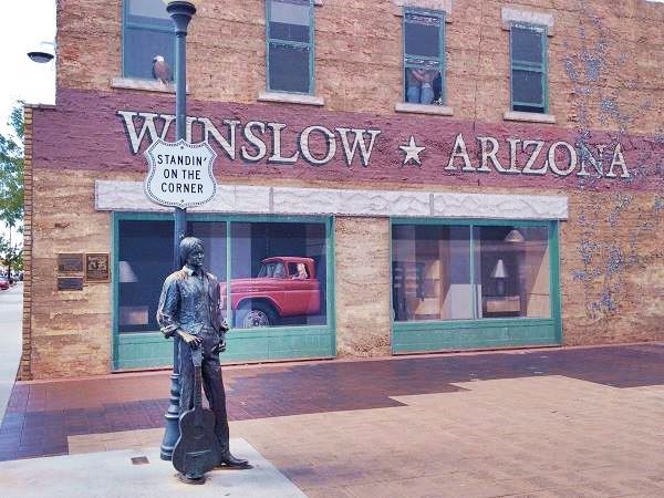
Route 66 entered Winslow along Second Street, which was the original 1920s to 1950s alignment but later 3rd St. became the westbound lanes and 2nd St. the eastbound ones.
The statue at the famous "Corner" in Winslow Arizona. Route 66

Continue your journey
Our itinerary from Lupton to Winslow Arizona ends here, you can continue your Road Trip along Route 66 westwards into Twin Arrows, Winona and Flagstaff AZ, see below:
Accommodation: Hotels along this leg of your trip
Find your room in the motels nearby in Winslow or Holbrook:
>> Book your Hotels in Holbrook
More Lodging Near Holbrook along Route 66
There are plenty of lodging options in the cities and towns along Route 66 east and west of Holbrook; click on the links below to find your accommodation in these towns, listed from east to west:
Eastwards
In Arizona Along Route 66
Westwards
You are so close to Las Vegas and the Grand Canyon!
There is a RV campground in Barringer Crater
Nature and Outdoors Close to this Section
Petrified Forest
Tip: consider visiting the Petrified Forest National Park (near Holbrook) on your Road Trip.
Only National Park on Route 66
If you visit the Grand Canyon
>> Learn more about the Grand Canyon National Park and US66
Some tours and sightseeing
Sponsored content
>> Book your Hotel in Winslow


Credits
Banner image: Hackberry General Store, Hackberry, Arizona by Perla Eichenblat
Jack DeVere Rittenhouse, (1946). A Guide Book to Highway 66.
A Fly in the Amber: Route 66 Architecture at Petrified Forest National Monument, Lillian Makeda. Buildings & Landscapes: Journal of the Vernacular Architecture Forum,Vol 17, No. 1, Spring 2010, pp. 53-81 (Article) Published by University of Minnesota PressDOI: 10.1353/bdl.0.0042
Painted Desert Trading Post, Route 66 Co-Op.


