Midpoint of Route 66
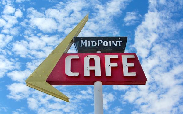
Midpoint café sign, Adrian, Texas
Index to this page
About Adrian, Texas
Facts, Trivia and useful information
Elevation: 4,035 ft. (1,230 m). Population: 130 (2025).
Time zone: Central (CST): UTC minus 6 hours. Summer (DST) CDT (UTC-5).
Adrian is located in the southwestern region of Oldham County, in the western Texas Panhandle along the water divide between the Canadian River to the north and the Palo Duro Creek to the south.
Route 66 entering Adrian, Texas
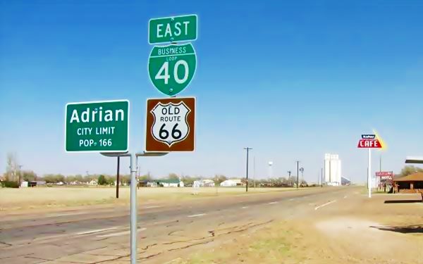
The Image above shows the sign of the Midpoint Café on the right side (south) of the image and the midpoint sign, on the left side of the image (north).
The city is located on the midpoint of the old US Route 66, 50 miles (80 km) west of Amarillo.
Name: Adrian
The town's name is that of an early farmer who settled in the area, Adrian Cullen. Not much is known about him.
Adrian is a form of Hadrian derived fromthe Roman word Hadrianus, which in Latin meant "From Hadria". Hadria was a town in northern Italy which gave its name to the Adriatic Sea.
Adrian was the name of the Roman emperor who built a wall between England and Scotland in the 2nd century AD, and also the name of Adrian IV the only English pope.
Adrian's History
The Panhandle region of Texas has been inhabited for over 10,000 years and sophisticated Paleo-Indian stone tools have been unearthed at nearby Clovis, NM.
In the mid 1500s, the Spanish explored the region but left it to the Comanche and Kiowa Indians, who ruled the plains, hunting buffalo until the mid-nineteenth century.
White settlers started to occupy the area after the U.S. incorporated Texas. Settlement led to problems with the Indians and after a war (1874 - 76) they were defeated and sent to reservations.
The town of Tascosa, on the Canadian River became county seat of Oldham County (1880), the railway link finished in 1887 increased the inflow of homesteaders.
The surveyors for the Choctaw, Oklahoma and Texas Railroad (it later became the Chicago Rock Island Railway) studied the area in 1900 and chose this spot for a station. At that time the first settler was a former Texas Ranger, Calvin G. Aten, who lived in a dugout just west of what would become Adrian.
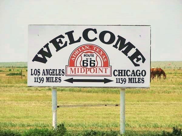
Midpoint Sign, Adrian, Texas
The first train ran through the new station in 1909 and the land was sold by the American-Canadian Land and Townsite Co. to farmers and settlers. The town had a school and post office by 1910 as well as a bank, newspaper (the Adrian Eagle) and several stores.
By 1915 it had added two churches and its population had swelled to 50. In 1926, the brand new U.S highway 66 was routed through Adrian and this brought a flow of travelers.
Wheat farming led to the building of the first grain elevator (1929). It weathered the Great Depression and experienced the boom of the 1940s and 50s in leisure road travel.
Adrian incorporated in 1953. I-40 drew some trade away from the main street and population which peaked at 222 in 1984 has dropped slightly.
Getting To Adrian
Adrian is the fourth town to the west of Amarillo (50 mi away) along I-40. It is 153 mi (247 km) west of the Texas state line. Heading west from Adrian, it is 24 miles (39 km) to the New Mexico state line.

Where to Stay in Adrian
You can stop at the "Fabulous 40 Motel" in Adrian, after that, the closest town with hotels is Vega, you can also find lodging in Amarillo.
> > Book your Hotel in Vega
More lodging Near Adrian along Route 66
The towns along Route 66 in Texas offer different lodging options. Check out some of the hotels and motels in the main towns below listed from east to west
In Texas Along Route 66
>> There are RV campgrounds in Adrian.
The Weather in Adrian
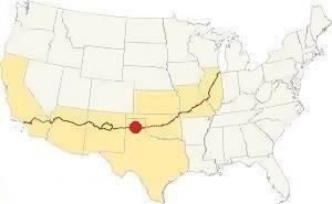
Map showing where Adrian is located on U.S. Hwy. 66
Adrian is located in a region that is dry and sunny: about 20 inches (500 mm) of rain fall yearly. During the summer, temperatures average between 90°F (30°C) and 65°F (19°C). During winter temperatures range from 50°F (10°C) to 25°F (-4°C).
Snow can fall in Adrian between September and May (first snow is usually on the first week of December). The high altitude causes greater snowfall than locations further east: 17” per year on average (with peaks of about 40”) - 43 to 102 cm. The region around Adrian is among the windiest in the U.S.
Tornadoes, Adrian is located in the "Tornado Alley". Read more: Tornadoes on Route 66.

1926-36 Route 66, in Adrian
Map of Route 66 through Adrian
We divided the course of the highway across Texas into two legs, from Texola in the east to Glenrio on the NM state line. The midpoint of Route 66 is located in Adrian TX:
>> See this Interactive Map of US66 in Adrian.
The original Route 66 alignment from 1926 to 36 between Vega and Adrian ran on the north side of the railroad (both highway and railroad tracks have
since been removed) roughly 100 yards north of I-40.
You can still see the concrete culverts along the old road (View).
Once US 66 reached Adrian it headed west until Walnut St. (red arrow in map). See this map with directions. It is shown with the red arrow in the 1936 Texas State Highway Dept. Map.
After 1936 the Route moved to where I-40 is nowadays. But a small section can be driven en Adrian: At Exit 23 - 22, follow I-40 Business, which is US66.
It runs across the southern part of town.
See this map of US 66 alignment in Adrian (after 1936).
Route 66 segments near Adrian
These are the sections of Route 66 in the area; we describe each of them in a dedicated webpage with maps, itineraries, and US66 attractions along the highway.
Alignment of Route 66
- Glenrio to Tucumcari Historic Route 66 (next)
- Amarillo to Glenrio Historic Route 66 (Adrian's section)
Adrian’s Route 66 Landmarks
- Tour Adrian (read on below)
- Tours & Itineraries
Town Attractions
Adrian
Adrian is quite a small western Texas rural town. its main attractions are along its Main Street, Historic US 66. But, the old town north of the Freeway has its share of relics from the late 1800s and the first alignment (1926-36) of Route 66 in town.
Jack Rittenhouse wrote about the town in his 1946 guidebook of US Highway 66:
ADRIAN. (Pop. 250; cafe; gas; no garage or other tourist facilities.) Here, also, the village consists of a few homes, grain elevators, and the usual gas station Rittenhouse (1946)
We begin our city tour on the eastern side of Adrian, at I-40s Exit 23, where Route 66 heads straight west and the freeway curves south. You can see the grain elevators mentioned by Rittenhouse to the west. Just ahead is the site of an old gas station.
Site of Standard Gas Sation
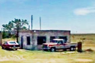
Just 0.3 miles ahead, to your left is the concrete access drives and parking area of the old service station. You can see its foundations. It is a tragic place.
Larry Lee Travis lived in Glenrio but, work was scarce there after I-40 bypassed the town, so in 1975 the young man rented the Standard Service Station that Don Morgan owned in Adrian. Larry had worked for Don, and his former employer knew that he had to support his wife Roxann and their child.
He drove every day from Glenrio to Adrian and back, a 50 mile round trip. But on March 7, 1976 he was murdered in cold blood by Lewis Steven Powell. His Pontiac Catalina is now parked at his widow's home in Glenrio by the ghost town's Texaco Gasoline Station. Powell got (a life sentence). Morgan shut the station, and eventually it was torn down.
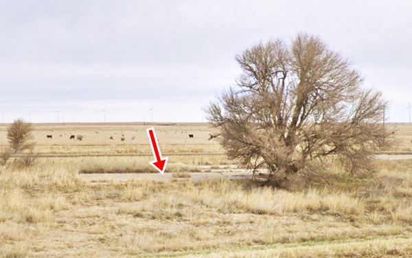
Drive west for 0.4 miles, to your right are Historic Route 66 road signs that point west, turn right along 5th Street. Just 150 ft. ahead is the junction with the 1926-36 Route 66 coming from the east. And 100 feet north of this point, the original Route 66 curves west into Adrian. Drive along 5th St. until you reach Walnut Ave. and turn south (left) along it. You will see two old buildings from the first Route 66 period.
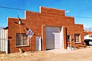
1935 Garage
To your right, at 300 Walnut Ave. A red-brick facade with a large door for vehicles, two smaller doors and windows. This was a repair shop and a garage. Pictured below.
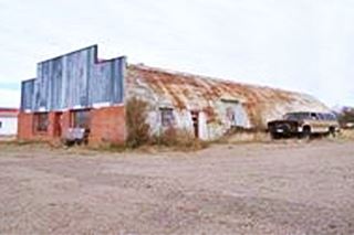
Another 1930s Garage
Facing it, at 303 Walnut Ave is a garage from the same period. It has a structure of a Quonset hut, with a brick facing towards the street. See picture above.
The Giles Hotel
On the corner of W 4th and Walnut St., to your right. This building dates back to the late 1800s.
The Giles Hotel was built by J. P. Collier and was the town's hotel facing the railway depot (4th street ran along the north side of the railroad). Between 1910 and 1946 it was owned by Chafin Glasscock and Stella Hawkins (renamed as Adrian Mercantile); it combined the hotel with a general store and a café.
It catered to the first travelers along Route 66.It finally became the Adrian Community Center.
The solid building stands to this day, over one century after it was built, outlasting Route 66 and the railway tracks.
The windows on the ground floor are the same, those of the top floor have gone, together with the balconies. But the building is clearly recognizable. See the Then and Now sequence below.

Early 1900s Postcard Giles Hotel. Source
Continue south along Walnut, 100 yards, to Route 66 (here are two of the town's three Phillips 66 gas stations and the famous Bent Door Cafe).
Bent Door Cafe & Phillips 66 station
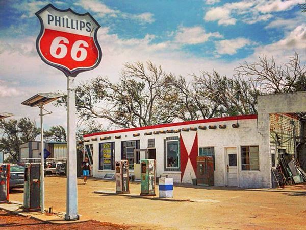
To the east, on the south side of the 1936-1985 Route 66 is the former gas station and Bent Door Cafe. According to different sources the first building here was the "Krazy Kottag Kamp" which Manual and Claudia Loveless opened in 1937. It had a Phillips 66 service station, a café and Modern Cabins. It burned in December 1947. After that, the cabins became "Adrian Courts".
The Bent Door Cafe restored
Control Tower Windows

The control Tower at Dalhart AAF in 1944, and at the café ca.1960. A. Whittall
Airfield.
A former employee of Loveless, Bob Harris built the present cafe shortly after (1948) and according to the local stories, used the windows of surplus World War II control tower that he bought from the nearby Dalhart Army Air Field that had closed in 1945 after the end of WWII. The image from the 1944 Dalhart AAF yearbook has an image of the control tower there, and its design seem similar (see picture), maybe distance flattened the octogonal shape in the 1944 picture.
The new place was named Tommy's Cafe and Phillips 66 Service. Another version says that it was owned by Tommy Loveless and built by Bob Harris -this would explain the name.
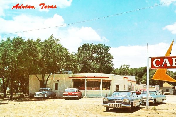
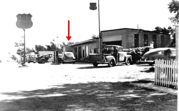
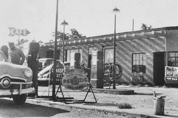
The photographs from the late 1940s (black and white, below) and a color postcard of it in the 1950s (below) show a slightly different lay out to the current one. It didn't have the famous bent door. Instead it had an entrance hallway or vestibule that protruded out from the main building onto the service area of the gas station (red arrow in the image below), the hall had a regular door.
Red arrow marks the entrance hall in this late 1940s photo.
A 1950s photo. The hall is partly visible behind pump beneath the "Cafe" sign.
The red "bent door" was added later (1970s?) as you can see in the sequence below. The building in the early 1960s has the vestibule with a regular door facing east. The control tower windows have three panes and there are three supporting poles reinforcing them (blue arrows). Later, the vestibule has gone and a fourth sector has been added on the western tip of the window, a narrow pane and the bent door with a transom window above it. A fourth post has been added to support this new panel as you can see in the last image.

Bent door not there, it had a vestibule ca.1960

Bent door there, vestibule gone
The place closed in 1970 as I-40 drew traffic away from the old Route 66. It was purchased by the Kiewerts in 2006, who restored it and are working on it. They own the Motel down the road.
Old 1920s Phillips Station
Next to the cafe, to your right, is a cottage shaped building, with a gable over its main entrance, and two windows on each side. This was the old Knox's gas station.
It had been kept next to the Milburn - Price Culture Museum in Vega (see a St. view of it while it was there).
The old gas station in its new home in Adrian
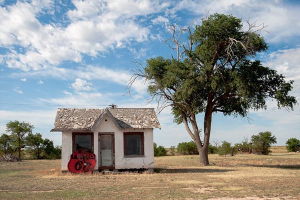
The owners of Fabulous 40 motel and Bent Door Cafe have acquired it and moved it to its present home in Adrian. It is the oldest (built in the 1920s) and also newest (it arrived in 2016) Phillips 66 of the three in town.
Drive east along Route 66 towards the grain elevators. One hundred yards from the Bent Door Cafe, to your right is another old gas station.
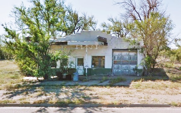
Marak Lubrication
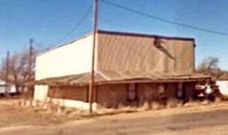
It has a serrated parapet atop its facade, a flat canopy with curved tipped beams jutting from the wall in an Art Deco style. These rounded tipped beams served as a backdrop for the brand in Texaco stations.
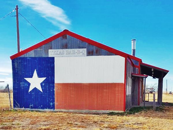
Texas Flag Mural
Drive another 200 yards east, and visit a building facing the grain elevators. Its eastern wall is decorated with the Texas flag.
Turn around and head west along Route 66, just after passing Knox's old Phillips station, is another old gas station.
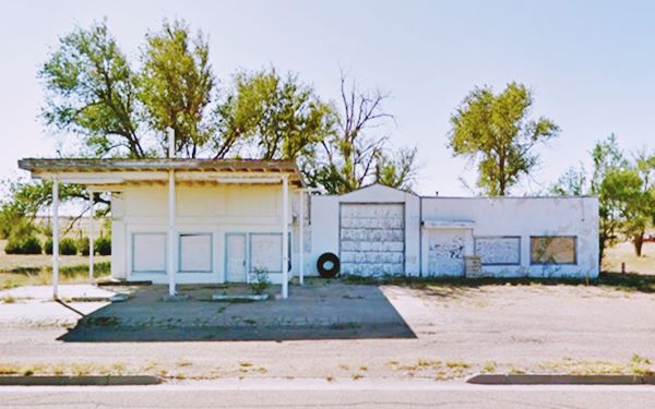
Harwood Cafe and Service Station
Passing Grand Ave., next to the post office, to your left (South) is an old gas station with a flat roofed canopy and a single bay garage. It dates back to 1950. Following the garage is what used to be the Café.

Fabulous 40 Motel, Adrian
Just ahead is the Motel.
Fabulous 40 Motel
Built in 1967 and run by the Callstroms, it closed after their death and was bought by Roy and Ramona Kiewert (owners of the Bent Door Cafe) and reopened in 2016 Learn all about it at its official facebook page.
The name of the 20-room motel comes from the fabulous freeway, Interstate 40, that runs behind it, brand new back in 1967.
Midpoint Café
"When you're here, you're halfway there"
Next to the motel is a Restaurant & cafe, souvenir and antique shop. It is a Route 66 Roadside Attraction, and it faces the Midpoint marker and signs.
This cafe bears the record of being the oldest continuously-operating cafe along U.S. Highway 66 between Amarillo, TX and Tucumcari, NM, as well as being the only cafe on the midpoint between Los Angeles and Chicago.
In 1928, two years after the creation of U.S. 66, a very simple brick building went up in Adrian to cater for the travelers: a one-room construction with a compacted earth floor which was known as "Zella's", after Zella Prin, who leased it from its owner, Jeannie VanderWort.

Cafe's neon sign, Source
It was enlarged in 1947, a period when it was open 24 ⁄ 7. And was finally bought by Jesse Fincher and Dub Edmunds in 1956 who renamed the place "Jesse's Cafe" and ran it for 20 years together with a service station that was next to it (more on the station below).
Business turned sour in 1969 when I-40 bypassed Adrian and travelers stopped passing through the town; this led to the sale of the Cafe.
Terry and Peggy Creitz acquired it and changed its name to "Peggy's Café". After another change of ownership (when it was renamed again, as "Rachel's"), it was sold to Fran Houser in 1990.
At first Houser called it the "Adrian Café" but in 1995 she renamed it "Midpoint Café" to ratify its unique location on the halfway point of US 66.
Fran retired in 2012 and after being owned by Dennis and Donna Purschwitz, in 2018 it was bought by Brenda Hammit and Carrie O'Leary.
Midpoint Café and Cars Movie
Pixar was inspired by the Midpoint Cafe to create Flo's V8 Café in the animated film Cars (2006).
The characters Flo, Mia and Tia were based on Fran Houser and two of her restaurant's employees, the sisters Christina and Mary Lou Mendez.
The movie's credits acknowledges the café and Fran Houser.

Sunflower station, Source
Sunflower Station
The neighboring former Dubs Enco - Humble gasoline station is now the Sunflower Station, an antique and souvenir shop
Its office and flat canopy have survived. The gas pump islands too. But the two bay garage to the right of the building have been torn down (see postcard below from the mid to late 1960s).
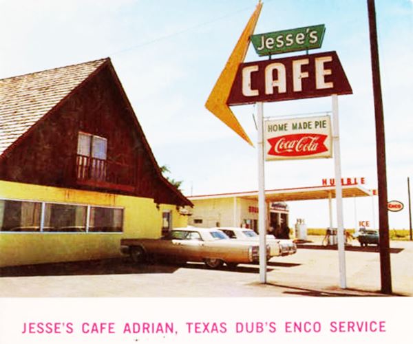
The postcard says "Jesse's Cafe & Dubs Enco Service Featuring the finest in complete dinners, steaks & home made pies. Also fine Enco products... Have your car serviced while you eat. We have a tiger next door... Happy Motoring"
Notice the upper part of the sign which now says "MidPoint" then said "Jesse's". Also notice that the gabled roof is lower than in the postcard: the room on the second floor burned in a fire and the roof was lowered.
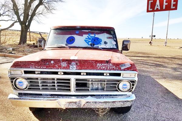
Don't miss the red pickup truck with autographs written all over it.
Midpoint Markers
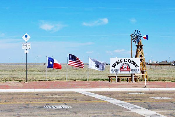
There are several markers on the midpoint of Route 66, you can take some nice photographs here.
Originally there was a sign, pictured further up, then shields and a painted band across the roadway marking the spot. Flags, an old windmill (the modern wind turbines can be seen in the fields behind the signs), and a marker of the "National Old Trails Road Association" stating 1139 mi. to Chicago and Los Angeles.
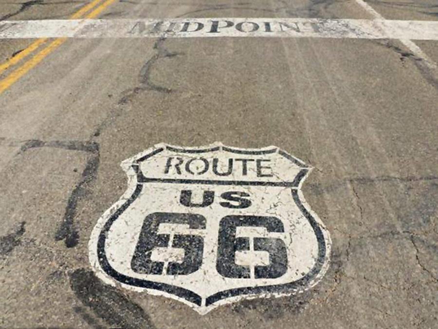
At the "Midpoint of Route 66", halfway between Los Angeles and Chicago there are some shields on the road
> > Read about all the Shields painted on Route 66
Another Cafe Sign
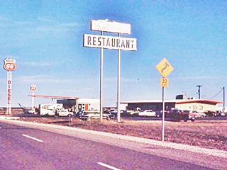
Continue your journey west, on the corner of Co. Rd.22 you will see the second Cafe sign, it also had the Enco station sign at one time.
Across the Freeway, to the south, behind the sign you can spot the last sight in town, Tommy's second cafe and Phillips station.
Cross the overpass to visit it.
Tommy's Second Cafe and Larry's Phillips 66 Station
When I-40 was built, traffic stopped flowing by Tommy Lovless' original Cafe and service station (Bent Door). He built two new ones, a cafe (the second one) and another Phillips 66 gas station (the third in town).
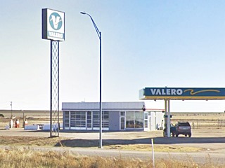
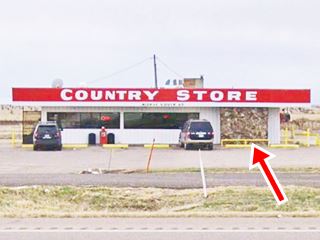
The old gas station is still standing, and the current Valero gas station office and store is in fact the original Cafe (see the stone facade on its western tip, part of the old cafe, marked with a red arrow in the images below).
The gas station's oblong box with two garage bays and a plate glass office is still standing, now vacant. The steel pole of the original sign is also standing (now with a Valero sign).
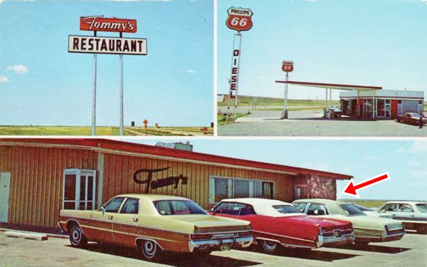
The postcard above says "Tommy's restaurant & Larry's service center Phillips 66 products - Relax and enjoy home style cooking and western hospitality. Good coffee and home made pies. Interstate 40 & Highway 66, Adrian Texas."
Gull Wing Station
This gas station pictured below is a "Gull Wing" or "Bat Wing" Phillips 66 style station. Starting in the late 1950s Phillips Petroleum Co. standardized their filling stations across the US and adopted a "space age" design.
The Gull Wing stations like this one in Adrian had a large triangular "gull-wing" canopy which was supported at its narrow tip by a pole designed to look like an oil derrick. The pole was capped with a Phillips 66 revolving sign.
The canopy and its tip pole have been removed, but are clearly visible in both vintage images.
> > Learn more about Phillips 66 Gull Wing stations on Route 66
This ends your tour of Adrian.
Tours & Itineraries
Gruhlkey
Head west from Adrian along I-40 to visit the old Caprock gas station at Gruhlkey and the old alignment of Route 66 through Boise (map with directions). In the section close to Exit 18 at Gruhley the 1920s and later alignments run on the north side of I-40. This is a Map of the original US 66 through Gruhlkey. It ends in a dead-end west of the town. At Exit 18 on the north side of the road are some foundations and steel poles of a former gas station. And in Ghurlkey itself, an old gas station box sytle built with blocks, and with one of its pumps is still standing. It belonged to Percy Gruhlkey. See picture.

Old gas station in Gruhlkey. Source
Boise
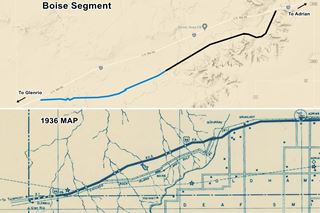
Before its 1936 realignment, the highway ran to the south of the current I-40 alignment, parallel to the railroad tracks and passed by a siding called Boise.
This road has been abandoned and in private property, but it can be seen and -with permission- could be driven in part (Pale blue in the map. The Black Line shows the non-driveable alignment).
Its eastern terminus is at Exit 15. The former depot or siding of Boise (see map showing its location) is 1 mile south of I-40 along an unnamed road, and the exit point is 11.5 mi east of Glenrio, and 11.5 mi west of Adrian.
It was a shipping point for the ranchers in this area, midway between Glenrio and Adrian. It had a depot which remained open until the Rock Island railway abandoned the line in the 1980s. Today there is a ranch there. The tracks have been lifted but some old railway bridges can be seen.
Sponsored Content

>> Book your Hotel in Amarillo Texas

Credits
Banner image: Hackberry General Store, Hackberry, Arizona by Perla Eichenblat
H. Allen Anderson, Adrian, TX. Handbook of Texas Online, Published by the Texas State Historical Association.
Jack DeVere Rittenhouse, (1946). A Guide Book to Highway 66.


