Route 66 in Bard New Mexico
Index to this page
About Bard, New Mexico
Facts, Trivia and useful information
Elevation: 4,090 ft (1,247 m). Population: 0.
Time zone: Mountain (MST): UTC minus 7 hours. Summer (DST) MDT (UTC-6).
Bard is a small ghost town in Quay county NM.
In our San Jon page we describe the early history of Bard.
Bard, the name
There are two versions about the origin of its name, one says that it derived from the Bar-D ranch brand, the other that one of its first settlers, a Mr. Haynes, named it after a water-melon railway siding in Texas.
Haynes chose the name because it was colorful, poetic and related to musicians who performed there. "Bard" is a Celtic word, found in Scottish Gaelic ("bàrd) and Welsh ("bardd"). It was used as a term to designate an itinerant musician.
Located on the old alignment of Route 66, five miles east of San Jon and 13 miles west of Glenrio
The townsite was established in 1906, next to a siding of the CRI&G Railroad (Chicago, Rock Island and Gulf Railroad). A post office opened in 1908.
It served the local farming and ranching community and in its early days was a very wild cowboy town where gunfigths were not uncommon. In 1926 Route 66 was aligned through it.
In the mid 1940s it had a gas station and a store. The population once reached 195 residents, but declined after the 1950s alignment of Route 66 was built (now the North Frontage Road of I-40), bypassing the small village. Today it is a ghost town.
Getting to Bard
West of Bard along Route 66 is San Jon. To the east is another "ghost town", Endee, followed on the New Mexico - Texas state line by Glenrio, and further east is Amarillo (86 mi.)

Where to Stay
Find your lodging nearby, there is no accommodation in Bard but you can find a room in other in nearby towns along Route 66
> > Book your Hotels in nearby Tucumcari or Santa Rosa
Lodging Near Bard along Route 66
Below you will find a list of some of the towns along Route 66 in New Mexico. Click on any of the links to find your hotel, motel or accommodation in these towns (listed from east to west);
On Route 66's Main alignment
The Santa Fe Route 66 segment
Eastwards
Westwards
>> There are RV campgrounds close to Bard.
Weather in Bard
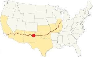
Location of Bard on Route 66
On our San Jon Weather page you will find more information.
Map of Route 66 in Bard
There are two alignments of Route 66 through Bard:
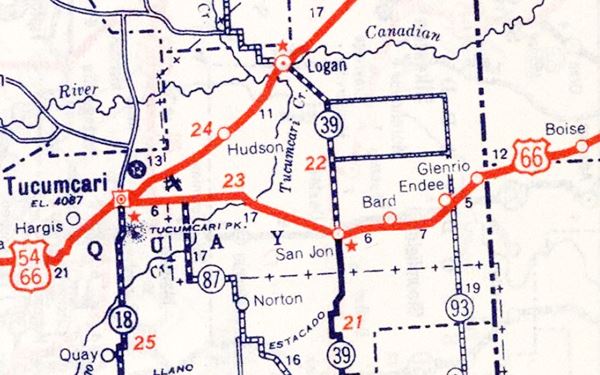
- The original 1926 - 1952 alignment. See this Map of Route 66 through Bard (1926-1950s alignment). Now it is a dirt road east of San Jon. It used to be paved but the county removed the paving for cheaper upkeep.
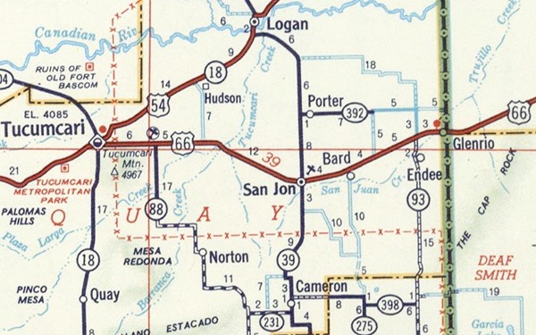
- The later alignment (after 1952) which is paved. And cut buy I-40 just east of San Jon. See this Eastern segment north of I-40, and Western segment south of I-40 into San Jon.
Our Route 66 Map of New Mexico has all of the alignments of Route 66 across the state over and links to the towns along it.
Glenrio to Tucumcari Historic Route 66
Route 66, Montoya, NM.
Listed in the National Register of Historic Places.
This segment of Route 66 that passes through Bard, is a historic landmark listed in the National Register of Historic Places and runs from Glenrio to Tucumcari.
We have a webpage that describes this historic alignment with maps and plenty details; vist our Glenrio to Tucumcari Historic Route 66 webpage for more information.
Route 66 Map through Bard. 1939 (original alignment)
The following map shows the later alignment, that bypassed Bard.
Route 66 Map Glenrio to Tucumcari in 1956 (new, post-1952 alignment)
Bard's Route 66 Attractions
Jack DeVere Rittenhouse wrote about Bard in his book "A Guide Book to Highway 66", published in 1946:
Bard. (Pop. 26;... gas and garage.) This "town" consists of a single building, but it includes a post office. Jack Rittenhouse (1946)
Landmarks in Bard
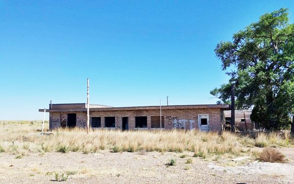
Bard Trading Post
If you are driving down the freeway (I-40) to avoid the gravel surfaced section from Glenrio to San Jon, leave it at Exit 361, and turn right, head north. The North Frontage Road is the alignment of US 66 built in 1952.
On the NW corner of Q Ranch to Market Rd. and old US 66 is an abandoned building. The former "Bard Trading Post".
As you can see in the images below, a Then-and-Now sequence, it used to be a Chevron Gas station, with a Post Office, and it sold all sorts of articles (ice cream, souvenirs, films, toys, cameras, gifts, groceries, meats, pop).
The outline of the building is the same: The two windos of the store on each side of the entrance door, and the garage bay on the western tip of the building. The old canopy over the pump islands has gone but the steel pole the held the Chevron sign is still standing.
Bard Trading Post nowadays on the 1952 US 66 alignment
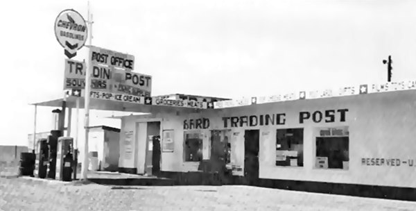
The photo above is from an advert that read: "Ad reads, "Bard Store & Trading Post - General Merchandise - Groceries, Drugs, Notions, Hardware, Vet Supplies - Phone 2861 - Clyde Robbins - Dovie Robbins".
Bard Trading Post nowadays on the 1952 US 66 alignment
Bard townsite
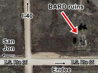
Head south into "Bard" itself, on the original 1926-52 alignment of Route 66 (it is less than one mile away, see map with directions).
Nothing is left of the old "town" only the foundations of the razed gas station and garage (the one mentioned by Rittenhouse), on the north side of the dirt road.
Your city tour ends here.
Return to the freeway or drive 5 miles west to San Jon.
Sponsored Content

>> Book your Hotel in Albuquerque

Credits
Banner image: Hackberry General Store, Hackberry, Arizona by Perla Eichenblat
Robert Julyan. 1996, The Place Names of New Mexico. UNM Press
Jack DeVere Rittenhouse, (1946). A Guide Book to Highway 66.


