Get your Kicks on Amarillo's Route 66
Index to this page
About Amarillo, Texas
Facts, Trivia and useful information
Elevation: 3,605 ft. (1,100 m). Population: 204,503 (2025).
Time zone: Central (CST): UTC minus 6 hours. Summer (DST) CDT (UTC-5).
Amarillo is located in the Texas Panhandle region. It is county seat of Potter County, and also extends into Randall County. Its Metro area has almost 250,000 inhabitants, making it the 185th in the U.S.
The Name: Amarillo
The word is of Spanish origin and it means "yellow". There are two explanations for this colorful name: one, that it was inspired by the yellow flowers that grow in spring and summer. Another that it derives from the name of the Amarillo Creek, which in turn has yellow clay on its banks; A. Whipple wrote about this in 1853: "At Arroyo Amarillo (Yellow creek), some beds of sandy marl, instead of being red and green, are greenish-yellow".
Amarillo is also the fourteenth most populous city in Texas, is also known as the "Yellow Rose of Texas".
Amarillo's History

Art Deco (1932) Paramount Theatre, Amarillo, Source. Click for St. view
The Panhandle area has been inhabited for over 10,000 years, as "Clovis" type stone tools of that age have been in Clovis NM and Amarillo was a source of flint for the Indians and their ancestors.
In the 1540s, the Spanish "Conquistadors" explored the region searching for the mythical city of gold (Eldorado), but found only endless plains.
Pedro Vial probably crossed the area in 1786 seeking a route between Santa Fe and Natchitoches. Canadian River was explored by Maj. Stephen H. Long in 1820. The California Gold Rush prompted new explorations (Josiah Gregg in 1840 and Randolph B. Marcy in 1849). They were followed along Canadian River by Lts. James W. Abert and Amiel W. Whipple in 1845 and 1853, respectively.
Tecovas springs was a pasture land for Mexican shepherds and a trading post for Comancheros.
White buffalo hunters exterminated the herds, livelihood of the native Comanche and Kiowa Indians; this led to war with the natives (1874-75). They were defeated and penned off in reservations.
Soon ranchers and settlers began arriving, cattle breeding was the basis of the local economy.
The Fort Worth & Denver City Railway crossed the area in 1887. At that time there was a tent city, the "Ragtown" built along the eastern edge of the Frying Pan Ranch, it housed the railway construction workers.
At that time elections were held to choose the county seat. A townsite proposed by J. T. Berry, Oneida was backed by the first county judge, William B. Plemons, won the vote thanks to the cowhands of nearby LX Ranch. The new town was renamed Amarillo.
A post office was opened and the first newspaper (Amarillo Champion) and a school were established in 1888. The town moved to avert flooding dangers, to a higher site in 1890, around Polk St. This was ratified by another election in 1893.
More railways were built and the large ranches were subdivided into farms, so farmers began arriving in large numbers.
Gas was discovered in 1918 and oil in 1921. In 1928, the discovery of the Cliffside gas field, with abundant helium, led to the first Helium extraction plant in the U.S.
The Dustbowl afflicted famers with drought, and the Great Depression hit the recent boom in the oil business. The New Deal programs were centralized in Amarillo and funded improvements in streets and sewerage. Population in Potter County reached 54,265 in 1940.
Amarillo Trivia
Actress and dancer Cyd Charisse was born in Amarillo.
The city layout was defined by William H. Bush (the nearby town of Bushland was named after him); he defined that the north to south streets be named after U.S. presidents in chronological order (John Quincy Adams was skipped because John Adams had used the surname first). The last president to be named was Grover Cleveland.
World War II brought prosperity: the Army Air Field opened (it closed in 1946 but reopened in 1951 as the Amarillo Air Force Base -it closed in 1968). Cattle, Oil, natural gas and helium are the pillars of local economy.

Amarillo: Where to Stay
Accommodation in Amarillo: There are plenty of hotels and motels in the town.
Find your Motels and Hotels in Amarillo:
> > Book your Hotels in Amarillo
More lodging Near Amarillo along Route 66
The towns along Route 66 in Texas offer different lodging options. Check out some of the hotels and motels in the main towns below listed from east to west
In Texas Along Route 66
>> There are RV campgrounds in Amarillo.
Weather in Amarillo
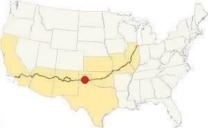
Map showing where Amarillo is located on U.S. Hwy. 66
Amarillo has a semi-arid weather, with great day-night temperature variation. Temperatures in summer average 108°F (42°C) and the lows average 90°F (32°C). The high altitude moderates the summer temperatures, so nights are about 25°F cooler than daytime (14°). Winter is relatively mild, with maximum temperature averaging 52°F (11°C) and lows of around 25°F (-4°C).
Rainfall is scarce; around 20 in (500 mm), mostly in summer. Sunny weather is very common and moderates the winter daily temperatures. Amarillo is the windiest city in the U.S.
Snow can fall in Amarillo at any time between September and May (the first snow usually falls during the first week of December). The high altitude causes greater snowfall than locations further east: 17” per year on average (with peaks of about 40”); 43 to 102 cm.
Tornadoes, Amarillo is located in the Texas region belonging to the famous "Tornado Alley"; read more: Tornadoes on Route 66.
Map of Route 66 in Amarillo
Click on the links below to zoom into the different image maps of US66 in Amarillo.
>> custom interactive map. Eastwards into Amarillo
>> custom interactive map, Westwards from Amarillo
Route 66 itinerary across Texas
We divided the course of the highway across Texas into two legs, from Texola in the east to Glenrio on the NM state line. The midpoint of Route 66 is located in Adrian TX:
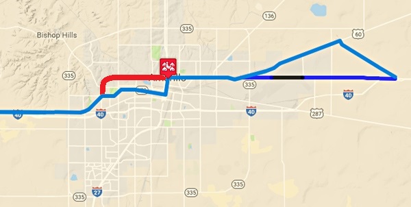
Alignments of Route 66 Through Amarillo.
Click links for large size images
Color Key to these maps of Route 66 in Amarillo: Pale Blue: driveable Historic Route 66 alignment; Blue line: older Route 66 alignment now cut by the airport. Black: roadbed now gone or buried under airport. Red: Beltline 66.
Map with the alignment of Route 66 through Amarillo
You can also use this Map with US 66 alignment in Amarillo (1928-85).
Route 66 Alignment near Amarillo
- Amarillo to Glenrio (next)
- Texola to Amarillo (Amarillo's)
- Clinton to Texola (previous)
Attractions & Sights in Amarillo
Things to Do and See in Amarillo
- In Amarillo - Read on below:
- Museums, Events & Art
- Tours & Itineraries
- National and State Parks
Amarillo City Attractions
Some Amarillo Trivia:
Jack Rittenhouse drove along Route 66 in 1946 and wrote his book "A Guide Book to Highway 66" in which he mentions Amarillo.
...4 leading hotels and 40 smaller ones; 36 auto courts; many garages; all facilities Rittenhouse (1946)
Get your Kicks in Amarillo
"Route Sixty-six": is an emblematic song that immortalized Route 66 in the minds of several generations as an iconic Road Trip, a journey where the traveler can get his kicks, enjoying and savoring the moment and the freedom of riding the Mother Road. It was written by Bobby Troup in 1946 and since then, it has been a hit evoked by all those who have driven (or dream about driving along) Route 66.
Read More: Get your Kicks on Route 66, full details on the song and its context.
Amarillo is the one and only Texan town mentioned in the song, and it appears in the following stanza:
Now you go through Saint Looey
Joplin, Missouri,
And Oklahoma City is mighty pretty.
You see Amarillo, Gallup, New Mexico,
Flagstaff, Arizona.
We will begin our tour of Amarillo on the eastern side of the city, along Historic Route 66.
Into Amarillo from the east
Amarillo Blvd. 1926-85 Route 66
It was known as Northeast 8th and Northwest 8th, as U.S. 60-66, as Motel Row, but in 1964 it became Amarillo Boulevard.
Triangle Motel
Listed in the National Register of Historic Places
7954 East Amarillo Blvd. To your left. Silas Clayton (1888 - 1984) built the Triangle Motel between 1946 and 1952 on a triangular site at the intersection of US 66 and US 60 (E. Amarillo Blvd.)
At that time Route 66 ran along the southern side of the motel because the alignment coming from Conway had an east to west direction as it hadn't yet been cut off by the airport. US 60 ran along the western side of the property.
The Amarillo Triangle Motel neon sign
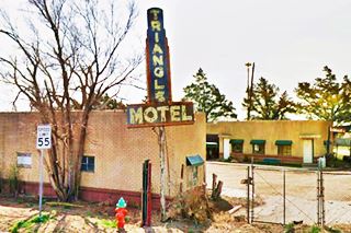
The buildings were built in Streamline Moderne style and remodeled in 1956 replacing the stucco finish with a brick veneer. The rooms were located in two linear buildings that face each other with inset garages between rooms.
The site included a café and service station (Triangle Phillips66) that is still standing on the corner. It was hit by a small tornado in the 1950s. Clayton retired in 1977 and sold the business.
Below is a "Then and Now" set of images of the old Café and the motel looking east along Route 66. The café now has a hipped roof, but the layout is the same.

Triangle Motel 1950s postcard. Source
Across Route 66, facing the motel is a fading rusty neon sign of Buster's Café (1963) that reads "Beer" and "Cafe" (St. view).
Whiting Bros gas station
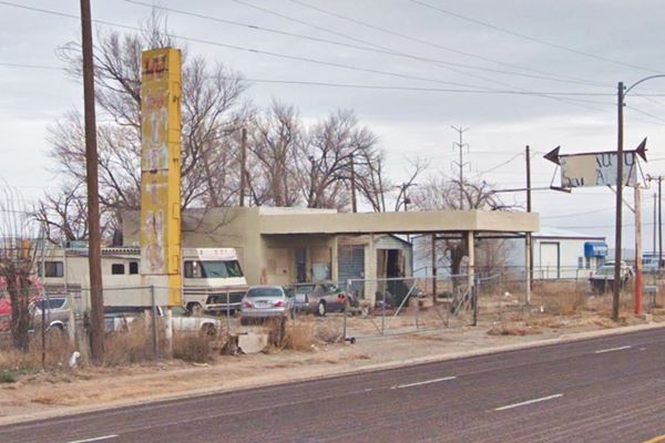
Ahead, at 7501 E Amarillo Blvd, to your right. The building is in disrepair, but the canopy, islands and office are standing. On the western side of the property, there is a yellow vertical sign with the faded letters "Whiting" written on it.
The old Amarillo Whiting Bros. Gas Station
> > Learn more about Whiting Bros. stations on Route 66
Teague-style Texaco
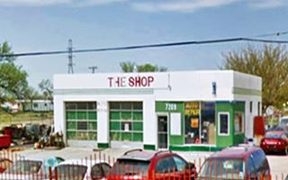
At 7209 E Amarillo Blvd., is a 1930s-40s oblong box former Texaco gas station with two service bays with multiple windows, and its white porcelain enamel panels on the walls with the parallel green stripes across its facade indicate it was a Teague-style Texaco. This was a classic design that modernized service stations across the nation, starting in 1937. There is another Teague in the Historic 6th St. District.
>> Learn all about the Teague-style Texaco service stations along Route 66
Aviatrix Neon Sign
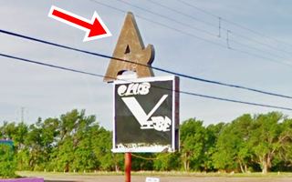
Route 66 continues west and curves adopting an east to west course. At 5600 E Amarillo Blvd., to your left is a neon sign from the old Aviatrix club. It was a small drive-in that opened in the late 1930s, and was owned by Earl Hooper. It was a cafe and dance club. The original building burned down in 1953, was rebuilt and remained in the family until the 1980s. The stylized letter A with the faded word "the" written on it, sits atop the original neon sign, but now beneath it, it says "Club Vibe."
Ruths Steak House
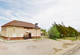
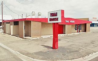
This restaurant opened in 1954 (5601 E Amarillo Blvd), facing Aviatrix. The building with its diamond shaped gable end is still a restaurant (now serves Thai food) and the lower part with the forked poles of the neon sign is still in use.

Ruth's Steak House c.1965. Source
Colonial Manor
On the next block, to your right, at 5407 E Amarillo Blvd. is an old motel, its original name was "Colonial Courts", later the Colonial Manor Motel, this building dates back to the 1930s. It is still operating as a motel now under the name "Rama". It promoted itself as "Amarillo's Largest and Newest" at that time Amarillo Blvd was called N.E. 8th St. The neon sign is gone, but the brick structure that held it up is there.

Postcard, Colonial Manor Motel. Source
On the same block, to your right, is the neon sign of Eastridge Bowling Palace, from 1959. Now it is known as "Eastridge Bowling Lanes".
Woods Inn
At 4600 E Amarillo Blvd. to your left is an old cabins complex, now called "Woods Inn". It opened in 1945 as the "Biltmore Courts Tourist Camp", with cabins set in two concentric rings.
The place is in very good shape and well kept. Don't miss the original neon sign, still there!

Postcard 1940s Biltmore Court. Source
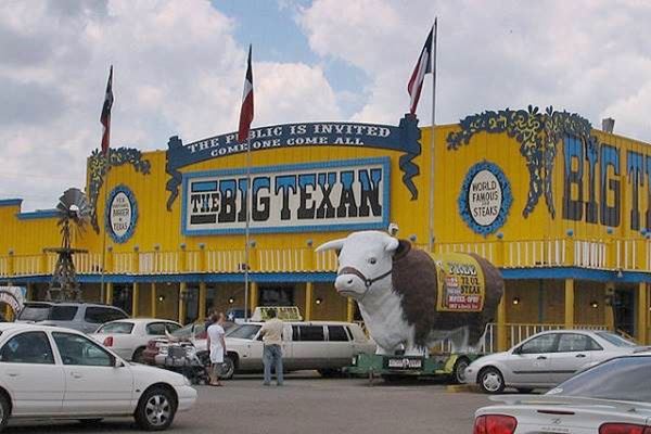
The Big Texan Steak Ranch
This is where the famous steakhouse first opened back in 1960. The building dates back to 1955 and first housed Underwood's BBQ See Underwood's 1950s postcard.
When the freeway bypassed its location, Big Texan moved in 1970 to a more visible spot on the interstate (at 7701 I40, 3.3 mi. away, see map). It burned down in 1976 and was rebuilt in 1977.
Below is a then and now of its original location, notice the "Big Texan" cowboy neon sign, now gone and the vertical brick wall next to its entrance, on the eastern side of the building.

Postcard 1960s Big Texan. Source

Original Big Texan building as Underwood's BBQ 1950s, and nowadays. Click for St. view
See Underwood's 1950s postcard
It also used an eye catcher at its new location: A large steer!, placed in front of the premises that announces its famous 72 oz. (2.02 kg) steak, the "Texas King", which costs $72 but is served free to those who can eat the steak and the trimmings (bread roll with butter, baked potato, shrimp cocktail, and salad) in less than one hour.
Head west, at 4011 E Amarillo Blvd. is the Silver Spur Motel, with a classic neon sign dating back to 1952. Now it is on the side road by the overpass, but during the golden days of Route 66, this was a grade crossing. The overpass has shaved off some feet from the front part of the motel, including its porch, relocating the sign.
The motel had "twenty deluxe units featuring Franciscan furnishings... Mansell and Allene McNew, Owners".

Postcard 1950s Silver Spur Motel, Amarillo. Source
Two classic Route 66 gas stations Gulf and Chevron
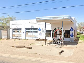
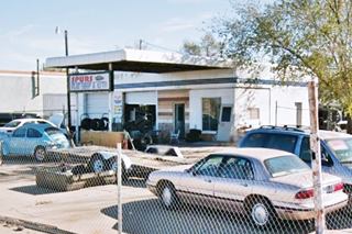
To your right, on the corner of the block (4001 E Amarillo Blvd.) is a former Gulf Gas Station that opened in 1953 as Huddleston Red Gulf Service. Later it was Bob Matthews Gulf Station, and J.L. Gulf Station, before becoming an auto sales and now a garage. See its St. view, an oblong box design with three service bays and a flat canopy.
Across US66, at 3902 E Amarillo Blvd. is a former Chevron Station built in 1962 for westbound traffic (St. view).
Cattleman's Café
At 3801 E. Amarillo Blvd. to your right. This cafe has been open since 1961, it offers "Breakfast, Steaks and Dinners" and is open 24/7. Its now fading steer shaped neon sign is worth a photo.

Cattleman's Café neon sign. Amarillo. Source. Click image for St. View
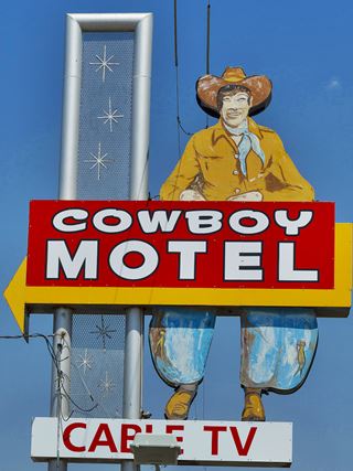
Cowboy Motel neon sign. Amarillo. Click for St. view, Source
Cowboy Motel
At 3619 E Amarillo Blvd. the "Cowboy Motel" beckons its potential guests with a gigantic cowboy on its neon sign.
The motel's postcard tells us it had "Children's and adult swimming pools. Rooms with Color TV, playground. Good Parking Facilities", those were
the days when the whole family went on road trips!
It began in 1950 as the "Del Camino Motel" (see postcard) ran and owned by the Wares. Later became the "Cowboy."
Sundown Motel
Ahead, across the street (3612 E Rte. 66), to your left. This motel has had many names since it opened back in 1944 Pantex Courts, James Tourist Court, Ace Court, and finally, Sundown Motel. It had 30 units with "Massage Mattresses". Notice how the neon sign has changed over the years.

Postcard 1960s Sundown Motel, Amarillo. Source
Adjacent to it is the former "Casa Mia Courts" which opened in 1940. At 3602 E Amarillo Blvd. It has a linear lay out. The motel was renamed "Wagon Wheel Motel" in the 1950s. (St. view).
Estess Motel
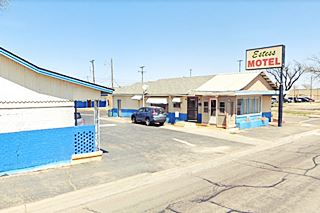
To your right, ahead, at 3511 E Amarillo Blvd. It was built in 1950 and was known under different names: Apache Courts, Woody's Motel, Hill's Motel and Estess Motel. Below in the "Then and Now" sequence you can see that the flat roofed office now has a gabled roof and that the great 1950s neon sign was replaced by a bland contemporary one.

Postcard 1960s Estess Motel, Amarillo. Source
To your left, on the south side of Route 66 are some large grain elevators. The postcards of the 1950s proclaimed that Burris Elevators were the "World's Largest Grain Elevators". They are gigantic (St. view).
Seminole 66 Station
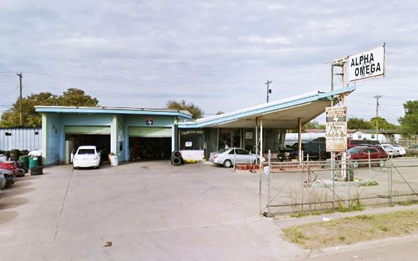
At 3207 E Amarillo Blvd. (Route 66), it was built in 1964 and known as Seminole station. Later it became Monterey Auto Sales and now Alpha Omega. It is in good shape, with its Canopy still in place and a two bay service area.
Seminole Gull Wing. Amarillo Route 66
Hill Crest Motel
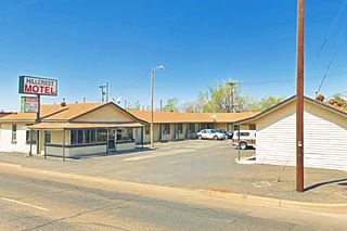
To your right, on the next block at 3017 E Amarillo Blvd. This motel always operated under the name "Hill Crest", it opened in 1945.

Postcard 1960s Hill Crest Motel, Amarillo. Source
Royal Inn
Facing the Hill Crest, to your left (2830 E Amarillo Blvd.) is the Royal Inn, which opened in 1948. It operated under different names: Bailey's Motel, Cactus Motel, Carter's Motel, and Royal Inn. It had "All tiled baths, tubs and showers... vented Panelray heat, air-conditioned, Franciscan Furniture."

Postcard 1940s Cactus Motel, Amarillo. Source
Palo Duro Motel
To your left (2820 E Amarillo Blvd), the former Palo Duro Courts is still there. It opened in 1949. Its units have a U-shaped layout around a centra gable roofed office. Its slanted neon sign is intact.

Postcard 1940s Palo Duro Motel, Amarillo. Source
Route 66 Inn
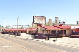
Next to the Royal Inn at 2806 E Amarillo, is the 53 unit "Route 66 Inn". Built in Spanish Ecclectic (Spanish Ranch) style back in 1951, it was originally named "True Rest Motel". Located at 2806 E Amarillo Blvd it also has a U-shaped layout.

Postcard 1960s True Rest Motel, Amarillo. Source
Redwood Motel
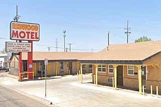
Facing the Route 66 Inn, to your right is the Redwood motel. It was also built in 1951 (2691 E Amarillo). It had a U-shaped plan and offered "All refrigerated, Tee Vee, Phones, Sound Proof, Garages."

Postcard 1940s Redwood Motel, Amarillo. Source
Mc Pherson Service
At 2623 E Amarillo, to your right is old McPherson Service station from 1947, an oblong box station with two service bays, multiwindow, a canopy with two parallel bands and rounded corners (both featured on Conoco and Magnolia-Mobil stations 1930 to 1950).
On the next block (2415 E Amarillo) is the neon sign of the 1957 Mandarin Café later Ding How Restaurant, slowly rusting and fading (St. view).
Wimpy's
This 1963 restaurant at 1210 E Amarillo Blvd, to your left has a steep-pitched gabled roof. A small chain during the 1960s, it was named after a Popeye character who loved to eat burgers (St. view).
The next vintage place is 9 blocks to the west.
La Rose Courts
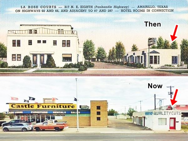
At 307 E Amarillo Blvd., to your right is what remains of a motel built in 1945 as La Rose Courts, later Smith's Motel, Motel Barber Shop and also a Holiday Inn. The long narrow building contained several rooms while the main building (now gone) was located on the western side of the property. It was "Quite, adjacent to excellent restaurants." In the Then and Now sequence below, the red arrow marks extant building, a barber shop.
Route 66 1926 alignment and the Later Alignments Split
Here at Fillmore and East Amarillo Blvd. the original Route 66 alignment turned south along S Fillmore St. and headed into Downtown Amarillo.
Only in 1956 did Route 66 bypass the city center, as a "Beltline" or "66 By-Pass", that curved around the city along W Amarillo Blvd. The older alignment became B.R. 66. See Map of Beltline 66.
Westwards, along Beltline 66
Motel Row on the 1956-85 Route 66
Town House Motel
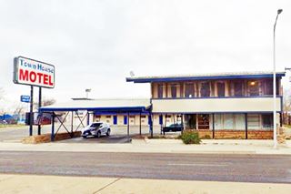
Head west along Route 66 Beltline and at 112 W Amarillo Blvd., is the former 42-room Farrell Manor Motel, that opened in 1956 (the year that the Beltline 66 or was inaugurated). Then it became the Town House, still there with some changes such as a canopy over the entrance and a more sedate neon sign.

Postcard 1940s Town House Motel, Amarillo. Source
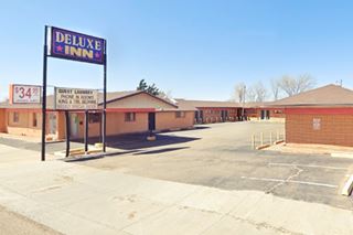
De Luxe Motel
At 620 W Amarillo, to your right, is the Caravan Motel, later Shalom Inn. It opened in 1957. It change its name to De Luxe. It had a U-shaped layout and 24 carpeted and airconditioned rooms, with "Room phones - Free Morning Coffee, Radio and TV." It has gabled roofs now and it lost its great neon sign, but it is clearly the same motel.

Postcard 1950s Caravan Motel, Amarillo. Source
Holiday Shell and Neal's Texaco
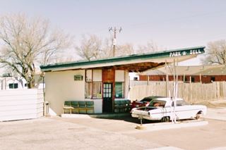
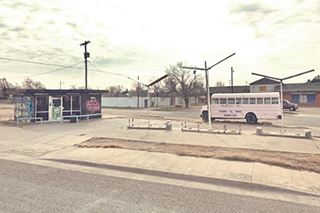
Across the street, to your left, at 701 W Amarillo Blvd. Is a Tamal and Burritos drive-thru, it opened in 1963 as Holiday Shell Station, the shop has occupied the former office and there are
two service bays to the right (St. view).
On the next corner (713 W Amarillo) is another gas station, Neal's Texaco. As you can see in its St. view, the red-brick building with stout columns holding up the canopy has a retro look for the time it was built, back in 1954. Later it became a liquour store.
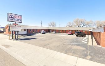
Star Lodge
To your left, at 810 W Amarillo is the gable-roofed bungalow-style "Star Lodge". It began in 1955 as the Jewel Motel and was also known later as the Ranch House Motel and The Sleepin' Inn.

1950s postcard Jewel Motel, Amarillo. Source
Jay's Phillips 66
Ahead, to your right at 818 W Amarillo is another Phillips 66 Gull wing station. This one is quite atypical, it lacks service bays and has a small office and a mini-gull-wing canopy. It was known as Jay's 66, and later was a Tire store. It was built in 1962.
Wild Horse Service
To your left, across Route 66 on the small triangle at 1013 W Amarillo is a gas station that opened back in 1945 and was called Wild Horse Service Station and EC's Carriage.
Westwards, on the north side of Route 66 Beltway at 1336 W Amarillo Blvd are the remains of a large motel complex. Take the northern side road to visit it.
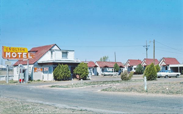
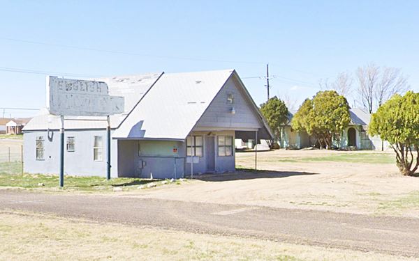
English Motel
Below is a picture taken in 1977. The English Motel had Tudor Revival style cabins with gabled roofs, it opened in 1955. The cabins One-and-a-half-story front-gabled motor court office/residence with centered single entry door flanked by paired sash windows, stuccoed walls, Hardiplank in gable ends, shed-roofed dormer on south roof, gable-roofed rear addition with single entry door, and small flat-roofed addition on the north side for a garage and shed. The front part appears to have been the office under a slightly lower gable roof with residence section behind.
It had two typex of motor court cabins: single and multi cabins with two to three units. The old neon sign with faded paint says "English Motel", the office (pictured) and the brick walled Cafe (to the east) are still there.
Harold's Automotive - Arrow
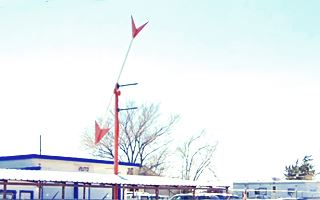
Head west. At 2707 W Amarillo to your left is what was a former gas station (Harold's Automotive & U-Haul).
It opened in 1954 as gas station and auto repair shop,
Now it is a used car sales. Its most interesting feature is the large "arrow" sign pointing downwards.
Allen's Gulf Service
3611 W Amarillo Blvd. Also to your left. This Gulf station dates back to 1957.
It has the original white porcelain enamel panels with the three Gulf bands on the upper part of the service bays and office.
The flat canopy over the pump island is in good shape.
Arthur's Super Phillips 66
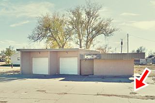
At 3703 W Amarillo Blvd. is Arthur's Super Phillips 66 it was built in 1956. It has two service bays with projecting service bay walls that are slanted to the side. The "V-shapted" canted canopy has been removed but you can see the spot where the pylon that held its tip up was located (red arrow).
Half a mile to the west, the highway begins a 1.5 mile long sweeping curve that changes its direction 90° from east-west to north-south. In this area none of the classic Route 66 landmarks have survived.
Amarillo's City Limits During Route 66 heyday
Beltline and 9th St.
At SW 9th Street the Beltline 66 meets the older 1926-56 alignment coming from the downtown area and the U.S. Route 66-Sixth Street Historic District.
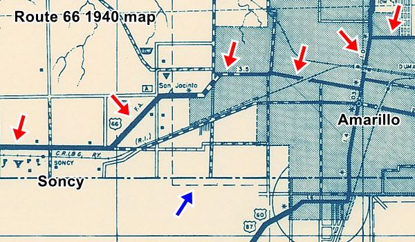
Amarillo expanded and engulfed the surrounding communities as it grew in the late 1950s. But originally its incorporated area was much smaller as you can see in the map below, published in 1936. The red arrows mark the alignment of Route 66 through Amarillo (from East, upper right corner) to Soncy in the West (lower left). This is the 1926-56 alignment. Notice how the dashed line (blue arrow) marks the "Corporate Limit" or city limit of Amarillo.
This city limits line crosses US66 at the San Jacinto triangulation station, on what is now SW 9th Ave and Clyde St. To the east of the later Beltline 66.
See the full sized map
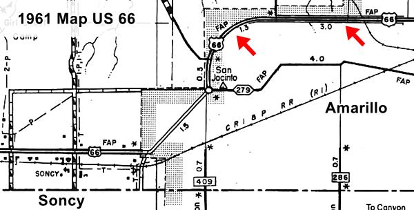
By 1961 the city had grown and it now included the new Beltline 66 (red arrows in map below), but Soncy was not part of it. The dashed line with cross hatching marks the city limits (it cuts Route 66 at Coulter St. S, east of Soncy) at the point where its curve ends and it assumes an east-west course once again.
See the full sized map
Below we describe the attractions along W Amarillo Blvd (1926-85 alignment) south of SW 9th Street. The highway has a 1.5 mile-long NE-SW course in this section and it ends as Route 66 enters Soncy.
Southwestern Amarillo
Head westwards along Route 66 to visit a gas station and two motels. In the 1950s the eastbound lanes of W Amarillo Blvd followed what is now the side road that links it to Bell St. passing right in front of these landmarks.
Circle Service Station
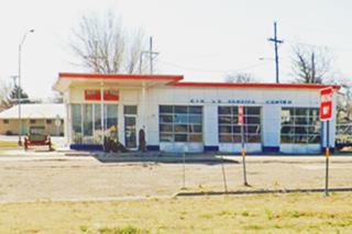
On the corner with Bell at 6001 W Amarillo. It opened in 1953 as Circle Shell Station. It has a flat roof, white porcelain enamel exterior finish, large glazed doors on its three service bays, and a canopy extending from the office. Oblong box style.
Next to it stood the now demolished "Broncho Motel" followed by the "Astro".
Astro Motel
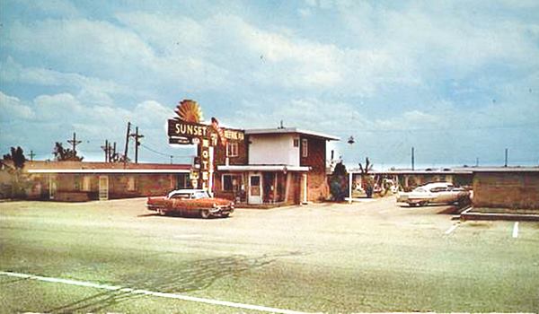
At 6007 W Amarillo, it opened in 1950 and was named "Sunset Motel". Later it became the Astro. It was owned and operated by Mr. and Mrs. Pete Georgantones, it had 20 "modern units" with a U-shaped layout, and it accepted Diner's Club, American Express and Carte Blanche cards. It has the same two floor office but has lost its 1960s sign.
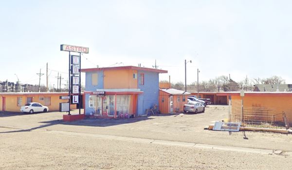
Skyline Motel
Next to the Astro (6011 W Amarillo), also with a U-shaped design, is the Skyline Motel now named Economy Inn. Built in 1951 "Across from Veterans Hospital, West city limits... featuring eighteen Ultra-Modern Units, Franciscan furniture, Private tiled baths... Mr. and Mrs. Elmer Dowell owners and operators." Below is a Then-and-Now set of images, you can see it hasn't changed much.

Skyline Motel, see postcard
Helium Times Columns Monument and Museum
Take a right along Killgore Dr. it is an 0.3 mi. drive to the monument. 1200 Street Drive, Amarillo (map).
It is a Time Capsule (and also a sun dial) located in front of the Don Harrington Discovery Center, an interactive science center with exhibits and a planetarium, named after a philanthropist.
The six-story high monument was built to commemorate the 100th anniversary of the discovery of helium. It has three stainless steel legs and a vertical one. They contain four
capsules that are to be opened 25, 50, 100 and 1,000 years from the date of erection (1968). The first capsule was opened in 1983 and its contents are exhibited at the Discovery Center.
In 1982 it was moved to its current location by helicopter from Nelson and I-40. Head back to Route 66 and turn right.
Ranch 66 Motel
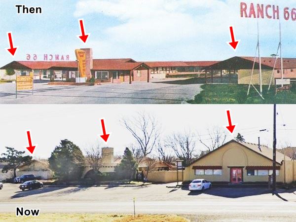
Its postcard says "6666 West, Highway Route 66. Ken Bourland, manager; Amarillo'w Finest; Radio, television, swimming pool, refrigerated air conditioned. The U-shaped motel on the eastbound lanes later became the "Guest House Motor Inn", and is still there, now as "Las Tiendas". It opened in 1954 and had 31 units.
Though modified, the building with its U-shaped layout, the vertical element in the central building and the gable roof units have survived.
Ahead, as Route 66 curves with an east-west course, on the south side is a motel built in 1969, the "Interstate Motel", at 7401 W. Amarillo. As its name indicates, it was built to cater to the traffic on adjacent I-40. (St. view).
Soncy
At this point classic Route 66 entered the small community of Soncy, and this marks the end of your roadtrip through Amarillo.
West Along the 1926-56 US66 alignment
Into Downtown Amarillo City 66
Route 66 left E Amarillo Blvd. and headed south along N Fillmore St., after meeting US 87. Not many buildings have survived the ravages of progress in this segment. One exception is the Burlington Route 66 Rock Island Railroad underpass was built in 1931 with an Art Deco style, see its St. view.
Since Fillmore now runs from south to north, you will have to head south along Pierce St. Turn right along Sixth Street and follow US 66.
Brick Road Paving
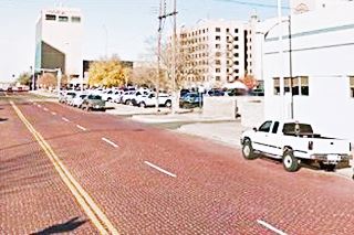
You will notice the road is paved with red bricks! Local citizens voted in 1910 for streets to be paved with bricks. The downtown area of the city still has 16.2 mi (26.1 km) of red brick streets, which it diligently restores.
> Read more about Brick paved sections of Route 66.
U.S. 366 Spur of Route 66
Here in Downtown Amarillo, there was a spur of Route 66 between 1926 and 1935. It went all the way to El Paso, Texas, crossing eastern New Mexico.
> > Read about The six spurs of Route 66
1920s Gulf Service station
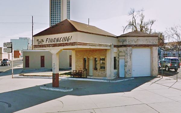
Ahead, to your left, at 525 SW 6th, on the corner is a 1920 Gulf gas station. Gulf from 1917 to 1930 adopted this design with a single centrally placed column with trangular brackets holding up its canopy (the gabled roof is new, the original station had a flat roof). The clean vertical lines have a strong Art Deco stylistic influence. It has a small office, and the service bay opens to the west.
Ahead at 802 SW 6th, to your right is a used car dealer (St. view) which used to be Morris Service Station, and later West 6th Super Service. It opened in 1963. Flat canopy, two bay service area.
On the 1600 block is the art moderne style underpass (former Rock Island Railroad) built in 1938. Steel bridge, concrete underpass.
1920s Gas Station
After the underpass, take a left along S Crocket St. and on the next corner turn left. In the middle of the block is a 1920s Spanish ecclectic style station, it looks like a home, with terracota tiles on its roof (St. view). Head back to Route 66 and head west.
The neighborhood has an industrial look to it, but on the 2000 block, to your left you will see a large apartment complex called "Park Royal - Senior Living"; it was built in 1924, and has over 100 units in its seven stories of red-brick buildings.
Dempsey's Gulf
On the SW corner of S Lamar and SW 6th, is an old gas station, built in 1941. It has had different names over the years: Sixth Ave Garage, Dempsey's Service Station, Chaney's 66 Service Station, Bradley Bros Service Station. The building has a flat canopy with three service bays with multi-light windows, two to the right and one to the left. Two columns with ridges define the office. These features were typical of Gulf stations of that period.
Ranch-O-Tel Historic Motel
On the next corner, at 2501 Sixth Ave. is a historic motel.
Listed in the National Register of Historic Places
The Ranch-O-Tel (or Ranchotel) was built in 1940. It belonged to Betty and Chester Bordwell. It has a "U" shaped layout with 16 units linked by alternating garage parking spaces.
It created a Western ranch air with its stucco-covered walls, chimneys, wooden windows & shutters. Gabled roofs with exposed rafter ends and wagon-wheel handrails added to the charm.
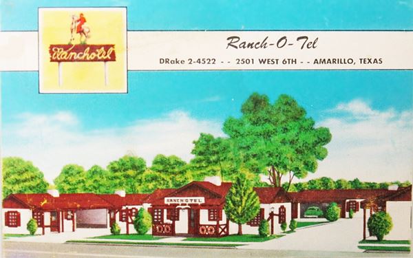
They were furnished with rustic beads, tables and chairs; the lamps had cowhide lampshades, the mirrors were horseshoe shaped.
When traffic moved to Amarillo Blvd. in 1953, it became an apartment building (and remains so until today) which was listed in the National Register of Historic Places in 1995.
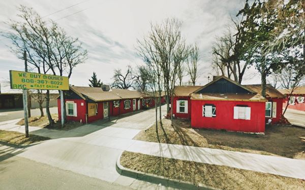
U.S. Route 66-Sixth Street Historic District
The Historic District is defined by 6th Street between Georgia and Forrest Avenues, Amarillo TX.
Listed in the National Register of Historic Places
The Historic Route 66 - 6th Street District spans 13 blocks along Sixth Street in the San Jacinto Heights district of Amarillo.
It has several vintage service stations and buildings with different architectural styles ranging from the 1920s to 1940s including stores, shops, and a motel.
A journey along Route 66 in the Historic District is like time travel to the classic Route 66 days.
It was developed in the early 1900s as a streetcar suburb; in 1921, the road already had a gravel surface, as part of the Ozark Trail highway system. San Jacinto Heights was incorporated into the city in 1925 and the road was paved with brick in 1927 the year after it became part of the Route 66 alignment. Its current asphalt paving dates back to 1942, when the street was widened in 1942.
Historic Route Marker and Monument & Historic District sign
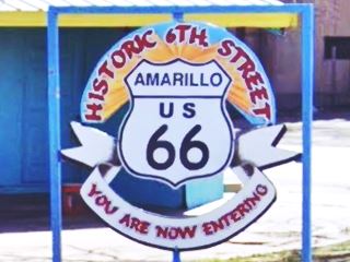
At S. Georgia St. to your right, on a small plaza is a small monument, a Historic Route 66 road sign with the US66 shield, and a Historic Marker (St. view). The text reads "Commonly called the 'Main Street of America' and also the 'Mother Road,' Route 66 became the first paved transcontinental highway in the U.S. spanning from Chicago to Los Angeles; the route in Texas crossed 7 panhandle counties over 177 miles. Route 66 was popular with automobile tourists. The road was important in the development of Sixth Street and the San Jacinto area in Amarillo, which was the only large urban city on the Texas route. In 1994 the area was listed in the National Register of historic places, and has become the focus of local preservation efforts. (1996)."
To your left is the colorful sign marking the beginning of the Historic district (see picture).
The Sixth Street became a part of town catering to the 1920s travelers: a City Tourist Camp accommodated them; "auto campers" slept by their cars in the open, there were 12 service stations by the end of the 1930s. Service Stations were now designed to attract customers, with canopies, restrooms and pumps that were set away from the roadside. There were 25 tourist courts along route 66 in Amarillo by 1928.
US Route 66 moved to its newer alignment in 1953 when the four laned Amarillo Blvd. was completed to bypass the congested downtown area. Motels with swimming pools and restaurants soon sprung up along the new route, ending the golden era for the old Sixth St.
The Natatorium
Half a block to the south (left) at 604 South Georgia on the western (right) side of the street.
Nat Ballroom or simply "Nat". It was built in 1922 to house an indoor swimming pool, it was turned into a ballroom in 1926. It had a 10,000 sq. ft. polished maple floor, neon-lit
seating area on the lower area and a revolving mirrored ball. The second floor had a dining area, dance floor and small stage with balconies overlooking the main dance floor.
It has been labelled the ugliest building in Amarillo, with a medieval castle facade including corner turrets and battlements on its eastern dofr. The north face of the building was designed to look like an ocean liner with lifeboats included.
There were dances every night except Monday and a "big" band would play there every month (Duke Ellington performed at Nat's). It closed in 1960 and reopened in the 1970s for private events. The Nat Café on 6th St. was built by Nat's owners in 1935 and is still open.

Vintage photo Nat Ballroom. see postcard
Humble Station
Across the street, facing Nats at 609 S Georgia is a former Humble-Enco gas station. The main feature of this 1950-60s style was the two-part roof with a higher roof over the service bays (this one has three bays) and an inward sloping roof over the office. The slanting plate glass window is quite unusual.
San Jacinto Fire Station
610 South Georgia, next door to the Natatorium. The San Jacinto Fire Station was built in 1926 in a Mission Revival style. It was an initiative of W.E. Cazzell to improve the neighborhood and it remained in use until 1975. It is the only surviving pre-World War II fire station in Amarillo.
Short side trip
Take a short 1.5 mile round-trip detour to visit two landmarks (map with directions).
A Cottage-style Phillips 66
Drive down S Georgia, three blocks south, to Line Ave. and to your right, on the SW corner is a 1920s cottage style Phillips 66 station, in very good shape. Gabled roof, chimney and all! (St. view).
Head south along S. Georgia and turn right along SW 10th Ave. ahead, to your right is an example of "Americana".
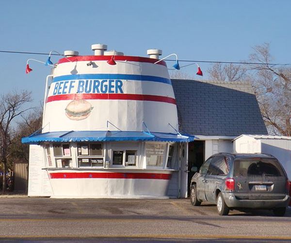
Beef Burger Barrel
Americana
3102 Plains Blvd. This is a barrel-shaped building first opened in 1937 as an A&W root beer stand. Roy Allen and Frank Wright (the first letters of their surnames originated the A&W name) founded the company in 1922.
It was located on Hayes and E Amarillo Blvd. until 1947 and moved around Amarillo before reaching its current location in 1952.
Bussey Building
Head back to Route 66, turn left and go west into the Historic District. The whole block to your left (2713-2727 West Sixth) is a historical building.
Four store fronts built with dark brown colored bricks with limestone details. The complex was commissioned by L.W. Bussey and built by Albert Randall. The building at 2719-27 was built in 1924 and the 2713-17 one (pictured) in 1927. They were the first important commercial buildings along Sixth Street.
They housed various shops such as drug stores, cafes, grocery stores, and even a Beauty School from 1941 to 1964.
Cazzell Buildings
2806 and 2801 West Sixth. W.E. Cazzell and his wife Ada lived around the corner from West Sixth, on 510 South Florida St. In 1918, they bought the property next to their home (2806 W. Sixth) for $190, and opened a general store there in 1918.
It was a simple one story rectangular brick building. Pictured below.
Later it was subdivided to house two separate stores such as grocery stores or bakeries. The Cazzells sold it in 1922 to Allen Early for $7,500 (they had made a good investment), and had a two story building built across the road, at 2801 West Sixth.
When the street was widened in 1942 its facade was demolished and rebuilt with its current configuration, blending the styles of the 1920s with those of the 1940s.
Cazzell was known as "The Mayor of San Jacinto" for his efforts to promote the district's development.
Gulf Station
Don't miss the 1940s gas station at 2815 6th St., on the corner to your left. Flat canopy, two bay service garage. Before its current restoration it had three parallel ridges running across the upper part of the service bay, office and the canopy edge (right angled corners). This indicates that it was probably a Gulf station.
Sinclair Station
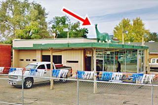
With a dinosaur on the office's roof (red arrow in picture above), this 1950 Sinclair gas station, on the NW corner at 3000 6th St. was really a Sinclair not only becaus of the dinosaur, but because it has a Sinclair sign of the wide-shield style that replaced the former round ones in the late 1950s. It also has an office that is lower than the service bays, narrow metal poles support the canopy.
Borden's Heap-O-Cream
Ahead, at 3120 West Sixth, on the corner is an Art Moderne building. Notice its details: rounded metal sheet corners, plate glass windows with oval shape, rounded metal awning on the facade and side.
It was part of the Borden Company's chain of dairy bars. Borden had two downtown bars and had this building built in 1941. It was rehabilitated in 1990 (pictured below.)
Adkinson-Baker Texaco
3200 West Sixth on the NW corner. The Adkinson-Baker Tire Company's Texaco gas station was built in 1939 and also displays an Art Moderne style, reflecting the Texaco's corporate identity of the 1930s.
It is a one story, two service bay, oblong box service station with a flat canopy with two parallel, forms that project across it. The word Texaco was written on it.
Notice also the three ridged bands on the building, they would have been painted Texaco green, and the building would have been white.
It belonged to the Adkinson-Baker Tire Company, that sold Texaco gasoline. Later, in 1945 it housed the Theo A. Bippus filling station.
Magnolia station
On the SW corner at 3303 6th St. From 1934 to 1940 Magnolia built gas stations with a Spanish Eclectic style: they had flat roofs and the parapet was a pent roof wuth terra cotta tiles. The two surviving service bays to the right, have bracketed corners. The canopy of this station must have been removed but the two sturdy corner piers still stand on each side of the office.
Dutch Mill Service Station and Café
3401 W 6th, to your left, SW corner. This rectangular shaped building with stucco walls with crenellations on its upper facade was built in 1932. It had a Dutch windmill on the curb to attract customers which gave it its name. It housed a cafe and a service station until 1950; when the cafe moved into another building.
San Jacinto Methodist Church
On the corner with South Tennessee you will see the church, built in 1926 in a Classic Revival style. It is a two story building, with dark brown brick and a pedimented entry.
The 1942 widening of Sixth Street led to the demolition of the original stairway entrance. The sanctuary and educational facilities are now housed in a two story brick addition built at the rear.
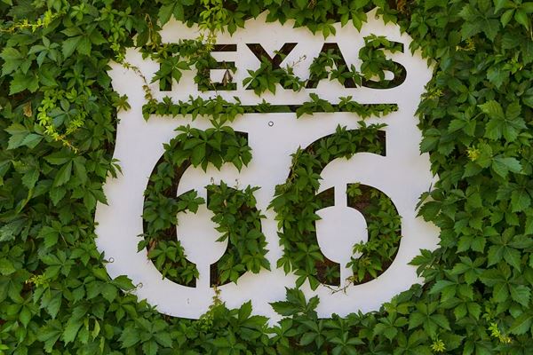
Texas Route 66 "ivy" shield
To your right, after the Methodist Church and the Generation Next Worship Center. The antiques store has a Route 66 shield on its ivy covered wall.
Moe Dogs Grill: Cities Service gas station
One block west, at 3515 W 6th, on the SE corner is a 1950s gas station, now known as Moe Dogs Grill; it is pictured below. Although it carries some Sinclair signs, it was a Cities Service filling station. The vertical parapet in the middle of the building (which held the sign) and the green and white porcelain enamel finish, the angled corner entrance were typical of the late 1950sCities Service stations.
Taylor’s Teague Texaco Station
3512 West Sixth, across the street from the Cities Service. This former Texaco was built around 1950. It is a one story rectangular building. Its walls are covered with white porcelain enameled panels.
It has a Streamline Moderne design (curved canopy supported by pipe columns, with two horizontal boxes with curved tips that once held Texaco signage. It follows the design laid down by Walter Dorwin Teague in the mid 1930s.
Martin's Phillips 66 Station

1963 photo of Herbert Martin Phillips station
3821 West 6th, on the SE corner. The current building dates back to 1963, when the 1930 Tudor Revival cottage style service station was demolished.
This is the fourth "Gull Wing" in town, a modernistic space-age style with a soaring triangular shaped canopy, canted plate glass walls in the office and angled service bay entrances.
Its first owner was Chet Cain who sold it to Herbert Martin in 1944. Herb ran the station until 1991.
St. view of the former Martin's Phillips 66 Station in Amarillo Texas
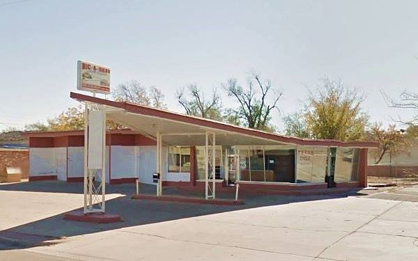
Humble Enco station
At the end of the Historic District, at Forest St., Route 66 curves to the south becoming Bushland Blvd, on the right side of the street is a former Humble station that is now an upholstry shop. It opened in 1952.
It has an two original service bays and a canopy held up by metal columns with an upward slant (Humble-Enco used this type of poles in the 1950-60 period).
Bel-Aire Motel
On the next block, SE corner of Independence St. to your left, is the "Bel-Aire", a motel that opened in 1955, it is still active, but now as an apartment complex, see this St. view.
Some more 1950s filling stations
To your right on the next corner (US 66 and S Western St.) is what remains of a 1955 gas station, an office with slanted plate glass windows. St. view.
Route 66 runs with a NE-SW course along the eastern flank of Amarillo Country Club and turns right at SW 9th Ave. At the curve, to your left is a "Red-brick" former gas station built in 1952, with two garages and no canopy, see its St. view.
The 1926-56 Route 66 heads west along 9th St. and meets the Beltline 66 alignment at Bell St. both then turn south towards Soncy.
Your city tour in Amarillo along Route 66 ends here.
Museums, Events & Art

Quarterhorse, Amarillo, Source
The American Quarter Horse
The quarterhorse is typical in the Western U.S. (though the breed originated in England), it is a compact heavily muscled horse that can outrun any other horse in short distances, of up to a quarter of a mile; which gives it its name. There is a museum in Amarillo (2601 East I-40. Amarillo by Exit 72A) with the American Quarter Horse Hall of Fame, and many horse statues around the town commemorate this reliable and very American horse.
Events: Cowboys and Rodeos
Tri-State Fair &Rodeo
Details at their website: www.tristatefair.com
A celebration of the Texas and cowboy culture. During the third week of September. Participants from New Mexico, Texas and Oklahoma.
Since 1921. Venue: Tri-State Exposition grounds.
The World Championship Ranch Rodeo
Details at their website: wrca.org
At the Amarillo Civic Center, during November. It is sponsored by the Working Ranch Cowboys Association
World Championship Chuckwagon Roundup
During the first weekend in June. Teams compete in preparing western foods of the 1860s (sourdough biscuits, baked beans, mashed potatoes and beef).
Texas, a musical
1514 5th Ave, Canyon TX, Tel. 806-655-2181. www.texas-show.com
The Pioneer Amphitheater, located in nearby Palo Duro Canyon is the setting for the outdoor musical drama "Texas". Every night, during the summer. Onstage for 50 years. The musical tells the epic saga of the Texas Panhandle settlers and pioneers.
Tours & Itineraries
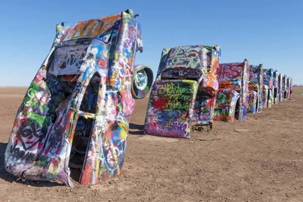
The area around Amarillo has several attractions. Get your car and hit the road to visit them. The most famous is the Cadillac Ranch.
Front view of the Cadillacs at Cadillac Ranch
Natural Attractions
National & State Parks
Amarillo has great landscapes, scenic beauty and nearby places for outdoor recreation:
Lake Meredith National Recreation Area
It is 38.6 mi. north of Amarillo, see Map with directions. You can also visit adjacent Alibates Flint Quarries Nat. Mon.

Yellow wild flowers at, Amarillo,
The park is open all year round, 24 hours a day. Ideal spot for trekking, camping, horseback riding and of course, fishing, swimming and boating in the lake. It is named after A. A. Meredith, former Borger city manager who promoted the dam (Sandford dam) on Canadian River to provide drinking waters to eleven Panhandle towns.
The dam was completed in 1965 and the lake covers 21,640 acres (8,760 hectares). Canadian River runs across the Panhandle and Oklahoma, to flow into the Arkansas River in eastern Oklahoma.
Alibates Flint Quarries National Monument
Next to Lake Meredith, the quarries provided Native Americans with top quality flint stone for tools and weapons for over 13,000 years.
Palo Duro Canyon
30 mi SE of Amarillo Map with directions.
View of Palo Duro Canyon
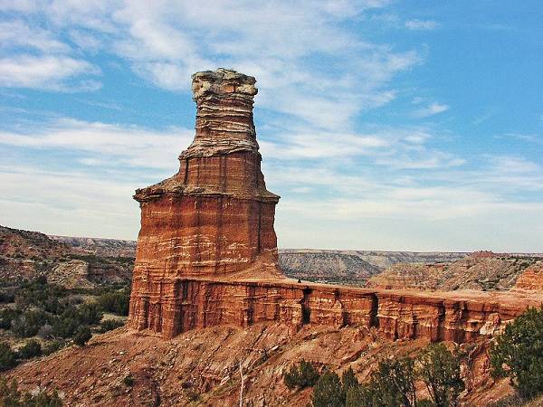
The Palo Duro Canyon State Park (27,173 acres) protects the second largest canyon system in the United States (after the Grand Canyon): it is 120 mi long and
between 600 and 800 ft. deep; it formed over the last million years.
Its name is a Spanish word meaning "hard wood", derived from the tough Rocky Mountain Juniper trees that still grow in the Canyon.
At the Visitor Center you can buy books, jewelry, pottery and souvenirs. The Park has 30 mi. of trails for bikers, hikers and horseback riding.
Buffalo Lake NWR
32 miles SW of Amarillo (Map with directions).

Coyote at Buffalo Lake, Amarillo. Source
It began as a protected area around a lake formed by the 1938 Umbarger dam, and protects the best remaining short grass prairie in the U.S. of which 175 acres were designated a National Natural Landmark.
The now temporary lake forms during major storms in the Tierra Blanca Creek basin, as the springs that fed it ran dry in the 1970s.
Sponsored Content

>> Book your Hotel in Amarillo Texas

Credits
Banner image: Hackberry General Store, Hackberry, Arizona by Perla Eichenblat
A. W .Whipple (1856). Reports of Explorations and Surveys to Ascertain the Most Practicable and Economical Route for a Railroad from the Mississippi River to the Pacific Ocean. Vol.3
Jack DeVere Rittenhouse, (1946). A Guide Book to Highway 66
Two Historic maps of Amarillo: 1940 Roadmap and 1961 Roadmap.


