The "Modern Restrooms" in the foreground, at Endee.
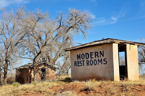
US Highway 66 in Endee NM
Index to this page
About Endee, New Mexico
Facts, Trivia and useful information

Detail of a map showing Route 66 and Endee, NM
Elevation 3,829 ft. (1.168 m). See map with its location.
Time zone: Mountain (MST): UTC minus 7 hours. Summer (DST) MDT (UTC-6).
Endee is a small ghost town in Quay county NM.
Visit our San Jon page for information on the early history of Endee.
It is located 4.7 miles west of Glenrio, along the old Route 66.
The Day brothers, John E. and George, and Mr. Norris established a ranch named after their initials: "N D" in the area in the early 1880s. A post office opened in 1886 and was closed in 1955.
Endee, the name
It took its name from the ND ranch brand.
The Chicago, Rock Island and Gulf Railway crossed the region in the early 1900s, loading cattle at its siding. An "Endee Townsite Company" operated by W.L Bateson as "Sole Agent" promoted the place as "the center of agricultural and stock industries for 1,000 square miles of territory", Bateson added that "A good hotel, school and churches are amont the latest improvements. Telephone connection with neighboring towns has already been established."
The small town was renown for its rowdy cowboys and their gunfights. The original houses were built with poles and sod roofs.
Located on the old alignment of Route 66, five miles west of Glenrio and 14.5 mi. east of San Jon. In 1926 Route 66 was aligned through Endee and that brought prosperity until the new alignment was built in 1952, to the north of Endee.

Hotels close to Endee
You can find your accommodation nearby, because there is no lodging in this ghost town, but you can find a room in other in nearby towns along Route 66
>> Book your Hotels close to town, in Tucumcari or Santa Rosa
Lodging Near Endee along Route 66
Below you will find a list of some of the towns along Route 66 in New Mexico. Click on any of the links to find your hotel, motel or accommodation in these towns (listed from east to west):
On Route 66's Main alignment
The Santa Fe Route 66 segment
Eastwards
Westwards
>> There are RV campgrounds close to San Jon.
Weather in Endee
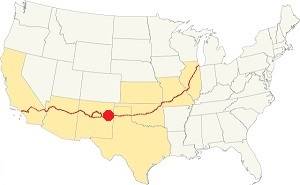
Location of Endee on Route 66
On our San Jon Weather page you will find more information.
Map of Route 66 in Endee
Read the Detailed Description of this segment (Glenrio to Tucumcari). Below is the interactive map:
>> Custom map of Route 66 in Endee
There are two alignments of Route 66 through Endee:
- The first Route 66 alignment, from 1926 to 1952. See this Map of Route 66 through Endee, originally paved, the county reverted it to a dirt road beacuse it is easier to maintain.
- The post-1952 alignment that runs on the North side of I-40 (Eastern segment), and continues later on the south side (Western segment) of I-40 into San Jon.
Our Route 66 Map of New Mexico has all of the alignments of Route 66 across the state over and links to the towns along it.
Glenrio to Tucumcari Historic Route 66
Route 66, Montoya, NM.
Listed in the National Register of Historic Places.
This segment of Route 66 that passes through Endee, is a historic landmark listed in the National Register of Historic Places and runs from Glenrio to Tucumcari.
We have a webpage that describes this historic alignment with maps and plenty details; vist our Glenrio to Tucumcari Historic Route 66 webpage for more information.
Dirt surfaced Route 66 between Glenrio and Endee

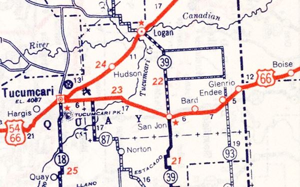
Route 66 Map through Endee. 1939 (original alignment)
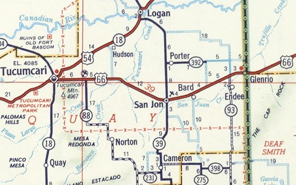
The following map shows the later alignment, that bypassed Endee.
Route 66 Map Glenrio to Tucumcari in 1956 (new, post-1952 alignment)
Route 66 Attractions in Endee
In his 1946 book about Route 66 (A Guide Book to Highway 66) Jack DeVere Rittenhouse dedicated a line to the "town" of Endee:
ENDEE. (Pop. 110; gas; small garage; grocery and a scant handful of cabins.) Only three establishments in this "town" Jack Rittenhouse (1946)
What to See in Endee
We will begin our drive in the former "town", you can drive here from Glenrio along the dirt surfaced historic Route 66, or via I-40, by taking NM-93 south for 3 miles (map with directions).
To the east of the intersection of NM-93 and US66, on the north side of the highway are the ruins of Endee.
Modern Restrooms and Motel
The Endee Grocery, mentioned by Rittenhouse sold "General Merchandise, Tires and Tubes, Auto Accessories" and was owned by Wellington Johnson. The foundations are still there.
In the front, is the famous "Modern Restrooms" building, facing the highway. Behind it, in the trees is the abandoned motel building.
Modern Restrooms on the left, and Route 66 on the right.
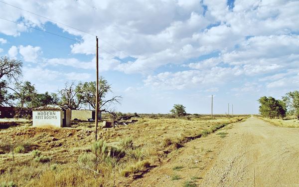

Old abandoned buildings in Endee, NM. Source
The motel seems to have had only three units, separated by two garages. Each unit has a door and a window facing US 66, and a slightly angled roof. Primitive lodging.
Head west to visit one of the original timber bridges from 1930.
Wooden Cyprus Bridge
The original Route 66 faced several small streams as it crossed the basin of the San Jon and Trujillo creeks. The road made several grade crossings of the railroad to ford them. The alignment was straightened out in 1930 and kept the road parallel to the railway tracks.
The highway engineers build several concrete culverts and four bridges. All of them were build with laminated wood decks supported by wood girdrs. They are lined by post and cable guardrails.
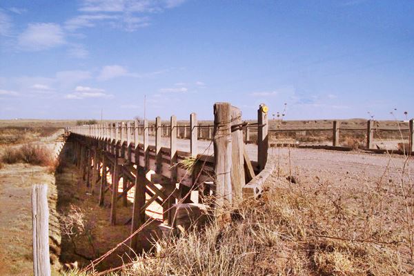
On Route 66, 2.1 mi. west of Endee you can see one of these old Route 66 Wood Bridges (Location map).
It was built in 1931 with timber. It its 302 feet long and its deck is 20 feet wide. The longest span is 20 ft.
There are several shallow river beds and flood plains in the area. They were bridged with cresote-treated pine timber. The decks were built with laminated wood and could be easily repaired by unskilled workers.
Route 66 crossing a wood bridge west of Endee NM
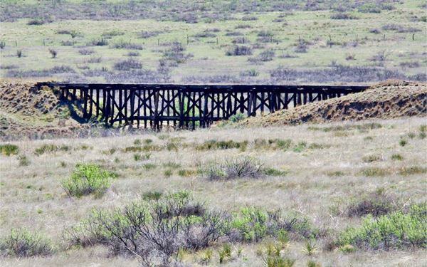
Next to it, on the southern side of the road is an old train tressle that supported a railway bridge, now abandoned. Also built with wood.
Former Cafe and Motel
There are photos and references on the Internet about a Café and Motel with a great neon sign, located in Endee. But this place was razed to build Russell's Truck Stop.
The motel was built on the 1952 Route 66 alingment on the NW corner of Exit 369. You can see this St. view of the sign, and a picture of the motel while it was there.
Your city tour ends here.
Head west along dirt surfaced US66 towards the ghost town of Bard and the small town of San Jon, go east to Glenrio or return to the freeway for a paved road journey.
Sponsored Content

>> Book your Hotel in Albuquerque

Credits
Banner image: Hackberry General Store, Hackberry, Arizona by Perla Eichenblat
Robert Julyan. 1996, The Place Names of New Mexico. UNM Press
Jack DeVere Rittenhouse, (1946). A Guide Book to Highway 66.

