Index to this page
Historic Route 66 Amarillo - Glenrio
Texas Route 66 Itinerary and maps
Each leg of Route 66 described below has an interactive map and many image maps so you can follow the alignments of the highway along the way:
New Mexico, next leg
Oklahoma, previous leg
Amarillo to Glenrio Historic Route 66
Starting point: Amarillo
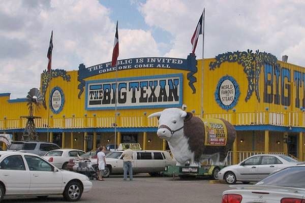
Drive west along Route 66 from Amarillo (Texas).
Route 66 Into Amarillo
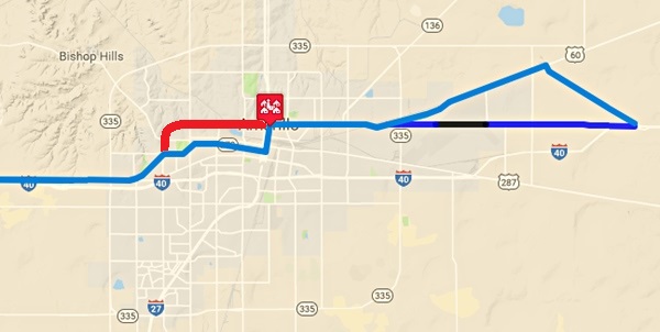
Alignments of Route 66 Through Amarillo.
Click links for large size image maps
These are the courses taken by Route 66 coming from the east into Amarillo:
Color Key to these maps of Route 66 in Amarillo: Pale Blue: driveable 1956-85 Route 66 alignment into Amarillo; Blue line: 1932-56 Route 66 alignment now cut by the airport. Black line: roadbed now gone or buried under airport.
Our custom maps:
>> black line in our custom map is the gap at the airport
>> blue line in our custom map is the 1932-56 Route 66 West of the Airport
The 1932 and 1956 alignments meet on the western side of the airport at the "Triangle" and head into Downtown Amarillo:
>> red line in our custom map is the 1932-85 US 66 into Amarillo
Westwards out of Downtown Amarillo
Two alignments carried US66 westwards, the 1926-56 one along 6th St., and the 1956-85 Beltline 66. Below we describe both:
Route 66 1956 Beltline
At Fillmore and East Amarillo Blvd. the original 1932-56 Route 66 alignment turned south along S Fillmore St. and headed into Downtown Amarillo.
A new alignment was built in 1956 to improve traffic flow it curved around the north and western sides of Amarillo, bypassing the city center: it was known as the "Beltline." It eliminated the 6th St. alignment that became B.R. 66.
>> red line in our custom map is the Beltline 66
1926 to 1956 Route 66 in downtown Amarillo
The first 1926 to 1932 highway reached the center of the city from the southeast.
>> green line in our custom map is the 1926-32 US66
In 1932 it was realigned further north, entering the town from the NE. It ran along this alignment into downtown until 1956:
>> violet line in our custom map is the 1932-56 US66 into downtown Amarillo
Both 1926 and 1932 alignments met and turned west along SE 6th Avenue (now TX-279). Keep straight as the road becomes SW 6th Ave. There is an underpass (1.2 mi) and a slight change in the direction of the 6th Ave. (1.7 mi).
Historic Sixth Street District
Listed in the National Register of Historic Places
Route 66 enters the Historic Sixth Street District. With several historic buildings and gas stations.
Street view of the former Martin's Phillips 66 Station, Historic 6th St. District Amarillo Texas
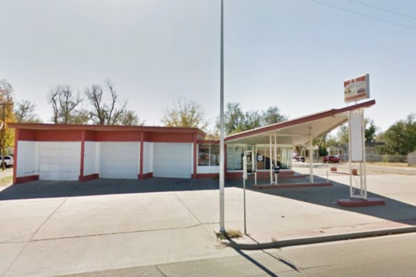
Keep on 6th Ave westbound, and turn left into Bushland Avenue.
The road has a southwesterly course and after the underpass at Bell Street turn left onto West Amarillo Blvd. (which is the Business Loop of I-40) then along W 9th St. westwards around Amarillo Country Club. Ahead it meets the beltline 66 and turns south.
>> pale blue line in our custom map is the 1926-56 Amarillo Route 66
Amarillo's City Limits During Route 66 heyday
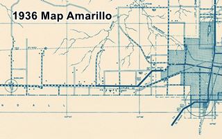
Amarillo expanded and engulfed the surrounding communities as it grew in the late 1950s. But originally its incorporated area was much smaller as you can see in the map below, published in 1936. The red arrows mark the alignment of Route 66 through Amarillo (from the east, upper right corner) to Soncy in the west (lower left). This is the 1926-56 alignment. Notice how the dashed line (blue arrow) marks the "Corporate Limit" or city limit of Amarillo.
This city limits line crosses US66 at the San Jacinto triangulation station, on what is now SW 9th Ave and Clyde St. To the east of the later Beltline 66.
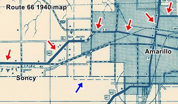
See the full sized map
By 1961 the city had grown and it now included the new Beltline 66 (red arrows in map below), but Soncy was not part of it. The dashed line with cross hatching marks the city limits (it cuts Route 66 at Coulter St. S, east of Soncy) at the point where its curve ends and it assumes an east-west course once again.
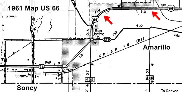
See the full sized map
Soncy
The US 66 alignment then heads to the southwest and crosses TX 335. It enters the town of Soncy where you can see the Historic Helium Plant.
>> navy blue line in our custom map is the 1926-85 Soncy Alignment
After the Fort Amarillo RV park you must take a right onto the Old alignment of Route 66 along Indian Hill Rd. This was a 2 lane alignment replaced in 1956 by a 4 lane highway and the modern railroad underpass next to I-40's Exit 62B
>> turquoise line in our custom map is the 1956-85 US 66 here
Cadillac Ranch detour
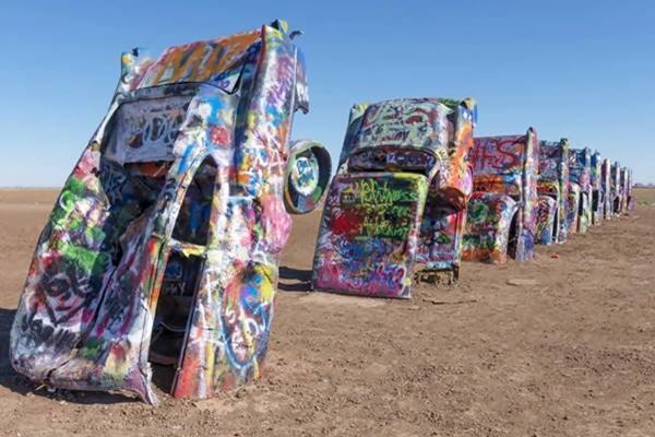
If you head straight towards I-40, you can visit the Cadillac Ranch, which is on the south of I-40. You can only reach it from I-40.
Into Bushland
Stay on Indian Hill Road and take a left on Hill Road, site of the Deadly Underpass and enter the North Frontage Rd. of I-40. Head west. At Exit 57, is the town of Bushland.
The Deadly Underpass of US 66
It is located on Hill Dr. and Indian Hill Rd., 2.1 mi. east of Bushland. You can see it in the map published in 1936 (far left, close to Bushland.)
It was later replaced by the underpass that is close to Exit 62 of I-40, where the W. Amarillo Blvd. merges with the Interstate (see where it is). This later underpass was built to replace the very dangerous underpass whose remains survive until this day, close to Bushland.
The old deadly underpass
>> red marker in our custom map is ths site of the deadly underpass

Deadly Underpass on 1940s Route 66, Bushland. Austin Whittall
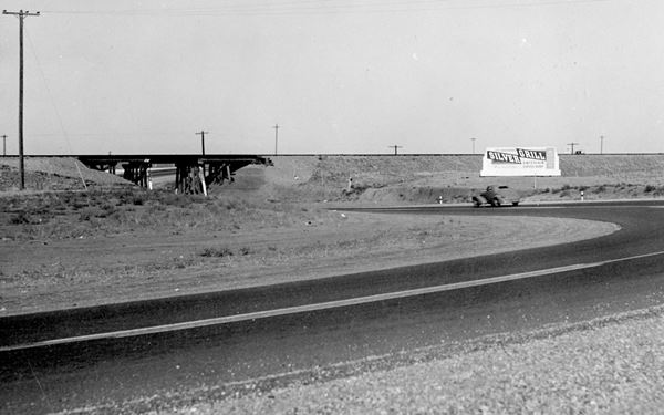
The 1930s and 40s alignment of U.S. hwy 66 did not pass under the tracks by the Helium Plant. Instead the road kept its westerly direction for another 3.5 miles, along what is now Indian Hill Road, on the north side of the railway until it reached what is now Hill Dr., where it took a sharp entry and a sharp exit curve to pass in a very closed "S curve" under the tracks.
Just before its intersection with Hill Drive, the remains of the old 1940s highway paving can be seen on the left side of the road.
It seems that this part of Route 66 was the most dangerous of the whole highway. The unexpected "S curve" caught drivers unaware and speeding drivers crashed there quite often.
Just before the intersection with Hill Dr. you can spot the big chunks of cracked tar road surface curving towards the left between the old railway corridor (the tracks are long gone) and Indian Hill Rd.
The image shows (top) the "S" of the old road in Red, the arrow marks the surviving portion of US Highway 66, and the railway line in yellow (Street View). It also shows (bottom) a 1984 USGS map with contour lines, which explains why the underpass was located here: The drainage is towards the south (bottom) through a culvert on Indian Hill Rd. and under the tracks, which ran on an embankment at that point (brown dashed lines). It is clear that the railway's bridge over this natural drainage was selected for the old U.S. 66 underpass (Red "S" in the bottom part of the image). Modern I-40 is the double red line below the tracks.
The "Death Trap", as it was known, stood there until the early 1950s (a deadly accident was recorded there in 1951) when the road was shifted to the south side of the tracks and the underpass, with a less pronounced "S curve" was built at its current position closer to Amarillo.
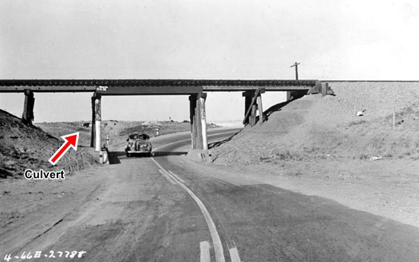
Below are two photos of the underpass in the 1940s. You can also see this 1949 newspaper article mentioning the proyect to eliminate the deadly underpass, it includes a map.
The culvert seen in the bottom image partially hidden by the column to the left of the car, is still visible in the satellite image, just before the crossing.

Bushland to Wildorado
West of Bushland, the original roadway was disrupted when I-40 was built, it is overlaid by the freeway across Wildorado and all the way to Vega. Take I-40 to reach Wildorado at Exit 49. The freeway also erased Route 66 in Wildorado.
>> black line in our custom map is the gap from Bushland to Vega
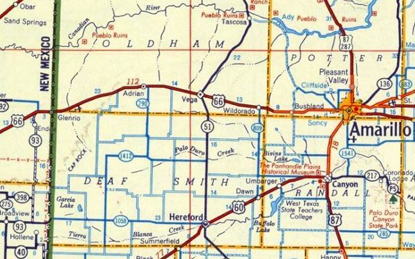
Below is a map from 1956 showing that west of Amarillo almost to Wildorado, US 66 was a "Super-highway 4 or more lanes".
Route 66 (Shell) Map 1956.
Vega
Continue along the I-40 until you reach Exit 37 on the eastern side of Vega. I-40 shifts towards the left to bypass the town. Here you can see several old alignments of US66
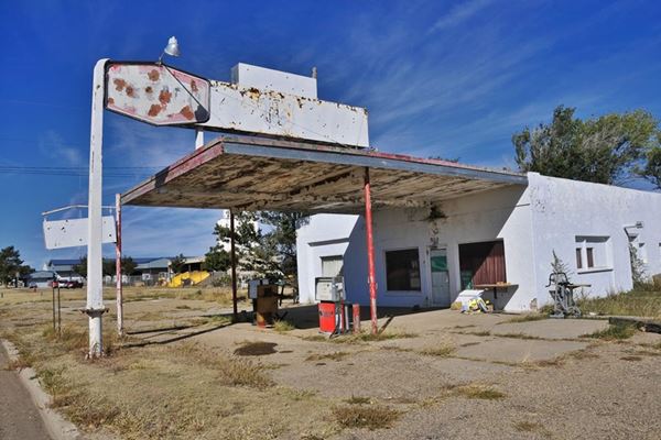
Texaco on Route 66 in Vega TX
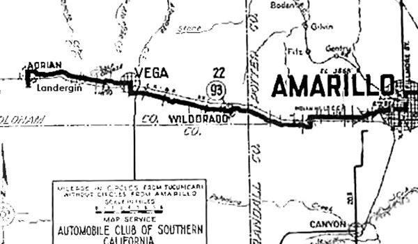
The map above, from 1920, predates Route 66 and shows the Ozark Trail which was suitable for cars at that time. This later became the first alignment of Route 66 in 1926 and early 1930s. It shows us that Route 66 entered Vega along a different alignment than it did later. From the North frontage road by I-40's Exit 37, it did not take a NW tack as it does now. Instead it kept on straight west, and when it reached the town, it became Culberson St.
At S. Main St, it took a right heading due north (along what is now US 385), crossed the railroad and passed through the downtown area by the Courthouse, passing in front of the historic Magnolia Service Station, At W. Main St. it took a left and continued westwards beyond the current end of West Main St. towards Adrian.
>> yellow line in our custom map is the 1926-30s Vega US66
1930s Vega alignment
>> red line in our custom map: 1930s to 70s US 66 in Vega
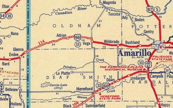
In the map below, from 1937 you can see the paved road reach Vega, and the unpaved yet "graded road, drained and maintained. Usually bad during wet weather" leave Vega as we described above.
Route 66 (Standard Oil Co.) Map at Amarillo to Glenrio, 1937.
The following map also shows this road on the north side of the tracks (red arrows) and the paved US 66 on the south side. In case you are wondering, we too are surprised that the 1936 map shows a paved US66 and the 1937 one doesn't. Maybe the Standard Oil map used older documents when preparing their map, or the Texas State Hwy. Dept. showed the proposed US66 alignment that was being paved at that time (?).
Texas State Highway Dept. Map from 1936
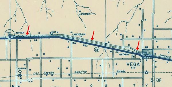
Post 1936 alignment into Vega
It followed I-40 Business W - US 66, and reached the outskirts of Vega (35.1 mi). But instead of heading north like the 1926-36 alignment, it kept west along Vega Blvd. after passing Main St. (35.7 mi). See this map with directions.
>> red line in our custom map is the 1930s-85 Vega to Adrian US66

1926-36 Route 66, in Adrian
Adrian, Midpoint of Route 66
Route 66 1926-36 alignment from Vega to Adrian
West of Vega, the original alignment is more or less parallel to I-40s North frontage road, but about 100 yards to its right. At one time the railroad ran between both roadways. The original alignment is gone and can't be driven (gray line) between Vega and Adrian but some concrete culverts have survived. We marked them with blue markers in our custom map:
>> pale blue line in our custom map is the 1926-30s Vega to Adrian US66. Blue markers are the culverts
Satellite views of the culverts: View #1, View #2, View #3, View #4, and View #5. Just ahead, the 1926-36 Route 66 can be driven into Adrian; it crosses the town and then turns sharply south to cross the now gone railroad tracks and here it meets the 1936 US66 coming from Vega.
>> violet line in our custom map is the driveable 1926-36 Adrian US 66
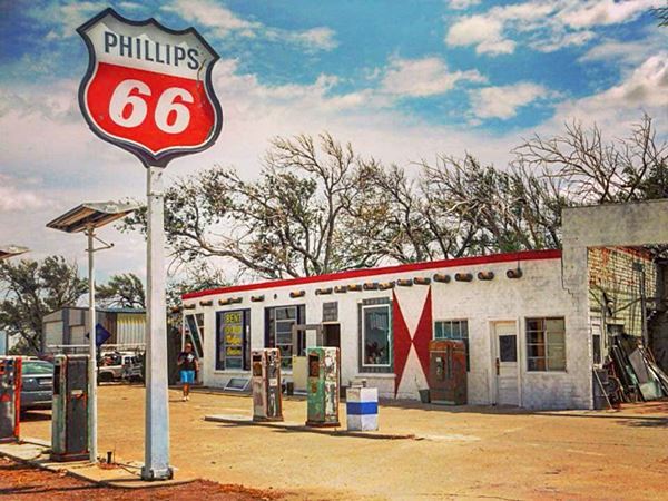
Landergin
Located before reaching Adrian, you will drive by Landergin a former train depot, it is next to Exit 28 by I-40 now abandoned.
1936-60s Adrian Route 66
The later alignment from 1936 survives in Adrian: After Exit 23 - 22, follow I-40 Business, which is US66. It goes into the southern part of Adrian. The town claims that it is the midpoint of Route 66, half way point between Chicago and Los Angeles.
Midpoint Sign, Adrian, Texas
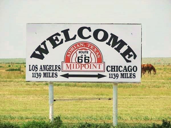
>> yellow line in our custom map is the 1936-60s Adrian alignment
Gruhlkey
>> black line in our custom map is the gap from Adrian to Gruhlkey
West of Adrian the alignment is buried by the freeway:
But here, as the freeway curves to the SW, the 1926 alignment continued along what is now the North Frontage road; it ends in a dead-end west of the town. At Exit 18 on the north side of the road are some foundations and steel poles of a former gas station. And in Ghurlkey itself, an old gas station box sytle built with blocks, and with one of its pumps is still standing. It belonged to Percy Gruhlkey. See picture.
>> pink line in our custom map is Route 66 in Gruhlkey (driveable)
Boise segment
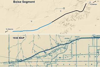
Ahead the 1926 to 36 Route 66 took a winding alignment that curved south, following the railroad tracks (that have been lifted) towards Boise, a railway siding that has long vanished.
>> bordeaux line in our custom map is the 1926-36 Boise alignment
This road has been abandoned, but it can be seen and -with permission- and could be driven in part (Pale blue in the image map is the "driveable" section, the black line shows the non-driveable alignment). Click on the image for a large sized map.
There are many culverts along the now vanished alignment (blue markers in our custom map), and a concrete ford across a dry river bed (red marker):
>> blue markers in our custom map are the culverts, red marker is the ford.
Glenrio, the end of the journey
Head west along the freeway, it overlays the 1936-60s alignment of Route 66 all the way to Exit 0 in Glenrio.
>> pale blue line in our custom map is the gap to Glenrio
Drive into Glenrio: take Exit 0 to reach the ghost town. Cross over I-40 and on the south side. At the exit you will see two abandoned 1980s gas stations, a Chevron and a Texaco.
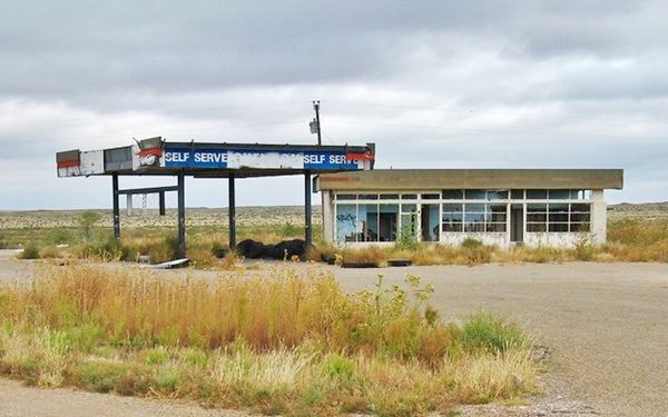
Just south of the freeway you will meet the old alignment of Route 66 coming from the east, buried beneath the freeway further east; turn right, westwards to reach Glenrio a ghost town on the Texas - New Mexico State Line.
>> red line in our custom map is 1926-70s US66 in Glenrio
This is the end of this segment.
Little Juarez Diner, Glenrio, Texas
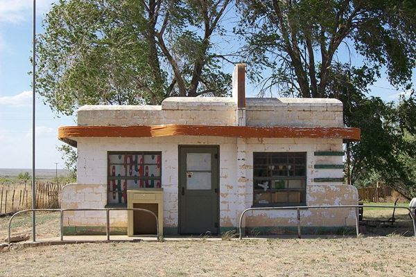
I-40 Welcome Center NM
If you head back to the freeway, there is a very modern Welcome Center on the Interstate 40, just after the Texas - New Mexico state line.
US Highway 66 into New Mexico
Historic Route 66 alignment into New Mexico
The Old highway 66 (1926-70s) continues west, from Glenrio, into New Mexico. It is listed in the National Register of Historic Places.
Quay County in NM removed the paving to cut maintenance costs, so now it is a gravel road all the way into San Jon, except for the first half mile that is paved.
A view of vintage cars, a Route 66 diner, and gas station in Glenrio
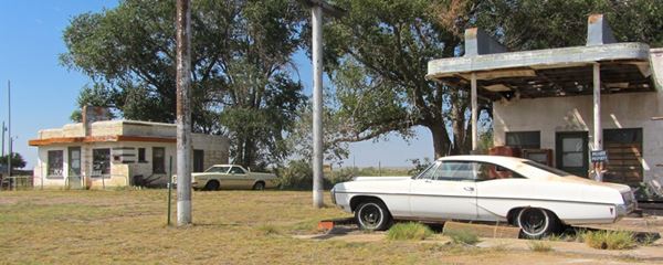
Glenrio is the end of your Journey
The NM TX state line marks the end of this leg of Route 66. In our next section we describe the highway west of Glenrio to Tucumcari in NM

Some sponsored content
> > Book your Hotel in Amarillo

Credits
Banner image: Hackberry General Store, Hackberry, Arizona by Perla Eichenblat.
Survey of Route 66 through Texas Texas Historical Commission.
Maps Texas Historical Commission.


