Route 66 in Santa Fe NM
Index to this page
About Santa Fe, New Mexico
Facts, Trivia and useful information
Elevation: 7,200 ft (2.196 m). Population: 90,125 (2025).
Time zone: Mountain (MST): UTC minus 7 hours. Summer (DST) MDT (UTC-6).
Santa Fe Trivia
Its altitude (7,200 ft-2.196 m) makes Santa Fe the highest state capital in America.
It is also the Oldest Capital City in the US.
Santa Fe, nicknamed "The City Different", is indeed "Different": it is the State Capital of New Mexico and seat of Santa Fe County. It has an ancient heritage that combines Native American, Spanish and American cultures.
Its metro area has around 155,000 residents. Its full name is "La Villa Real de la Santa Fe de San Francisco de Asís."
The city was located on the alignment of Route 66 from 1926 to 1937 when it was cut off.
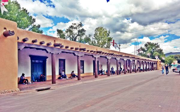
Palace of the Governors, a photo we took in 2016:
This part of New Mexico has been inhabited for more than 10,000 years (the site at Sandia Cave is proof of this). Later the Pueblo people settled in the valleys of the rivers that flowed south from the Rocky Mountains.
There were Pueblo villages where Santa Fe now stands, the oldest was built around 900 AD. The Pueblo of Ogapoge was located where the modern Plaza stands. The Santa Fe River provided water for crops and residents.
The Spanish coming from Mexico explored this region, that they named New Mexico, in the mid 1500s. Francisco Vásquez de Coronado named the native people "Pueblo", after the Spanish word for "village".
In 1598, Juan de Oñate erected San Juan de Caballeros as their capital (near modern Ohkay Owingeh Pueblo). But it was moved in 1607 to its current location; it became capital of the province of New Mexico in 1610.
Origin of the name Santa Fe
The Spaniards used the names of Catholic saints and the Virign Mary to name their towns during the Counter Reformation period. So they aptly named the town as "La Villa Real de la Santa Fe de San Francisco de Asís" (Royal Town of the Holy Faith of Saint Francis of Assisi). Later shortened to "Santa Fe" or "Holy Faith."
The Indians expelled the Spanish and destroyed their towns during the Pueblo Revolt (1680). But the Spaniards returned in force, crushed the rebels and in 1692 and resettled the area.
After its independence from Spain, Nueva Mexico passed on to Mexico and Santa Fe remained as the provincial capital. After the Mexican-American War (1846-48), Mexico ceded the territory to the U.S. In 1862, during the Civil War, the Confederate troops occupied the town briefly but were forced to withdraw.
The Atchison, Topeka and Santa Fe Railway bypassed Santa Fe as it was a complex engineering task to go through the town. A branch line was built in 1880 linking it to the main line at Lamy. A second railroad (Denver and Rio Grande Western Railroad) built a line through the town in 1886.
In 1912, New Mexico became the 47th state of the Union and Santa Fe became its capital city. At that time the city planners decided to preserve the historic town and build a harmonious town around it using traditional styles and methods.
In 1926, Route 66 was aligned through the town along the old Santa Fe-Las Vegas trails. But in 1937 the highway was realigned further south, when the "Santa Fe cut-off" shortened the road which took an east-west course from Santa Rosa through Moriarty to Albuquerque, instead of the previous long route further north. This bypassed Santa Fe and eliminated the The Santa Fe Loop alignment of Route 66.

Where to Stay
There are plenty of accommodation options and lodging along Route 66 in Santa Fe:
> > Book your room in Santa Fe NM
More Lodging Near Santa Fe along Route 66
Below you will find a list of some of the towns along Route 66 in New Mexico. Click on any of the links to find your hotel, motel or accommodation in these towns (listed from east to west):
On Route 66's Main alignment
The Santa Fe Route 66 segment
Eastwards
Westwards
Weather in Santa Fe
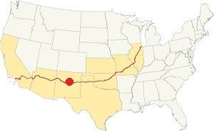
Location of Santa Fe on Route 66
The climate in Santa Fe is semi-arid, it has rather hot summers and very cold winters. Altitude and the dry air influence the daily temperature swings which can jump around 25°F (14°C) on average during the day.
The average high in Summer (July) is 85.9°F (29.9°C), and the average low is 54.4°F (9.7°C). In winter the average high is (Jan) 43.5°F (6.4°C) with an average low of 17.5°F (-8.1°F).
Rainfall is 14.2 in (360 mm) yearly with most falling during June through Sept. during the "North American Monsoon" period. There are 66 days with precipitation per year. Snow falls between October and March: 23 inches (58 cm), the average is less than 9 snowy days per year.
Tornado risk
The tornado risk in Santa Fe is nil: Santa Fe county has no Tornado watches. Tornado Risk: read more about Tornado Risk along Route 66
Map of Route 66 in Santa Fe, NM
Visit our The Santa Fe Loop (1926-37) alignment page for a detailed description of Route 66 in this area. Below is the color coded interactive map:
>> Custom map of Route 66 in town
The original Route 66 was aligned through Santa Fe in 1926 along three previous highways, the "Ozark Trail", the "Santa Fe Trail" and the "National Old Trails".
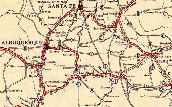
These highways were known as "Auto Trails" and part of a public demand for "better roads": a movement that lobbied for good highways that could be used by motor vehicles, and also signs to mark them and help drivers to find their destination. New Mexico authorities improved the original Ozark Trail in 1914 and designated it as New Mexico State Highway 3. The thumbnail map (Click to see large size map), shows some of the "Auto Trails" that could be used by cars in 1912 in the area near Santa Fe; the trails are marked with red lines.

1912 Road map, western NM
Click on image to enlarge.
Source

1925 Road map, western NM
Click on image to enlarge.
Source
The second thumbnail map above from 1925 (click on it to see the full sized map) shows the roads that existed one year before Route 66 was created.
Those marked "22" (National Old Trails Rd., coming from Los Angeles) and "32" (New Santa Fe Rd.) with white letters in a black box, went from Gallup to Albuquerque and through Santa Fe. Highway "50" was the Ozark Trails.
The only paved sections (full black line) were between Albuquerque and Bernalillo, and Albuquerque and Tijeras. The highway from Bernalillo to Santa Fe, and beyond Isleta was "improved" (dashed line), the rest were either graded or dirt roads.
The Santa Fe Loop (1926-1937)
This was the first alignment of Route 66, from Santa Rosa to Albuquerque via Pecos and Santa Fe.
We describe this segment in our Santa Fe Loop page, a dedicated webpage, with the full alignment, from Santa Rosa, through Dillia, Pecos, Santa Fe, Santo Domingo, and Bernalillo all the way to Albuquerque.
This original highway also continued beyond Albuquerque to Isleta, Peralta and Mesita.
1937 Realignment of Route 66
A political dispute between New Mexico Governor A. T. Hannett and local politicians led to the realignment of Route 66 in 1937.
Hannett blamed the local party bosses when he lost his 1927 bid to re-election. He decided to punish them, and their backers (the business men in Santa Fe) so he quickly had state highway #6 built, in 1927, to link Moriarty with Albuquerque. This highway bypassed the capital city, and was 90 miles shorter for those driving from the east to Albuquerque.
In 1937, the Federal roadbuilders decided to realign Route 66 using Hannett's road, and paved it. It was a straighter highway, and only had a short mountain segment across the Sandia Mountains between Sedillo, Tijeras and Carnuel.
Route 66 Alignment near Santa Fe
With maps and full information of the alignments of Rte. 66.
- Albuquerque to Lupton (next)
- Santa Rosa to Albuquerque 1937-85 (parallel)
- Tucumcari to Santa Rosa (previous)
The Santa Fe Loop (1926-1937)
Our Santa Fe Loop page describes the complete 1926 to 1937 alignment of Route 66 from Santa Rosa to Albuquerque through Pecos, Santa Fe and Bernalillo.
Sights and Attractions in Santa Fe
Attractions and Must See Landmarks
UNESCO Creative City
Santa Fe, the ancient provincial capital of the Spanish Colony of Nueva Mejico is a historic town with Route 66 landmarks and an artistic flair.
The city was appointed to the UNESCO Creative Cities Network due to the great achievements of its cultural development and diversity: fairs, crafts, and multicultural character.
A Walking Tour in Santa Fe
See the Walking tour Map, which covers the main sights in the downtown of Santa Fe and is a 1.2 mile round trip.
Spanish colonial towns in America were laid out following strict rules laid down by the King and his Consejo de Indias Council. A central square was laid down and the main buildings of the community were built around it: the Cabildo (or City Hall), the governor's offices if it was a capital city, the Cathedral and the main convents (Franciscans, Dominicans, etc.). The towns usually had a grid-like lay out and were nestled against a stream or river (Santa Fe River in this case).
Begin your walking tour at the main square (Plaza):
Palace of the Governors
120 Washington Ave., Santa Fe, NM.
Listed in the National Register of Historic Places & U.S. National Historic Landmark
The adobe building has been the seat of government in New Mexico since 1610, it is located on the central Plaza of Santa Fe.
It was the seat of the Spanish colonial governor in New Mexico and of the territorial government in the late 1800s. From 1909 to 2009 it was the Museum of New Mexico.
It is the oldest continuously occupied public building in the U.S.
Visit the The New Mexico Museum of History which is just behind the Palace.
Native Crafts
Buy some ot the handicrafts created by Native American artists, at their stalls under the Palace's historic portal.
The Plaza

End of the Santa Fe Trail Marker. Austin Whittall
Bordered by Old Santa Fe Trail, Washington, Lincoln Avenues and San Francisco St. this plaza has has been the center of the city for over 400 years. Native American vendors and stores line the streets around it, a neat green island in the heart of town.
See the Santa Fe Trail ending place on the SE corner of the Plaza on E San Francisco St and Old Santa Fe Trail (pictured).
The Santa Fe Trail
Santa Fe was linked to Mexico City by the "Camino Real de Tierra Adentro," a Royal Highway built by the Spanish Crown. Another trail was opened in the 1792 across the Great Plains to trade with the French Louisiana settlements on the Missouri River (now St. Joseph and Independence MO).
Wagon trains used it to move goods and pioneers to settle the west.
Head one block east along E. San Francisco St. and visit the Cathedral:
Cathedral Basilica of Saint Francis of Assisi
131 Cathedral Place, Santa Fe, NM.
Historic Landmark

Cathedral Basilica of Saint Francis of Assisi, Santa Fe, NM. Austin Whittall
A church has stood on this ground since 1610, the current Cathedral was built between 1869 and 1886 in a French Romanesque Revival style. This is its St. view.
It is the seat of the Roman Catholic Archdiocese of Santa Fe and was commissioned by Archbishop Lamy. The original church was destroyed during the Pueblo Indian Revolt of 1680 and another church was rebuilt there in 1692. Remains of the former church can be seen in the Chapel of Our Lady of the Rosary.
The wooden image of the Virgin was first brought to Santa Fe in 1625.
Take a right along Cathedral Pl and another right along. E. Water St. to visit Loretto Chapel:
Loretto Chapel
207 Old Santa Fe Trail, Santa Fe (St. view).
Built in 1878 by the Sisters of the Loretto, in a Gothic-Revival Style it was inspired by King Louis IX's Sainte Chapelle (Paris). The "Miraculous Staircase" is its main sight.
Route 66 sign

"Historic Route 66" sign in Santa Fe, Austin Whittall
Head west along E. Water St. and to your right, at the junction with the Old Santa Fe trail is a Route 66 road sign marking the "Pre-1937" alignment (St. view). See the pictureI took in 2016.
Continue your downtown Santa Fe walking tour
You have several options: you can go back to the Plaza and visit the Downtown Museums there, or you can head south along the Old Santa Fe Trail for 2 blocks from the Route 66 sign, crossing Santa Fe River (actually a small stream) to reach Vargas St. and visit the Oldest Church and the Oldest Home in the U.S.A, located in the Barrio De Analco Historic District.
Barrio De Analco Historic District
E de Vargas St., Santa Fe, NM.
Listed in the National Register of Historic Places
This district includes many historic buildings. Its name combines the Nahuatl language words "A" (water), "nal" (close to) and "co" (place), meaning "close to the water", in allusion to the Santa Fe River that runs next to it.
Besides San Miguel Mission and the Oldest House in the States, both mentioned below, there are several buildings that you can see along Old Santa Fe Trail and East Vargas Street
- St. Michael's Dormitory or Lamy Building. 413 Old Santa Fe Trail
- Gregorio Crespin House. 132 E. De Vargas St
- Roque Tudesqui House. 129-135 E. De Vargas St
- Boyle House. 327 E. De Vargas St
- Adolph Bandelier House. 352 E. De Vargas St
Walk east along East De Vargas Street to visit them.
San Miguel Mission
The Oldest Church in the United States (1610)
On the corner of E. Vargas St. and Old Santa Fe Trail, 401 Old Santa Fe Trail, Santa Fe, NM. St. view.
Listed in the National Register of Historic Places
San Miguel Mission, oldest church in the U.S., our photo from 2016:
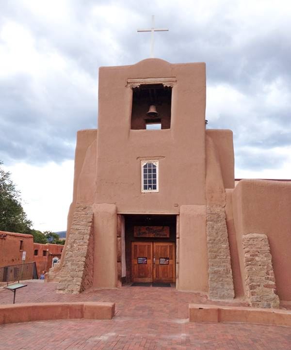
Building began in 1610 and finished in 1625 making San Miguel Mission (or San Miguel Chapel) the oldest church in the United States
It is located on the main throughfare towards the south of New Mexico. This Catholic church is still active. It was built in adobe, in a Romanesque fortress style, with a flat roof and thick walls. The building was damaged during the 1680 Pueblo Revolt, and it was rebuilt after the return of the Spaniards (1692-1710). The wooden image of St. Michael was carved in 1709 and added to the church in 1798.
Oldest House in the U.S.: De Vargas Street House
215 East De Vargas St. Santa Fe
Listed in the National Register of Historic Places
The oldest house in the United States
It was built on the remains of an ancient Indian Pueblo inhabited from 1200 to 1435 A.D. When the Spanish settled the area in 1608 their native auxiliaries set up their homes here, and gave the ward (Barrio) its name "Analco" (close to the water). The area was razed during the Pueblo Revolt in 1680. After the reconquest of the town in 1692, the house was repaired, and in 1709-1710 was the residence of the new Governor Marquis of Peñuela.
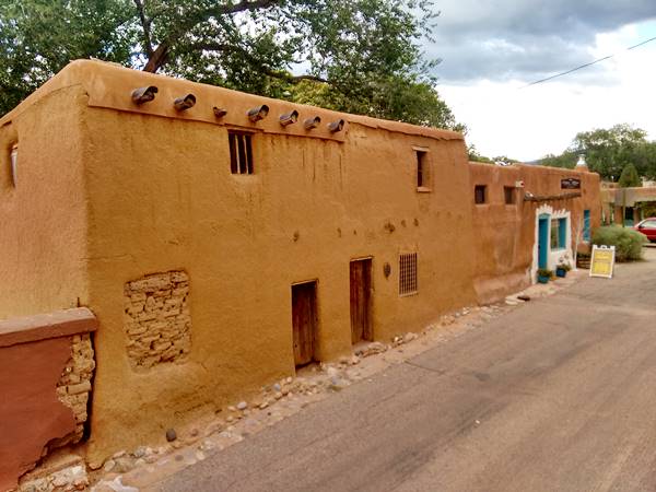
It has remained continually occupied until the 1920s. Now it has a gift shop and a small "museum" with items from the 1700s (St. view).
Your walking tour ends here, but if you have a fancy for art, you can head east along Vargas St. to visit the Canyon Road Art Galleries:
Canyon Road Art Galleries
Canyon Road is located to the southeast of the Plaza and the Cathedral, on the south side of Santa Fe River, and a western continuation of East Vargas Street. It has most of the art galleries in Santa Fe, and has a wide range of art, spanning Southwestern, Native American, experimental, contemporary, and Taos Masters pieces.
You can head back to the Plaza to visit the downtown museums:
Downtown Museums
There are several museums close to the Historic Plaza:
New Mexico History Museum
At 113 Lincoln Avenue, it holds artifacts and collections with the history of Santa Fe and New Mexico just behind the Palace of the Governors.
New Mexico Museum of Art
107 W Palace Ave, Santa Fe. On the NW corner of the Plaza next to the Governors Palace, it houses collections of Southwestern Arts.
Santa Fe Indian Market
New Mexico's largest cultural event is organized by SWAIA, an advocate for Native American arts & culture (swaia.org).
A fair is held annually every August with over 600 boths with crafts and art on the Santa Fe Plaza where you can shop and taste the local food too.
Georgia O'Keeffe Museum
217 Johnson St., Santa Fe. Just two blocks west of the Plaza. It exhbits the work of New Mexico-based artist Georgia O'Keefe, she lived in Santa Fe and Abiquiu NM.
Museum Hill
There are four museums at Museum Hill, located 2 miles southeast of the Plaza.
- Museum of International Folk Art, with folk art, toys and textiles
- Museum of Indian Arts and Culture, with 70,000 objects of Native American art
- Wheelwright Museum of the American Indian; exhibits of their history and art
- Museum of Spanish Colonial Art, a journey into Spanish Colonial America
Other Sights in Downtown
Rail Runner To Albuquerque and Santa Fe Depot
Just eight blocks west of the Plaza. Visit the historic Railyard District with shop at Sanbusco Market Center (Location map).
Buy your ticket online or onboard. A high-speed rail link that gets you to Albuquerque in 80 minutes. Named after the "Roadrunner", the state bird, it gives you some views of the Sandia, San Felipe, Santo Domingo and Cochiti pueblos.
The train station in Albuquerque is in the downtown area Albuquerque Station.
Santuario de Guadalupe
At 100 S. Guadalupe St., just southwest of the main Plaza, it is the oldest extant shrine dedicated to the Virgin of Guadalupe in the United States.
Japanese American internment camp
Frank Ortiz Park, Casa Solana subdivision, Santa Fe. A plaque on a granite boulder marks the spot in the Casa Solana neighborhood, 2 miles northwest of the downtown area (Map with directions).
The camp held 4,555 Japanese American civilians who were incarcerated here during World War II, a clear racist violation of their rights (no such thing happened to German Americans or Italian Americans during WWII). The barracks were demolished in the 1950s.
Classic Motels, Motor Courts and Gas Stations
Remains from the past
Cerrillos Avenue was the main link between Santa Fe and Albuquerque. It was also the alignment of Route 66 and US Highway 85 when they were created in 1926. Route 66 was realigned in 1937, but US 85 is still there (south of town it is now part of I-25). Many classic motels have survived from the 1940s and 50s. Perhaps some predate 1937. Most of them are still open. Below we mention a few of them.
De Vargas Hotel, now St. Francis
At 210 Don Gaspar Avenue in downtown Santa Fe. The old Hotel is still there, under another name: Hotel St. Francis, a 4-star hotel.
It has been here for over a century; the postcard below, from the 1940s states: "At the End of the Santa Fe Trail... near historic Plaza... within one block of State Capitol... Coffee Shop, Barbrer Shop, Beauty Shop and Cocktail Lounge."
>> You can Book a Room in the Hotel St. Francis.
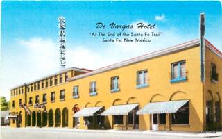
The De Vargas Hotel, vintage Postcard. Source.
El Pueblo Court
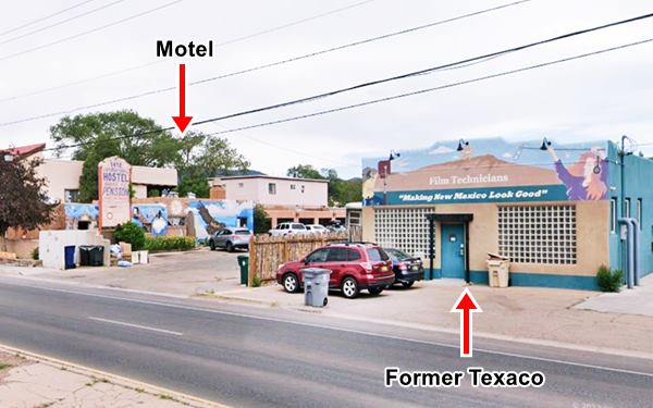
Turn west and head for Cerrillos Road, take a left and head south; at 1412 Cerrillos Rd. is the former "Auto Court" owned by John J. Koury. It had "17 completely modern units, wal to wall carpeting, tiled bath rooms." It is still hosting guests, as the International Hostel Santa Fe Pension, a B&B.
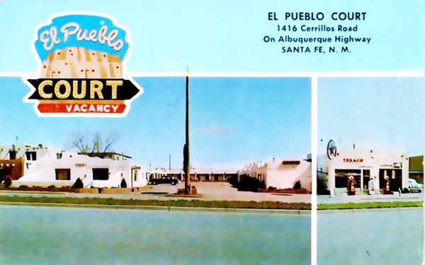
Texaco Gas Station
On the left side of the old Pueblo Court is a building (now a store) that can be seen in the motel's postcard above as a Texaco Gas Station. The building is stil there with some minor changes. It dates back to the 1930s.
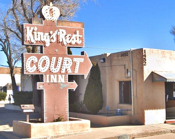
King's Rest Court Inn: Neon Sign
1452 Cerrillos Rd. We have listed it because of its Neon Sign, worth stopping to take a picture of it.
Western Scene Motel
1608 Cerrillos Rd. This motel is unchanged as you can see in the photo and postcard below;at one time was also known as the Western Holiday Hotel, however it was and stil is the Western Scene Motel. The old neon sign is stil there too.
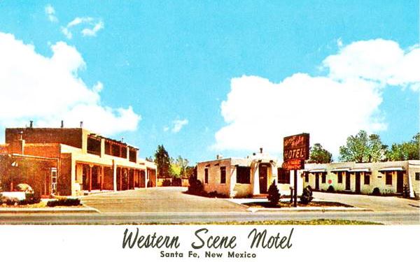
The postcard says "One of the Finer Motels in "The City Different"... Telephone in every Room. T-V and Music... All Credit Cards Honored-"
Cottonwood Court
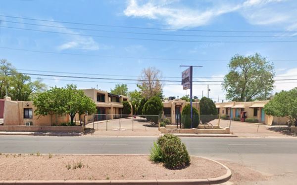
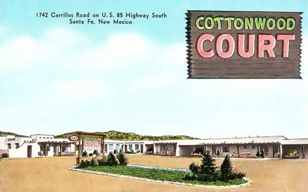
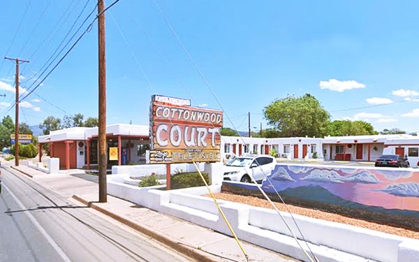
1742 Cerrillos Rd., Santa Fe. The postcard of the Cottonwood Court, that is still open, said: "Duncan Hines Recommended. 'One of Santa Fe's Finest' George & Irma Sale Operating Owners. AAA Approved." Duncan Hines (1880-1959) was an American entrepreneur who introduced the concept of restaurant ratings for travelers.
It has undergone some minor changes but it kept its neon sign:
Thunderbird Inn
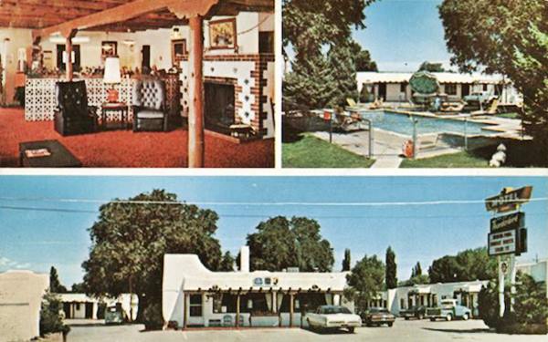
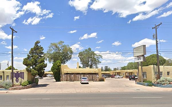
1821 Cerrillos Rd, Santa Fe; the former Thunderbird Inn is no longer a motel, but offers monthly rental apartments. Its 1960s postcard tells us the following: "44 Rooms, 5 Suites, Family Rooms, Air-conditioning, Color TV, Room Phones, Heated Pool, Playground, with Restaurants nearby... U.S. Highway 85 South, one mile from Historic Old Plaza."
The motel has not change much since the 1960s:
El Rey Motel
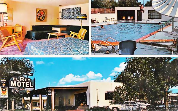
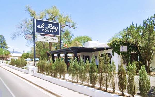
1862 Cerrillos Road; the El Rey Motel (which in Spanish means "The King") had "40 Luxurious Units situated on spacious grounds... 1 1⁄2 miles south of State Capitol on Albuquerque Highway... "In Old Santa Fe"." It is stil open as a motel, the El Rey Court.
>> You can Book a Room in the El Rey Court.
Phillips 66 Gull Wing Gas Station
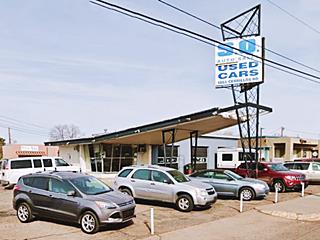
Don't miss the gas station facing it across the street at 1863 Cerrillos Rd. This is a Phillips 66 gas station from the 1960s is currently an auto dealership. Back in the 1960s, Phillips Petroleum Co. standardized their filling stations across the US and adopted a modern design with a triangular "gull-wing" canopy which was supported at its narrow tip by a pole designed to look like an oil derrick. A Phillips 66 revolving sign stood at the top of the pole. The office had canted plate glass control-tower-like windows.
> > Learn more about all the Phillips 66 Gull Wing stations on Route 66
Lamplighter Motel
2405 Cerrillos Rd. The motel is still operating under the name Lampligher Motel, and has kept its original western ranch style with a gabled roof, but lost its 1960s neon sign. The postcard said: "Luxurious, New... Heated swimming pool. Pancake House and Restaurant... Omer and Orva Brazda-Co-Owners and Mgrs."

The Lamplighter Motel, vintage Postcard source
Silver Saddle Motel
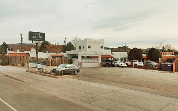
2810 Cerrillos Rd. The 1950s postcard tells us that it was a Mom and Pop motel that had "14 beautiful units. Franciscan Style Furniture... ceramic tile baths... Cool in summer, warm in Winter. Friendly Western Hospitality. Owned and Operated by Tye and Thelma Terrell." It is still there, since 1958 now it is The Mistic.
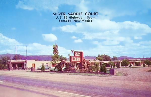
Some changes (a second floor in the front) but basically unchanged:
Westerner Motel-now Stage Coach Motor Inn
3360 Cerrillos Road, Santa Fe. This motel announced in its 1957 postcard pictured below: "Only 8 minutes from Plaza... At the Foothils of the Beautiful Sangre De Cristo Mountains... Of Spanish-Indian architecture... In easy driving distance to the picturesque Indian Pueblos." The motel is stil open, now operating as the Stage Coach Motor Inn with the same Spanish-Pueblo architecture
And this is the end of the 1950s Motel's Tour in Santa Fe
Tours & Itineraries plus outdoor Fun
Visit Northern Indian Pueblos
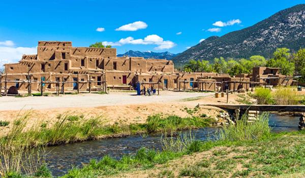
A full day tour from Santa Fe to Taos Pueblo visiting Native Pueblos along the way. These are eight Indian Pueblos located in the mountains between Santa Fe and Colorado. Buy souvenirs and experience the Native culture and foods. Check out some of their feast days to witness their celebrations and dances.
Important rules of etiquette during your visit to a Pueblo
Pueblos are on tribal lands and the local customs, religion and traditions must be respected.
- Check that access is allowed (leaders may restrict access for private ceremonies) and be prepared to pay an access fee
- Photography. Taking photos may be totally prohibited or a permit may be required. Check with the Tribal Office. Even if you have a permit, always request permission before taking a photo of a tribal member. Leave your cell phone out of sight and silence it, as it could be confiscated
- Don't litter. Don't carry or use alcohol or drugs
- "Off Limits" signs must be respected. Don't remove artifacts or pottery shards
- Don't speed. Respect traffic signs
- Respect the local people. Dances are not a show, they are a ceremony. Show respect and remain silent at all ceremonies
- Cemeteries, Kivas, ceremonial rooms are sacred places and entry is not allowed for non-Pueblo people.
Tesuque Pueblo
10 mi. north of Santa Fe along U.S. 84. See Location and Map with Directions.
Listed in the National Register of Historic Places
Occupied since 1,200 AD "Te-Tsu-Geh" means "Cottonwood Tree Place" in the foothills of the Sangre de Cristo Mountains.
Visit the Tesuque Pueblo Flea Market and experience the local Feast days: Corn Dance and Blessing of the Fields (First Saturday in June) and the San Diego Feast Day (Nov. 12).
Pojoaque Pueblo
From Tesuque head north along U.S. 84 to Pojoaque. 16.5 mi. north of Santa Fe on U.S. 84. See Location and Map with Directions from Tesuque.
The name derives from "P'o Suwae Geh" (Water Drinking Place). Stop by to visit the Poeh Cultural Center and Museum.
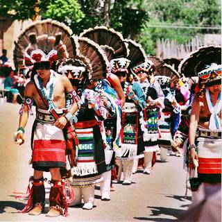
Pueblo people at Ohkay Owingeh. Source
Nambe Pueblo
Head east along NM-503 and after 2 miles you will reach Nambé Pueblo. 19 miles north of Santa Fe via U.S. 84 and NM-503 just east of Pojoaque. See Location.
A place to buy pottery and jewels. Visit the Nambé Falls Recreation Area with a waterfall and the Feast days with traditional dances.
San Ildefonso Pueblo
Head back to Pojoaque and from there take NM-502, westwards for 7 miles to reach San Ildelfonso Pueblo. It is 23 miles northeast of Santa Fe along US 84 and NM-502. See Location.
The natives moved here in the late 1500s and named it "Po-Who-Ge-Oweenge" means "Where the Water Cuts Through". It is next to the Black Mesa.
Well known for its black-on-black pottery, visit the Maria Poveka Martinez Museum and the San Ildefonso Museum. Don't miss the Jan. 23 Feast Day with Buffalo or Deer Dances and a Nativity Feast on Sept. 10 with the Corn Dance
Santa Clara Pueblo
Head west along NM 502 and then north along NM-30 to reach Santa Clara Pueblo after 12 miles, on the way stop at Puye Cliffs.
Puye Cliff Dwellings
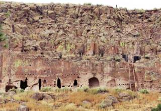
Pueblo dwellings at Puye Cliffs. Source
Visit the Cliff Dwellings built by the early Pueblo people, enjoy the great views and visit an original Harvey House, part of the chain of hotels, restaurants and shops built by Fred Harvey for the Santa Fe Railway in the early 1900s.
The natives who moved to Santa Clara Pueblo area in 1550 and named it "Ka'p'o" (Valley of the Wild Roses). It is famous for its red and black pottery, willow baskets and animal figurines.
There is a golf course and casino. But the must-see sight is the Santa Fe Clara Feast Day with Buffalo, Harvest or Corn Dance on Aug. 12.
Ohkay Owingeh
Head 7 miles north from Santa Clara, along U.S. 84 and NM-68 and reach Ohkay Owingeh:
Just 25 mi. north of Santa Fe along US 84 & NM 68. See Location and Map with Directions.
The name means "Village of the Strong People", at one time it was known as "San Juan Pueblo". It has cliff dwellings. The Spanish conquistador Juan de Oñate built the first capital city of New Mexico close to this pueblo.
Its San Juan Lakes are a fishing spot. Visit the local native craftspeople and artists at the Oke Oweenge Crafts Cooperative.
There is a resort, hotel and casino.
Picuris Pueblo
Head for Picuris Pueblo located off the main highway between Okhay Owingeh and Taos, 30 mi. east of the former it is part of the journey to Taos Pueblo.
60 mi. north of Santa Fe. See Location and Map with Directions.
Next to the Rio Pueblo River in the "hidden valey" its name means "Those Who Paint". The place is well known for its micaceous pottery.
Visit its adobe church San Lorenzo de Picuris (during the St. Lawrence Feast on Aug. 10 there are dances and pole climbing). Don't miss the Picuris Pueblo Museum and the buffalo herd.
From Picuris head on towards Taos Pueblo (it is 61 mi. from Okhay Owinge to Taos via Picuris, 45 mi. bypassing Picuris).
Taos Pueblo
Only 68 mi. north of Santa Fe, it is the last pueblo of the circuit. See Location and Map with Directions.
Taos Pueblo, Taos, NM.
Listed in the National Register of Historic Places
The 1680 Pueblo Revolt began here, at "Tau-Tah" (The Place of the Red Willows) a World Heritage site of UNESCO
It is one of the U.S.'s oldest continuously occupied villages. Renown for its art and multi-storied adobe buildings. Don't miss the Feast Day of San Geronimo (Sept. 30) and the Taos Pow-wow (July 11-13).
Another Great Side Trip!
The Turquoise Trail Tour
Scenic Byway
Turquoise
Turquoise is a gem and ornamental stone with an opaque blue to green color. It is a hydrous phosphate of aluminium and copper and has been used in jewelery since prehistoric times.
The name comes from the French words "pierre tourques" for "Turkish stone." Not because there were found there, but because the Turkish traders sold these gems.
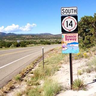
Turquoise Trail scenic byway road sign. Santa Fe, NM. Austin Whittall
This circuit is a full day trip, almost 120 miles (round trip) to the south of Santa Fe through to Tijeras Village on the 1937-85 Route 66 alignment in the Sandia Mountains. See the Map and Directions (one way).
Start at Santa Fe and head south along New Mexico State Highway 14 (NM-14) that follows an ancient route that passes through several towns (Cedar Crest, Sandia Crest, Madrid) and reaches Tijeras. There are many intersting sights along the way.
You will be able to drive up the Sandia Crest Scenic Byway to the summit at 10,652 ft. (3.249 m) for spectacular views of Albuquerque and the forested Sandia mountains.
National and State Parks
Kasha-Katuwe Tent Rocks National Monument
41 miles SW of Santa Fe. Via I-25, exit 264 and NM 16 and 22. See Map and directions.
Hoodoos at Kasha-Katuwe Tent Rocks National Monument
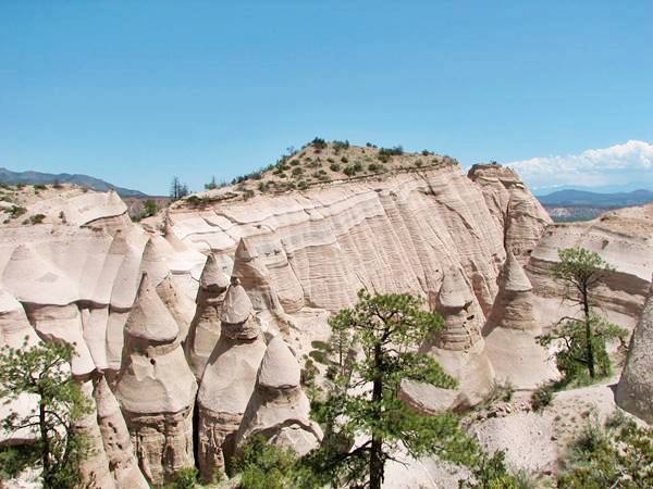
Near the Cochiti Pueblo the place is amazing with rock formations known as Hoodoos, cone shaped rocks of volcanic origin that formed around 6 million years ago. There are trails that wind through canyons, climb to a mesa and give great vistas of the scenery.
For more details visit the Official Website.
Santa Fe National Forest
More information at our Pecos page.
Cibola National Forest
11776 Highway 337, Tijeras NM. (505) 281-3304. Official Website. The Cibola National Forest and National Grasslands spans several locations covering 1.6 million acres in New Mexico, Texas, and Oklahoma.
The area nearest Santa Fe is the Sandia and also the Mountainair Ranger Districts they are south of Santa Fe.
Bandelier National Monument
15 Entrance Rd, Los Alamos, NM 87544
It covers almost 34,000 acres (13.630 km2) and preserves pueblo structures, petroglyphs and cliff dwellings dating back to the year 1,100 A.D.
Visit its Website for full details.
Ideal place for hikers with 70 miles of hiking trails. It was named after Swiss scientist Adolph Bandelier who studied the local cultures in the 1880s.
During World War II, it housed the scientists of Oppenheimer's team who worked on the Manhattan Project to develop the atom bomb.
There are bears and mountain lions in the park and you should walk the Main Loop Trail that is 1.2 mi. (1.9 km) long and let's you visit some archaeological sites along the way.

Sponsored Content

>> Book your Hotel in Albuquerque

Credits
Banner image: Hackberry General Store, Hackberry, California by Perla Eichenblat


