Route 66 in Funk’s Grove IL
Index to this page
Funk’s Grove Illinois
Facts, trivia and information
Elevation: 697 ft (212 m). Population n⁄a (2023).
Time zone: Central (CST): UTC minus 6 hours. Summer (DST) CDT (UTC-5).
Funk’s Grove or Funks Grove is a small unincorporated community in McLean County, central Illinois.
History
The prairies of Central Illinois were the land of the Illini (Illinois) Native Americans when the first French explorers reached the area in the 1600s as fur trappers.
The first pioneers arrived after the 1812 War with Britain but they chose to settle along river banks as the distances and difficulties to enclose the land in the prairies hampered any attempt to raise cattle or grow crops on them.
The first settlers in what would become Funk's grove were two brothers, Isaac and Absalom Funk, who arrived here in May 1824. They had learned how to raise cattle in Ohio, and moved west to claim their homestead in the prariries. They built a 12 by 14-foot cabin and started raising and selling cattle. Robert and Dorothy Funk Stubblefield arrived shortly after.
McLean County was created in 1830 and named after John McLean, a pioneer lawyer, territorial judge, first Representative in Congress from Illinois and United States Senator for Illinois.
Mount Hope township with Mt. Hope was established in 1836, west of what would become Funk’s Grove, but it was unsuccessful.
The forest grove in the area was very suitable for the settlers, and once the railroad (Chicago, Alton & St. Louis R.R.) reached the area in 1853, farming took off.
The name: Funk’s Grove
Named for the pioneer brothers and the forest grove. The surname Funk comes from Middle High German "vunke" which means "spark" and was used as a nickname for a blacksmith.
When Route 66 was created in 1926 it was aligned along State Hwy 4 that passed near the depot just east of it.
Trivia
Funks Grove is known as the mid point of Route 66 in Illinois
Funk’s Grove's Hotels & Motels
Find your accommodation close by:
> > Book your hotel in neighboring Atlanta
More Lodging Nearby along Route 66
Below you will find a list of some of the towns along Route 66 east and west of this town; click on any of the links to find your accommodation in these towns (shown from east to west):
Along Route 66 in IL
- Hotels in Illinois
- Route 66 Starting point ▸ Chicago
- Lockport
- Willowbrook
- Bolingbrook
- Plainfield
- Romeoville
- Joliet
- Wilmington
- Dwight
- Pontiac
- Chenoa
- Normal
- Bloomington
- Atlanta
- Lincoln
- Springfield
- Raymond
- Litchfield
- Staunton
- Williamson
- Hamel
- Edwardsville
- Collinsville
- Troy
- Glen Carbon
- Pontoon Beach
- Granite City
- East St. Louis
West in Missouri
- Hotels in Missouri
- Florissant MO
- Bridgeton MO
- St. Louis MO
- Kirkwood MO
>> See the RV campground in neighboring Bloomington
The Weather in Funk’s Grove
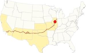
Location of of Funk’s Grove, on U.S. 66 in Illinois
With a humid continental climate, Funk's Grove has wet hot summers and cold winters. Summer (Jul) average high temperature is 85°F (29.7°C) and the avg. low is 65°F (18.1°C).
Winter (Jan) average high temperature is 34°F (1 °C) and the low is 18°F (-7.8 deg;C).
Yearly rainfall is around 36.6 inch ( 1,007 mm) and is highest during summer, reaching 5.08 inches (129 mm) in July (129 mm). It is lowest in winter with 1.93 inches (49 mm) in January.
Snow falls each year between November and late March, and averages 22 inches (55 cm).
Tornado risk
Funks Grove is located in Mc Lean County, which is struck by around 7 tornados per year. Tornado Risk: learn more about Tornado Risk on US 66.
Map of Route 66 in Funk’s Grove
First Alignment of Route 66 in Funk's Grove
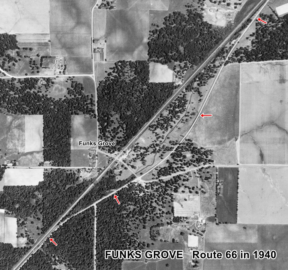
1940 aerial photo Funks Grove IL. Source
Click thumbnail map to enlarge
The road continues towards Funks Grove, where the original State highway #4 and the original 1926 Route 66 alignment ran along a now partly closed alignment that curved eastwards from the current straight alignment; it can be seen (red arrows) in the thumbnail image (click on it to enlarge), that shows a 1940 aerial view of the area. We also marked it with a yellow line in our custom map. The northern part of the roadbed is still there hidden in the forest as you can see in this satellite view. A better image of the original alignment can be seen in this 1970 aerial photo, as an arched segment to the left of the current alignment.
This curved segment was eliminated in 1946. The image below by Gerald Allan Sohl looks northwards along Route 66 under construction. The original alignment can be seen curving to the right.
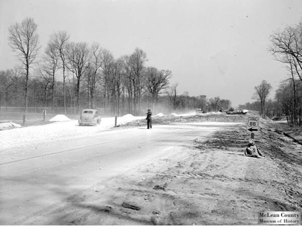
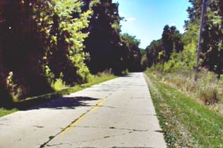
The original roadbed of US66 (1920s-1946), Funks Grove. Source
After 1946, the old roadbed was abandoned and the new one that ran parallel to the railroad was adopted. See the pink line in our custom map marking the post-1946 road.
The Route 66 alignment in Funk’s Grove
Visit our pages with old maps and plenty of information about US 66's alignments in this area.
- Springfield to Staunton IL (1926-30 US66) south from Springfield (next)
- Springfield to Hamel (after 1930) south from Springfield (next)
- Pontiac to Springfield (Funk’s Grove's)
- Chicago to Pontiac (previous)

Attractions on Route 66 in Funk’s Grove
Landmarks Funk’s Grove
Historic Context: Funk’s Grove US 66 in 1946
In his work, published in 1946 ("A Guide Book to Highway 66") Jack Rittenhouse described US 66 during its heyday, he mentioned the small hamlet as follows:
Funk's Grove... gas station; cafe; no tourist accommodations... The town itself lies across the railroad tracks which parallel US 66 Rittenhouse (1946)
Route 66 sights in Funks Grove
Drive westbound along the highway, starting in Shirley. The scenery begins to change as you approach Timber Creek; the prairie gives way to a forested area. I-55 moves eastwards away from US66 as you enter the "grove."
The Grove
National Natural Landmark
The Grand Prairie of Illinois has small islands or patches of land with forest groves. These were places where the trees managed to survive the prairie fires and gain a foothold against the grasses.
Funks Grove is the largest remaining intact prairie grove in the state of Illinois and covers more than 1,000 acres of which 443 have been designated a National Natural Landmark. It is located on Timber Creek, a tributary of Sugar Creek whose water flows into the Illinois River.
The area was a white oak, bur oak, and sugar maple tree forest. And the local Illinois Indians made maple syrup and maple sugar from the maple trees.
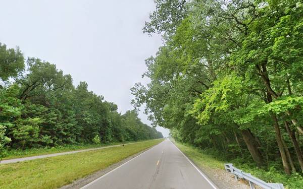
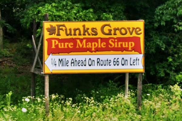
Ahead, at the crossroads with Funk's Rd., to your right you will see a sign announcing the "sirup" store that lies ahead, further south (pictured below).
As Rittenhouse mentioned, the village is to the right, across the railroad tracks. After crossing them, to your right is the old store:
Walker General Store
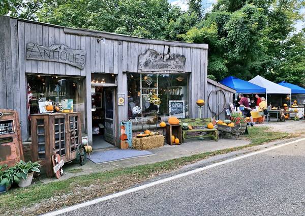
Beyond the tracks, on Funks Rd. to your left. It was originally a grocery store and also a gas station, it closed in the late 1970s. This is surely the cafe and gas station mentioned by Rittenhouse.
Now it is still open as the "Country Store" with antiques, pictured below with an old rusty gas pump:
Old Shirley Depot
The train depot is located across from the old General Store to your right. It was originally from Shirley it was built before 1909 and was relocated to Funk's Grove in 1970 by Robert Rehtmeyer. The building is on the Illinois Historic Society's Register; it has a hip roof with French tiles and a dormer.
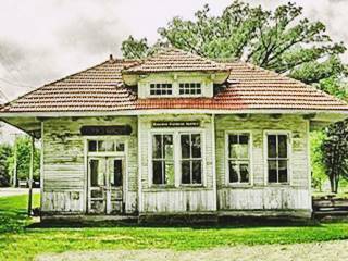
Shirley railway depot in Funks Grove IL. Source CC license
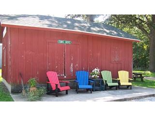
The old depot of Funks Grove IL. Source
By the way the old Funks Grove depot is now located the Maple Sirup Store 1⁄4 mile away, south of this spot (pictured above). So Funks Grove has two railway depots.
Sugar Grove Nature Center
4532 North 725 East Road. Head west and then south (it is a short 2 mile drive; see this map with directions).
It opened in 2004. With four dedicated nature preserves, and 5 miles of trails, you can trek the different habitats: riverine, forest and prairie. Live animals, exhibits and displays complete the experience.
The Grand Prairie of Illinois has small islands or patches of land with forest groves. These were places where the trees managed to survive the prairie fires and gain a foothold against the grasses. Funks Grove is the largest remaining intact prairie grove in the state of Illinois and covers more than 1,000 acres of which 443 have been designated a National Natural Landmark.
Funks Grove Pure Maple Sirup
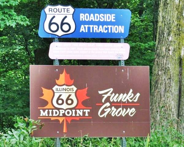
Turn back to US 66 and head south along it for some sirup. At the junction with US 66 is a sign promoting the spot as "midpoint" on Route 66 in Illinois and also tells the story of the sirup "Established in 1891, Funk descendants have been making sirup since 1824 when Isaac settled in the Grove that bears his name."
Midway point sign in Funks Grove, Illinois
To your right, at 5257 Historic U.S. 66 is this maple sirup family business. It is still run by the Funk family, who have been making sirup here since 1891. They spell it "Sirup" with an "i" instead of a "y", which is correct, and is used to distinguish genuine sugar maple sirup from the regular industrial sugar-based syrup.
It is sold on a seaonal basis (stocks run out quickly!) at the gift shop with Route 66 collectibles. Next to it is the old Funk Grove's railway depot pictured further up.
Sirup is harvested from mid-February to mid-March which is the period that the sap flows. Sales begin in March and end when the supply is depleted around August.
Continue your Route 66 Road Trip
This marks the end of this leg of your road trip in Funk's Grove, head south to continue your journey and visit the next town: McLean.

Sponsored Content
>> Book your Hotel in Chicago

Credits
Banner image: Hackberry General Store, Hackberry, Arizona by Perla Eichenblat
Jack DeVere Rittenhouse, (1946). A Guide Book to Highway 66.

