Route 66 in Lawndale IL
Index to this page
Information about Lawndale Illinois
Facts, Trivia & Useful Info
Elevation: 600 ft (183 m). Population 58 (2023).
Time zone: Central (CST): UTC minus 6 hours. Summer (DST) CDT (UTC-5).
Lawndale is a small rural community in Logan County, Illinois, between Atlanta and Lincoln, on Historic Route 66.
Lawndale's history
First inhabited some 11,000 years ago, the region was later peopled by Illinois Indians. French trappers explored the rivers in this area in the 1600s, but only in the mid 1800s did the first settlers arive to the grasslands of central Illinois.
Logan county was created in 1839. The first settler in future Lawndale was Thomas Esten Massachusetts, who arrived in the late 1840s as the agent of the Leanderville company that was going to establish a colony in Logan county.
Esten built a saw mill on the Kickapoo Creek. The community was first known as "Kickapoo." The town was platted on the Chicago, Alton & St. Louis railroad in 1854 and post office opened the following year.
The name: Lawndale
Lawndale is quite popular in the U.S. and uses the old English term "dale" (Valley) with lawn: grassy valley.
In 1926 Route 66 was created and aligned along the existing Pontiac Trail and state highway 4. It passed in front of the town until it was decertified in 1977.
Lawndale's Hotels & Motels
There is no lodging in town, but there are many accommodation options on Route 66 nearby in Atlanta and Lincoln; you will easily find your room in either of these cities:
> > Book your hotel in Atlanta
More Lodging Nearby along Route 66
Below you will find a list of some of the towns along Route 66 east and west of this town; click on any of the links to find your accommodation in these towns (shown from east to west):
Along Route 66 in IL
- Hotels in Illinois
- Route 66 Starting point ▸ Chicago
- Lockport
- Willowbrook
- Bolingbrook
- Plainfield
- Romeoville
- Joliet
- Wilmington
- Dwight
- Pontiac
- Chenoa
- Normal
- Bloomington
- Atlanta
- Lincoln
- Springfield
- Raymond
- Litchfield
- Staunton
- Williamson
- Hamel
- Edwardsville
- Collinsville
- Troy
- Glen Carbon
- Pontoon Beach
- Granite City
- East St. Louis
West in Missouri
- Hotels in Missouri
- Florissant MO
- Bridgeton MO
- St. Louis MO
- Kirkwood MO
>> See the RV campground in neighboring Lincoln
The Weather in Lawndale

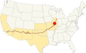
Location of of Lawndale, on U.S. 66 in Illinois
With a humid continental climate, Lawndale has wet hot summers and cold winters.
Summer (Jul) average high temperature is 85°F (29.7°C) and the avg. low is 65°F (18.1°C). Winter (Jan) average high temperature is 34°F (1 °C) and the low is 18°F (-7.8 deg;C).
Yearly rainfall is around 36.6 inch ( 1007 mm) and is highest during summer, reaching 5.08 inches (129 mm) in July. It is lowest in winter with 1.93 inches (49 mm) in January. Snow falls each year between November and late March, and averages 22 inches (55 cm).
Tornado risk
Logan County is struck by some 7 tornados each year. Tornado Risk: learn more about Tornado Risk on US 66.
Map of Route 66 in Lawndale
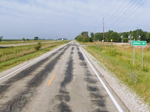
The highway had two-lanes until it was upgraded to a four-lane divided one in the late 1940s. The former eastbound lanes of this highway are under I-55 and you drive the former westbound ones from Atlanta towards Lincoln.
The original alignment of Route 66 runs with a NE to SW course from Atlanta passing by Lawndale on its way to Lincoln in a straight line as shown with this blue line in our custom map.
On the northeastern side of Lincoln the highway's four lane alignment reappears after I-55 cuts west to flank the city.
The Route 66 alignment in Lawndale
Visit our pages with old maps and plenty of information about US 66's alignments in this area.
- Springfield to Staunton IL (1926-30 US66) south from Springfield (next)
- Springfield to Hamel (after 1930) south from Springfield (next)
- Pontiac to Springfield (Lawndale's)
- Chicago to Pontiac (previous)

Lawndale's Route 66 Attractions
This leg of your Route 66 Road trip in Lawndale
Historic context
Jack Rittenhouse wrote his classic "A Guide Book to Highway 66" in 1946 after driving from Chicago to Los Angeles. In it he mentions Lawndale, and little has changed since then:
Really not a town at all, since it consists of a couple of red railroad shacks, a few homes, and a pair of grain elevators. No facilities at all on Route 66 Rittenhouse (1946)

Kickapoo Creek Bridge (Gone)
Driving westwards from Atlanta, just north of Lawndale, was a bridge that spanned Kickapoo Creek, it was built in 1954 and was rehabilitated in 2015.
"Kickapoo" is the name of the nomad tribe from northern Indiana, north-central Illinois, southern Wisconsin. The word may mean "wanderer". They were later moved beyond the Mississippi after supporting the UK against the U.S. in the 1812 war, and forced to cede their land to the American government. They were relocated in the west and now live in Kansas, Texas and Oklahoma.
The grain elevators mentioned by Rittenhouse are gone, they went in the late 2010s.
Trivia: The 1977 Thunderbird Incident
Tunderbirds are a category used in cryptozoology (Cryptozoology is the study of "mythical" animals that are rumored to exist such as Bigfoot, Nessie, or the Yeti) that comprises gigantic birds that form part of the Native American Thunderbird myths and legends.
The local lore is that Marlon Lowe, a ten year old boy, was playing with two friends in his backyard when two gigantic birds of prey swooped down on them and one of them grabbed Marlon with its claws.
The boy fought and yelled and the bird dropped him after carrying him for about 90 feet.
Of course there is no known species of bird that can lift a large child off the ground. And no such birds or their nests have ever been found or photographed.
The largest bird in North America is the condor, a midget in comparison to the world’s largest known flying bird, that lived in Patagonia, South America, some 6 Million years ago: the Argentavis magnificens; it belonged to a family of birds known as Teratornithidae (Greek for "monster bird"). This vicious predator weighed some 70 kg (155 lb.) and had a wingspan of over 7 m (23 ft.). Like condors it lived in the mountains where it could find strong winds and thermals to keep it aloft. It lacked the claws of modern predator birds but its beak and massive head 55 cm (1.8 ft.) long clearly indicate that it was a predator and not a carrion eater. Condors do not descend from Argentavis but from another line of North American Teratorns that later spread into South America. These gigantic Teratornid ancestors of the condor became extinct some 10,000 years ago at the end of the last Ice Age.
>> Further reading on this incident.
Continue your Route 66 Road Trip
This marks the end of this leg of your road trip through Lawndale; head south to continue your journey and visit the next town: Lincoln.

Sponsored Content
>> Book your Hotel in Chicago

Credits
Banner image: Hackberry General Store, Hackberry, Arizona by Perla Eichenblat
Jack DeVere Rittenhouse, (1946). A Guide Book to Highway 66.

