Route 66 in Ocoya IL
Index to this page
About Ocoya IL
Facts, Information and trivia
Elevation: 700 ft (213 m). Population n⁄a (2024).
Time zone: Central (CST): UTC minus 6 hours. Summer (DST) CDT (UTC-5).
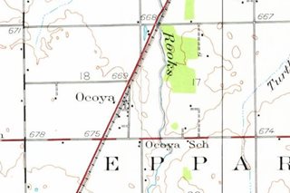
Ocoya is an unincorporated community in Central Illinois, in southern Livingston County.
History of Ocoya
See Pontiac's history for a description of the early history of Livingston county. Livingston County was created in 1837 and its seat is Pontiac, it was named for Edward Livingston (1874-1836), lawyer and politician who had been mayor of New York City and helped write the Louisiana Civil Code. He was also congressman for Louisiana and New York and US Secretary of State (1831-33).
The small community of Ocoya was born as a station on the Chicago & Alton Railroad in 1854. Duff and Cowan, from Pointiac platted it. Its post office opened in 1860 (now closed). Overshadowed by Chenoa and Pontiac, it remained tiny: it still has some grain elevators and a few scattered homes and perhaps 30 residents.
The Name: Ocoya
Maybe an Miami-Illinois word for the whippoorwill (Antrostomus vociferus) also called "whip-o-will", a medium-sized bird, but could also be the Illinois word "apacoya" that designated the reed mats used to cover the wood frames of native houses.
In the early 1910s the "Pontiac Trail" was created as a hard surfaced highway from St.Louis to Chicago. The Illinois State Higway 4 was built along it in the early 1920s and paved. Route 66's 1926 alingment incorporated the state highway into its course.
During World War II, route 66 was improved, repaved and widened. Then in the early 1950s, a second set of lanes were built making it a 4-lane divided highway. The freeway bypassed it in 1958 and US 66 was decertified in 1977.

Hotels and Motels in Ocoya
There is no lodging in this village but you can find your accommodation close to Ocoya:
> > Book your hotel nearby in Pontiac
More Accommodation near Ocoya on Route 66
Below you will find a list of some of the towns along Route 66 east and west of this town; click on any of the links to find your accommodation in these towns (shown from east to west):
Along Route 66 in IL
- Hotels in Illinois
- Route 66 Starting point ▸ Chicago
- Lockport
- Willowbrook
- Bolingbrook
- Plainfield
- Romeoville
- Joliet
- Wilmington
- Dwight
- Pontiac
- Chenoa
- Normal
- Bloomington
- Atlanta
- Lincoln
- Springfield
- Raymond
- Litchfield
- Staunton
- Williamson
- Hamel
- Edwardsville
- Collinsville
- Troy
- Glen Carbon
- Pontoon Beach
- Granite City
- East St. Louis
West in Missouri
- Hotels in Missouri
- Florissant MO
- Bridgeton MO
- St. Louis MO
- Kirkwood MO
The Weather in Ocoya
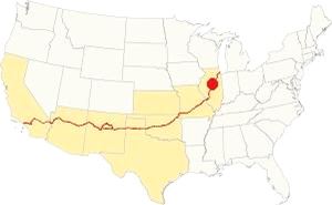
Location of Ocoya on U.S. Hwy. 66
The weather in Ocoya is a "Humid Continental" one, so it has very wet, damp, and hot summers; and cold winters.
Its average temperatures are the following: during summer (Jul) the high is 85°F (29.7°C) while the low is 63°F (17.2°C). During winter (Jan) the avg. lows are a freezing 17°F (-8.3 deg;C) while the high is a chilly 30°F (-1 °C).
Rainfall is around 38 in. (965 mm) per year, and the sunny days are, on average 194 days per year. Snowfall is 26 inches (66 cm) each year and falls from Nov to the first days of Apr.
Tornado risk
Livingston County (where Ocoya is located) is hit by some 6 tornados each year.
Tornado Risk: read more about Tornado Risk on US Hwy 66.
Map of Route 66 through Ocoya, Illinois
Route Alignment
>> pale blue line in our custmo map shows the alignments of US66 in Ocoya.
As you drive by Ocoya, you wil notice a set of abandoned lanes to your right on the west side of Historic Route 66, these lanes are the former southbound lanes of US 66 when it was a four-lane freeway, back in 1954. This is now a Historic Place:
Historic Route 66, Cayuga to Ocoya (1943-44 ⁄ 1954-55)
Listed in the National Register of Historic Places
The original 1920s road that had been paved as Illinois State Highway 4, only had two narrow lanes 9 feet wide and 6-inches thick. The heavy wartime truck traffic during WWII broke the paving in the early 1940s.
In 1943-44 it was improved: two brand new lanes of 10 inch-deep concrete and with a total width of 24 feet were built on top of the old 1920s highway. It was also planned to add a second set of lanes and upgrade the highway to a "superhighway" grade.
After the war, the second pair of lanes were built (eastbound), and completed in 1954-55. Route 66 was now safer and wider, it became a four-lane divided freeway running past Ocoya. One set of lanes was abandoned when I-55 was built, but the former southbound lanes in Ocoya can be seen just west of the present highway.
Route 66's four lane alignment was completely bypassed by the I-55 interstate built further west, which bypassed Ocoya too. It carried US 66 until it was delisted in 1977.
Route 66 is a Historic highway and has also been designated as a National Scenic Byway and an All-American Road in the state of Illinois.
Visit our pages with old maps and plenty of information about US 66's alignments in this area:
The Route 66 alignments near Ocoya
- Springfield to Staunton IL (1926-30 US66) south from Springfield (next)
- Springfield to Hamel (after 1930) south from Springfield (next)
- Pontiac to Springfield (Ocoya's)
- Chicago to Pontiac (previous)

Sights and Route 66 Landmarks in Ocoya
What to see in Ocoya
US 66 in Ocoya: historic context
Jack DeVere Rittenhouse drove from Chicago to Los Angeles in 1946 and wrote his "A Guide Book to Highway 66" describing his itinerary. In it he also mentions Ocoya as follows:
...another dwindling community with the ever present grain elevator, a score of homes, two small stores, and a gas station...Ritenhouse (1946)
Very little of this remains, the gas station and stores have vanished, but the grain elevators have survived.
Drive westwards from neighboring Pontiac, to the right are the decommissioned former westbound lanes of the four-lane U.S. 66.
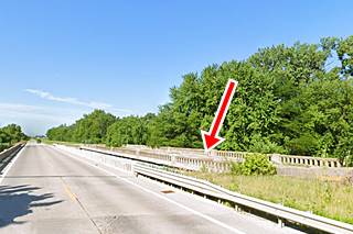
Rooks Creek 1946 Bridge
At Rooks Creek there is a bridge on the former WB lanes that was closed to traffic in 1998. It was built in 1946 when the highway was upgraded. The original bridge was located on the current highway and built in the 1920s and replaced in 1940 and again rebuilt in 1997.
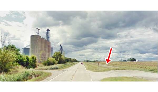
Just 0.6 mi. west of the bridge, E 1250 N Rd. meets the highway on the right side. Formerly it curved as it crossed Route 66, crossed the railroad tracks that run along the left side of the highway using a grade crossing, and entered Ocoya. This northern access into Ocoya is closed, you can only reach the village from its south side.
Grain Elevators
As you look west you can see, to your left, the grain elevators mentioned by Rittenhouse in 1946, pictured below:
Grain Elevators and Historic Route 66 in Ocoya, Illinois
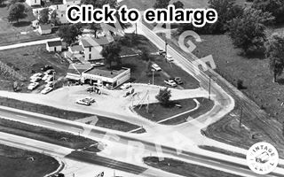
1968 aerial view of Ocoya and US 66. Source. Click image to enlarge
There is a an autobiographic novel by Theresa M. Ripley (Growing up on Route 66), who in her own words "lived on a 200-acre farm near the 100 mile post of Rt. 66 in Illinois. Our driveway led out to the Rt. 66, and we were directly across from the Ocoya elevator." Ripley lived there from 1944 when she was born until 1962 when se left for college. Her brother lived here all his life (1935-1986).
Ripley recalls that her mother sold the farm's eggs to those traveling along the highway, she had placed a sign on the side of the road with the words "Ripley's Eggs Believe it Or Not," there were also billboards on the farm advertising other stops along the highway. Sometimes cars broke down by the farm and stopped there till they were towed.
Continue your Route 66 Road Trip
This is where your journey across Ocoya ends, head south into Chenoa to continue your US 66 road trip.

Sponsored Content
>> Book your Hotel in Chicago

Credits
Banner image: Hackberry General Store, Hackberry, Arizona by Perla Eichenblat
Jack DeVere Rittenhouse, (1946). A Guide Book to Highway 66.


