The 2nd oldest city in Oklahoma
Index to this page
About Vinita, Oklahoma
Facts, Trivia and useful information
Elevation: 699 ft. (213 m). Population: 5,385 (2025).
Time zone: Central (CST): UTC minus 6 hours. Summer (DST) CDT (UTC-5).
Vinita, is the county seat of Craig County, Oklahoma, in the northeastern tip of the state, close to Missouri and Kansas in the "Green Country" region of Oklahoma, where the forested Ozark Highlands blends with the prairie.
Historic Route 66 crosses the town from North to South, there are Route 66 shields painted on the roadbed here.
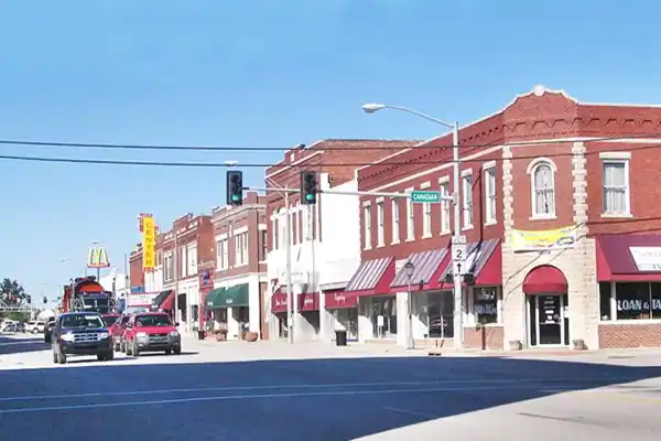
Vinita's History
Founded in 1871, Vinita is celebrating 150 years of history throughout 2021. So don't miss the chance to drop by during your roadtrip.
This part of America has been inhabited for over 10,000 years. The Native American people were hunters and gatherers. The current Cherokee population in Oklahoma is the result of their "Removal" from their original homeland east of the Mississippi by the U.S. government.
In the early 1800s, the Federal government swapped their lands in Georgia for other land west of the Mississippi River. Treaties were signed and the Indian Removal Act was passed by Congress in 1830.
The natives relocated in what is now Oklahoma and set up the Cherokee Nation with its capital, Tahlontiskee (near present Gore, OK) in 1839 after a terrible migration (the "Trail of Tears").
There were two battles near Vinita during the American Civil War, at Cabin Creek:
Battles of Cabin Creek
Cabin Creek is about 30 miles from the Kansas state line and was the point where the Old Military Road , coming up from Texas, split off from the Texas Trail. A large double plank cabin was built here, and it would give its name to the trail, the creek and a also -though much later- to a nearby town.
There were two battles fought here: the first battle took place on July 1 - 2, 1863, and resulted in a Union victory. It was the first in which African American troops (the 1st Kansas Colored Infantry) fought alongside white soldiers. The Second battle (Sept. 17, 1864) was a Confederate victory. Vinita's Eastern Trails Museum has relics of the battles. Which are reenacted every third year (next one is in October 2016).
The Cherokee Nation in the late 1860s granted permission for the laying of railways through their territory. The first tracks were those of the Missouri - Kansas - Texas Railroad Company (or MKT or "Katy"), who builtits line southwards down the "old Texas Road" towards Texas.

Lavinia "Vinnie" Ellen Ream ca. 1870
Katy's attorney and mixed-blood Cherokee Col. Elias C. Boudinot II, chose a spot next to Cabin Creek for the location of a townsite. He set up a tent town there. He knew that this would be the point for a junction between MKT and another railroad, the Atlantic and Pacific Line (A&P). He named the town Vinita.
A&P was building a line that crossed the country in a diagonal from St. Louis to Vinita and intended to head west towards California (it reached Needles, CA in 1885, after being purchased by the Santa Fe Railroad in 1880).
But A&P had negotiated with some Cherokee leaders that opposed Boudinot, and moved their tracks so that the junction would not fall within Boudinot's land. Instead the junction was to be located about 3 miles further north.
Both railways met and a town was laid down in 1871 by Joseph Vann, Dr. Miller and Joseph Thompson (who became its first Mayor and built its first building). Its original name was Downingville after Lewis Downing, the main Cherokee Chief at that time.
Boudinot's Vinita
Boudinot named the town after his lady friend Lavinia "Vinnie" Ream. Lavinia is an ancient Latin name and was the daughter of Latinus, King of the people of Latium, Italy, who gave her as wife to Aeneas, prince of Troy when he landed in Italy. She is the mythical "mother" of Rome.
Lavinia Ellen Ream Hoxie (1847 - 1914). American sculptor best known for the statue of Abraham Lincoln in the U.S. Capitol rotunda.
Boudinot's town was short lived, but the name prevailed, Downingville became Vinita (though for many years it was known as "The Junction") and was incorporated under Tribal laws in 1873.
The town grew and the railway junction allowed cattle-shipping to St. Louis and to Kansas City.

Between 1898 and 1906, the Federal Government curtailed the authority of the Cherokee Nation and in 1897 Congress nullified tribal laws and in consequence Vinita was incorporated in 1898. The tribal government was dissolved, the reservation terminated and Oklahoma admitted as a state of the Union in 1907, and Craig County was established.
Vinita Trivia
Vinita has the honor of being:
- "America's Crossroads" US highways 60, 66 and 69 crossed Vinita
- The second oldest town in Oklahoma
- The first town in the state with electricity
- The oldest incorporated town on Oklahoma's Route 66
Phil McGraw, TV personality "Doctor Phil" was born in Vinita, and Will Rogers, actor, singer, politician, cowboy, vaudeville performer, humorist, social commentator was, despite being the local celebrity, born 40 miles away in Oologah, Oklahoma.
In the meantime, telephones were installed in 1897 year and electricity in 1899 (it was the first city in Oklahoma with electricity).
When the national highway system being discussed in the 1920s Vinita lobbied effectively to have some of them pass through the town: US highways 59, 60, 66, 69 and 73 were all aligned to cross the town.
Its economy received a boost from travelers driving down Route 66 during the Great Depression and the World War II period. However the road became unsafe and too small to handle the growing flow of vehicles. By 1957 the Will Rogers and Turner turnpikes had replaced it between Joplin and Oklahoma City.
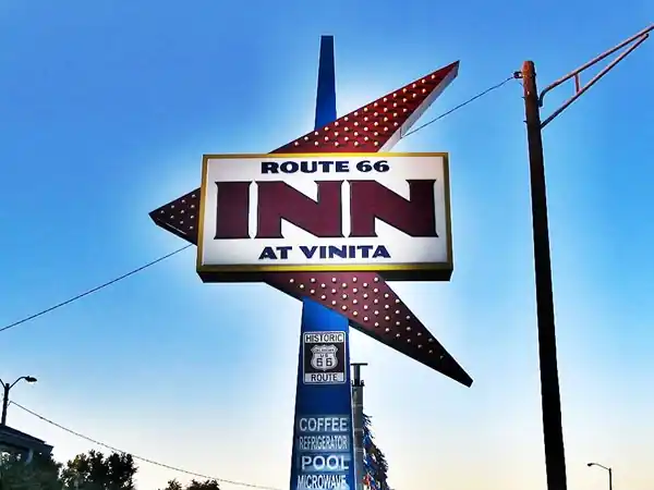
Clasic US 66 Neon sign, Vinita Inn, Oklahoma
Hotels in Vinita
Where to Stay
There are several hotels in Vinita. Alternatively you can also lodge in the neighboring towns along Route 66 in Oklahoma:
> > Book your hotel in Vinita
More Accommodation along Route 66
There are several hotels in the area close to this town. Alternatively you can also find your accommodation along Route 66 in the neighboring towns and cities. We list them below (listed from east to west):
On Route 66's Main alignment
Eastwards
Westwards
>> There are two RV campgrounds in Vinita.
Vinita’s Weather
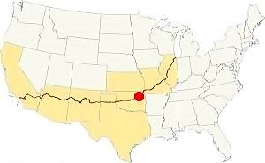
Location of Vinita on Route 66
Average annual rainfal is 43 inches (1.090 mm) and it rains about 91 days per year, mostly during late spring and summer. Sunny days are the most frequent: 226 days yearly.
The average high temperature in July is 93°F (33.9°C) and in January the average low is 24°F (-4.4°C). It snows in Vinita during winter and about 11 inches (28 cm) fall between Nov. and March.
Tornado Risk. Vinita is located inside Oklahoma's "Tornado Alley and experiences about 8 to 9 Tornado watches every year.
Read more about: Tornadoes on Route66.
Map of Route 66 through Vinita
See the description of this segment in our KS-OK state line to Vinita and the
Vinita to Tulsa webpages.
The interactive maps below show the alignment:
map of this segment east of Vinita and Map of this segment west of Vinita.
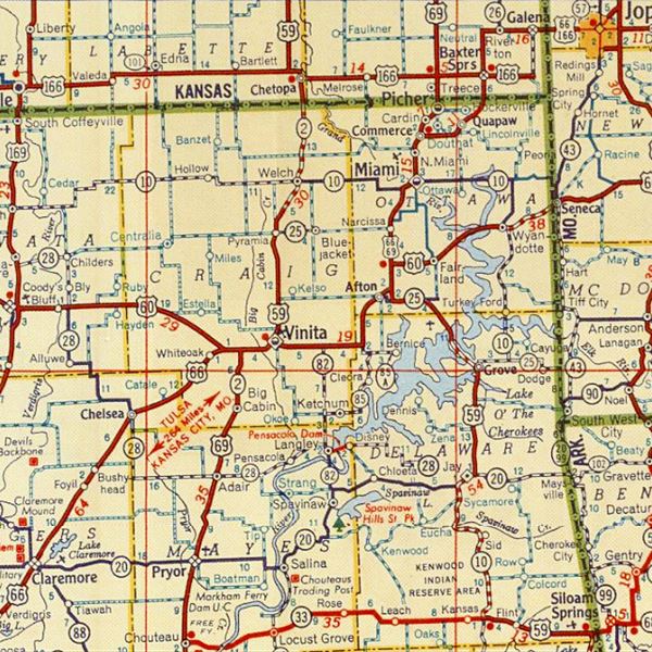
1948 Shell Roadmap northeast Oklahoma
Click on map to enlarge
Source
The thumbnail map (click it to enlarge) was published in 1948. It is a Shell Highway Map and it shows northeastern Oklahoma and SE Kansas. You can follow Route 66 from the upper right (Galena KS) to Claremore OK on the lower left. Vinita is in the middle.
Check out Vinita on our Map of Route 66 in Oklahoma, which has the complete alignment of the Mother Road across the state and all the towns along it.
See this map with US 66 alignment in Vinita
The following map is an "AutoTrails" map published in 1924, two years before Route 66 was created.
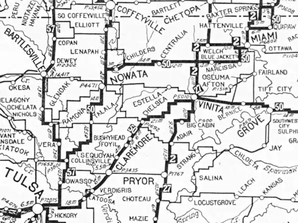
Vinita is in the middle and the highway which would become Route 66 is marked as "50", meaning the "Ozark Trails", you can follow it from Baxter Springs KS to Tulsa OK.
Route 66 Alignment near Vinita
Visit our pages with old maps and plenty of information of the old US 66 roadway.
- Tulsa to Chandler (next)
- Vinita to Tulsa (Vinita's)
- KS-OK state line to Vinita (previous)
Route 66 landmarks & attractions in Vinita
- In Vinita: City Tour - read on below
- Tours & Itineraries
- State Parks
Jack Rittenhouse drove along Route 66 in 1946, collecting information which he included in his book "A Guide Book to Highway 66", a great resource for those keen on learning more about US 66 during the post-war period. In it, he wrote about Vinita:
There was a gas station 2 miles east of the town. Then came the downtown area which had the "hotels: Vinita and Cobb" followed by the "courts: DeLuxe, Ranch Motel, Meeks, 66 Court, Texaco Cabins -all on the south side" (courts were motels), two miles west of the town was Tip Top Court, which had a cafe and gas. Followed 2 miles west by a gas station with a small garage. Then came the village of "Whiteoak" (he wrote it as one word not two).
Hotel Vinita is still standing, but all the motels mentioned by Rittenhouse are gone (for instance, the 66 Court on 449 S Wilson has been razed).
Nevertheless, there are plenty of Route 66 classics to see in town.
Town Attractions
Our city tour starts four miles east of Vinita, on Old US 66.
McDougal Filling Station
Listed in the National Register of Historic Places
On the NW corner of 443956 East State Highway 60 (and S 4440 Rd.), 4 mi. east of Vinita (See this Map showing where it is).
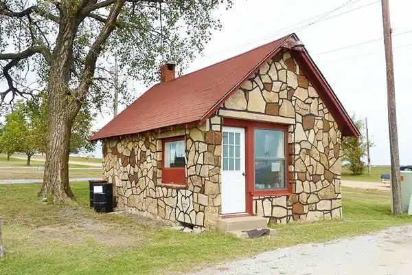
This independent gasoline station was built in 1940 by Grace and George McDougal. It was designed to look like a house: red shingled roof, brick chimney and home-like door and windows. It has a sandstone veneer which alternates dark and light stones in a style found in the region and known as "Giraffe Stone". At first it sold Conoco gasoline. It operated until 1968.
Historic Marker
Across the street on the NE corner of Route 66 and S 4440 Rd. you will see a "Will Rogers Highway marker". (Street view).

Little Cabin Creek Bridge, Source. Click for St. view
Historic Little Cabin Creek Bridge
Listed in the National Register of Historic Places
Drive 1.7 mi. west, to your right is the old historic bridge. It was built in 1934-5 to carry Route 66 across the Little Cabin Creek. It is closed to traffic. The bridge is 388 ft. long and is 24 feet wide between curbs. It consists of 8 steel stringer I-beam approach spans and a central 95-foot Parker Pony Truss.
Continue west along Route 66, pass under I-44 and at S 7th St., take a short detour to visit an example of Americana.
Former largest McDonald's in the world - bridge-restaurant
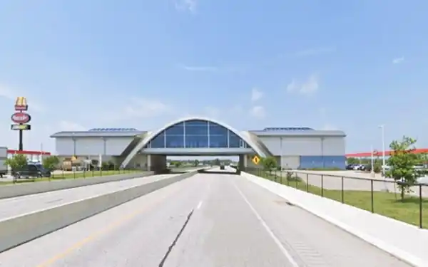
On I-44 and S420Rd. It spans the interstate but you can visit it without having to get onto the Turnpike and pay the toll. See this map with directions it is just 2 mi round trip.
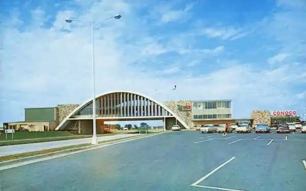
This "bridge-restaurant" spans the Will Rogers Turnpike (Interstate 44) just south of Vinita. It is known as the Glass House McDonald's.
It was built in 1957 and at that time, its surface area of 29,135 sq. ft. (2707 m2) made it the biggest McDonald's in the world.
After being refurbished in 2013, it reopened on Dec. 22, 2014 and was renamed as the "Will Rogers Archway".
Vinita Inn - former El Rodeo motel
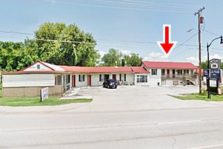
Return to Route 66 by retracing your steps and turn left into Vinita along Route 66. Ahead, after crossing the Fallen Heroes Memorial bridge, at 598 E. Illinois Ave., to your right is the former "El Rodeo Motel".
As you can see in the "Then and Now" images below, the 1950s star shaped neon sign is gone, but the building at the back, with its stairs and porch is clearly the same (red arrow). Now it is an apartment complex.

Rodeo motel, Source
Continue west and to your left is a Classic eating spot on US66.
Clanton's Cafe
319 E. Illinois Ave. It is the longest continually family owned restaurant along the whole of Route 66, and has been operated by four generations of the same family.
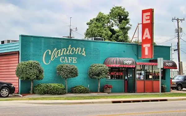
The Cafe opened in 1927 and serves the best of Southern cuisine (burgers, steaks, fried calf and more).

Old Lewis Motel sign. Now gone. A. Whittall
Site of the Lewis Motel ❌
Across the street was a classic motel with a great neon sign (see image). The motel was demolished in 2006.
The sign has also gone, but the two steel posts that held it up (red arrow in image) are still there; see Street view.
Continue into town, and after crossing the railroad tracks to your right is the town's historic Post Office built in 1938. Opposite, on the south side of Route 66 is the "Mural".

Mural (detail). Source
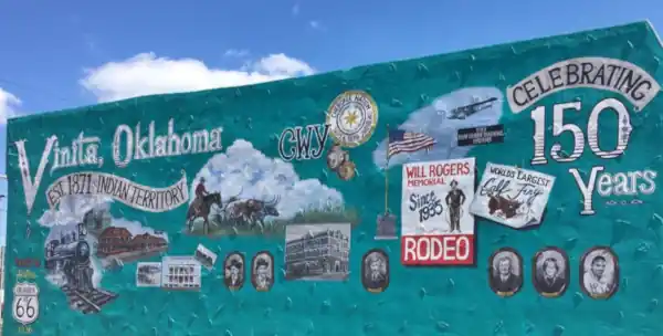
Historic Vinita Mural for the Sesquicentennial
The mural is at 123 E Illinois, on the western wall of H&R Block Building which is the site of the former Cobb Hotel mentioned by Rittenhouse in 1946. Mural is on this wall.
This mural depicts the history of Vinita over the course of the past 150 years. It is the work of Jessica S. Stout.
It is 42 feet long and 20 feet high. It includes a Route 66 Shield, the railroad, longhorn cattle, the Will Rogers Rodeo, the Cherokee Nation,
the WWII gliding training field at Theldor Field, the "largest" fried calf, and honors the veterans, among others.
City Hall
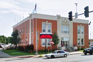
Ahead, on the NE corner of Wilson St. is the City Hall, built in the early 20th century. As you can see in the "Then and Now" sequence below, it hasn't changed (notice the US66, 60 and 69 signs on the corner).

1950s postcard Vinita City Hall
Turn left, following Route 66's course, along South Wilson. To your left, a classic movie theater.
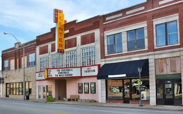
Center Theater
At 124 S. Wilson Street. The building was built in 1922 as the Lyric Theater, remodeled in the 1930s and restored recently and is probably the oldest theater in Oklahoma that is still operating.
Historic Hotel Vinita
Listed in the National Register of Historic Places
Ahead to your right, on the SW corner of S Wade and Canadian, at 106 West Canadian, stands a historic red-brick building.
The historic hotel was built in 1930 and, unlike previous hotels which were built to cater to the railroad passengers, this one was especially built on Route 66 to serve those traveling down the highway which ran right past its door.
Although it may seem a box-like red brick building, its design included elements of the Baroque and Spanish Colonial styles. Below is a "Then and Now" set of pictures one from the 1930s, another now. Virtually unchanged!

1930s postcard Hotel Vinita, Source

Historic Hotel Vinita nowadays. Click for St. view Source
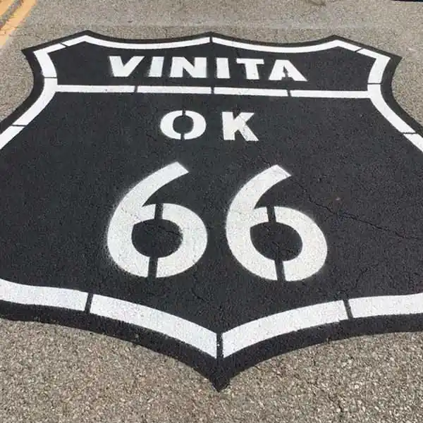
US Highway 66 shield painted on the road surface
Drive south across the Shields painted on the Roadway (Canadian and Route 66).
> > Read about all the Shields painted on Route 66
Randall Tire Company
Listed in the National Register of Historic Places
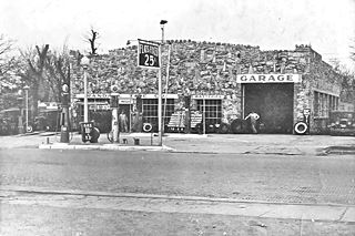
On the southern tip of the block, to your right, at 237 S. Wilson is a another Historic building, it was built in 1931 and has a distinctive facade with irregular stone that gives it a castle-like appearance, with sawtooth parapet and all. Its windows are framed with bricks. It is still open.
Facing Randall's is the "Site of Spraker Service Station", torn down. Although it was listed in the National Register of Historic Places this cottage-style 1927 Conoco gas station (240 South Wilson) was torn down.
Roger's Garage and Auto
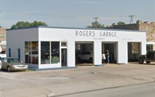
Located next to Randall Tire, for the last 30 years it has been a used automotive dealer (249 S Wade). It is an oblong box style building, with a glassed office on the southern corner and three garage bays. The design is that of a 1940s-50s gas station, but we can't say which company.
Southern side of Vinita: more US66 attractions
Classic gas stations
Former Cities Service Gas station ❌
Gone It was on the NW corner of W South Ave and Route 66. With a two-part roof(a lower roof over the office and a higher one over the two service bays). It had no canopy but had white porcelain enamel finish, with three green horizontal bands painted along the roofline. In the image, the company logo (red arrow) can be seen above the office's entrance door. Lost in the early 2020s. Below is how it looked in 2018:
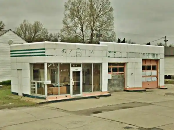
Old Gas Station
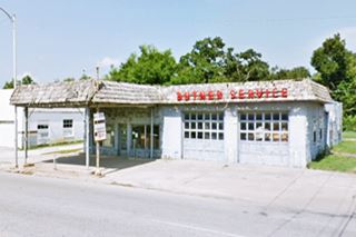
Across South Ave. from the Cities Service, on the SW corner. See picture. It is a 1930 building that was modified later (the mansard shingle roof on the canopy and building. Notice the rock faced office. The garage had two multi-window doors and the pumps island is still standing. It is slowly falling apart.
Drive south and on the next block, to your left is a Classic Phillips 66 Gas Station Design.
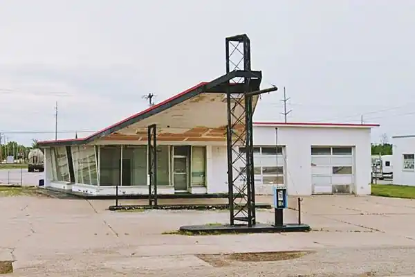
Phillips 66 Gull Wing Gas Station
SE corner of Excelsior Ave and Route 66. This is a design that Phillips Petroleum Co. standardized for all of their filling stations across the US in the early 1960s. They adopted a "modern" design with a triangular "gull-wing" canopy which was supported at its narrow tip by a pole designed to look like an oil derrick. A Phillips 66 revolving sign stood at the top of the pole.
> > Learn more about Phillips 66 Gull Wing stations on Route 66
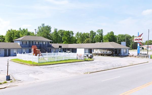
Route 66 Inn
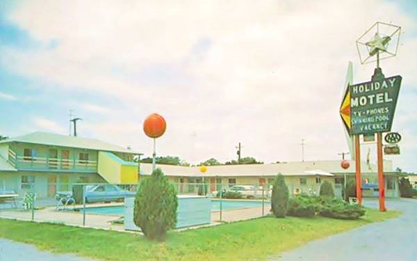
Drive on. Ahead, to your right (519 S Wilson) is the a classic motel neon sign (pictured at the top of this page). It is a typical U-shaped motel, formerly the "Holiday Motel".
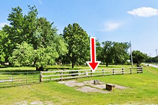
The pool was filled in and its shape can be made out in the grassy area in the central court:
The old postcard below shows its kitschy Route 66 neon sign designed to look like the "real" Holiday Inn neon sign. It shows the now gone pool:
Original US 66 alignment
Route 66 starts to curve towards the west. Here, to your left is the first alignment of US 66. The Oklahoma DOT map of Vinita says that the Wilson St - Euclid St. are the "probable historic alignment (unverified)" they also point out a "Concrete Foundation" on the curve. In the USGS map published in 1913 (thirteen years before Route 66 was created) you can see inside the red circle, the point where Euclid St. (running east to west -left to right) meets Scraper St - S 4400Rd (running north to south - top to bottom) and Wilson St. (with a NE-SW angle or upper right to lower left).
The black dot on the intersection is the "concrete foundation", probably a gas station at a very strategic location. See picture. It could also be the remains of "De Luxe Courts" with modern cabins and a gas station located 0.5 mi. south of the town. This image seems to show it at a junction of several roads (see old postcard).
Sharp curves were dangerous, so it is likely that in the 1930s US 66 was moved to its present alignment, with a soft curve. This curve of Route 66 is no longer South Wilson St., instead is is named West Dwain Willis Avenue.

1913 USGS map of Vinita
Relax Inn
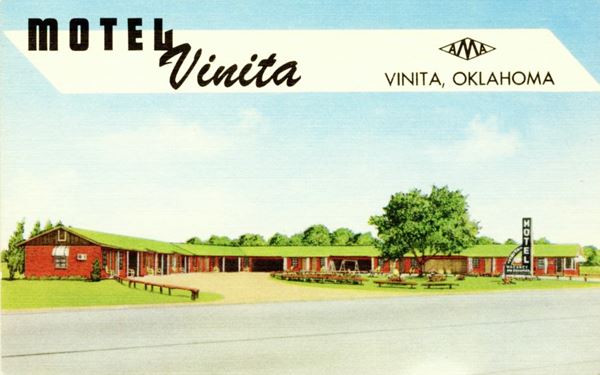
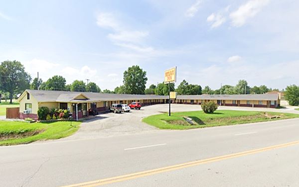
Keep on the later US66 alignment, and to your right, at the curve on Route 66 is the "Relax Inn" motel, at 110 W Dwain Willis Ave. It has an "L-shaped" layout. It was formerly known as the Motel Vinita. Its postcard tells us it had "17 Units - Garages - Panel Ray Heat - Free T.V. - Refrigerated Air - Tile Baths... Nick Douvas - Owner"
Old Filing Station
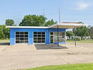
Across the highway, to your left, on the curve is another old gas station with a flat roof canopy, glassed office and a two door (also glassed) garage. There were two separate pump islands. The place is now closed. See picture below left.
Will Rogers Highway Marker
Passing the gas station, to your right, just before Schaefer Ave. (Street view).
The marker was erected in 1999 and tells that US66 was renamed Will Rogers Highway in 1936, it also says that Will Rogers went to school in Vinita.
The road now becomes a four-lane divided highway, it was paved in concrete in 1931 to the county line. In the 1960s it became a four-lane highway (the original road followed the eastbound lanes). It crosses the big cabin creek and to your left, 0.8 miles west of the bridge, is another motel.
Park Hills Motel
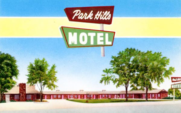
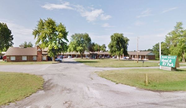
438415 US-60, Vinita. On the eastbound lanes, to your left. Still operating as the Park Hill Motel & RV Park, its vintage postcard shown below says "PARK HILLS MOTEL 20 RCA Refrigerated Units. Thermostatically controlled electric heat TVs-Carpeted Floors-Instant Hot Water Tile Baths - Tubs & Showers Bill & Ruth Patty, Owners Phone 1486J1. 2 Mi. West Vinita."
It is unchanged - see the chimney on the left building, it is stil there.
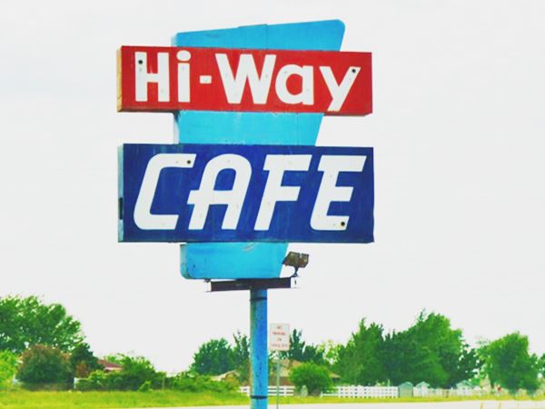
Hi-Way Cafe
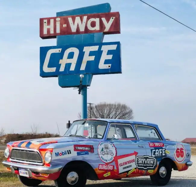
Drive 0.5 miles west and at 437918 US-60, to your right. Is this cafe with a classic Route 66 neon sign. It is the "Best Little Café on Route 66".
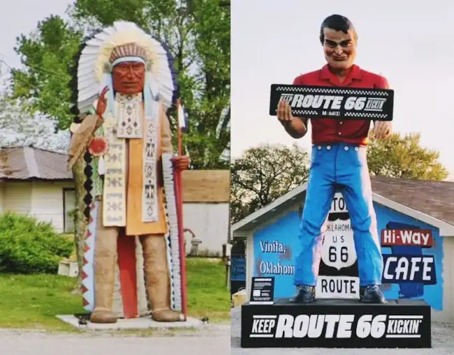
It is next to the Western Motel is a classic restaurant that opened in 1963. It has a 21-foot-tall fiberglass muffler man next to an enormous suitcase covered with Route 66 road trip stickers. Its known as Big Bill, after Bill Wood, the late father of the cafe's owner Beth. Further left is Big Chief, 20-foot-tall and hand carve in wood. He came from Massachussets where he stood at a gift store. , hand-carved wooden statue originally from a gift shop in Massachusetts that was restored and moved to the Hi-Way Cafe in Vinita. Soon the Big Chef who was located at the now closed Carl's on Route 66 in Springfield, Missouri, will be relocated here.
Don't miss its great sign.
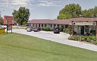
Western Motel - former Horse Motel
Next to it, also on your right, is the former "Horse Motel" (437866 US-60).
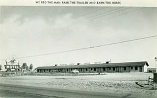
This motel is 3 miles west of Vinita, it used to be the Horse Motel ("We bed-the-man park-the-trailer and barn-the-horse") and has changed a lot, however the door and window layout of the main building has remains unchanged. Click images below for larger sized views.
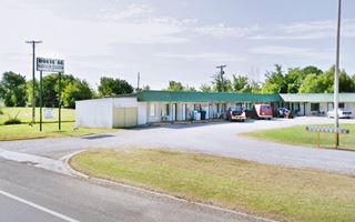
Old Motel
Half a mile to the west, on the south side of the highway is a former motel.
Now it is an apartment complex (Route 66 Apartments) with an L-shaped layout.
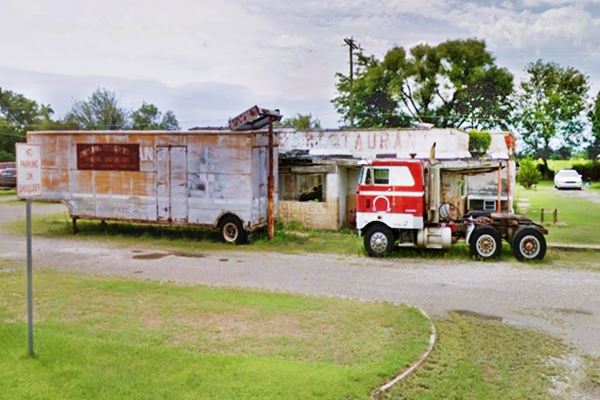
Next to it are some old gas stations and an abandoned restaurant.
Gas station and restaurant complex. Tip Top Court?
This group of buildings is a bit further than the "Tip Top Court" mentioned by Rittenhouse (two miles west of the town) which had a cafe and gas, but it probably is the old site.
From east to west you will see the following buildings:
(1) a garage with two bays and the remains of the concrete base for the filling station's pumps (Street view).
(2) The restaurant pictured below, which was in ruins and torn down in the early 2020s, now gone ❌.
(3) Another gas station (3) -see image- with five concrete pump islands (marked in the image with red arrows).
Abandoned Restaurant on Route 66 in Vinita
Tall Native American Chief "Standing Brave" Statue
A short tour, 4.6 miles south, along US 69 (Map with Directions) at I-44's Exit 283, will take you to visit a gigantic statue.

Standing Brave statue, Source. Click for St. view
DeWayne and Kathrena Franks opened it in 1966. The 46-foot-tall (14 m) "Standing Brave" was conceived as an eye-catcher for the truck stop. It is the work of Wade Leslie, who took over 800 man-hours to complete the task.
Inaugurated in 2001, it has a steel bar structure supporting insulating foam which was sculpted and then covered with fiber glass and polyurethane resin, Sanded, and painted.
It has concrete foundations and weighs 15,500 lbs. (7030 kg). The spear and headdress give it rigidity. Notice the Oklahoma state flag in the chief's shield.
This is the end of the tour through Vinita.
You can turn back, do some short tours close to Vinita, or head west along US66 to visit White Oak.
Tours, Local Events & Itineraries
Local Events
World's Largest Calf Fry & Cook-Off
The World's Largest Calf Fry Festival is held every year. It began in 1979 and is now sponsored by the the Vinita Area Chamber of Commerce. It is a typical rural and ranching community delicacy.
The highlight is the "calf frying competition" and the beans, salsas, cobblers and breads cook-offs.
Will Rogers Memorial Rodeo
This is a week-long event in memroy of Will Rogers, born in 1879 and killed in a plane crash in 1934. He attended school in Vinita. His death took place two days before a Rodeo in Vinita he was going to attend, so it became a memorial event in his honor.
It consists of an opening parade, the All Settler's Day event and rodeo events including barrel racing, bronc riding, bull riding, roping and more.
Four day passes available. More information at their website: www.willrogersmemorialrodeo.com.
Eastern Trails Museum
215 W. Illinois. Exhibits of the early days of Vinita, native artifacts, pioneer's objects. And re-created settings: a post office, general store and doctor's office. Admission is free.
Natural Attractions
Grand Lake State Park
Vinita combines the prairie and the forested Ozark highlands. It has several areas nearby that are great for outdoor recreation and enjoying nature along the "Grand Lake State Park". The Grand Lake O' The Cherokees has a surface area of 45,000 acres and boasts 1,300 miles of coastline. The park is known as the "Crappie Capital of the World" and is ideal for swimming, walking and enjoying water activities.
Cherokee Area
Leave Vinita eastbound along U.S. 60 - 69 (Route 66), towards Afton. When you reach the intersection with OK-82, turn right and follow it
till it meets OK-28 north of Langley. Keep south along Hwy 28 and pass the town, head east into the Park. Distance: 17 miles. (Map with directions).
It is set on the shores of the Grand Lake O' The Cherokees. Great fishing and an ideal place for water sports. There are picnic areas, campsites and RV sites. There are other areas in the park: Riverside, Grand Cherokee and Grand View. Read more at the official website.

Sponsored Content
>> Book your Hotel in Vinita


Credits
Banner image: Hackberry General Store, Hackberry, Arizona by Perla Eichenblat
Jack DeVere Rittenhouse, (1946). A Guide Book to Highway 66
Official town's website: www.cityofvinita.com
Craig County Genealogical Society, The Encyclopedia of Oklahoma History and Culture, Vinita

