Route 66 in Lupton AZ
Index to this page
Click to See the same spot now
About Lupton, Arizona
Facts, Trivia and useful information
Elevation 6,188 ft (1,886 m). Est. Population 27 (2025).
Time zone: Mountain (MST): UTC minus 7 hours. Summer (DST) no DST⁄ PDT (UTC-7).
Lupton is a tiny hamlet in Apache county, right next to the New Mexico State Line.
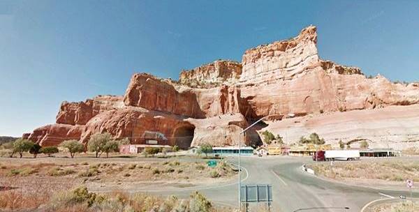
Trading posts beneath the Painted Cliffs in Lupton AZ
History
This part of Arizona has been inhabited for at least ten thousand years. In more recent times, the Anasazi, or Ancestral Puebloans lived in this area. Their homeland covered the Colorado Plateau, a vast part of the south of Utah, Colorado, Western New Mexico, and Arizona west of the Colorado River and north of the Little Colorado and Puerco Rivers.
The Anaszi were farmers and reached their peak between 700 and 1150 A.D., after which drought and invading nomads forced them to move south into New Mexico, becoming the Pueblo people met by the Spanish explorers after 1540.
The groups that pushed the Anasazi to the southeast, were the Navajo people, hunter gatherers who learned some farming abilities from the Pueblo people. Later they adopted goat and sheep herding after the Spanish introduced them into their settlements.
The Navajo or Diné ("People") were of Athabaskan origin, from Northwestern Canada and migrated to the American Southwest around 1400 A.D.
Francisco Vázques de Coronado was the first European in the area (1540), he conquered the village of Zuni Pueblo, and before marching towards the Rio Grande, sent a party commanded by Garcií López de Cárdenas to verify the rumors about the "Tizá" River, Spanish for "Firebrand", due to its intense red color. This tiny expedition marched across what is now Lupton, reached the Hopi village of Tuzan and discovered the Grand Canyon.
The Spanish claimed Arizona, as a part of their American colonies, but never settled the region. They met and named the "Navajo" in 1620, north of Santa Fe NM. THe word derives from "Apachu de Nabajo" (Apache of -a place namded- Nabajo).
From their territory in NW NM and NE AZ, the Navajo raided the villages in Colonial New Mexico and continued doing sor during the Mexican period after 1821. Once the U.S. acquired the area (Arizona was a part of New Mexico at that time) after defeateing Mexico in the 1846-48 Mexican-American War, the American Army devised a plan to pacify the region.
Fort Defiance was erected by Col. Edwin Sumner in 1851, in what is now Arizona, in the heart of Navajoland. It was attacked several times in the 1850s, and due to the onset of the American Civil War, was abandoned in 1861.
Trivia
Apache County has the most land designated as Indian reservation of any county in the United States (68.34% of its area). Neighboring Navajo County is in third place.
The new Commander Brig. Gen. James Carleton engaged the Navajo from The "Old" Fort Wingate near Grants (1862), rounded them up and marched them to an internment camp near Ft. Sumner. The terrible "Long Walk" of 450 miles (720 km) and the lack of water and food at Ft. Sumner led to a public uproar. Carlton was replaced, the Navajo Treaty was signed (1868) and the Indians were allowed the Indians to return to their homes in the new "Navajo Reservation".
The spot where Lupton is now located was actually a crossroads in the 1800s. The "Shirts Trail" from Zuni Pueblo to Oak Springs crossed the Star Mail Stage Route, from Ft. Wingate, to Navajo Springs en route to Ft. Whipple.The nearest stops were at Cooks Ranch in NM (Nowadays it is Manuelito), and Emigrant Springs in AZ, south of what is now Sanders.
Apache County was created in 1879 and in 1895 Navajo county was split from it western part. The Atlantic & Pacific Railroad which later became a part of the Atchison Topeka and Santa Fe RR (AT&SF) built its tracks westwards from Gallup in extended their tracks into the area in 1883 following the Rio Puerco of the West River.
The Name: Lupton
It was named after the 1905 Winslow train master G. W. Lupton, though another version is that G. W. Lupton owned the first trading post in the area.
The surname Lupton is derived from a place in Cumbria, England originating in old Anglo-Saxon words "Hluppa" (a personal name) and "tun" (village).
The small first post office opened in 1917. Gorman and Beck ran a Trading Post here at that time. Shortly after, in 1926, Route 66 was aligned through Lupton following the National Old Trails Highway which had been created in the early 1910s. Lupton figuired in the (1927) Rand McNally Map, along U.S. 66, as being 12 miles east of Houck, Arizona on an unpaved but "graded road" which would be realigned in 1930.
Route 66 was later replaced by I-40 in the 1960s.
Accommodation in Lupton, Where to Stay
There is lodging along Route 66 very close to Lupton:
> > Book your Hotels in Gallup or Chambers
More Accommodation near Lupton on Route 66
There are plenty of lodging options in the cities and towns along Route 66 east and west of Lupton; click on the links below to find your accommodation in these towns, listed from east to west:
Eastwards
In Arizona Along Route 66
Westwards
You are so close to Las Vegas and the Grand Canyon!
>> There are RV Campgrounds nearby in Holbrook AZ and in Gallup NM
The Weather in Lupton
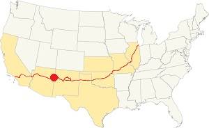
Location of Lupton on Route 66
The climate in Lupton is dry and semi-arid climate with hot summers and cold winters. The altitude and low relative humidity provoke considerable day-to-night temperature swings throughout the year; this means that summer nights are cool, but winter nights can be quite cold.
The average high temperature in summer (July) is 95°F (35°C). The average summer low is 59°F (15°C). The winter (Jan) has an average high of 50°F (10°C); with an average low of 21.9°F, below freezing (-6.1°C).
Annual rainfall is scarce, with 9.5 inches (241 mm), and most of it falls during the Summer Monsoon period between July and October (5 in, 127 mm). There are only 50 days with precipitation every year. Snowfall is quite light with only 6.5 inches yearly, on average (16.5 cm). Most falls from October to April.
Tornado risk
There are no tornados in Lupton: Apache County has no Tornado watches. The area west of this point has no tornado events at all. Tornado Risk: read more about Tornado Risk along Route66.
Map of Route 66 in Lupton, AZ
>> Custom map of Route 66 in Lupton

Lupton to Houck, detail of 1937 map. Source
Click on image to enlarge
The Arizona segment of Route 66 starts in Lupton. To the east is New Mexico.
The original alignment ran to the north of the freeway west of Manuelito on the northern bank of the rio Puerco River. As it approached the state line, it continued straight, but is now cut by I-40 as marked with a yellow line in our custom map.
The eastbound lanes of the freeway cover the original road from state line to the access to I-40 on the south side, at Exit 359. Here the old roadway follows the access ramp, and continues west along the South Frontage Rd. You can only drive this segment if you enter the freeway heading east as shown in this map of Lupton ramp.
West along the South Frontage Road
But from the underpass' on the south side of I-40 you can turn right and head west along the original 1926 to 1965 US 66 (in 1965 the highway was realigned as a four-lane superhighway where I-40 now runs). Our custom map marks the short section in Lupton where east and westbound traffic were split: green line shows the now missing WB lanes.
This segment is shown in this map from Exit 359 to 354.
Just over 1 mile west of Lupton, the highway crosses the steep and narrow gully of Lupton Wash (Original Bridge) built in 1927 and rehabilitated in 1939 this section was known as the "Adamana to Lupton Highway" (map showing where it is.)
Getting to Lupton
To the east is the New Mexico state line. Beyond it is Manuelito, Gallup (23 mi.) and further east, the city of Albuquerque (163 miles).
To the west are Houck (11 mi.), Chambers (26 mi.), Holbrook (73 mi.) and Winslow (106 miles).
Route 66 Alignment near Lupton
With maps and full information of the old roadway.
- Winslow to Winona (next)
- Lupton to Winslow (Lupton's)
- Albuquerque to Lupton (previous)

Lupton's Sights & Attractions
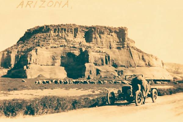
The town of Painted Cliffs
Historic Context. Lupton: Gateway to Navajoland
In his classic Guidebook to US Highway 66 written in 1946, Jack Rittenhouse mentions Lupton:
New Mexico-Arizona State Line. As you pass under an arch, you pass the "State Line Station," which maintains a good cafe, gas station, etc. Rittenhouse (1946)
Then he mentions that this "wide stretch of Arizona Highway" continues for the next 10 miles.
The US 66 Gateway Arch: "You Now Leave New Mexico"
We will drive this leg of your Route 66 Road Trip heading west from Gallup and Manuelito along the original Route 66 alignment. Nowadays it is cut by the freeway as it approaches the state line. But it followed the course marked with our yellow line in our custom "missing segments" map. Then it ran where the eastbound lanes are now located and followed along the South Frontage Road.
The first landmark travelers encountered as they entered Arizona was the "Archway", on the state line.

Welcome Arch at NM AZ state line. US 66 Lupton, 1938. Source
Click on image to enlarge
The main landmark in the 1940s was the arch or "gateway" arch across Route 66 with the legend "You Now Leave New Mexico, Come Again" and the "US 66" shield crowning it.
This iconinc landmark was here until 1955 and then it was removed. The image below shows the Gateway ⁄ Archway over Route 66 as it was in 1940 when "The Grapes of Wrath" was shot here, on the NM AZ state line
Location of the arch
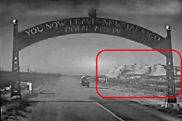
But where was the archway? Another still from the film, taken just before the Joads ride under the arch, shows a rock formation (red box in image), this landform is located at Lupton. But further west from the border than the Painted Cliffs.
The Gateway ⁄ Archway over Route 66 and a view of the hills to the NW of it.
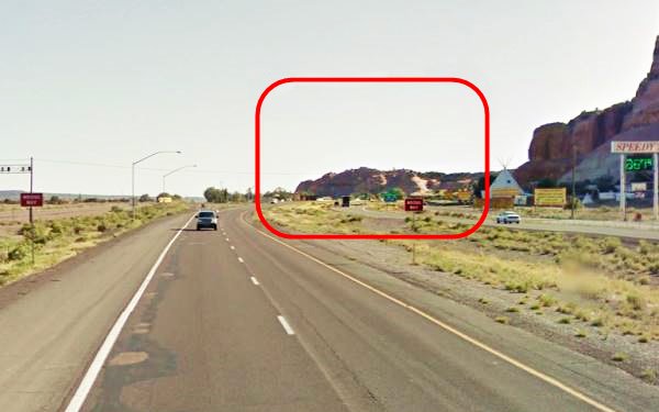
The view nowadays from where the gateway once stood: at State Line and the eastbound lanes of the freeway, this Map marks the spot
Notice that the pale sandstone cliffs in the center of the image are the same ones as seen in the movie still (inside the red box in both images).
The place where the gateway stood nowadays.
The archway is famous for being a location in the award winning novel and movie, "The Grapes of Wrath."
Lupton and the novel and movie "The Grapes of Wrath"
This Pulitzer Prize winning novel written in 1939 by Nobel Prize author John Steinbeck (1902 -1968).
>> Learn more on our Grapes of Wrath webpage.
The novel "The Grapes of Wrath" is set in the U.S during the mid-1930s. At that time, the Great Depression and the Dust Bowl drought had disrupted the American economy and millions were unemployed and defaulting their mortgages.
Steinbeck portrays the fate of a family of sharecroppers, the Joads, who lose their land and home, pack their scant belongings and head west, to California seeking a new start. The novel was published on April 14, 1939 by Viking Press-James Lloyd.
The Movie
The book was filmed as a movie directed by John Ford with a screenplay by Nunnally Johnson. The cast included Henry Fonda, Jane Darwell and John Carradine.
The Joads drive west towards California along Route 66, and the movie gives us irreplaceable glimpses of the Mother Road in 1940. One of the key scenes was shot in Lupton, the Arizona border control post.
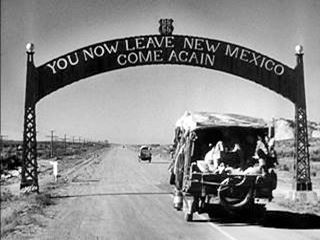
The Gateway Arch at New Mexico - Arizona state line on Route 66. From The Grapes of Wrath (1940)
These people were not wanted in Arizona, and the state officials made it clear to them, they had to keep on moving and reach California. Arizona would not be a haven for them. Steinbeck describes the terse exchange when the "Border Guard" stopped them, as follows:
"Where you going?"
"To California," said Tom.
"How long you plan to be in Arizona?"
"No longer'n we can get across her."
"Got any plants?"
"No plants."
"I ought to look your stuff over."
"I tell you we ain't got no plants."
The guard put a little sticker on the winshield.
"O.K. Go ahead, but you better keep movin'."
"Sure. We aim to." John Steinbeck - The Grapes of Wrath
Joad is clear, he is going to California, Arizona is of no interest, he may be poor and homeless, but he is still a proud man with a mission.
J. Gregory (1989) states that these border posts show that migrants were "a despised and economically impaired group,... scorned newcomers", yet "the tragic images of this migration have been overblown. The experience was often tough... but the challenge cannot be compared to the pioneer migrations of the nineteenth century, nor with the refugee migrations that occur with such frequency in the third world" (Gregory J.N., 1989). In fact, many of them returned to their abandoned homes, but others stayed and made good in California.
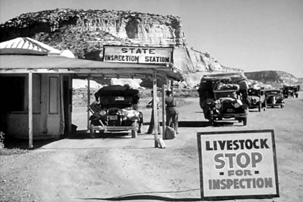
Historic views of Lupton in 1940: inspection station
For the Route 66 historian, the images from John Ford's movie are interesting, they were clearly shot in Lupton, the Painted Cliffs are the badckdrop to the "State Inspection Station" (see image below).
Looking east from the Border Control Station near Lupton's Painted Cliffs. Route 66 as it was in 1940 when "The Grapes of Wrath" was filmed
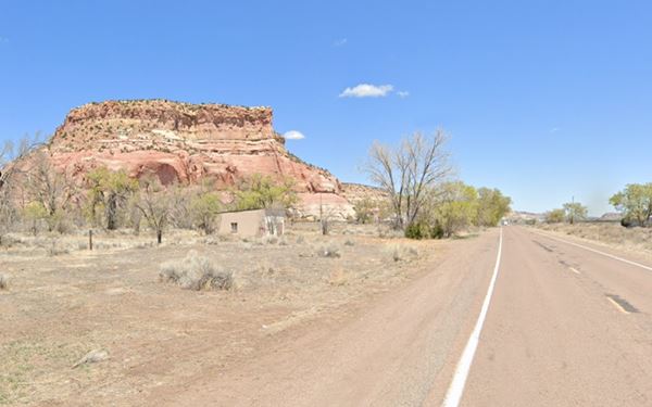
The same spot nowadays, it is on the South Frontage Road, looking east is pictured below:
Border control station site nowadays
The photograph below shows the original Inspection Station very close to the archway, in 1938 (red arrow).
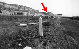
Old Port of Entry, 1938. Lupton AZ Source
Click on image to enlarge
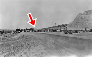
1939 New Port of Entry, Lupton AZ Source
Click on image to enlarge
A new building was built further west in 1939 which is the one that appears in the movie -marked with a red arrow in the image above. This is the Current view of the spot.
It was here, around the Entry Port close to the old railroad depot, that the village sprung up.
The port of entry was later moved (1940s?) close to Sanders. Where it still is.
Landmark: Painted Cliffs
The Navajo name for Lupton is inspired in this landform: Tsé Si'ání or "Setting Rock" and Tsedijooli or "Round Rock", both names refer to the Painted Cliffs.
They are not towering (their height above sea level is 6,733 ft. - 2.054 m) which places them 545 ft (166 m) above the surrounding terrain in the Puerco River valley.
To the south, beyond the Rio Puerco River there are high white and pink cliffs that have been worn down by rain and sand blown by the wind to form caves and pinnacles. Further west, the gray sandstone and purple shales form low mesas to the north and south of the highway. But here in Lupton the red sandstones form the Painted Cliff, which can also be seen along Helena Canyon.
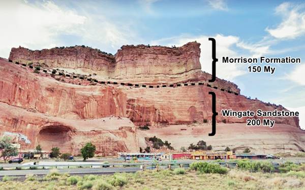
The upper layer of the cliffs consists of bedded sandstones of the Morrison Formation of rocks. These are Jurassic sediments roughly 156 to 146 Million years old (My). they rest upon the massive red to orange Wingate sandstone, that forms bluff sandstone and red shale cliffs over 175 feet thick. These are from the late Triassic, roughly 200 My old. Below you can see both of these rock formations identified by the Lupton trading posts.
Lupton and the Pixar ⁄ Disney movie Cars

Still showing Wheel Well Hotel. Credits
When Disney decided to make the animated film "Cars" (2006), it sent out scouts along Route 66 to identify iconic characters and unique features. They reached Lupton and spotted the Painted Cliffs. It inspired them and that was the origin of the "Wheel Well Motel" which was a ruin in that movie, but in "Cars 2" had been refurbished as a restaurant.
Compare the actual location with the still showing the "Wheel Well Motel" from the movie "Cars": the cave and the cliffs are strikingly similar in both images. It also appeared in the sequel. It was a motel that had to shut down when the freeway opened and later reopened. In Cars 2 it had become a restaurant.
The mistakenly placed Painted Cliffs
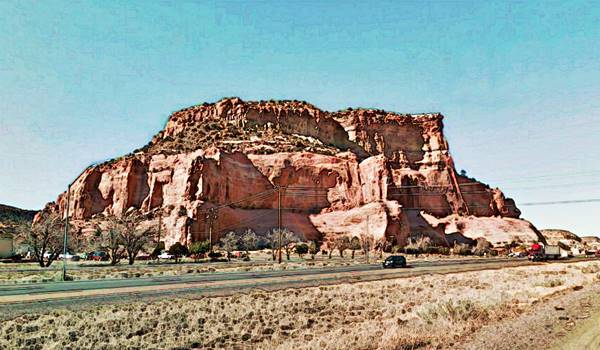
The Painted Cliffs are a classic sight at Lupton. Located on the north side of US Highway 66, they have been a landmark since the AT&SF laid its tracks through the area in the early 1880s. You can see them nowadays as you drive by along I-40, with their curves and ridges, steps and caves in the red sandstone mesa.
Below we reproduce a postcard of the Painted Cliffs, which states on its front side: "Sandstone formations as seen from U.S. Highway 66, Manuelito, New Mexico". And that is a mistake, the cliffs are not located in Manuelito, NM, but in Lupton Arizona.
Postcard of the Painted Cliffs in Lupton AZ mistakenly said to be in Manuelito NM
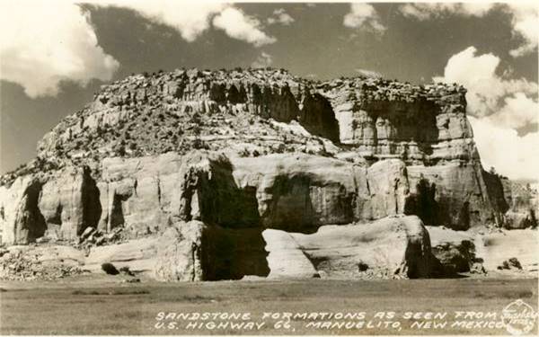
Caption: "Sandstone formations as seen from U.S. Highway 66, Manuelito, New Mexico."
Painted Cliffs in Lupton AZ as seen today, from I-40
Lupton's Trading posts and Gas stations
The eye-catching buildings at the foot of the red sandstone cliffs appeared in the late 1950s and early 1960s when the freeway was built. After passing by New Mexico's "State Line Curios" the last stop in that state (now obliterated by I-40), there has been a truck stop in AZ since the 1960s; now it is "Speedy's", the vacant lot next to them was where the The Yellow Tepee stood, site of Yellowhorse's firts store in Lupton.
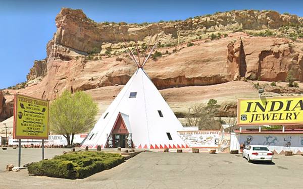
Teepee Trading Post
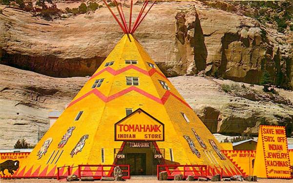
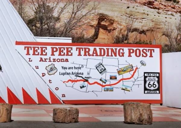
The first of them has a gigantic Tepee and a wall with a Route 66 map painted on it with a "You are here - Lupton" marked on it. The Tepee has changed colors over the years from yellow to white. The postcard below c.1980s shows that at one time the "Tomahawk Indian Store" was located here and it had "The Southwest's largest tepee."
Now the tepee is white and the place is the "Teepee Trading Post":
The map is on the wall on the right side of the tepee.
State Line Store
Next to the Teepee is the "State Line Convenience Store". A former gas station with two pump islands and a canopy over them that was repurposed as a store. It was built after 1962 as it does not appear in an aerial photo taken that year."
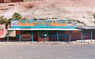
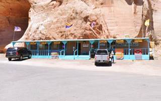
Next door is the Chaparral Trading Post, neat and tidy followed by another trading post offering "Silver, Jewelry and Blankets."
Whiting Bros gas station

Thumbnail of Lupton's Whiting Bros.
Click for full size view
Lupton's Whiting Bros station is closed and in need of repair. It appeared in the phone directory since 1955 and was located close to the Eastbound lanes of I-40 (read more about its Original site). Razed by the freeway in 1960, it moved to its current location. The thumnbail image (click on it to enlarge) shows it during its golden days. The gas station has a flat canopy held by steel poles, box-shaped woodframe building with a single split pump island and the now empty sign above the canopy. Another room was added to the right side of the building. It is pictured below.
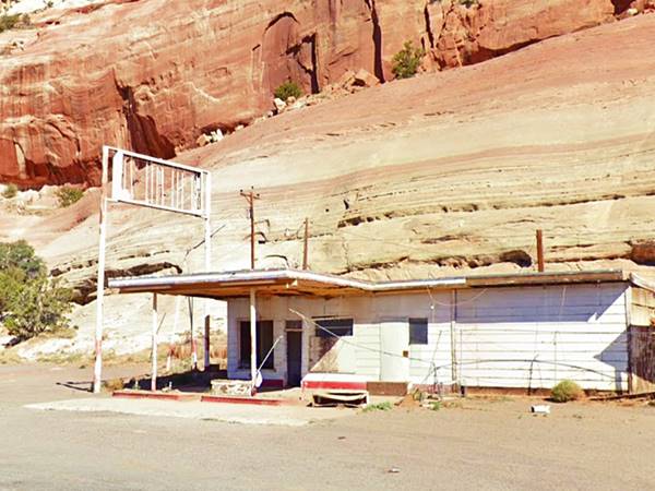
Read more about all the motels and gas stations of Whiting Bros. on Route 66
Yellowhorse Trading Post
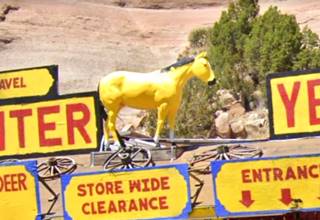
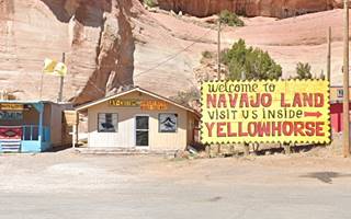
Ahead, is another former trading post, a long low gable roof building with yellow signs and red letters, and a yellow horse atop its roof (pictured), this is the Yellowhorse Gift Shop and it has a long history in Lupton.
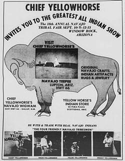
Thumbnail of 1964 advert of Yellowhorse's Navajo Tepee in Lupton. Source
Click for full size view
Juan (1930-1999) and Frank Beasly (1933-2020) sons of Arthur Beasley, Sr. and Anna Yellowhorse, adopted their mother's Navajo name when they went into the Navajo crafts business. But they had started out at a young age: Chief Juan Yellowhorse recalled that he and his brothers sang a Good Luck Song (actually a Navajo ceremonial song!) to the tourists, and his mother charged them a few cents to hear them (1). After returning home from the Korean War, both brothers partnered in the
"Chief Yellowhorse's Navajo Tepee" in Lupton, owned by "Two Friendly Navajos" and later by "Four Friendly Navajo Tribesmen" (all brothers). The thumbnail image -click on it to enlarge shows a advertisement published in 1964 it mentions the "Navajo Wigwam".
By that time they also owned stores in Scottsdale and Gallup.
The image inside the buffalo shows a block-shaped trading post flanked by two tepees and an El Paso Dixie gas station.
The background does not show sandstone cliffs, only a low bluff or hill across the background.
So this was probably located further west, in the "downtown" area of Lupton and not here at the base of the painted cliffs.
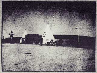
Detail of the 1964 advert of Yellowhorse's Navajo Tepee in Lupton.
Source
Click for full size view
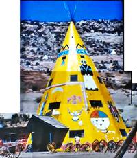
Yellowhorse's Navajo Tepee in Lupton, reconstructed by A. Whittall from a 1970 video
Source
Click for full size view
Yellow Tepee
The brothers built a trading post inside a four story tepee, behind it was a small "zoo" with some animals and hogans. This 1970 aerial photo shows the tepee on the west side of what is now Speedy's Truck stop. North of the N. Frontage Rd. At that time there was also a stop there. Above is a composite image we made from a 1970 video of the spot. Next to it, western side, was their Shell Gas Station. This is a map showing the spot where it was located. An arsonist burned it down in 1971.
The brothers parted ways, with Juan opening the "Yellowhorse Fort" just east of the state line, in Manuelito NM, in what had been "Indian" Millers' Cave of the Seven Devils. He ran it until his death there in 1999. (2)
Frank opened the current Yellowhorse complex next to Exit 359.
Chief Juan Yellowhorse, said he owned "Historys Oldest Village on Route 66" because the highway had been built through a 1,000-year-old village in 1927. (1).
There are many members of the Yellowhorse clan in the Navajo trading store business: Frank's sons and daughters David Yellowhorse, Alvin Yellowhorse, Brian Yellowhorse, and Tasbah Glasses and his uncle John (b.1938) with his wife Barbara all own their stores. It is interesting to point out that John and Juan (John in Spanish) are two different brothers.
Frank's son David Yellowhorse described the family owned and operated stores in Lupton as follows:
First is Brian Yellowhorse's Store, pictured below:
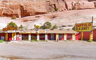
Next comes the Yellowhorse Gift Shop that was Frank's store, and now run by David's uncle and aunt John and Barb's store pictured above. Notice the yellow horse on the roof!
Alvin's custom jewelry store AY Customs is next:
David's sister Tasbah Glasses nee Yellowhorse owns the next store: Yellowhorse Trading Post.
Indian Village
Then, to the left is the last store, just west of the underpass at Exit 359. it is the vacant Indian Village with some broken windows. Above it there are animal statues placed on a ledge in the sandstone cliff: deer, eagles, mountain lions.
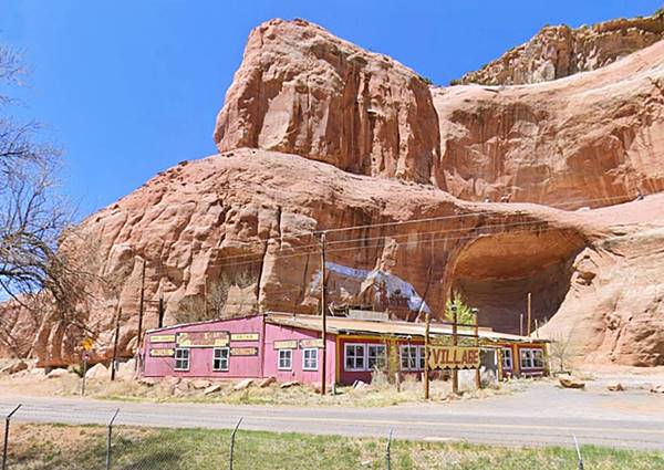
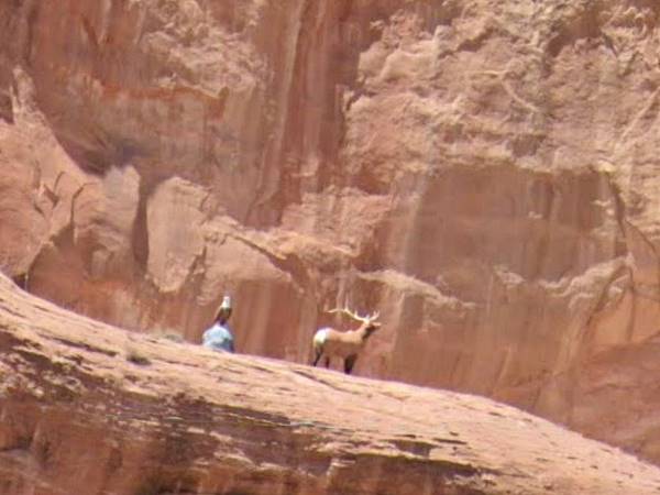
To follow the original Route 66 and the remaining classic sights, you will have to take the underpass at Exit 359 and head to the South Frontage road, turn left to do so, then take a right westwards along the S. Frontage Rd. which is old 66.
Along Old 1926-60s Route 66 in Lupton
Lupton

Map of US 66 and Lupton AZ, 1937. Source
The town sprung up next to the railroad depot, and gradually grew after US66 was aligned through it in 1926. The map from 1937 shows the Inspection Station mentioned further up, and a post office together with other buildings.
Tomahawk Trading Post and Night Club
At the time the freeway was being built, the Winslow May 1962 phone directory for Lupton entries, listed the Tomahawk Trading Post & Night Club, Tomahawk Garage, Lupton Motel and Ardry CF Restaurant. A few years earlier, the 1955 directory mentioned a Whiting Bros. station and "Lupton State Line Terminal" gas station.
The 1950s postcard below looks west along Route 66 into Lupton. The highway ran where I-40s Eastbound (EB) lanes now run. The red arrows mark the Tomahawk trading post, recognizable thanks to its sign, a tomahawk across a wide billboard promoting "Save 5 ¢ per gal." just beyond it you can see the Whiting Bros. station, with its long narrow yellow sign with the "WB" shield on its left tip. We include the same view nowadays with both buildings gone, razed by the freeway construction. The cliffs serve as a reference to place the spot.

1950s postcard Welcome to Lupton. A. Whittall. Source
Click image to enlarge

2021 Welcome to Lupton. A. Whittall. St. view
Click image to enlarge
The postcard below shows the "Save 5 ¢ per gal." sign and the tomahawk across the top of it. Some classic cars and the building painted with "Tomahawk Trading post - Cafe Steaks Shrimp & Chicken. Tomahawk Package Goods. Night Club & Cocktail Lounge. Mixed Drinks. Cold Beer." and six gas pumps lined up in the sun (no canopy).
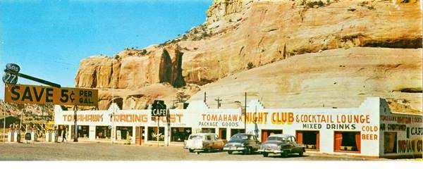
Whiting Bros. original location
Just west of the Tomahawk as you can see in the picture further up. Both Tomahawk and Whiting relocated further north, on the N. Frontage Rd. Both buildings were located on the north side of current south access ramp to I-40 as you can see in this Aerial photo from 1952 (approx. location map).
Dome shaped Indian Village
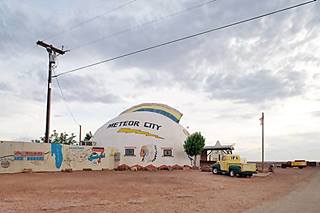
There is a string of dome-shaped trading posts along Route 66 in Arizona, all belonged to Gilbert Ortega. His Lupton store was called "The Indian Village" and according to its postcard below "specializing in Indian handmade arts and crafts... We pack and ship anywhere C.O.D. Wholesale and Retail. Gilbert Ortega Owner" On the eastern side of the property was a Chevron (later it was a Texaco) gas station, still standing, with a flat canopy, two bay service area and glassed corner office. Then came the crested dome followed by a cafe and at least one tepee. Below is a "Then and Now" set of photos (c.1970 and 2021, before it burned down in 2022):
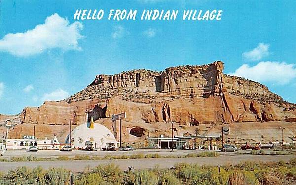
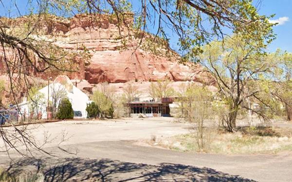
Geodesic Dome
A dome was built to house the trading post. This dome is peculiar because it has a crest running along its upper part; which is quite unusual in geodesic domes.
A geodesic dome is a building with a shell structure shaped like a sphere or partial-sphere. The shell is based on a network of great circles (called geodesics) that intersect forming triangles on the surface of a sphere.
In practice, to simplify construction, all of the triangles have the same size. They provide rigidity and are light and stable.
The first geodesic dome was designed by Walther Bauersfeld in Germany in 1926 to house a planetarium. In the U.S., R. Buckminster Fuller named the dome "geodesic", studied it from a mathematical point of view and patented it in 1954.
Ortega's domes can be seen in Barringer Crater, Meteor City, and the now gone Allentown dome.
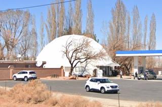
Barringer Crater RV Camp nowadays; dome still standing. Click for St. view

Ortega's dome-shaped store on US66, Houck AZ in 1979. Credits
Gilbert Ortega Sr. (1936-2003) a fourth generation Arizonan started working at his father Max's trading post in Lupton. He built his first store in the mid 1960s (Allentown's?) and developed the Indian jewelry retail and wholesale business. By 1977 he had 16 stores but refocused on high-level fine stores after the 1980s (3).
There is a marker in memory of Gilbert's father, Max Ortega (1905-1979), who won a plot of land in Lupton and opened a trading post there, starting the family business. The marker is located at the rest area on the north side of I-40 passing Exit 359.
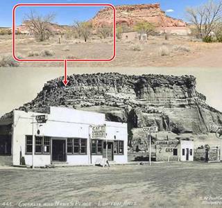
Charlie and Mary's Place (gone)
Just ahead, next to the "Little Post Office Sanctuary", on its left side stood "Charlie and Mary's Place". It offered cabins, and had a Texaco gas station. You can see it in this Aerial photo. It was torn down during the 1970s.
Indian Trail Trading Post (gone)
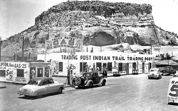
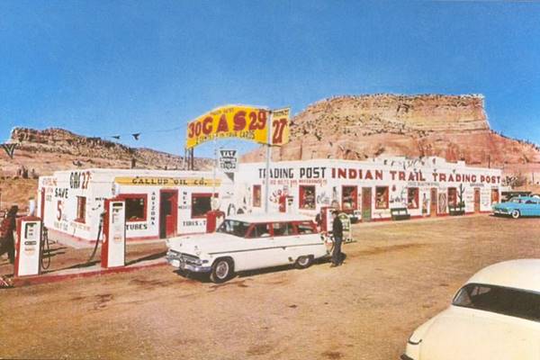
Five hundred feet west, this map marks the spot; is the site of the Indian Trail Trading Post. It belonged to Max Ortega, who opened his business here in 1946; he operated it with his wife Amelia. It changed over the years, and also the price of gas: from 25¢ in the 1940s to 27¢ in the 1950s and 29 ¢ when Ruscha photographed it in 1962. You can see it in this 1952 aerial picture.
With gas at 25¢ per gal. painted on the gas station's wall
With gas at 27¢ per gal. painted on the gas station's wall
With gas at 29¢ per gal. painted on the gas station's signpost
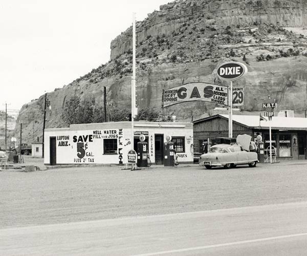
The image above is a detail from the photograph taken in 1962 by Edward Joseph Ruscha, an American artist who travelled along Route 66 many times from California to visit his family in Oklahoma. His first photobook titled "Twentysix Gasoline Stations" published in 1963 is the result of one of those trips. The Lupton Dixie station at the Indian Trails is one of the 26 in the book. By that time, the post's building had a gable roof and the stucco walls had been modernized with a wood facing.
The highway forked ahead, roughly where Navajo Rd. 7140 is, as you can see in this 1952 aerial photo with a short segment with separate east and westbound lanes. Our custom map marks the westbound lanes with a green line.
Lupton Trading Post and Post Office (gone)
The post office was the one of the last buildings in town; it was also known as "Hawthorne Trading Post" Navajo Owned, with a gas station (4)
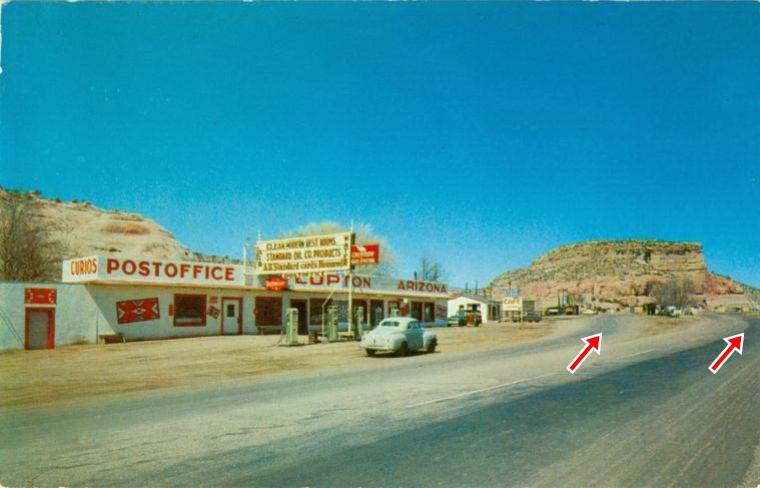
Lupton Post Office c.1950. Source
Click image to enlarge
Here the two alignments met again again (red arrows in the image -click on it to enlarge); it stood on the north side of the highway. The image below shows it. It looks east along Route 66. It housed the "Lupton Trading Post" - "Hawthorn Trading Post" and had five Chevron gas pumps lined up in front of it. This map marks the spot.
Lupton Motel site (gone)
Adjacent to the Post Office. You can see it in the following image taken in the 1950s that looks eastwards, back into Lupton from its western tip, you can see the "last" building in town, with a red gable roof on the north side of the highway followed by the Post Office. The Lupton Motel was parallel to the highway and had 14 rooms. You can see it in this aerial photograph taken in 1952. The Post Office and Trading Post is on the top of the image, box shaped, cars by the pumps, white walls visible. Followed (bottom of image) by the motel, a long building with a gable roof with a cross gable facing the highway in the middle of the structure.
Click to See the same spot now

Just 0.4 mi west of this point, the highway crossed the Lupton Wash Bridge, built in 1927 and rehabilitated in 1939, the images below show it in 1939 and nowadays:

1939 photo Lupton Wash Bridge, US66, Lupton AZ. Source

Lupton Wash bridge nowadays. Credits
Continue your Road Trip
Continue your Route 66 road trip by heading west into the next town, Allentown, Arizona.
National and State Parks, Outdoors
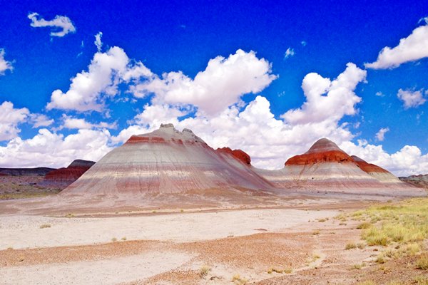
Petrified Forest National Park
Tip: consider visiting the Petrified Forest National Park (further west, as you approach Holbrook) during your Road Trip.
The Only National Park on Route 66

Sponsored Content
Lake Havasu City

Lake Havasu City, the lake and London Bridge. Source
The resort town of Lake Havasu City on Lake Havasu has beaches along the lake's scenic shoreline, an active nightlife and the original London bridge (you can take a Tour to visit it)
The adjacent state park is open 24 hs, and there is an entrance fee. It is located on a reservoir on the Colorado River. You can hike and enjoy the riverside.
Visit the scenic shoreline with beautiful beaches, nature trails, boat ramps, and many convenient campsites.
>> Book your Hotel in Lake Havasu City
Learn more about the outdoor sites in the Havasu State Park official website.
>> Book your Hotel in Holbrook AZ

Credits
Banner image: Hackberry General Store, Hackberry, Arizona by Perla Eichenblat
Jack DeVere Rittenhouse, (1946). A Guide Book to Highway 66.


