Historic Route 66 in Stroud
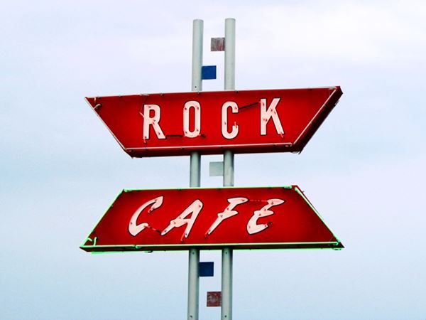
Rock Cafe sign- Route 66 in downtown Stroud, Oklahoma
Index to this page
About Stroud, Oklahoma
Facts, Trivia and useful information
Elevation: 886 ft. (270 m). Population: 2,690 (2010).
Time zone: Central (CST): UTC minus 6 hours. Summer (DST) CDT (UTC-5).
Stroud is a located on the eastern edge of Lincoln County, Oklahoma. Its Motto is: "Oklahoma's Winery and Grape Capital"
Stroud's History
For an early history of the region see Tulsa's History.
The town was originally a part of the Oklahoma Territory, just west of the land of the Creek Tribe and therefore was not part of the Indian Territory.
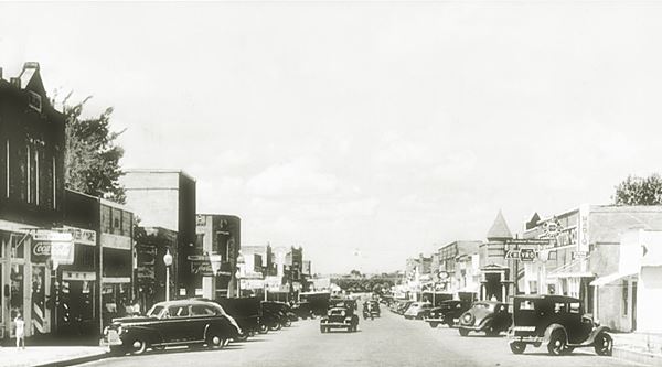
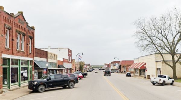
James Wrexel Stroud was the first to settle the area and, in 1892, built a store about one mile from the current townsite. He also ran the post office and the local saloon which sold alcohol (which was banned in the neighboring Indian Territory).
When Arkansas and Oklahoma Railroad (acquired in 1901 by the St. Louis and San Francisco Railway or "Frisco") defined the location of the station along the line it was building, Stroud moved the town to its present location.
James W. Stroud House is listed in the National Register of Historical Places
The Name: Stroud
Chauncey M. Stroud was a U.S. senator (R) for New York from 1899 to 1911. He was a great orator and speaker, and once said: "Speech-making is a tonic to me".
His main focus was the railroad business and he began as a railroad attorney for the N.Y. Central Railroad he eventually became its president. Later on he was accused of catering to the interests of railway and insurance concerns.
When Oklahoma became a state of the U.S. in 1907, the "whiskey town" business ended as it became a "dry state". At that time it had 1,312 residents. It was included in Lincoln county.
Cotton processing at the local cotton gins ando cottonseed-oil mill were the mainstay of the local economy.
A legendary bandit, Henry Starr robbed both local banks, the Stroud National Bank and the First National Bank in 1915, but he was captured after being wounded in a gun battle and sentenced to prison.
The oil industry fueled the local economy after 1920 and Route 66, which passed through Stroud provided additional income as the town catered to the travelers' needs.
The Turner Turnpike (I-44) was completed in the late 1950s and bypassed the downtown district.

Where to Stay: your hotel in Stroud
There are several hotels in Stroud and also in other nearby towns along Route 66
>> Book your Motel or Hotel nearby in Chandler
Lodging Near Stroud
There are several hotels in the area close to this town. Alternatively you can also find your accommodation along Route 66 in the neighboring towns and cities. We list them below (listed from east to west):
On Route 66's Main alignment
Eastwards
Westwards
>> There are RV campgrounds in Stroud.
Stroud’s Weather
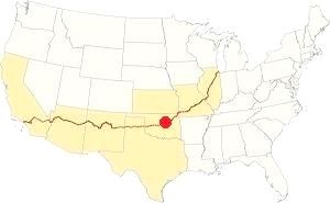
Location of Stroud on Route 66
During winter, the average high (January) is around 48°F and the low is about 27°F (8.9 & -2.5°C). The summer (July) average high and low are 93 and 71°F (34 & 21.7°C). Temperatures can exceed 100°F (38°C) during summer. Which is also (together with late spring) the rainest period. Total rainfall averages 41 in. (1.040 mm) and around 90 days a year rainy. Around 9.6 inches (24.3 cm) of snow falls in winter (Nov. to Mar.)
Tornados
Thunderstorms may cause tornados at any time of the year, but they are more frequent during Spring and Summer. As Stroud is located inside Oklahoma's "Tornado Alley there are about 10 Tornado watches every year.
The 1999 Tornado Strike
During the night of May 3, 1999, a tornado which had touched down near Sparks Oklahoma headed straight for Stroud and hit it with F2 - F3 strenght.
It destroyed the Tanger Outlet Mall which had 53 stores, the truck distribution center of Sygma, a foodservice company and damaged the Municipal Hospital. It dissipated one mile south of town just before midnight.
Fortunately there were no fatalities but it caused the loss of 800 jobs: neither the mall or the Sygma warehouse were rebuilt.
Tornado Risk read more about Tornado Risk along Route66.
Map of Route 66 in Stroud
Route 66 Alignment near Stroud
Visit our pages with old maps and plenty of information of the old US66 roadway.
- Chandler to Yukon (next)
- Tulsa to Chandler (Stroud's)
Route 66 landmarks & attractions
Sights in Stroud
- City Tour: Route 66 in Stroud (read below)
- Tours & Itineraries
- State Parks
Stroud Attractions
US66 in Stroud in 1946
In his "Guidebook to US Highway 66" published in 1946, Jack Rittenhouse describes Stroud as a "busy farm trading center" with Route 66 as its Main Street "which is of brick."
STROUD... garage: Ford; hotel: Graham; courts; Poplar and two others; gas; cafes; small garages; all facilities but short on tourist accommodations. Rittenhouse (1946)
We will tour the town from east to west, 5.8 miles west of Depew is the "shoe tree".
Shoe Tree
To your left, at 3750 E. Highway 66, Stroud. The trading post, now closed, was on the southeastern side of the old curved segment of Route 66 (1928-84 alignment, shown in this map with a dark green line).
The original "shoe tree" collapsed in 2010 under the weight of the shoes, but soon another tree took its place, and was also victimized by passersby who began flinging their discarded old shoes tied together by their laces across its branches. Another Route 66 shoe tree (a tamarisk) stood in the desert close to Amboy in California, and it also succumbed under the weight of the shoes.
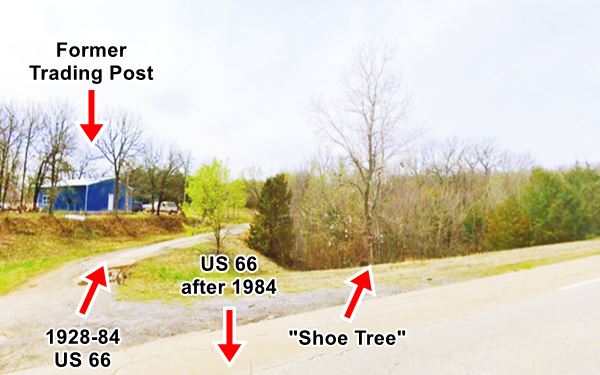
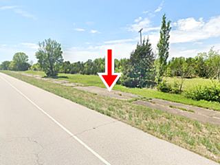
Head west, after 1.2 miles, US 66 curves to the SW. The 1926-30 alignment heads west (read about it: US 66 1926-30 east of Stroud). After the curve, the highway was upgraded in 1960, to your right you can see the older (1930-1960) roadbed, paved in Portland concrete in 1930. It runs on the north side of modern OK-66, parallel to it for a while, but then it moves away, through private property. Yo can follow this Rte. 66 alignment in this map (burgundy colored line). The image shows a view of the old highway to the right, and the later post-1960 road to the left (red arrow).
All alignments (Ozark Trail - 1926 to 30, 1930 to 60 and post 1960) meet on the eastern side of the city and run through Stroud with an east to west direction for one mile, then, at 8th St, they separate once again.
Poplar Courts
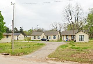
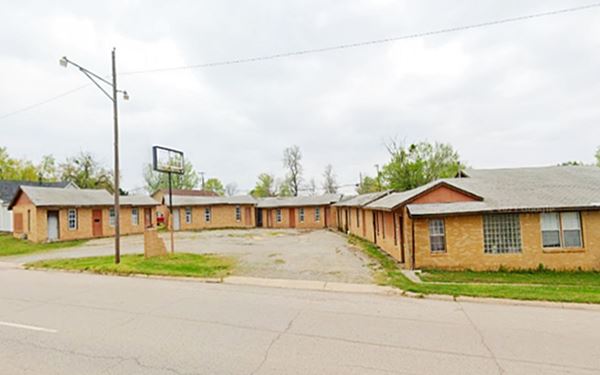
On the NE corner of Route 66 and Poplar Ave., to your right. Mentioned by Rittenhouse in 1946, the place is now an apartment complex with individual cabins around a central courtyard. The gable roofed cottages are typical of the 1930-40s tourist courts. Pictured below.
Old Motel
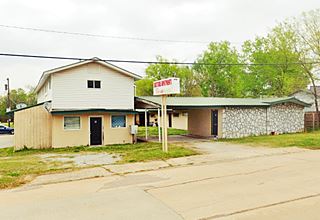
Ahead, at 301 E Main St. is a former motel, now repurposed as apartments (and now a religious worship place). The original motel is on the eastern side of the property. Office at the front, with a canopy over the entrance and an L-shaped layout. The building parallel to it, along N. Cedar, elevated over a parking area was built between 1980 and 1995. Pictured above.
Henshaw's Phillips 66
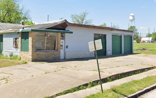
On the SW corner of Route 66 and N Bryant Ave. The black and white image below is an advertisement published in 1959, at that time it had an old style, with a solid canopy held up by brick columns and was angled to face the corner. It sold "Lee Tiress-Batteries and Accessories" and its phone number was "66"!
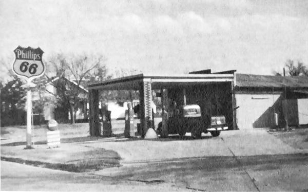
The building was replaced soon after that date by the present one, with three service bays, large slanted plate glass windows and a stone (rock) wall, the feature that gave this type of design its name: Rock Frame stations. They were adopted by Phillips 66 in the early 1950s and replaced the older designs.
Across Route 66 is another classic motel.
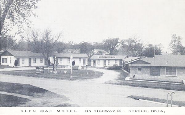
Glen Mae Motel
At 111 E Route 66, to your right, the motel had 12 units in gable roof cabins, with a U-shaped layout around a central courtyard. The "Then and Now" sequence below shows that the motel hasn't changed much.
Rock Café
Just ahead, to your left, at 114 W. Main St., Stroud, OK.
Listed in the National Register of Historic Places
A landmark cafe built by Roy Rives. It opened it in 1939 to cater to those traveling along Route 66. It was later a Greyhound bus stop and after World War II it was open 24 hours-a-day.
It is built with rubble sandstone in Giraffe-style (its color resembles the skin of a giraffe) with coarse mortar joints and a very large chimney. It reopened in 2010 after the fire that gutted it in 2008 and still sells fries and burgers. Below is a "Then and Now" sequence; in the 1940s it had the words "Rock Cafe" written on the roof.

c.1940 photo Rock Cafe US66 Stroud. Source

Rock Cafe nowadays, Stroud. Click for St. view. Source
Trivia: Rock Café and the movie "Cars"
Pixar - Disney's 2006 animated movie "Cars" was inspired by Route 66's characters and attractions.
One of them, Radiator Springs character Sally Carrera is based on Dawn Welch, proprietor of Rock Café. The movie mentions her in the final Source: "Dawn Welch, The Rock Cafe, 'Home Of The Fried Pickle Spears', Stroud, OK."
Obelisk Replica in Stroud
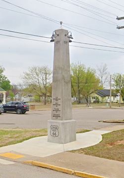
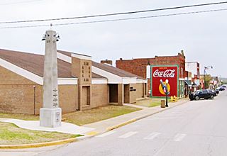
Just ahead, on the SW corner of Route 66 and 2nd Ave you can see a replica of the Ozark Trail obelisk. It was inaugurated in 2020, it has a bronze plaque that reads: "This obelisk is an exact replica of the original
Ozark Trail Marker now located between Stroud and Davenport. The Ozark Trail was a precursor for Route 66 and existed from 1915 to 1926. The first markers were telephone poles painted green and white. These were
replaced with obelisks painted white with green directional lettering of cities with the mileage to point travelers along their way.
Twenty-one of these markers were
constructed while only two remain in Oklahoma, one in Stroud and the other in Langston. The marker stands 21' tall, is 48" square at the base and is 6' below ground.
It contains 12 yards of concrete and weighs around 48,600 pounds.
The original marker was located at the intersection of Highway 66 and Highway 99. After becoming
a traffic hazard with the increase of vehicles, it was relocated to its current location 3 miles West (N3540 Road) and 1.3 miles South (E890 Road) of Stroud."
Site of Lafoon Mobil
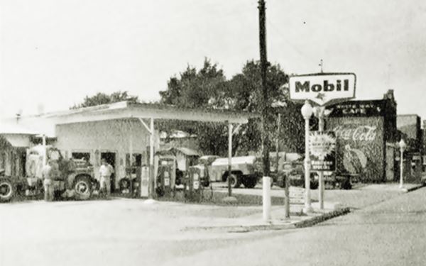
At 212 W Main Street, the Senior Citizen Center stands behind the obelisk. But, until it was torn down in the late 1990s Gene and Harold Lafoon's Mobil Service Station stood here.
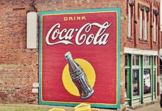
Below is a photo from 1959; notice the Coca Cola sign on the right side of the image, painted on the wall of the adjacent building. It has survived and been upkept.
Ghost Sign
A ghost sign is an old hand-painted advertisment that has survived on a building for a long time and not been removed or painted over.
The old sign advertising Coca Cola painted on the eastern brick wall of Burford building at 214 Main St. is a ghost sign that has been maintained. There is one next to it, to the left, but it is illegible.
Stroud Trading Co.
Listed in the National Register of Historic Places
There are ghost signs across the street on the corner building, the historic Stroud Trading Co. with those words written on both sides of its upper floor (Street view).
It was build in 1902 and its second floor served as a lodge hall and opera house until 1925 when it became the "Liberty Hotel".
Hotel Lincoln
Listed in the National Register of Historic Places
Head west and at 323 Main St (NE corner of Main and N 4th Ave), to your right, is a two-story red-brick Commercial style building built in the early 1900s.
It originally catered to those traveling to town in train, but quickly adapted to the flow of visitors that Route 66 brought to town. It is one of the few hotels that competed against tourist courts and motels along Oklahoma's Route 66. It predates US 66 and the second floor was added in 1924.
Cross D-X station
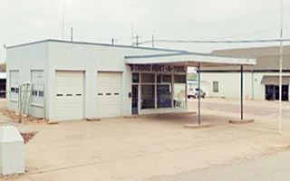
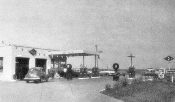
To your left, on the SE corner of Main and N 5th Ave. is an old gas station, this was Robert Cross' D-X Service Station that also sold Firestone Tires and Accessories and offered washing and lubrication its 1959 advertisement from which the photograph below was taken, said that "We Give S & H Green Stamps" (these were Sperry and Hutchinson trading stamps very popular in the US from 1896 to the 1980s).
It had a flat canopy held up by slender steel poles and a pump island split into two parts. A two-bay service area, corner office with large plate glass windows and transom over the single entrance. Two windows faced east and the rest rooms faced west.
Continue west and at the intersection with SH-99 ⁄ US 377, to your right is the classic Skyliner Motel.
Skyliner Motel

Skyliner Motel sign, Stroud, Source. Click for St. view
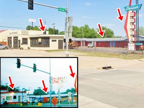
The Skyliner held its opening in the summer of 1959. It has a great neon sign and ten units with a L-shaped layout facing the Gibble Gas station at the corner. It was owned by Jack and Lorene Tarter. It survived the tornado of '99 and is still open.
Was it named after Ford's 1957 Skyliner? (the only all-steel retractable - hideway hardtop in the world) or Trans World Airlines - TWA Skyliner magazine (published from 1929 to 2002)?
Gibble Gas
On the NE corner of the intersection, next to the Skyliner is a former gas station. In the early 1990s it sold Gibble gasoline. Earl R. Gibble created this gas station company in 1960, it was a classic brand in Oklahoma, now defunct. The building has survived and now is a real estate office.
The corner office has been altered considerably but you can see it is the same building in the "Then and Now" images below. The red arrows mark the same structures in both images (office, motel gable roof and apex of the red boomerang on the neon sign).
Two service bays face SH-99, and the pumps and pump islands are gone.
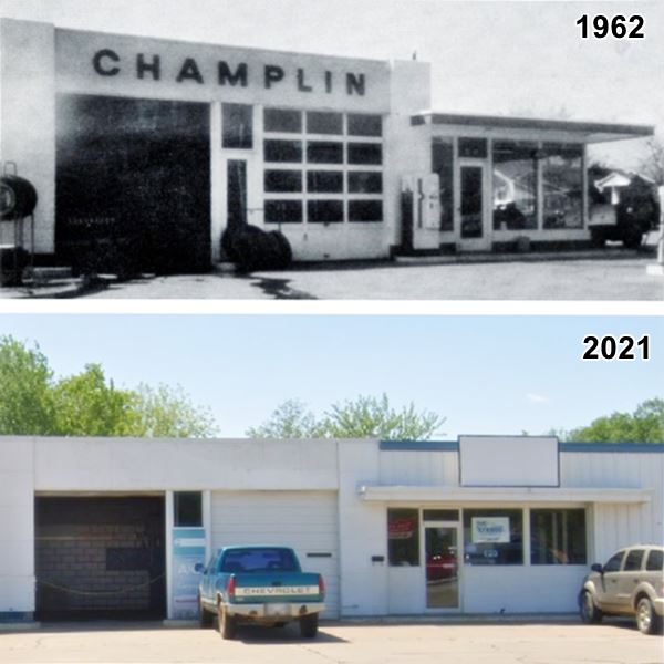
Across the street, is a former Champlin gas station.
Dervin's Champlin
Just half a block north of Route 66 to your left, was the Champlin station that in 1959 it had been owned by Hopkins, and by 1962 hadbecome Dervin's Champlin Service Station. Its advertisement says it sold Goodyear Tires, Delco Batteries and offered Washing & Lubrication. Lee Dervin owned it. The original building is still there, but it has been enlarged. A third service bay was added to the south of the original two bays. The office windows were walled in on their lower halves and the facade above the original office roof was elevated to give it the same height as the garage areas. Two additional service bays were built on the north side of the property.
The office has a short canopy and a transom entrance that were not altered, and the entrance door with a transom between the two original bays is still there. Below is a then and now comparison (1962-2021).
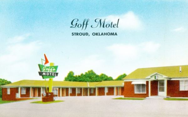
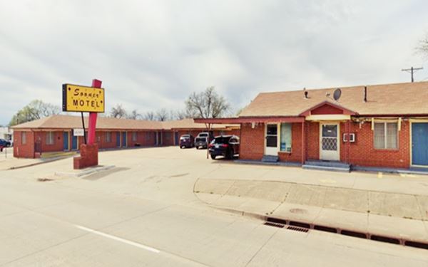
Goff Motel (now Sooner Motel)
With an L-shaped layout, facing highway 99, its appearance is unchanged in the "Then and Now" sequence below. It has changed its Googie style neon sign for a bland contemporary sign.
UFO in Stroud
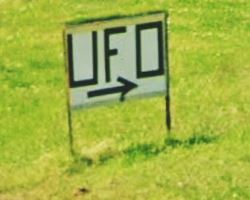
Return to Route 66, and turn right, the next sreet is 9th, 400 ft. ahead, to your right you will spot the sign (see picture) with the word "UFO" and an arrow. It points to a house located on W 4th St. whose backyard gives onto Route 66 (street view).
In the garden you will spot a small UFO craft (or, as they are called nowadays, a UAP or unidentified aerial phenomena). This yard artwork was created by Vernon McGuire out of a satellite dish and other recycled parts (like hard drive disks).
Your Road trip through Stroud ends here, you can head west along Route 66 to visit Davenport, or take a tour and dirve the Ozark Trail and visit the original obelisk.
Tours, events and Itineraries
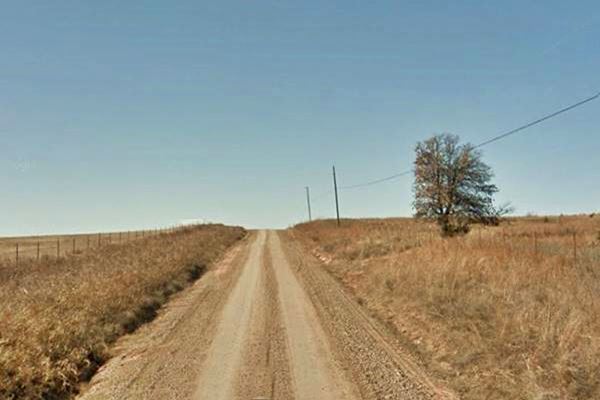
Ozark Trail Alignment West of Stroud
1915 O.T. & 1926-30 US 66 alignment
See this map of the segment.
It is known as the "Ozark Trail Section of Route 66" and was build in 1915. This section predates Route 66.
The private organization, the Ozark Trail Association petitioned the Lincoln County commissioner to create and designate a county road system belonging to the "Frisco-Ozark Trail system". The roadbed was built between 1915 and 1917 and was incorporated into the Ozark Trail highway network.
The network was a collection of dirt or gravel roads linking the towns in Lincoln county. Later, when Route 66 was created in 1926 it used these roads in its initial alignment.
The old road however remains in use until this day as a "improved" dirt road, that is, one that is ocassionally graded and surfaced with some gravel.
Ozark Trail Route 66, Stroud
Ozark Trail Monument

Original whitewashed O.T. obelisk, old US66 Stroud. Source
The Ozark Trails Monument is a concrete obelisk that is 21 feet tall, with a base that is 48 inches square and 46 inches tall.It is quite unique and rare. It marked the intersection of Ozark Trail roads.
There was one, now gone in Romeroville, New Mexico, on what would become the 1926 US 66 alignment. It was the western terminus of the Ozark Trail. Another obelisk stood in Tucumcari, on Route 66.
This map marks the site of the obelisk.
It is one of only two of these monuments surviving in Oklahoma (the second is in Langston). On the apex of the obelisk you can see some square recesses that once held electric light fixtures that lit it up from abovebove. It was recently whitewashed by the Oklahoma Route 66 Association as you can see in the image.
The town hosts an annual, city-wide garage sale in June and, of course, a Fourth of July celebration.
Events: Sac and Fox Indians' Annual Powwow
The tribal festival takes place every year, in early July-
Native Americans whose original lands were near Lakes Huron and Michigan. They were relocated to Illinois, Kansas and finally to the Indian Territories which later became Oklahoma in the 1870s.
Pow Wow
This can be written powwow, pow-wow, pow wow or pau wau. It is a gathering of Native Americans, and the word originates from the Narragansett language.
Their headquarters is near Stroud and their tribal jurisdiction spans Payne, Pottowatomie and Lincoln counties.
In Stroud they operate the Sac and Fox Nation Casino and they issue their own vehicle license plates for tribal members.
Jim Thorpe (1888-1953) was a Sac and Fox athlete who won gold medals (decathlon and pentathlon) at the 1912 Stockholm Olympics.
Interestingly, the nation is one of Stroud's major employers.
Local Wines & Wineries
Stroud names itself as "Oklahoma's Winery and Grape Capital" and as such there are several wineries and vineyards in the area.
In June it celebrates the Stroud's Annual Historic Route 66 Wine & Food Festival, a good opportunity to taste its wines and food. However, don't drink and drive.
Natural Attractions
Stroud Lake
Just 6 miles northeast of the town (map) is a spot for water sports, swimming, fishing and camping. It has RV parking space.
Full details and camping space reservations: Website. (405) 747-7300
Some sponsored content
>> Book your Hotel in Tulsa

Credits
Banner image: Hackberry General Store, Hackberry, Arizona by Perla Eichenblat
Jack DeVere Rittenhouse, (1946). A Guide Book to Highway 66
www.cityofstroud.com, city website.
Danny R. Beltz, Stroud, Encyclopedia of Oklahoma History and Culture


