
The Dangers of Route 66
Index to this page
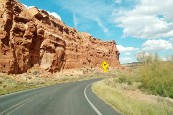
Is Route 66 Dangerous for travelers?
Route 66 isn't dangerous for tourists or roadtrippers; it is safe to drive and safe to visit and enjoy.
Route 66 nowadays is far safer than it was in its golden days. Traffic has dropped and uses the faster interstate system that runs more or less parallel to the old roadway.
Further down we detail the dangers of US66 during its heyday.
Nowadays the risks are few and you can encounter them anywhere across America and not only on Route 66; they are the following:
Safety Tip - Big cities and crime
Some cities and towns in the Greater St. Louis metropolitan area have a very high crime rate: and this includes Venice, Granite City, St. Louis, East St. Louis and Madison.
Use common sense in this area as you would in any large city: ONLY VISIT the Route 66 sights DURING DAYTIME and then move on to stay in accommodation in the suburbs further east or west. There are many shabby districts in the Metro area with a very high crime rate. It is not advisable to spend the night there.
Drug abuse and crime rates are high. Keep off the streets at night, park in a covered garage if you can, you can park on the street but only do so if visiting for a few hours during daylight hours, don't leave valuables in your car, and know exactly where you are going because you don't want to get lost or end up in a nasty neighborhood.
Downtown Los Angeles and in Chicago are safe to walk and explore during daytime and early evening, but during nighttime don't wander off alone into solitary, unknown districts or dark alleys. Stay vigilant, and know your surroundings.
Extreme Weather on Route 66
We have dedicated three pages to this subject, because nasty weather can make a road trip an unpleasant experience, from rain, and snow to extreme heat, thunderstorms and dehydration risk in the Southwest during summer:
Trivia: The Snowiest City in the US is on Route 66!
Flagstaff AZ, on Route 66, has an average yearly snowfall of 100.3 inches (254.76 cm) and is one of the snowiest incorporated cities in all of the United States.
Snow on Route 66 in Flagstaff, winter 2019

Road upkeep
Roughly 85% of the original Route 66 can still be driven. There are gaps in the old alignments where the old roadway is cut by the Interstate, and in the places where it is overlaid by the alignments of the freeways (I-55, I-44, I-40 and I-15).
Visit our Road Conditions to learn where to find updated road information.
There are well maintained segments especially in the urban areas, where Route 66 became the Interstate Business loops or routes, and runs down the towns' Main Streets, in other sections the old roadway became the freeway's frontage road and also has good upkeep. State highways usually numbered "66" or "Historic Route 66" are in general in good shape, several of them have maintained a four-lane divided highway alignment from the 1950s.
There are also many miles of dual lane highway where one should drive with care, following the speed limits and overtaking only when it is safe to do so. Traffic along these sections is not what it was in the highway's heyday, it is mostly local traffic or Route 66 roadtrippers.
Nevertheless keep your eyes open at crossroads, and in urban areas, remember that Route 66 was "America's Main Street" and runs through the downtown areas of many towns.
We drove a rough asphalt surfaced section from Suwanee to Mesita in NM along the 1926-50s Historic US Highway 66. It was cracked, uneven, and had some potholes, with overgrown shoulders and, in some parts just plain dirt and gravel. Quite an experience! Below is a picture I took looking forward, through the windshield:
The original roadbed: Route 66 just west of Suwanee, NM heading towards Mesita:

Dirt or Gravel sections

Mud at Jericho Gap, July 2021, Source
There are also dirt surfaced sections like the infamous Jericho Gap in Texas, the dirt road from Glenrio to Bard NM, where the original asphalt roadway was removed and replaced with gravel to reduce maintenance costs. Another unpaved section is the 1926-30 Route 66 alignment from Allentown to Sanders AZ.
The dangers of Route 66 during its heyday
Bloody 66
Two Route 66 wayside exhibits by Route 66 in Pontiac and Bloomington in Illinois that mention that "Route 66 was one of the most dangerous roads in the nation, earning it the nickname «Bloody 66»."
Most accidents happened at intersections with county roads or railroad crossings. A bad stretch north of Pontiac had the nickname Dead Man’s Alley. Lieutenant Chester Henry
The old Route 66 was dangerous for many reasons:
- Different highway building technology. Route 66 from the 1920s to 40s had narrow roadways with only two lanes, grade crossings, rough shoulders, sharp curves, obstacles close to the road, narrow bridges, zig-zagging alignments and more.
When the first four-lane alignments were built, the medians were narrow, included ditches and lacked guard rails and it included many grade crossroads. It was a dangerous drive. - Heavy traffic. The road was very congested, and there were trucks, travelers, and buses that used the transcontinental highway.
- Speeding. This became an issue as cars improved after the 1940s and the road was upgraded. It caused many fatalities.
- Unsafe vehicles. Until the mid 1960s when Ralph Nader brought the issue into the open , cars were death-traps, many lacked seat belts, and if they had them, they were not used. Full of knobs and chromed steel bumpers, vehicles didn't have energy absorbing bumpers or crumple zones to disipate collision energy.

Let's look at each of these danger factors:
Highway Engineering
When U.S. Highway 66 was commissioned in 1926, modern roadbuilding was in its infancy.
Although Route 66 was part of the original interstate highway system that carried a uniform signage along the its whole length, it would take until 1935 for the American Association of State Highway Officials (AASHO) to publish the first standarized manual describing sings, markings, signals for streets in urban settings, and highways (such as the Stop, School or Railroad signs now in use).
In the early 1900s, each state paved and designed their highways to their own standards, and these included brick paving like the historic brick road segment on US66 in Auburn IL pictured below.
The Brick Paved Route 66 in Illinois

> Read more about Brick paved sections of Route 66.
The AASHO adopted its first technical guidance for highway engineers in 1928 to begin implementing uniform highway design across the interstate system. These first standards established 10-feet (3 m) wide lanes and 8-feet (2.4) m shoulders.
In 1927 the AASHO created a committee to establish road design policies for upgrading existing roads and building new ones.
The 1920s and 30s interstate highways tested some roadbuilding concepts that were later abandoned, such as the "lip curbs" or "half curbs" that can be seen in Bridgeport OK; Canute OK also has them, called half-curbs, built in 1931, and Doolittle IL.
The curbs were built in areas with an incline or grade. They were sloping, curved, concrete curbs, not the usual 90° ones. The idea was to contain any water that fell on the highway when it rained and not let it soak into the shoulder, the curbs conducted it downhill along the edge of the highway and then drained at specific points through channels into a ditch.


Half Curb on Route 66. Click for St. view

The 9 foot wide 1920s Route 66
"Ribbon Road", Miami, Source
These lip curbs had an unexpected consequence: they were hazardous; vehicles could flip over if they hit the curbs. So they were not included in later highway construction.
The 1930s saw a general process of straightening out Route 66's alignment, eliminating the old zig-zag course with sharp 90° turns followed by the "section line roads" that marked the lines used by surveyors to map the counties and towns. Farmers used them as roads, and the main ones became the first highways.
The Ribbon Road - Nine-foot section of Route 66 between Miami to Afton, OK (Historic Site) is an example of a zig-zagging narrow stretch of Route 66.
Buildings, gas stations and motels were often built close to the highway's right of way, and the road ran close to natural obstacles increasing the risk of collision with them. One example of a large boulder by the roadway is Elephant Rock in Carnuel NM, which was later removed for safety reasons and toppled down the slope, where it can still be seen.

Another giant rock is the famous Owl Rock, that still stands by the highway, below is a picture we took in 2016, driving west along US66:

Hazardous Bridges and Underpasses
Bridges with sharp curves at their ends were common along Route 66 and many accidents occurred against the bridge's butresses or on the curves when drivers miscalculated their speed. Some examples are listed below:
- Dead Man's Curve at the entrance to the dangerously narrow Beaver Creek Bridge near Doolittle IL (replaced in 2021).
- The "old bloody" 1.1-mile stretch near Plano, MO, had two sharp curves at the two bridges that carried US 66 across the Pickerel and Sac River. The curves were removed and the bridges relocated in 1972, but the death toll here was 19 persons over the course of the years Source.
- The historic Rainbow bridge in Baxter Springs. It was bypassed in the early 1960s via Alt US 69 and US 400 because the bridge was narrow and congested, and had two sharp curves at its north and south access points. In 1992 a new bridge was built next to it. The bridge was declared a Historic Place and saved from demolition.
- Bushland's deadly underpass under the Rock Island and Pacific Railroad was a narrow tressle and had two sharp 90° curves at each end. The "Death Trap", as it was known, stood there until the early 1950s (a deadly accident was recorded there in 1951) when the road was shifted to the south side of the tracks, and the underpass, with a less pronounced "S curve" was built at its current position closer to Amarillo. It is pictured below in the 1940s.

Dead mans' curves
These were sharp, long or very dangerous curves along the Mother Road. There were manyo of them; apart from those mentioned above, there were other deadly curves, we mention them below.
Towanda Dead Man’s Curve in Illinois was a lethal tight curve on the narrow 1930s alignment of the highway (it was bypassed after World War II). Westbound motorists often kept on straight causing accidents. You can still drive this segment. Nearby was the McLean's Dead man's Curve (gone).
West of Albuquerque in New Mexico, in Mesita, there is another "Dead Man's Curve", a sharp loop where the road turns 270°: first you drive north, turn 90° to drive east, then 90° to drive north again, and finally 90° to head west!
Dead Man's Curve between Mesita and Laguna
The remains of another "Dead Man's curve" can be seen at Parks, Arizona, on Route 66's 1926 to 1931 alignment.
Another set of these deadly curves were located east and west of Rolla, Missuori; we describe these deadly curves on our Rolla webpage.
The Blu Inn Curve in Lincoln IL was named after a motel close to it was also known as "Killer Curve" even though it was a four-lane divided highway built in the 1940s. Speeding combined with the sharp right angled curve provoked many fatal accidents here.
Another dangerous curves were Deadmans corner between Afton and Vinita in Oklahoma, and Dead Man's curve in Parks, AZ.
The steep and winding alignment across the Black Mountains through Oatman AZ was a dangerous segment; it had hairpin bends and crossed Sitgreaves Pass with an elevation of 3,595 ft (1.096 m) so in 1952 it was replaced by a longer section along level ground through Yucca; the route now followed by I-40.
Kingman to Oatman Arizona in the Black Mountains, hairpin bend:

Tragic Curve between Sullivan and Stanton
Lowell Silverman wrote an excellent article on the life of 2nd Lieutenant Paul W. Taylor (1911–1942) (read the full article) who died in a tragic accident here on this curve at Winsel Creek, on Route 66 during World War II. It was a combination of winding highway and heavy traffic.
On the night of September 27–28, 1942, Taylor and five other officers were traveling back to Fort Leonard Wood on U.S. Route 66 in a Chevrolet coupe. Shortly after midnight their vehicle collided with a cattle truck roughly midway between the towns of Stanton and Sullivan, Missouri. Three men were killed: 2nd Lieutenants Taylor, Ennas Calvin Cave (1919–1942), and Booker T. Owens (probably 1913–1942), the driver...Lowell Silverman
We marked the spot of the accident with a cross in our custom map.
Grade Crossings at highway intersections
Stop signs or flashing lights were not effective at certain crossroads. Those driving along U.S. 66 sometimes didn't see them or ran a red light causing deadly crashes. An example was the intersection in Dwight Illinois.
"The First Traffic Light South of Chicago"
The crossroads of U.S. 66 and State Highway 47 was a dangerous one, and ordinary STOP signs didn't work well. Below is an excerpt from an article published in 1968 about this deadly crossroads:
Livingston [ranked] third with 20 [fatalities]. The worst trouble spot in Livingston County is the intersection of U.S. 66 and Illinois 47 at Dwight. Troopers ptrolling this area are convinced that motorists southbound from Chicago become "hypnotized" in the long uninterrupted drive to Dwight where they encounter the first stop light or stop sign. Even though the intersection is well protected with warning signs and flashing lights, motorists apparently just don't "see" the traffic lights until it is too late. The Pantagraph, Bloomington, Illinois, Sun. 21 Jan 1968
The picture below looks east along IL-47 at the crossroads with Route 66 running across the image (left to right), you can see the Standard station and the Crown Restaurant.

The building of I-55 around Dwight in the 1970s reduced the traffic along the old alignment making it safer.

1949: Truck and car crash on U.S. 66 and U.S. 24, Chenoa IL. Sources: 1, 2, 3. Click image to enlarge
The image shows the junction of U.S. highway 66 with U.S. higway 24, in Chenoa, Illinois. It was mentioned by Rittenhouse in 1946 in his Guidebook to US Highway 66.
It was an important and dangerous crossroads. There were many accidents here over the course of the years.
In the image we combined some pictures of a crash at this intersection that took place on July 12, 1949 between a Stetson China Co. truck, of Chicago and a car. Notice the traffic light hanging above the intersection. Click the image to enlarge it.
Nowadays there still is a flashing red light and a stop sign at the crossroads. It too was bypassed by the safer freeway.
Heavy Traffic
World War II brought an increase in traffic along Route 66, trucks and all kind of vehicles circulated along the vital transcontiental link carrying men and military cargo.
Fort Leonard Wood in St. Robert MO was an army training center that by the end of the war had trained 320,000 men. Its construction in 1940 brought a large workforce to the area, and while a railroad spur was being built all the materials and men that were to be trained at the new Army base moved in along Route 66. Route 66 in this area was narrow and winding and the narrow Bridge at Devil's Elbow built in 1923, had a dog leg on it; the road was unsafe and congested.
Traffic had tripled and the road became crowded. Accidents increased (53 dead and 454 injured during the first nine months of 1941).
The War Department had a four-lane highway built through the dangerous area starting in Hooker MO. Instead of winding around the hills coasting the Big Piney River, the new road would cut a straight line towards the fort. The new highway eliminated steep gradients and was wide; it was a four-lane divided highway; a 90 foot-deep cut was made in Hooker and a new concrete bridge built across the Big Piney River to carry it.
This "freeway" became, together with the Pennsylvania Turnpike, the only two highways with four lanes in the U.S. at that time.
But even this divided highway was dangerous: it had a narrow median, with concrete Jersey wall separating traffic. Instead there was a curbed median.

Old Postcard of Hooker Cut, on four-lane U.S. Highway 66 in Hooker, Missouri

Hooker Cut nowadays in Hooker, Missouri

This road section carried Route 66 until its decertification, and after 1958 when I-44 was designated in this part of Missouri, it coexisted with the new interstate I-44 that ran along it until a more modern segment replaced it in 1981.
Post-War Boom
After WW II and during the 1960s, traffic boomed, tourist buses, families on vacations to visit the Southwest, people migrating to California. The traffic along Route 66 grew.

Traffic crossing the Mojave Desert reached 357,000 vehicles in 1960 and more than 500,000 automobiles in the mid 1960s. Further west, adding the traffic along U.S. 91 (now I-15 from Utah, Colorado and Nevada), almost 1,161,000 cars entered Los Angeles along the U.S. Highway 66 corridor. This led the California Department of Highways to make Foothill Boulevard one of the first four lane divided highways in the state. Source.
They were driving close to each other along dual lane highways. The dangers when overtaking were great. Added to this was the urban segments, with Main Streets carrying all this traffic across the towns. Few cities had bypass alignments for Route 66 to relieve downtown traffic.
Speeding
An article in the Miami News-Record published on Aug. 17, 1930 titled "A Death Trap For Motorists" reported that "With a traffic said to be the third heaviest in the state, the Miami-Commerce U. S. 66 highway continues to claim a heavy toll of life and limb of motorists [with] 39 persons reported either killed or injured in automobile accidents on U. S. Highway 66 between Miami and Commerce since March 4, 1929." The article blames the accidents on speeding and high speed at night. This was a dangerous segment with several sharp curves where speeding drivers would run off the highway.
During the 1930s and 1940s cars became more reliable and faster, drivers drove at higer speeds increasing fatalities. The death rate peaked in 1937 with 30.8 motor-vehicle related deaths per 100,000 population. Nowadays, safer cars, highways, and better driver attitudes have reduced this figure to 14.3 per 100,0000.
Measured against vehicles on the road, the death toll fell from 33.38 per 10,000 vehicles in 1913 to only 1.66 per 10,000 vehicles in 2021. And when compared to the distances driven, it was 18.65 per 100 million miles driven in 1923 and now stands at 1.50 deaths per 100 M miles driven. Source
Fatigue, distraction and single-vehicle accidents
There were many single-vehicle accidents on Route 66, even on the four-lane segments.
A study conducted in 1964 found that "single-vehicle accidents on Route 66 appear much more
severe than traffic accidents as a whole. But this would be expected because of the generally high operating speeds on Route 66."
High speeds made drivers loose control and skid, slide, and rollover. Few used seat belts, but the study found that "the much higher percentage of those having belts and who were wearing them on Route 66 suggests that longtrippers are more likely to use available belts."
Long straight stretches in the Southwest tempted many to speed but "many parts of Route 66 are exposed to areas where high winds are common. Wind was suggested as a contributing factor in a number of the accidents reported."
Being a long distance highway, it had a different accident pattern from other highways, normally morning and evening accidents (7-9 AM and 4-6 PM) rush-hour traffic accounted for 31.1% of the accidents, but on Route 66 they were much less: 18.5%.
Most accidents happened on Fridays (18.7%) and Saturdays (18%) with 1 to 2 PM being the riskiest hour with 6.4% of daily accidents. All of these are related to weekend travelers and most traffic on the highway -midday hours.
Darkness added to the risks, but due to the drivers who had been drinking or those who fell asleep.

Safer Highways after 1956
The Federal-Aid Highway Act of 1956, that created the modern system of interstate highways changed the game. It authorized spending $25 billion over a 12-year period to build a 41,000 mile-long system of new highways that were to be built to the highest safety and efficiency standards.
The Interstate divided multi-lane highways bypassed towns, congested downtown areas and had well designed median strips, controlled access, overpasses to replace grade crossings and traffic lights.
Below is a "Then and Now" set of pictures taken at the same spot seven miles east of Williams AZ along the Winona to Williams segment; in the old 2-lane days and now, with the interstate:


With the Interstate era, the dangers, excitement, diversity and wackiness of America's U.S. highways vanished and were replaced by a new era of safety that also brought a neutral uniformity to the gas stations, fast food restaurants and motels that clustered at the freeways' exits. The dangerous but good old days are gone for good.
Safe Travel Tips
The following safety tips apply for travel along Route 66 and any other destination across the world.
- Before you leave: Tell a trusted neighbor your travel plans so they can keep an eye on your home. Don't post on social media your travel plans. Lock windows, doors and stop the mail and newspaper delivery.
- Try not to drive or travel at night. Visibility on the highway is worse at night. Drunk or tired drivers are a risk.
- Ask your hotel manager if there are "unsafe" areas in town, and avoid them.
- In your hotel, take note of emergency exits in case of fire or earthquake.
- Take out travel insurance.
- Keep your friends and family updated on your itinerary.
- Be wary of free public Wi-Fi hackers will steal personal information, bank or credit card data, etc.
- Keep an eye on your personal belongings at all times.
- Carry your medicine and a good first aid kit.
- Buckle up, don't drive if you are sleepy or tired. Take a break. It is a road trip, not a race!
- Act smart: drink responsibly, don't invite strangers to your room, be aware of your surroundings, don't keep all your cash and credit cards in one place.
Enjoy the ride, and live your adventure!
Sponsored Content
>> Book your Hotel in California
Credits
Banner image: Hackberry General Store, Hackberry, Arizona by Perla Eichenblat
Chen, Chun-Chu & Petrick, James. (2013). Health and Wellness Benefits of Travel Experiences A Literature Review. Journal of Travel Research. 52. 709-719. 10.1177/0047287513496477.