Route 66 in Berwyn IL
Index to this page
Berwyn IL
Facts, Information and trivia
Elevation: Elevation 700 feet (214 m). Population 53,030 (2024).
Time zone: Central (CST): UTC minus 6 hours. Summer (DST) CDT (UTC-5).
Berwyn is a city, located on Route 66 in the southwestern suburbs of Chicago, in Cook County, Illinois.
History of Berwyn
This marshy area near Chicago was inhabited around eleven thousand years ago, when the ice sheets retreated north after the end of the last Ice Age leaving the Great Lakes in their wake.
More recently, the Native American Potawatomi tribe lived in this area. During the mid 1600s, the French explored the area and the natives disclosed the Chicago Portage to them.
After a war with England, France ceded the territories in the 1750s, and shortly after it became part of the U.S., following its independence from Britain. Fort Dearborn was established on the Chicago River in 1803 but burned down during the 1812 War with Britain. The fort was rebuilt in 1816.
In 1818, this territory incorporated into the Union as the state of Illinois. There was trading along the portage, but the roads were terrible. In 1835 Cook County was created: it was named after Daniel Pope Cook (1794 - 1827) newspaper editor and politician, he was the first Attorney General of Illinois, and later a congressman.
In 1856 Thomas Baldwyn bought 347 acres of land which he subdivided into 10-acre lots to form "LaVergne" a upper-class community, in 1862 he sold a strip of land so that the Chicago, Burlington & Quincy Railroad (CB &Q) could extend their tracks into the area, and in 1870 the neighbors built the railway depot.
After Baldwyn's death in 1876 his daughter sold part of LaVergne to a realtor group led by Marshal Field. To the north a group of Swedish immigrants settled in what was later known as "Swedetown."
But the real origin of Berwyn was the real estate business plan of Charles Piper and Wilbur Andrews who bought part of Field's land and developed it. They built another railroad station on the CB &Q Railroad and named the town Berwyn after seing the town on a Pennsylvanian railroad timetable. They recorded its name as such in 1890.
The name "Berwyn"
The town in Pennsylvania after which Berwyn Illinois was named, in turn got its name from the Berwyn mountains in Wales. The Welsh name comes from "bar" (summit) + "gwyn" (white)", for the snow capped mountain tops.
The post office opened in 1891, and the town offered all types of modern services (sweage, water, electricity, schools and churches); the community grew and in 1902 it incorporated as a village; By 1908 it had become a city.
It was a city of commuters who worked in Chicago. In 1921 a new development began and a large inflow of Czechs arrived. Berwyn was completely built up in a few years.
The newcomers worked in Cicero and in 1926 Route 66 was aligned along Ogden Ave. Cermak Road was named "The Bohemian Wall Street".

Accommodation in Berwyn
> > Book your hotel in Chicago
Find More Accommodation close to Berwyn along U.S. 66
Below you will find a list of some of the towns along Route 66 east and west of this town; click on any of the links to find your accommodation in these towns (shown from east to west):
Along Route 66 in IL
- Hotels in Illinois
- Route 66 Starting point ▸ Chicago
- Lockport
- Willowbrook
- Bolingbrook
- Plainfield
- Romeoville
- Joliet
- Wilmington
- Dwight
- Pontiac
- Chenoa
- Normal
- Bloomington
- Atlanta
- Lincoln
- Springfield
- Raymond
- Litchfield
- Staunton
- Williamson
- Hamel
- Edwardsville
- Collinsville
- Troy
- Glen Carbon
- Pontoon Beach
- Granite City
- East St. Louis
West in Missouri
- Hotels in Missouri
- Florissant MO
- Bridgeton MO
- St. Louis MO
- Kirkwood MO
>> See the RV campgrounds in Chicago or in Joliet.
The Weather in Berwyn
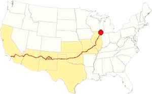
Map showing the location of Berwyn, Illinois on U.S. 66
Berwyn's climate is humid and continental; with very well defined seasons: Spring is cool and wet; summer is hot and frequently humid. Winter is cold and has on average 28 inches (71 cm) of snow, while autumn is very mild.
Temperatures: Average high in Jan (winter) 31°F (-0.3°C) and the average low is 17°F (-8.6°C). Average high in Jul (summer) 84°F (29°C), with an average low of 64°F (17.7°C).
Rain averages 36.82 inch (936 mm) per year and it is heighest - 3 to 4.3 inch monthly (78 and 110 mm) from Apr. The rest of the year has an average of 1.7 in. (28 mm) per month.
Snow: Berwyn may get snow from October to April, however usually the first snow falls in Nov. and the last happens in April (usually one quarter inch -8 mm).
Tornado risk
Cook County may experience about 4 tornados each year. Tornado Risk: read more about Tornado Risk on US 66.
The Maps of Route 66 in Berwyn
>> Our Custom map shows the alignment of Route 66 in Berwyn.
The map below was published in 1924, two years before the creation of U.S. Highway 66. The map displays the Auto Trails in NE Illinois around Chicago.
Auto Trails were highways that were in good conditions and could be used by motor vehicles. Some are marked with numbers inside black boxes; they are the "named trails." Like "78" in Berwyn that was the "Southwest Trail" or "15", the "Cannon Ball Trail". Illinois State highways are marked with numbers inside white circles. For instance Route 66's predecesor State Highway 4 is marked with a "4" inside a white circle in this area and it can be seen running from Chicago to Lyons.
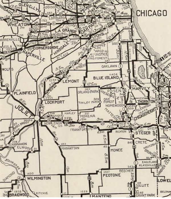
The map shows LaGrange and Lyons, Berwyn does not appear in the map, it is beside Lyons.
Route 66 in Berwyn

1927 Chicagoland map. Source

1928 Illinois State roadmap (see State Hwys 4 and 4A). Source
Route 66 ran from 1926 onwards through Berwyn, that can be seen in both maps above.
Highway 66 from 1956 to 1977

1969 Illinois State Roadmap. Source
Click map to enlarge
The highway map published in 1969 shows the changes in the network, by the 60's, Chicago's urban sprawl grew expanded and freeways crossed it. I-55 and US-66 ran together into Chicago to the exchange with I-294, where they split, I-55 running further south and US-66 north. See Berwyn on the upper right.
Route 66 is a Historic highway and has also been designated as a National Scenic Byway and an All-American Road in the state of Illinois.
The old Route 66 is a Historic highway and has also been designated as a National Scenic Byway and an All-American Road in the state of Illinois.
The Route 66 alignments near Berwyn
Description and interactive maps of US 66.
- Pontiac to Springfield (next)
- Chicago to Pontiac (Berwyn's)

Berwyn's Route 66 Landmarks and Attractions
What to see in Berwyn
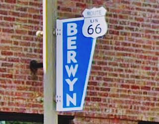
US66 shields decorating Ogden Ave in Berwyn
US 66 in Berwyn: historic context
The WPA published a guide to the state of Illinois in 1939 and in its Route 66 tour ("Tour 17"), it tells us that it was created in 1890 by two businessmen, Charles Piper and Wilbur Andrews who laid it out with the essential facilities as a "ready-made" viillage, where the homes were sold as one-floor buildings with flat roofs under the assumption that the owners would later add a second floor -which almost never happened.
It adds that many of its residents at that time were Bohemians "by birth or descent".
Driving along Route 66 in Berwyn
The drive through Berwyn along Route 66 is a very short one, only 1.4 miles, along Ogden Avenue, between Cicero in the east and Lyons in the west.
Ogden Avenue
Ogden Ave. Chicago, Cook County
This throughfare was named after Chicago's first mayor: William Butler Ogden, this throughfare runs for 37.5 miles (60.4 km) from Chicago (Chestnut St. near Milwaukee and Chicago Avenues) all the way to Naperville, IL
When Chicago was a fort on Lake Michigan (Fort Dearborn) in the early 1800s, the trappers used a muddy known as "Ottawa Trail" that linked the fort with what nowadays is Lisle. The trail was improved and a stage coach service was established, stopping at what now is Hinsdale in the 1830s, but the cart traffic ruined the dirt road, forming ruts. The trail was a muddy bog during the rainy season. Then some entrepreneurs built a toll road, the "Plank Road", which made traffic flow easily across the quagmire.
Plank Road
Construction began in 1848 and it was known as "The Southwestern Plank Road", it was the first of many that would radiate from Chicago. This one followed the trail to Lyons and in 1851 it was extended through Lisle to Naperville.
The road was built with wooden planks with log stringers on their outer edges. The boards were 3 in. thick and only 8 feet wide.
Toll fees were charged ranging from 3¢ for one hog or sheep, 12¢ for a horse and rider to 37¢ for a cart drawn by four hourses.
When the Chicago, Burlington and Quincy railroad began operating in 1863, the traffic along the plank road declined.
It was re-named in 1877 as Ogden Avenue and it was surfaced with gravel surfaced road. But by the early 1900s the first cars appeared and by 1914 it had been paved becoming a main throughfare.
Route 66 and US 34 were aligned along it in 1926, and in the 1930s the roadway was widened to four lanes.
Begin your tour on Ogden Ave and head westwards from Cicero starting at at its intersection with Lombard Ave., the border between both towns.
Berwyn's mini-spindle
To your left, on the SW corner of Lombard Ave with Ogden Ave, at 6226 Ogden Ave, is Paisans Pizzeria and Bar, with its "mini-spindle" (a car kebag) sculpture that is a homage to the classic Spindle sculpture created by artist Dustin Shuler (1948–2010) in 1989. It was a 50-foot tall spike that had eight cars impaled on it, it was located at Cermak Plaza in Berwyn, one mile north of Ogden Ave. It was a controversial landmark and this led to it being taken down in 2008. Both are pictured below.
The mini spindle has seven miniature vintage cars impaled on a 23-foot-tall spike. It is the work of local artist Pete Gamen, who created it in 20222.
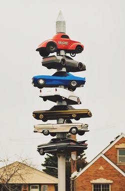
Mini spindle US66, Berwyn. Source. Click image for St. view
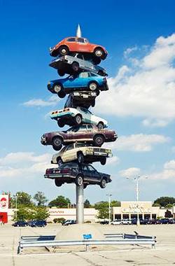
Original Spindle sculpture (gone), Berwyn. Source. Click image for St. view
Gas Stations along Ogden
There are several former gas stations along the alignment and some have been altered since the golden days of Route 66; to your right at 6229 Ogden Ave is Avrey's Service an early 1960s former filling station with a restored enamel panel building that is flanked by recent additions.
Watson's Texaco
Listed in 1957 as "6346 West Ogden. W. G. Watson, Texaco" it is gone. Opposite, at 6345 Ogden, on the NE corner with Ridgland is another early 1960s gas station, now a used auto dealership. The original building is the tall structure at the back, with two service bays and a corner office. The 1946 telephone directory reported that "Jack's Service Station" stood at Ogden and Ridgeland and the 1951 aerial photo of this spot seems to show a building on this site that could be a gas station.
Court's Standard Service
Across the street on the SE corner at 6400 Ogden Ave, is a Shell gas station with the Ranch style that was introduced in 1957. It has a low sloping gable roof with brick finish spanning the service bays and the office (Street view). This was listed in 1957 as "6400 West Ogden. George M. Court, Standard."
To your left, at 6420 Ogden, on the corner with Elmwood is a Muffler and Brakes repair shop from the early 1960s (Street view).
Student's Service
To your right, on the SW corner with Gunderson is a red brick building that housed Student's gas station (6501 Ogden). It dates back to the creation of Route 66 as Student opened it in 1926. It can be seen in this aerial photo taken in 1938. It most likely had pumps by the curb, on the sidewalk.
Top & Trim
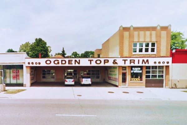
To your left, at 6609 Ogden Ave. Ogden Top & Trim is a three generation business founded by Frank Nesladek in 1919. Restorations of classic cars and customizing automobiles is their forte. The award wining company is a must see stop on Ogden Ave.
Top & Trim in Berwyn, Illinois
Just ahead, at 6732 Ogden, now there is a garage and auto repair shop, but in 1957 it was listed as "F. E. Widmann, Phillips" station.
Prince Castles Robin site (gone)
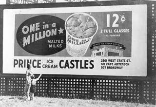
1930s Prince Castles billboard
The Taco Bell restaurant at 6956 Ogden Ave was originally a "Prince Castles", an Ice Cream store back in 1941. It was a chain established by Earl Prince and Walter Fredenhagen. Their classic was the "One-In-A-Million" malt. When the partners split in 1955, Fredenhagen renamed the business Cock Robin. He ran it until 1990 and sold it to Peterson Ice Cream Co. that eventually sold them all.
Slerba's Standard Station
At 7020 Ogden Ave. was "Carl Slerba. Standard" listed in 1957. We believe it is the current tire shop at 7000 Ogden. It has a curved Streamline Moderne office, with service bays to the right a design used by Standard Oil in the 1940s and 50s. The aerial photos show a gas station here since at least 1938.
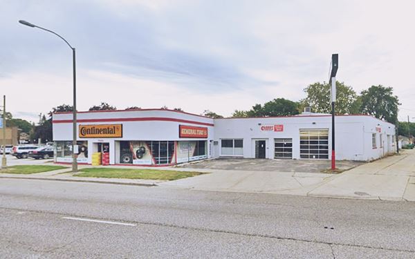
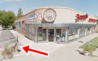
Berwyn’s Toys & Trains
7025 West Ogden Avenue
To your right, on the corner of Wenonah Ave and Ogden. There is also a "Route 66 Scenic Byway Wayside Exhibit" here.
The family-owned shop has many model trains, toys, and accessories for collectors and hobbyists.
Berwyn Route 66 Car Show
Route 66 Event
Held on Ogden Avenue between Oak Park and Ridgeland.
This is "THE" Car Show in the area. It is held every year on the last Saturday in August. It features hundreds of vintage and custom built cars, motorcycles and trucks.
Visit the event's official website berwynrt66.com for more information.
White Castle
Just ahead at Harlem Avenue and Ogden (7155 W Ogden), on the westernmost tip of Route 66 in Berwyn, on the NE corner of the intersection is a Classic attraction from the 1930s.
This is the Oldest Original Site of the White Castle chain on Route 66. The building dates back to 1939, and has been modernized over the years.
The first White Castle opened here on January 14, 1939, Route 66 was only thirteen years-old. White Castle was the first hamburger chain to standardize their marketing, from their buns and burgers to their buildings. It was the creation of Walter Anderson and E.W. "Billy" Ingram. They opened the chain in 1921 and by the early 1930s had one-hundred restaurants. They imposed strict standards and their premises were clean and spotless, reassuring customers that they were eating good quality food.
McDonald's Ray Kroc wrote about this very restaurant in his autobiography, Grinding It Out: The Making of McDonald, as follows: "...They used a sort of tiny ice-cream scoop to make a patty about one-inch square, and they sold their burgers by the bagful..." 1. Below is a "Then and Now" set of pictures of this classic landmark.
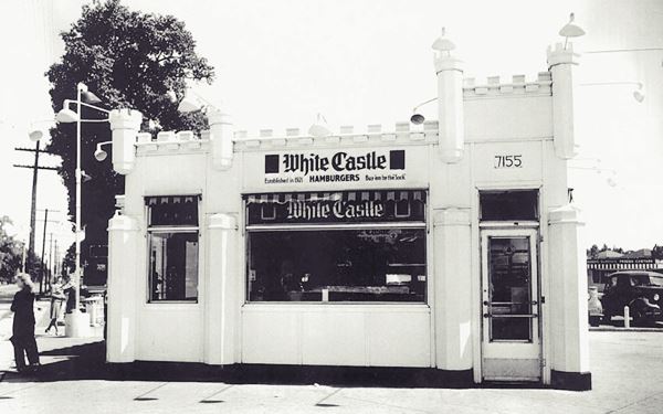
The Berwyn White Castle nowadasys
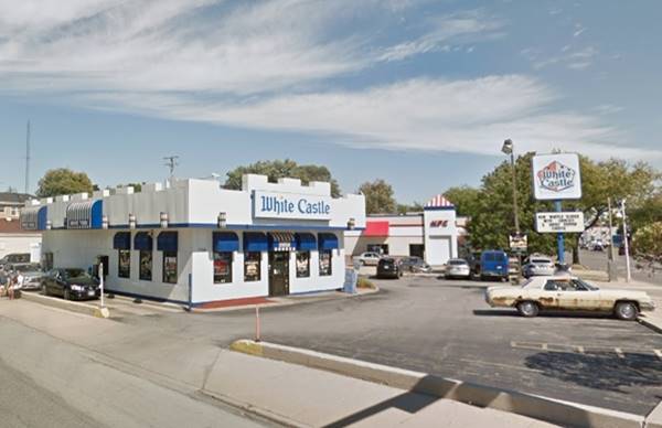
This marks the end of the Route 66 sights along its alignment, but Berwyn has many more attractions a few blocks away. Take a short side trip to visit them.
Side Trip into Berwyn
A 7 mile-long round trip displayed in this map with directions. And these are the main attractions:
- Richards Restaurant & Lounge
- Spindle site
- Former Phillips gas station
- The World’s Largest Laundromat
Richards Restaurant & Lounge
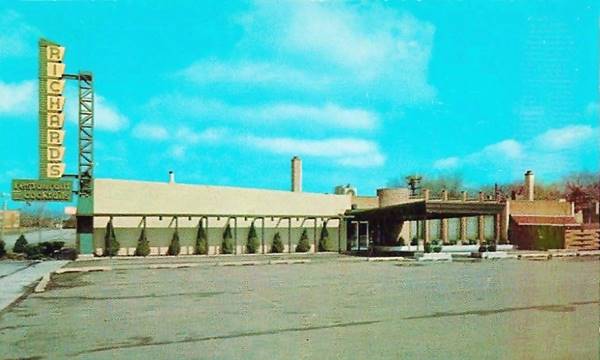
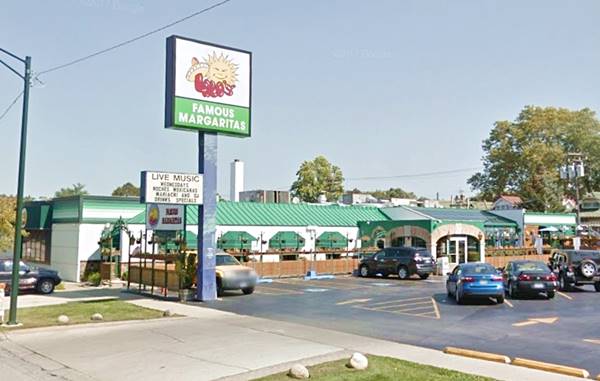
Turn left along South Harlem and head north for almost one mile. At 3011 South Harlem Ave. is the classic building that housed Richards Restaurant and Lounge.
The postcard pictured below, from the 1950s tells us that it was located on "Route 42A, 1 mile North of Route 66" that it belonged to Joseph Wilkos whose slogan was "Thou Shalt Not Go Hungry," it also had a mysteriously named "Secret Harbor Lounge." Nowadays it is still catgering to hungry patrons as Lalo's Mexican Restaurant. The original building is still there, but the large neon sign has gone as you can see in the "Then and Now" sequence below:
The (Gone) Spindle
Continue straight along Harlem Ave. at Cemak Ave. you will pass by the site of the now gone 50-foot-tall Spindle with cars impaled on it. We mentioned further up when at the modern Berwyn's mini-spindle on Route 66. Torn down in 2008 when the Cermak Plaza shopping center was redeveloped amd Its cars were auctioned off.
Former Phillips gas station
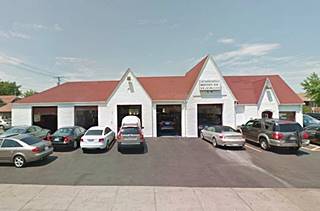
Turn right along 16th St. and head north for seven blocks to visit a former cottage-style Phillips 66 gas station. At 6801 16th St, to your left.
This old brick building is a former Phillips 66 station that is now the J & S Foreign Car, Inc. a car repair shop. The building with its steep gabled roofs has the "cottage style" favored by several gas companies in the 1930s to blend gas stations into their urban surroundings.
The World's Largest Laundromat
Americana & Wacky Roadside Attractions
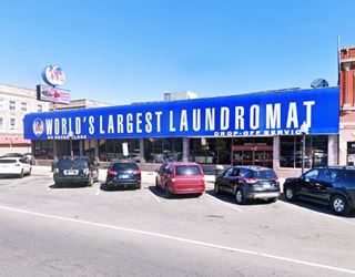
Drive on to Cermak Rd. at 6246 Cermak Rd. is a genuine example of Americana. Pictured below, the store covers 13,500 sq. ft. (1.254 m2). It has 301 machines it was pronounced the The World’s Largest Laundromat by the Coin Laundry Association in 1983.
The Swan Sevice Station was torn down in 2020, it stood at 3100 S Ridgeland (street view). Return to the White Castle.
Continue your Road Trip
This is the end of this leg of your Route 66 road trip through Berwyn continue westwards into neighboring Lyons.

Sponsored Content
>> Book your Hotel in Chicago

Credits
Banner image: Hackberry General Store, Hackberry, Arizona by Perla Eichenblat
Jack DeVere Rittenhouse, (1946). A Guide Book to Highway 66.


