Route 66 in Joliet IL
Index to this page
Joliet IL
Information, facts and trivia
Elevation: Elevation 614 ft (187 m). Population 149,845 (2024).
Time zone: Central (CST): UTC minus 6 hours. Summer (DST) CDT (UTC-5).
Joliet is a city in Will County (it is its county seat) but it also spreads into Kendall County, Illinois. It is located on the 1926-40 Route 66 and the later ALT US 66 alignments.
History of Joliet
At the end of the last Ice Age the paleoindians peopled the area (about 11,000 years ago), in more recent times, the first European explorers, the French from Canada enocuntered Illinois and Potawatome Native Americans in the area.
In 1673, two of these explorers, Louis Jolliet and the Jesuit Missionary Father Jacques Marquette paddled up the Des Plaines River, that runs through modern Joliet. The region became a part of their North American colony of Nouvelle France ("New France").
Des Plaines River
The river is 133 miles (214 km) long and flows south from Wisconsin, goes by Chicago and then with a southwestern course, it passes through Joliet and meets the Kankakee River to form the Illinois River which flows into the Mississippi River.
The French named it after the trees along its banks: "La Rivière des Plaines" (River of the Plane Trees). They named the American sycamore and the red maple after the European plane tree which they resembled.
The Des Plaines was an Indian trade route as it had a short portage that linked it to the the Chicago River and the Great Lakes (learn more about the Chicago Portage).
France lost its Canadian colonies to England after the Seven Year War (1756-63) and the territories became part of the US shortly after. Fort Dearborn at present Chicago was built in 1803.
The state of Illinois was admitted into the Union (1818) and the first settlers sarted arriving in the late 1820s. The 1830s the Indian Removal Act forcibly removed all Indians west of the Mississippi River opening the area for farmers.
In 1836 Will County was created. It was named for Dr. Conrad Will, a member of the first Illinois Constitutional Convention and member of the Illinois Legislature.
Charles Reed built a cabin here in 1833 and the following year, James Campbell, treasurer of the Illinois and Michigan Canal laid out the town. It incorporated as a village named it "Juliet". Villagers rescinded their incorporation during the depression of 1837.
The Illinois Legislature changed its name to "Joliet" in 1845. Pronounced either "Jew-lee-et" or "Jah-lee-et", and in 1852 it reincorporated as a city.
The name: Joliet
There are different versions on the name: it was named after Campbell's wife (he founded it); as a complement to neighboring Romeo; that it was chosen from "Romeo and Juliet" or that it is the deformed name of French explorer Louis Jolliet, who passed by here in 1673, along the Des Plaines River. The last option is the most probable.
A 1674 map based on Jolliet's expedition named a 60-foot (20 m) limestone ridge along the river as "Mount Joliet;" it was later mined as a quarry and now is a depression. In the 1700s English speakers pronounced the French name as "Joo-lee-et" (in French it is: "Jolly-et") which when written became "Juliet", "Joliete" and so it appeared in the maps of that time.
Jolliet, the explorer, had a French surname derived from "gai, joyeux, agéable (gay, joyful, agreeable).
Work began on the Illinois and Mississippi Canal in 1836 and it was completed in 1848, later the railroad arrived. Joliet started as a farming community, it also quarried limestone but steel beame an important part of Joliet's economy when coal was discovered nearby in the 1870s.
The Chicago Drainage Canal was dug in the 1890s, parallel to the old I&M canal, to be used not only for navigation but also to send the raw sewage of Chicago westwards so that it didn't taint its drinking water supply (Lake Michigan) and help eliminate the constant cholera outbreaks.
The Pontiac Trail highway in the 1920s passed through the town and in the early 1920s, State Highway 4 was built from Chicago through Joliet.
Route 66 in town
When Route 66 was created in 1926 it followed the alignment of State Highway 4 until 1939. In 1940 the road was renamed US ALT 66 after a new US 66 was built further west, running between Braidwood, Plainfield and Willowbrook, this new US 66 bypassed Joliet.

Accommodation in Joliet
Find your room in town.
> > Book your hotel in Joliet
Find More Accommodation near Joliet along Route 66
Below you will find a list of some of the towns along Route 66 east and west of this town; click on any of the links to find your accommodation in these towns (shown from east to west):
Along Route 66 in IL
- Hotels in Illinois
- Route 66 Starting point ▸ Chicago
- Lockport
- Willowbrook
- Bolingbrook
- Plainfield
- Romeoville
- Joliet
- Wilmington
- Dwight
- Pontiac
- Chenoa
- Normal
- Bloomington
- Atlanta
- Lincoln
- Springfield
- Raymond
- Litchfield
- Staunton
- Williamson
- Hamel
- Edwardsville
- Collinsville
- Troy
- Glen Carbon
- Pontoon Beach
- Granite City
- East St. Louis
West in Missouri
- Hotels in Missouri
- Florissant MO
- Bridgeton MO
- St. Louis MO
- Kirkwood MO
>> See the RV campground in Joliet or nearby in Braidwood
The Weather in Joliet
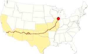
Map showing the location of Joliet, Illinois on U.S. 66
The climate of Joliet is a humid continental one with all four seasons distinctly represented; summers are hot and humid, spring is wet and cool, fall is mild and pleasant while winters are very cold.
Temperatures: The average winter (January) high is 31°F (-0.3°C); and the average low is 17°F (-8.6°C). The summer average high (July) is 84°F (29°C) and the average low is 64°F (17.7°C).
Rainfall ranges from 3 to 4.3 (78 and 110 mm) inches monthly from April to November, and falls to a drier 1.7 in. (28 mm) the rest of the year. On average, the town gets 36.82 inches of rain each year (936 mm).
Snowfall: on average, 28 inches (71 cm) of snow falls each year in Joliet. The first snow falls in Nov. and the last (less than 1⁄4 inch or 8 mm) falls in April. There is usually no snow between May and September.
Tornado risk
The area that near Joliet has around 4 tornado strikes per year. Tornado Risk: read more about Tornado Risk on US 66.
Map of Route 66 in Joliet, IL
>> Our Custom map shows the alignments of U.S. 66 in Joliet.
The map below was published in 1924, two years before Route 66 was created. It displays the "Auto Trails" or roads that were suitable for cars. The ones near Joliet are marked with numbers: as "34" for the "Lincoln Highway" through Joliet and Plainfield, or "13" for the "Mississippi Valley Highway" from Lyons, to Joliet and westwards. The number "4" inside a white circle is State Highway 4.
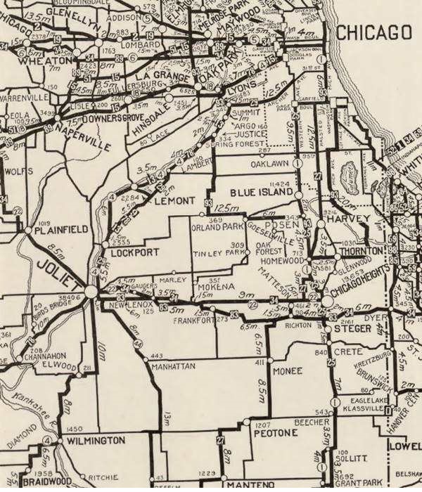

1928 Illinois State roadmap (see State Hwy 4A). Source
Click map to enlarge
Illinois funded its original state highway network by floating a bond in 1918. Among the roads built was SBI 4 (State Bond Issue) along what had been the "Pontiac Trail" that ran from Chicago to St. Louis. Originally it was aligned to the northeast of Joliet, through Lockport into Lemont and Summit to Lyons; Route 4 was paved completely by 1923.
Route 66
US 66 1926 to 1928
The original alignment initially ran along State Highway 4 through Lockport and into Joliet as shown with a bordeaux line in our custom map.
1928-40 US 66
But soon the new roadway that ran along the north and western side of the Des Plaines river in a straighter course across open countryside with farms and fields (the current town of Countryside on this alignment got its name for this reason). The new alignment avoided the urban crossings of Summit, Justice, Argo, Lemont and Lockport; it also eliminated many sharp curves and turns.
The new alignment was re-designated as both US 66 and Route 4. The old alignment through Lemont and Lockport was designated as Route 4A. The realignment across Joliet is shown with pale blue line and red in our custom map.
ALT US 66 1940 to 1967
As the truck traffic grew during the war the road between Chicago and Joliet was widened to four lanes and designated as ALT US 66.
A new roadway was built with a straighter alignment west of Elwood and Joliet, through Plainfield and it was designated as US 66; see the yellow line in our custom map.
This ALT 66 alignment ran south from Romeoville through Joliet, Elwood, Wilmington, Braidwood, Godley and Braceville, meeting the Main 66 at Gardner. The Alternate 66 alignment was eliminated in February 1967 and replaced by Illinois State Highway 53 from Welco Corners to Gardner.1
The traffic was split as it went through Joliet, westbound vehicles followed Chicago St while eastbound traffic went along Scott St, as marked with a green line in our custom map. And when Chicago was made a two way street in 1964, the westbound Alt 66 traffic was realigned along Ottawa St. See the pink line
US 66 final years: 1958 - 1977
In 1958 US 66 was moved east west to a brand new freeway that now bypassed all the towns including Plainfield, Braidwood and Gardner. US 66 and I-55 shared the freeway until 1977; see the violet lines in our custom map west of the Kankakee River (near Braidwood), and east of Plainfield.
Alternate US 66
In 1959 the American Association of State Highway and Transportation Officials (AASHTO) came up with the "Alternate" designation.
It was to be used to designate a highway that branches off from the main one, passing through certain cities and then links up with the main route again.
If the Main and alternative routes followed a similar course, the better built or shorter highway would be the one marked as "Main", while the other would become the "Alternate" one.
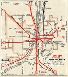
1956 Joliet roadmap Source
Click map to enlarge
There are only six places along Route 66 where an Alternate 66 alignment existed: From East to West they were this one close on Route 66 into Chicago, Carthage MO, the one in Joplin MO, Oklahoma City, Alt 66 in San Bernardino, California, and the one leading into Los Angeles CA.
Route 66 is a Historic highway and has also been designated as a National Scenic Byway and an All-American Road in the state of Illinois.
The Route 66 alignments near Joliet
Description and interactive maps of US 66.
- Pontiac to Springfield (next)
- Chicago to Pontiac (Joliet's)

Joliet's Route 66 Landmarks and Attractions
What to see in Joliet
US 66 in Joliet: historic context
In 1946 Jack DeVere Rittenhouse does not mention it in his 1946 "Guide Book to Highway 66" because he drove the "Main US 66" through Plainfield and Braidswood, bypassing it.
The 1939 WPA's guide to the state of Illinois mentions Joliet in its Route 66 tour: with a reference to the "new modern prison for men" in Stateville and then the town itself: "Points of Interest: Joliet Wall Paper Mills, American Institute of Laundering Vocational Training School, Oakwood Mound."
Route 66 Road Trip leg in Joliet
Begin your this leg of your road trip driving westwards from Romeoville, the highway runs close to the Des Plaines river, along its western bank. After passing Lockport, in Crest Hill, is the Stateville prison mentioned by the WPA in 1939 (right).
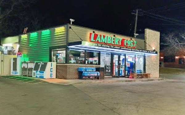
Lambert 1957
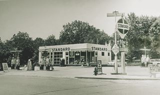
Lambert Standard Station, Joliet. c.1957. Source
On the SW corner of Broadway and Theodore you will spot a modern gas station. Dan and Helen Lambert opened it in February 1957, and it has been operated by the Lambert family since then. The sign on its facade reads ""Thank you for visiting the oldest continuously operating gas station on Route 66."
The original Standard station was torn down in 1982 when Standard Oil became the Amoco Oil Co. Inside the convenice store there are pictures of Helen, the gas station and gas station memorabilia.
As the highway approaches Joliet it passes under the railroad and becomes Broadway St. Ahead, at Ingalls St. to your left is the Route 66 Park.
Route 66 Park
Route 66 Roadside Attraction
The park has several attractions that you can visit. It includes a parking area. Below is a summary of each landmark.
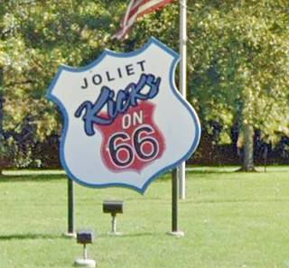
Joliet Kicks on 66 Shield-sign
To your left, at Hutchins and Broadway. It is a large shield-shaped sign promoting "Joliet Kicks on 66."
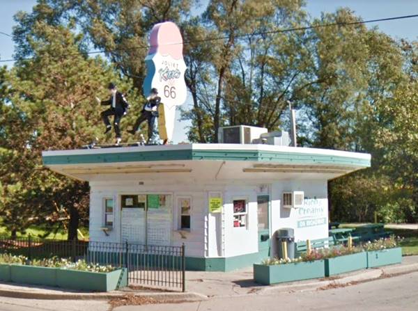
Rich and Creamy Ice Cream Stand
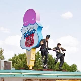
On the next block, also to your left at Moran and Broadway is the famous Rich and Creamy Ice Cream Stand with Jake and Elwood Blues (the Blues Brothers) dancing on the rooftop beside a giant ice cream cone.
The stand is located at 920 N Broadway St. The city of Joliet considered demolishing the stand for safety reasons because it was too close to the road. It has been there since 1976, and was known as "Creamy delight" formerly it was a mobile home sales office built in 1965.
The city purchased the building and neighboring property in the early 2000s for a development plan (Broadway Greenway) that included a water park and marina, but barge operators objected and it was scrapped.
Rich and Creamy Ice Cream Stand with Jake and Elwood Blues dancing on the roof top in Joliet, Illinois
Dick’s Towing
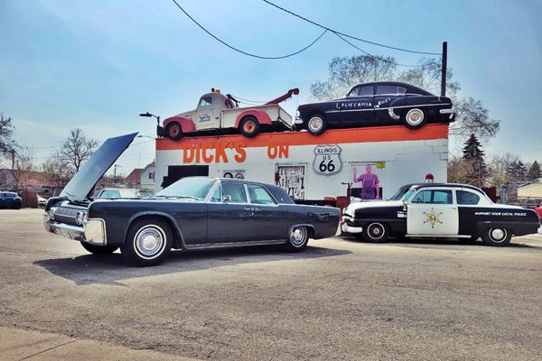
On the next block, to your right, at 911 N Broadway St, Joliet (NW corner of Ross and Broadway)
This is not a mock up, it is a real towing company (Dick's Towing). Don't miss the vintage cars and the very unusual rooftop decoration.
Dick’s Towing in Joliet, Illinois
There is a small rectangle containing brick paving of the old Route 66 with a sign that reads "You are now standing on the original Route 66 roadway." They have the word "BARR" on them and were made by Barr Clay Company in Streator, IL over 100 years ago and used to pave streets and even highways. Whether these are genuine or not is up to you. Good spot for a photograph.
> Read more about Brick paved sections of Route 66.
Ruby Street Bridge
Ahead, at the junction with Ruby St., turn left along it towards the bridge. This was a typical alingment of 1920s highways; they zigzagged their way across the dense business districts of the towns they crossed, they were the Main Streets!
Just before the bridge, on the SW corner at 150 Ruby St and N Bluff St. is the two story red-brick Ecimovich building, that dates back to 1907. It housed Matthew Ecimovich's Saloon from then until the prohibition, later sold sodas and had a grocery store catering to locals and travelers (street view)
The bridge ahead has one main span and 3 approach spans and carries US 66 across the Des Plaines River. It was built in 1935 and has a total length of 396 ft (121 m). It is movable, to allow ships to pass. There are only three movable bridges along the whole of Route 66, the otehr two are in Chicago and are similar to this one.
On the eastern side of the river, the road curves into Joliet proper. Ahead the road forks: Chicago (straight) was the original two way traffic alignment in Joliet, but after 1940, with the heavy wartime truck traffic from the Joliet Army Ammunition Plant (near Elwood), the route which at that time became ALT 66, was realigned and the 1950s maps show that
- Westbound traffic went along Chicago. And when Chicago was made a two way street in 1964, it was realigned along Ottawa St.
- Eastbound traffic followed Scott St.
Site of the World's First Dairy Queen Store
Here, at the fork with Ottawa St., is the First Dairy Queen Store in the whole World:
Joliet local landmark
501 N. Chicago St., Joliet. Sherb Noble owned three ice cream parlors in Kankakee Illinois and his ice cream suppliers, the McCullough's told him about a new soft frozen dairy product they had developed. He tried it at his stores and it was a success. The McCullough family went on to estabish Dairy Queen and their friend, Novle opened the first store named "Dairy Queen" in Joliet. By 1941 they had opened 10 stores, growing to 100 by 1947 and 2,600 by 1955.
The oval brass plaque says "Original Dairy Queen Store - Established 1940 - Building Erected ca. 1895 - Joliet Local Landmark".
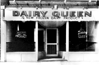
First Dairy Queen Store vintage photo, Joliet, Il. noblestores.com
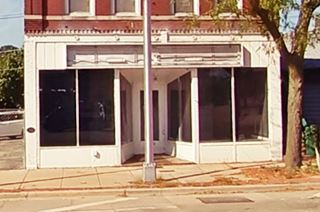
First Dairy Queen Store nowadays, Joliet, Il. Oval is on the lower left side of the facade. Click for street view
Ahead is the fork in the westbound alignments of Route 66. Take Ottawa St. to your right. After two sharp turns you will reach W Benton Street where you can park your car and take a short stroll in the downtown district to see some interesting sights and get a feel of Joliet. On the next corner to your right, on the SW corner of Webster and Ottawa Streets is a Route 66 Wayside Exhibit and half way down the block to your left is the museum with the US 66 photo - selfie opportunity.
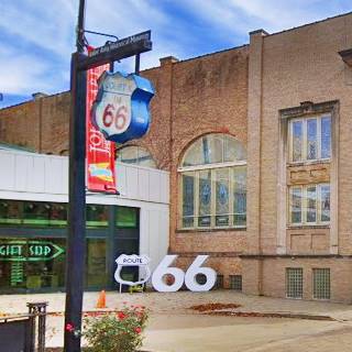
Joliet Area Historical Museum and US 66 selfie stop
At 204 N Ottawa St. to your left. The museum houses many interactive exhibits on the local history, including Route 66 and a souvenir shop. The
This museum has colorful & interactive exhibits focused on regional history, a free Route 66 exhibit, plus a souvenir shop.
There is a Selfie Station with a hollow Route 66 shield and a large "66" next to it, ideal for a great photo opportunity! It is part of the 2026 celebration of the Route 66 Centennial (1926-2026) (see picture).
Head south along Ottawa and turn left on Cass St. which is U.S. Highway 30, the Lincoln Highway.
Illinois Rock & Roll Museum on Route 66
Half way down the block, to your left, at 9 Cass St is a muesum dedicated to preserve the history of musicians and bands with ties to Illinois, and it includes a hHall of Fame. The giant guitar-shaped sign on its facade is two-stories tall, pictured above.
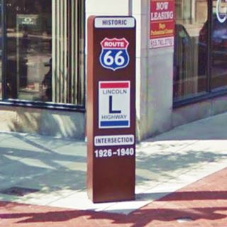
Lincoln Highway and Route 66 Marker
At the next corner (SW side of Cass St. and N Chicago St) is a 7-foot tall steel marker that reads "Historic Route 66 Lincoln Highway Intersection 1926-1940"
The Lincoln Highway Meets Route 66
The Lincoln Highway was a private initiative to actively promote decent roads for cars (instead of muddy dirt tracks used by carts). The owner of the Prest-O-Lite Headlight Co., Carl Fisher got the support of his fellow automobile industry businessmen and founded the Lincoln Highway Association in 1913 to build a road from New York city to San Francisco.
It was the first transcontinental highway across America, spanning 3,400 miles. In 1926 Route 66 crossed its course here in Joliet. The two longest highways in the world at that time met in Joliet.
In 1940 it moved to Planefield when US 66 was realigned through it.
Today the Illinois alignment of the Lincoln Highway is an Illinois State Scenic Byway and also a National Scenic Byway.
US 66 and the Lincoln Highway cross each other twice in Will County. Here in Joliet and on the 1940-58 alignment of US 66 in Plainfield. Read more about: US 66 and Lincoln Higway in Plainfield.
Chicago Street
To your left, along Chicago St., at 231 N Chicago was the now gone F. W. Hanson Billiards and Pool Hall whose upper levels became the Leverne Hotel from 1927 until 1933, on Route 66. Turn right and head south along Chicago St. and head south.
Auditorium Block
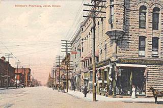
Stillman's Pharmacy 1909, Joliet, Il. Source. Click image to enlarge
At 150 N. Chicago St. is a two story stone building dating back to 1891 known as Auditorium Block; it housed St. John's Universalist Church and several offices of dentists, surgeons, opticians and oculists. On the ground floor was Stillman's Pharmacy. The images above show it in a 1909 postcard and nowadays.
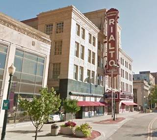
Rialto Square Theatre
Listed in the National Register of Historic Places and Illinois Route 66 Hall of Fame Inductee
On the next block, to your left, at 102 North Joliet Street
This "Vaudeville movie palace" was the brainchild of the Rubens brothers and opened on May 24, 1926, the same year Route 66 was born. It was designed in a style that combined Greek, Roman, and Byzantine styles. It has been restored and there are tours most weekends.
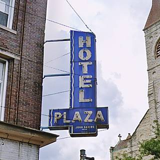
Hotel Plaza Neon sign
Head back to your car walking along Clinton westwards at the corner with S Ottawa is a hotel that is located in a building that is over 100 years old. (26 W Clinton St.)
Designed in commercial classical style by Raymond Hobbs it was built in 1910 and housed the Hobbs Hotel, a grocery, a florist, and a cafe. It was run by Hobbs until the 1940s when it was sold to new owners becoming the Plaza Hotel. A third floor was added later. It is pictured above. Don't miss the two neon signs.
More Downtown Sights
Continue driving south along Ottawa St. after Clinton St., to your right, At 19 W Jefferson is the Cutting Building, built in 1897 and still standing. From 1932 until at least 1945 it housed the Majestic Hotel.
Milano Bakery
Illinois Route 66 Hall of Fame Inductee
Many buildings have been torn down in this area and replaced by the County Courthouse and the State Attorney Building and parking areas. Head south along Ottawa, after the tracks, it meets Chicago St along a roadway built in 1990, before that the traffic went along Allen St. head south for 0.3 miles to visit the bakery.
Located at 433 S Chicago, it opened in 1915 when Mario DeBenedetti I started baking Italian bread and named his store after the Italian city of Milan. It has remained in the family ever since, selling tasty rolls and bread.
Murray's Gas Station
Turn around, head north along S Chicago that carries the northbound I-53 & US 6 (formerly Northbound ALT US 66). On the NE corner of S. Chicago and Osgood St (180 S Chicago), you can still see to building, and the contour of the pump island in the concrete driveway of Murray's Service Station, pictured above.
FitzHenry Oil Company was located at 76 S Chicago St. It was an Illinois Route 66 Hall of Fame Inductee. It had a garage and service station and was opened by Myron FitzHenry in the 1930s. It was torn down.
After the railroad underpass, turn right along Washington St. and where it curves again to head north along Scott Ave. is the historic Union Station.
Historic Joliet Union Station
Listed in the National Register of Historic Places
Located at the curve where Washington meets Scott Ave. it the classic railroad depo built in 1912. It had a "Grand Ballroom" with crystal chandeliers and 45 foot tall ceilings. See this street view.
Carlson Hagger Service Station (gone)
On The SE corner of E Jackson at 50 S Scott Ave. was a 1939 Art Deco style gas station, that was built with similar materials (Bedford limestone) as the adjacent Union Station, it even had an angled face to both streets mimicking the depot.
The Louis Joliet Hotel
National Landmark
Two blocks north, on the SW corner of E Clinton and Scott is a former luxurious hotel that was built in 1927, just one year after Route 66 was aligned through Joliet. Its postcard pictured below says "Modern - Fireproof, Famous for fine food - Louis Joliet Famous French Expl."
It is an eight-story building with 225 rooms with a two-story lobby housing an enormous fireplace. It closed in 1964. It was later refurbished and sold as apartments.
The Louis Joliet Hotel vintage postcard in Joliet, Illinois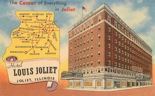
Short Side Trip to an Indian Burial Mound
Oakwood Mound
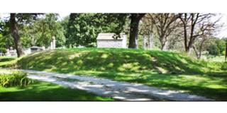
Oakwood Mound in 2011. Emerson.
A 3.4 mile round trip along US 30 Map with Directions to visit a Native American burial site located inside a modern cemetery that was built around it. Located at 1321 E Cass St, the Oakwood Mound is situated south of the main entrance of Oakwood Cemetery (map marking ths spot).
The Christian cemetry was established in 1855.
The mound is the work of Langfor Culture individuals and was built around 1,000 AD. It once stood 8-feet high, now it is only 4 feet high after archaeological excavations by the University of Chicago in 1928.
It was circular, flat topped and had steep sides; it was roughly 65 feet in diameter. It contained the remains of more than 150 persons. An analysis of the remains "show signs of tuberculosis and other respiratory conditions, nutritional deficiencies, and infection. What is even more interesting is the limited evidence of trauma associated with interpersonal violence or frequent accidents. No evidence of scalping is present, nor are there any signs of trauma that might be associated with arrow wounds. This is very different from what is observed in contemporaneous populations such as those at [other] sites." 2
Return to North Scott St. and continue your tour.
Stefanich's Restaurant
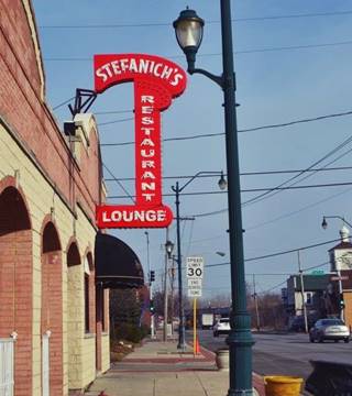
Stefanich's neon sign. Source. Click for street view
Drive eastbound along N Scott. To your right at the NW corner with E Clay (457 N Scott St.) is a classic restaurant that John and Ann Stefanich opened back in 1933 to serve chicken to the neighboring brewery and steel plant workers. Route 66 travelers were attracted by its classic neon sign that has survived with some minor changes until this day. It read "Stefanich's Chicken Tavern" and after being repaired in 2005 it said "Stefanich Restaurant Lounge." Since 2017 the "'s" has been added once again.
It remained inthe family for over 60 years, later it became Mama's restaurant and more recently a Mexican restaurant.
Ahead the highway passes beneath the railroad curves to the left, and passes again under the tracks to cross the Des Plaines Bridge. Here, before the second underpass, to your right is the Historic Joliet Iron Works with a Parking area. A steel silhouette stands by the park's sign, representing a worker at the mills.
Joliet Iron Works Historic Site
Listed in the National Register of Historic Places and Route 66 Roadside Attraction
At 31 Columbia Street, Joliet. Abundant coal and good communications in the 1870 made Joliet an ideal spot to manufacture steel. The plant is now closed but there is a self-guided tour along a paved trail to learn more about it.
Take a short (3 mile round-trip) to visit the Collins Street Prison & Prison Park, see this Map with directions.
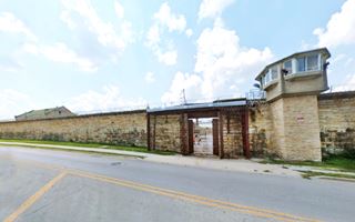
Collins Street Prison
1125 Collins St, Joliet. The old Prison with its limestone walls and its Medieval castle appearance was built in 1858 using forced labor of prisoners. The walls are 25 feet high and 5 feet thick. It closed for good in 2002 as it had become obsolete and expensive to upkeep.
Collins Street Prison in Joliet, Illinois
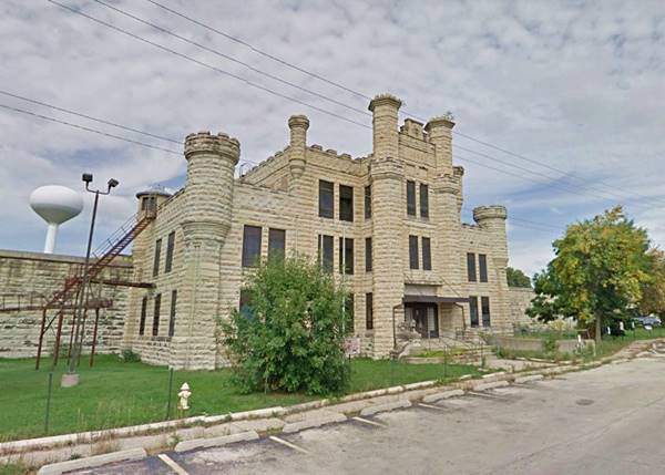
It served as the Illinois State Penitentiary. The new Stateville Correctional Center that opened in 1925 was meant to replace it, but instead both prisons remained operational. Joliet prison housed women inmates until 1933.
It housed 1,300 inmates. It has appeared in the TV series Prison Break and the iconic 1980 movie The Blues Brothers.
Blues Brothers
The cult classic movie "Blues Brothers" (1980) directed by John Landis starring John Belushi, Dan Aykroyd as the Blues brothers, "Joliet" Jake Blues and Elwood Blues respectively. Also included in celebrities in the cast, such as Carrie Fisher, Ray Charles, John Lee Hooker, John Candy, and Aretha Franklin.
Both characters got their names from Elwood and Joliet, towns on Route 66. They became popular after appearing on Saturday Night Live in the late 1970s. The brothers wore a distinctive attire, black suits, pencil ties, trilby hats and dark sunglasses. Cool jazz outfits. %hey drove a Bluesmobile.
Joliet prison appears in the movie when
The Blues Brothers' (1980) Jake Blues, played by Belushi is paroled from the Joliet Prison and with his brother (Aykroyd) they put together their old band to raise funds and help save the Catholic orphanage where raised in a "Mission from God." In the process the are shot at, chased by the cops and arrested; but save the orphanage.
The images show the spot where in the movie Elwood picks up his brother as he leaves prison.
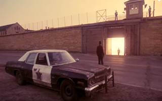
Prison release scene, The Blues Brothers movie.
The City Tour part of Joliet ends here, at the jail, there are some more interesting sights near town both along Route 66 towards Elwood described below.
Route 66 South of Joliet
Cross the town, and head along the old 1926-40 Route 66 - 1940-66 Alt 66 towards Elwood. After passing Milano's Bakery and the I-80 exchange, IL-53 keeps a north to south alignment. After 2.4 miles you will spot the Bluesmobile to your right.
The Bluesmobile
Wacky Sight
At Route 53 and Laraway Road's SW corner is the Route 66 Food N Fuel, a truck stop that opened in 2013. The "Bluesmobile" is set on the top a column.
The Blues brothers drove around in the "Bluesmobile" a former police car, a 1974 440 Dodge Monaco. The gadget on the roof is a loudspeaker. According to Dan Aykroyd, the horn-shaped loudspeaker is a duplicate of the one back at his school in Ottawa Canada. It was a Cold War siren.
The Bluesmobile, a replica in Joliet, Illinois
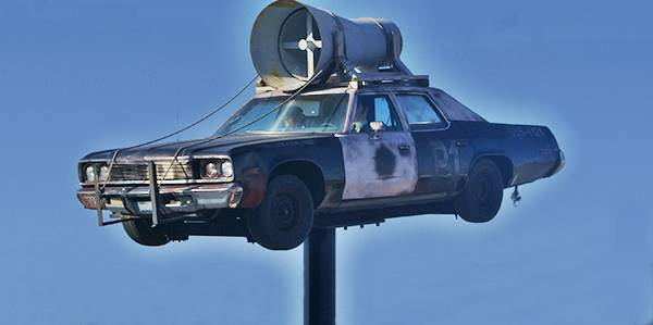
Drive south for one mile, and turn left at W Schweitzer Rd. to see a Highway Right of Way Marker on the SE corner.
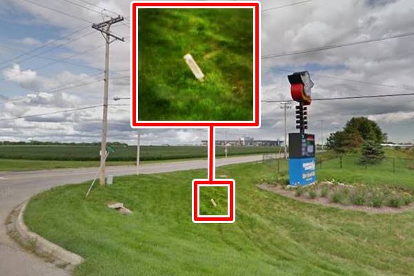
Right of Way Marker 1926
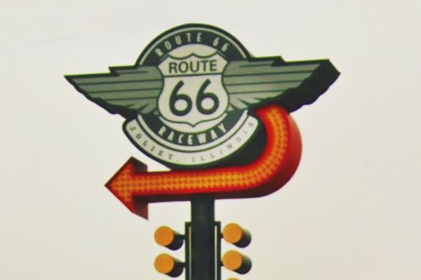
SE corner of Route 66 and W Schweitzer Rd, it is hidden in the grass. It is an old state highway right of way marker next to the Route 66 Raceway sign. This dates back to the SBI 4 (State Hwy 4) days early 1920s and predates Route 66. You can see it in the yellow box in the image below. It was there till 2021.
Right of Way Marker 1926 in Joliet, Illinois
Ahead are two venues for car racing fans
Chicagoland Speedway
500 Speedway Boulevard, with a 1.5 mile oval it hosts NASCAR events and ARCA Racing series.
Route 66 Raceway
A quarter mile drag strip and a half mile dirt oval it annualy hosts the NHRA National Drag Racing events and Demolition Derbies.
On the 1958 Four-lane Route 66
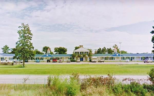
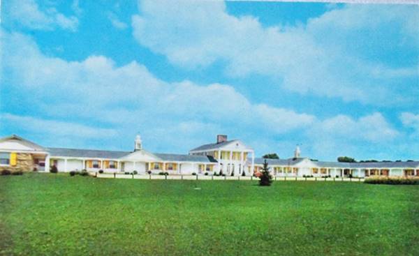
The Manor Motel
South along the original alignment there aren't any surviving buildings from Route 66's heyday. But on the 1940-77 Route 66 alignment that was upgraded to four lanes in 1958, there was a motel at the overpass where U.S. 6 crossed U.S. 66, on its NE corner. The motel can be seen in the 1952 aerial photos of the intersection.
Located at 23926 W Eames St, Channahon, IL, its postcard tells us it was located on "Rte 66 (I-55) and US 6." Its relaxed colonial style building is virtually unchanged, and it is still operating as a motel.
The Manor Motel is listed by the National Park Service as one of the "ca. 1935-58 motel buildings remaining on Route 66 in Illinois... Brick, U-shaped 1 and 2 story, colonial style motel with end gable roofs. 77 units. Ca. 1950s."
The Manor Motel, a 1950s postcard in Joliet, Illinois
Continue your Road Trip
This is the end of your Route 66 Road Trip across Joliet, head south into Elwood to continue your journey.

Sponsored Content
>> Book your Hotel in Chicago

Credits
Banner image: Hackberry General Store, Hackberry, Arizona by Perla Eichenblat
Jack DeVere Rittenhouse, (1946). A Guide Book to Highway 66.


