Cuervo (Crow) NM
About Cuervo, New Mexico
Facts, Trivia and useful information
Elevation: Elevation4,859 ft (1,481 m). Population: n⁄a (2025).
Time zone: Mountain (MST): UTC minus 7 hours. Summer (DST) MDT (UTC-6).
Cuervo (pronounce "Cuhr-voh" by the locals), is a very small village in Guadalupe County, N. Mexico (an unincorporated community).
This part of New Mexico has been inhabited for more than 10,000 years as attested by stone tools found at the Clovis Site not too far from Cuervo.
This area was explored by the Spanish (Coronado's expedition passed by Cuervo in the mid 1500s). The area was later incoprorated into their American colonies as "Nueva México", which was governed from Santa Fe (NM). However Cuervo was not settled; and the local Querecho Apaches natives lived as they had done for generations.
After Mexican Independence from Spain, the land passed to Mexico, but lost it after being defeated during the Mexican - American War (1846 - 48): the territory became part of the U.S. as New Mexico. The U.S. Army pacified the Kiowa, Kiowa Apache and Comanche natives allowing settlement in the mid-1870s.
The town was founded when the CRI&G Railroad (Chicago, Rock Island and Gulf Railroad) reached it as it expanded its tracks westwards from Texas towards Arizona. The railroad siding was built in 1902 and named "Cuervo". The post office was opened that same year.
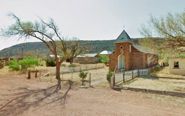
Catholic Church Cuervo, built 100 years ago.
The name: Cuervo
"Cuervo" is the Spanish word for crow and probably originated from one of two hills located close to it: Cuervo Hill (5,366 ft.) 9 m. northwest of the town or Cuervito Peak -Cuervito is Spanish for "Small Crow" (4,984 ft.) located just 1 mi. northwest of the village.
It was a small rural community in a ranching district, but the trains stopped stopping there in 1910, which drew trade to nearby Santa Rosa. However when Route 66 was aligned through it in 1926 it added some gas stations and stores to cater to the travellers. The town grew and had a couple of churches (still standing).
After World War II, Jack Rittenhouse in his 1946 "A Guide to Highway 66" describes it as follows: "(Pop. 128... few gas stations; groceries; no cafe, garage or other tourist accommodations) A scant dozen dwellings comprise this small town...".
The Interstate highway system which was created in 1956 would reach Cuervo in the late 1960s and deliver a blow to its moribound economy. Interstate 40 was built right through the middle of Cuervo and traffic zipped passed, not stopping there any longer.
Now it is a scattering of houses and, the two churches.
Find your Hotel near Cuervo
Cuervo does not have any accommodation but there are several hotels in other major towns that are close to it.
>> Book your Hotels close to town, in Tucumcari or Santa Rosa
Lodging Near Cuervo along Route 66
Below you will find a list of some of the towns along Route 66 in New Mexico. Click on any of the links to find your hotel, motel or accommodation in these towns (listed from east to west):
On Route 66's Main alignment
The Santa Fe Route 66 segment
Eastwards
Westwards
>> There are RV campgrounds close to Cuervo.

Weather in Cuervo
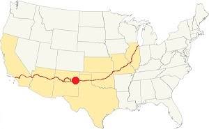
Location of Cuervo on Route 66
Cuervo is located in a semiarid area with around 15 inches (381 mm) of rainfall per year. Summer is hot but during the night, the temperature falls. Winters are cool.
There are approximately 266 sunny days per year and around 40 days with precipitation. Rainfall is higher during the summer with intense downpours: Between May and the end of August around 9.4 in. of rain falls (239 mm).
Snowfall is quite moderate with around 8.4 inches of snow (21.4 cm). You may encounter snow at any time between Sept. and May
Average high temperature in summer (July) is about 93°F (34°C). In winter (Jan) the high is 53°F (12°C). The average summer low is around 64°F (18°C) and the winter low is 23°F (-5°C).
Tornado risk
Cuervo is located in an area with almost no tornado risk: it only has two (2) Tornado watches per year.
Tornado Risk: read more about Tornado Risk along Route66.
Map of Route 66 in Cuervo NM
Visit our Route 66 Map of New Mexico. It has all of the alignments of US66 across the state over the course of the years, and the towns along it.
The Two alignments of Route 66 through Cuervo
> > Map with US 66 1926 alignment in Cuervo
> > Map with US 66 1930s to 1950 alignment in Cuervo
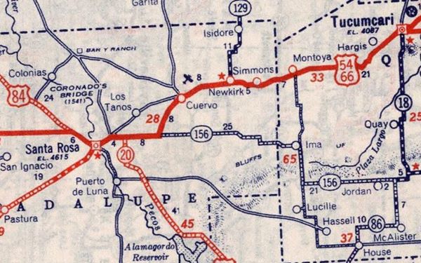
Route 66 Map Cuervo area in 1939
Cuervo: its Attractions
Landmarks, Route 66 sights
- In the "Ghost Town" of Cuervo (see below)
- Tours & Itineraries
Cuervo, its Attractions
Almost a Ghost Town
Cuervo is a village that is almost a ghost town, with a few scattered homes and some abandoned buildings along Historic Route 66 in New Mexico.
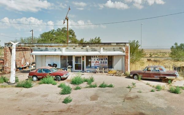
On the south side of the freeway is the old catholic church that was built over one century ago, during World War I (1914-1918) in sandstone (pictured above), On the north side is an old gas station from the 1950s, maybe a Texaco.
Gas station in ruins, Cuervo
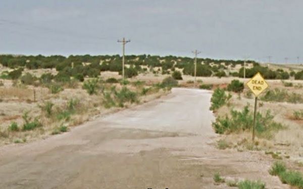
To the south west of the village is the old alignment of Route 66, from 1930 to 1950.
The old 1932 Route 66 west of Cuervo
Tours & Itineraries
Visit, to the east, the nearby towns: Newkirk, Montoya (A ghost town), Tucumcari, San Jon and Glenrio (on the Texas state line).
To the west is Santa Rosa and Clines Corner.
The Old alignment of Route 66 near Cuervo
Newkirk to Cuervo Historic Route 66
Route 66, Cuervo, NM.
Listed in the National Register of Historic Places.
This is the historic segment of Route 66 from Newkirk to Cuervo and on to Santa Rosa.
Route 66 segments near Cuervo
These are the sections of Route 66 in Cuervo. We describe each of them in a dedicated webpage with maps, itineraries and attractions along the way.
Alignment of Route 66
Sponsored Content

>> Book your Hotel in Albuquerque

Credits
Banner image: Hackberry General Store, Hackberry, Arizona by Perla Eichenblat

