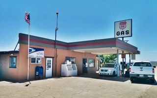
Route 66 in Newkirk New Mexico
Index to this page
About Newkirk, New Mexico
Facts, Trivia and useful information
Elevation: Elevation 4,560 ft (1,390 m). Population: 35 (2024).
Time zone: Mountain (MST): UTC minus 7 hours. Summer (DST) MDT (UTC-6).
Newkirk is a very tiny village in Guadalupe County, N. Mexico (an unincorporated community).
Eastern New Mexico has been inhabited for over 11,000 years and stone tools found at the Clovis Site, close to Newkirk NM are among the oldest in the New World.
This area was explored by the Spanish and incoprorated into their American colonies as "Nueva México", which they governed from Santa Fe. The local natives were the Querecho Apaches.
The Mexican - American War (1846 - 48) resulted in the defeat of Mexico and the land north of the Rio Grande became part of the U.S. as New Mexico. The U.S. Army pacified the Kiowa, Kiowa Apache and Comanche natives allowing settlement in the mid-1870s.
It was not until the early 1900s that the CRI&G Railroad (Chicago, Rock Island and Gulf Railroad) extended its tracks westwards into the area.
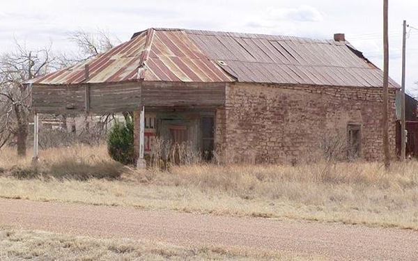
An abandoned Route 66 Service Station. Newkirk, New Mexico
The Name: Newkirk
The work "Kirk" that in Scottish English and some English dialects means "Church", it derives from Greek "kyriakon"). Of course Newkirk means just that: "New Church". Probably a surname or a place name in England.
The railroad set up a siding there in 1901 and gave it its original name: Conant, after the first settler, a rancher James P. Conant. However it soon switched its name to Newkirk when a settler formerly from Newkirk, Oklahoma set up his residence in the town. The post office opened in 1910.
It was a small town catering to the local ranches and when US Route 66 was aligned through it following the "Ozark Trail" in 1926, it got some additional business from the motorists.
Newkirk was an unloading station in the 1950s when the Conchas Dam was built to contain flooding along Canadian River.
Nowadays I-40 bypasses the few houses that make up the village, which is almost a Ghost town.

Hotels close to Newkirk
Where to Stay
Newkirk does not have any accommodation but there are plenty of motels and hotels in the other Route 66 towns that are close to it.
>> Book your Hotels close to town, in Tucumcari or Santa Rosa
Lodging along Route 66 in NM
Below you will find a list of some of the towns along Route 66 in New Mexico. Click on any of the links to find your hotel, motel or accommodation in these towns (listed from east to west):
On Route 66's Main alignment
The Santa Fe Route 66 segment
Eastwards
Westwards
>> There are several RV campgrounds in Santa Rosa and also nearby at the State Parks.
Weather in Newkirk
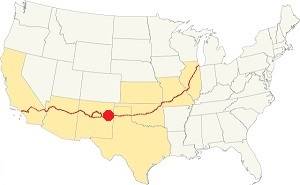
Location of Newkirk on Route 66
Tornado risk
Newkirk is located in an area with an extremely low tornado risk: it only has two (2) Tornado watches per year.
Tornado Risk: read more about Tornado Risk along Route66.
Newkirk is in a semiarid area and the rainfall is about 16 inches (406 mm) per year. Summers are hot but with lower temperature during the night due to the altitude, and winters are cool.
There are around 266 sunny days every year and about 40 days with precipitation yearly mostly during the summer with intense downpours. Between May and the end of August an average of 9.4 inches of rain falls (239 mm).
Snowfall is quite light and averages about 8.2 inches of snow (21 cm), snow can fall at any time between Sept. & May
Average high temperature in summer (July) is 93°F (34°C). In winter (Jan) the high is 53°F (12°C). The average summer low is 64°F (18°C) and the winter low is 23°F (-5°C).
Map of Route 66 in Newkirk
See this Map of Route 66 through Newkirk.
You can also visit our Route 66 Map of New Mexico. It has all of the alignments of US66 across the state over the course of the years, and the towns along it.
Route 66 Map Tucumcari to Santa Rosa in 1956
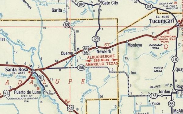
Tucumcari to Montoya Historic Route 66
Route 66, Montoya, NM.
Listed in the National Register of Historic Places.
This segment of Route 66 is a historic landmark listed in the National Register of Historic Places and runs from Tucumcari all the way to Cuervo and onwards to Santa Rosa.
We have a webpage that describes this historic alignment with maps and many details; vist our Tucumcari to Santa Rosa Historic Route 66 webpage for more information.
Route 66 Map close to Newkirk in 1939
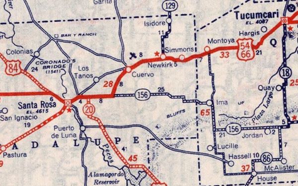
Route 66 Attractions in Newkirk
In 1946, Jack DeVere Rittenhouse published his "A Guide Book to Highway 66" after driving the whole of the highway. In it, he mentioned all the towns and, he had an entry about this village: "NEWKIRK. ( Pop. 115 ; alt. 4,330' 4 gas stations, 2 lunchrooms, few cabins; De Baca's Trading Post; no garage or other facilities.) Newkirk's main importance today is its location at the junction of a road (R) to the large CONCHAS DAM".
Newkirk Whiting Bros. Station
1004 Emerald Rd. Newkirk
It is located on the south side of the side road that runs parallel to the original Route 66 alignment (I-40s N Frontage Rd.) at Exit 300.
This was Whiting Brother's station #78. The building has survived and is still operating as a service station.
You can see what it looked like in this 1980s photo, when it was a WB station.
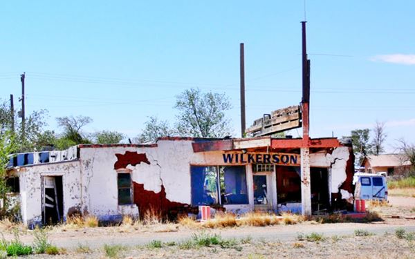
Drive east one block to see the Old Post Office creted in 1910. It was also a store and a gas station. Ahead on the next block are the remains of Wilkerson’s Store.
Wilkerson’s Store
The former store and gas station and store is in ruins, the truncated V-shaped canopy is collapsing, the boards that once announced the gas brand it sold, above the canopy are fading.
The deteriorated remains of Wilkerson's gas station
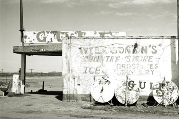
The following image, taken in 1985 shows us that "Wilkinson's Country store" sold ice, groceries and Gulf gasoline.
Wilkerson's in a 1986 black and white photo
On its eastern side is an old motel, also in ruins.
This ends your "city tour" in Newkirk.
Route 66 segments near Newkirk
These are the sections of Route 66 in Newkirk. We describe each of them in a dedicated webpage with maps, itineraries and attractions along the way.
Alignment of Route 66
Sponsored Content

>> Book your Hotel in Albuquerque

Credits
Banner image: Hackberry General Store, Hackberry, Arizona by Perla Eichenblat
Robert Julyan. 1996, The Place Names of New Mexico. UNM Press
Jack DeVere Rittenhouse, (1946). A Guide Book to Highway 66.


