Route 66 in Moriarty NM
Index to this page
About Moriarty, New Mexico
Facts, Trivia and useful information
Elevation: Elevation: 6,220 ft (1,896 m). Population: 2,054 (2025).
Time zone: Mountain (MST): UTC minus 7 hours. Summer (DST) MDT (UTC-6).
Moriarty is a town in Torrance County, New Mexico, on the east side of the Sandia Range, next to Route 66's late 1930s alignment.
History
This part of New Mexico has been inhabited for over 10,000 years (the nearby archaeological sites at Clovis and Sandia Cave have some of America's oldest stone tools).
The area was later explored by the Spanish and became part of their American colonies as "Nueva México".
The Name: Moriarty
The city is named after the first permanent settlers in the community: the Moriarty family.
Moriarty is the name of Sherlock Holmes most formidable foe, and is the Anglicized form of an Irish name: "Ó Muircheartaigh", found in County Kerry, Ireland. The meaning is "sea worthy" or "navigator".
After Mexico's independence from Spain New Mexico became part of the new country who later lost it to the U.S. after being defeated during the Mexican - American War (1846 - 48).
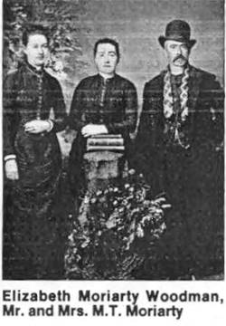
Mr. Moriarty (right). Source
Michael Timothy Moriarty born in Ireland in 1841 and migrated to america in 1854, following the potato famine. He moved to Estancia Valley NM with his wife and three children from Iowa, escaping from the cold northern winters. He settled there in 1887 as a rancher. The post office opened in 1903 (Mr. Moriarty was its first postmaster). He died on his sheep ranch in Moriarty in 1932, at the ripe age of 91 years.
The railway reached the town in 1903 when the Santa Fe Central Railroad laid its tracks from Santa Fe to Willard and Vaughn where they met the CRI&G Railroad Chicago, Rock Island and Gulf Railroad that linked it with El Paso and Chicago.
The railway soon built a station and depot and the townsite grew into Moriarty. New settlers arrived by train, and established farms.
Route 66 was created in 1926, but its original alignment did not go through Moriarty. Instead it took a longer route north towards Santa Fe, by Las Vegas NM and then south again to Albuquerque. A shorter alignment was built in 1927 but was only paved in 1937, bypassing Santa Fe and shortening the trip between Santa Rosa and Albuquerque, it passed just north of Moriarty through Buford.
Santa Fe cut-off
Although the original alignment of Route 66 was based on necessity and followed the preexisting roads, it was a matter of time for it to adopt a shorter alignment with a straight east to west course along the 35th Parallel across the state of New Mexico.
Arthur T. Hannett New Mexico's governor, who had been mayor at Gallup, was aware of this and after being displaced in his 1927 bid for reelection by the party bosses in Santa Fe, took revenge in an unexpected way:
He ordered that a State Highway built from Santa Rosa to Moriaty, placing Albuquerque on the main crossroads of the state and relegating Santa Fe and Socorro to the backwaters.
The dirt surfaced road was completed in record time before he left office, but it would wait for ten years before it was incorporated into Route 66's aligment.
The Trans-America Footrace 1928 took thus short cut and ran up Tijeras Canyon through Moriarty and on to Santa Rosa.
This "Santa Fe Cut-off" (or shortening of Route 66) as it was known, was backed by the Route 66 Association and finally included in the Federal Aid (FAP) system for execution in 1931 and was finally completed by 1937. Santa Fe was cut-off and the road was shortened. Hannet got his revenge.
At that time, in the mid-1930s, the "Dust Bowl" drought had also hit the farmers in New Mexico and many of them were forced to leave Moriarty.
Buford
In those difficult days of the Depression and the Dust Bowl, a new community was created north of town, Buford.
Buford took its name from the son of a settler who owned the land east of the railroad, H. Crossley.
It was located in a strategic place, at the junction of NM-6, (later U.S. 66) and NM-41, and when Route 66 was aligned through it in 1937, it prospered.
Jack DeVere Rittenhouse, 1946 in his book "A guide to Highway 66" mentions Buford as a crossroads with "four cafes, six gas stations, two courts [motels]"
Eventually both communities (Moriarty and Buford) would merge as the City of Moriarty when it incorporated in 1953.
Irrigation overcame the drought problems and the flow of traffic along Route 66 and later Interstate 40 in the 1970s brought prosperity to the community. The railway tracks were lifted in the mid 70s.

Where to Stay: Hotels in Moriarty
Moriarty has plenty of lodging options for those travelling along Route 66, you can book a hotel or motel in town:
>> Book your Hotel in Moriarty
More Lodging Near Moriarty along Route 66
Below you will find a list of some of the towns along Route 66 in New Mexico. Click on any of the links to find your hotel, motel or accommodation in these towns (listed from east to west):
On Route 66's Main alignment
The Santa Fe Route 66 segment
Eastwards
Westwards
>> There are RV campgrounds in Moriarty and also nearby in Edgewood
The weather in Moriarty
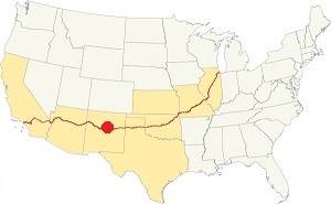
Location of Moriarty on Route 66
Moriarty is located in a very dry area. On average 12 in. of rain (305 mm) fall each year. The highest takes place during summer from July to Oct. (6.84 in. - 174 mm). Snow averages 25 inches (63.5 cm) and falls between October and April.
Summer is hot but during the temperature drops during the night (influenced by altitude). Winters are cold.
The average high temperature in Summer (Jul.) is 88.1°F (31.2°C), while the average low is 54.5°F (12.5°C).
The winter average high temperature (Jan) is 46.4°F (8°C) and the average low is 15.6°F (-9.1°C).
Tornado risk
Moriarty is located in an area with virtually no tornado risk: it only has one (1) Tornado watch per year.
Tornado Risk: read more about Tornado Risk along Route66.
Map of Route 66 in Moriarty NM
Read the Detailed Description of this segment (Santa Rosa to Albuquerque). Below is the interactive map:
>> Custom map of Route 66 in Moriarty

USGS map of Moriarty
The alignment into Moriarty is buried beneath I-40, that was built over it. There is a small section close to Longhorn Ranch this can be driven. The pink lines mark the gaps at the eastern and western tips of this segment.
At I-40's Exit 197, it runs straight through Moriarty and then all the way to Edgewood parallel to the freeway (map).
Getting to Moriarty
Moriarty is 200 miles from the Arizona - NM state line. Heading west from Moriarty along route 66 is the town of Edgewood (10 mi.), and further west are Tijeras (23 mi.) and Albuquerque (39 miles). Close to the Arizona state line is Gallup (178 mi.)
To the north of Moriarty, on the Santa Fe loop of Route 66 is Santa Fe (53 mi.)
To the east is Clines Corners (21 mi.), Santa Rosa (77 mi.), and further east, Tucumcari (137 mi), San Jon (161 mi.) and Glenrio (179 mi.) on the Texas state line.
The Santa Fe Loop (1926 - 1937)
Our Santa Fe Loop page describes the complete 1926 to 1937 alignment of Route 66 from Santa Rosa to Albuquerque through Pecos, Santa Fe and Bernalillo.
Route 66 Alignment near Moriarty
With maps and full information of the old roadway.
- Albuquerque to Lupton (next)
- Santa Rosa to Albuquerque (Moriarty's)
- Tucumcari to Santa Rosa (previous)

Moriarty: its Attractions
Landmarks, Route 66 sights
Historic Context
In his 1946 Guidebook to US Highway 66, Jack Rittenhouse mentions Longhorn Ranch as he approached Moriarty, and then he describes the crossroads north of the town, a small village named Buford:
US 66 continues to descend , leveling off as you approach BUFORD... small crossroads hamlet offers four cafes, six gas stations, two courts: Yucca and one other Rittenhouse (1946)
We will describe this leg of your Route 66 road trip, heading west from Clines Corners into Moriarty.
The Moriarty segment of your US66 Road Trip
Longhorn Ranch
When you reach Gemmerville at Exit 203 of I-40. 6 mi east of Moriarty take the overpass to the south (left) side of the freeway. On the SW corner of the overpass is a Motel, and the signage of the "Longhorn Truck Stop", drive one hundred yards south. At the intersection with highway A123 you reach the original Route 66 alignment that is mostly buried by I-40 between Santa Rosa and Moriarty. Here it resurfaces on the south side of the freeway and can be driven (map), its western and eastern tips are cut by the Interstate (pink lines in our custom map.)
Take a right at the junction and ahead, to your left is the motel, and to your right the other Longhorn Ranch remains, including the neon sign.
Looking west along Old Route 66 at Longhorn Ranch (left) and its motel (right)
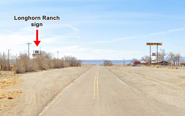
Old Longhorn Ranch Sign
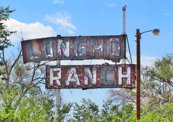
The ranch was named after the Texas Longhorn, a sturdy breed of cattle which gets its name from its very "long" horns: they can measure up to 7 feet (2.1 m) from tip to tip. (More on Longhorn cattle).
Capt. William A. ("Bill") Ehret (1902-1972) was a former patrolman from Lincoln Co. NM. He opened his Longhorn Ranch trading post in 1940 and dubbed it "Where the West Still Lives." He operated with his wife until his death in 1972.
The Longhorn grew into a formidable complex which welcomed travellers after the long lonely and boring trip across the desert from Santa Rosa. The Ranch included not only a motel, garage, service station and an Indian trading post with curios it also had a museum, an imitation cowboy town, Indian dances and a "Real Concord Stagecoach used to Haul Mail and Passengers in the days of Buffalo Bill."
The original builidings and the gas station were on the south side of the highway and they were a pile of rubble by the mid 1990s.
Longhorn Ranch Motel
The motel was located on the northwestern side of the property, a long linear single story building with a gable roof immediately behind the offices and a neat 1950s neon sign pictured further down. Its vintage postcard below tells us that it had "15 Units - Air cooled by nature..."
Looking west along Old Route 66 at Longhorn Ranch (left) and its motel (right)
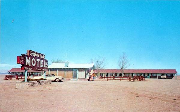
After Ehret's death, the NM Highway Dept put it up for sale (1), and it was acquired by the Gemmers. Interest in cowboys and the Far west waned in the 1970s. I-40 despite the interchange brought less guests to the motel.
Gemmerville
This is a relatively new place name from the 1980s. The place where Longhorn Ranch once stood is now known as Gemmerville. It took its name from the Gemmer family who settled here in 1981. Merv Gemmer operated the motel and service stop. Soon after, the spot became known by their name,. The "village" had a motel, night club, restaurant, and gas station.
Nowadays the site is closed: A fire in 2016 damaged the motel units. The surviving structure on the west is the old office, and to the right, is the El Vaquero bar and grill that shut for good in 2017.
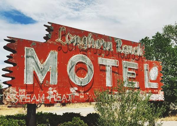
Looking west along Old Route 66 at Longhorn Ranch (left) and its motel (right)
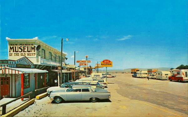
The 1960s postcard above shows the Far West builidings, museum, the 1866 Salon and you can also see the red and white "Longhorn Ranch" sign that has survived. The gas station is the westernmost building, the motel is on the right side, out of view.
The Great Lake
To the south of Route 66 at I-40 Exit 203.
Lake Estancia once covered an area of 434 sq.mi. (1.125 km2) with a water level of 6,200 ft (1.890 m). It was 35 mi. long and 23 mi. wide.
Nowadays all that remains are intermittent salt lakes and salt flats, but between 12,000 and 7,000 years ago the wetter and cooler climate allowed an enormous freshwater lake to form.
The high water level at that time would cover the nearby town of Estancia wth 100 ft. (33 m) of water but later it evaporated and became briny.
The natives farmed near some springs that flowed into the salt flats at Estancia and the Spanish explorers who stopped there named the village as a "resting place" or "Estancia".
Route 66 and I-40 cut across the northern tip of Lake Estancia at Exit 203.
John Claar's Hitchin Post
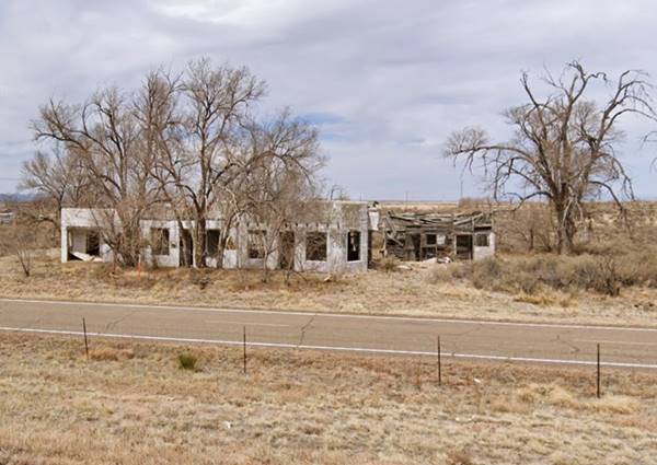
Turn around and return to the freeway. On the north side is the now vacant Zia RV Park, which is later than the Route 66 days. Drive west along Abrahames Road (N. Frontage Rd.) for 3.6 miles as shown in this map with directions. To your right you will see the remains of a Whacky Route 66 attraction.
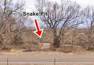
It was a trading post and gas station that also included a zoo with some western wild life and, on the eastern side of the property, a "Snake Pit", a concrete block-shaped containing box with a wire mesh top so that the visitors could see the rattlesnakes. Still standing next to old Route 66.
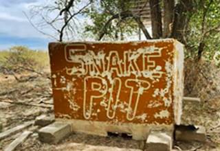
Snake Pit closeup. Source
John Claar moved here from Ohio to open his grocery and curio store. The words "Trading Post" decorated the building's facade. Tourists were a great source of revenue; two-thirds of their sales during summer were curios! (2)
Continue west for 4.7 miles (see this map with directions) to enter Moriarty along the original Route 66 alignment(now cut by the freeway as marked with a red line in our custom map.
Lewis Antique Auto & Toy Museum
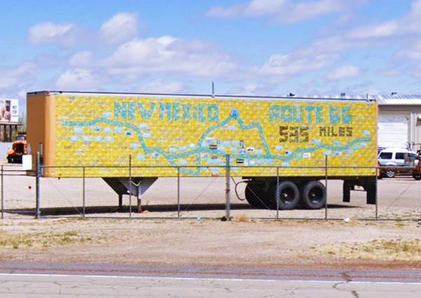
To your right at 905 E. Central Ave. this 8 acre indoor and outdoor Museum, with over 700 classic and vintage autos, 1000 toy trucks, trains and more! Here we saw the License Plate Memorial Wall pictured below; it is an initiative by "Retro 66 - Relieve the Route" (more information at their Facebook page.) The semi-trailer has been covered with New Mexico license plates: yellow for the background and others green and black tracing the 1926-37 and the 1937-85 alignments of Route 66 across the state. Being mobile it is used at different venues so it may not be here when you visit Moriarty.
Former gas station
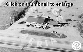
On the next block, to your right is Route 66 Auto Repair at 803 E. Central Ave. It was the first gas station as you entered Moriarty from the East. It appears in an aerial photograph taken in 1953, and as you can see before it was reformed (2011 view) it had three service bays to the right and a glassed corner office on the left. The office has been modified into a service area with higher clearance for trucks.
Another gas station
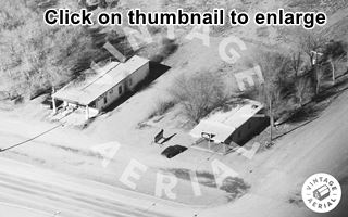
At 707 E. Central Ave. To your right. Now it is a gun shop. The gabled roof canopy over empty gas pumps indicates it was a service station. The missing roof has been there since 1990 as you can see in the aerial picture taken then (click on the thumbnail to enlarge).
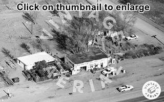
Ahead, to your left, at 520 E. Central Ave. is a former Café now closed. You can see it in this 1990 aerial photo and its current St. view.
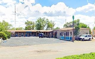
Sunset Motel
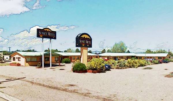
Across the street from the cafe, to your right, at 501 E. Central Ave. Bill and Elaine Pogue sold their home to Whiting Bros. (the gas station is located on their former property) and bought the adjacent piece of land. Bill, a WWII B-17 bomber pilot built the first two rooms himself and opened the motel in 1959. It grew to 18 rooms in 1969. Bill's mother had owned the Yucca Motor Court mentioned in 1946 by Rittenhouse.
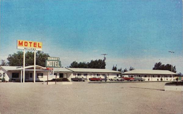
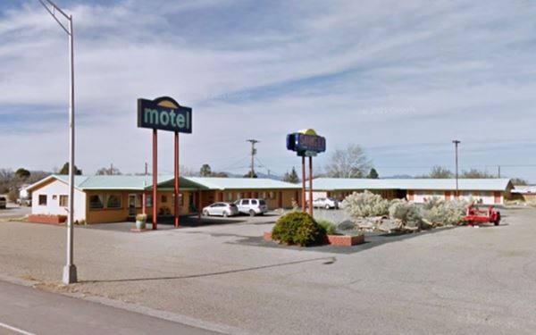
The postcard mentions "Thermostat-controlled heat and refrigerated air conditioning for year 'round comfort.... Free TV".
Sunset Motel with its old signs
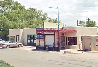
Whiting Brothers Service Station
Nex to the motel, is a neatly painted vintage gas station.
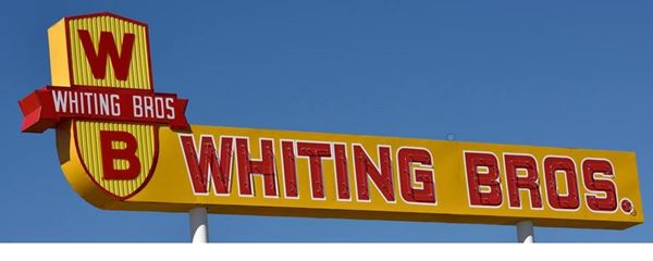
Four Whiting brothers (Arthur, Earnest, Eddie and Ralph) founded the company in 1926 and saw it grow to over 100 filling stations plus motels and truck stops from California to Texas. Many of them were located along Route 66 where you can still see the remains of those that were abandoned.
Read more about all the motels and gas stations of Whiting Bros. on Route 66
The Moriarty Service Station was the #72 and opened in 1954. By the mid-1980s the company folded and sold off or closed its service stations.
In 1985 the #72 was bought by an employee who had worked there since 1965, opening the Sal & Inez Service Station, which is still operating.
Its sign, which was rusty and needing repair was an original one, and was restored in 2014.
Moriarty Whiting Brothers Service Station

Drive west to the crossroads at E. Central Ave. and Eunice St. There are some Route 66 oldies here hidden in plain sight. You can see them all in this 1953 Aerial Photo. Below we describe them.
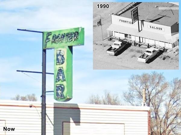
Frontier Saloon
The bar on the NE corner has been a drugstore in the 1930s, and most recently the Frontier Bar and saloon at least since the 1990s as you can see it in this 1990 aerial photo. It has a great neon sign but it changed over the years: see the 1990s sign in the aerial photo and in the image below.
Bufourd Auto Courts, Crossley Standard station and Thunderbird Cafe
Across the street, on the NW corner of Eunice and E. Central Av. was the tourist complex built by Buford Crossley, the man who created this community named after him on the crossroads of Route 66 and Hwy 41.
A 1953 Aerial Photo
Shows the Crossley service station and Buford Auto Courts on the upper part of the Image.
Below is a 1930s view of the Cafe (left) and the Courts' office (right).
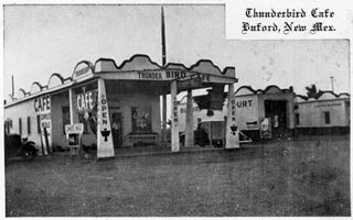
Thunderbird Cafe and Buford Court (1930s) Moriarty NM. Source
Click thumbnail to enlarge
The 1990 aerial photograph above shows that the cafe (left) was still standing. The word "Cafe" is painted on the wall and it has the same pyramidal columns holding up the canopy. The motor court is on the right, and has survived until now, the cafe was torn down to make space for the Quality Inn. The weird pedimented parapets (those curved - jagged decorations around the top of the building) were also removed.
Crossley also owned a Standard gas station, on the same property.
There is still one remaining building on the property, the one on the corner of Eunice St. and Route 66. Now it is a restaurant. We chose its 2013 St. view because it shows a clear view of the building. You can see it below with a collectible matchcover of the motel. Notice it said it was owned by Crossley and Crossley and rooms cost $1.5 and up!
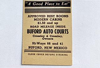
Buford Courts matchcover. Source
Siesta Motel (gone)
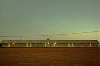
Siesta Motel in 1981 by Steve Fitch. Source. Click to enlarge
On the south side of Route 66 is the the site of the Siesta Motel, on the SW corner of Eunice and Route 66. It was torn down, but you can still see the foundations in this image (Red arrows mark the foundations, and the inset is a satellite view showing the L-shaped layout of the motel):
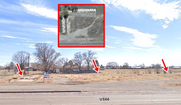
Here, by the Siesta and Bufford Courts, the highway met NM-41; on the eastern side of the intersection, the right turn lane on US66 and the right turn lane on NM-41 described wide curves (1953 aerial photo) that now have been eliminated. The reason for this was the railroad that ran parallel to Hwy 41, and that has since been removed. Now there is a traffic light here. Drive west. To your right is Crossley Park with its five steel stallion statues welcoming visitors to Moriarty "Crossroads of opportunity", see image below.
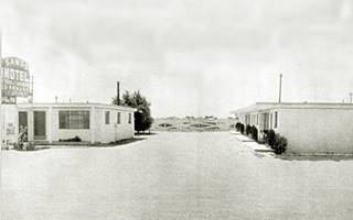
1950s picture of the Sands Motel, Moriarty NM. Source
Sands Motel
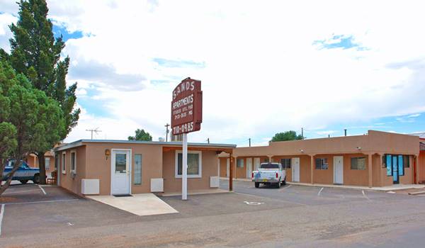
To your right, at 502 Route 66. It has an L-shaped layout with an office in the middle. It opened in 1954 with six rooms and was ran by Simms. In the late 1960s J. C. Alderson added more rooms to it. It has been neatly restored and repurposed as apartments.
1950s Gas Station
Across Route 66 at 407 Route 66, on the north side of the highway is 8 to 8 Auto Care, a garage that was formerly a gas station. The office on the western side of the property faces the now vacant pump island. The two service bays closest to the office have a sandstone veneer half way up the wall. The place appears in this aerial photo from 1953 (top). Its flat canopy with rounded tips style indicates it could have been a Chevron, Conoco, Mobil or Sinclair 1940s-50s station. This is its St. view.
Greene Evans Garage
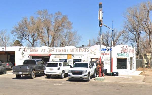
On the next block, to your right after crossing Broadway is a historic garage 601 Central Ave, Moriarty, NM.
Listed in the National Register of Historic Places
Also known as Jr's Tire Shop, this establishment opened between 1937 and 1940 as the Whiteway Garage, it also had a gas station. It belonged to a welder named Greene Evans. Later, c.1960s it became Jr tire shop. It retained its gas pumps until quite recently. It has a peculiar decoration on the walls' cornice and was built in a Southwest Vernacular style.(3)
Blackie's Place
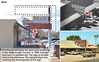
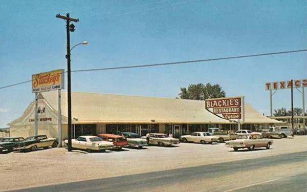
Across the street, to your left, at 612 Central Ave. is the Double C diner, a restaurant. It began in 1945 when Hubert Odell "Blackie" Ingram opened his "Blackie's Place" opened by Hubert Odell "Blackie". He ran it until his death in 1966 and his widow Norma Dilbeck kept it going for almost another decade.
It changed over the years as you can see in the images below. Actually it stood further east, occupying the now vacant lot on the SW corner of Broadway and Central Ave and the adjacent one, now occupied by the pharmacy. The original neon sign minus some parts (dashed line in the image -click on it to enlarge) has survived. The red arrows in the image show the surviving lower portion. The thumbnail includes this 1990 aerial photo, by then the Texaco had gone.
The current building (St. view) was moved further west, beyond the original site. The new Blackie's is built where the Sinclari, later a Texaco gas station once stood.
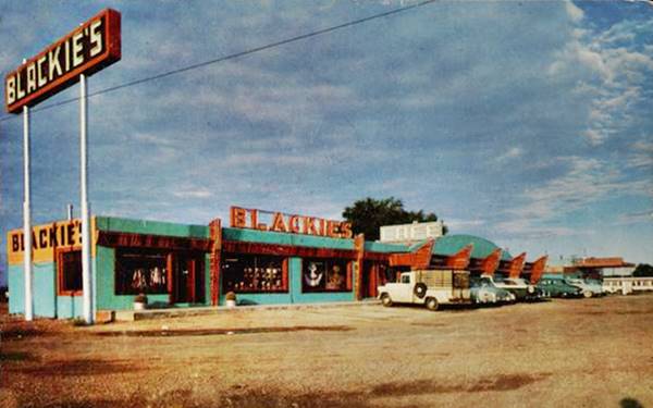
The 1950s postcard above tells us it was "Owned and Operated by Mr. and Mrs. H.O. Ingram - The Best food and the Largest Selection of Curios on Highway 66." The 1960s one below added the following text "Also handling Stuckeys delicious pecan candies." It also had the sign that has survived until now:
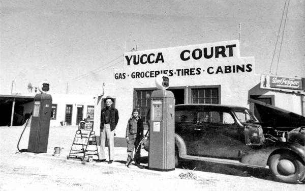
Yucca Motor Court (gone)
Opposite Blackie's, was another motel, torn down and replaced by the Dollar General store.
This motor court was mentioned by Rittenhouse in 1946, it was located on the NE corner of Harvard and Route 66 . Below is a vintage photograph showing the Phillips 66 gas pumps, and the sign of the motel "Gas-Groceries-Tires-Cabins". You can see it in this aerial photo from 1953.
To your left, following Blackie's is another motel.
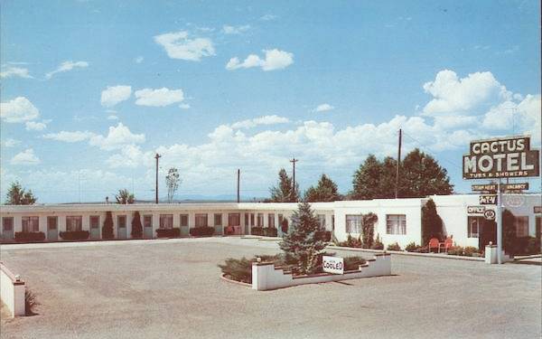
Cactus Motel
At 700 Central Ave. on the SW corner with Harvard, It was owned by Charles McPherson and his wife Maria, who opened it in 1952 after retiring from the Army in 1952. It had 12 units. Now it is a shopping mall. The postcard below adds: "... tile bathtub and shower combination, steam heat, air conditioning. Free television in rooms. Baby beds, cafe and service station."
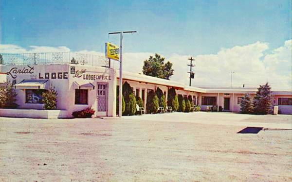
Lariat Lodge Motel
Following the Cactus is the Lariat Lodge motel at 708 Central Ave. Its postcard says it was owned and ran by Mr. and Mrs. E. K. Hanks, and had "11 modern units... TV - Good Restaurant - Texaco Service Station."
Phillips 66?
To your left, at 904 W Central Ave. the Nachos restaurant was a gas station at least since 1953 according to the aerial photos. The building was altered before 1990 (1990 aerial picture) but even nowadays you can see the two modified service bays on the left side of the property, and the office to the left. See its St. view
The office has an interesting feature, a canted window that has been replaced by a vertical one. This was a feature adopted by Phillips 66 in their "Rock Frame" design from the early 1950s. This design had large plate-glass window panes that were canted (or slanted) and used a curtain wall system combining glass and concrete blocks that were faced with rocks (hence its name "rock frame"). The idea behind canted windows was that they reduced the glare of car headlamps and increased the visibility and indoor light. Below we highlight the slanted window panes in the 1990s view of this property and a Phillips 66 advert from the 1950s. These windows were used on the later "Gull Wing" stations.
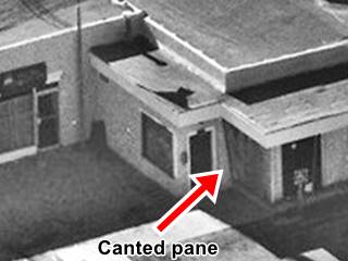
Canted pane in the 1990 aerial picture
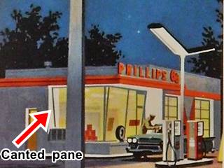
Phillips 66 advertisement. Notice the canted window pane.
Read more about Phillips 66 Rock Frame and Gull wing stations
Walts Garage
Ahead, on the next corner is another 1940s garage with streamline lines: a flat canopy with rounded edges held by slender steel tubes. A corner office with a curved multi-pane window corner, pump island and to the left, a two bay service area where now there is a mural. This began as Tillery's garage and filling station and during the 1990s was Walts Garage. See picture. And this 1990 aerial photo
Lazy J Motel
To your right, after passing Princeton St. at 911 W Central Ave. It had 8 units and was ran by Mr. and Mrs C. E. Bostwick, who owned it. The building from the 1950s is still standing, and like the Cactus and Lariat, it has added a gabled roof to the property. No longer open as a motel. Below is a "then and now" set of images:
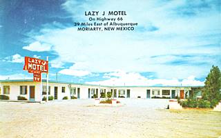
Lazy J Motel in 1960s. Moriarty NM. Source
El Comedor Restaurant
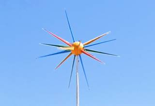
Across Stanford St. at 1005 Central Ave. was a classic Mexican food restaurant, now it is "Country Friends Antiques", with a Route 66 mural painted on its parapet. The sign reads "El Comedor" ("The Diner" in Spanish), de Gonzalez y Cabeza de Vaca. Mike Anaya opened it in 1953 as El Comedor de Anayas, Mike is an older brother of former NM Governor Toney Anaya.
Its main feature is the Rotosphere, a star-like ball, a Sputnik-satellite shaped object with two halves of its spherical centre counter rotating and lit up (pictured). Below is a classic 1980s view of the restaurant (2022 St. view)
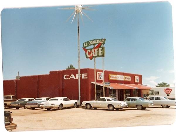
Mike's Friendly Store
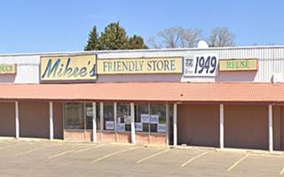
This store has been part of Route 66 since Mike Anaya (who also owned the El Comedor) opened int in June 1949 with his sister Manuelita "Cookie" and his brother-in-law, Owen Konz. It is to the left of the restaurant, at 1009 Route 66. Below is a Then and Now set of pictures. Funnily, the name on the billboard says "Mikee's" not "Mike's".
Mike Anaya was inducted into the New Mexico Business Hall of Fame in 2006. He also owned the Best Western Hotel.
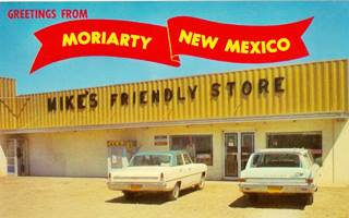
Mike's Friendly Store 1960s, Rte66 Moriarty NM. Source
Ponderosa Motel
Across from the store and the restaurant, to your left, at 1000 Central Ave, is another motel, The Ponderosa, with a "C" shaped layout, brick buildings and gabled roofs. It seems to be from the late 1960s or early 1970s. We haven't found any references older than 1980. St. view. It is still in operation.
Route 66 Shield
Drive west and as you reach the western tip of the town, to your right is a great red, white and blue Route 66 shield opposite the Moriarty Travel Center at 1691 W Central Ave. It makes a good picture.
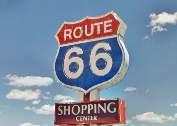
Just ahead, the original Route 66 alignment is cut by the access ramps to the freeway (orange line in our missing segments map). Turn on NM-333 to follow the original Route 66 westwards (map.) To your right, as you turn is another statue with the horses welcoming you to Moriarty.
Continue your Road Trip
Continue your Route 66 road trip by heading west into the next town, Edgewood NM.
Tours, outdoors and history
Salt Missions Scenic Byway
A circuit of 116 miles (roughly 2.5 hours of driving). See the Map of the Circuit.
The Salt Missions Scenic Byway follows ancient trails and trade routes that run from Tijeras in the mountains, to the plains.
From Moriarty head south along NM-41, which heads to McIntosh and Estancia. The railway linked them with Santa Fe. Lumber, wool and pinto beans were shipped from the McIntosh while Estancia was an ancient Native campsite with plenty of fresh water in the desert.
Next is Mountainair, established in 1902 with interesting buildings (don't miss Shaffer Hotel or Rancho Bonito).
From Mountainair you can take some side trips to visit ancient "pueblos" belonging to the Salinas Pueblos Missions National Monument: Abo ruins (9 mi. along US-60, west), Quarai (8 mi. north alog NM-55) and Gran Quivira (25 mi. south on NM-55). Full information at the visitors' center in Mountainair.
These pueblos traded salt (from the salt flats of Lake Estancia), squash, cotton and corn. They have the remains of Spanish Mission churches dating from the 1600s.
From Mountainair the road heads north (NM-55 and later NM-337) passing through the towns of Manzano (stop by at the Manzano Mountains State Park), Tajique, Chilili, Escobosa, and Yrisarri. Visit their catholic churches.
The byway enters Cibola National Forest (more on it below) south of Tijeras (ideal for hiking, camping or just taking in the scenery). At Tijeras, on Route 66, head east along Old Route 66, which is aligned along the trail used by Apaches to raid the Spanish settlements on the Rio Grande. You will reach Moriarty after completing the circuit.
Cibola National Forest
11776 Highway 337, Tijeras NM. (505) 281-3304. Official Website
The Cibola National Forest and National Grasslands spans several locations covering 1.6 million acres in New Mexico, Texas, and Oklahoma.
The areas nearest to Moriarty are the Sandia (described in our page on Tijeras), and the Mountainair Ranger Districts. Further west, between Albuquerque and Gallup is the Mt. Taylor Ranger District.
Manzano Mountains State Park
The park is 42 miles southwest of Moriarty (Map with directions).
Contact: Website.
A great place for hiking, birding, wildlife viewing and camping in the forests at the foothills of the Manzanos. There is a campground and RV Park.
Sponsored Content

>> Book your Hotel in Albuquerque

Credits
Banner image: Hackberry General Store, Hackberry, Arizona by Perla Eichenblat
Jack DeVere Rittenhouse, (1946). A Guide Book to Highway 66.


