Route 66 in Defiance NM
Index to this page
About Defiance, New Mexico
Facts, Trivia and useful information
Elevation 6,450 ft (1.968 m), population n⁄a.
Time zone: Mountain (MST): UTC minus 7 hours. Summer (DST) MDT (UTC-6).
Defiance is a small villagfe in McKinley county, 9 miles west of Gallup in western New Mexico on Route 66.
History
Central western New Mexico has been inhabited for over 10,000 years. During the historic period, the Navajo and Zuni people lived in this region and they were the first to encounter the Spanish in 1540, when an expedition led by Francisco Vásquez de Coronado's reached Zuni pueblo searching for gold.
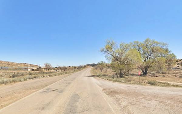
A view of old Route 66 in Defiance, New Mexico
As no gold was found Spain left it alone until 1597, when they returned and settled the area of the Rio Grande River and neighboring pueblos. The area close to what is now Gallup and Defiance was never settled during the Spanish Colonial period.
The Navajo people who lived in the area permanently raided the Spanish settlements. In 1821 an independent Mexico replaced Spain as the ruler of New Mexico, but had to cede the territory to the US after being defeated in the Mexican American War of 1846-48.
The U.S. decided to pacify the region and established a fort in what is now Arizona (at that time it was part of New Mexico), in Navajo territory: Fort Defiance. It served as a base for the expedition led by Lt. Edward Fitzgerald "Ned" Beale to open a wagon trail from Kansas to California in 1857 (this expedition used camels as pack animals).
The constant raids of the Navajo forced the Army to plan a military campaign against the natives. However the American Civil War broke before it could be carried out, so Fort Defiance was abandoned and another fort closer to more pressing military objectives was established near Grants in 1862, the Old Fort Wingate. The Navajo were defeated and finally constrained to the Navajo Reservation.
The fort at Defiance was reopened and Fort Wingate moved further west, to Wingate, just east of Defiance.
Fort Defiance and the Navajo Wars
Fort Defiance was established by Col. Edwin V. Sumner in 1851 as a military outpost in the Navajo territory. It was the first military post in what is now Arizona (in those days it was a part of the New Mexico territory). The site was chosen because it had very good grazing land around it.
The fort was in fact a "Defiance" to the war-like Navajo who were not allowed to use the pastures. They resisted and attacked the fort in 1856 and 1860. In 1861 the American Civil War broke out and the fort was abandoned as the Army retreated to New Mexico to face the Confederate threat.
This emboldened the Indians who intensified their raids on the New Mexican settlements. The new Commander in New Mexico, Brig. Gen. James Carleton clamped down on the Navajo and conducted an attrition war from the Old Fort Wingate near what is now Grants.
.The natives finally surrendered and were forced to march (the Long Walk) under dreadful conditions for 450 miles (720 km) to a camp near Fort Sumner in NM. The dreadful conditons of this internment place led to Carleton's replacement and the Navajo Treaty of 1868 allowed the Indians to return to their homes. The Navajo Reservation was created and Fort Defiance was reestablished as an Indian agency.
Now it is a village in the Navajo Nation in Arizona. (Map with Fort Defiance's location).
The military road that linked both forts passed by what is now Gallup, and it was the route chosen by the The Atlantic & Pacific Railroad (later the Atchison Topeka and Santa Fe Ralroad) to cross the Continental Divide in its route to California.
The name: Defiance
The station built here was named after the fort it supplied: Fort Defiance.
The railroad reached Gallup in 1882. At that time coal mines had been discovered to the north of the town and they gained importance because they would be used as fuel for the steam engines and also, the coal could be shipped out eastwards cheaply using the railroad.
When the tracks pushed further west, the station that was named Defiance in 1882 displaced Fort Wingate station and became the main shipping point for supplying Fort Defiance (26 miles to the NW). A wagon road linked the depot with the fort and the original Defiance railroad depot was built where the Pittsburg-Midway Mine railroad spur now meets the main line.
Defiance would be in replaced by Ferry Station (later renamed Manuelito) further west as the main station for supplying Fort Defiance.
The Navajo called Defiance "Gap in the Rocks", and it had a post office from 1881 to 1890.
In 1926 Route 66 was aligned through the area following NM state highway 6. Defiance appeared in the Rand McNally 1927 map of Route 66, as being 8 miles west of Gallup and 9 miles east of Manuelito on an unpaved but improved highway.
Route 66 was later replaced by I-40 as the main highway in the 1960s, bypassing Defiance on its south side.

Where to Stay: Find your Hotel near Defiance
There are plenty of accommodation options on Route 66 in neighboring Gallup so you won't have difficulty to book your room in that city:
> > Book your Hotel in Gallup
More Lodging Near Defiance along Route 66
Below you will find a list of some of the towns along Route 66 in New Mexico. Click on any of the links to find your hotel, motel or accommodation in these towns (listed from east to west):
On Route 66's Main alignment
The Santa Fe Route 66 segment
Eastwards
Westwards
>> There are RV campgrounds in neighboring Gallup
The weather in Defiance
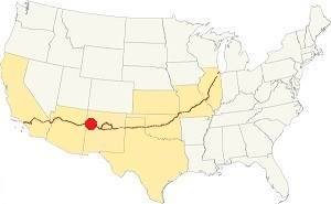
Location of Defiance on Route 66
Defiance is located in the high western region of NM; its climate is semi-arid with cold winters and relatively hot summers. Dry air and high altitude provide relief in summer: nights are cool, but in winter it makes the nights even colder. There is a large day-to-night temperature swing throughout the year.
The winter average high is around 45°F (7°C) and the average low is a "below freezing" 11°F (-12°C). The average summer high is 89°F (32°C) and the low is a cool 51°F (10.5°C).
Rain is not abundant; only 11.5 in (292 mm) per year and most of it falls between Jul. and Nov. (6.8 in, 173 mm); there are around 71 days with precipitation each year.
Snow is quite heavy: 30.4 inches (77.2 cm) per year; it falls at any time between Oct. and May, but mostly between November and March.
Tornado risk
There are no tornados in Defiance: McKinley County has no Tornado watches. The area west of this point has no tornado events at all.
Tornado Risk: read more about Tornado Risk along Route66.
Map U.S. 66 in Defiance New Mexico
Read the Detailed Description of this segment (Albuquerque to Lupton). Below is the interactive map:
>> Custom map of Route 66 in Defiance
Maps of Route 66
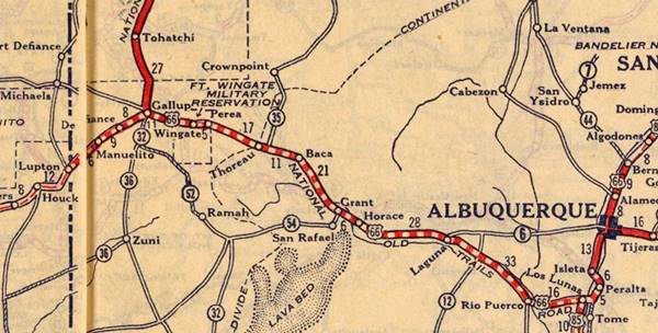
Route 66 runs westwards from the city of Gallup is the largest in the western New Mexico alignment of Route 66. for 10 mi. without any gaps until it reaches Defiance as shown in this US66 map west of Gallup to Defiance.
At Defiance, just east of the NM Gallup Port of Entry, U.S. highway 66 is cut by I-40 as marked with a blue line in our custom map. It resurfcaces on the south side of the freeway for only 1.3 miles (map) before being overlaid by the freeway once again all the way to Exit 8, where it crosses to the north side of the Freeway and the railroad to follow NM-118 westwards towards Manuelito. This gap is marked with a yellow line.
Route 66 Alignment near Defiance
With maps and full information of the old roadway.
- Lupton to Winslow (next)
- Albuquerque to Lupton (Defiance's)
- Santa Rosa to Albuquerque (previous)
Defiance: its Attractions
A long gone Coal Mining Town
Historic Context
Jack Rittenhouse wrote his Guidebook to Highway 66 in 1946 and mentioned the following spots along it west of Gallup. We have added the distance from Gallup in brackets, using the mileage given by Rittenhouse from Albuquerque.
[6 mi] Twin Butte Nazarene Navajo Mission...Gas station nearby... [7 mi] New Mexico Port of Entry (L). Trucks are inspected here. Gas station nearby...[10 mi] Defiance Trading Post. Gas here... At [12 mi.] is the Rocky Point Mercantile Co. Gas and grocery...[14 mi] HISTORICAL MARKER: CORONADO'S ROUTE. The text states that Coronado came through here Rittenhouse (1946)
Route 66 Road Trip Leg across Defiance
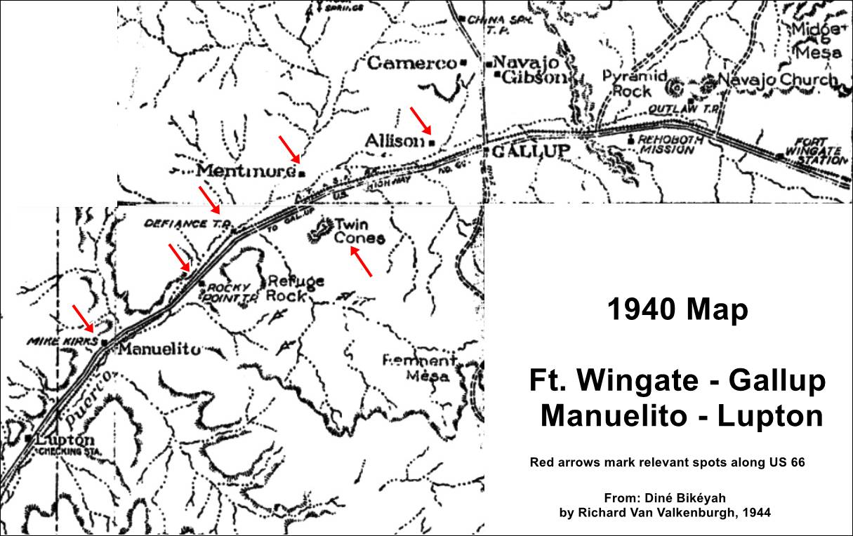
Gallup, Defiance, Lupton map from 1940 adapted from this Source. Click to enlarge
We will drive west along Route 66 from Gallup's western edge. The image shows a map from 1940 with the main landmarks at that time (click on it to enlarge), it will serve as a guide as we follow Route 66 westwards.
Twin Buttes Trading Post ❌
On old Route 66, about 4 mi. West of Gallup
This was a genuine Navajo Trading Post (they named it "Tsé Ndeeshgizh" or "Gapped Rock"). The post was established in the early 1930s on the original Route 66 alignment by Walter and Margaret Florence. It had six tourist cabins. In the late 1940s, they moved to a new spot on US 66 after it was realigned. After Florences death, Walter gave up and sold it in the late 1950s. They both appear in the 1940 census aged 51 and 46 respectively with their "Adopted Son", a Navajo, Saming Florence, age 7 on "Highway 66."
The address is given as c. 4 mi W of Central Gallp on "old Route 66" (1), and based on this 1952 aerial photograph and the distance from Gallup, the trading post was located behind the Gallup Red Roof Inn parking area (map). These aerial photographs show what may be the original dirt surfaced highway that carried Route 66, it runs close to the railroad and west of Mentmore, skirts the rocky foothill of the mesa that the later alignment cut through. We mark this presumed roadbed with an orange line in our custom map.
Their original store burned in 1942 and they also had 6 tourist cabins. They built a simple woodframe store which they hauled to the new Route 66 alignment.
Below we will also describe the "villages" (almost ghost towns) that lie between Gallup and Defiance close to US66:
Allison
A ghost town
Allison (Location map) is 2.8 miles west and north of Gallup; see this map from Gallup to Allison (with directions).
It was, as most of these small villages to the north and west of Gallup, a coal mining town. Nowadays it has about 500 residents living in scattered trailer houses and the remains of company houses dating back to the 1920s.
It was named after Fletcher J. Allison, who bought the mining stake in 1897 and sold it in 1917 to the Diamond Coal Co. who owned the town. It provided the housing and services for its workers. It wasn't located on Route 66 but half-a-mile north of it, at the height of Gallup's airport.
Allison to Twin Buttes
The AT & SF railway had a depot here between Allison and Twin Buttes, named West Yard 4.3 miles west of Gallup station. It served as a coal shipping point from the mines.
Further west, after crossing I-40 which here takes a wide "S" and passes to the south side of US 66 you will reach Twin Buttes:
Twin Buttes
Twin Buttes is 5.3 miles west of Gallup; see this map from Gallup to Twin Buttes.
In his 1946 Guide Book to Route 66, DeVere Rittenhouse mentions the "Twin Butte Nazarene Navajo Mission" and a "Gas station nearby" 6 miles west of Gallup.
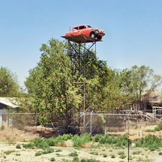
Car atop a tower
There is an old car (it looks like a 1960 Ford Anglia) on a platform on the top of a tower roughly 4 stories high, on the right side of the highway as an eye catcher for the local junkyard.
Nazarene Mission
To see the changes in the area, see this aerial photo from 1952 that shows the church and mission and the gas station (?) just west of Crest View Rd. not many buildings in the area.
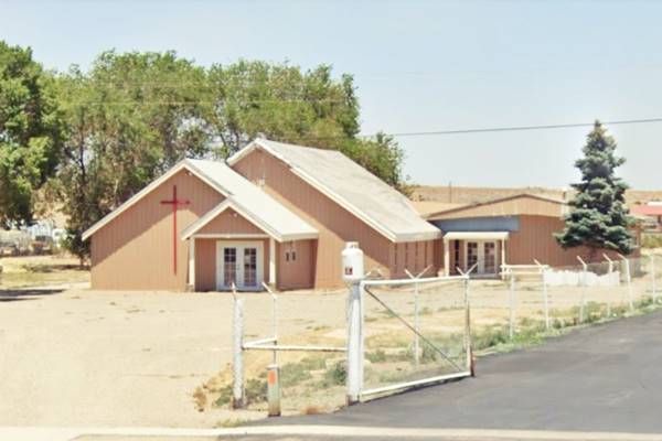
The Nazarene Church is on the north (right) side of the highway, pictured below:
Nazarene Church, Twin Buttes on the old alignment of Route 66
The Twin Buttes landform
Looking south you will see the "buttes" that gave the place its name. Rittenhouse wrote that "'Butte' is pronounced like the first syllable in 'beautiful' and Webster defines it as 'a conspicuous hill or natural turret'."
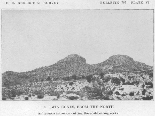
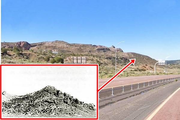
Beyond I-40 is a lumpy hill, which formerly had two summits and was therefore named "Twin Buttes". It is a volcanic neck, one of many in the Navajo Volcanic Field. During the construction of I-40 basalt was mined from this hill for road aggregate, as rock extraction continues, the hill is gradually being consumed and is a shadow of its former self.
Butte
A Butte is an isolated hill with sheer steep sides and a relatively flat top; they are a small type of mesa or plateau. This is a Street View of the Twin Buttes from the East.
They were also known as "Twin Cones" due to their volcanic origin. Its eastern peak is 6,838 ft. (2.086 m). NM 26 runs on the east of the hills and I-40 runs in front of them. The Twin Buttes Wash flows along its western flank draining into the Western Rio Puerco River.
Two Cones seen from the North in 1925
The following image shows them as they were in the 1970s, and as they are now.
Twin Buttes are being whittled away. Then and now.
Mentmore
North of the Nazarene Mission is Mentmore (Map showing its Location), 5.9 miles west of Gallup; along Route 66.
Altitude 6,405 ft. (1.953 m.) Pop. n⁄a.
Mentmore, the meaning
Mentmore is a parish in Buckinghamshire, England, and the name is an Old English name that means "Menta's Moor". It was recorded in the Doomsday Book in 1086 as Mentmore.
Mentmore is a small village located on the south side of the tracks of the former Atchison Topeka & Santa Fe Railroad (AT & SF), and of Route 66 now NM-118; it is north of I-40. Further north, beyond the tracks is the Western Rio Puerco River, Torrivio Mesa and the former coal mines.
The Dilco Coal Mine belonging to Direct Coal Company opened a mine there in 1913, and named the place "Dilco". But three years later, when the post office opened, it did not use the name Dilco. Instead it used Mentmore, of unknown origin.
Defiance Coal Company
In 1918 the mine and another one just one mile north of it named Morris Mine, were acquired by George Kaseman, who renamed the combined mining operation "The Defiance Coal Company".
The mine covered 320 acres and had a narrow gauge railroad (40 inches between the tracks) with two steam engines that shunted the coal in "pit cars" along a 20 mile-long system both underground and on the surface. The coal yard was located at Mentmore where the cargo was shipped out via the AT & SF railroad.
One of the mine's steam locomotives, the "Porter No. 1" and some ore cars survived being scrapped after the mine closed, and are now on exhbition at the Rail City Historical Museum in Sandy Creek New York. A very long way from their original home in New Mexico.
Hollywood trivia in Mentmore
Many Cowboy movies were shot in Gallup in the 1940s, the desert, and red sandstone were an exciting backdrop for the films.
One was filmed in Defiance in 1943, but it was not a western, instead it was a musical with a World War II moral-boosting theme: a group of desert bandits fight the Nazis who want them to work on their railroad.
The film, "Desert Song" was shot using railroad equipment from the Defiance Coal Co. It was directed by Robert Florey and starred Dennis Morgan, Irene Manning, Gene Lokhart and Jack LaRue. It was nominated for "Best Art Direction".
A view of Mentmore, Route 66, New Mexico
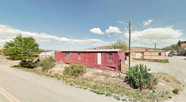
The small coal mining town had around 500 residents and the mining company provided housing for its employees as well as a post office, elementary school, a company store and a power plant.
In 1952, the mines became exhausted and the company folded. Mentmore became a shadow of what it was. The townsite is now privately owned and has a scattering of houses and old caravans used as permanent homes the streets are named after Greek letters.
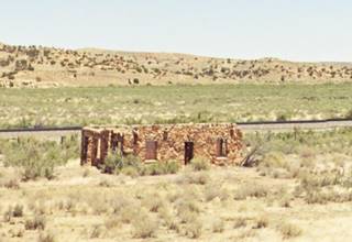
Rittenhouse mentions a truck inspection post on the south side of the highway one mile west of the Nazarene Mission, nothing remains of it. But further ahead you can see a stone building on the old Route 66 alignment, to your right, close to the tracks (where the old highway ran). See image of the ruins.
Defiance
Route 66 reaches Defiance 9.1 miles west of Gallup, a few scattered houses.
Defiance Trading Post
Just ahead you reach another trading post. It was mentioned by Rittenhouse in 1946; you can see it in this aerial photo taken in 1952 shows the building on the north side of the highway, to your right.
Over the course of the years, there were two trading posts here, the first one, about 0.25 mi. west of the later one, opened in the 1890s and lasted till around 1918. D. M. smith ran it and had developed and later sold a coal mine here. He returned to Defiance to open a trading post aroun 1893 but was killed by some Navajos over a drunk-gambling brawl. Later it was ran by John Golino who died in the influenza pandemic of 1918 (1).
The second trading post opened c.1935 on the new Route 66 and closed when it was bypassed c.1955. It was owned by Thomas and Violet Kilpatrick who appear in the 1940 census aged 42 and 40 respectively with their three sons and daughter aged 17, 9, 5 and 3.
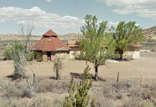
They catered to the local Navajos and to those traveling Route 66. They had two gas pumps. The Kilpatricks built the post as a large sandstone hogan with a conical roof, it had two pumps in front. A hogan was a traditional dome-shaped Navajo dwelling, built in adobe, logs or stone.
The foundations are still visible and in the 2012 picture below you can see the trading post.
Ahead the original roadway is cut by I-40 as marked with a blue line in our custom map. It resurfcaces on the south side of the freeway, this is the map with directions to reach the south side of I-40 and drive the old roadway.
The highway crosses Saltwater Wash using a bridge built in 1949. It replaced an earlier bridge from the mid 1930s when the highway was paved which in turn replaced an even older bridge on the dirt surfaced original 1926 Route 66.
After 0.9 mi. you reach a point where the mesa to your left approaches the highway. This is Rocky Point.
Rocky Point Mercantile ❌
This map marks where the Rocky Point Mercantile was located. Rittenhouse mentioned it in 1946. It had a grocery store and gas. You can see it in this aerial photo taken in 1952. When the four-lane freeway was built in the late 1950s, it ran stright through the property and it was torn down.
The original Route 66 continues west skirting the Rocky Point mesa but is overlaid by the freeway as shwon in our map marked with a yellow line. After 1.3 mi. reaches the Puerco River. The current bridge on the frontage road never carried Route 66. The highway ran a bith further north and is buried by the Interstate.
Puerco River Bridge
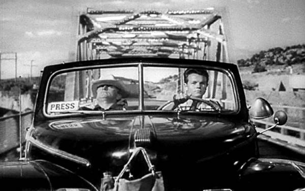
The highway crosses the river here (it will cross it again in Winslow Arizona) but is now overlaid by the Freeway. The current bridge was built in 1962 and now carries the westbound lanes of I-40, but there was a previous one dating back to the 1930s, a steel one that was built when the highway was paved, this 1962 aerial photo shows it carrying the westbound lanes of I-40, and this 1952 aerial photo shows it on the 2-lane Route 66. It appeared in the movie "Ace in the Hole Movie" starring Kirk Douglas and Jan Sterling shot in nearby Manuelito and released in 1951 (2).
The Historic Marker of Coronado's Route has vanished. Based on the mileage given by Rittenhouse it seems to have been obliterated when the freeway was built. This is the map marking the spot.
Ahead the highway crossed the railroad using an overpass.
Continue your Road Trip
The overpass marks the end of your journey through Defiance. Continue your road trip by heading west along Highway 66 into the next village: Manuelito NM
Sponsored Content

>> Book your Hotel in Albuquerque

Credits
Banner image: Hackberry General Store, Hackberry, Arizona by Perla Eichenblat
Jack DeVere Rittenhouse, (1946). A Guide Book to Highway 66.
Field Guide: Northern Colorado Plateau, J. Keith Rigby 1976
Source on Trading posts.


