Route 66 in Grants NM
Index to this page
About Grants, New Mexico
Facts, Trivia and useful information
Elevation: 6,460 ft (1.969 m). Population: 8,908 (2025).
Time zone: Mountain (MST): UTC minus 7 hours. Summer (DST) MDT (UTC-6).
Grants is the county seat of Cibola County in western - central New Mexico, its motto is "City of Spirit", and it was also known as the "Uranium Capital of the World" and "Gateway to Lavaland".
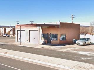
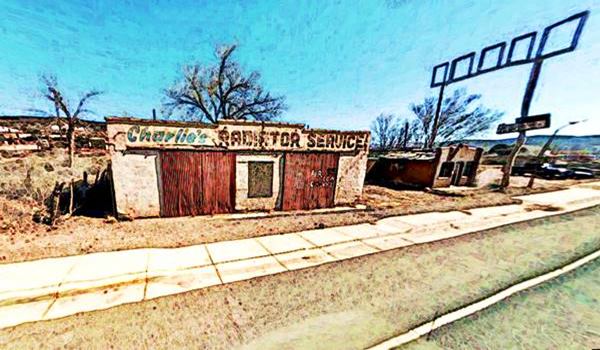
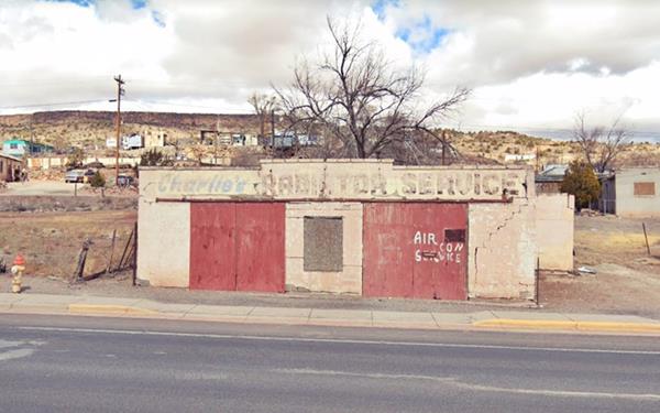
Old abandoned Charley's Garage on Route 66, Grants New Mexico
Human beings have been living in this area for over 10,000 years. Over the millennia their Native American descent became farmers and used the water of the rivers that flowed from the Rocky Mountains to irrigate their crops.
The first Europeans to reach the area, were those of the expedition of Francisco Vásquez de Coronado, who visited the nearby Zuni and Acoma pueblos in 1540; the Spanish returned and occupied the area to the east (Laguna) in the early 1600s. A revolt in 1680 expelled the conquerors, but they returned in 1693, to defeat the natives.

Angus A. Grant c.1900. Source
This area on the western side of the San Jose river basin was not settled during the Colonial period due to the constant raids of the Navajo Indians. New Mexico became a part of Mexico upon its independence from Spain in 1821, and then part of the U.S. after Mexico ceded it following defeat in the Mexican-American War of 1846-48. The Navajo raids were finally crushed with the presence of the U.S. Army at nearby Fort Wingate (1862-1864), opening the area to settlement.
The first settler here was Antonio Chávez, who lived on the south side of the San Jose River in the 1860s. He planted cottonwoods by the river. In 1872, Jesús Blea settled there too and named the place "Los Alamitos" (Spanish for "The Little Willows", in alluson to the cottonwood trees) he was followed in 1873 by Ramón Baca and his family.
The name, Grants
The Atlantic & Pacific Railroad extended its tracks into the area in the early 1880s, the contractors who were in charge of builiding the line were three Canadian brothers, Lewis, Angus and John Grant.
They set up their base at Los Alamitos which then became known as "Grants Camp". A depot and coaling station were built there because it was halfway between Gallup and Albuquerque. The stop was named "Grants Station". A post office opened in 1882 and was named "Grant" (without the final "s"). Finally in 1935 it changed its name again, to Grants (with the final "s").
The postcard shown below incorrectly stated on its back that: "was named for President Ulysses S. Grant when he was General of the U. S. Army. Today, Grants (the S being adopted)..."
Boomtown: Logging, Farming carrots, Uranium and Lavaland

Vintage 1942 postcard of Grants. Source. Click to enlarge
The Atchison Topeka and Santa Fe Railway acquired the A&P Railroad and built a roundhouse to the west of Grants at a site known as Breecetown after the local logging magnate Breece.
Logging in the Zuni Mountains to the south was the main business in Grants but after the Bluewater Dam was built in 1927, irrigation allowed farming and Grants was named the "Carrot Capital" of the U.S.
At that time (1926), Route 66 was created and aligned through Grants along the National Old Trails Road between New Mexico and California.
Uranium ore, with a characteristic yellow color was discovered by a local Navajo shepherd, Paddy Martinez at the foot of Haystack Butte 1950. This led to a mining boom, the creation of the neighboring town of Milan and an excessive use of water for ore processing -which wiped out farming. Population tripled and a radio station, a General Hospital and Job Corps training facility opened in the late 1950s. The mining cycle ended with a bust in the 1980s.
Now "Lavaland" is another nickname, due to its proximity to the scenic lava flows of El Malpais (bad lands).
In 1981, a group of local citizens lobbied with the Legislature of New Mexico and Cibola County, the third youngest in the United States was created. They western tip of Valencia County was assigned to it, and Grants was designated county seat.
Grants' Native Names
The native Navajos remember that a group of their tribe was massacred at Grants during a Comanche raid. They called the place N'ahto-Si-Ka'I "white smoke" or "friendly smoke" probably after a fumarole or because a peace treaty had been signed there between Chief Manuelito and Kit Carson.
Christopher Houston "Kit" Carson (1809 - 1868) was a legendary American frontiersman, guide, Army officer. Chief Manuelito (1818 - 1893) was an important Navajo leader who resisted the onslaught of the U.S. Army and fought for his people's freedom. Learn more about him at our page on Manuelito, NM.

Where to Stay: Find your Hotel in Grants
There are several lodging options on Route 66 in Grants itself, you won't have difficulty to book your room:
> > Book your Hotel in Grants or Gallup
More Lodging Near Grants along Route 66
Below you will find a list of some of the towns along Route 66 in New Mexico. Click on any of the links to find your hotel, motel or accommodation in these towns (listed from east to west):
On Route 66's Main alignment
The Santa Fe Route 66 segment
Eastwards
Westwards
>> There are RV campgrounds in Grants.
The weather in Grants
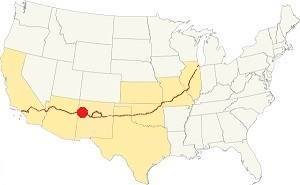
Location of Grants on Route 66
Grants is located in a sunny, dry, relatively high and arid region nestled between mountain ranges close to the continental divide. Winters are cold and summers hot. There is a large day-night temperature swing.
The average high in summer (July) is around 91°C (33°C), and the average low is 57°C (14°C). The average high in winter (Jan) is 49°C (9°C), while the avg. low is only 15°C, well below freezing point (-9°C). Only 10.5 inches of rain fall each year (266 mm) and July, August, September and October have most rain (5.6 in - 143 mm).
Snowstorms may strike during winter and on average 11 in. of snow fall each winter (28 cm).
Tornado risk
There is virtually no tornado risk in Grants: Cibola County has no Tornado watches. The area west of this point has no tornado events at all.
Tornado Risk: read more about Tornado Risk along Route66.
Map U.S. 66 in Grants New Mexico
Read the Detailed Description of this segment (Albuquerque to Lupton). Below is the interactive map:
>> Custom map of Route 66 in Grants
Maps of Route 66
Driving west from McCartys, the original roadway reappears as NM-117 at Exit 89, on the North side of the Freeway.
McBride Rd.
Route 66's alignment from 1936 to the 1950s ran along NM-117 with a SE to NW to Horace where an overpass was built to carry it across the railroad. Here it turns west and runs parallel to the railroad one-quarter mile north of it, until it reaches the outskirts of Grants.
This is the map from Exit 89 into Grants
Another Early alignment
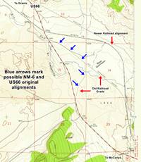
Just north of Exit 89, there is a trail heading straight north (white line in our custom map), and Jim Ross places some culverts and a bridge here (see it in our custom map); he describes the bridge as follows: "Timber bridge on the 1926 unpaved alignment over the Rio San Jose east of Grants. Date Built: Unknown. Type: One-lane, 3-spanTimber Stringer with concrete piers and abutments. Status: Abandoned; restricted access; on Acoma Tribal land."
The 1957 USGS map of Grants quadrant marks this trail as part of an "Old Railroad Grade." This seems to have been abandoned in the 1900s and may have been used to carry State Hwy 6 and the first US66 into Grants without the need to build an embankment or bridges. Click on the thumnail image map to enlarge it.
The custom map's white line west of the bridge is hypothetical and only follows the old railroad grade.
The original Route 66 in Grants from 1926 to the 1930s (1) left the town along the south of the railroad along San Jose Drive, a winding road on the south side of the San Jose river that crossed the early Hispanic settlment of Alamitos. It left Grants along Third St., with a grade crossing. The western tip of this segment is gone. See the pink line in our custom map.
Route 66 Alignment near Grants
With maps and full information of the old roadway.
- Lupton to Winslow (next)
- Albuquerque to Lupton (Grants')
- Santa Rosa to Albuquerque (previous)
The Santa Fe Loop (1926 - 1937)
Our Santa Fe Loop page describes the complete 1926 to 1937 alignment of Route 66 from Santa Rosa to Albuquerque through Pecos, Santa Fe and Bernalillo.
Grants: its Attractions
Landmarks, Route 66 sights
Gateway to Lavaland
Historic Context
Jack Rittenhouse in his classic "Guidebook to U.S. Highway 66" published in 1946 gave an interesting description of the lava flows of the El Malpais National Monument (the Spanish words "Mal País" mean: badlands.) and El Malpais National Monument. He mentioned Grants as follows:
...hotels: California and Yucca; courts: Lakeside, The Encanto, Kimo, Grants and Zia; garage: Conley; stores; cafes; all facilities... Mike Croteau's Trading Post is an interesting place... Rittenhouse (1946)
Your Route 66 Road Trip leg across Grants
Horace - Stuckey's
We will begin this segment of your road trip, by driving westwards from the lava fields at McCartys, at what is now I-40s Exit 89 in a spot known as Horace, by Horace Springs at the foot of Horace mesa. Here Frank and Hope McClure opened their Stuckey's franchise "Pecan Shoppe" in 1967; it was their second location because they owned anoter at Rio Puerco but it was torn down when I-40 was built. The original building with its characteristic roof is still standing. Their postcard reads: "4 miles east of Grants... Located in the heart of the lava beds... The lava flow Stuceky's is built on occurred about 1,000 years ago."

Stuckey's at Horace NM vintage postcard. Source. Click to enlarge
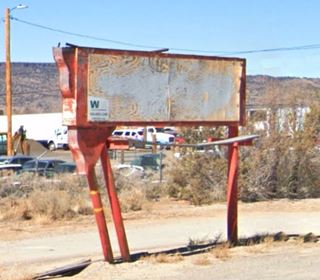
Sahara Drive In neon sign
Drive west along the old Route 66 and on its eastern outskirts at 1570 Mc Bride Rd (old US 66) are the remains of the local drive-in theater's sign, the "Sahara". It was owned by J.C. West, who also owned the Lux theater in downtown and the Trail Drive-In in neighboring Milan. It opened in 1958 and could accommodate 400 cars. It closed in 1964.

Sahara c.1960 neon sign Source
Canton Cafe
The town's first buildings in the 1940s and 50s appeared after Halsey St., but in the early 1960s, motels sprung up further east. And and also a Chinese restaurant, Canton Cafe, whose 1970s postcard shows it has changed little, and its neon sign has remaind intact. To your right at 1210 E Santa Fe (Street view).

Canton Cafe c.1960s. Source. Click to enlarge

Canton Cafe sign nowadays. Source. Click to enlarge
Travelodge
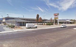
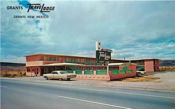
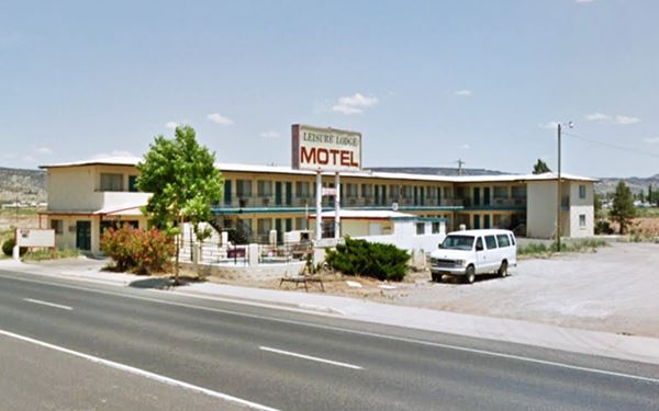
Next door, yo your right, at 1208 E Santa Fe is the former Travelodge that offered "Electric Heat - Room phones - TV - Pool - Ref. Air" and 33 rooms in "Grants Newest Motor Hotel." Still standing but closed, its sign reads "Leisure Lodge Motel". Below is a "Then and Now" set of pictures.
Western Host Motel
To your left, on the next block, at 1150 E Santa Fe was the Western Host, with 50 rooms and a heated swimming pool. More recently it was the now closed Historic Route 66 motel with its pool filled in.

Western Host Motel c.1960s. Source. Click to enlarge
Desert Sun Motel

The Desert Sun 1960s postcard. Source. Click to enlarge
An arsonist set it on fire in Jan. 2022. To your left at 1121 E Santa Fe.
The swimming pool has gone, and the neon sign modified; it had a U-shaped layout, gable roof around a central courtyard.
Below it is pictured before the fire.
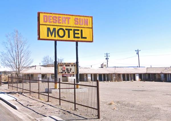
Franciscan Cafe
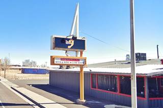
Ahead, at 1109 E Santa Fe, to your left where Pizza 9 is now located -before that it was the Outlaws Saloon and Dance- once stood the Franciscan cafe, part of the adjacent motel complex. You can see it in the 1958 advertisement below. The same neon sign has survived over sixty years (red arrow).

1958, Cafe on US66, Grants. Source. Click to enlarge
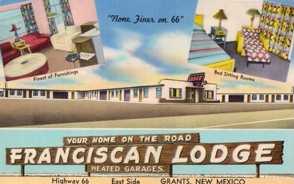
Franciscan Lodge ❌
Ahead to your left at 1101 E Santa Fe was the Franciscan Lodge motel. It was torn down in May 2023, another lost classic on Route 66. It had a T-shaped layout with its office and cafe in the central spar of the T. Its postcard below reads "This beautiful new Motel (Completed September 1950) offers unsurpassed accomodation in large, comfortable rooms... "The Best Costs No More".
The image below shows the motel before it was razed:
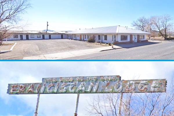
The Franciscan had been built and designed by Auro Cattaneo, a contractor from Gallup NM. He had also designed the Bluewater Motel (Bluewater NM) and in 1959, the Desert Skies Motel in Gallup. A newspaper article tells us that in 1952 it was owned by Mr. Nestor E. King and his wife, from Dallas Texas. He operated the furniture stores in Texas and his wife ran the motel in Grants. Their daughter Rhetta Mike King mentioned that the long horizontal neon sign originally stood on top of the building until her parents installed the pitched roof and placed it in the eastern courtyard on top of three poles. She added that "I sold all signs to an out of town museum that was in construction before Covid, maybe I will get to see them again, restored" (1).
This museum is the Glorieta Sation Neon Park in Albuquerqe. There are photographs showing the Franciscan's office sign there, awaiting restoration:

Franciscan neon sign at Neon Park. Source. Click to enlarge

1950s advert of the Kings motels on US66, Grants, Milan and Bluewater. Source. Click to enlarge
The Kings also owned the second Franciscan in neighboring Milan, and Bluewater Motel n further west along Route 66. Peggy and Cal "Toad" Cowell ran the Bluewater Inn for the Kings in the 1960s.
Torn down and gone!
The landmark is no longer there, it was torn down in May 2023. The tall sign has also gone and only the three poles and the sandstone doorframe of the office remain standing.

Franciscan lodge site after demolition, 2023. Source. Click to enlarge
Into Grants downtown
Sebedra's Pueblo Texaco
Opposite the Franciscan, to your right, at 1100 E Santa Fe was the East Pueblo Texaco Servkce. It appeared in the 1956 phone book. An advert from 1973 says it was managed by "Sonny" Sebedra. Pictured above.
Next to it (right) was the now gone Paulson's Sinclair station at 1104 E Santa Fe.
The Lariat Lodge - now South West Motel
To your right, after the Texaco at 1000 E Santa Fe, is a U-shaped, gable roof single story motel formerly The Lariat Lodge, now the Southwest. It had "24 comfortable and attractive units with the finest furnishings". Further down is a "Then and Now" view of the motel.

The Lariat Lodge 1950s postcard. Source. Click to enlarge
Grants Motel ❌

Grants Motel, 1950s. Now gone Source. Click to enlarge
Opposite the South West Motel, to your left, at 1009 E Santa Fe was the Grants Motel with a great neon sign. It was owned and hosted by Dale and Shirley Edmundson. It had "16 - Clean Comfortable Units." Torn down years ago, now it is a Self Storage business. Neon sign lost.
Just aheaed, on the corner with McArthur St. there are three classic Route 66 sights: a motel and its neon sign, and an old garage & gas station.
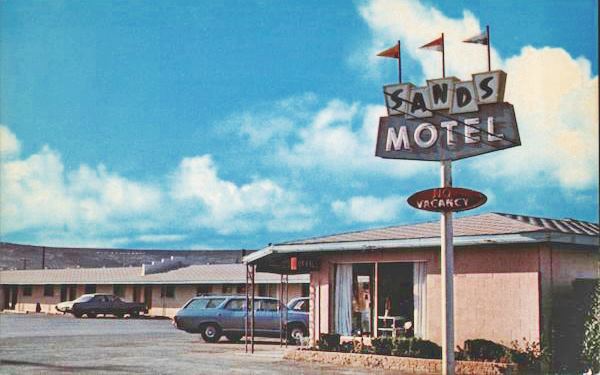
Sands Motel and Neon Sign
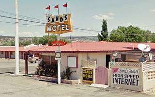
Sands Motel Neon Sign
The motel was half a block north of the highway, on McArthur St. so a flashy eye-catching sign was needed, and the result was this awesome classic neon sign, to your left, pointing the direction with a red arrow:
Sign of the Sands Motel on Route 66, Grants New Mexico
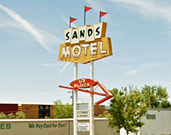
The Sands Motel
Still open. You can visit their website to book your room.
As the arrow said, it was 1⁄2 block off Route 66, to your right, along McArthur St. It was owned by Jim and Billie Shue and Leon and Cecile Koch, who also managed it. Their postcard promised "Modern, New Carpeted Rooms, Restaurant, Cocktail Lounge & Service Station. Free TV's & Telephones in all rooms... Quiet - Relaxing - Off the Highway." The motel has another great original neon sign and you can see it in the "Then and Now" images.

Back to Route 66
Crosby's Chevron
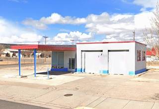
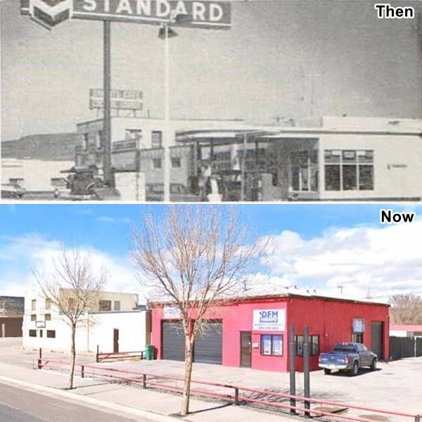
Head back to the main highway, to your right, on the NW corner of McArthur and E Santa Fe (938). This was Chuck Crosby's Chevron service station, open 5 AM to 11 PM. Below is a "Then and Now" sequence of the old gas station. The two service bays remain. The office has been walled in, the canopy gone.
Grants Cafe

Grants Cafe advertisement. 1950s. Source. Click to enlarge
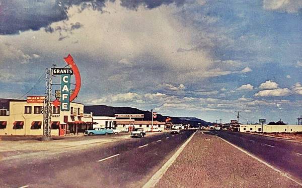
Next door, to your right at 932 E Santa Fe (You can see it in the image above: the two story building to the left), was Grants Cafe and Cocktail Lounge.
The cafe opened in 1937 and the sign went up in 1958. It is pictuered below, in 2018:
Grants Café neon sign in 2018.
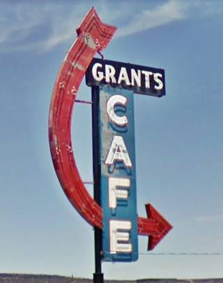
The sign was restored under the neon preservation project sponsored by the NM Route 66 Association, the National Park Service and New Mexico Historic Preservation Divison only to be removed in 2019, purchased by a collector. The old cafe and bar are still standing.
Grants Café and its now gone neon sign are on the left.
Wayside Motel ❌
The Wayside Motel stood on the south side of the highway, razed in 2018 (Current view of the premises).
The motel dated back to the 1930s when it was known as the Grants Motor Lodge.
It was located at 923 E Santa Fe, to your left. Nothing remains of it.
It is pictured below while it was still standing.
Wayside Motel on Route 66, Grants New Mexico in 2016
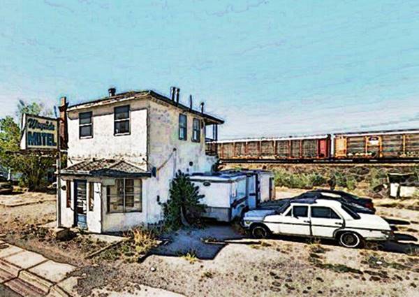
The two story office was added at some later period. The 1940s postcard shows its U-shaped layout with a single story central office. It had 16 rooms with "Wall to Wall Carpeting - Ranch Style Furniture - Inner Spring Mattresses," and a "Next door a new and modern Shell Super Service Station."
Later it became the "It'll Do Inn", and the second image below shows that it had the second story at that time. The neat shutters on both sides of the window of the left unit can be seen in both images.

Grants Motor Lodge 1940s postcard. Source. Click to enlarge

It'll Do Inn, Grants 1970s. Source. Click to enlarge
On the now vacant NE corner of Nimitz at 900 E Santa Fe was Gilbert's Texaco Service, Gilbert Savedra was the brother of "Sonny" Sebedra -owner of the Texaco further east. Notice how their surname's spelling was distorted: Savedra in Spanish sounds the same as Sebedrea in English!
Starlite Cafeteria
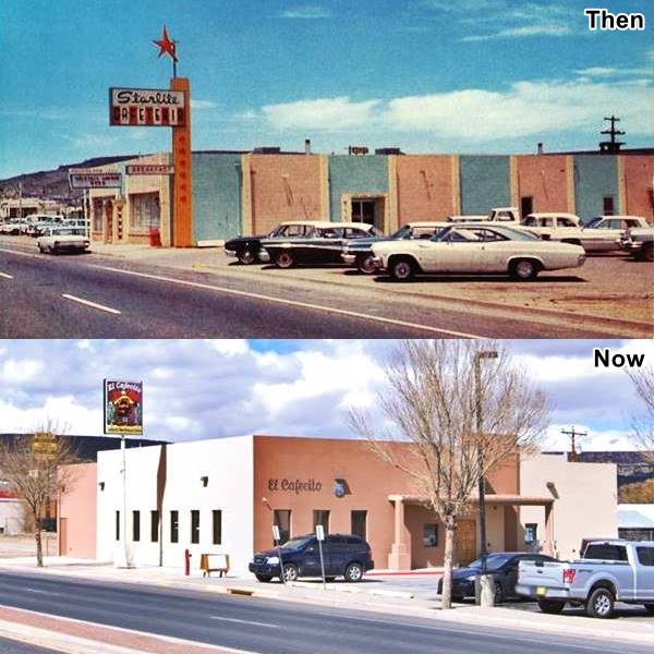
To your right, at 820 E Santa Fe where the El Cafecito Mexican restaurant is now located, was the site of Dougherty Cafeteri in the early 1960s that in the mid 1960s became the Starlite Cafeteria. Mr. and Mrs. Pablo Pena owned it and they opened from 6 AM to 9 PM daily. The entrance from Santa Fe was direct entry to the bar, the side entrance led to the dining area. It hada a dancing area that opened on Friday and Saturda. A fire struck it in 1982. Its great neon sign is gone. Below is a "Then and Now" view of the spot.
Laguna Shell Service Station
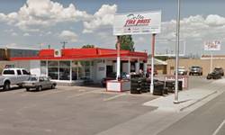
Opposite the cafeteria, to your left at 833 E Santa Fe is Delta Tire, that prior to its recent refurbishing that modernized it and did away with the canopy, it looked like a typical 1960s gas station with a plate glass corner office and four service bays. There was a flat canopy over vacant pump islands too. It was a Shell.
Brummett's ⁄ Fank's Mobil
On the next block there were two more service stations, both are still standing.
On the NE corner with Bradley (right), at 800 E Santa Fe is the first, a former Mobil filling station that changed its name over the years: Brummett's and then Frank's. Pictured below with its 1966 advertisement.

1966 advert, Frank's Mobil. Source
Polich's Shamrock
The second gas station is across Bradely, on the NW corner, at 720 E Santa Fe: Polich's Shamrock Service Station. Pictured below (2).
Whiting Bros Gas Station ❌
Across the street, on the south side of Route 66 at 719 E Santa Fe was a Whiting Bros. Station, torn down; now it is a parking lot (2).
B&B Gulf ❌
On the corner of Patton and E Santa Fe (which one?) It offered Complete Auto Service and was owned by Epimenio "Pino" Brito. See its 1966 advertisement below.

1966 advert, B & B Gulf. Source
Duck's Humble
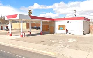
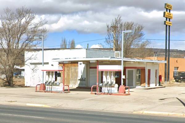
On the next block is a surviving gas station, at 600 E Santa Fe (left), neatly painted, with a flat canopy over an empty pump island with its two service bays to the right and plate windows on the corner office. Pictured above, it was Duck's Humble service station in the 1966 phone directory.
To your left, at 515 E Santa Fe was Reynolds Chevron Service Station, later Kramer Chevron ❌ (2).
Lavaland Motel

Luna Court and Mobil station, c.1940 Grants. Source
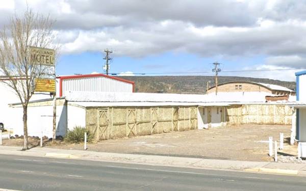
After crossing Charles St., to your right, at 416 E Santa Fe is what remains of the Lavaland Motel.
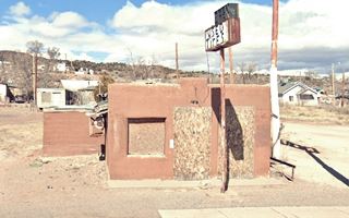
It had an L-shaped layout on the corner; the verandah has been boarded in but its sign facing the highway has survived. In the 1940s it was Luna Court and had a Mobil station on the corner as you can see in the vintage photograph -click on it to enlarge.
Downtown
The next block to the east with the 200s and 300s of East Santa Fe had two relevant Route 66 buildings, both of them long gone:
Mike Croteau Trading Post ❌
Rittenhouse mentioned it in his 1946 guide as "an interesting place, and Mike himsefl is full of unusual anecdotes for those who come to know him."

Aerial photo 1958, Grants NM Source

Aerial photo 1958 part 2, Grants NM Source
The images above were taken by Lee Marmon in 1958. We have marked the Trading post, Phillips 66 station, Railroad Depot and the California Hotel.
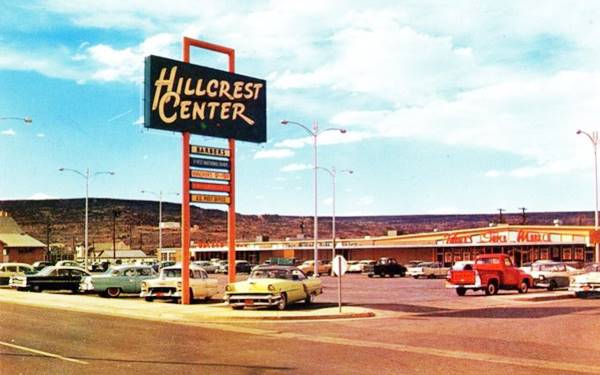
Hillcrest Center
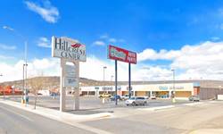
In the late 1950s, the Hillcrest Center shopping mall was being built. It was the first mall in Grants, it is still standing.
California Hotel ❌

Woodard Hotel c.1920s. Source
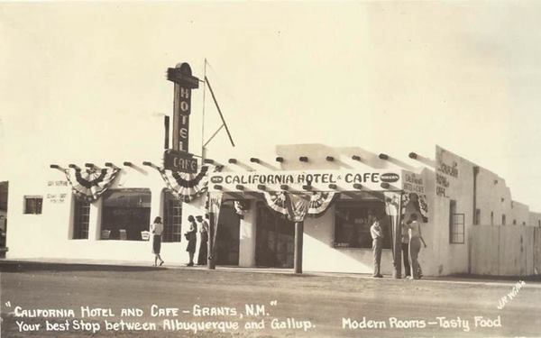
At 18 W Santa Fe, there is a Pizza Hut standing on the spot where the California Hotel and Cafe once stood. On the NW corner of First St. and Santa Fe. It opened in 1938 and its postcard proclaimed: "Your best Stop between Albuquerque and Gallup - Modern Rooms - Tasty Food."
It was preceded on this same site by the Woodard Hotel that opened in 1916 and burned down in the 1930s; see picture. Rittenhouse mentioned it in his 1946 Guidebook to US Highway 66. A 1958 advertisement mentions it was operated by Mr. and Mrs. E.C. Bell. It was torn down around 1971.
West Theater
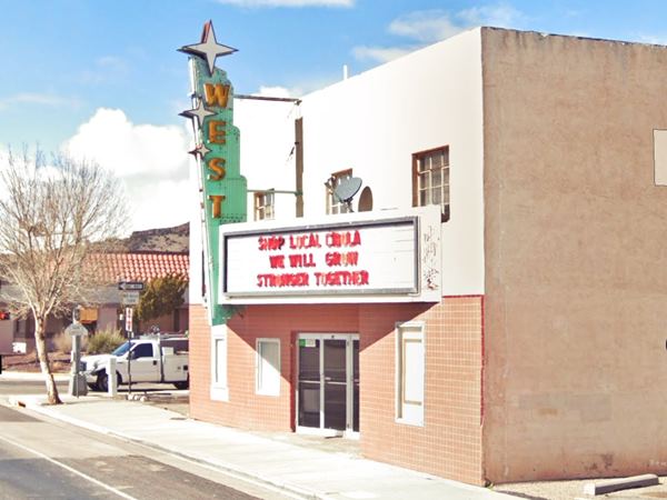
To your right at the end of the block (118 W Santa Fe) is this theater that opened in April 1959. It was named after its owner J.C. West who also owned the Sahara Drive In that opened in 1958, the Lux theater that he had acquired in 1950. The Trails Drive-In in neighboring Milan was also his. It has a great neon sign!
On the 200s block there were three Route 66 classics:
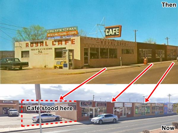
The Conoco at 200 W Santa Fe, offered the services of an "Expert Auto Technician," now the local newspaper stands on the spot. Opposite, on the south side of the highway at 201 W Santa Fe (to your left) was the Royal Café:
Royal Cafe ❌
It was owned by George and Doris Hantges who ran it from the early 1960s till the mid 1970s. Its neon sign was the work of Zeon Sign Co., made in 1959.
Below is a picture from that time and the current view of the same spot. The cafe (gone) stood to the left of the current buildings, it was torn down; below is a then and now set of buildings. The buildings to the right of the cafe, still standing, were built in the 1960s replacing the units of Encanto Court that stood on the property.
The Encanto Court
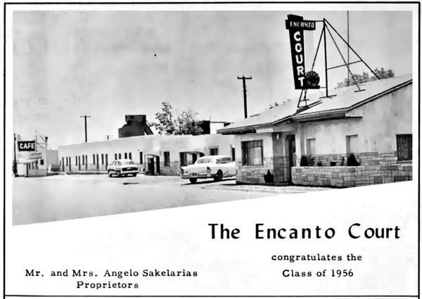
At 219 W Santa Fe was the Motel and Cafe, owned by Mr. Angelo and Mrs. Sakelarias in 1956 as you can see in the image below. The Royal Cafe can be seen on the left side of the image and the units facing Route 66 with a parking area between them and the highway can also be seen. Stores replaced these units (1960s?) and the motel's office remained on the western side of the property with units on its western (right) flank. "Encanto" in Spanish means "charm" both as a magic spell and also as charming due to its beauty.
Across from the Encanto at 208 W Santa Fe the 1966 phone book mentions the Grants Super Service station ❌.
Eddie's Roarin' 20's ❌

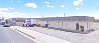
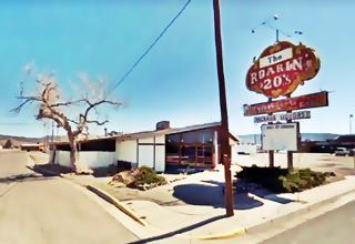
Third and W. Santa Fe "Then and Now", Grants NM. A. Whittall. Source, St. view
Click on image to enlarge
Red Ball Garage ❌
On the corner at 218 W Santa Fe was the Red Ball Garage as you can see in the image taken in in 1951 or 52; it also shows, to the left, across Third St. the building on the NW corner: the Grants Beacon still there, now the Serenade Music Video Co., and further left, Pat's Lounge and Bar that in those days had a single story.
Thomas Garcia owned the Red Ball, Tom had taken his courses in auto mechanics at the College of Agriculture and Mechanic Arts in Las Cruces, what is now the New Mexico State University.
Sunshine Cafe ❌
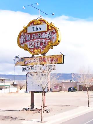
The classic neon sign came from Vena's Roarin' 20's that was next to Eddie McBride's Albuquerque nightclub "Inferno" at 5920 Central E. Ave (Route 66). The topless club closed when the IRS sold the liquor license and equipment of its owner, Luna Pizzeria Inc. in Jan 1964 to cover a tax lien of $38,899.06. So Eddie moved the sign to his father's Cafe, Bar and Dance Hall in Grants, the Sunshine. (4).
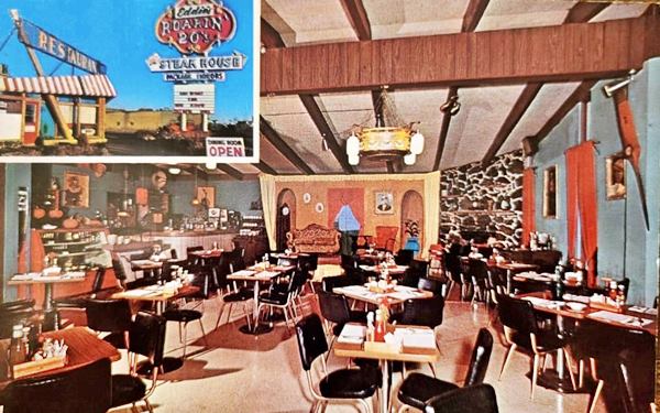
The Sunshine dated back to the 1920s and was operated by Louis B. McBride, Sr. and his wife Clara owned the Sunshine, Eddie modernized it and rebranded it "Eddie's Roarin' 20's". It was torn down in 2014.
Its postcard pictured below advertised it as "Family Steak House... The friendly fun place dedicated to serving traveling families, Serving delicious charbroiled steaksfrom $2.00, sea food, Mexican dinners, chicken, oups, salads and cocktails, Piano bar & meldrams evenings, the most pleasant suprise is the price. Tourist information for side trips to Indian country and mountains. See a $40,000 coin and hand made Indian silver jewelry."
Pat's Lounge & Bar
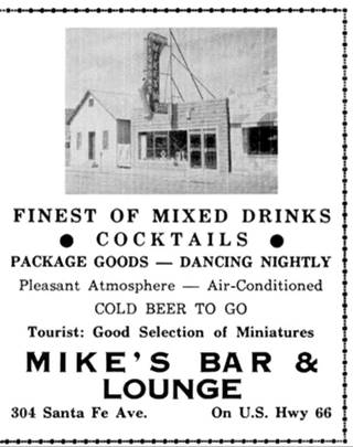
The 300s block begins with the Grants Beacon now Serenade Music building, followed by another bar Pat's Lounge at 304 W Santa Fe. It dates back to 1929 or 1933 and began as a hotel and bar. Later, in the 1950s it was owned by Mike Dominguez, and it had only one story (pictured below in a 1958 advertisement):
Pat took over in 1972 and his son Eddie continued his work in 1999. The place closed for good in 2016.
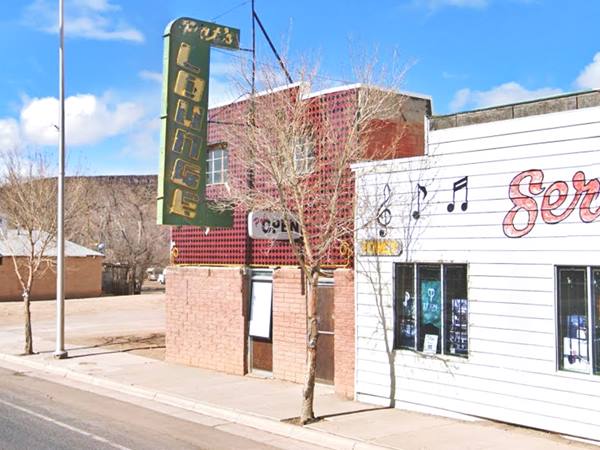
Texaco
Opposite, on the south side of the street, at 301 W Santa Fe, was a Texaco station. Over the years it was known as La Linda Service Station, Leroy's Texco, Dale's Texaco, and Cash Texaco.
Pueblo Court
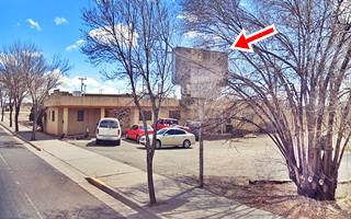
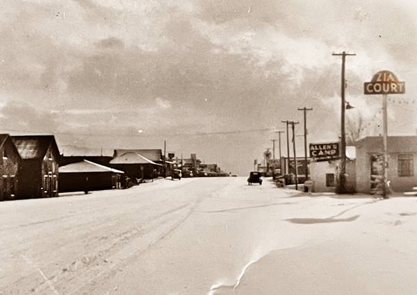
Ahead, to your left, at 325 W Santa Fe is the former Pueblo Courts; you can see its decaying neon in the bushes (red arrow in the picture above). It advertised its "Modern Units -Clean - Comfortable 'Located Center of Town'." In the 1930s it was known as "Allen's Camp." Below is a view of it c.1930s looking east along Route -covered with snow. 66 Zia Court and Allen's Camp are on the left side of the image and La Linda Texaco's sign can be seen in the distance:
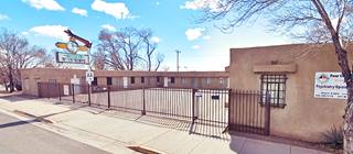
Zia Motel
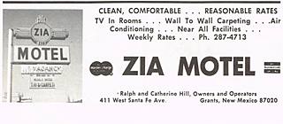
Ahead, adjacent to the Pueblo, at 411 W Santa Fe is the old Grants Zia Motel. Its advertising stated it had "T.V. - Carpeting - Reasonable commercial rates Catherine Hill - Owner & Manager." Tha advert, click to enlarge, mentions Ralph Hill as co-owner.
Zia is the name of a Native American group of Anasazi origin, that lived in the Chacco Canyon region. They were forced to migrate during a long drought in the early 1200s AD, settling where Zia Pueblo is now located around 1250 AD. They created the Zia sun symbol that appears on the New Mexico state flag.
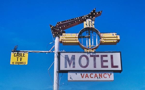
Notice how the neon sign changed over the years (semi-circle in the 1930s, Zia symbol in the 1960s, later an arrow was added to its upper side).
The classic neon sign of the Grants Zia Motel
Uranium Cafe
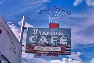
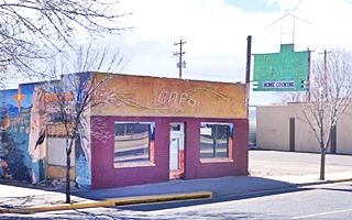
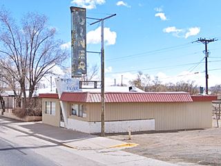
Cross the bridge, to your left is the Uranium Cafe at 519 W Santa Fe. Eugene Woo opened it in 1956 offering Chinese American food. Later he opened the Canton Cafe on the eastern side of town. The 1969 Yearbook of the Grants' Pirates Ahoy, has an advertisement: "Eugene Woo... Yee Kwong - Welcome to the Very Best in the Finest of American, Chinese and Mexican Dishes - Courteous, Prompt Service Come as you Are Open 6 a.m. to 10 p.m." One of its dishes was the "Tasty Uranium Burger" for 45¢

Miners walking outside Uranium Cafe, 1956. Grants. Source
New Mexico Mining Museum
Across the street from Uranium Cafe is the museum at 100 N. Iron Avenue, Grants NM.
The museum recreates the life of the uranium miners and their legacy in Grants. It is the "Only (simulated) Uranium Mining Museum in the World!" More Information (505) 287-4802 and at their Facebook page.
Grants West Conoco
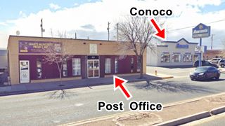
To your left, west of the Kia Motel, at the western end of the block, is the former post office building at 523 W Santa Fe. Later it moved to Gold Ave. There is a hardware store on the left side where Grants Mainstreet Project Inc is located nowadays. Across the street, on the SW corner you can see a two story box-shaped Conoco in the 1940s, and Speedway Service Mobil in 1966. Currently Aaron's. Below is a "Then and Now" set of images.

1930s Grants Post Office and Conoco station. Source. Click to Enlarge
Route 66 Neon Drive-Thru Sign
Must Stop for Route 66 Roadtrippers
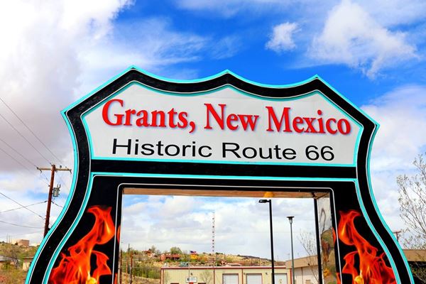
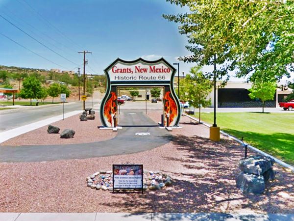
On the next block, to your right, on the NW corner of W Santa Fe and 9-11 Ave. is a modern classic stop, at 600 W Santa Fe.
This is an 18-foot-tall gateway shaped like a U.S. Highway shield, with the words "Grants, New Mexico - Historic Route 66" written on its upper part and flames flanking the drive-thru arch. It lights up at night.
A Must-See Stop in Grants
The Montecarlo Cafe
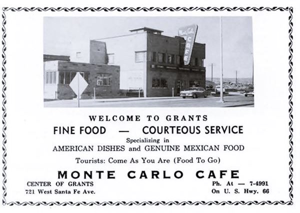
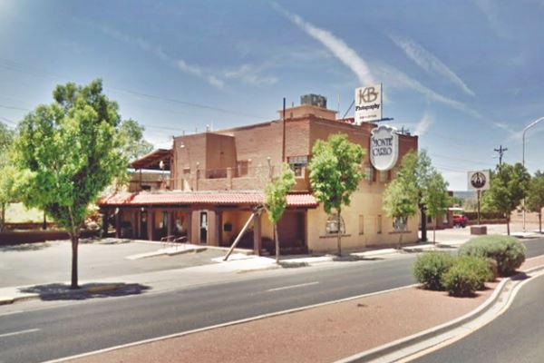
Ahead, on the next block, to your left, at 721 W Santa Fe, was the classic Montecarlo Cafe and Restaurant.
The Montecarlo was established by Escolástico "Esqui" Mazon (1919-2002) in the 1940s. He worked on his father's sheep ranch till he was 18 and then decided to try something else, he moved to Gallup. He worked as a contractor in the construction of the El Rancho Hotel there. He was drafted in 1941, came back home to marry his sweetheart Seferina Dominguez and after a stint at Gunderson's store and Thigpen's store he opened his restaurant in the early 1950s. His timing was great because clients boomed when Uranium was discovered in the area, miners, mining service staff and locals were patrons at the restaurant (3). Below is a "Then and Now" set of pictures:
Opposite, to your right, at 800 W Santa Fe was the El Pueblo Service Station that in the 1966 phone book appeared as Manning's Texaco ❌.
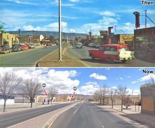
On the next block, at 900 W Santa Fe was Campbell's Chevron Service ❌ (see picture below); you can also see it in the "Then and Now" image (Click on it to enlarge); the Chevron sign appears in the 1950s view, the spot in the current view is marked with a (1).

Advertisement Campbell's Chevron advertisement.
Source.
Click to Enlarge
Magnolia Super Service
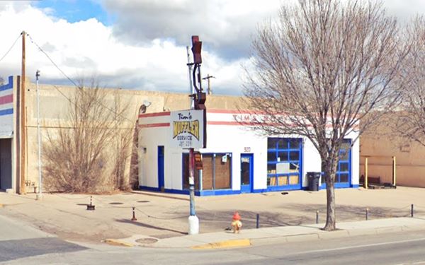
The Magnolia Super Service of 1956 became a Mobile when the picture above was taken. You can see the sign above, in the late 1950s photograph and its current view as (2). Below is how it looks today, Tim's Muffler Service, with its two service bays and icebox design, no canopy and no pumps or pumps islands.
On the next block there were several cafes -all gone; the movie theater a bank and a drugstore:
Lux Theater
1018 W Santa Fe Avenue, to your right, is the Lux Theater that opened in 1937 and was owned by a Mr. C.E. Means. It had seating capacity for 518 viewers. J.C. West, who owned the Sahara Drive In and Lux theater bought it in 1950 and it continued operating until the 1980s.
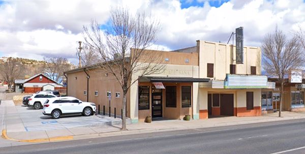
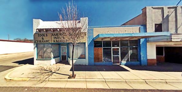
To the left -west side of the theater- is the old Grants State Bank building. It was chartered on June 16, 1947 so this must have been its first location. Now it is located at 847 W Santa Fe. The marble facade has the original name inscribed in it.
Next door, now a parking space, was where Carradine's Drug Co. ❌ once stood. The pharmacy and drug store was ran by Duke and Nellie Carradine. It was standing into the 2010s. Below is a street view from 2009 showing both the bank (right) and the now gone drugstore (left):
Yucca Hotel ❌
On the next block 1120 W Santa Fe, was the site of a classic hote, the Yucca. Rittenhouse mentioned it in his 1946 Guidebook to US Highway 66.
Before the hotel, Latham's Stockman's store stood on the property (it opened a new store on the other side of Central Ave. that is still standing). George Ades built the Yucca Hotel, it had two stories and a Pueblo air to it.
The hotel included in its eastern wing Graham's Jewelers store and on its western side a Greyhound Bus Stop, the Yucca Cafe, and a Cocktail Lounge.
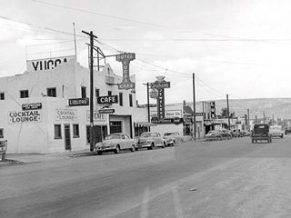
The image above from the 1950s looks east along Route 66. It shows the Yucca Hotel to the left and beyond it, Carradine's drugstore, Grant's State Bank, the Lux theater, and cafes.
Hollywood Diner
Valentine Diner on Route 66
Opposite the cinema, at 1023 W Santa Fe, to your left. This diner is actually a modified Valentine diner, one of at least 2,000 built by the Valentine Manufacturing Company of Wichita, Kansas.
Arthur Valentine (1891 - 1954) invented them and began producing them in 1947. They were movable diners that came in different sizes and models. This model is a "Double Deluxe" one with 10 stools and seven booths for 36 customers. The company gradually lost business in the 1960s and folded in 1975, the fast food chains and suburbia had displaced the small diners. There are several of them along Route 66.
George Karvounaris born in Greece in 1891, migrated to the US in 1907 and changed his name to Coleman. Eventually he moved west and in 1955 opened this Diner in Grants.

Advertisement Hollywood Diner from 1958. Source.
The advertisement (above) stated "Tourists Welcome - Breakfast-Luncheon-Dinner. Steaks-Chops-Sea Food. Sandwiches. (Food to Go). Free Parking... Opposite Lux Theater." Notice how the neon sign changed over the years in the "Then and Now" pictures.
Andy's Phillips 66
At 1103 West Santa Fe, is a classic "Rock Frame" design that displaced the icebox-shaped buildings in the early 1950s. This design had large plate-glass windows that were canted (or slanted) and used a curtain wall system combining glass and concrete blocks that were faced with rocks (hence its name "rock frame"). The canted windows reduced the glare of car headlamps and increased the visibility and indoor light. This one appears in the 1956 telephone directory as Jolly 66 Oil Co. Service Station.
A few years later it was photographed by Ed Ruscha and had been renamed Andy's 66 Service.
American pop artist Edward Ruscha lived in Los Angeles and drove frequently along Route 66 (he was captivated by it). His 1963 book Twentysix Gasoline Stations depicts black and white pictures of 26 gasoline stations along Route 66 with the location and gas brand sold. One of them is this Phillips 66 station in Grants photographed in October 1962.
Edward Ruscha's Grants Phillips 66, 1963©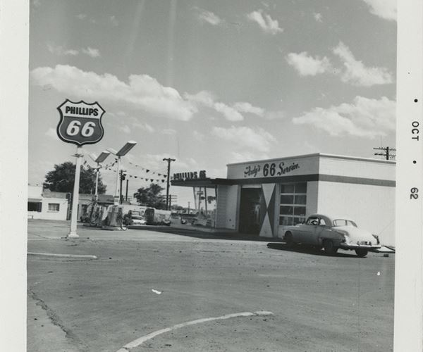
Below is the current appearance of the old gas station
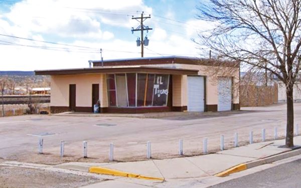
White Arrow Garage ❌
This garage stood at 1114 W Santa Fe, to your right, now a vacant lot (Street View). Its first owner in the 1920s was M.R. "Bill" Prestridge who also owned the Prestridge and Seligman Logging Co. The image below shows it around 1939. The "G" (for Grants) on the cliff by the top of the mesa can be seen in the image below -and also in the street view. Prestridge sold it to the Navajo Chevrolet Co. of Gallup, owned by J. M. Williams a Navajo businessman in 1940. Hardy Conley owned it in the 1950s as Conley Motor Co. and Rittenhouse mentions Conley garage in his 1946 guidebook.

White Arrow Garage c.1930, Grants. Source. Click to Enlarge

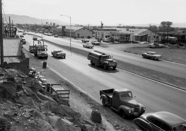
Ford dealership, Yucca Hotel and Sturges Supermarket c.1950s, Grants. Source. Click to Enlarge
The picture above from the late 1950s or early 1960s -click on it to enlarge it- looks east along Route 66 and it shows the Ford Dealership, formerly White Arrow Garage to the left, the Yucca Hotel and Lux theater beyond. To the right is the now gone Sturges Supermarket.
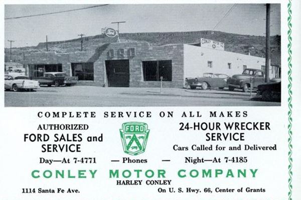
By the 1970s it had become a Chrysler dealership, Cibola Motors Inc. Torn down.
Sturges Supermarket ❌
The building stood at 1115 West Santa Fe, just west of Jolly's Phillips 66. It began as Simon Bibo Mercantile Co. The Bibo brothers migrated from Westphalia Germany to the U.S. in 1868 and settled in New Mexico estabilishing trading posts. Simon opened his store in Grants in 1881. In 1921 they sold their interest in the business to Seligman who operated the Bernalillo Mercantile Co. Carl Seligman sold it in 1945 to Bond-Gunderson who in turn leased it to Gladin in 1953 for their grocery store. Sturges Supermarket acquired the business in 1957. You can see it in the image below, to the right as Gladin's (beside McQueary's Chevron); also see this image from the 1940s of the same spot, at that time it was Bernalillo Mercanitle. (5)
McQueary Chevron Station

McQueary Chevron in the 1950s, Grants. Source. Click to Enlarge

McQueary Chevron 1968 advertisement, Grants. Source. Click to Enlarge
At 1201 W Santa Fe was the McQueary Chevron station. There still is a gas station on the property, no longer a Chevron, now it is a Phillips 66. The original building has been torn down. See the current street view.
Across the street, to your right at 1300 was a Shell service station. In the phone book it appears as Kelley's Shell Service Station ❌ nothing remains of it. In 1969 Judge Creggar bought it. By 1975 it was Gil’s Shell Service Station.
Charley's Automotive Service

Charley and Joseph Diaz in 1949. Grants. Source
Click to enlarge
Listed in the National Register of Historic Places and the New Mexico State Register of Historic Places
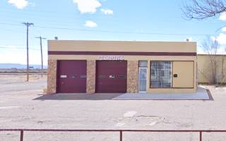
Founded in 1941 by Charles "Charley" Diaz (1914-1995) and located to your right at 1308-1310 W Santa Fe. You will spot the remaining buildings of Charley's Garage and gas station.
It has five buildings including the Diaz family home: on the east was the Star Cafe (pictured below in a "Then and Now" sequence) ran by Charley's great uncle Salome Saiz; that was built in 1949 and served its last meal in 1985. Left is the main garage building which originally had Mobil gas pumps and offered full service. Later Charley focused on radiator repairs and kept on running it until his death (6).

Star Cafe 1950s, Grants. Source
Below are two "Then and Now" pictures, in 1949 and nowadays with the current appearance of the property:
Notice the Mobil sign and pumps.
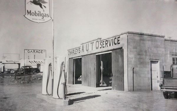
Notice it is spelled "Charlie's" instead of "Charleys"
Los Alamitos Motel ❌
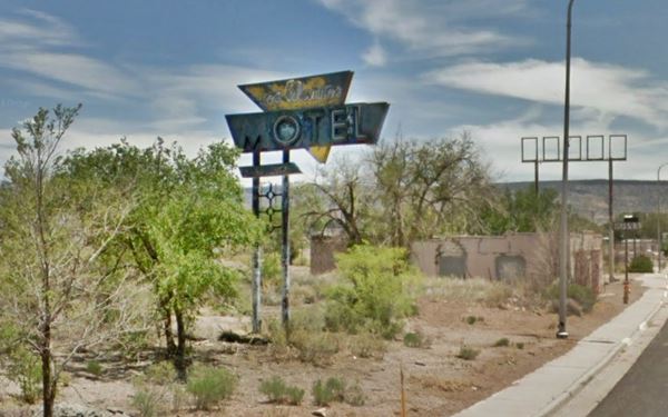
Adjacent to Charley's at 1400 W Santa Fe (you can see Charley's garage on the right side in the image below, that looks eastwards along Route 66). Named for the Hispanic community on the south side of the railroad (Alamitos means "small willows" in Spanish). It stood on the north (right) side of the highway but was torn down years ago. It had an L-shaped layout and its fading and flaking neon sign stood by the highway until recently, now gone. Pictured below in 2018.
Los Alamitos motel sign in 2018 while it was still standing
Ahead, at 1424 W Santa Fe was Ramsey's Texaco Station ❌ now all that remains are its foundations (Street view).
Continue west and at 1871 W Santa Fe, 0.3 miles after passing the access to the freeway's exit 81A, to your left is a 1950s curio shop the Indian Trails Trading Post.
Continue your Road Trip
This old trading post marks the endpoint of your journey through Grants.
Continue your Route 66 road trip by heading west into the next town, neighboring Milan NM.
Sponsored Content

>> Book your Hotel in Albuquerque

Credits
Banner image: Hackberry General Store, Hackberry, Arizona by Perla Eichenblat
Jack DeVere Rittenhouse, (1946). A Guide Book to Highway 66.


