Route 66 from Albuquerque NM to Lupton AZ
Sponsored content

TheRoute-66.com is reader-supported. When you buy through links on our site, we may earn an affiliate commission at no additional cost to you.
Index to this page
Albuquerque to the Arizona State Line along Route 66
Historic Background of this section of US Highway 66
Route 66 was created in 1926 and it used pre-existing highways as its first alignment. The original highways in the area were the "Ozark Trail", the "Santa Fe Trail" and the "National Old Trails". All of them were due to the efforts of a privately sponsored highway system created in the early 1910s.
These highways were known as "Auto Trails" and part of a public demand for "better roads": a movement that lobbied for good highways that could be used by motor vehicles, and also signs to mark them and help drivers to find their destination.
New Mexico authorities improved the original Ozark Trail in 1914 and designated it as New Mexico State Highway 3.
The thumbnail (Click to see large size map), shows some of the "Auto Roads" or "Auto Trails" that could be driven by cars in 1912 in the area between Albuquerque, Albuquerque and Santa Fe. These trails are marked with red lines.

1912 Road map, western NM
Click on image to enlarge.
Credits

1925 Road map, western NM
Click on image to enlarge.
Credits
The map above (from 1925) -click on thumbnail to see large size map- shows the roads that existed one year before Route 66 was created.
Those marked "22" (National Old Trails Rd., coming from Los Angeles) and "32" (New Santa Fe Rd.) with white letters in a black box, went from Albuquerque to Albuquerque through Santa Fe. Highway "50" (Ozark Trails) had two forks, one from Albuquerque to Moriarty and then south through Clovis into Texas, and another from Albuquerque to Dillia.
The only paved sections (full black line) was between Albuquerque Bernalillo, and Albuquerque and Tijeras. The highway from Bernalillo to Santa Fe, and beyond Isleta was "improved" (dashed line), the rest were either graded or dirt roads.
The 1926 Route 66 alignment

Detail of a 1927 Map of Route 66 in NM.
Click on image to enlarge.
Credits
The Santa Fe Loop (1926 - 1937)
This was the first alignment of Route 66, from Santa Rosa to Albuquerque via Pecos and Santa Fe.
We describe this segment in our Santa Fe Loop page, a dedicated webpage, with the full alignment, from Santa Rosa, through Dillia, Pecos, Santa Fe, Santo Domingo, and Bernalillo all the way to Albuquerque.
This original highway continued beyond Albuquerque to Isleta, Peralta and Mesita.

The 1926 -1937 into Albuquerque from Bernalillo
South of Bernalillo, starting at I-25's Exit 248 continue along Camino Real Pan American Central Hwy or NM 313, and follow it south all the way into Albuquerque. At Sandia Pueblo the highway merges with NM-556 at a roundabout. Head south along NM 556, it becomes 4th St. NW. At Marquette Ave., 4th St. changes direction so you can't drive along it into downtown Albuquerque, for those driving, you must follow 5th until meeting the 1937-85 alignment of US 66 on Central Ave.
This is the Map of the driveable part from Bernalillo to Lomas Blvd., and this is the yellow line shows the course of the old '66 that can't be driven across the Civic Plaza, and southwards to Barelas district as 4th St. runs from south to north.
Albuquerque
Albuquerque is the largest city along Route 66 in New Mexico, set at the foot of the Sandia Mountains in the valley of the Rio Grande. Inhabited for thousands of years by Native Americans, and founded in 1706 as a key stopover on the Camino Real (Royal Road) from Santa Fe to Mexico.
Albuquerque to Suwanee along the 1926 - 37 Route 66
Isleta, Peralta, and Los Lunas
1916 N.O.T. Road map, Los Lunas
Click on image to enlarge.
Source
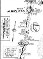
The original Route 66 was aligned through Los Lunas in 1926 along the "National Old Trails". See the 1916 National Old Trails (N.O.T.) image map from Albuquerque to Los Lunas (click to enlarge it).
The highway crossed the Rio Grande in Barelas and then along what is now NM 314, headed south along the western bank of the river going through the villages of Isleta, Peralta, and Los Lunas. There it turned west.
At Isleta, the 1926 alignment of US66 crossed the river to its eastern side and went south, going through Peralta. South of this point it crossed the Rio Grande again into Los Lunas.
>> orange line in our custom map
1931 realignment from Isleta to Los Lunas
>> red line in our custom map.
US 66 was paved by 1928 and it was realigned along the west bank of the Rio Grande in 1931 to shorten its course and remove the two additional crossings of the Rio Grande river south of Albuquerque's Barelas Bridge. This realignment bypassed Peralta (what now is NM-47 used to be US66).
West of Los Lunas it headed west and ran close to the Atchison Topeka and Santa Fe railroad tracks climbing out of the Rio Grande Valley, curving towards Suwanee.
Westwards from Los Lunas to Suwanee
This alignment is marked with an orange line in our custom map. As you can see, in some places it deviates from the course of the current roadway in several spots. The modern highway was realigned in the 1940s, after it ceased to be Route 66. This section is now NM 6 higway. It flanked the Cerro de los Lunas mountain (5,957 ft) and then crossed the Puerco River. It ran close to the railroad and both skirted a 6,500 ft. high volcanic plateau (Mesa Carriza, Mesa Lucero)
West of Los Lunas the original roadway ran around the north side of the Amazon warehouse as a dirt road, and then after crossing the railroad with a grade crossing (as shown in our custom map).
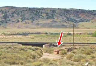
Ahead it heads south in a wide curve away from the modern alignment. At the point where it meets the current alignment you can spot the abutements of a 1920s bridge to your left (pictured below; orange marker in our map).
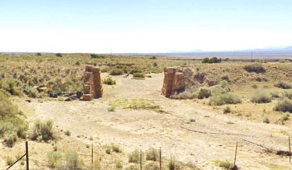
Ahead, it forks again to the south in a curve with another gone bridge whose abutements have survived and can be seen to your left (See picture and the red marker in our map); ahead both alignments converge and the highway crosses the rio Puerco river.
Route 66 heads west to Suwanee
Return to the main alignment, ahead there is another deviation of the original roadway orange line in our map, as it climbs a steep hill.
It runs towards Suwanee, where it meets the later alignment adopted in 1937 that bypassed all these towns south of Albuquerque.
>> teal line in our custom map is the 1937-85 Suwanee alignment
End of this 1926-37 leg of your Road Trip South of Albuquerque
This is the end of your journey through along the original 1926 to 1937 alignment; from Suwanee to Mesita is the 1937-85 US66
1937 Realignment of Route 66
A political dispute between New Mexico Governor A. T. Hannett and local politicians led to the realignment of Route 66 in 1937.
Hannett blamed the local party bosses when he lost his 1927 bid to re-election. He decided to punish them, and their backers (the business men in Santa Fe) so he quickly had state highway #6 built, in 1927, to link Moriarty with Albuquerque. This highway bypassed the capital city, and was 90 miles shorter for those driving from the east to Albuquerque.
In 1937, the Federal roadbuilders decided to realign Route 66 using Hannett's road, and paved it. It was a straighter highway, and only had a short mountain segment across the Sandia Mountains between Sedillo, Tijeras and Carnuel.
South of Albuquerque, the "Laguna Cut-Off" (named after the Laguna Mission Village west of ABQ and Los Lunas) eliminated the southern section of the 1920s alignment: in 1937 the whole highway was moved north. It used the new bridges and climbed out of Albuquerque westwards and took a straight course towards Suwanee and Laguna. Both Isleta and Los Lunas had been cutoff.
Route 66 across Albuquerque (1937 - 85)
Carnuel
We describe this section from east to west, starting on the eastern side of ABQ, at the western terminus of Tijeras Canyon, in Carnuel.
1937-50s two lane highway
The original Route 66 had two lanes and had a winding course along the north slope of Tijeras Canyon in this section. Below is a view close to the now gone Mountain Lodge motel in Carnuel.
Route 66 Carnuel a vintage photo
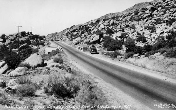
The highway followed the alignment marked with a bue line in our custom map.
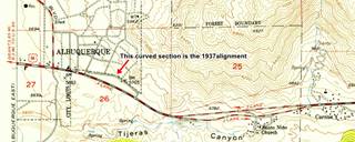
Finally, when the highway reached the level area at the foot of the mountains it curved (green line in our map) to the north and met Central Ave. at Tramway Blvd.
This quarter mile long, curved segment has survived and you can walk along it. It is pictured below:
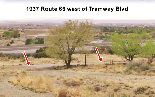

1937 roadbed nowadays Credits
1950s Four Lane US66
As traffic grew, a safer and straighter highway was needed so the old roadway became the eastbound lanes and a new set of straighter lanes were added north of them, for the westbound traffic. We marked them with a red line in our custom map.
Below is a view looking west towards Albuquerque along the four lane highway in 1958.
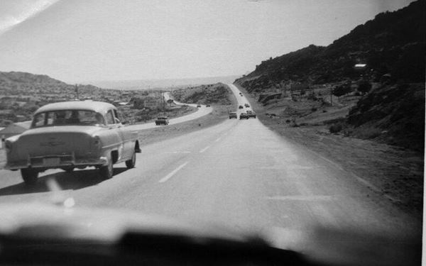
The image below looks west along the four lane alignment where Exit 167 offramp begins.
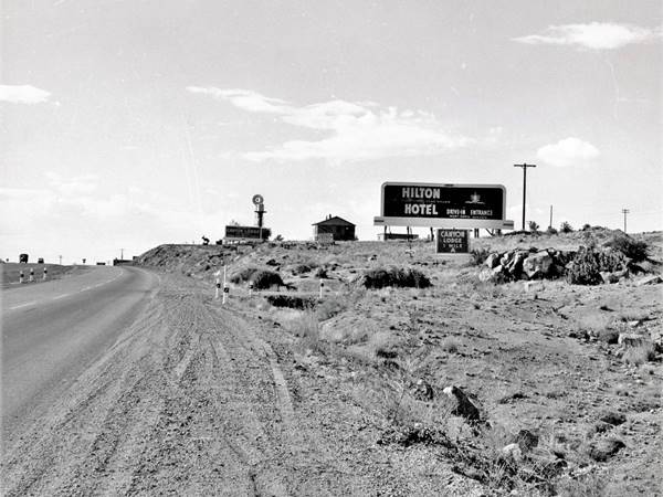
This four-lane alignment was buried by I-40 and the same spot where the picture shown above was taken is now under the freeway's westbound lanes (same spot as it is nowadays). So a new extension to Central Ave was built east to carry I-40s frontage Rd., NM 333.
Central Avenue
This area at Tramway and Central Ave. was empty space. There were motels along Route 66 west of this point. The first signs of an urban area appeared at Wyoming Blvd. three miles west.
Route 66 followed Central Ave all the way into downtown Albuquerque and then through the Old Town and onwards until it crossed the Rio Grande.
It did so from 1937 until it was decertified in 1985. This is the map of Route 66 across Albuquerque.
>> green line in our custom map
The original 1937 Route 66 ran along the westbound lanes of Central Avenue from the Rio Grande bridge all the way along 9-Mile Hill (Map of the first 6 miles; also see the green line) a second set of eastbound lanes were added in the mid 1950s. At what is now Exit 149, the highway followed the alignment shown with a violet line (0.8 mile gap in the alignment) and ended up as the North Frontage Rd. The eastbound lanes were buried by I-40s WB lanes in 1970. This 1951 aerial photo shows what Exit 149 looked like before I-40 was built.
The highway headed west for another 7.7 mi. all the way to the Rio Puerco River (map to Exit 140; also see the light blue line in our custom map) where Exit 140 disturbed its alignment; the gap is marked with a green line here.
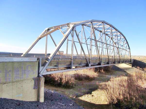
Rio Puerco Bridge
Located on the north side of I-40, on old US 66 in Suwanee, NM.
Listed in the National Register of Historic Places
Though the Rio Puerco is usually dry, it can flood and carry large volumes of water. For this reason the State Highway engineers chose a Parker through truss bridge to cross it.

Rio Puerco
The Rio Puerco is a tributary of the Rio Grande. Its sources are on the west slope of the Nacimiento Mountains and it flows 230 mi. (370 km) with a north to south course before meeting the Rio Grande about 50 mi. (80 km) south of Albuquerque.
It is a temporary river, and is dry during part of the year. Its average discharge is about 39.5 cu.ft.⁄s. (1.12 m3⁄s).
The name refers to its muddy and dirty waters (puerco is also "pig" in Spanish).
This kind of bridge does not need a center pier to support it, and therefore eliminates the risk of it being washed away.
The placement of the bridge was strategice: on a narrow location with steep banks it was suitable for the 250 foot long single span bridge.
The bridge was built in 1933 on NM State highway 6, employing federal funds for highway construction. It was part of the plan to shorten the transcontinental route and became part of Route 66 in 1937 when the "Laguna Cut Off" was implemented, bypassing Isleta and Los Lunas.
The bridge's deck is 25 feet wide and was remodeled in 1957. When I-40 absorbed the traffic of Route 66, it became its Frontage Road until 1999 when the NM Transportation Department replaced it. It is open to pedestrian traffic.
Rio Puerco Bridge, historic landmark
Across the Freeway, Route 66 Travel Center offers some interesting retro-styled signage with Indian arrows and a 1950s-look to them!
The highway continued west along what is now the N Frontage Rd. for 2.1 mi. (map), and then it turned and runs under I.40s EB lanes as marked with a red line in our custom map, all the way to Suwanee. Here as I-40 curves north, the original highway continued with a SW course.
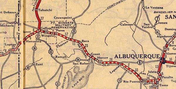
From Albuquerque to Lupton AZ, a map from 1927
Suwanee - Correo
>> teal line in our custom map is the driveable Suwanee to Mesita section
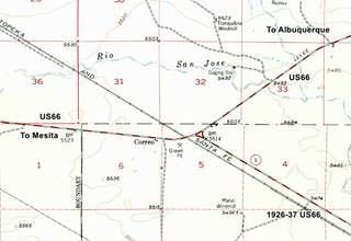
The 1926-37 and 1937-50s alignments meet here in Suwanee; the first coming from Los Lunas became NM-6 when the 1937 roadway was built . Only a few buildings dotted the intersection. Later NM-6 was extended north to meet I-40 at Exit 126. The map shows the 1956 layout of Correo.
Mesita
This is the Map across Suwanee from its eastern tip by I-40, and its course along higway 169 to the NW where it meets I-40 on the south side of Mesita at where Sparrow Hawk Rd crosses it. After this point, the original 1926 alignment it is overlaid by the freeway (blue line in our custom map). The highway passes along the western side of the village of Mesita.
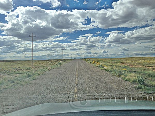
The original roadbed: Route 66 just west of Suwanee, NM heading towards Mesita:
Owl Rock
You will have to take Exit 117 to cross to the northeastern side of the Freeway to continue your journey. Ahead, 1.7 mi. west of Mesita along Old Route 66 (see this Map and directions). It is a rock formation on the eastern side of the road (right side heading from Mesita towards Laguna), that actually looks like an... owl.
Dead Man's Curve
>> green line in our custom map; 1926 Mesita-Laguna US66
Keep on along Route 66 for another 0.7 mi. and drive the "deadly" Dead Man's Curve:
Dead Man's Curve between Mesita and Laguna
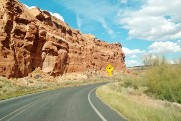
2.4 mi. west of Mesita along Old Route 66 (see this Map marking the spot).
The narrow canyon of the river is closed in by red colored sandstone bluffs, and the road runs between the cliff and the river. There are great views of the red sandstone rocks on the sheer walls of the mesa.
At the northern tip of the mesa the river curves sharply around it, and so does the old Route 66. It takes a long curve around switching its south-to-north direction for an east-to-west one, and does so by following a circular curve as can be seen in the image above. It was a much cheaper option than cutting through the sandstone. But, as the curve's name shows, a not very safe option for unwary drivers.
Laguna
The next stop is the ancient village and mission of Laguna. Due to the dangers of Dead Man's Curve, a new alignment was built in 1932 (it already appears in this 1951 aerial photo), we marked it with a yellow line in our custom map.
This is the older 1926-32 alignment map with the road from Mesita into Laguna including Owl Rock and Dead Man's Curve. Both alignments meet at Laguna next to Exit 114.
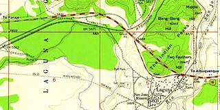
The first Route 66 alignment in 1926 crossed the San Jose river on a timber bridge, 100 yards south of the current one. It headed west for 100 yards and then turned sharply south, following the original railroad bed around the souther side of the village of Laguna. Then it ran northwards past the cemetery and with a NW course to meet its current alignment. This is marked with a green line in our custom map.
By the late 1920s, the traffic along the highway disturbed the ceremonies, endangered villagers and the dust and noise were unbearable so the Pueblo's authorities petitioned to move the highway out of the village. And it was moved.
The 1929-55 alignment curved to the south around the Indian Peaks flanking the hill west of Laguna (map) and then continued along a now eliminated roadbed on the eastern side of NM 124, as marked with a pink line in our custom map.
This roadway was straightened out in the mid '50s by the new four-lane highway that cut straight across them with a SE-NW course (map).
Paraje
The highway after leaving Laguna followed the valley of San José River with the railroad to the south of Route 66.
West of New Laguna, there is an old segment marked with a orange line in our custom map. There is a 1920s Bridge on it at the stream that runs beside Encinal Rd., a former early 1920s Route 66 alignment.
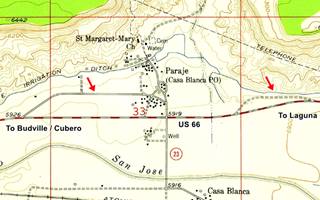
There are more remains of an older alignment near Paraje, the red arrows in the map mark them: the violet line in our map marks the eastern segment, part of which can be driven, and this is the map West of Paraje.
The later 1938 to 50s highway followed a straight course as shown in this map from Paraje to Budville - Cubero
>> pale blue line in our custom map: Paraje to McCartys alignment
Cubero and Budville
Budville
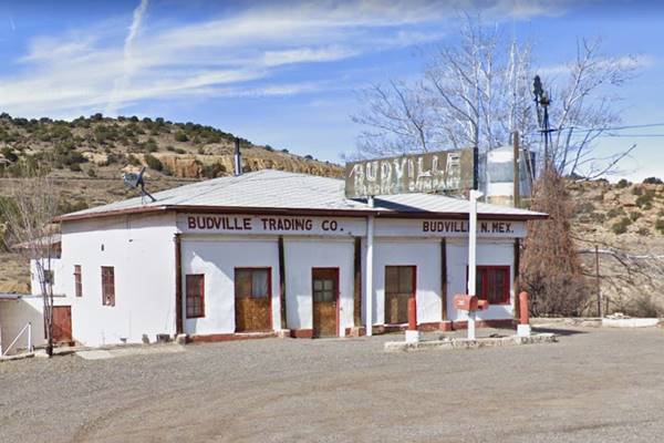
At Budville, there is an old trading post and gas station to your left, on the eastern side of the road. Here there is a fork. The original 1926 to 37 Route 66 continued straight into Cubero and then turned west as shown in this 1920s-37 map.
>> Yellow line in our custom map; driveable Cubero Gap segment
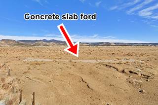
The western tip of the old alignment has been obliterated, but you can still see the original concrete slab ford on its western tip (pictured). We mark this gap in the highway with a green line
Cubero Cutoff
The 1937 highway bypassed Cubero along where NM-124 now runs, this is known as Cubero cutoff.
San Fidel
The 1920s-60s highway then went into San Fidel; see this Budville-San Fidel alignment map.
It continued west and is now cut by I-40 at Exit 96, built in the mid 1950s as you can see in this map west of San Fidel.
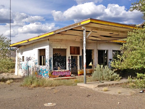
Abandoned Whiting Brothers Service Station near San Fidel, Route 66, New Mexico
Mc Cartys
The gap at Exit 96 is shown with a red line in our custom map. The highway continues with a NE to SW course as the South Frontage road of the freeway, curving south towards Mc Cartys as it approaches the lava flows. The freeway also curves at this point.
It passes beneath the railroad using a subway, and the entrance to Mc Cartys' along Pueblo Rd. ahead it crosses the San Jose River on a stringer bridge built in 1936 (see its plaque).
Possible early alignment in Mc Cartys
The 1955 aerial photo shows another possible roadbed more or less parallel to the later course of Route 66 south of the freeway. Its reamains can be seen in the open country, and along Abeita and Pueblo roads where it can be driven (map); I-40 cuts its course, but we show it here, with a white line.
We have not found any early 1900s map of the area to prove or disprove that this was the original alignment adopted by State Highway 6, and later by Route 66.
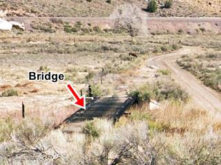
Jim Ross mentions a "One-lane timber bridge on the 1926 alignment at McCartys", and we marked its position in the map. It is pictured below.
The early and 1936 alignments meet one-quarter mile west of the San Jose river bridge.
The 1926-60s highway continues westwards (yellow line in our custom map) and forks at the San Jose River with the 1936 alignment heading straight, and the older one curving left.
Roadbuilding was an engineering challenge when it was built as it crossed the basaltic flows of the Malpais badlands. New Deal programs during the Great Depression improved the road and paved it between 1935 and 1936 once it had been straightened in this section in Anzac.
The 1936-60s roadway (pale blue line in our custom map) crosses the San Jose River again on a steel Pony Truss bridge with a single-span camelback built in 1936. Three hundred yards west, as the highway approaches the modern freeway is a second bridge also built in 1936. Route 66 then runs next to the EB lanes of I-40 and after 1.8 mi., there is another bridge from 1936.
Ahead is the tunnel under I-40. Route 66 carried on straight here and is overlaid by the freeway (western tip of the light blue line in our custom map), it reappears as NM-117 at Exit 89, on the North side of the Freeway.
The original unpaved alignment along Anzac Rd (1926-37) is marked with a blue line in our custom map.
Lava Flows
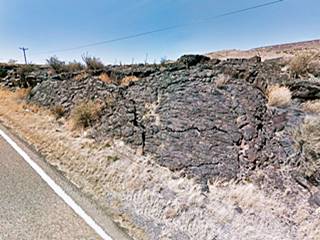
Just ahead you will notice lava flows to your right, the lava has been dated to between 2,910 and 3,080 years ago. And the Pueblo natives have an ancient legend about it! The Pueblo people tell about a river of fire in the San Jose River Valley, so they must have witnessed the outflow of slow moving Pahoehoe type lava that solidifies into ropy, smooth or lobular surfaces.
This lava flow is part of the El Malpais National Monument, the Spanish words "Mal País" mean: badlands.
McBride Rd.
Route 66's alignment from 1936 to the 1950s ran along NM-117 with a SE to NW to Horace where an overpass was built to carry it across the railroad. Here it turns west and runs parallel to the railroad one-quarter mile north of it, until it reaches the outskirts of Grants.
This is the map from Exit 89 into Grants
Another Early alignment
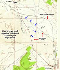
Just north of Exit 89, there is a trail heading straight north (white line in our custom map), and Jim Ross places some culverts and a bridge here (see it in our custom map); he describes the bridge as follows: "Timber bridge on the 1926 unpaved alignment over the Rio San Jose east of Grants. Date Built: Unknown. Type: One-lane, 3-spanTimber Stringer with concrete piers and abutments. Status: Abandoned; restricted access; on Acoma Tribal land."
The 1957 USGS map of Grants quadrant marks this trail as part of an "Old Railroad Grade." This seems to have been abandoned in the 1900s and may have been used to carry State Hwy 6 and the first US66 into Grants without the need to build an embankment or bridges. Click on the thumnail image map to enlarge it.
The custom map's white line west of the bridge is hypothetical and only follows the old railroad grade.
Grants
>> pale blue line in our custom map is the 1936-80s US 66 into Grants
Grants was the first major town west of Albuquerque and it has its share of Route 66 landmarks, with its neighbour Milan they were a uranium mining center from the 1950s to 1980s.
Grants to Prewitt
The original Route 66 in Grants 1926-30s (1) ran south of the railroad along San Jose Drive, a winding road on the south side of the San Jose river that crossed the early Hispanic settlment of Alamitos. It left Grants along Third St., with a grade crossing. The western tip of this segment is gone. See the pink line in our custom map.
Milan
Route 66 enters Milan after crossing the railroad along a viaduct. The current one was built in 1985, but the first one was erected in 1930.
Towards Bluewater and Prewitt
This is the US66 map from Grants to Prewitt through Bluewater, 18.7 mi along the N. Frontage Rd of the Interstate.
Bluewater
Since 1926 the highway more or less followed the course of what is now NM-122 west of Milan through Bluewater and onwards to Prewitt.
West of Milan, the 1926 alignment of Route 66 was paved in the mid 1930s and remained unaltered until the mid 1950s when it was upgraded to a four-lane divided highway. At that time, a segment in Bluewater was straightened out and a portion of it was eliminated. We marked this section with a yellow line in our custom map. Part of this segment is overlaid by the freeway. By 1957, US 66 was a four lane alighment from Grants to Bluewater.
This four lane roadway was Route 66 from 1935 until the mid 1960s when the highway was realigned along the brand new I-40.
Prewitt
At Prewitt the original Route 66 took a slight curve to run past the post office and trading post there as you can see in our custom map, where we marked it with a yellow line (1926-30s alignment).
This alignment continued on the north side of the modern highway all the way to Thoreau, below we describe this alignment in detail. In the mid 1930s when the road was paved, this curve at Prewitt (and the alignment into Thoreau) were eliminated by a straighter, shorter and safer roadbed (pale blue line into Prewitt and blue line west of it).
>> blue line in our custom map is 1930s-60s US 66 to Thoreau
Pre-1930s Alignment Prewitt to Thoreau
There is a faint alignment running parallel to the current one sandwiched between the two railroad grades that link both towns. There are many culverts and surviving bridge abutements along this segment. It can't be driven. The bridges are marked along the violet line in our custom map.
Thoreau
This old alignment enters Thoreau at its eastern tip, using a long gone grade crossing across the AT & SF tracks.
This old alignment crosses the town along 1st Ave. vanishing on the west side, where once again it is a faint trail north of the tracks.
Post-1930 Aligment Prewitt to Thoreau
Straightened out when it was paved in the 1930s, it runs along the south side of the railroad and passes about one-quarter mile south of Thoreau. Now it carries the N. Frontage Rd. This is the 1930s-60s map Prewitt to Thoreau, see the blue line in our custom map.
Thoreau to Continental Divide
>> red line in our custom map
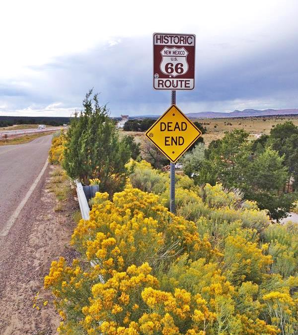
The 1930s-60s alignment runs along the Frontage Road all the way to Continental Divide it has a minor alteration at the freeway's exit there, and it ends in a Dead End on the western side of that community. This is the 1930-60s alignment Thoreau-Continental Divide map
Dead End Sign on Route 66, Continental Divide New Mexico
Highest Spots Along Route 66
Continental Divide is the current highest spot on Route 66. There are several passes along Route 66 where it crosses mountain ranges, the highest spots are the following:
- 7,550 feet (2,301 m). Glorieta Pass NM, Sangre de Cristo Mountains. Highest point from 1926 to 1937. On the Santa Fe Loop.
- 7,405 feet (2,257 m). Bellemont to Parks, Arizona, crossing the San Francisco Mountains, 1931-41 alignment.
- 7,245 feet (2,208 m). Continental Divide, New Mexico, crossing the Rocky Mountains. 1927-85 alignment.
- 7,102 feet (2,166 m). Sedillo, NM on the 1937-45 alignment, replaced when it was realigned, by a spot at 7.057 feet (2,150 m). Comer's Cafe close to Sedillo on the 1945-85 alignment. Crossing the Sandia Mountains.
- 3,595 ft (1,096 m). Sitgreaves Pass near Oatman, California, crossing the Black Mountains. 1926-53 alignment.
The Older Alignment, a "trace"
Stephan Joppich marks it with an uncertain course from Thoreau to Coolidge along the north side of the railroad. We mark its approximate alignment in our custom map with a pale violet line. You can see two culverts along the trail: our map shows them: culvert 1 and culvert 2.
Westwards from Continental Divide
Coolidge
The 1930s-60s course of Route 66 is interrupted at Continental Divide and it ran parallel to what is now I-40, on its northern side as you can see in our custom map where we marked it with a green line. This 1961 aerial photo taken at Coolidge shows the new freeway and Old '66.
There is a section that can be driven at Coolidge (map) but it is altered by Exit 44's ramps; from there to Perea the old road is buried under the freeway (yellow line) and resurfaces at Exit 36 to enter Perea.
Old NM-6 and 1926-30 Route 66 from Coolidge to Perea
This is a road with some remaining culverts, a mostly and some segments still in use. The gray line marks the approximate course of the 1920s-30s alignment. But it isn't 100% accurate. Our custom map marks the spot of an old bridge on this alignment near Staples and also the trading post B.I. Staples built on this alignment in 1926.
Perea to Gallup
>> light blue line in our custom map with directions
Perea ruins lie on the south side of the highway at its junction with Hwy 27. From here you have a 14 mile-long uninterrupted course into Gallup as shown in this map: Perea to Gallup map going through Wingate and Rehoboth.
Gallup
The city of Gallup is the largest in the western New Mexico alignment of Route 66. The highway crossed the town from east to west as shown in the following map, and runs westwards for 10 mi. without any gaps until it reaches Defiance. US66 map west of Gallup to Defiance.
Original 1920-30s Alignment
The Twin Buttes Trading Post 4 mi. west of Gallup was located on the original 1920s state highway that became the first alignment of US66. Based on this 1952 aerial photograph and the distance from Gallup, the trading post was located behind the Gallup Red Roof Inn parking area (map). These aerial photographs show what may be the original dirt surfaced highway that carried Route 66, it runs close to the railroad and west of Mentmore, skirts the rocky foothill of the mesa that the later alignment cut through. We mark this presumed roadbed with an orange line in our custom map.
Defiance
At Defiance, just east of the NM Gallup Port of Entry, U.S. highway 66 is cut by I-40 as marked with a blue line in our custom map. It resurfcaces on the south side of the freeway for only 1.3 miles (map with directions and teal line in our custom map) before being overlaid by the freeway once again all the way to Exit 8, where it crosses to the north side of the Freeway and the railroad to follow NM-118 westwards. This gap is marked with a yellow line.
To Manuelito and State Line
Manuelito
The highway now follows NM-118 for 3 miles, all the way to Manuelito, a small community on the north side of the Puerco River, running parallel to the railroad tracks. The freeway runs beyond the river, along its south side.
>> violet line in our custom map is the Manuelito Lupton section
State Line
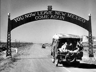
The Gateway Arch at New Mexico - Arizona state line on Route 66. From The Grapes of Wrath (1940)
Ahead, 4.3 miles west of Manuelito, at the state line, the freeway crosses the railroad and interrupts the original US66 alignment into Arizona. The modern N. Frontage Rd. curves north and follows the freeway into Lupton, Arizona. However the original alignment of Route 66 continued straight and ended up on the South Frontage Road after crossing the State Line. This map marks the alignment with a red line. A short section along the access ramp at 359 in AZ and the EB lanes of I-40 are aligned along the original roadbed.
This was the location of the classic Academy Award winning movie "The Grapes of Wrath" (1940), based on the Pulitzer Prize-winning novel written in 1939 by Nobel Prize author John Steinbeck (1902 -1968).
>> Learn more on our Grapes of Wrath
This marks the endpoint of this segment. Ahead lies Arizona, and its attractions, on the next section as you approach Holbrook is the Petrified Forest National Park (near Holbrook), Only National Park on Route 66
Visit the Petrified Forest National Park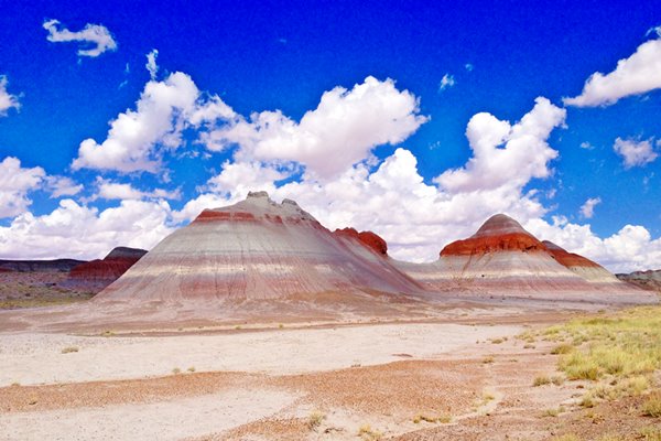
Accommodation: Hotels along this leg of your road trip
Albuquerque has plenty of lodging options for those travelling along Route 66, you can book a hotel or motel there:
>> Book your Hotel in Albuquerque
More Lodging Nearby along Route 66
Below you will find a list of some of the towns along Route 66 in New Mexico. Click on any of the links to find your hotel, motel or accommodation in these towns (listed from east to west);
On Route 66's Main alignment
The Santa Fe Route 66 segment
Eastwards
Westwards
>> There are RV campgrounds in Tijeras, Edgewood, and Albuquerque.
Continue your Route 66 Road trip:
Continue your road trip
Next Section
Route 66 from Lupton to Winslow (Arizona).
Previous Sections
Route 66, 1937-85 Main alignment Santa Rosa to Albuquerque
Route 66, 1926-37 alignment Santa Fe Loop (Santa Rosa to ABQ via Santa Fe)

Sponsored Content
>> Book your Hotel in Albuquerque


Credits
Banner image: Hackberry General Store, Hackberry, Arizona by Perla Eichenblat
Jack DeVere Rittenhouse, (1946). A Guide Book to Highway 66.


