Route 66 in Coolidge NM
Index to this page

TheRoute-66.com is reader-supported. When you buy through links on our site, we may earn an affiliate commission at no additional cost to you.
About Coolidge, New Mexico
Facts, Trivia and useful information
Elevation: 7,100 ft (2.170 m). Population: n⁄8 (2020).
Time zone: Mountain (MST): UTC minus 7 hours. Summer (DST) MDT (UTC-6).
Coolidge is a small community along Route 66 and I-40 in McKinley County, New Mexico.
History
This part of New Mexico has been inhabited for more than 10,000 years. The descendants of those Paleo Indians evolved into the Diné or Navajo people encountered by the first Europeans to explore this region in the mid 1500s.
Francisco Vásquez de Coronado led an expedition in 1540 seeking the golden cities of Cibola. They only encountered humble farming villages of the Pueblo people, the pueblos of Acoma and Zuni near Coolide. At the end of that century they returned and occupied the Rio Grande Valley. After overcoming an uprising (1680-1692) they came back and dominated the local natives. Spain incorporated Nueva Méjico as part of its colonial empire and Mexio received it after its independence from Spain in 1821. The territory was again ceded to the U.S. after it defeated Mexico in the 1846-48 Mexican American War
The U.S. Army defeated the Navajo with military campaigns in 1862-64 opening the area to European settlement.
The many names of Coolidge
The place was known as Bacon's Ranch, and was located on a pre-railroad military wagon road linking the Pueblos in the east with Wingate to the west. It was also a mail stage stop between Santa Fe and Prescott.
The Atlantic and Pacific Railroad laid the tracks through this area in 1880 and chose a spot known as Bacon Springs for their "First Division". At that time there was a small cluster of houses named Cranes (after William "Uncle Billy" Cranes). "Uncle Billy" had based his business there supplying beef and hay to the Army base in neighboring Fort Wingate. The railway built a stop there which was briefly named Cranes Station, the post office opened as Cranes in 1881 but closed in 1888 (1).
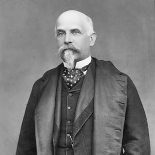
Thomas Jefferson Coolidge in 1889
In 1882 it was renamed Coolidge after Thomas Jefferson Coolidge, the president of the railroad.
Thomas Jefferson Coolidge (1831-1920) was a member of a wealthy Boston family who worked in the industry until 1880 when he switched to railroads. He retired in the early 1890s. Coolidge was a great grandsone of the third U.S. President, Thomas Jefferson and was also a distant relative of Calvin Coolidge (1872-1933), Americas 30th President.
The town boasted a tailor shop, fourteen saloons, rooming house and two general stores. Someone described it in 1884 as "the only town of one hundred people... between Albuquerque and Winslow." But in 1890 the railway moved its divison hedquarters to Gallup and at that time a fire razed the town, and what was left of it began to shrink and waste away.
The post office was renamed "Cranes" in 1896. The railroad renamed the station Dewey in 1898 to remember the hero of Manila Bay.
Admiral of the Navy George Dewey (1837-1917) defeated the Spanish fleet in the naval battle of Manila Bay in 1898, during the Spanish–American War. This victory allowed the U.S. to occupy the Philippines. The war began after the U.S.S. Maine blew up in Havana harbor and this was considered an act of Spanish sabotage. At that time Spain was combating Cubans seeking their independence. After the war, The U.S. annexed the former Spanish colonies of Puerto Rico, the Philippines and Guam, and granted Cuba full independence.
In 1900, the railroad changed the name again, to Guam.
Guam
Guam is the largest of the Mariana Islands in the western Pacific Ocean, in Micronesia. It was captured by U.S. naval forces during the Spanish - American War in 1898 without any bloodshed and annexed to the U.S.
Guam is now an unincorporated territory of the United States in the western Pacific Ocean and their residents are U.S. citizens.
The exotic island became a household name at that time, during the Spanish-American war, and was adopted by the Guam Lumber and trading Co., an Indian trading post that started its business in Coolidge in 1899 and kept on operating until 1913.
There were actually two Guam's on the railroad. One was North Guam, the other South Guam.
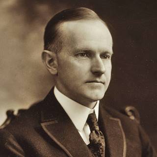
Calvin Coolidge in 1919
Finally in 1926 Berton I. Staples settled here and opened a trading post. He was a Republican so he named the new post office Coolidge (the old one had closed in 1919) after Calvin Coolidge.
The current village of Coolidge is located 3 miles south of the original railway station on the alignment of Route 66, with a trading post and gas station.
The old post is long gone, and Coolidge is a ghost town.

Where to Stay: Find your Hotel in Coolidge
There are several lodging options on Route 66 in neighboring Grants (to the east) or Gallup (west) so you won't have difficulty to book your room:
> > Book your Hotel in neighboring: Grants or Gallup
More Lodging Near Coolidge along Route 66
Below you will find a list of some of the towns along Route 66 in New Mexico. Click on any of the links to find your hotel, motel or accommodation in these towns (listed from east to west).
On Route 66's Main alignment
The Santa Fe Route 66 segment
Eastwards
Westwards
>> There is an RV campground at Lake Bluewater and another in Grants
The weather in Coolidge
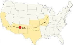
Location of Coolidge on Route 66
Coolidge has dry and sunny weather. The area is quite high and arid close to the continental divide. Summers are warm and Winters are cold; there is a large day-night temperature swing which makes for cool summer nights and very cold winter ones.
The average high in summer (July) is about 91°C (33°C), and the average low is 57°C (14°C). The average high in winter (Jan) is around 49°C (9°C), while the avg. low is only 15°C, well below freezing point (-9°C). Only 10.5 inches of rain falls each year (266 mm), most of it during the Summer Monsoon: July, August, September and October with 5.6 inches (143 mm).
Snowstorms do take place in winter and strong cold wind can be met during spring. Expect around 12 in. of snow during winter (30.5 cm).
Tornado risk
There is no tornado risk in Coolidge: McKinley County has no Tornado watches. The area west of this point all the way to California has no tornado events at all.
Tornado Risk: read more about Tornado Risk along Route66.
Map U.S. 66 in Coolidge New Mexico
Maps of Route 66
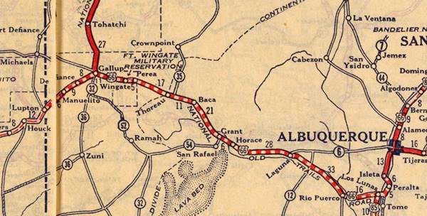
The original 1926 to 1937 US 66 ran further north, beyond the railroad tracks. Stephan Joppich marks it with an uncertain course from Thoreau to Coolidge along the north side of the railroad. We mark its approximate alignment in our custom map with a pale violet line. You can see two culverts along the trail: our map shows them: culvert 1 and culvert 2.
The 1937-60s course of Route 66 west from Continental Divide is now gone. It ran parallel to what is now I-40, on its northern side as you can see in our custom map where we marked it with a green line. This 1961 aerial photo taken at Coolidge shows the new freeway and Old '66.
There is a section that can be driven at Coolidge (map) but it is altered by Exit 44's ramps; from there to Perea the old road is buried under the freeway (yellow line) and resurfaces at Exit 36 to enter Perea.
Old NM-6 and 1926-30 Route 66 from Coolidge to Perea
This is a road with some remaining culverts, a mostly and some segments still in use. The gray line marks the approximate course of the 1920s-30s alignment. But it isn't 100% accurate. Our custom map marks the spot of an old bridge on this alignment near Staples and also the trading post B.I. Staples built on this alignment in 1926.
Perea to Gallup
Perea's ruins lie on the south side of the highway at its junction with Hwy 27. From here you have a 14 mile-long uninterrupted course into Gallup as shown in this map: Perea to Gallup map going through Wingate and Rehoboth.
Route 66 Alignment near Coolidge
With maps and full information of the old roadway.
- Lupton to Winslow (next)
- Albuquerque to Lupton (Coolidge's)
- Santa Rosa to Albuquerque (previous)
Coolidge's Route 66 sights and Attractions
Landmarks, what to see in Coolidge
Historic Context
Jack Rittenhouse in his 1946 Guidebook to U.S. Highway 66 describes the highway west of Continental Divide mentioning some landmarks that are part of Coolidge without naming the village. He wrote the following and we have included the distance from Continental Divide in brackets:
Leaving the Divide, US 66 starts to descend in a series of dips [3 mi.] is Fred Wilson's Indian Trading Post. Gas here. [4 mi.] Navajo Trading Post Co. One establishment: offering gas, cafe, and a few cabins. Rittenhouse (1946)
We will begin this leg of our Route 66 Road Trip by driving westwards from Continental Divide, losing altitude as we head west.
After the Divide the railroad split into two lines, one to the north, passing through North Guam and Ciniza, another to the south, passing through South Guam. They both met at Perea located on the eastern tip of Fort Wingate Military Reservation. Here the highway used to run along the south side of the railroad but it was removed when I-40 was built. It reappears on the eastern side of Exit 44 as a North Frontage Road by the former Fred Wilson Trading Post.
Fred Wilson Trading Post
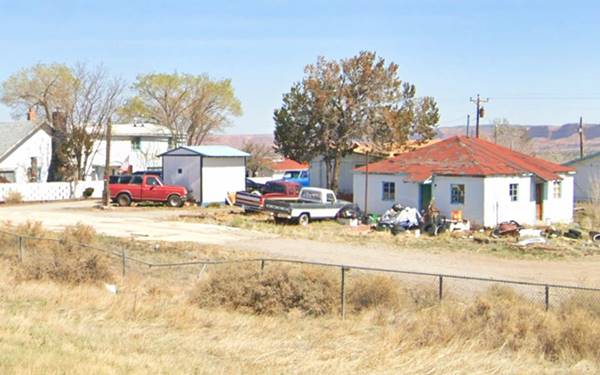
This place which is 3 miles west of Continental Divide, according to Rittenhouse there is a group of buildings at the eastern tip of this frontage road, probably the site of the trading post.
Frederic Edwards Wilson (1881-1969) worked in the automobile industry, selling cars in different parts of the U.S., starting in 1905. He took a transcontinental road trip in 1928 by car! and visited this region. He moved to Phoenix, Arizona in 1933 still working as City Manager in car sales.
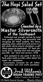
1938 advertisement Fred Wilson Trading Post. Source.
Click image to enlarge
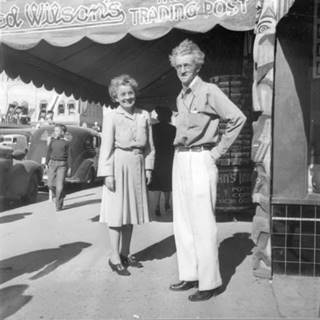
Fred Wilson and wife Ruth. Source. Click image to enlarge
In 1936 he acquired Vaughn's Indian Store renaming it "Fred Wilson's Indian Trading Post". He built it into a chain of stores across the Southwest. His first wife Georgiana McIntosh died in 1915. He remarried Ruth Rardin (1888-1962) who was his associate in his trading business (2).
just ahead, at the overpass where Highway 27 forks to the right heading north towards the railroad tracks that are 0.6 miles away to yor right, there are some more buildings. On the western side is a vacant, grafitti covered structure, falling apart. Pictured below.
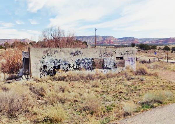
Crafts del Navajo Trading Post ❌
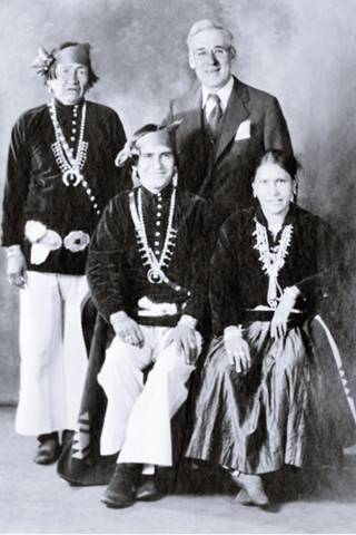
B. I. Staples and Navajo craftsmen, c.1930. Source
Berton Isaac Staples was born in Vermont in 1875. At a young age he was diagnosed with asthma and in 1912, prompted to move to the dry fresh air of the Southwest. He did so, and by 1926 he opened his trading post here in Coolidge. A contemporary report tells us that it was located " in the Wingate Valley, amile west of old Guam", the date and the location set it on the original Route 66 alignment, a faint trace that runs close to the railroad tracks to the north of the later alignment and I-40. The gray line in our custom map marks the approximate course of the 1920s-30s alignment, and the site where the old trading post was located is marked on the map, you can also see it in this satellite view and this 1952 aerial photo taken before it burned down.
It was an enormous building 200 feet long and 70 feet wide that was styled after the Palace of the Governors in Santa Fe: a single story adobe building with vigas and trunk poles supporting a wide porch. It had an area dedicated to trading Indian crafts, and also an exhibit area like a mini-museum. It housed many celebrities and also archaeologists digging the nearby pueblos.
Staples who had been a dress designer in New York developed a rapport with the Navajo and worked with them to improve the quality of the wool they used in their rugs. He also became the first president of the United Indian Traders Association (UITA) formed in Gallup in 1931.
The Navajo's name for Staples and his place was "Chísii Nééz", which means "Tall Chiricahua" due to his skinny tall appearance (the Chiricahua were Native Americans that lived in the SW of the USA and were quite similar to the Apache). His wife died in 1937 and Staples was killed in a car accident in 1938, at that time Route 66 was being realigned bypassing his business.
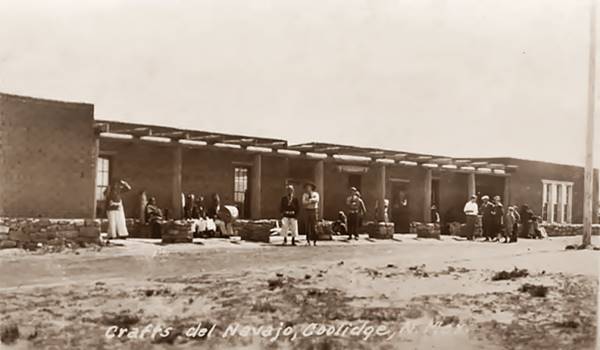
After his death Charlie and Madge Newcomb bought the trading post. They had previously been in the trading business in Crystal and Prewitt. They, in turn sold it to Hazel Prewitt. It remained open for many years until it burned down in 1955, only some rubble remains on the site (2) (3) (4).
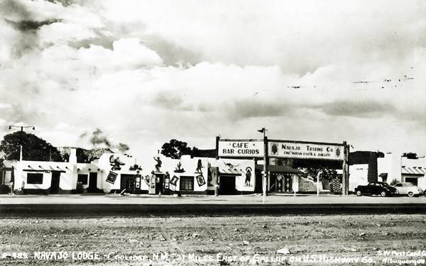
Navajo Lodge
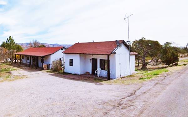
Mentioned by Rittenhouse in 1946 it was located 0.3 miles west of Coolidge crossroads, to your right on the north side of the highway on the top of a hill. The place opened on the new Route 66 alignment in 1936 and had a Café store, filling station and some cabins for travelers. Merle and Daisy Muncy ran it. Later the Rogers, Noble and Hazel built a trading post next to it. The place is still open, though no longer with a Pueblo style to it; the cabins have gabled roofs.
Continue your Road Trip
Your journey through Cooldige ends here. Follow I-40 (Route 66's roadbed was overlaid by the freeway) and head west into the next town: Wingate NM, to continue your Route 66 Road Trip.
Sponsored Content

>> Book your Hotel in Albuquerque

Credits
Banner image: Hackberry General Store, Hackberry, Arizona by Perla Eichenblat
Jack DeVere Rittenhouse, (1946). A Guide Book to Highway 66.

