Route 66 in Prewitt NM
Index to this page
About Prewitt, New Mexico
Facts, Trivia and useful information
Elevation: 6,827 ft (2.081 m). Population: 861 (2025).
Time zone: Mountain (MST): UTC minus 7 hours. Summer (DST) MDT (UTC-6).
Prewitt is an unicorporated rural community in McKinley county, in western New Mexico, located on former U.S. Hwy. 66 .
New Mexico has been inhabited for more than ten thousand years. The historic Native Americans who lived in this area were Navajo Indians; to the south were the Pueblo people.
In 1540 the expedition led by Spanish "conquistador" Francisco Vásquez de Coronado reached the nearby Acoma and Zuni pueblos. These were the first Europeans to visit the region. But only after 1597 did they effectively settle in New Mexico. The natives reacted and expelled them during the 1680-1692 Pueblo Revolt. However, the Spaniards returned, subdued the natives and held the territory as part of their empire in the Americas until Mexico became independent in 1821.
The area where Prewitt is now located was under not settled at that time. Only after Mexico lost the territory to the U.S. as a result of the 1846-48 Mexican-American War, did it become pacified when the U.S. Army subdued the Navajo people in 1864, and set up a fort (Fort Wingate) to the west.
Prewitt is located on the main transcontinental route across the Rocky Mountains south of Colorado, and The Atlantic and Pacific Railroad (which later became part of the Atchison Topeka and Santa Fe Railroad) reached the area in 1881 and built a stop on mile 1456.4 and it named "Baca". However, at that time there was another station with the same name just west of McCartys which was renamed Anzac.
Baca was the name of a very ancient local family of Spanish origin dating back to the origin of the New Mexico colony. It figures with that name in the 1927 Rand McNally Map of New Mexico further down,
The Name: Prewitt
The town was named after the two Prewitt brothers who settled here in 1916. See the main text.
The Normans brought the French name "Proz" or "Proux" to England, and it meant "brave", "valiant". It became "Prew" or "Prow" in English, and it received the diminutiv suffix "ett" (from French "Petit") becoming "Prewett", "Prewitt" and "Pruitt".
Robert Chandler Prewitt Senior (1861-1950) married Margaret Parker Anderson in Missouri in the 1880s and moved West to Colorado looking for better opportunities.
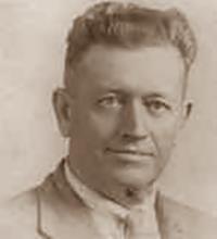
Robert C. Prewitt Jr. Source
They had four children, two of whom were involved in the history of the town, Robert Chandler Jr. (1891-1978) who ran the trading and mechantile business, and his brother Harold F. Prewitt (1892-1945) who operated a vast ranch and logging company (1). More details below when we describe the Prewitt Trading Post.
Route 66 was aligned through the town in 1926 along the old wagon trail linking Gallup with Grants. It was realigned in 1930 a few yards north, and the post moved with it. When the freeway was built in the 1960s it bypassed the village.

Where to Stay: Find your Hotel in Prewitt
There are several lodging options on Route 66 in neighboring Grants (to the east) or Gallup (west) so you won't have difficulty to book your room:
> > Book your Hotel in neighboring: Grants or Gallup
More Lodging Near Prewitt along Route 66
Below you will find a list of some of the towns along Route 66 in New Mexico. Click on any of the links to find your hotel, motel or accommodation in these towns (listed from east to west):
On Route 66's Main alignment
The Santa Fe Route 66 segment
Eastwards
Westwards
>> There is an RV campground at Lake Bluewater and another in Grants
The weather in Prewitt
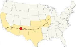
Location of Prewitt on Route 66
Prewitt has dry and sunny weather. The area is quite high and arid close to the continental divide. Summers are hot and Winters are cold; there is a large day-night temperature swing which makes for cool summer nights and very cold winter ones.
Only 10.5 inches of rain falls each year (266 mm), most of it during the Summer Monsoon: July, August, September and October with 5.6 inches (143 mm).
Strong snowstorms may hit Prewitt during winter; and the average snow fall each winter is about 11 inches (28 cm).
Tornado risk
There is no tornado risk in Prewitt: McKinley County has no Tornado watches. The area west of this point has no tornado events at all.
Tornado Risk: read more about Tornado Risk along Route66.
Map U.S. 66 in Prewitt New Mexico
Read the Detailed Description of this segment (Albuquerque to Lupton). Below is the interactive map:
>> Custom map of Route 66 in Prewitt
Maps of Route 66
This is the US66 map from Grants to Prewitt through Bluewater, 18.7 mi along the N. Frontage Rd of the Interstate.
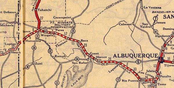
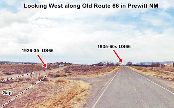
Since 1926 the highway more or less followed the course of what is now NM-122 west of Milan through Bluewater and onwards to Prewitt where the original Route 66 took a slight curve to run past the post office and trading post there as you can see in this 1926 alignment map; see the picture of both alignments further up. This alignment continued on the north side of the modern highway all the way to Thoreau, below we describe this alignment in detail. In the mid 1930s when the road was paved, this curve at Prewitt (and the alignment into Thoreau) were eliminated by a straighter, shorter and safer roadbed.
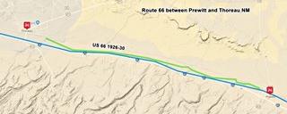
Pre-1930s Alignment Prewitt to Thoreau
There is a faint alignment running parallel to the current one sandwiched between the two railroad grades that link both towns. There are many culverts and surviving bridge abutements along this segment. It can't be driven. The bridges are marked along the old alignment shown with a violet line in our custom map of missing Route 66 segments.
Route 66 Alignment near Prewitt
With maps and full information of the old roadway.
- Lupton to Winslow (next)
- Albuquerque to Lupton (Prewitt's)
- Santa Rosa to Albuquerque (previous)
Prewitt: its Attractions
Landmarks and Route 66 sights
Historic Context
Jack Rittenhouse in his 1946 Guidebook to U.S. Highway 66 mentions this area as follows:
PREWITT. A small community, including several railroad siding shacks and Prewitt's Trading Post. Just west is the depot of the Petroleum Products Co. Gas station here. Rittenhouse (1946)
He also mentioned there were no tourist accommodations in the village and that roughly three miles east of Prewitt the scenery changed as scrub trees appeared, leaving the desert behind; the highway also began to climb slowly towards the continental divide.
Road Trip across Prewitt
Driving west wards from Bluewater the highway has a SE-NW course and curves to the west as it enters Prewitt. The first building along the 1930s-50s Route 66 was located where the current post office is. This was the Zuni Mountain Trading Post.
Zuni Mountain Trading Post
To your left. This was the second trading post in Prewitt, it opened in 1947 and was operated by T.B. Greer, whose brother Bert owned a post nearby at the Continental Divide. It was a complete tourist stop as it not only sold goods and curios, but it also had a motel, café, and a filling station.
Greer sold it in 1950 to Dave and Betty Ortega who changed its name to "Zuni Mountain."
During the uranium mining heyday the Ortegas focused on catering to the miners and the local Indians while the other trading post in Prewitt concentrated on the travelers driving along Route 66.
When Interstate 40 bypassed Prewitt, the Zia Mountain Trading Post shifted its line of business and led by Ortega it focused on wholesale and retail of Native American handicrafts. After Dave Ortega passed away, the premises were leased to other business. Dave passed away in 1980 and Betty leased the property. The building with its vacant gas pumps is still standing.
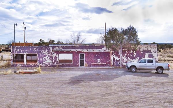
You can see it in this aerial photograph taken in 1952.
Prewitt Refinery site ❌
One quarter mile west of the trading post, to your left is a 70-acre tract of land enclosed by a chain link fence topped with barbed wire. This is the site of the former oil refinery. It was built in 1940 to process the oil from Hospah 40 mi. north of Prewitt, where it had been discovered in 1926. It operated until 1957.
It began as Petroleum Products Inc. and was owned over the course of the years by Malco and El Paso, who closed it demolishing the structures and buildings. The operation of the refinery contaminated the soil and groundwater. Cleanup and remediation of the surface has been completed, but subsurface structures may continue in the future (2). Rittenhouse mentions their Depot and gas station in Prewitt.
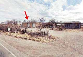
Just ahead, to your left, the original gravel surfaced 1926-35 Route 66 turns away in a wide curve to the south. It was along this alignment that Robert Chandler Prewitt Junior opened his trading post in 1916.
Prewitt Trading Post
The two Prewitt brothers, Robert "Bob" Chandler (1891-1978) and Harold F. Prewitt (1892-1945) moved to Baca, New Mexico to trade and do business. Harold had built a parnership with George Breece and owned a 320,000-acre ranch on the Continental Divide with sheep and cattle as well as being a logging company. His older brother "Bob" had focused on trading with the local Navajo, and in 1917 applied for a Stockraising Homestead on the land here and built a store 25x25 feet square, next to his 32x32 foot dwelling, windmill and tank (4).
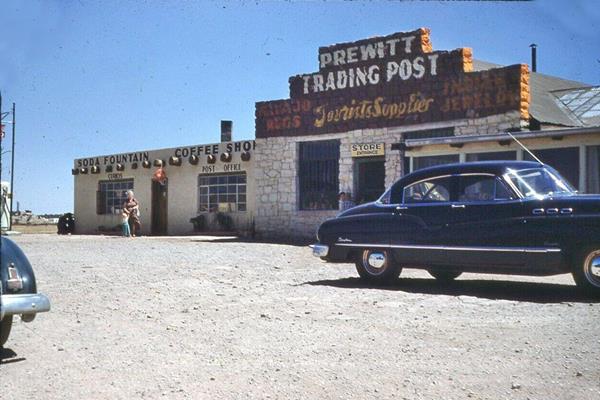
The Navajo called it "Kin Łigaií" which means "White House", after the building. There was a post office here too since 1928, and Robert Prewitt Jr. was its first postmaster.
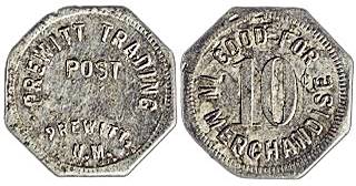
Prewitt Trading Co. Indian trading token. Source
Trading with the Native Americans was a lucrative business, the shops usually minted their own currency in lieu of money. This meant that the Indians sold their crafts and got these tokens which could only be redeemed for goods sold at the same Trading Post. This created a "captive" customer. The token in the image, from Prewitt's Post, says: "Prewitt Trading / Post / Prewitt, N.M." , and on the other side: "Good For / 10 / In Merchandise."
When the Highway 66 was straightened out when it was paved in 1935, its roadbed was moved north (to where it is nowadays) and Robert moved his trading post next to it. He let the Navajo families build their hogans on his porperty and didn't charge them any rent.
Robert "Bob" C. Prewitt Jr. also known as "Old Man" Prewitt married Cornelia (or Corneline), known as "Old Lady Prewitt". Robert C. Prewitt Sr. moved to Albuquerque in 1943, and probably prompted by the untimely death of his younger brother in 1945, Bob sold the trading post in 1946 to Justin LaFont. After he became a widower in 1948, he remarried Selma Graff (3). He moved to San Bernardino California in the 1950s.
Justin's Western Shop
Justin and his wife Odessa LaFont changed its name to "Justin's Trading Post." J.D. LaFont became Prewitts postmaster, in 1956 he was succeeded by his mother-in-law Irene Fullerton, who also helped in the store 3).
Justin and Odessa added fashionable fiesta style dresses designed by Odessa to their regular curio shop items and renamed the trading post "Justin's Western Shop." They employed local Navajo women to cut and sew the garments and as business flourished, they opened another shop in the Historic Old Town district in Albuquerque. Their marketing efforts included postcards with the Western-style clothes modelled by Odessa and Justin themselves! Below are some examples:
Odessa LaFont (right)
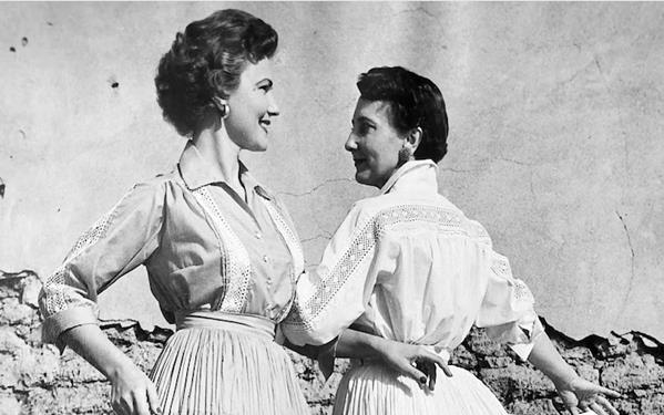
Justin LaFont
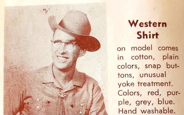
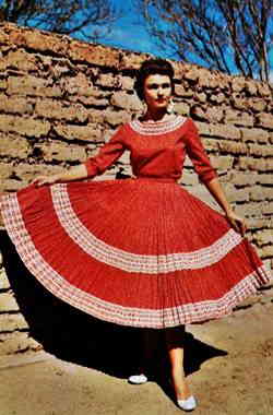
1950s Western Fiesta Dress, Justin's Shop postcard. Source
Click to enlarge
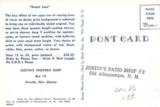
Details on the back of a Justin's Shop postcard. Source
Click to enlarge
However, the LaFonts realized that the coming of the interstate would seal the fate of the trading post business in Prewitt, so they sold the traing post in 1958, and moved on to explore the tourist services industry and in 1960 they purchased the Thunderbird Lodge in Canyon de Chelley National Monument in Chinle Arizona. They phased out the trading post there and built two motels to cater to the tourists visiting the National Monument. The trading post era was coming to an end (5)(6).
Tomahawk Bar
Further west, to your right, on Route 66 by I-40 Exit 63. Prewitt.
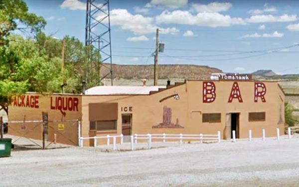
The bright pink Quonset hut Tomahawk Bar is a sight you cannot miss, it was built in 1947, it is not only a bar it is also the town's third trading post.
Quonset Hut
Quonset huts were developed during World War II as quickly assembled prefabricated structures. They were made out of corrugated galvanized steel and have the shape of a half-cylinder, with a semicircular cross-section. Their name comes from the town where they were first built, in Rhode Island in 1941.
Tomahawk Bar, Prewitt, New Mexico
Continue your Road Trip
This marks the endpoint of your journey in Prewitt head west into the next town: Thoreau NM, to continue your Route 66 Road Trip.
Sponsored Content

>> Book your Hotel in Albuquerque

Credits
Banner image: Hackberry General Store, Hackberry, Arizona by Perla Eichenblat
Jack DeVere Rittenhouse, (1946). A Guide Book to Highway 66.


