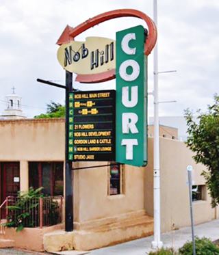
Route 66 in Nob Hill ABQ NM
Albuquerque's Attractions along US 66
A List of Stops and Landmarks
We will use the ❌ symbol to mark those that have been torn down.
1. Eastern Albuquerque
- Paradise Club ❌
- Little Beaver Town ❌
- Original 1930s Roadbed
- Holiday Inn East
- Bar-B-Q Inn
- Phillips 66 Gull Wing service station
- Tropicana Lodge, later Nendel's ❌
- Caravan Nightclub neon sign
- Iceberg Cafe in East ABQ ❌
- Rodeo Court ❌
- Steer on a pole
- Eldorado Court later Roma Motel ❌
- Zuni Motor Lodge ❌
- Muffler Man
- Fair Grounds Motel ❌
- Carrico Modern Court ❌
- Sundowner Motel & Bill Gates
- Former Denny's Diner
- Leonard's ❌
- Tracy's Modern Court ❌
- Trade Winds ❌ / Replica Neon Sign
- Honey Dew Drive Inn ❌
- Nod-A-While Motor Lodge / Silver Spur ❌
- American Car Wash
- Cooksey Court, later New Mexico Motel ❌
- Bimbo's Drive In ❌
- Anchor Inn / Bar-X Motel& ❌
- New Chinatown Restaurant neon sign
- Ambassador Lodge ❌
- Coronado Court ❌
- El Sombrero ❌
- American Motor Inn
- La Puerta Motor Lodge
- Luna Lodge
- Piñon Motel
- Lo-La-Mi Lodge ❌
- Bow & Arrow Lodge
- Chevron Gas Station
- Phillips 66 Gull Wing Gas Station
- Loma Verde Motel
- Pioneer Motel
- Texaco Station
- Ace Cafe
- Tewa Lodge
- La Vela Lodge
- Desert Sands Motel Neon Sign
- Hiland Theater
- Zia Motor Lodge
2. Nob Hill (This Page)
- De Anza Motor Lodge
- Circle K Motor Court
- Bel Air Motel
- Goody's Restaurant
- Martens Tourist Court and Trailer Park ❌
- Comfort Lodge
- Town House Restaurant
- Aztec Court ❌
- Two Gas stations, one gone, Mobil survived
- One of the First KFC in ABQ
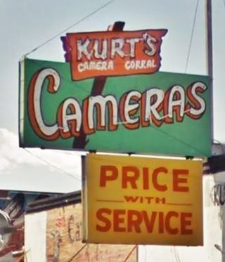
- Kurt's Camera Corral ❌
- Original Iceberg cafe ❌
- Rainbow Cafe
- Hiway House Motel
- Pipp's Texaco
- Triangle Cafe ❌
- Tonnie Pegue's Standard Oil Service Station ❌
- Lobo Joe's ❌
- El Oriente Auto Court
- Premiere Motel
- TraveLodge Motel
- The Toddle House
- Nob Hill Motel
- Nob Hill Conoco
- Johnson Standard Station
- Nob Hill Business Center
- Jones Motor Company & Texaco
- Valentine Diner Police Substation
3. Downtown
- Pig and Calf
- 66 Diner
- A Phillips Petroleum Gull Wing
- Cottage Bakery
- Zia Oil Station
- Park Lane Hotel ❌
- Lorlodge Motel
- Central Ave. Underpass
- Hiway House #1 ❌
- Railway Depot
- Glorieta Sation Neon Park
- Yrissari Building: Maisel's first store
- Franciscan Hotel ❌
- Sears
- Hospital
- Little House Cafe ❌
- Crossroads Motel
- Hyatt Chalet Motel
- Whole Hog Cafe
- Imperial 400 Motel
- TraveLodge Downtown
- Hilton Hotel
- El Fidel Hotel
- Kimo Theater
- Lindy's Coffee Shop
- Maisel's Indian Trading Post
- Holocaust & Intolerance Museum of New Mexico
- El Rey Theater
- Firestone Tires
- Downtowner Motor Inn
- Skinner Grocery
4. Old Town & Western Albuquerque
- Chevron ❌
- Lorlodge West
- Bell Indian Trading Post
- World Court ❌
- Desert Inn ❌
- Arrowhead Lodge ❌
- Texas Ann Court ❌
- Moon Motel and Café ❌
- White Way Court ❌
- Katson's Drive Inn ❌
- Country Club Court ❌
- Pueblo Bonito Court ❌
- Casa Grande Complex ❌
- Tingley Beach and Beach Motel ❌
- Rio Grande Bridge
- The Volcanoes
- El Nido Motel ❌
- Rainbow Court
- Sandia Motel ❌
- Duke's Court ❌
- Stop In Court ❌
- Auto-Tel Court ❌
- Miller's Court ❌
- Silver King's Auto Court ❌
- Blue Bell Court ❌
- Hill Top Court ❌
- Arrow Court and Hill Cafe ❌
- Navajo Court
- Dutch Motel ❌
- California Court ❌
- Hill Crest Motel ❌
- Sky Court ❌
- Mile Hi complex
- Covered Wagon Court
- Hubbell Motel ❌
- Oasis Lodge ❌
- Phillips 66 Gull Wing ❌
- Jerry Unser ❌
- Route 66 Conoco
- Route 66 Travel Center
- Capri Motor Hotel
- Horn Oil Co. Motor Lodge
- Sandia Theatre
- Old Town of Albuquerque
- San Felipe de Neri Church
- Tower Court
- El Don Motel
- Monterey Motel
- Country Club Court
- El Vado Auto Court Motel
- Relict Motel Signs: Cibola and Super 6
- El Campo Tourist Court
- La Hacienda Camp
- Siesta Court
- Americana
- Western View Diner and Steak
- Adobe Manor
- Westward Ho Motel
- French Quarter Motel
- Grandview Motel
5. Fourth St. Route 66
- Cavalier Court ❌
- Crossroads of Route 66
- Ruffin's Texaco #1
- Horn Oil North 4th St.
- Ruffin's Texaco #2 ❌
- El Camino Motor Hotel
- King's Rest Court ❌
- Court John ❌
- Madonna of the Trail
- Monkbridge Manor ❌
- Luke Apartments
- Clyde Miller Tire & Service Station
- Texaco Gas Station
- Scott's New Motel ❌
- Barelas-South Fourth Street Historic District
- Hudson Auto Sales
- B. Rupee Drugs
- Tasty Freeze Drive In
- Durand Motor Company
- Hi-Way Service Station - Horn Oil
- Sinclair Service Station
- Magnolia Service Station
- Navajo Super Service Station
- Red Ball Cafe
- Fito's Cafe

Nob Hill - Albuquerque attractions
Along Route 66 From Nob Hill into Downtown ABQ
In this page we describe the classic Route 66 sights from east to west, starting at the intersection of Washington St. and Central Avenue on the 4300 block, on Nob Hill's eastern tip, and westwards from there into Downtown Albuquerque.
We will use the ❌ symbol to mark those that have been torn down.
Nob Hill: its History
Col. D.K.B. Sellers developed this area in the early 1900s. He served a term as Albuquerque's mayor and was a local entrepreneur. In 1916 he erected a water tank on the top of a hill in eastern University Heights for the local residents and he named this hill "Nob Hill" after the posh and expensive neighborhood of San Francisco, California, well known for being the place where the city's wealthy upper class lived.
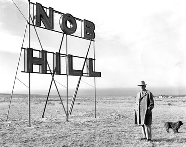
It was developed in the mid 1920s. The photo above was taken near Silver and Tulane S.E. streets.
Sellers said that this would be "the coming aristocratic section of Albuquerque", and prior to that he had promoted it as a healty place for tuberculosis treatment, the clean air, sunshine and altitude was the only treatment for TB in those days. Sellers said "move out of the low zone and up to the ozone;" the low zone being the coal and wood smoke polluted Albuquerque valley area.
The alignment of Route 66 along Central Ave. in 1937 brought prosperity and spurred growth in Nob Hill and its surroundings. Between 1937 and 1930 the buildings in the district grew from six to forty four!
Route 66 in Nob Hill
Your Route 66 Road Trip through Albuquerque
At Washington St. and Central Avenue (4300 block) you leave Eastern Albuquerque and enter Nob Hill District, These are the landmarks along Route 66:
Nob Hill
Central Ave. S. E., (4300 - 2900) between Girard and Washington and from Lomas to Silver.
This district is roughly 2 mi. east of Downtown's 1st St., just beyond the University of New Mexico. It spans fifteen block along old US 66 and is the place for shopping and eating. It has many historic iconic Route 66 buildings.
Route 66 was aligned along Central Avenue in 1937 and this brought new life to the dormant rural highway: motels and diners popped up along it. Flashing neon signs enticed drivers and stores sprung up to cater to the travellers. Route 66 gave Nob Hill its personality, it became Albuquerque's "Main Street" with the added charm of Route 66 Americana style architecture.
As you enter Nob Hill, to your right is a Historic Landmark:
De Anza Motor Lodge
4301 Central Ave NE, Albuquerque, NM.
Listed in the National Register of Historic Places
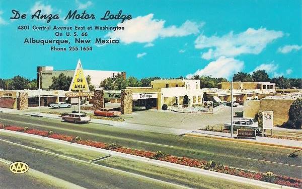
Opened in 1939 by S.D. Hambaugh and C.G. Wallace the De Anza Motor Lodge offered comfortable accommodation, as well as a Zuni crafts and jewelwry trading store to Route 66 travelers. It was mentioned by Rittenhouse in his US 66 Guide book published in 1946.
De Anza Motor Lodge in a vintage 1960s postcard:
Below is a photograph we took in September 2016:
The De Anza Motor Lodge while it was still standing
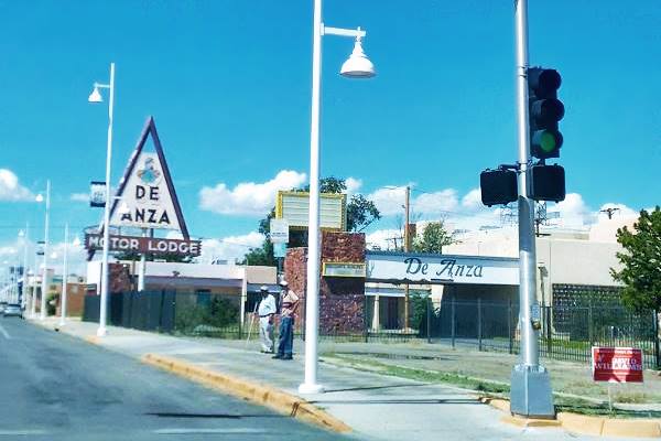
The old motel was torn down in 2017, and the neon sign remains, a legacy from the past. This is a 2022 street view.
The motel that occupied the whole block was named after Juan Bautista de Anza, a Spanish soldier and Explorer, born in Mexico in the 1700s, who opened the overland route from Mexico to California and founded what is now the city of San Francisco, California. In its heyday, it was the biggest motel on East Central Avenue built in Spanish and Pueblo styles. It had private phones and air-cooling in every unit. Wallace kept working it until his death in 1993.
For Trivia lovers: some scenes of the series Breaking Bad were shot in its parking lot.
Circle K Motor Court / Swayze's Dinner Bell

Swayze's Diner. Source.
Click to enlarge
On the next bloc, to your right, on the NW corner of Graceland NE St., at 4223 Central Ave NE was Swayze's Dinner Bell.
Mr. and Mrs. H. H. Swayze bought a restaurant called Dinnerbell Cafe in 1942, and its postcard says it "Offered motorists Albuquerque's finest meals... steaks, chicken." Click on the thumbnail postcard to enlarge it.
Later it became the Circle K, a "Motor Court" with two lines of rooms facing each other. Its postcard announce that it was "Best For Rest". The building is still there, as private apartments. It had 12 units and "choice of shower or tub." The name comes from a cattle brand, a letter K inside a circle.

Classic postcard of the Circle K Motel. Source. Click to Enlarge
Heights Cocktail Lounge
Adjacent to the Circle K, at 4217 Central, it opened in 1950, It was owned by a gay couple, George Konougres and Vasilios N. Kartsotis who also owned Duke's Cave, and it became a gay people meeting point. (1). They later moved to downtown Albuquerque. Now it it still a bar, the Rocksteady's Social Club.
Bel Air Motel
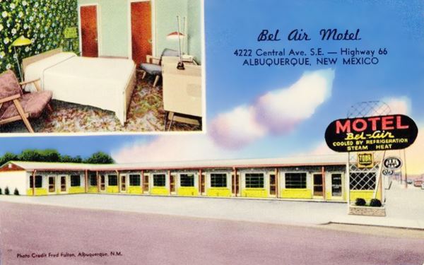
To your left, on the south side of old Route 66, at 4222 Central Ave SE, on the SW corner of Graceland was another classic motel, the Bel Air Motel.
It has an L-shaped layout and its postcard pictured below describes it as "A new motel with beautiful modern furniture and wall-to-wall carpeting. All room have private ceramic tiled baths, tub and shower-are heated by hot water heat and cooled by refrigeration."
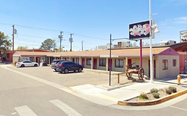
This is its current appearance; the units are still there. Now it is the parking lot of a Thai restaurant that is across the street:
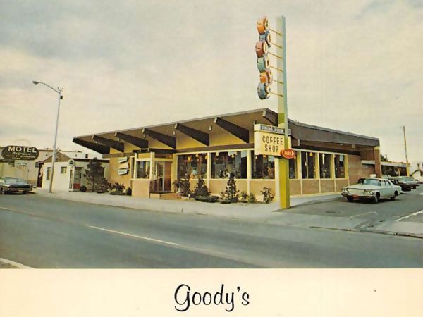
Goody's Restaurant
Adjacent to the Bel Air, with a modern 1960s design (upwards canted roof tip with exposed eaves). It was a "popular dining place for business and professional people... fine food at popular prices." It had a tall neon sign with red and white disks aligned vertically with its name. Then, by the late 60's it was pruned to a lower height, and a new sing went up on the eastern side of the building. The postcard image below shows the original neon sign and the car in the driveway is a 1963 chrysler New Yorker.
Der Wienerschnitzel

Der Wienerschnitzel" Hot Dog restaurant "Now and Then". Source. Click for street view.
At the end of the block at Sierra Dr., on the north side of the avenue to your right (NE corner at 4203 Central) the 1949 Albuquerque City directory listed an A & W Root Beer stand. A steep gable roof restaurant now stands on the property that in 1969 was one of Albuquerque's three "Der Wienerschnitzel" Hot Dog restaurants. That was their original design.
4100 Block: Development razed the old motels
On the next block both to your right (street view right) and left (street view left) urban development has altered the scenery in the past few years.
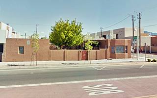
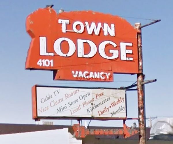
The Town Lodge, formerly El Oriente Auto Court and Martens Tourist Court (later the Royal Hotel with the Sarape Restaurant) were torn down.
Below is the history of these now gone motels:
Martens Tourist Court and Trailer Park ❌

Martens Tourist Court (gone) c.1940s. Nob Hill, ABQ Route 66. Source
Click to enlarge
It stood at 4119 E Central, on the NW corner with Sierra Dr. it was "New Mexico's Finest Trailer Park. Pleasant, quiet and courteously managed." It had cottages some of which had kitchenettes.
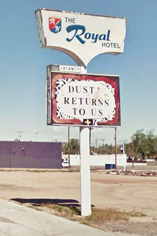
The old motel was torn down in 1972 and replaced with a new building, the Royal Hotel, with the El Sarape Restaurant on the corner.
The motel was razed under the city's nuisance abatement laws in 2009. Unfortunately the El Sarape was destroyed by arson shortly after. See this 2007 view of the motel with the two neon signs (El Sarape and the Royal Hotel).
These signs survived until recently as you can see in this st. view of them in 2019. They were removed when the new buildings went up.
Nightclubs on the south side of the highway
The south side of Central was the location of the 1980s 4100 Club Lounge and Liquor Store, that later grew into The Acropol Dinner and Dance Club. These became the Coral Western Night Club. And were later leased to Paul Vilella and Bill Preveti who ran it as Leo's La Roc. More recently it was The Pulse. A neon sign stood there until the new building went up in 2018 (view of the sign).
El Oriente Auto Court / Minton / Town Lodge ❌
It stood at 4101 Central Ave NE, now the Broadstone building stands on the spot. It opened in 1935 as the El Oriente Auto Court. Later, after 1946 (Rittenhouse mentions the El Oriente in 1946) it became the Minton Lodge. It had "21 Large attractively furnished rooms... All rooms facing shaded restful patio for the convenience of guest." Its last reincarnation was as the Town Lodge, torn down in 2020. Below are some views of all these versions of the same motel:
It stood at 4101 Central Ave NE, now the Broadstone building stands on the spot. It opened in 1935 as the El Oriente Auto Court. Later, after 1946 (Rittenhouse mentions the El Oriente in 1946) it became the Minton Lodge. It had "21 Large attractively furnished rooms... All rooms facing shaded restful patio for the convenience of guest." Its last reincarnation was as the Town Lodge, torn down in 2020. Below are some views of all these versions of the same motel:
El Oriente Auto Court in a vintage c.1940s postcard
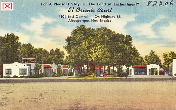
It stood at 4101 Central Ave NE, now the Broadstone building stands on the spot. It opened in 1935 as the El Oriente Auto Court. Later, after 1946 (Rittenhouse mentions the El Oriente in 1946) it became the Minton Lodge. It had "21 Large attractively furnished rooms... All rooms facing shaded restful patio for the convenience of guest." Its last reincarnation was as the Town Lodge, torn down in 2018. Below are some views of all these versions of the same motel:
Minton Lodge c.1950s postcard
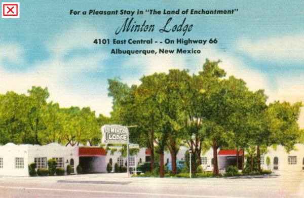
Below is its final view shortly before being torn down; the trees have gone, and the curved walls have been "modernized" to straight lines, but note that the curved tops of the doors have remained unchanged and the neon sign is the same!
The Town Lodge before it was torn down. 2017
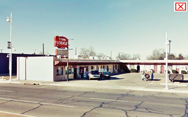
Neon sign of the Town Lodge motel before it was torn down. ❌
Comfort Lodge
To your left on the SW corner with Montclaire Dr SE, at Central 4020 SE is the 1950s Comfort Lodge site, the orignal motel had a single story with its units laid out in an J-shape distribution along Montclaire. The current building has added a second story but it remains recognizable.
It was owned and ran by Mr. and Mrs. E. C. Ryan and was a "very attractively furnished motel in the uptown shopping district of Albuquerque." It had "Colored tile baths... Radios and free alarm clocks. Television in the lobby..."

Former Comfort Inn nowadays. Source. Click to enlarge
Morningside Shopping Center
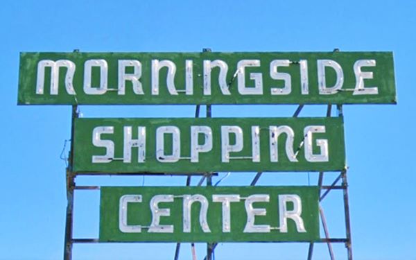
To your right, on the NE corner of Morningside and Central Ave. is the Morningside Shopping Center that dates back to the 1940s, it appears in the 1942 Sanborn Fire Insurance Map with a corner restaurant, El Cortez at 4001 Central, and shops along both streets. One of them, at 4003 Central was Mike's Liquor Store. The building is still standing and has a c.1960s neon sign on the corner, pictured above.
Town House Restaurant / Paramount Cafe
Across de street, opposite the Shopping Center, to your right is an antiques shop at 3911 Central Ave NE. In the 1940s it was the Paramount Cafe and Cocktail Lounge and it appears in the 1942 Sanborn map as a restaurant.
George Argyres opened it in 1958 and closed it around 2007 after an issue with the lease and the death of one of his sons, Pete. It was a Greek seteakhouse that served Greek ethnic food and Southwestern classic dishes.
George and his son Constantine "Dino" Argyres reopened the steakhouse in eastern ABQ in 2012 (read our description in our East Albuquerque Route 66 attractions page as: Steer on a pole). That restaurant sported the steer in its signage, over the roof. But it closed in 2018 when Dino died, aged 57.
Below is a view of the original Nob Hill Town House steakhouse and the current appearance of the same spot, the Town House antique shop:

1960s Town House Restaurant and steer. Source. Click to enlarge
On the next corner to your left, SE side (3900) was the Hoyts Dinner Bell Restaurant, torn down in the 1980s, now there is a laundromat there.
Motels on Aliso Av. and Central
There were two motels at the intersection. From south to north:
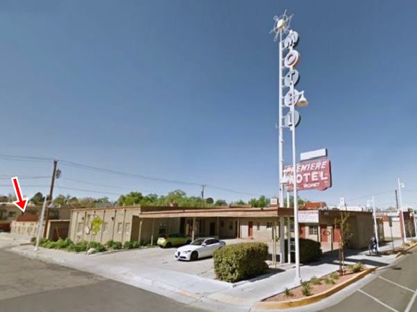
Premiere Motel
Starting at the SW corner of Aliso, at 3820 Central Ave SE and including an annex behind the main building.
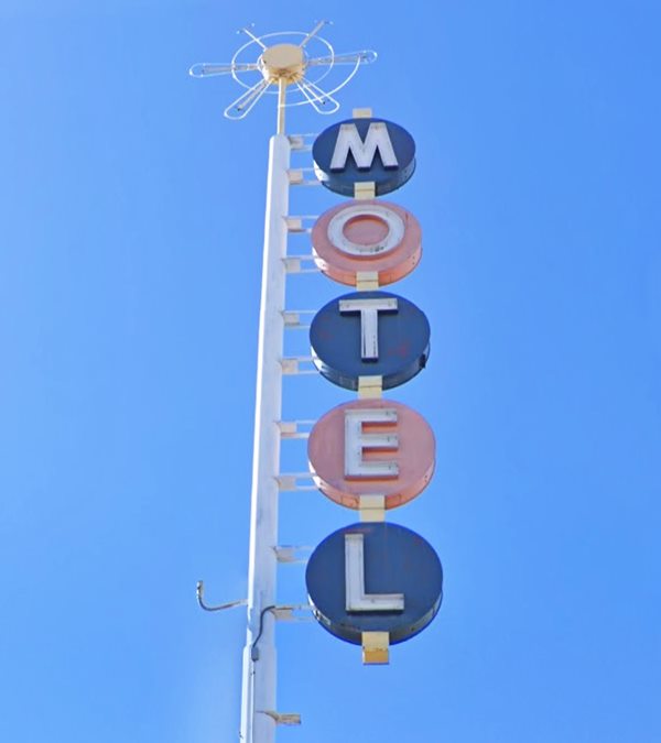
It opened in 1941, and a 1946 postcard says "Mr. and Mrs. H. Dendinger, operating owners" it depicts the same neon sign later used on the side entrance along Aliso Ave. for the annex units on the south side of the property.
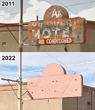
A postcard mailed in 1950 tells us its owner was H. Dendinger (what had happened to his wife?) and that it was "Not the Largest but the Best" adding that it had "rear units and patio" and "30 De Luxe units." These rear units were in an annex was located at 119 S Aliso Ave. and originally had six units and an L-shaped layout along the corner and a central courtyard. It later evolved into a U-shaped complex in the early 1970s and is still there, now an apartment complex, with its neon sign still there, though painted over with brown paint (see image).
By the 1960s the postcard announced 35 rooms and its owners were Manly and Dorothy Betts, a modern vertical neon sign with red and white circles appeared on the corner.
Below are a "Then and Now" set of images of the motel, the red arrow marks the sign along Aliso Ave.
Premiere Motel in a vintage c.1960 postcard
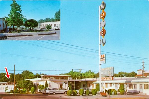
Current view shows it has kept its original appearance and preserved its modern 1960s neon sign, the red arrow marks the old neon sign around the corner on Aliso Ave:
Aztec Court ❌
Listed in the National Register of Historic Places
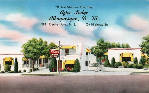
The second motel was on the NW corner with Aliso Ave., the razed Aztec. Located to your right at 3821 Central Ave NE. It opened in 1932 built with a Pueblo style, with wood vigas in the two story office. Its postcard said "If you stop... you stay... 12 modern cottages" and was owned by Mr. and Mrs. Vernon Roof.
It was expanded in the 1950s when its garages were enclosed and converted into units and the new neon sign was added. It was listed as a historic place in 1993. It received funding in 2003 from the National Park Service Route 66 Corridor Preservation Program to restore its neon sign. But the motel deteriorated and in 2001 it was torn down. The sign was preserved for further restoration.
This is the Aztec in a 2007 street view while it was still standing. The neon sign remained there until 2015 before it was taken down (see picture). The sign is now at the Neon Neon Park collection at Glorieta station in Downtown Albuquerque.

Conoco ❌
To your right, where the Alon gas station is now located (NE corner with Solano Dr) was a Conoco with a tall sign. And across Solano, at 3719 Central Ave NE, Albuquerque was the East TraveLodge Motel.
East TraveLodge Motel
The building is still standing and in great shape. After its term as a motel, it had been converted into apartments, the "University Lodge"; but in 2023 it became the "ZAZZ Motel", catering to travelers once again. The Travelodge had 55 units and a heated pool; it was located "Halfway between Uptown and Downtown areas, easy drive to Sandia Atomic Museum, Recreation Areas and Quaint Old Town." Notice the half-round barrel vaulted canopy by the office, very 1960s! The 1942 Sanborn Insurance map shows a gas station on this site.

TraveLodge Motel old postcard. Source
. Click to enlarge
The Toddle House
To your left, across from the old Travelodge, at 3718 Central Ave SE. This cafe dates back to the early 1950's.
James Frederick "Fred" Smith developed the concept created by J. C. Stedman in the 1920s and grew into a business with 200 restaurants in almost 90 cities by the 1950s. In 1962 it was acquired by a competitor and eventually liquidated.

Generic Toddle House postcard, 1940s. Source
It was one of the first fast food national chains. It was "Open All Night" offering "Good Food at its best" and sold saldads, sandwiches and soups. It had a standard brick cottage styled building with a blue gable roof. They all had a central stainless steel counter and stools, no tables.
Nob Hill Court - Modern Auto Court
Listed in the National Register of Historic Places
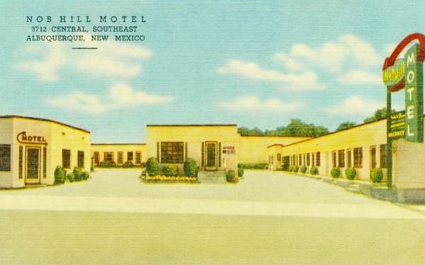
On the same block, west of the Toddle House, at 3712 Central Ave SE is the former Nob Hill Court, it opened in 1937 just when US 66 was realigned along Central Ave into Albuquerque.
I was originally known as the "Modern Auto Court" operating under that name into the 1950's when it switched to being thhe Nob Hill Court. It was listed as a Historic Place in 1993.
The 1942 Sandborn Insurance map shows it with thirteen units; The building, now a small mall is still there with its original vintage 1950s neon sign.
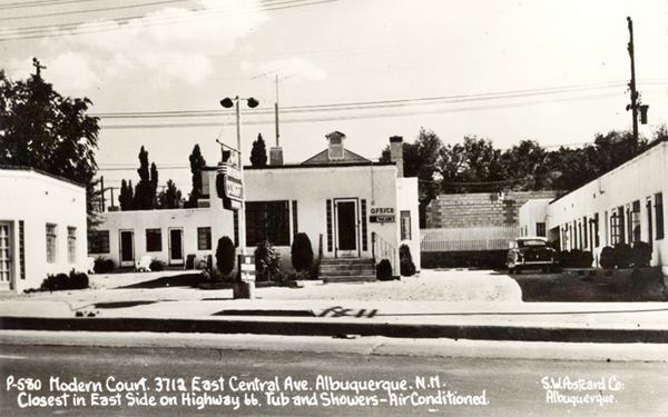
Below it has changed names to Nob Hill Court and placed a revamped neon sign with a curving arrow on the right side of the property:
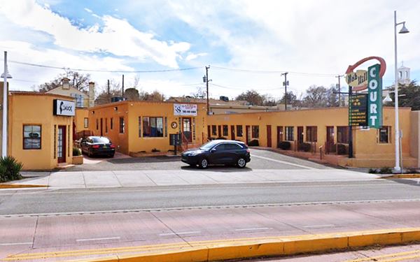
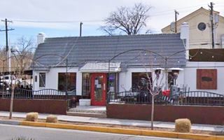
To the right is a classic florist, Peoples Flowers Shops. Max Pollack and his wife came to Albuquerque in 1944 and opened their first shop downtown, and this one, in Nob Hill in the early 1960s. The green tiles and the neon sign on the facade are the original ones (street view.)
Two Gas stations, one gone, Mobil survived
Here at the corner with Hermosa at 3625 Central, the 1942 Sanborn map shows two gas stations, one to your right, on the NW corner, a Mobil. Slender steel poles on an empty pumps island holds up the flat canopy with rounded corners and multiple horizontal bands typical of the 1940-50 Mobil styling. A corner office with glass panes, and the former service bays to the left have been walled in.
On the SW corner was another gas station (3624) its external tanks stood where the parking lot of Clowndog restaurant is now located. The building behind it, along Hermosa (107) was an auto repair shop. It was torn down to make space for one of Albuquerque's first Kentucky Fried Chicken (more on this below).
One of the first KFC in ABQ and its surviving sign

Old KFC neon sign over the years (1969-2022). Sources
Click image to enlarge
At 3624 Central, it was one of the five locations in ABQ by 1969 when it was photographed by Ernst Haas (See an advertisement from 1969) it had the classic Kentucky Fried Chicken bucket sign. In 1975 it became "Fat Humphrey's Hero Palace", founded by Irving Malott (1922-2006) a landmark eatery for nearly 25 years! Then it became "Nellos’s Ragin' Shrimp" who refurbished the neon sign in 2015 and since 2019 it is a hot dog restaurant. Click on the thumbnail image to see how the original KYC sign evolved over the years.
Classic 1969 photo of Central Avenue by Ernst Haas
The image below was taken in 1969 at Carlisle Blvd. and Central Ave, looking east. It is the work of photographer and artist Ernst Haas (American/Austrian, 1921-1986), its title is: Route 66, Albuquerque, New Mexico, USA.
To the left, you can make out the sites and landmarks mentioned further up: from the First National Bank in the distance, followed by the Ramada Inn sign with the man blowing a trumpet, followed by a yellow triangle (De Anza's), Town Lodge, Town House restaurant, Aztec Hotel, Conoco, Travelodge. On the right there is a Muffler Man with a yellow cap, the Premiere motel signs, Nob Hill Court, Peoples Flowers, and a Kentucky Fried Chicken.
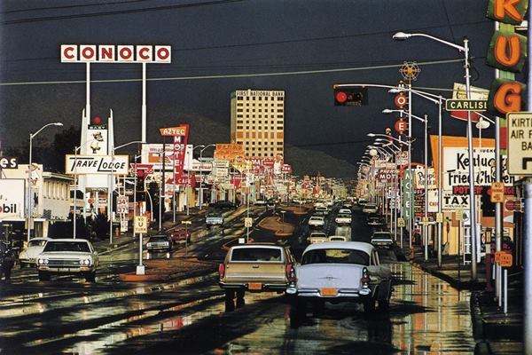
This is the Same view from Carlisle Blvd. nowadays.
Here on the north side of Route 66, at Carlisle are two great classic Art Deco gas stations, with bold geometric shapes including triangles, curves, chevrons, zigzags, ridges evoking a new era.
Nob Hill Conoco
To your right, on the NE corner of Carlisle at 3601 Central Ave NE, Albuquerque. The Nob Hill Station was a Conoco service station and dates back to 1939, shortly after Route 66 was aligned along Central Avenue. It is pictured below in a contemporary magazine with a curved corner service bay, a geometric stepped canopy over three gas pumps, and its name in modern font on the parapet, and large plate glass windows.
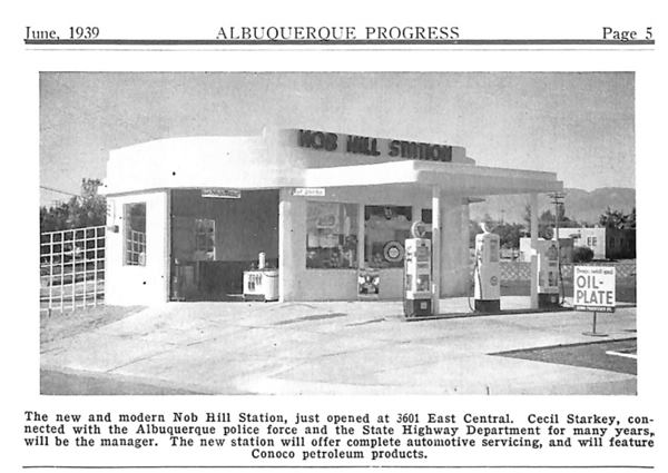
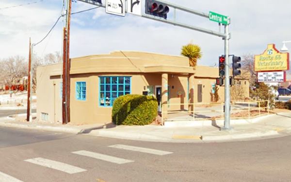
The building is still there, with a shorter canopy, plate glass windows replaced with multi-pane ones, and the curved corner walled in and a window placed there. Below is its current appearance from the same spot the 1939 photo was taken.
McCormick / Johnson Standard Station

McCormick Standard Service in 1946 and 1975. Sources
Click image to enlarge
Across Carlisle, at 3523 Central Ave NE, Albuquerque. The Albuquerque Oil & Gasoline Co. built its Standard Station in 1946, during the post-World War II boom years. It was first operated as F.V. McCormick's service and later known as Johnson Starndard Motor Company. It was also the venue of Club Rhythm and Blues and now an Asian Restaurant.
It has a distinctive turret on the office area, the flat stepped canopy on the corner has been enclosed. The two service bays to the left have been enclosed, but the Art Deco style is evident. Below is how it looks today:

Across Central, on the SW corner of Carlisle with Central is a unique historic site:
Nob Hill Shopping Center
3500 Central Ave and Carlisle Blvd, Albuquerque, NM.
Listed in the National and State Register of Historic Places
A photo I took of the Nob Hill Business Center in 2016 (click on image for Street View):
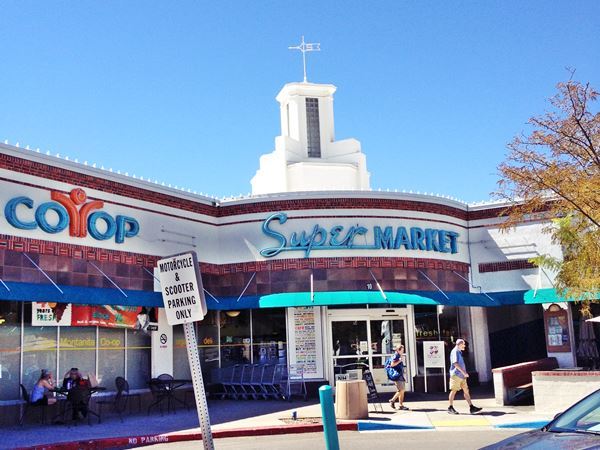
Built in 1946 the Nob Hill Business Center was New Mexico's first drive-in shopping center, an icon of America's love affair with automobiles.

Postcard, Nob Hill Business Ctr. Source
Click image to enlarge
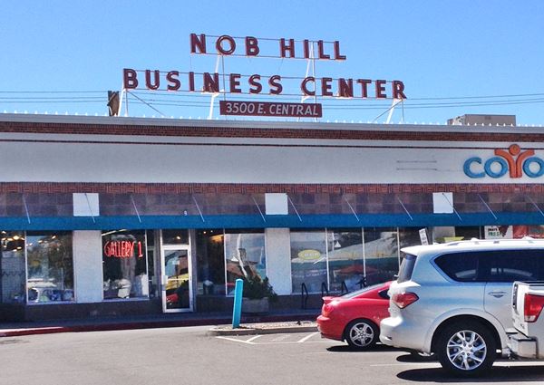
Robert B. Waggoman, a local real estate developer, in partnership with the Stromberg brothers saw the opportunity based on America's booming car-centered society and built it at a key location in Nob Hill. It opened in 1947 and had a U shaped distribution with a central parking lot. It is built in the Moderne style with two pairs of decorative towers on each side, stucco walls and decorative brick courses. It has twenty one commercial spaces and it is still open with stores, restaurants and a supermarket.
Being located outside of the Downtown - Railroad depot district, many local skeptics dubbed it as "Waggoman's Folly" however it soon attracted many tenants and prompted others to imitate the concept in Albuquerque and beyond.
Another view of the Nob Hill Business Center in 2016:
Vic Tanny's Gym neon sign
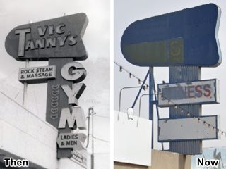
Vic Tanny's neon sign, Nob Hill. A. Whittall. Source
Click for St. view
Vic Tanny was a visionary fitness entrepreneur that in the 1950s opened the first national chain of gyms. In 1957 he incorporated in Albuquerque as Vic Tanny Albuquerque Inc. Having grown to 88 locations in 1960, his lavish lifestyle and bad management led to its bankruptcy.
Nowadays nobody remembers Tanny or his gyms. One of Tanny's spots was located across from the Nob Hill Business Center at 3503 Central Ave (right).
Since then many shops and stores, including a restaurant, but the Tanny neon sign is still there!
Kurt's Camera Corral ❌
There are many shops along Central on the 3500, 3400 and 3300 blocks, some have gone.
One, Kurt's Camera Corral at 3417 Central is an example: Kurt Kubie and his wife Edith moved from Vienna to Chicago and in 1950 a road trip to the West revealed Albuquerque to them, and they opened their camera shop in Nob City.
It thrived until the 2000's when digital cameras and online shopping displaced brick and mortar stores. Their son Jim shuttered the shop in 2015. The image shows its now gone neon sign, this is the street view now.
Baca's Restaurant ❌

Baca Restaurant, ABQ Source
On the 3300 block where there is a modern apartments and shops complex, at 3311 Central, once stood Baca's Mexican Restaurant.
It was owned and ran by Meliton E. "Milton" Baca Sr. (1914-1975) whose death was tragically tied to his business: he died after breing stabbed during a robbery attempt as he was on his way home from the restaurant.
At 3301, on the NE corner of the same block, the 1942 Sanborn insurance map shows a "Filling Stat. Auto Rep." with three external gasoline storage tanks.
Jones Motor Company & Texaco
To your left, on the SE corner with Wellesley Dr, at 3222 Central Ave. SE, Albuquerque, NM is a historic former gas station.
Listed in the National Register of Historic Places
This bold Art Moderne building dates back to 1939 when Ralph Jones had it built by Flinn and Stamm, contractors and Tom Danahy, architect, to serve as a filling station and car dealership.
Jones Station in Nov. 1939, as construction finalizes:
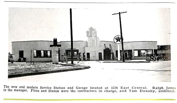
Jones moved to a new building in 1957 and the building was used for different purposes, in 1993 it became a historic site and in 1999 when Kelly's Brewery restored it for their brew pub. In 2021 M'Tucci's an Albuquerque Italian restaurant chain set up their newest location here.
Its tower was an eye catcher for those entering town from the east along Route 66. In its day it was the most modern service station in the West. Its curved contours, and diagonal location on a corner were part of its Art Moderne design. White colors, geometric lines. The dealership had large glass windows (right) and ths service bays of the station flanked the central office with rest rooms, and the lubrication area was to the left, with multi-pane windows. Pictured below, click on image to enlarge:

Jones Texaco late 1940s. Source
Click image to enlarge

Jones Texaco nowadays. St. view
Click image to enlarge
Rainbow Cafe
Opposite Jones' on the SE corner of Wellesley and Central (3300) was the Rainbow Cafe and, you can the building and its sign in this 1940s picture (click to enlarge) looking east along Central Ave. The corner property has been a jewelry shop and in 2022 a cannabis store. This is the Same view nowadays.
Jones Texaco & Rainbow Cafe sign c.1940. Source
Click image to enlarge

1960s Highway Host Motel. Source
Click image to enlarge
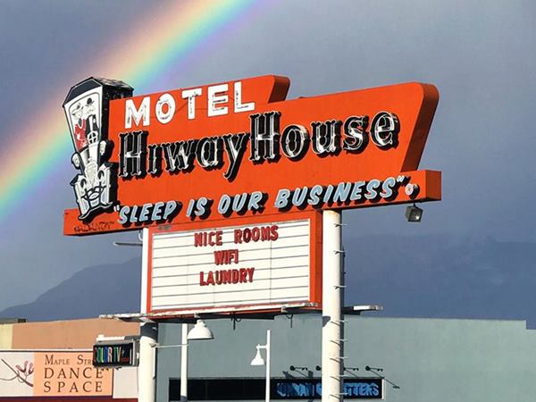
Hiway House Motel
Adjacent to Jones at 1924 Central, to your left, is the Highway House Motel. It was built in 1958 and was part of a chain created in 1956 by Delbert Eugene "Del" Webb (1899-1974), a real-estate developer, and a co-owner of the New York Yankees. In 1946 he was the general contractor for mob boss Benjamin "Bugsy" Siegel, and built the Flamingo Hotel and Casino in Las Vegas. He also built another Hiway House in Downtown ABQ. Its slogan was "Sleep is our Business." Del Webb sold the chain in 1960. The building and its neon sign have been restored by the current owners as you can see below. This is the Street view of the property nowadyays.
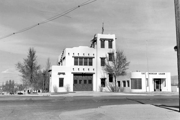
Nob Hill Firehouse and American Legion
Across Central, on the NE corner (3211) is the historic Nob Hill Monte Vista Firehouse and next to it (right) the old American Legion Building. Built in Pueblo revival style, they have been restored and repurposed as a restaurant and a commercial building.
It was built in 1936 under the Works Progress Administration funding, set up during the Depression to create jobs in the construction industry. It served as a fire station until 1972. Both images show a "Then and Now" view of the buildings.
Lobo Theater area
The 3100 block had a Standard Oil service station at 3123 (NW corner with Bryn Mawr) which also had a turret over its office we marked it with a number (2) in the vintage pictures below taken in 1939 -click on them to enlarge. Number (1) is the Monte Vista Firehouse.

Lobo Theater area in 1939, looking NE. Source
Click image to enlarge

Lobo Theater area in 1939, looking West. Source
Click image to enlarge
Below is another view in the 1940s, the area is developing quickly (Lobo Theater is in the center, behind the hanging traffic light):
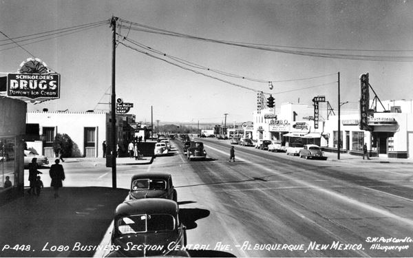
The American Home Appliances building where Yanni's restaurant is located was built after these pictures were taken. There was a Restaurant at 3120 (to your left on the south side of Central). There was a drugstore on the SE corner with Richmond and the building is still there: Schroeder's Drugs but the current neon sign is later maybe from the 1960s? See a "Then and Now" sequence below:

Schroeder's Drugs in 1937. Source
Click image to enlarge
On the NE corner was Little Chief a drive in cafe at 3101 Central. We marked it with a (3) in the images. Its postcard says: "Cleve Davenport, Prop. 'We Serve Nationally Advertised Foods'." It has been torn down.
The following 3000s block had one of Route 66's wacky stops before Lobo Theater was built:
The Original Iceberg Cafe ❌

Iceberg Frozen Custard advertisement, 1931. Source
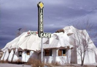
Iceburg Cafe, Bernalillo. Source
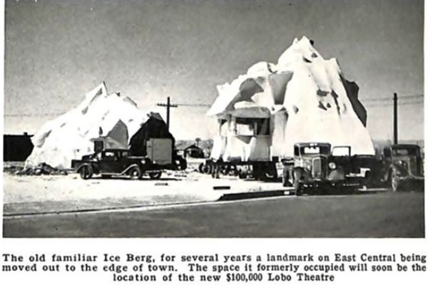
The Iceberg began life on May 27, 1931 as a frozen custard stand, at 3017 Central Ave. known as "Mac's Iceberg". The prefabricated structure had one module and was shaped to look like an iceberg and was the creation of Kansas born Carl Armstrong "Mac" McAdams, although he went broke in 1932, it was bought by new owners and a second module added. Being prefabricated (stucco over chicken wire with a timber frame) it was taken apart and moved in 1938 to 5219 Central Ave. as the second Iceberg Cafe, here it also included a filling station selling Cosden branded gas and signage with a polar bear.
Below is a photo of the 1938 moving of the building, the caption reads "The old familiar Ice Berg, for several years a landmark on East Central beingmoved out to the edge of town. The space it formerly occupied will soon be the location of the new $100,000 Lobo Theatre."
In 1953 it moved to Bernalillo on "Hwy 85 18 miles north of Albuquerque" and renamed the Iceburg (with a "U"); it was eventually torn down in the 1960s-70s.
On the corner across from the Little Chief, and kitty-corner from Schroeder's, at 3025 Central, was the Pantheon Restaurant, marked (4) in the preceding images, its menu included seafood and catered to locals, moviegoers and Route 66 travelers.
Lobo Theater
Listed in the National Register of Historic Places
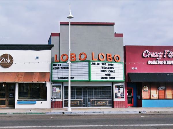
At 3013 Central, to your right is the historic Lobo theater, marked with number (5) in the images above. It opened in 1938 after the Iceberg was moved east. Its name is a reference to the University of New Mexico's sport team, the Wolves ("Lobo" is Spanish for wolf). It closed for good in 2000, and now is a lounge and event center.
.
Next to Lobo, a Bowling was built (3005) in the early 1940s, and on the NW corner there was a Texaco:
Pipp's Texaco

1940s view Pipp's Texaco and Sanborn map, A. Whittall. Source
Pipp's Texaco was located at 3001 Central on the NE corner with Dartmouth Dr NE.
It was built before the bowling next to it. It had a hip roofed canopy angled at 45° with the corner and a service bay facing Dartmouth.
It remained opin into the late 1960s. The image (click to enlarge) shows it -red arrow- and includes the 1942 Sanborn map showing it, and further down in a 1967 advertisement.
The building is still standing, its canopy has been walled in and converted into a room. Below is a view it nowadays.

Pipp's Texaco advertisement, 1967. Source
The Triangle
Central Ave. and Monte Vista Blvd. meet forming a sharp angle at Girard. Dartmouth Dr. forms the base of the triangle and this three-street intersection formed a triangular property that has seen many buildings over the course of the past 85 years. Below is a mid 1950s view of the spot (click on it to enlarge it). It looks east from Girard along Central. It shows: left, (1) the Triangle Cafe with its neon sign. Middle (2) Pegue's Standard Station. To its right is Pipp's Texaco, the bowling with the Schlitz sign on its roof with the slogan "The beer that made Milwaukee famous," and beyond the Lobo theater. On the right (3) is Lobo Joe's restaurant's sign.
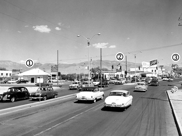
Triangle Cafe ❌
Located at 2901 Central, marked (1) in the image, it got its name from the triangular property and sported a neon triangle on its roof. It opened there in 1929, and was owned by C. M. Dyer. But, in 1934, when the owner of the property didn't renew his lease, Dyer opted to move it. The Albuquerque Progress of Dec. 1, 1934 wrote: "The Triangle Cafe... is being prepared for a hop across the street to 2901 Monte Vista Blvd... the building which is of brick, will be moved piecemeal... and will be of the same triangular shape." [1]. It had a triangular shape with the apex facing Girard and its base on its norteastern tip.
The Triangle switched from a Cafe to a cocktail lounge in the 1950s and remained open until the 1970s. In the 1980s it was torn down and now a Taco Bell stands on the property.
Tonnie Pegue's Standard Oil Service Station ❌
The site vacated by Triangle Cafe was quickly occupied by a gas station in fact, that was the reason that Dyer's lease wasn't renewed. It is marked (2) in the image above. The local media reported in 1935 that "Work has begun February 25 by the Lembke Construction company on foundations of the new super service station to be erected... by Standard Stations Inc." [2].
Tonnie Pegue operated it from 1939 to 1966 when he retired. His name appeared on the building (pictured further down); the Standard station had two canopies extending north and south, towawrds Monte Vista and Central, with a central building along the main axis of the triangle. Howard Hull took over with Howard's Chevron. Later known as Triangle Service Station, and by the 1970s, Robert E. Dobb's Triangle Chevron. A robbery gone wrong led to the death of Herbert Smith, the station's attendant in 1971. The place eventually closed and the property lay vacant for many years [3].
This aerial photo from 1967 shows all three landmarks at the triangle: Pipp's, Pegue's and the Triangle Coktail Bar.
Valentine Diner Police Substation
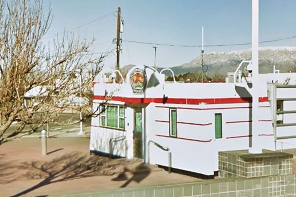
Now a former Valentine Diner stands on the triangle. It has been restored and converted into a Police Substation, but it has an interesting story:
It was originally the "Little House Cafe" located a 107 8th St. SW, on the corner of Park and 8th, by the Central Ave. roundabout (map marking the spot.)

Original Little House Diner, c.1990. Source
Click image to enlarge

Original Little House Diner, c.1950s. Source
Click image to enlarge
Joe and Della Hernandez ran it from 1947 until 1992. When they retired, they donated it to the Albuquerque Museum for its preservation. The Aristocrat model Valentine Diner was stored and around 1997 an agreement was reached with the Albuquerque Police to use the building as an APD substation in Nob Hill. It was restored and moved to the triangle.
Valentine Diners
Valentine Diners are a typical example of Route 66 "Americana" (More on Americana), it was a prefab restaurant, defined as "a restaurant shaped like a railroad car", the name derives from "dining car".
The diner was one of at least 2,000 diners built by the Valentine Manufacturing Company located in Wichita, Kansas. They were ready-to-use mobile diners with stools, tables and counters, plus a kitchen area. They were available in different sizes and models.
Arthur Valentine (1891 - 1954) invented them and began producing them in 1947. After good growth during the 1950s, the company gradually lost business in the 1960s and folded in 1975, the fast food chains and suburbia had displaced the small diners.
There are quite a few of these diners on Route 66: the Red Top Valentine Diner in Edgewood NM, Twin Arrows AZ Valentine, and the Winslow Arizona Valentine just to mention a few of them.
Lobo Joe's ❌
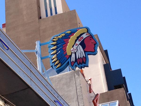
To your left, on the south side of Central, on its SE corner with Girard is the site of Lobo Joe's restaurant, its neon sign from the 1950s marked with a (3) in the image further up. It read "Howdy I'm Joe - Lobo Restaurant - Drive In."
It was located on the western side of where the Walgreens now stands, and was torn down --- Its advertising promoted "Lobo Joe's Chuck Wagon Acres of Free Parking 2900 E Central.... All you cna eat 1.75. Kiddies 1.00." Joseph L. Kramer opened it in 1959 and in 1965 sold it to Mannie Gianopoulos and changed its name to "Mannie's". In 1985 Mannie transferred it to Joe Koury. It closed in 2020 and was torn down in 2022.
End of this leg of your Route 66 Road Trip
Here, at the gateway spanning Central Ave., on the intersection of Central and Girard, you leave Nob Hill and it marks the end of this leg of your Road Trip.
Continue West into Downtown Albuquerque
Continue your Road Trip heading west along Route 66 ⁄ Central Avenue into the Downtown district of Albuquerque.
Read all about Downtown's Route 66 attractions in our Next Page.
The Route 66 Attractions in Albuquerque
Albuquerque is, after St. Louis and Oklahoma City, the third largest city between its two endpoint megacities, Chicago and Los Angeles. However, it has preserved far more classic landmarks along Route 66 than any of the other cities.
We have split this segment of your Route 66 road trip across Albuquerque into six separate webpages, to be able to mention all of them. They are, from east to west, the following:
- Main Page: Albuquerqe overview, hotels, history, maps
- Page 1. Eastern Albuquerque
- Page 2. Nob Hill
- Page 3. Downtown
- Page 4. Colonial Town & Western Albuquerque
- Page 5. 4th St. Route 66 - 1926-37 Sights
Continue your Road Trip westwards beyond Albuquerque
After covering each of our five webpages you will have reached western Albuquerque, the endpoint of your Route 66 acreoss the city. You can continue your Route 66 road trip by heading west into the next town, Suwanee NM on the 1937-85 alignment or Isleta on the 1926-37 alignment.
Sponsored Content

>> Book your Hotel in Albuquerque

Credits
Banner image: Hackberry General Store, Hackberry, Arizona by Perla Eichenblat
Jack DeVere Rittenhouse, (1946). A Guide Book to Highway 66.
Sources for the KFC neon sign: 1969, 1970s, 2010s, 2022
Sources for the McCormick station: 1946, 1975
Further reading on the Iceberg Cafe


