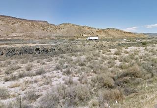
Route 66 in McCartys NM
Index to this page
About McCartys, New Mexico
Facts, Trivia and useful information
Elevation: 6,170 ft (1.880 m). Population: 718 (2025).
McCartys is a tiny village in Cibola County east of Grants, just off the old Route 66.
Time zone: Mountain (MST): UTC minus 7 hours. Summer (DST) MDT (UTC-6).
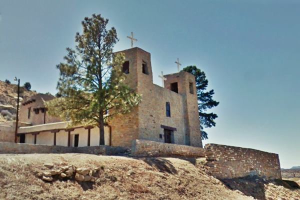
Santa Maria Mission, Route 66 at McCartys
The ancestors of the historic Pueblo and Navajo Native Americans have lived in New Mexico for more than 10,000 years; they were hunter gatherers that later became farmers and used the water of the rivers that flowed from the Rocky Mountains to irrigate their crops.
The first Europeans to reach the area, were Spanish, members of the expedition of Francisco Vásquez de Coronado, who visited the nearby Acoma Pueblo in 1540; the Spaniards would return and occupy the area in the early 1600s. A revolt in 1680 expelled them for a period of 12 years, but they returned and defeated the natives.
The Name McCartys
The A.T. & S.F. railway depot was named after a contractor who lived there when the railway was being built in the early 1880s.
McCarthy and McCarty is an Irish origin surname derived frm the Gaelic name Mac Carthaigh (son of Carthach) and Carthach in turn means "loving".
After Mexico's independence from Spain in 1821, New Mexico became part of its territory, but after being defeated by the U.S.A during the Mexican - American War (1846-48), it ceded the province to the U.S.
The Atchison Topeka & Santa Fe Ralway built a depot here and named it McCartys on mile 1422.2 in the 1880s. It appears on mile 1423.3 in 1936, probably due to the shortening of the line by realingments rather than a re-siting the station itself.
McCarty's is not located on the Route 66
It is not located on the original Route 66, but to the south and east of it, next to the southern bank of the San Jose River.
The town itself predates the railway and was founded as Santa María (Saint Mary). When Jack DeVere Rittenhouse drove through the town in 1946, he also called it "Santa Maria" in his "A guide to Highway 66."

Where to Stay: Find your Hotel close to McCartys
There are no motels or hotels in McCartys, but nearby in Albuquerque and Grants have plenty of lodging options for those driving along Route 66. You can book a hotel or motel in either town:
>> Book your Hotel in neighboring
>> Book your Hotel in neighboring Albuquerque, Grants or Acoma Pueblo
More Lodging Near McCartys along Route 66
Below you will find a list of some of the towns along Route 66 in New Mexico. Click on any of the links to find your hotel, motel or accommodation in these towns (listed from east to west):
On Route 66's Main alignment
The Santa Fe Route 66 segment
Eastwards
Westwards
>> There are RV campgrounds at Acomita and at Grants.
The weather in McCartys
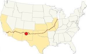
Location of McCartys on Route 66
The weather in McCartys is dry and sunny. The arid climate causes cold winters and hot summers. There are 278 sunny days per year.
The average high temperature in summer (July) is 89°F (31.7°C). The average summer low is 56.3°F (13.5°C). During winter (January) the average high is 47.4°F (8.6°C) and the average low is below freezing: 17°F (-8.3°C).
Rainfall is around 10.5 inches (292 mm) per year; and most rainfall (6 in. - 152 mm) is concentrated between July and Oct. during the "Monsoon" period. There are 53 days with precipitation per year. Snowfall is around 18 inches and may fall between November and March.
Tornado risk
There is virtually no tornado risk in McCartys: Cibola County has no Tornado watches. The area west of this point has no tornado events at all. Tornado Risk: read more about Tornado Risk along Route66.
Map U.S. 66 in McCartys New Mexico
Read the Detailed Description of this segment (Albuquerque to Lupton). Below is the interactive map:
>> Custom map of Route 66 in McCartys
Maps of Route 66
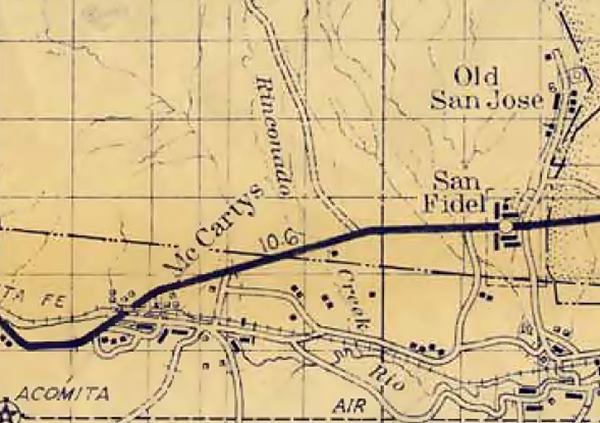
The Route 66 alignment coming from San Fidel is cut by the Freeway at Exit 96. The gap here is marked with a red line in our custom map. The highway continues with a NE to SW course as the South Frontage road of the freeway, curving south towards Mc Cartys as it approaches the lava flows to the Southwest. The freeway's alignment also curves at this point.
Old US 55 passes beneath the railroad using a subway, and the entrance to Mc Cartys' along Pueblo Rd. ahead it crosses the San Jose River on a stringer bridge built in 1936 (see its plaque).
Possible early alignment in Mc Cartys
The 1955 aerial photo shows another possible roadbed more or less parallel to the later course of Route 66 south of the freeway. Its reamains can be seen in the open country, and along Abeita and Pueblo roads where it can be driven (map); I-40 cuts its course, but we show it here, with a white line.
We have not found any early 1900s map of the area to prove or disprove that this was the original alignment adopted by State Highway 6, and later by Route 66.
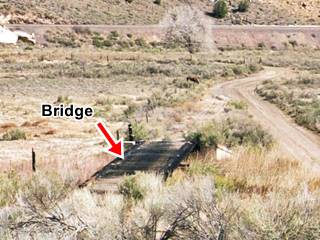
Jim Ross mentions a "One-lane timber bridge on the 1926 alignment at McCartys", and we marked its position in the map. It is pictured below.
The early and 1936 alignments meet one-quarter mile west of the San Jose river bridge.
Lava Flows
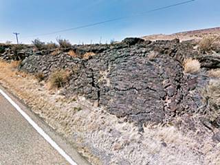
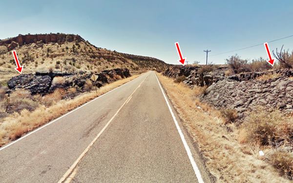
Just ahead you will notice lava flows to your right, this was an engineering challenge when US66 was built here, as it crossed the basaltic flows of the Malpais badlands. New Deal programs during the Great Depression improved the road and paved it between 1935 and 1936.
The road goes through Anzac, and once again crosses the San Jose River on a steel Pony Truss bridge with a single-span camelback built in 1936. Three hundred yards west, as the highway approaches the freeway is a second bridge also built in 1936. Route 66 runs next to the EB lanes of I-40 and after 1.8 mi., there is another bridge from 1936.
Ahead is the tunnel under I-40. Route 66 carried on straight here and is overlaid by the freeway (light blue line in our custom map), it reappears as NM-117 at Exit 89, on the North side of the Freeway.
Route 66 Alignment near McCartys
With maps and full information of the old roadway.
- Lupton to Winslow (next)
- Albuquerque to Lupton (McCartys')
- Santa Rosa to Albuquerque (previous)
The Santa Fe Loop (1926 - 1937)
Our Santa Fe Loop page describes the complete 1926 to 1937 alignment of Route 66 from Santa Rosa to Albuquerque through Pecos, Santa Fe and Bernalillo.
McCartys: its Attractions
Landmarks, Route 66 sights
Historic Context
Rittenhouse mentions McCartys in his 1946 Guidebook to U.S. Highway 66:
SANTA MARIA is a small village located off to the left here, with a cluster of adobe homes and a mission church clinging to the rocky side of the mesa. No tourist facilities except a gas station at the highway. Rittenhouse (1946)
"The Western Gateway to Acoma Pueblo"
Gas station?
Driving west from San Fidel, after leaving the Whiting Brothers gas station, cross the freeway at Exit 96 to its southern side. There is a gap in the roadbed where it was cut by I-40. The highway runs with a SW course beside the freeway. Ahead there is a fork to the left that leads to McCartys, it is an old road and it appears in the map further up (Abeita Rd.)
At the crossroads there is an abandoned ruin of a building. Probably related to Route 66 maybe even the "gas station" mentioned by Rittenhouse. Its vacant structure is pictured below.
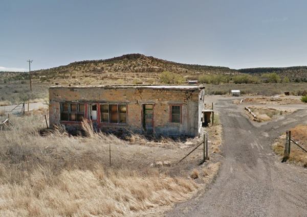
This road leads straight into the village. Keep on straight, ahead is the "subway":
Railroad Underpass
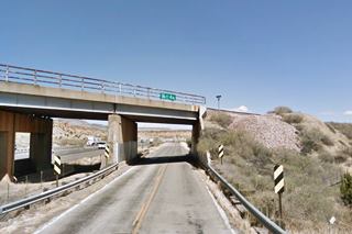
After 1936 the alignment of Route 66 passed beneath the A.T. & S.F. railroad using an underpass built for this purpose in a New Deal program. The picture below shows it was built under the Works Program Grade Crossing project (W.P.G.H. 74) in 1935, it provided "a concrete and steel subway under the A. T. & S. F. Railway on U. S. 66 near McCartys." The steep railroad embankment here makes us wonder if the older alignment ran further east, along Abeita Rd. and had a grade crossing or passed beneath the tracks at the same bridge used by the railroad to cross the San Jose river.
The underpass is still there, but altered when I-40 was aligned beside Route 66. A new one has been built on the same spot.
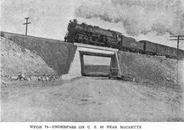
The highway crosses the San Jose river just ahead using a concrete stringer bridge also built in 1936. Then, to your left is the other access into McCartys. The main feature is the old Mission Church.
Santa Maria Mission
The simple stone building of the Santa Maria Mission was built in 1933 with a Spanish Colonial style. It has two sqare towers and a flat roof, overlooking the river and the railroad from a hill on its southern flank.
It was erected by The Marquette League for Catholic Indian Missions of New York City and was the gift of Mrs. Alfred J. Talley.
The Santa Maria annual feast day takes place on the first Sunday in May.
The WPA guide to New Mexico published during the New Deal days, describes the village as follows: "Santa MArí de Ácoma, formerly known as McCarty's... is a farming community of Ácoma Indians. A number of adobe houses clustered against the rocky hillside, the new stone church, and the people themselves, present a picture of yesterday."

1943 view of McCartys. Source. Click to enlarge
The black and white image (click to enlarge) was taken by Jack Delano in 1943. It looks eastwards along the railroad tracks towards the church and village. The right and north flank of the field in the foreground is now occupied by I-40. Route 66 (1) runs in a wide curve around its right and upper (eastern) side. You can see the mission church (2) upon its hill. To the left is the subway undrpass of Route 66 (3) and beside it are the foothills of Horace Mesa.
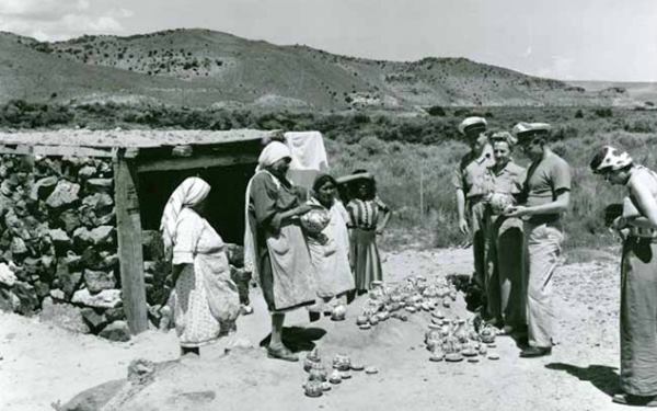
Westwards, the highway winds following the San Jose River and enters the lava fields. Rittenhouse mentions this spot where "you enter a lava flow, whose black lava lies in hardened masses on both sides of the road" and added that there is a Historical Marker about the flow. The marker is gone, but the black basaltic rock is there. Below is a photograph from the 1940s showing some local native women peddling their handicrafts. Their shelter - stall is built with black lava rock.
McCartys Lava Flow
The lava flows begin just west of the village it is a jumble of black rock that forms part of the Zuni-Bandera Volcanic Field. This field spans this part of New Mexico, and the McCartys lava flow is the youngest flow in the field and one of the youngest in the 48 contiguous United States.
The flow came from a volcano located 25 mi (40 km) south of McCartys, and when it reached the San Jose River it turned eastwards for another 6 mi (10 km) down the valley until it cooled and stopped.
It is Only 3,000 years old
The lava has been dated to between 2910 and 3080 years ago. And this is interesting: there is an Indian legend about it!
The Pueblo people tell about a river of fire in the San Jose River Valley, so they must have witnessed the outflow.
The lava flow is part of the El Malpais National Monument, the Spanish words "Mal País" mean: badlands.
Its clumpy and layered surface is typical of a slow moving viscous Pahoehoe type lava that solidifies into ropy, smooth or lobular surfaces.
Alaska
In the lava field, 3 miles east of McCartys was a small stop and siding on the AT & SF Railroad named Alaska. From the stop you have a great view of Mt. Taylor to the north.
Anzac
The road goes through Anzac, crossing the San Jose River three times along bridges built in 1936. Route 66 runs next to the EB lanes of I-40 and further west is now buried by the freeway (light blue line in our custom map), it reappears as NM-117 at Exit 89, on the North side of the Freeway at Horace.
Continue your Road Trip
This old gas station marks the endpoint of your journey through McCarty.
Your Route 66 road trip continues by heading west into the next town: Grants NM.
Sponsored Content

>> Book your Hotel in Albuquerque

Credits
Banner image: Hackberry General Store, Hackberry, Arizona by Perla Eichenblat
Jack DeVere Rittenhouse, (1946). A Guide Book to Highway 66.
Geologic Map of the Zuni-Bandera Volcanic Field
Guidebook of the Western United States: Part C - The Santa Fe Route, With a Side Trip to Grand Canyon of the Colorado, bulletin 613. Nelson Horatio Darton.


