Route 66 in Ballwin, Mo
Index to this page
About Ballwin, Missouri
Facts, Trivia and useful information and History
The place took its name from the first settler, John Ball, who established his farm here in 1804, he owned 400 acres of land that had been originally a Spanish land grant (read about the history of this area in our Wildwood page).
The new highway linking Saint Louis with the state capital in Jefferson City was built through this area, by his farm so Ball had a town platted on his property in 1837.
The name: Ballwin
There are different versions: the city's website says that its first name was "Ballshow", but Ball changed this to Ballwyn two days later. The "win" suffix meant precisely that: to beat the older neighboring town of Manchester in prestige and growth.
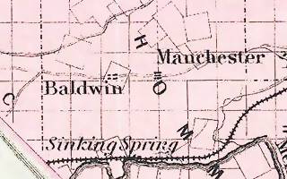
Colton's map published in 1855 spelled the name as "Baldwin" (Click on the map to see a larger view.)
Just west of town is Ellisville originaly settled in 1836 by Captain Harvey Ferris. It was named after the U.S. Consul in Venezuela, Vespasian Ellis who had a farm there. Later sold to William A. Hereford who named it after the post office of his hometown in Virginia: Ellisvile.
Ballwin's post office opened in 1876 on Fish Pot Creek.
In 1926 Manchester Rd. became US 66, and it was the main alignment of the highway until 1932 when it moved to the south through Eureka.
Ballwin incorporated many years later, in 1950. In 1963 Manchester Road was widened.

Where to Lodge in Ballwin, Missouri
Accommodation and hotels near Ballwin
> > Book your accommodation in neighboring Kirkwood
More Lodging close to Ballwin along Route 66
There are several hotels in the area close to this town. Alternatively you can also find your accommodation along Route 66 in the neighboring towns and cities in Missouri. We list them below (from east to west):
On Route 66's Main alignment in MO
Eastwards
Westwards
- Hotels in Kansas
- Baxter Springs KS
- Galena KS
- Riverton KS
- Hotels in Oklahoma
- Miami OK
>> Check out the RV campground in neighboring Fenton
Weather in Ballwin
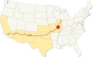
Location of Ballwin on U.S. Hwy. 66
Ballwin has four well marked seasons. It is located in the area where humid continental climate shifts towards a humid subtropical climate, so summers are hot and humid while winters are cold. It gets cold Arctic air and hot damp tropical air from the Gulf of Mexico. Spring is wet and may have extreme weather (tornados, thunderstorms and even winter storms). Fall is sunny and less humid, with mild weather.
Rainfall averages around 41 in. (1.041 mm). The most rainy months are from May through July with more than 4.1 in per month (104 mm). Snow falls betweem Nov. and Apr.: 17.8 in. (45 cm). Relative humidity is on average 70% all year round.
The average winter high (Jan) is a chilly 39.9°F (4.4°C) and the winter low is on average 23.7°F (-4.6°C). The summer (Jul) average high is 89.1°F (31.7°C) with an avg. low of 71°F (21.7°C).
Tornado risk
Ballwin is inside Missouri's "Tornado Alley" and St. Louis County has around 7 tornados each year.
Tornado Risk: read more about Tornado Risk along U.S. 66.
Map of Route 66 in Ballwin Missouri
The map below shows Route 66 between St. Louis and Stanton, the dark black line indicates that it was paved at that time (1931). In 1932 it was replaced by the new alignment running through Eureka, Pacific, and Fenton.
Map 1931 showing US66 into St. Louis
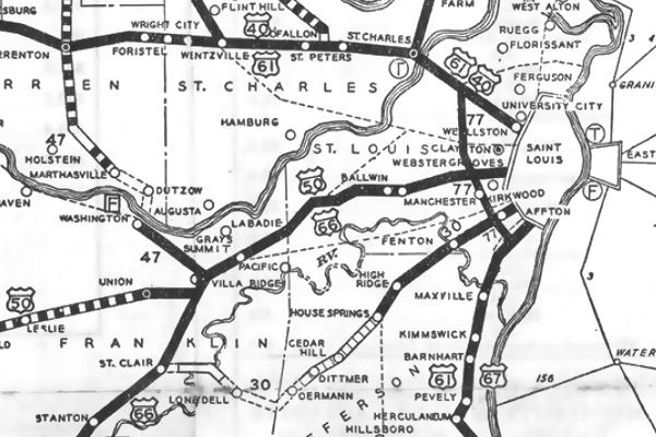
See this map with US66 alignment in Ballwin.
The Route 66 alignment in Ballwin
Visit our pages with old maps and plenty of information about US 66's alignments.
- Gray Summit to Rolla (next)
- Route 66 St. Louis to Gray Summit (In Ballwin)
- Route 66 Hamel IL to St. Louis MO (previous)
Route 66 Sights in Ballwin
Nothing remains of the 1926-32 Route 66 buildings or landmarks, but there are two interesting sights in town:
A Former Gas station
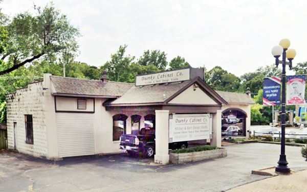
Driving westwards from Manchester, to your left at 14432 Manchester Ballwin just before Grand Glaize Creek. What is nowadays the Duenke Cabinet Co. was identified as a Gas ⁄ Service Station in the "Summary Report" prepared by Maura Johnson for the Route 66 Association of Missouri in 1993 (read more: Architectural - Historic Survey of Route 66 in Missouri and Detailed Survey).
It does look like one, with a gabled canopy over the former pump island and a one door garage bay to the north.
Former filling station
Historic Marker
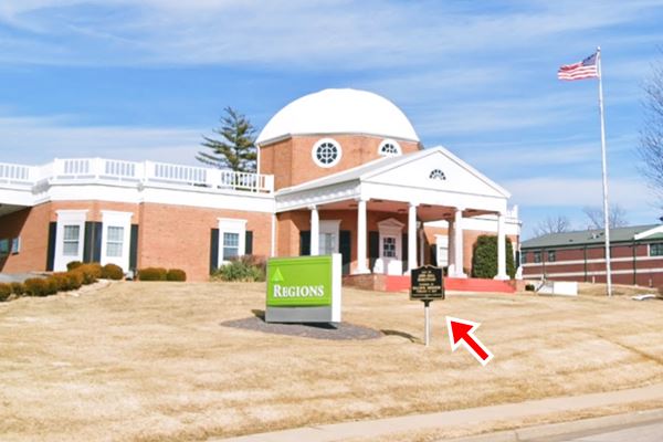
Drive west for 1.4 miles, and on the NE corner of Manchester Rd. and Ballpark Dr. is a historic marker:
The marker is on the lawn, to your right. It reads "Site of James Ball Homestead, founder of Ballwin, Missouri, Feb ruary 9, 1837." Pictured below.
This leg of your Route 66 Road Trip ends here, head west into Wildwood to continue your journey.
Some sponsored content
> > Book your Hotel in Lebanon

Credits
Banner image: Hackberry General Store, Hackberry, Arizona by Perla Eichenblat
Ballwin in the The Ramsay Place Names File


