Bypass Route 66 in Creve Coeur, Mo
Index to this page
- About Creve Coeur
- Creve Coeur's Weather
- Hotels and accommodation
- Map of US 66
- What to see and do in Creve Coeur
About Creve Coeur, Missouri
Facts, Trivia and useful information
Elevation: 535 ft (163 m). Population 26,950 (2019).
Time zone: Central (CST): UTC minus 6 hours. Summer (DST) CDT (UTC-5).
Creve Coeur is a town in St. Louis County, eastern Missouri.
History
This area was peopled around eleven thousand years ago. Later (AD 1300) the Native Americans built gigantic eath mounds that can still be seen on the eastern side of the Mississippi River.
The French trappers explored the region in the mid 1700s, coming from Canada and named it Louisiana after their king Louis XIV.
After a period under Spanish rule (1763-1800) the French recovered it but sold it to the US in 1803.
St. Louis on the junction of the two great rivers (Missouri and Mississippi) became an important town, the largest in the Missouri Territory (created in 1812). The state of Missouri became part of the Union in 1821.
What is now Creve Coeur began as a post office in 1876, and was part of the Bonhomme Township.
The name: Creve Coeur
The name is French for "Heart breaker", and comes from a fort in the Netherlands named so because its defenders considered it impregnable. However French King, Louis XIV took it during the War with Holland (1670-78).
There are several versions for the town's name; it was named after a fort built in by La Salle in 1680, named it after the Dutch fort. This fort was in Illinois, 150 miles from the modern town.
The town was a rural area until it was incorporated on December 21, 1949.

Getting to Creve Coeur
Reach Creve Coeur driving the historic 1926 - 1932 Route 66 now known as Missouri State Highway 100, or use Interstate I-44, I-270, or US 50, US 61, US 67. I-55 and I-64 also cross the area.
Where to Lodge in Creve Coeur, Missouri
Accommodation and hotels close to Creve Coeur
> > Book your accommodation in neighboring Bridgeton, St. Louis, or Kirkwood
More Lodging near Creve Coeur along Route 66
There are several hotels in the area close to this town. Alternatively you can also find your accommodation along Route 66 in the neighboring towns and cities in Missouri. We list them below (from east to west):
On Route 66's Main alignment in MO
Eastwards
Westwards
- Hotels in Kansas
- Baxter Springs KS
- Galena KS
- Riverton KS
- Hotels in Oklahoma
- Miami OK
>> Check out the RV campground in neighboring Fenton
Weather in Creve Coeur

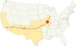
Location of Creve Coeur on U.S. Hwy. 66
Rainfall in Creve Coeur is, on average 41 inches per year (1.041 mm). The most rainy months are from May through July with more than 4.1 in per month (104 mm). Snow falls from Nov. to Apr.: 17.8 in. (45 cm). Relative humidity is on average 69.7%
Creve Coeur has four well marked seasons. It is located in the area where humid continental climate shifts towards a humid subtropical climate, so summers are hot and humid while winters are cold. It gets cold Arctic air and hot damp tropical air from the Gulf of Mexico. Spring is wet and may have extreme weather (tornados, thunderstorms and even winter storms). Fall is sunny and less humid, with mild weather.
The average winter high (Jan) is a chilly 39.9°F (4.4°C) and the winter low is on average 23.7°F (-4.6°C). The summer (Jul) average high is 89.1°F (31.7°C) and the average low is 71°F (21.7°C).
Tornado risk
Creve Coeur is inside Missouri's "Tornado Alley" and St. Louis County has around 7 tornados each year.
Tornado Risk: read more about Tornado Risk along U.S. 66.
Map of Route 66 in Creve Coeur Missouri
The map below shows Creve Coeur in 1955 with bypass US 66, bypass 67 and 61 running top to bottom through the area (red arrow shows US 66 BYP shield). Olive St. Runs left to right.

1955 Route 66 USGS map Creve Coeur MO
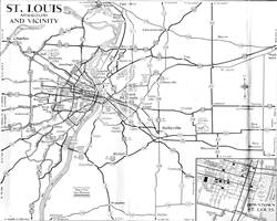
Above is another map, from 1955 showing all the roads leading into St. Louis (note US 66 and City 66); Creve Coeur is on the left side, at Olive St.
The 1940s bypass 66 was built around St. Louis through Creve Coeur.
See this Bypass 66 map.
The Route 66 alignment in Creve Coeur
Visit our pages with old maps and plenty of information about US 66's alignments.
- Gray Summit to Rolla (next)
- Route 66 St. Louis to Gray Summit (In Creve Coeur)
- Route 66 Hamel IL to St. Louis MO (previous)
Route 66 Sights in Creve Coeur
Landmarks and Places to See
Bypass 66
Apart from the "City 66" which went through the downtown area of St. Louis, there was another branch that split from the main alignment on the north side of St. Louis, at the "Chain of Rocks Bridge": "BYP 66" (Bypass 66).
On the western tip of the Chain of Rocks Bridge it took a sharp left, heading west, following what then was Hall Ave., and then further west it continued along Lindbergh Ave., nowadays Dunn Rd. on the north side of I-270.
At modern Exit 25 of I-270 the road curved south (now the ramp next to Pershall Rd.) heading straight south along N. Lindbergh Blvd. This old road is cut now by the extension of St. Louis Lambert Airport runways. The modern highway curves west and passes under the runway.
BYP 66 continued straight southwards all the way to Watson Rd. on the southwest side of the city, where it met the "City 66" alignment, and both "City" and "Bypass" 66 merged back into US 66 and headed west, crossing the Meramec River.
Rittenhouse and his 1946 Book: US 66 in St. Louis
Jack DeVere Rittenhouse in his "A Guide Book to Highway 66", published in 1946 gives us a first hand account: He drove through Edwardsville and Mitchell, and wrote that just past Mitchell, "Here City Route 66 forks off to the left into Saint Louis, while the main US 66 crosses railroad tracks and continues ahead to the CHAIN OF ROCKS BIRDGE and the "belt line" route skirting the city..." in his day the toll was for auto and occupants: 25¢ This was the best route if you were not planningon stopping in St. Louis. He describes its loop around the city, passing near the Airport and "rejoin[ing] City 66 at a point 26 miles from Chain of Rocks Bridge" the road was "a wide, high-speed route" lacking city traffic and with many service stations and some cabins and cafes.
He tells those who chose City 66 that, after the center of the city it ran along Gravois Ave. Chippewa St. and Watson Ave. meeting the Bypass 66 13 miles from St. Louis City Hall.
Only one landmark survives
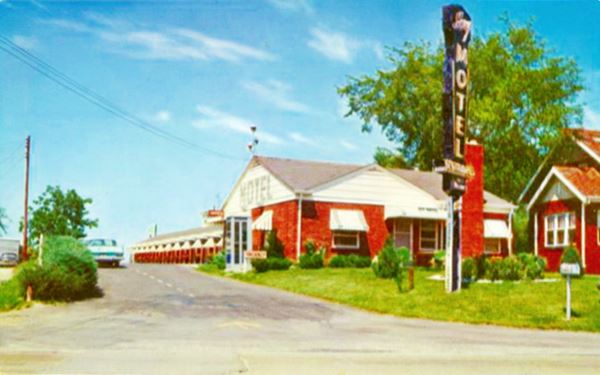
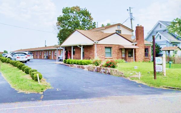
Ivy Motel
10143 Old Olive Blvd. Creve Coeur
Listed in the Rout 66 survey of 1993 (as SL.022), this classic motel was located on Olive Street Road (MO 340), but advertised as being on the better known Route 66.
They promoted their establishment with the slogan "Hospitality, Comfort, Economy", another motel was located in front of the Ivy, it survived until the 1980s, but has now been razed, it was the "Knotty Pine Court".
Old 1950s postcard Ivy Motel, Creve Coeur MO

The building is still standing, see what it looks like today:
Current appearance, Creve Coeur MO

This leg of your Route 66 Road Trip ends here. Head west into the next town Kirkwood along the 1926-32 Route 66 or along Bypass 66 alignment.

Some sponsored content
> > Book your Hotel in Lebanon

Credits
Banner image: Hackberry General Store, Hackberry, Arizona by Perla Eichenblat


