Index to this page
- Itinerary in Missouri
- Introduction: US 66 in St. Louis
- 1926-32 Original Alignment of Route 66 in St. Louis
- 1926-32 Original Alignment of Route 66 West of St. Louis
- 1929-35 Alignment to the Municipal Bridge in East St. Louis
- 1930s Chain of Rocks - City 66 Alignment into St. Louis
- 1935-54 City 66 in East St. Louis
- After 1954: Main US66 into St. Louis
- 1932-77 Route 66 realignment west of St. Louis
- Bypass 66 Alignment
About Route 66 in the "Gateway City"
Missouri Route 66 Itinerary and maps
Each leg of Route 66 described below has an interactive map and many image maps so you can follow the alignments of the highway along the way:
- This leg: Route 66 in St. Louis MO - map of this segment
- Gray Summit to Rolla - map of this segment
- Rolla to Springfield - map of this segment
- Springfield to Joplin - map of this segment
Kansas, next leg
Illinois, previous leg
Introduction: US 66 in St. Louis
Many of our visitors ask us "Where is Route 66 in St. Louis?" and the answer is quite simple: Historic Route 66 is all over the place. If you are interested in learning which were the routes taken by Route 66 to pass through Saint Louis over the years, you've come to the right website!
Did Route 66 go through St Louis?
Yes. Route 66 went through Saint Louis following at least five (5) different routes or alignments between 1926 and 1977.
The alignment of Route 66 in Saint Louis Missouri has changed a lot since it was created back in 1926. There was not one, but many different routes follwed by US 66 in the Gateway City. These included the plain "U.S. 66" alignment and also multiple "Bypass 66" and "City 66" variants, and even two of them at the same time.
These alignments went through the cities listed below, in the area that surrounds St. Louis:
Route 66, the "1926-32" Alignment into St. Louis
< West - Gray Summit ¦
Wildwood ¦
Ballwin ¦
Manchester ¦
Des Peres ¦
Kirkwood ¦
Rock Hill ¦
Brentwood ¦
Maplewood - East >
Bypass Route 66 Around St. Louis
<SW - Kirkwood ¦
Creve Coeur ¦
Maryland Heights ¦
Bridgeton ¦
Hazelwood ¦
Mitchell ¦
Edwardsville ¦
Hamel - NE >
The Main Alignment of Route 66 west of St. Louis
<West - Gray Summit ¦
Pacific ¦
Allenton ¦
Eureka ¦
Times Beach ¦
Fenton ¦
Sunset Hills ¦
Crestwood ¦
Marlborough - East >
The Main Alignment of Route 66 east of St. Louis into Illinois
<West -
East St. Louis (Illinois) ¦
Venice ¦
Madison ¦
Granite City ¦
Fairmont City ¦
Collinsville ¦
Hamel - East >
The Chain of Rocks Bridge
Sponsored Content
Safety Tip - Crime rate
See the Route 66 sights during daytime and then move on to stay in accommodation outside the city. St. Louis has a very high crime rate and
travelers don't feel safe to spend the night here.
The North Side of the city lost jobs during the recession so you may encounter people who are potential drug users. Use common sense as you would in any large city. Park in a covered garage if you can, nevertheless you can park on the street in the town but only do so if visiting for a few hours and during daylight hours.

Map of Route 66 through St. Louis
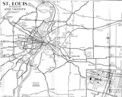
The map below shows St. Louis and the cities around it and was published in 1931. The dark black line indicates the paved roadbed. At that time Route 66 ran through Manchester and Ballwin to Villa Ridge. It would be replaced in 1932 by the new alignment running through Eureka and Pacific into St. Louis.
Map 1931 showing US66 into St. Louis
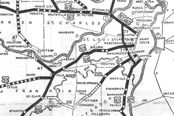
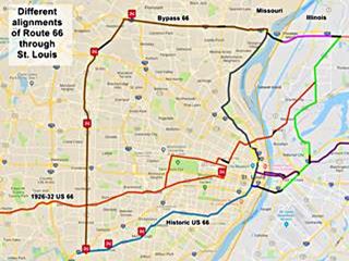
However, this map does not show the alignment in the city itself, we have prepared two maps to show all the alignments of Route 66 across St. Louis, an image map and an interactive custom map.
These alignments are based on the data provided by the Missouri Department of Transport historic maps (See their collection here), and the United States Geological Survey Historic maps (USGS) which you can also find online by searching in the USGS historical maps collection.
Interactive Map
>> see our custom map with the alignments of US 66 in St. Louis
Image Map
Click on the Map to see a large sized map showing Route 66 alignments through St. Louis MO
The following color key applies to this map: Orange line: is first, the original 1926-32 alignment of US66 through St. Louis. Brown marks Bypass US-66. Pale blue is the Historic Route 66 alignment after 1932 west of St. Louis. Other colors show different courses taken by US 66 over the years.
Original 1926 to 1932 Alignment of Route 66
Old Route 66 St. Louis
>> orange line in custom map shows the 1926 alignment from Mitchell IL to St. Louis.
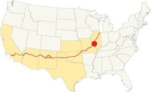
Location of St. Louis on U.S. Hwy. 66
The MO DOT 1926 map of Route 66 through St. Louis gives the following alignment from east to west: Starting in Granite City, Illinois the original US 66 headed southwest along Madison Ave. through Granite City and then along Broadway into Venice.
In Venice it reached the McKinley Bridge and used it to cross the Mississippi River into St. Louis and Missouri.
McKinley Bridge
This bridge dates back to 1910, and was originally used by the railroad. It carried US 66 as from 1926 and was closed to traffic from 2001 to 2007. It has three spans with 18 panel Pennsylvania Petit Through Truss. You can still use it, it is open.
Route 66 enters St. Louis
The original 1926 US 66 alignment bypassed the downtown area of St. Louis, and headed west along Salisbury St., crossing what would be the later City US66 alignment (in Gray in the image map) at W. Florissant Ave.
>> Pale blue line in custom map shows the McKinley segment and west across St. Louis.
Leave Salisbury Ave and turn into Natural Bridge Ave. take a right along North Grand Blvd. following the 1926 Alignment pass the ruins of "Speedwa School" (pictured below). Turn left along Delmar Blvd. This section of the original road is cut off by a Highschool nowadays -so the gap is shown in Black in the map. map with directions to here.
>> black line in custom map shows the gap at Delmar Blvd.
Speedwa School as it looks nowadays
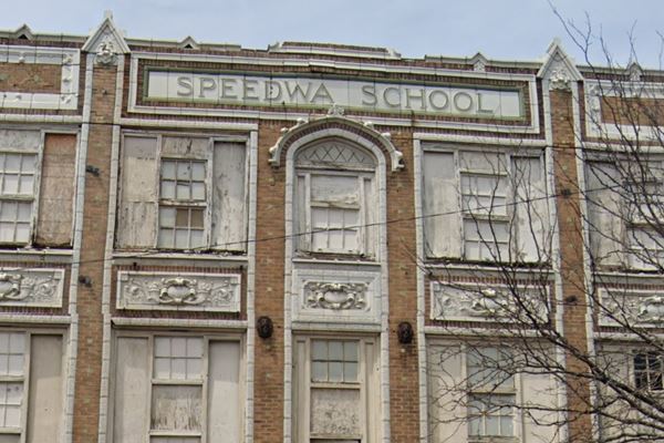
Westwards
After the school, turn left and head south along N. Sarah St., and west along Lindell Blvd, running along the north side of Forest Park. At the western tip of the park the old highway turns right to drive south along S. Skinker Blvd.
There was another alternative on the eastern side of Forest Park: After reaching Lindell, drivers could take a left and return east along Lindell Blvd. or keep straight ahead and do the same on Forest Park Ave. Both Lindell and Forest Park Ave. met N. Grand again, and here drivers would turn right along it, and take a right on Choteau Ave, which became Manchester Rd. and head westwards, to the south of Forest Park, meeting the other alignment at McCausland Ave.
Both alternate and official alignments met on the SW side of the Park, and here, at the corner with Skinner, before heading south along McCausland is a classic attraction, an example of Route 66 weird attractions, A giant gas station sign: The World's Largest Amoco Sign.
Amoco Sign today in St. Louis, Missouri
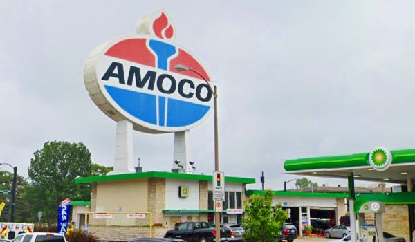
Drive south along McCausland and take a right on Manchester. You will leave St. Louis city limits, entering Maplewood.
>> Pale Blue line in custom map shows the 1926 alignment to Manchester Rd.
1926-32 Route 66 west of St Louis
This is the End of this itinerary in the City of St. Louis for the 1926 alignment, but it continues westwards.
Head west along Manchester Rd. and MO-100 all the way to Gray Summit where this alignment meets the later alignment of Route 66 (built in 1932).
It is a distance of 32.8 miles and it is shown in this map with directions of the 1926-32 Route 66 from Maplewood to Gray Summit.
Our custom map below includes several gaps and missing segments depicted in different colors and described further down.
>> Pale Blue line in custom map shows the 1926-32 Route 66 From Maplewood to Gray Summit.
The old road has some gaps and realignments along the way. Manchester Road was known as Market Street Road because farmers used it to bring their produce into the city. It was the first state highway, created in 1835. It linked St. Louis with the town of Manchester, on the road to state capital, Jefferson City.
The road was paved in 1921 and it became the obvious choice when Route 66 was created. It went through a series of small towns: Maplewood, Brentwood, Kirkwood, Des Peres, and Ballwin.
In Des Peres there is a realignment because the original roadway became the eastbound lanes at the exchange with I-270. Those diriving west must use a new roadbed built to carry WB traffic along MO-100.
>> red line in custom map shows the Original US66 in Des Peres.
The highway then goes through Manchester and Ballwin, and onwards to Wildwood
The Old Route 66 on Ruck Rd. in Grover
Ruck Rd curves to the south in a wide arch leaving modern MO-100, that was built later and straighter, so the old segment has been cut off from the main alignment. It ends in a dead-end but part can be driven.
>> pale blue and yellow lines in custom map shows the Ruck Road segment.
Just ahead Manchester Road forks to the south and here is another change in the original alignments: At first it followed the alignment marked in dark blue in the custom map, and later it was straightened out and aligned along the course marked with an orange line
.>> dark blue and orange lines in custom map shows the realignment in Grover.
West of Grover
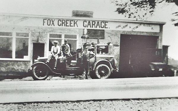
Route 66 and MO-100 diverge west of Grover, through Pond. At Fox Creek. Don't miss the remains of the old Fox Creek Garage built in 1917.
>> Light Blue line in custom map shows the divergence between MO-100 and the 1926-30 US 66 here.
Old photo Fox Creek garage, Wildwood, Missouri
Old US 66 Alignment in Hollow
Ahead the highway reaches the small community of Hollow where there are some additional old roadbeds.
There is an old Dead End Alignment on Stovall Road. It is only 0.2 miles long, this Map with directions shows the part that can be driven and our custom map shows the two gaps in orange:
>> orange lines in custom map shows the gaps at Stovall Rd.
Head west, and 1.2 mi. ahead is another abandoned section of Route 66.
Old Dead End Alignment of Route 66 on Deer Creek Rd.
Short stretch, to your left. The curve was later eliminated and the roadway moved north to straighten the highway.
>> green line in custom map shows the 1926-32 alignment at Deer Creek Road.
Old Alignment along "Old Manchester Rd."
Just ahead, Route 66's original alignment and modern MO-100's alignment take different courses. The original US66 forks to the right and runs along Old Manchester Road and Deer Creek Rd. in a wide circle to the north and then south again, see this map with directions. At Locust Lane it followed a now eliminated segment, the gap is shown in the map below:
>> violet line in custom map shows the gap, pale blue line is driveable.
Later, MO-100 was straightened and the current roadbed built.
Beyond this point you leave Wildwood, and the old Route 66 continues to Gray Summit where it meets the later (1932 - 1977) Route 66 alignment, it is a 5.4 mile journey (Map with directions).
>> pale blue line in custom map shows the alignment into Gray Summit.
The original 1926-32 alignment itinerary from St. Louis to Gray Summit ends here.
1929-35 alignment to the Municipal Bridge
In 1929 the alignment in Venice IL changed. Route 66 took a southwards course through Venice, Brookyln, and headed into East St. Louis, to cross the Mississippi alongside the railway on the "Municipal Bridge" which was toll free. It entered Missouri on the south side of St. Louis.
We prepared three maps, two with directions with to show this alignment:
- Map 1 Madison to 10th St. in East St. Louis
- Map 2 E. St. Louis to Piggott Ave.
- Map 3, crossing Municipal Bridge (now closed to car traffic).
>> pink line in custom map shows the 1926-35 Venice to Municipal Bridges alignment in Illinois.
Optional 66
So in 1929 the original 1926 alignment using McKinley Bridge became the Optional 66 highway.
Municipal or MacArthur Bridge
It opened in 1917 and carried a railroad, which still uses it. In 1929 US 66 used it. Car deck was closed in 1981 and dismantled in 2014. It has a steel viaduct on both sides of the river (picture below). The steel bridge has 3 spans: Modified Pennsylvania Through Truss with single-span Pratt Through Truss on its western tip.
The elevated Municipal Bridge viduct on the western side of the Mississippi river (see imgage) ended at S 7th St. in St. Louis. These viaducts for automobiles on both sides of the river were removed, and the bridge were cut off in 1981 for vehicle traffic. Now the bridge only carries rail traffic.
From here US 66 turned south and then right to head along Chouteau Ave. Later it met the other westbound "City US 66" alignment there.
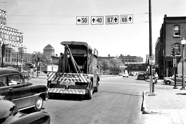
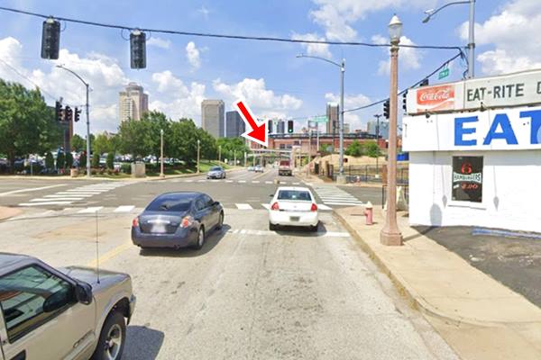
There is a Classic Diner called Eat Rite on Choteau Ave, and 7th Street, two blocks east of Tucker. Below is a "Then and Now" sequence at that very corner, looking north from Choteau Ave. towards the railroad bridge across 7th St. The sign reads "City Route 66" and on the next block, an arrow points right, for US66 towards the Municipal Bridge.
>> red line in custom map shows the Municipal Bridge; pale blue line: US66 westbound. Gray line: St. Louis City 66
The same spot today. The railroad (red arrow) is still there. The "Eat-Rite Diner" is to the right.
We will follow this alignment westwards towards Eureka, and Gray Summit after describing the other alignments that entered St. Louis north of this point.
1930s Chain of Rocks - City 66 alignment
Historic Chain of Rocks Bridge
Listed in the National Register of Historic Places
On July 20, 1929 the Chain of Rocks Bridge was opened to traffic, the Illinois side west of Edwardsville, through Mitchell was paved and ready to carry Route 66, bypassing the cities (Madison, Granite City, Venice) to the south, but as the Missouri side of the bridge wasn't yet ready Route 66 only moved to Chain of Rocks in the mid 1930s.
>> red line in custom map shows the access to Chain of Rocks Bridge in Illinois.
Named after the rapids formed by underwater rock outcroppings: the "Chain of Rocks".
Chain of Rocks Bridge nowadays in Madison, Illinois
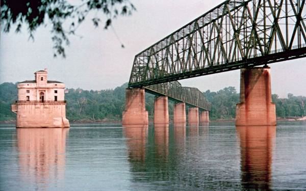
Below is a vintage postcard of the bridge, notice the toll booth.
Historical Chain of Rocks, vintage postcard in Madison, Illinois
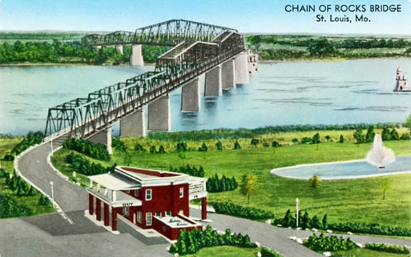
It was one enormous project in its day, and it was a private one.
It was suppposed to be straight, but ended up bended due to the complaints of riverboat crews because it was just next to the water intakes for St. Louis, and would have made navigation difficult. Also, the original straight course led it thorough bedrock that couldn't withstand the weight of the bridge. So it was "bent".

Wayside Exhibit at Chain of Rocks Bridge. Source
It stood 55 feet above the water and had a 40 foot-wide roadway with 10 spans.
Construction began in 1927 on both sides of the Mississippi and it opened in July 1929.
It carried Route 66 across it since then and in the late 1930s the Bypass US 66 was aligned across it to avoid going through downtown St. Louis. The bridge was initially a toll bridge but it was later removed.
In 1967 a brand new bridge, the "New Chain of Rocks Bridge" was built to the north and carried the freeway (I-270), this led to the demise of the Chain of Rocks Bridge that same year.
>> gray line in custom map shows the bridge (upper right), City 66 into St. Louis, the brown line is Bypass 66.
Tips for a Safe Visit to the bridge
Access to the bridge from the Missouri side is CLOSED due to severe issues with car vandalism. You can park on the Illinois access. Do not leave any valuables in your car. Park at your own risk. The bridge is open to bikers and pedestrians daily from 9:00am to dusk and is wheelchair accessible.
Bridge entrance is accessible in Missouri at North Riverfront Park, south of the Bridge along the Riverfront Trail.
Bypass 66
If you head north, and then west (north frontage Rd. of I-270), you will drive the Bypass 66 alignment -shown with a Brown line in the map. We describe the Bypass alignment futher down, starting at Hazelwood all the way to Kirkwood.
City 66 from Chain of Rocks to downtown
On the Missouri side of the river head south from the bridge. This is the Map marking the spot where your southbound journey into St. Louis begins. Take Riverview Drive.
The alignment runs along Riverview, N. Broadway, Calvary Ave, W. Florissiant and N Florissiant Ave where it meets the original Route 66 coming from Venice via McKinley Bridge. Map with directions from Chain of Rocks to intersection with the "Original 1926 US 66" that crossed along McKinley Bridge.
>> dark gray line in custom map shows the City 66 from the bridge to McKinley Bridge alignment.
Downtown St. Louis via City 66
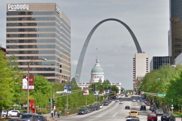
Five blocks further south, the 1940s City 66 alignment took a left along Herbert St. and then a right along N. 13th St, head south. At its junction with N Tucker Blvd. continue south along the boulevard. At the intersection with Market St. to your left you will have a great view of the old Courthouse and the Gateway Arch.
>> light gray line in custom map shows the City 66 alignment across downtown St. Louis.
In the 1950s N. Florissant Ave. was extended south and this avoided the Herbert St. segment. This is shown with a Yellow line in the custom map.
>> yellow line in custom map shows the City 66 after 1950 into downtown St. Louis.
The Arch is a monument shaped as a weighted catenary arch that is 630 feet high (192 m). It is lined with stainless steel and is the Tallest man-made monument in the Western Hemisphere.
It was designed in 1947 and built between 1963 and 1965. It cost roughly $200 million in 2021 dollars.
End of the City 66 alignment and US 66's Mississippi Bridges into Downtown St. Louis
At its intersection with Washington Ave. City US 66 met the "Main alignment of US 66" and the "City 66" coming from Illinois. See this map to this point. Let's look at the different "City" and "Main US66" in Illinois and the briges they used to cross the Mississippi into St. Louis.
Looking down Market St. from City US 66 in downtown St. Louis, Missouri
City 66 in Illinois
Second City 66
Called "second" to differentiate it from the one on the western side of the Mississippi.
After 1935 the "older" alignment through Madison to Venice became City 66 and by 1940 had been realigned together with Alt US 67 on the eastern side of Madison all the way to Collinsville Rd.
.Read all about City 66 in Illinois in our Hamel IL to St. Louis MO alignments webpage.
>> green line in custom map shows the Second City 66 in Granite City and East St. Louis.
1954 Realignment: "Main US66" in Illinois
The realignment is described in detail in our 1954 Realignment: "Main US66" section in our Hamel to St. Louis webpage.
>> yellow line in custom map shows the 1954-77 US66 from Hamel through Collinsville.
West of Fairmont Illinois
The 1954 highway followed the old "City 66" in Fairmont, but instead of using the Municipal bridge, it took a new course at at St. Clair Ave. in East St. Louis. Here it turned right and then left becoming a 4-lane highway which then split into two separate options (see image below), that allowed the traffic to cross the Mississippi River using two different bridges: Veterans Memorial Bridge of Martin Luther King Bridge to the north and Eads Bridge to the south; both were toll bridges.
>> green, violet and red lines in custom map shows the approaches to Eads and MLK bridges in Illinois.
Modern I-55 has cut off one of those access routes at Missouri Ave., so another route must be taken to reach it from old Rte. 66 (see map c below)
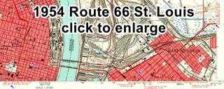
1954 USGS Map of US 66 in St. Louis
Click on the thumbnail map image to see a full size version. Main Route 66 coming from Collinsville (blue arrow right side of the map) reaches the old City 66 from Granite City (now ALT US 67 -green arrow upper right side of the map), it heads toards the Mississippi River (blue arrow lower right) crossing the Bridges into St. Louis. On the left-center side US 66 reaches St. Louis and the original City 66 coming from Chain of Rocks Bridge (blue arrow upper left). It turns to head westwards out of St. Louis (blue arrow lower left). You can also see how US 40 and US 66 shared the same alignment into St. Louis.
- Veterans Memorial Bridge, to the north. Built in 1951, it was renamed after Martin Luther King Jr. in 1968. This steel bridge is a Cantilevered Subdivided Warren Through Truss with a 2-span Warren Deck Truss approach. It is open and you can drive across it. Its eastern approach in Illinois, from US66 along Missouri Ave. was cut off by I-55 (in Black in the map).
It was restored in 1987 and now has two eastbound lanes and one westbound lane. - Eads Bridge, 800 feet to the south of the other bridge. It was named after its designer and builder, James B. Eads and built between 1867 and 1874. It was the first bridge across the Mississippi south of the Missouri River. It is an Arch bridge 6,442 ft long (1,964 m).
Once across the river, the traffic headed west along Washington Ave. and met the City 66 which ended at this point.
>> blue lines in custom map shows both bridges, and the gray and light blue one is Main US 66 (1932-77).
From this point westwards, the "Main US 66" continued as marked with the light blue line. We describe it in the next section.
This is the end of your journey into St. Louis along the old "Second City 66" and the later "Main 66". Below we describe the Bypass 66 and Main 66 (1932-77) west of the city towards Gray Summit.
The 1932-77 Route 66 West of St. Louis
Route 66 was realigned in 1932, leaving the previous roadbed through Manchester and Wildwood -the 1926-32 alignment- which became US 50.
The new course of US 66 began in St. Louis and reached Gray Summit after going through Pacific, Allenton and Eureka.
This alignment was further south and its original roadbed is now mostly buried under I-44. We will describe it east to west, starting in Downtown St. Louis.

Neon Sign. Click for street view
Leave downtown St. Louis and continue westwards along Historic 66 (Tucker Ave.) that splits from US66 as you cross I-55. Route 66 later becomes Gravois Ave. (MO-30).
Gravois Avenue
Originally a road in the early 1800s that led to the Salt Spring of Clamorgan close to Fenton. In 1839 it became a state road, authorized by the state. Gravois, in Fench means "gravelly" (made with gravel). In 1914 it was paved with concrete. In 1930 Route 66 was realigned along it.
Ahead, at Chippewa take a right along Historic Route 66, leaving Gravois Ave. The highway continues along Chippewa till it reaches the city limits of St. Louis after crossing the Des Peres river, and enters Shrewsbury, followed by Marlborough.
Map with directions to this point, showing Route 66 across the city, from the Bridges to St. Louis city limits.
This is the end of the alignment in St. Louis.
>> light blue and teal lines on the bottom of the custom map show the 1932-77 US66 from St. Louis to Times Beach.
Book your Hotel in St. Louis
Westwards from St. Louis City Limits
This map with directions shows Route 66 from the Des Peres to the Meramec river. It crosses Shrewsbury, Marlborough and Crestwood into Sunset Hills using Watson Rd. The part that can be driven ends at S. Geyer Rd. where you have to use the freeway (I-44) to cross the Meramec and head west.
>> teal line in custom map shows the segment buried by I-44 that can't be driven.
Crestwood and Sunset Hills
As mentioned, the highway was aligned to the south along Watson Rd. which was paved in 1932.
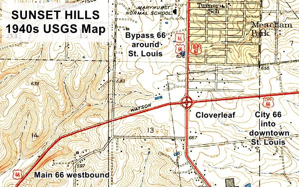
Route 66 meets the Bypass 66 alignment in in Sunset Hills, at the intersection of S. Kirkwood Rd (now U.S. 50) and Watson Rd. Both "Main" and "Bypass" 66 met in a "cloverleaf" interchange (pictured further down), and headed west as you can see in the map below:
Bypass meets Main 66 at Sunset Hills cloverleaf

US 66 Meramec River Bridge in Sunset Hills

Route 66 map (1927). West of St. Louis Credits
Click on Map to Enlarge
Route 66's 1932-77 Main alignment crossed the Meramec river west of Sunset Hills, where I-44 has its bridge.
We found an interesting map (click on it to see full size image) published in 1927 showing that at that time the Sunset Hills bridge hadn't yet been built. The curious fact is that Route 66 (marked with a Blue arrow) aligned along "Ozark Trail" on the map, ran eastwards from Pacific through Eureka and turned north to meet US 50 at Valley Park, crossing the Meramec River there! at the place where MO-140 is now located, it then merged with US 50 and headed east into St. Louis. US 50 (Red arrow) ran further north along what was the original 1926-32 Route 66 alignment.
The alignment of Route 66 that was built by 1932 is shown with the dashed red-yellow line from Valley Park, across the Meramec and all the way to St. Louis city limits.
The original bridge at Sunset Hills (a Lost Warren deck truss bridge) was built in 1932 by the Wisconsin Bridge & Steel Co. for the new Route 66 Alignment along New Watson Rd. It was a two lane bridge that remained operational for many years. The USGS maps of the area give us an insight into its evolution: The 1940 map shows it as carrying a simple 2 lane highway.
The 1954 map has it as a 4 lane highway running along the former (until 2022) westbound lanes of I-44.
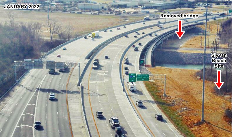
The original Route 66 steel bridge was replaced in the mid 1950s and its concrete piers remained in place and carried the north side of the westbound lanes. Another group of piers were built beside the original ones, but were much wider. They carried the second pair of lanes -in those days, eastbound lanes of the 4-lane highway. This bridge was taken down in 2022 as shown below.
Bridge removed in 2022
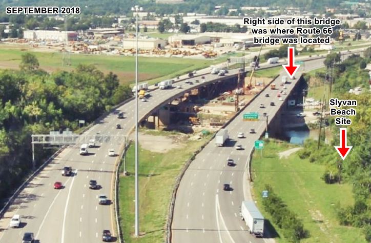
MO DOT upgraded the bridges across the Meramec River between 2019 and 2022 (click on the thumbnail images below for a "Before and After" sequence or see the day-by-day work progress images at the MO DOT site click on the images to enlarge them.
The images look west across the Meramec river, the site of Sylvan Beach is on the right. The original Route 66 alignment ran along the now gone bridge on the right side of the image.
Fenton
On the western side of the Sylvan Beach bridge across the Meramec, US66 entered Fenton.
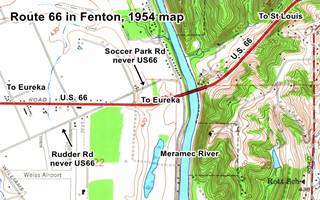
We have seen a webpage indicating that Route 66 from 1933 to 1954 adopted a course along what now is Soccer Park Rd. west of the Meramec river, crossing to what now is the south side of I-44, and continuing with a SW course along Rudder Rd., and then heading west along Horan Dr. until meeting I-44 again at present Exit 272. But a careful analysis of USGS Maps of 1940 and 1954 (Kirkwood 1:24,000) disprove it. See image -click for large size map. It is clear that the old 1932 Route 66 roadbed ran along what now are the westbound lanes of I-44.
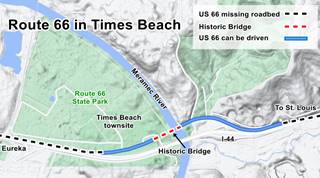
West of the Meramec, Route 66 was removed when I-44's roadbed was built over it. Nothing remains of the original road until you reach Times Beach.
Times Beach
Times Beach was a town that vanished after a chemical contamination with dioxin. It was evacuated in 1983, quarantined, and later disincorporated. The buildings were razed and the former townsite after being decontaminated became the Route 66 State Park.
The old roadbed can be driven here on the eastern side of the Meramec river towards the historic bridge; it is 0.7 mi long; see it in this map with directions.
>> red line in custom map shows the driveable segment in Times Beach.
Meramec River US 66 Bridge

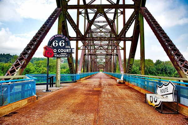
The historic Meramec River bridge at Times Beach
Listed in the National Register of Historic Places
The first bridge here was the Votaw Bridge built in 1900, a steel 10-panel Camelback Pratt Through Truss bridge. In 1933, coinciding with the new alignment of Route 66 between St. Louis and Gray Summit, it was replaced by the "historic" bridge.
It was a three span Warren Deck Truss bridge, 1,009 ft. long (308 m) and 30 ft. wide (10 m). The trusses are triangular beams used to provide support to the bridge. Warren patented a design in 1848 by which the triangles are equilateral. It rested on concrete piers and abutements. The deck with the roadbed was supported by horizontal chords.
A new brige is built (1956)
In 1956 a new set of lanes were built for eastbound traffic, and a new bridge was built to the south of the old one, which now carried westbound traffic only. In the late 1960s another set of lanes, now for westbound traffic was added to US-66 ⁄ I-44 to carry the westbound traffic and bypassing the original Route 66 through Times Beach and the old bridge, which remained open to local traffic. The bridge's deck is gone (removed in 2012), but it is still standing proud.
Eureka
Route 66 resurfaces on the north side of the freeway at Exit 264 as E Fifth St. in Eureka and you have to take it westwards all the way to the next exit (261) as shown in this map with directions Eureka-Allenton to drive it and reach the south side of I-44 in Allenton. The original alignment is cut by the freeway, and resurfaces in Allenton.
>> black line in custom map shows the gap east of Eureka.
>> orange line in custom map shows the driveable part in Eureka.
>> blue line in custom map shows the gap west of Eureka.
1960s Phillips gull wing gas station, Eureka, Route 66, Missouri

Allenton
Map 1940 showing Allenton
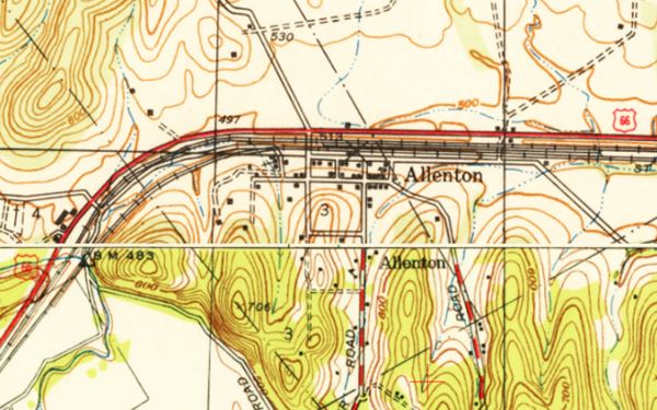
The highway then runs west from Allenton and then turns away from the interstate to skirt around the foothill of range of hills and enter Pacific (map with directions Allenton-Pacific). Then comes the final leg into Gray Summit, along the southern side of I-44 (map Pacific-Gray Summit).
>> pale blue line in custom map shows US66 from Allenton to Gray Summit (driveable).
The Main alignment of Route 66 in St. Louis ends here, head west to continue your Route 66 Road Trip westwards to Rolla: Route 66 Gray Summit to Rolla MO
The last segment in St. Louis was the Bypass 66. We describe it below.

1940s "Bypass" 66
The USGS 1940 map shows that the "Chain of Rocks Bridge" that carried US 66 across the Mississippi River north of St. Louis split into two branches:
- First City 66 in Missouri
- Bypass 66
"BYP 66" (Bypass 66) ran westwards from the river and then turned south, to flank it along its western side, till it met the Main alignment of Route 66 on the SW side of St. Louis.
>> brown line in custom map shows the Bypass 66 alignment around St. Louis.
>> red lines in custom map mark the gaps in the old Bypass 66.
Bypass 66 alignment
After crossing the "Chain of Rocks Bridge" it turned right, heading north, and then took a sharp left, heading west, following what then was Hall Ave., and further west Lindbergh Ave. Today this is known as Dunn Rd. and it has survived as a frontage road on the north side of I-270. It is cut at each of the freeway's exits, curving around the exchanges, but the roadbed is intact between these exchanges. See this map with directions of the north section of Bypass 66 showing the part that you can drive.
At what is now Exit 25 of I-270 the road curved south taking a left. This curve has been obliterated by the interchange (red line in our custom map). This custom map shows, with a red line, the original alignment. Parts of Route 66 along Dunn and Pershall Rd. can still be driven. It then headed south along N. Lindbergh Blvd. (US 67).
The old roadway was cut now when St. Louis Lambert Airport runways were extended see red line in our custom map. Nowadays, the new alignment of the highway curves around the airport, heading west and then passing beneath the runway.
After this point BYP 66 continued straight southwards all the way to Watson Rd. on the southwest side of the city, where it met the "City 66" alignment described above and both "City" and "Bypass" 66 merged back into the Main US 66 and headed west, crossing the Meramec River towards Eureka. See this map with directions of Byp 66's western leg.
1946
The 1945-46 MO DOT map used the following names for Route 66 after Chain of Rocks bridge: it split into BY 66 (bypass) and CY 66 (City).
Jack DeVere Rittenhouse in his "A Guide Book to Highway 66", published in 1946 gives us a first hand account. He drove through Edwardsville and Mitchell, and wrote about the highway afterpassing through Mitchell Illinois:
Here City Route 66 forks off to the left into Saint Louis, while the main US 66 crosses railroad tracks and continues ahead to the CHAIN OF ROCKS BIRDGE and the "belt line" route skirting the city.
If you are taking the route around Saint Louis, continue straight ahead five miles to the CHAIN OF ROCKS TOLL BRIDGE across the MISSISSIPPI RIVER. (Tolls: auto and occupants-25c.)
...US 66 passes the north edge of the city, tunrns south near the Airport, continues down the west side of the city, through Kirkwood, Mo, and rejoins City 66 at a point 26 miles from Chain of Rocks Bridge. This "belt line" is a wide, high-speed route, with plenty of gas stations... It avoids city traffic completely Rittenhouse (1946)
Changes to US 66 Bypass
The 1954 and 55 USGS maps of the area show more profound changes in the old road.
The main "US 66" and "Bypass 66" (BYP 66) separated much further east than they had done until then. The split took place far to the north of Mitchell and Edwardsville, at the point where modern Exit 33 on I-55 is located, north of Hamel, just east of Worden.
Both alignments gradually separated, BYP-66 opening towards the west and US-66 ran further east, as a four-lane highway, which is now under I-55.
The 1957 and 1958 MO DOT Map mentions it as "Bypass 66". The 1963 USGS map of St. Louis, revised in 1969 still has BYP 66 going around the city and meeting US 66 on the south side of St. Louis. The old City 66 is gone and US 66 enters St. Louis from the east (Illinois) along modern I-55 / US-40.
Route 66 is Decertified in Illinois and most of Missouri - 1974
Following the completion of the interstate system in Missouri, on June 24, 1974, the American Association of State Highway and Transportation (or AASHTO) decided to move the eastern terminus of Route 66 from Chicago, Illinois to western Missouri, placing it close to Joplin in Missouri.
This shortened Route 66 eliminating its designation in Illinois and most of Missouri.
The new eastern terminus was located at I-44's exit 15 east of Joplin, in the town of Scotland MO (see it on a map).
Decertified in Illinois and most of Missouri - 1974
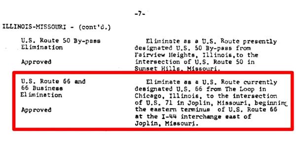
It wasn't implemented immediately, but you can see it in this MO DOT map from 1978.
End of this Leg
The leg across the city of St. Louis and onwards to Gray Summit ends here. You will have to head head west further into Missouri to continue your Route 66 Road Trip westwards, see below.
Credits
Banner image: Hackberry General Store, Hackberry, California by Perla Eichenblat
Jack DeVere Rittenhouse, (1946). A Guide Book to Highway 66


